Canyonlands National Park #2: Druid Arch
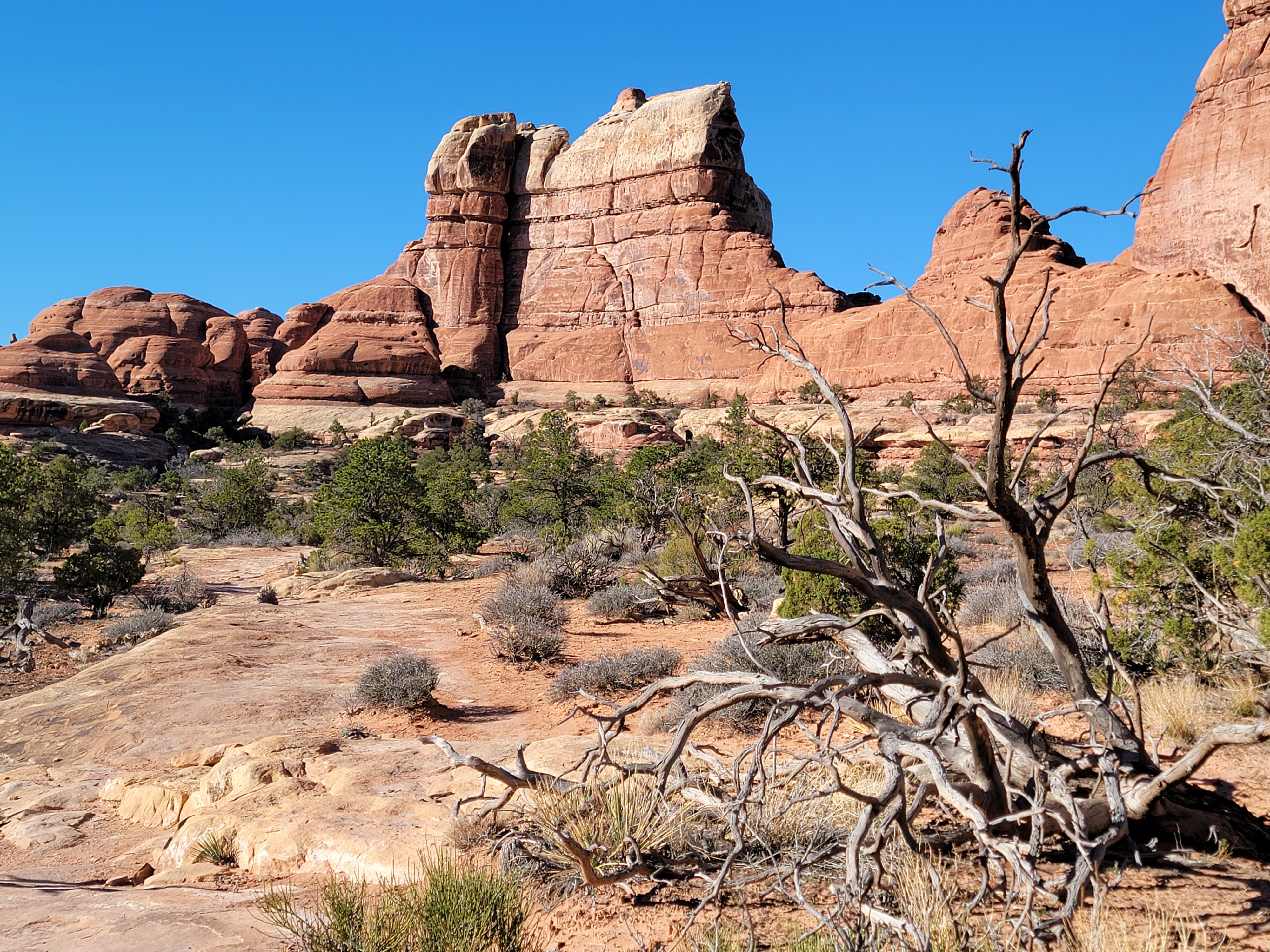 A beautiful morning for a hike
The second hike of my Canyonlands trip was going to be Druid Arch. It was the main reason I had come to the Needles District. On previous trips, I had done all of the other well known hikes in the area: Peekaboo, Big Springs/Wooden Shoe Canyons, Chessler Park Overlook and Chessler Park Loop with The Joint. All of those were good hikes so I wanted to do Druid Arch to "complete the set".
The trail descriptions that I read online said that near the end, the trail climbed steeply to the final viewpoint of the arch. Several of the descriptions mentioned significant scrambling. That didn't worry me. In fact it sounded like it would be fun. My one concern was that it was still early in the season. There might be ice in sheltered spots, especially higher up. It had only been thirty degrees on Friday evening when I arrived in Monticello. There was even an ominous sign at the trailhead the day before warning about icy conditions and advising hikers to carry microspikes.
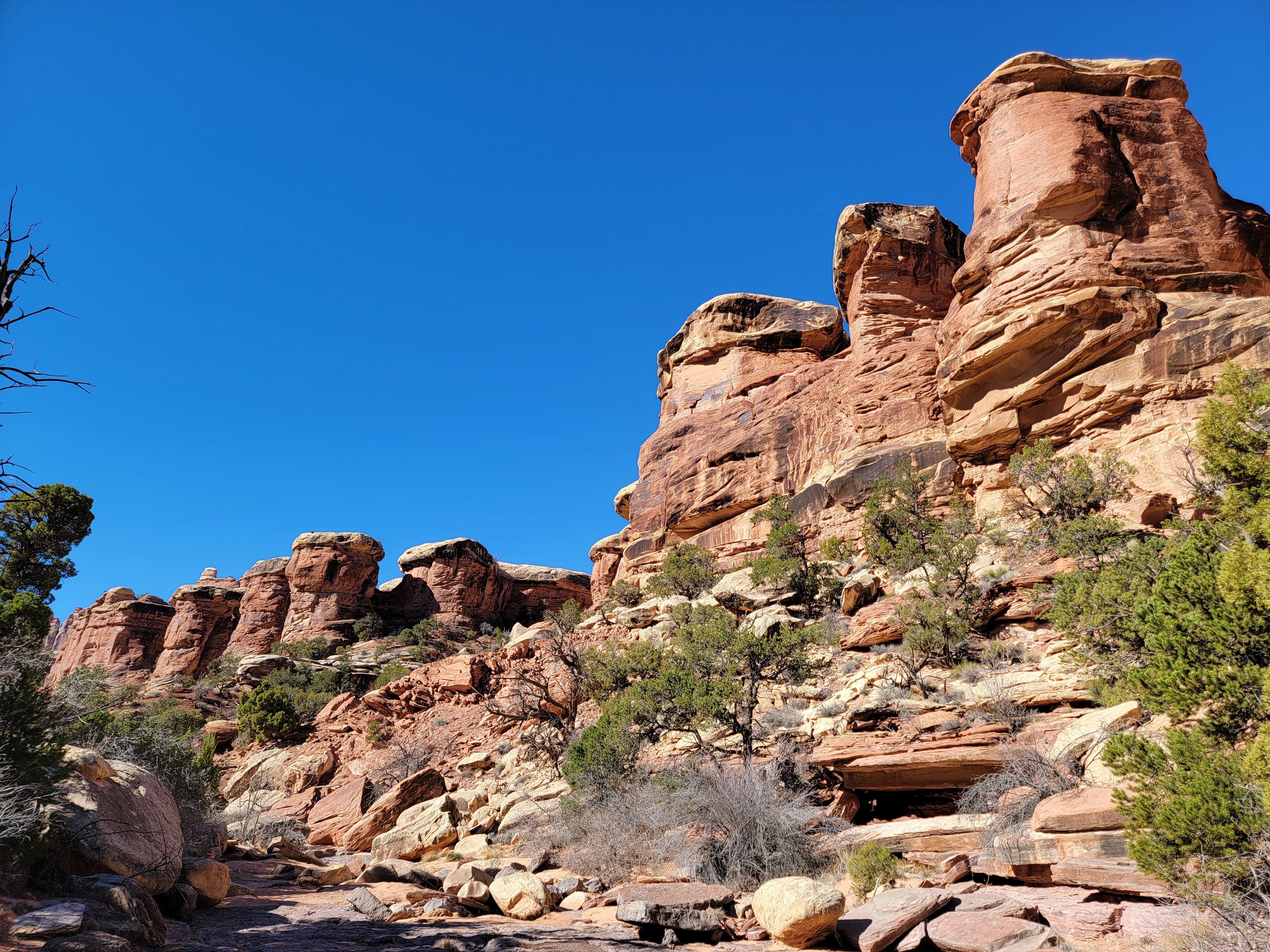
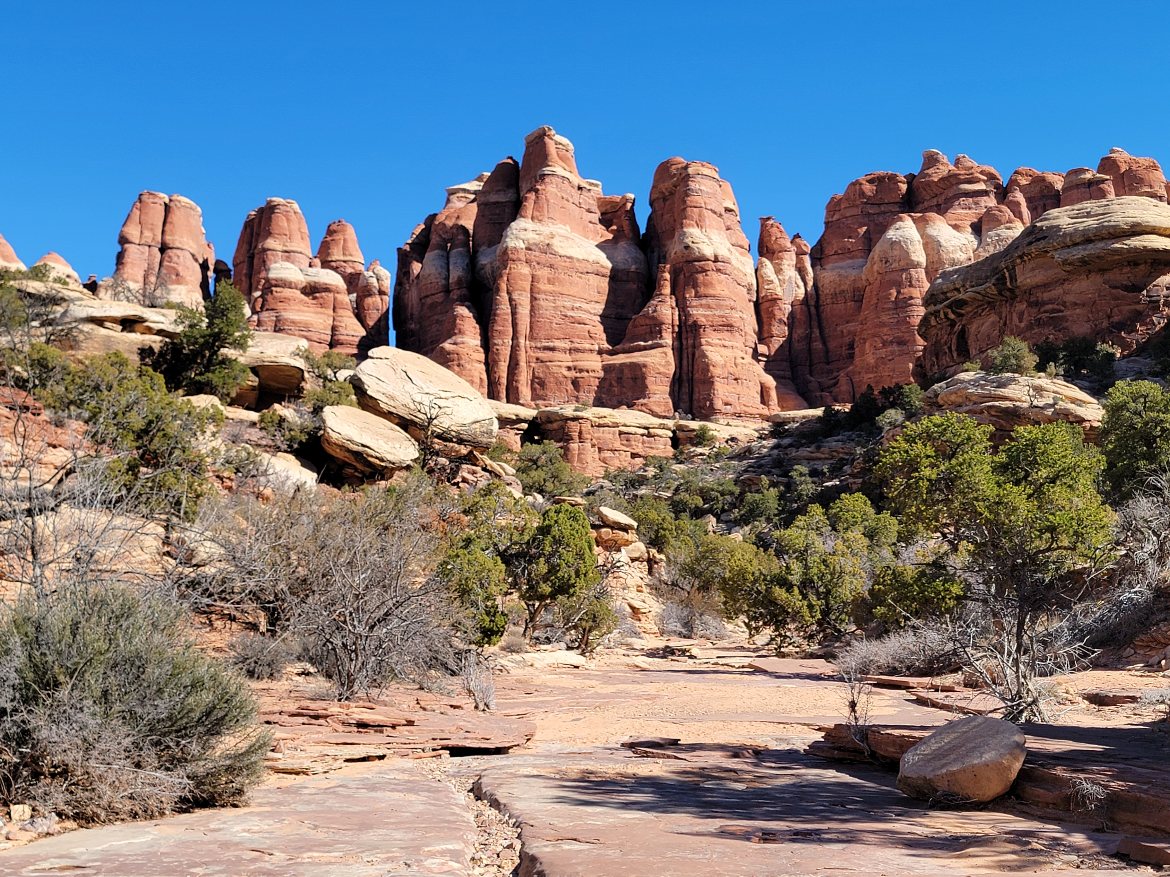
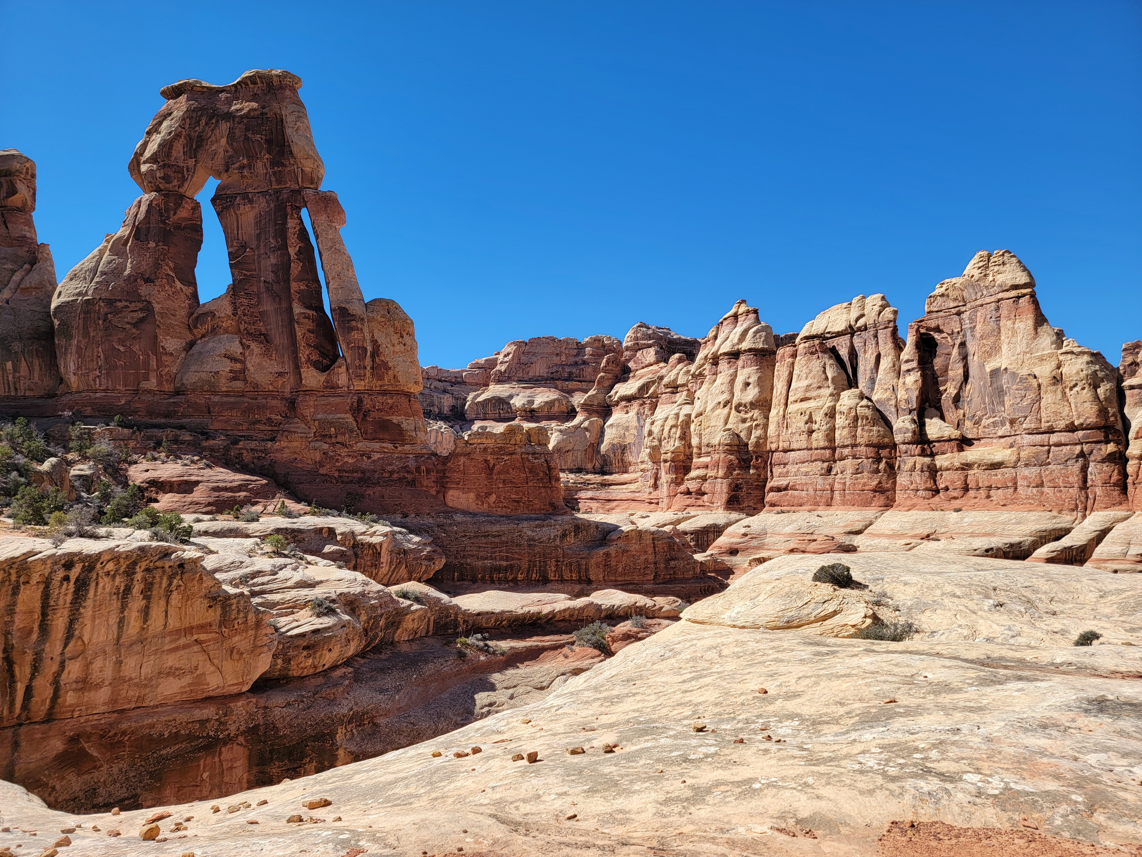
 A canyon lined by rock formations known as mushrooms
I decided to be conservative on my first day. I did the Big Springs/Wooden Shoe Canyon hike. It's shorter, with less elevation gain. I had done it once before so I knew what to expect. It would enable me to see what the trail conditions were like. Turned out everything was completely dry. There wasn't even a hint of ice anywhere. Armed with that information, I was excited to try the Druid Arch Trail today.
I was up early, in spite of the fact that daylight savings time started and I had to set my watch ahead an hour. I went to bed very early and got a good night's sleep. It still took about an hour to drive to the trailhead. I started hiking about 10 am, the same time as yesterday, except that it was really an hour earlier because of the time change. It was sunny and warm and this time I knew better than to bundle up. I wore my wind shell and left my extra layer in the car. That was smart because just like the day before, I was hiking in just jeans and a tshirt within fifteen minutes.
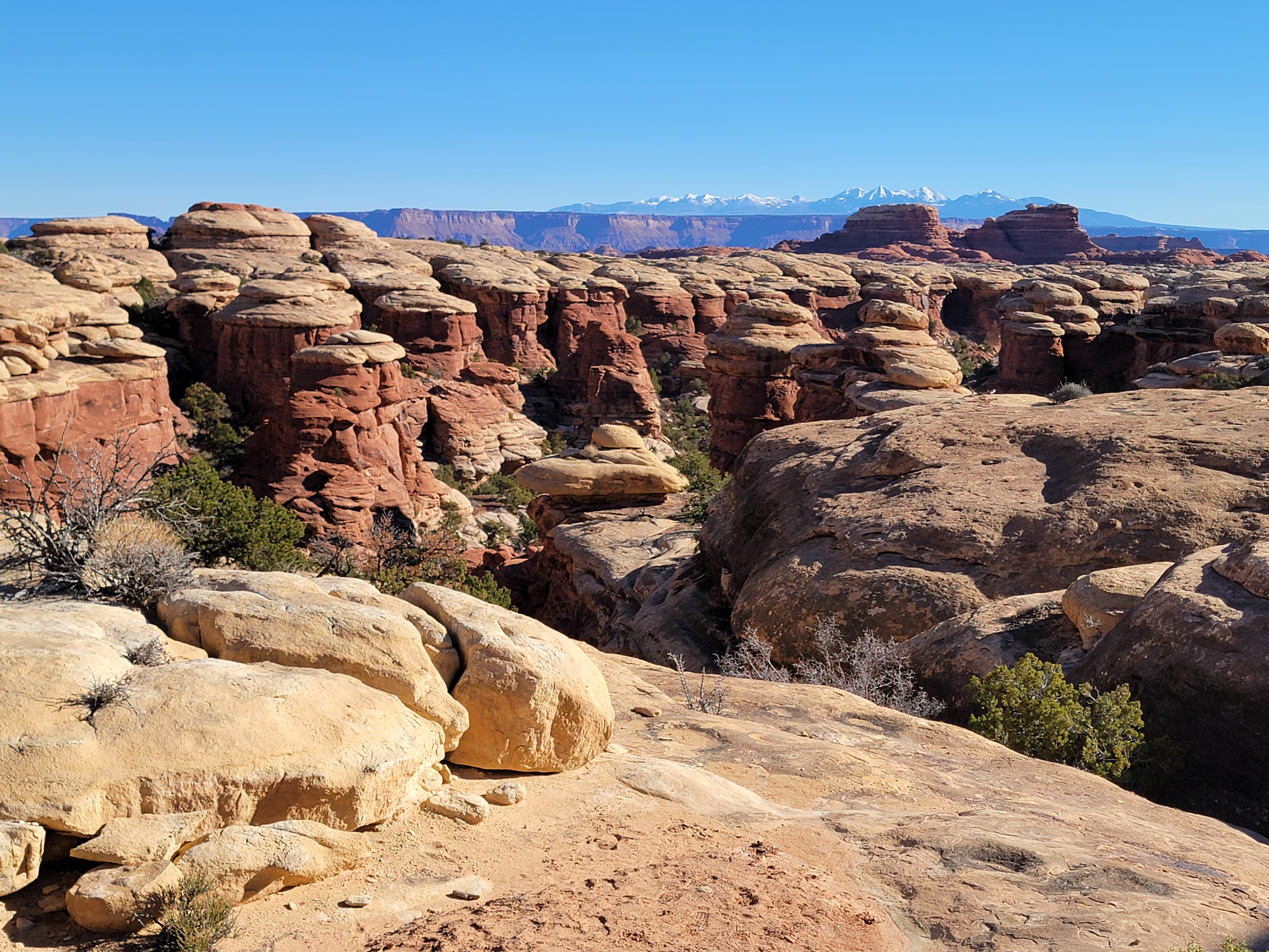
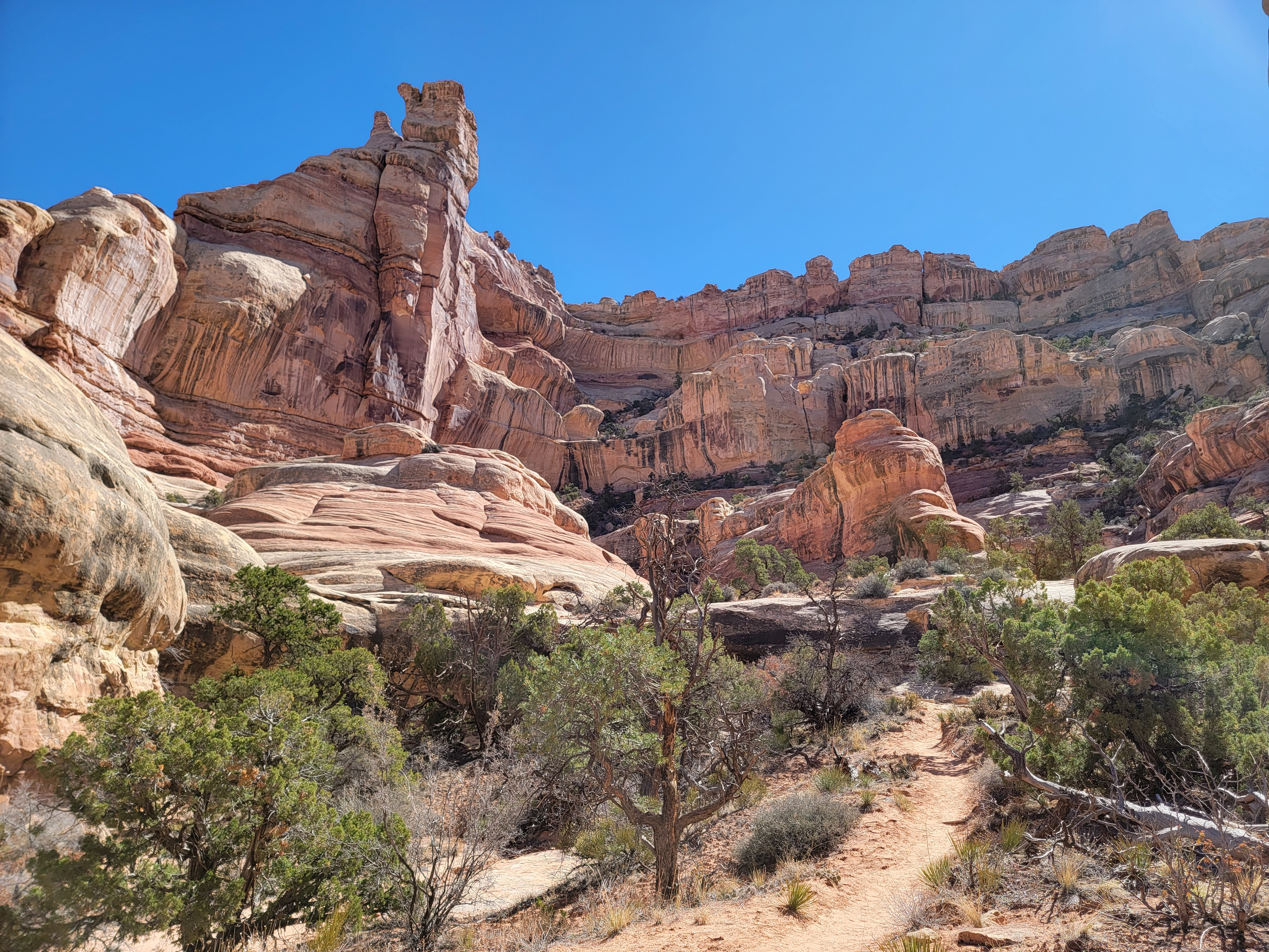
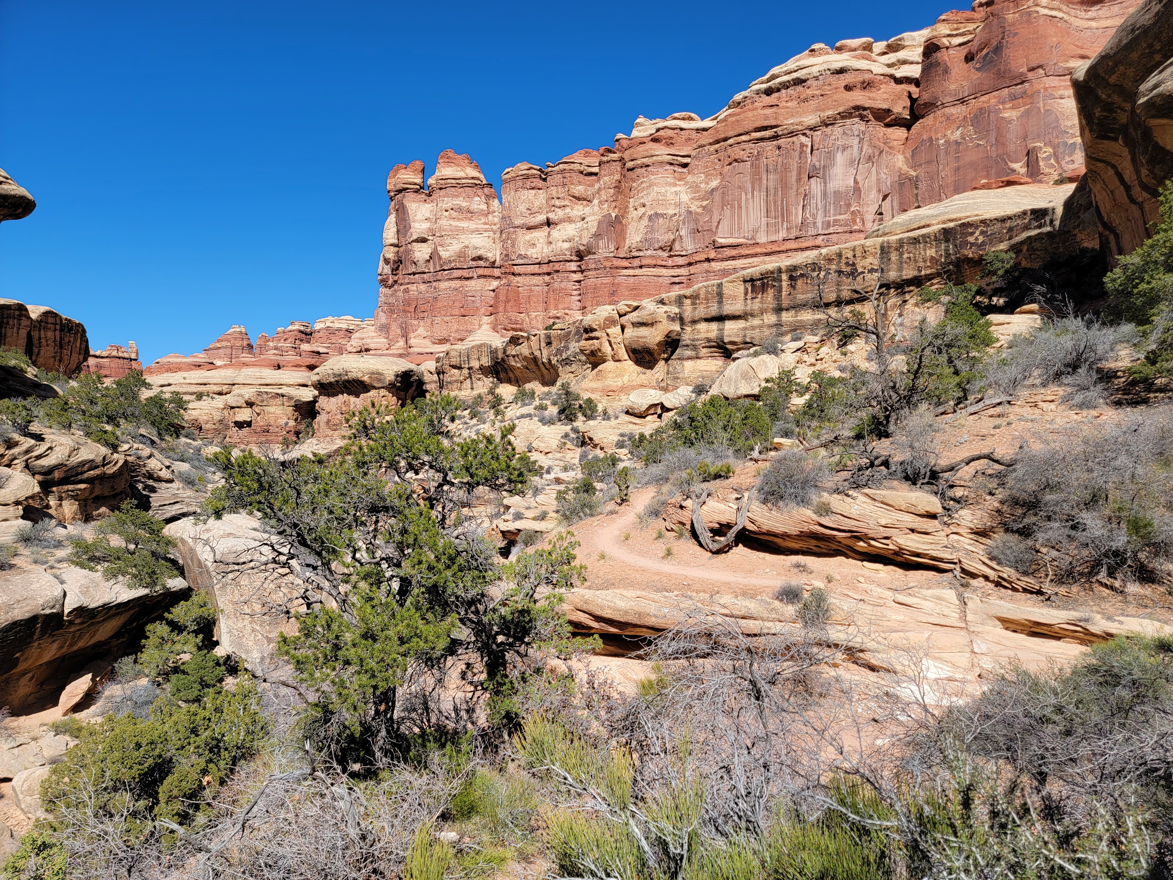
 Yeah, that's where the trail goes
I was familiar with the first two miles. It's the same as the route to Chessler Park. I've done that hike several times. The route passed through three rocky ridges. Not over, through. In each case it went through a narrow gap in the rock. One was only about three feet wide for about fifty feet. Where the trail to Chessler Park dropped down to cross Elephant Canyon and then climbed up the other side, the trail to Druid Arch turned to follow the wash at the bottom.
I watched carefully for cairns. Several times they marked where the route climbed very slightly out of the wash to follow a trail for a short distance before dropping back into the wash. While I stayed very alert so as not to miss any of these, I eventually figured out that they were probably there to avoid pools or mud in the bottom of the canyon. There was no need to worry about that today. It was dry as a bone and easy going. Once I realized that I didn't need to devote all my attention to following the route, I could sdmire the scenery more. I was glad for that because Elephant Canyon was very beautiful.
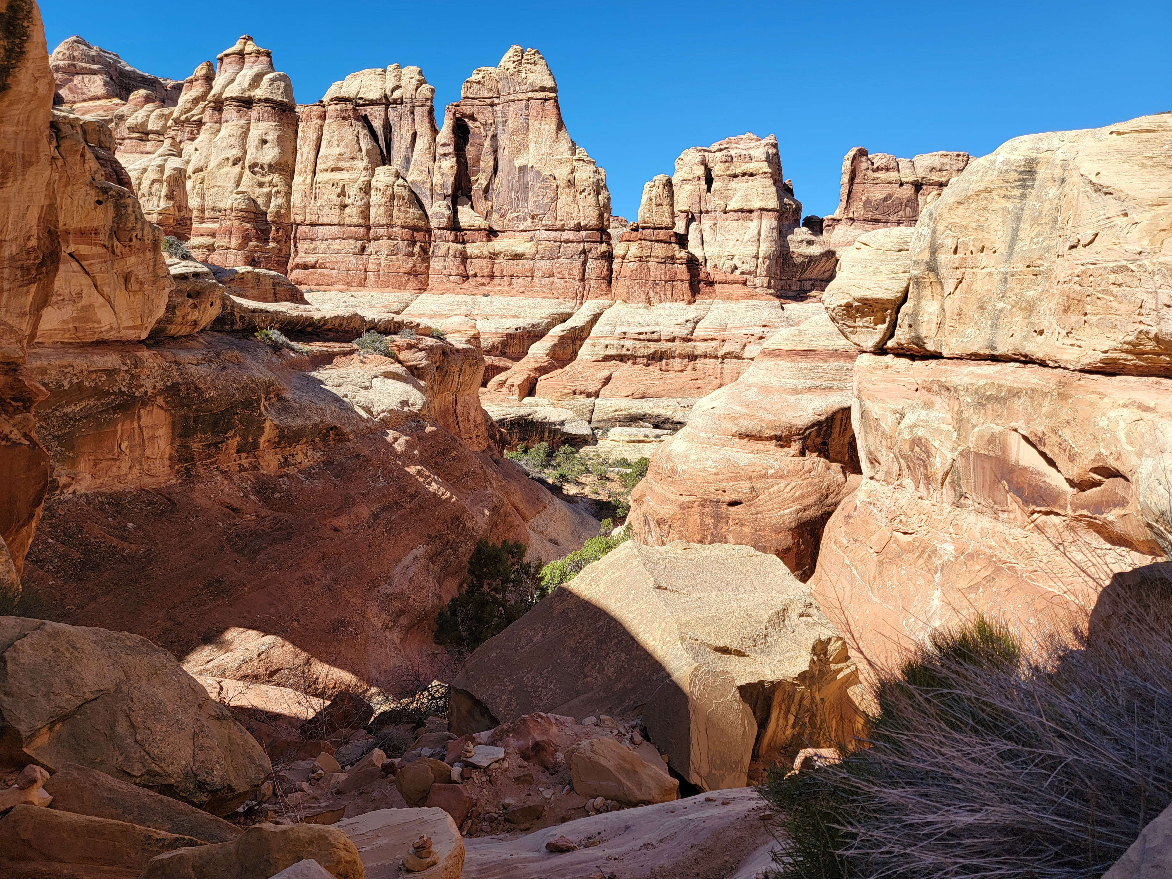
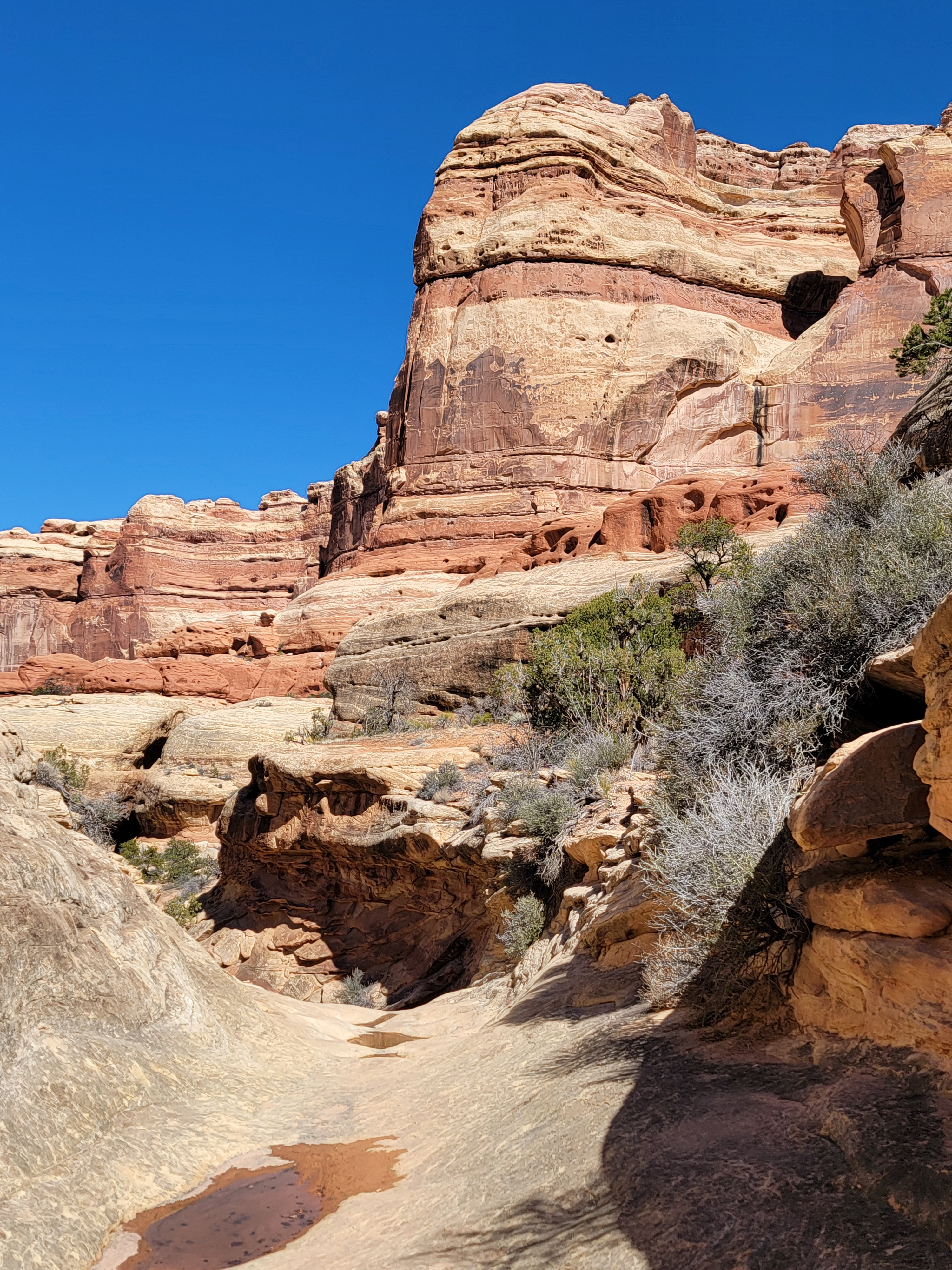
 Elephant Canyon
The route got a little more interesting in the last three quarters of a mile or so. At one point the tracks in the sand seemed to get faint and there were some puddles in the wash. Checking my GPS and AllTrails, sure enough, it said that the route had turned off about fifty feet back and showed it about twenty feet to my left. Since there was a rock wall five feet to my left and twenty feet high, I figured that the trail had to be about twenty feet higher too.
I backtracked and found a cairn marking a trail that climbed up a steep gap in the rocks and followed a narrow shelf for about a hundred yards. It went around a large pool that filled the bottom of the canyon, and a pouroff that looked like it would be tricky to climb up. Then it dropped back into the wash. Finally an obstacle that did require a workaround. I guess I shouldn't have been spending all my time looking at the scenery.
 Hiking in the wash at the bottom of Elephant Canyon
It wasn't long before I came to another pouroff. This time I had been watching and there was no side trail that allowed me to bypass the obstacle. The route went straight up and over. From a distance it didn't look too bad though. It was a rock slab about twenty feet high but angled back quite a bit. It looked like you could probably just walk right up it. I started to climb but the higher I got, the steeper and more intimidating the slab became. I stopped about three quarters of the way up, not sure how to proceed.
While I was in the bottom of the wash and approaching the slab, going up the right side had looked like the most straightforward way. From where I was now I could see that the slab there just kept getting steeper and steeper the higher you went. On the very far right was the canyon wall, but it was smooth and didn't offer any handholds that could provide extra security. Nope. I wasn't going that way.
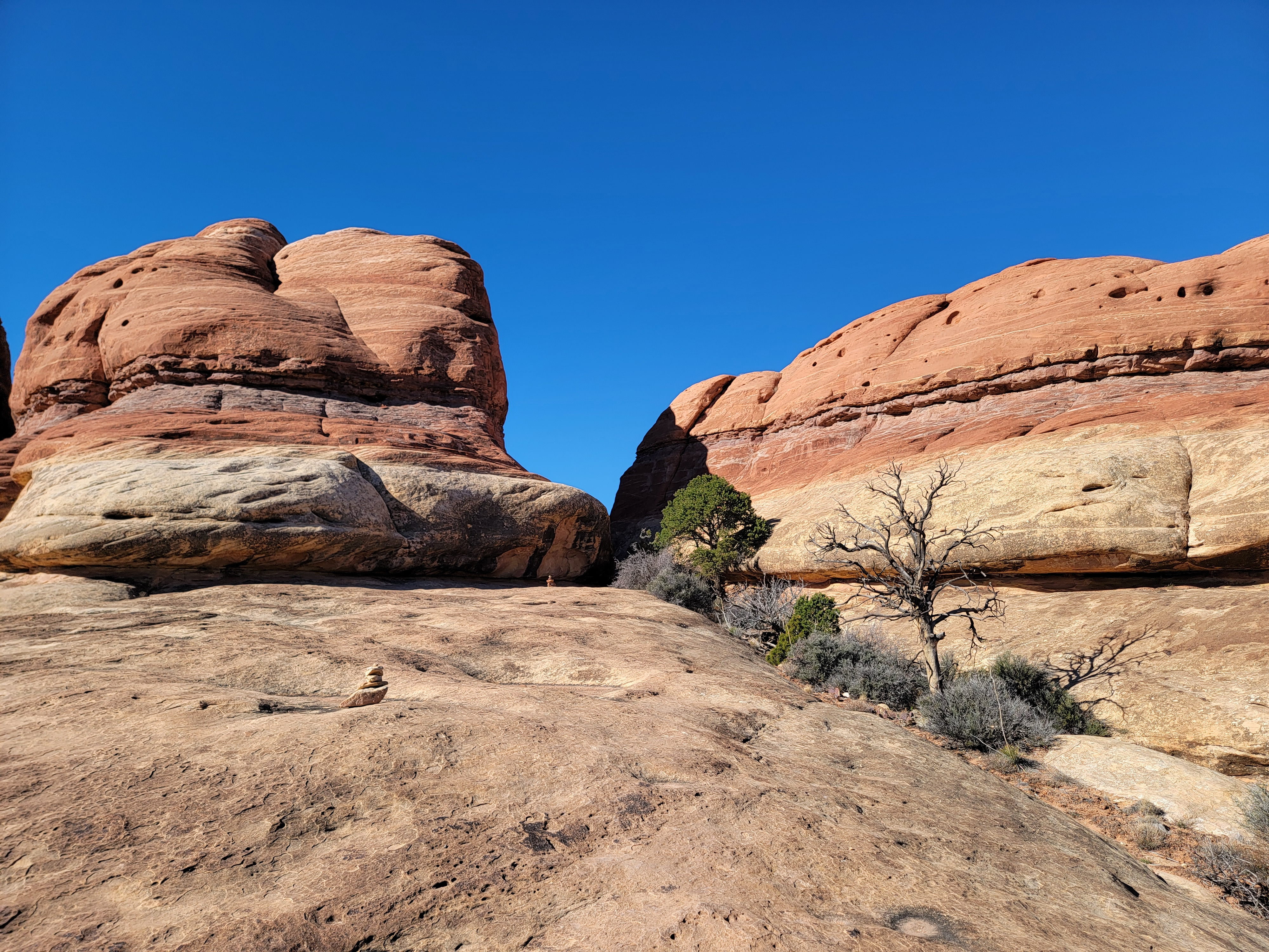
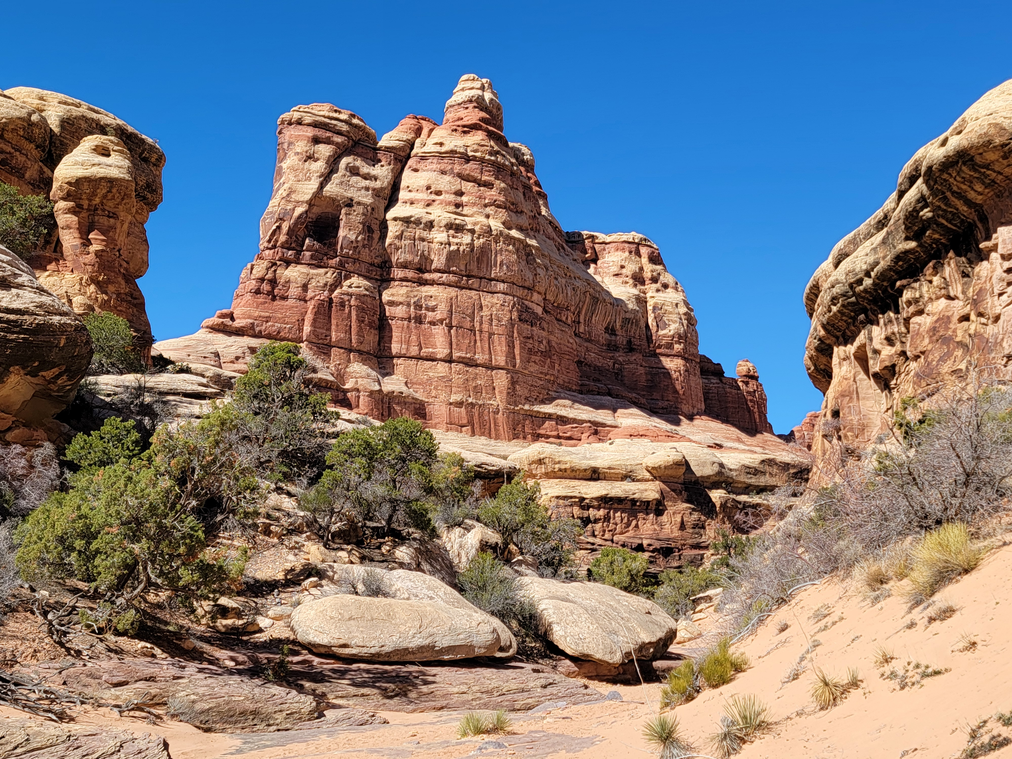
 My viewpoint was on the shelf below the tall spire
It looked like the best route was to the far left. There was just one tricky section. About two steps seemed sketchy, but after that the angle of the slope eased off and it looked easiser. I was also able to find some handholds on the canyon wall on this side. They weren't very good holds but every little bit helped! I hesitated for a bit and then went for it and made it up the two insecure steps. Then the angle lessoned for the last bit and the rest was pretty straightforward. Whew! That was pretty tough, but now that I was up I decided that it had actually been fun.
I didn't have to go much further before it looked like the canyon was coming to an end. A gully led up to the left. That's where the cairns went and so that's where I went. There was a ladder to get over an eight foot rock step. The ladder was easy although the exit across a sloping rock slab felt a bit exposed. Fortunately there was a metal rod anchored to the rock to provide a secure hand hold when moving off the top of the ladder.
 Looking down the steep gully that I climbed
Then the route just climbed straight up the steep gully, scrambling over rock steps and loose boulders. When I was about 150 feet above the bottom of the canyon, I sat down on a large boulder to catch my breath and appreciate the view. Druid Arch was now fully visible and was definitely impressive.
Looking around me, on one side, I could see a ten foot slab, fairly steep, that led to a large, flat rock shelf that was just across from the arch. Looking the other way, I could see a dirt track that led to a flat shelf on the other side. I chose the easy way and walked along the track. I found a large boulder and sat next to it in the only shade anywhere around. It was an excellent viewpoint for admiring the arch while taking a well deserved rest. I ate a few pieces of fruit and drank some water. I took lots of pictures. Then I just sat and admired the arch. It has an unusual form, and it's HUGE!
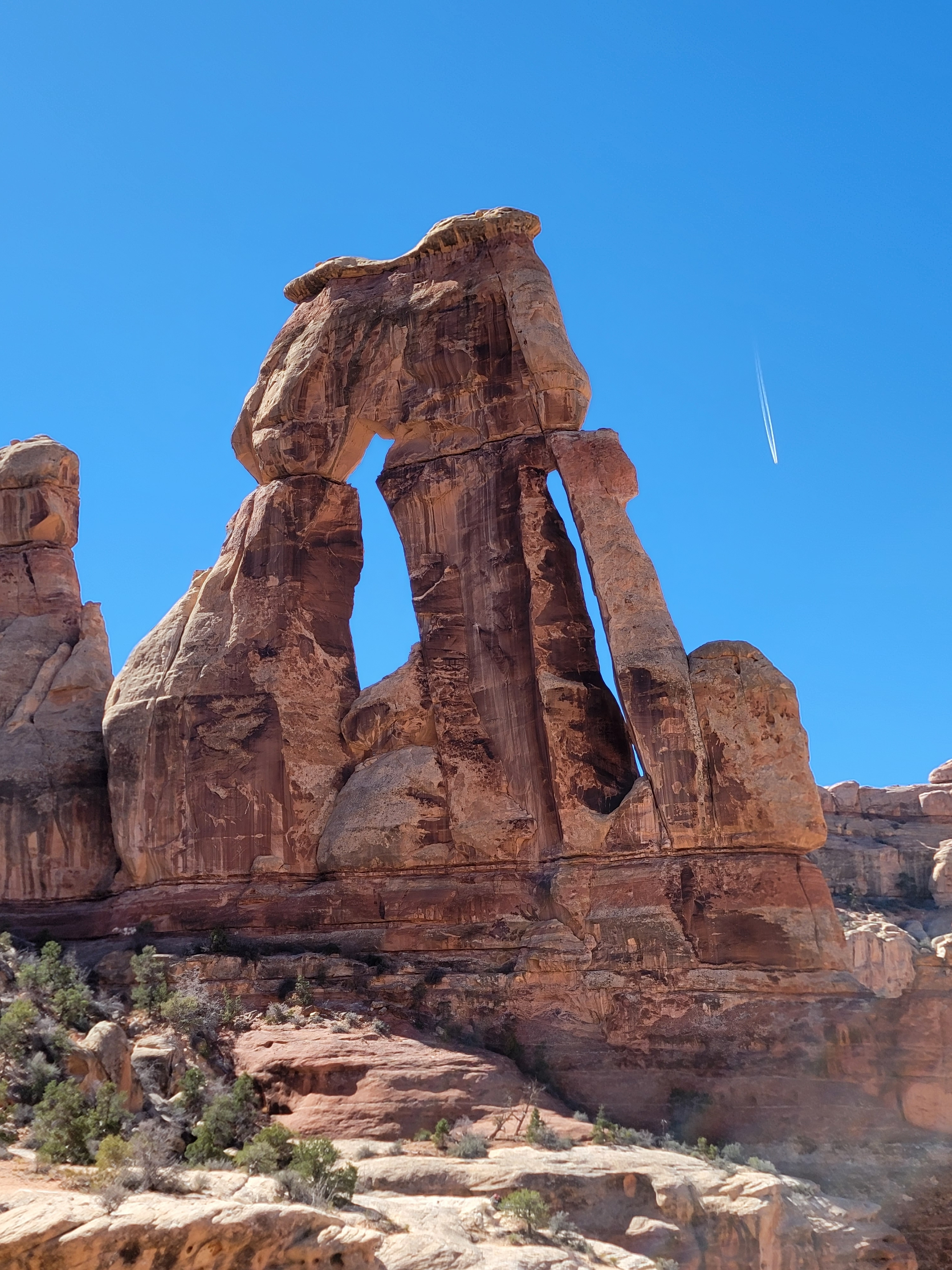 Druid Arch
I noticed people on top of the large area on the other side of the gully. That was probably the "official" viewpoint at the end of the trail. I watched when they descended and they didn't seem to have any trouble with the steep slab. I didn't mind where I was though. My spot had shade, just as good a view, and I had it all to myself. I stayed there about half an hour before heading down. Descending the gully was hard work and required some care, but I made it down without any trouble.
The ladder proved to be a little more difficult. It required traversing a few feet on a steep slab at the top of the rock step to reach the ladder. The rod attached to the rock provided an excellent handhold but I couldn't see over the edge of the slab to know where the top rung of the ladder was. It was tricky but I eventually got a foot on the ladder and then the rest was easy. In a few more minutes I was back at the bottom of the wash.
It wasn't long till I reached the top of the steep slab. There were two hikers coming up, a man and a woman. They were about three quarters of the way up, at the point where you realize that the last part is harder than it looks from below. I waited to give them a chance to climb up. The guy was moving far to his right - opposite from the side that I had climbed. But he looked kind of stuck. The lady asked me which way I had gone up and I told her it was their far left. We all stood there for a couple of minutes while they tried to figure out how to get up.
 View from my rest spot at the end of the trail
The guy finally started to move up very slowly on their far right. It looked pretty steep to me. His partner moved behind him into the middle of the slab and watched him. Since the side I had come up was clear now, I started to go down. I will admit that I didn't do it gracefully. I went down the steepest part on my butt, but at least that gave me a lot of friction. Even that was exciting for one or two moves, but then I got past the upper part and was able to stand up and walk down the rest of the way.
Meanwhile the guy had managed to get up the other side, but it definitely had looked hard. I was impressed. The lady decided that in spite of my lack of style, the way that I had come down was better. She went that way and made it pretty easily. They both had made it to the top and I had made it down. We shouted congratulations to each other and then turned and continued on our separate ways.
 Approaching the steep slab from above
At one point I paused to let a hiker who was quickly overtaking me go past. As he did he stopped and asked me about my Stanley Idaho tshirt. He wanted to know if I was from Stanley. I explained that I lived in Boise, but hiked in the Sawtooths a lot. He said that he and his wife had done a trip there with Sawtooth Outfitters and thought it was the beautiful place on earth. They even named their daughter Alice, after Alice Lake. Ok, that's pretty extreme. Maybe I should have named Tim or Mickey after a lake in the Sawtooths. They probably wouldn't have liked Alice, but Sawtooth or Goat might have been good names. Hell Roaring would have been even better.
The hike down Elephant Canyon was pretty. The afternoon sun was bright and really brought out the color in the rock walls. Other than climbing around the one pool, I didn't bother with any of the side trails. I was getting tired and it was easier to just trudge mindlessly down the middle of the wash, enjoying the view of all the cliffs and rock formations. Because of that I did manage to miss the turnoff and overshot the trail back to the car. Fortunately I caught it right away and only had to backtrack for about a minute to get back on course. I was glad that just like yesterday, there was no one there to see the Mighty Hiker's mistake. It's not like I was in a hurry to get back or anything.
 Returning down Elephant Canyon
I was tired enough that the climb out of the bottom of the canyon wasn't fun. Then it was just two miles of mostly flat trail to get back to the car. Going through the gap in one of the ridges, I passed a large group going the other way. It was so narrow that we had to turn sideways to get by. One guy had a baby carrier on his back so he couldn't turn. We were barely able to get past each other. Good thing I'm skinny! I finished the hike at 4:30. My car said that the temperature was 64 degrees. That's a little warmer than when I started out. Overall, it was a very pleasant day for a hike.
My stats for the hike from my GPS and AllTrails:
Distance = 11.09 miles
Elevation gain = 1,755 feet
Total time = 6:25:45
A good day's work, if you ask me.
 Starting to get tired but the scenery is spectacular
Then I had the hour drive back to the hotel again. The pizza place in Monticello was closed on Sunday so my only option was Subway. I had planned to drive to Moab to get something to eat but decided I really didn't want to drive an hour and a half for dinner. The last two days I had two hours of driving to and from the trailhead and had a long drive home tomorrow. I settled for Subway and I was hungry enough that it tasted really good. I went to bed early again. I would decide in the morning whether I would do another hike or just head straight home.
I didn't sleep that well. I really wanted to do the hike to Peekaboo, but just didn't have a lot of energy in the morning. Besides, I didn't want to do the extra two hours of driving to and from the trailhead on top of nine or ten hours to get back to Boise. So I went straight home. The drive back was easy. I hit Salt Lake around noon so traffic there was no problem. I was a little nervous when I reached Boise at about 5:30 but there wasn't as much traffic as I extpected. I was home by 6 pm.
Two great hikes. Fantastic scenery. Sunny skies. Comfortable temperatures. It was a short trip but an excellent one.
