MacKinnon Pass
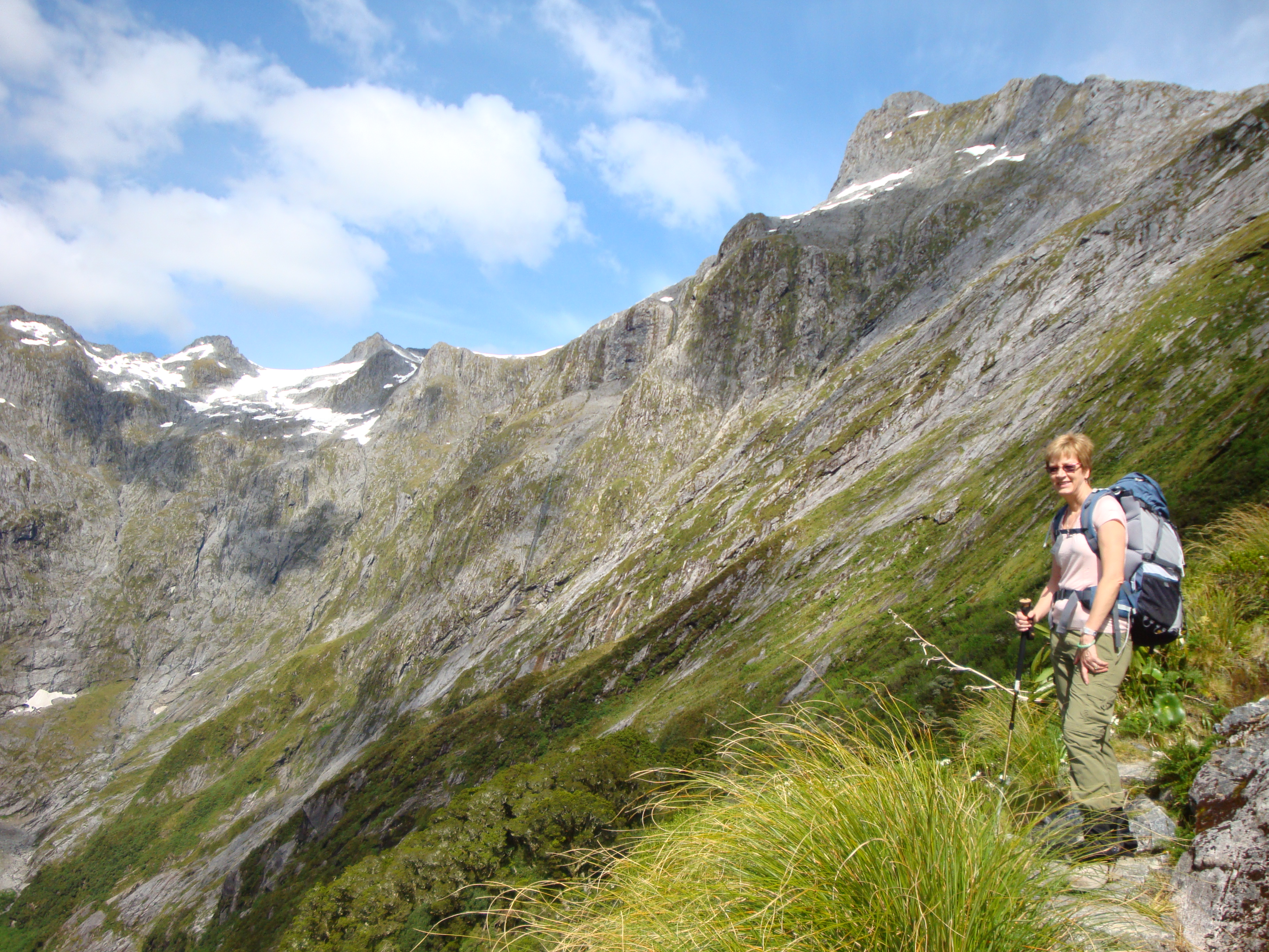 Half way to the pass and the clouds have vanished
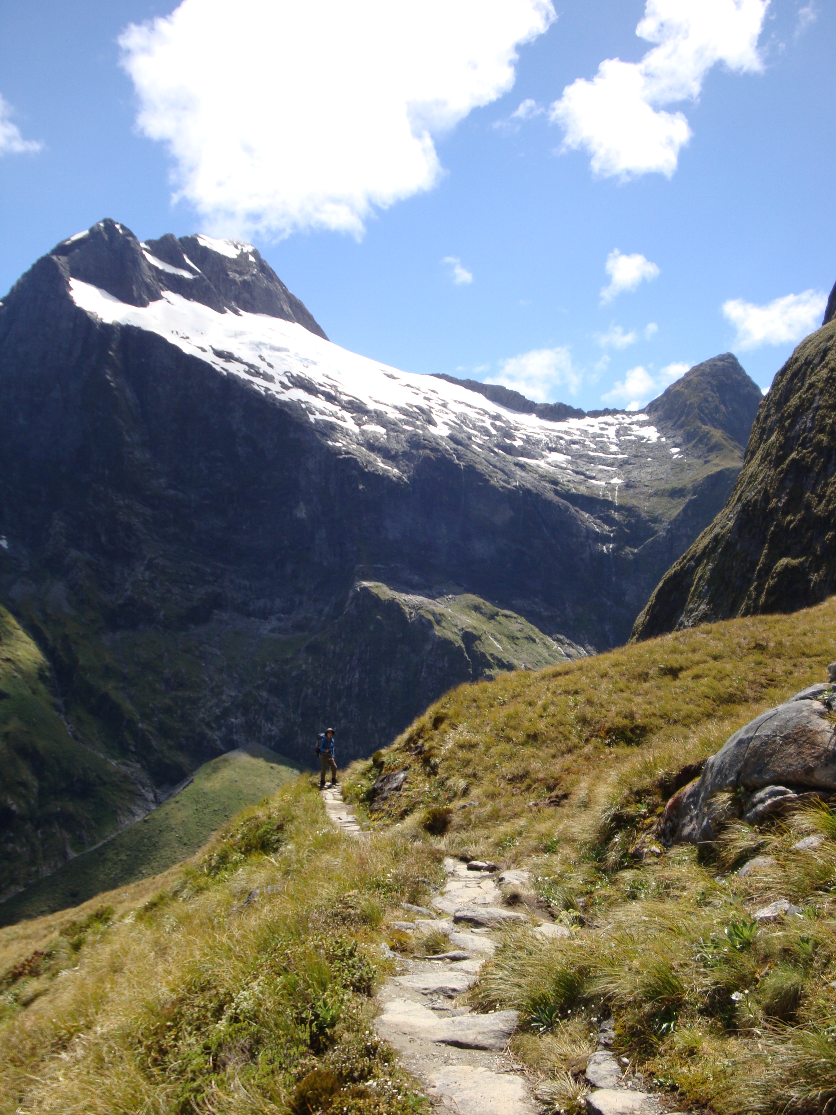
Today was The Day.
The day we went over the pass. The day that would make or break the hike. Would we be miserable in rain, fog and cold on the pass? Or would we have warm sunshine and spectacular views of the mountains?
The weather forecast was good but we woke up to overcast skies. Not to worry - it will burn off. We had breakfast, packed, and left at 7:30 am. Today would be the hardest day of hiking. The distance was only nine miles but we had to climb 700 meters to the pass and then descend 900 meters to the Quintin Hut. A healthy hike even in fine weather.
The Milford Track is pretty simple. It is a route from Lake Te Anau to Milford Sound. It heads up the Clinton River Valley, which is mostly flat until it reaches what appears to be a dead end. Then via a series of switchbacks it gets up a seemingly impossible obstacle to the pass. From there it skirts a 2000 foot cliff and finds a devious route down into the Arthur Valley which leads easily to Milford Sound. This route was discovered by Quinton MacKinnon in 1888. He was one tough dude to deal with the horrible weather, the thick brush, the steep terrain and the voracious sandflies. I am impressed. The original hope of the pioneers like MacKinnon was that the Milford would be a route for gold to reach Milford Sound to be shipped out (Central Otago was having a gold rush in those days). That never happened, but the Milford was very soon developed as a tourist route, which it remains to this day.
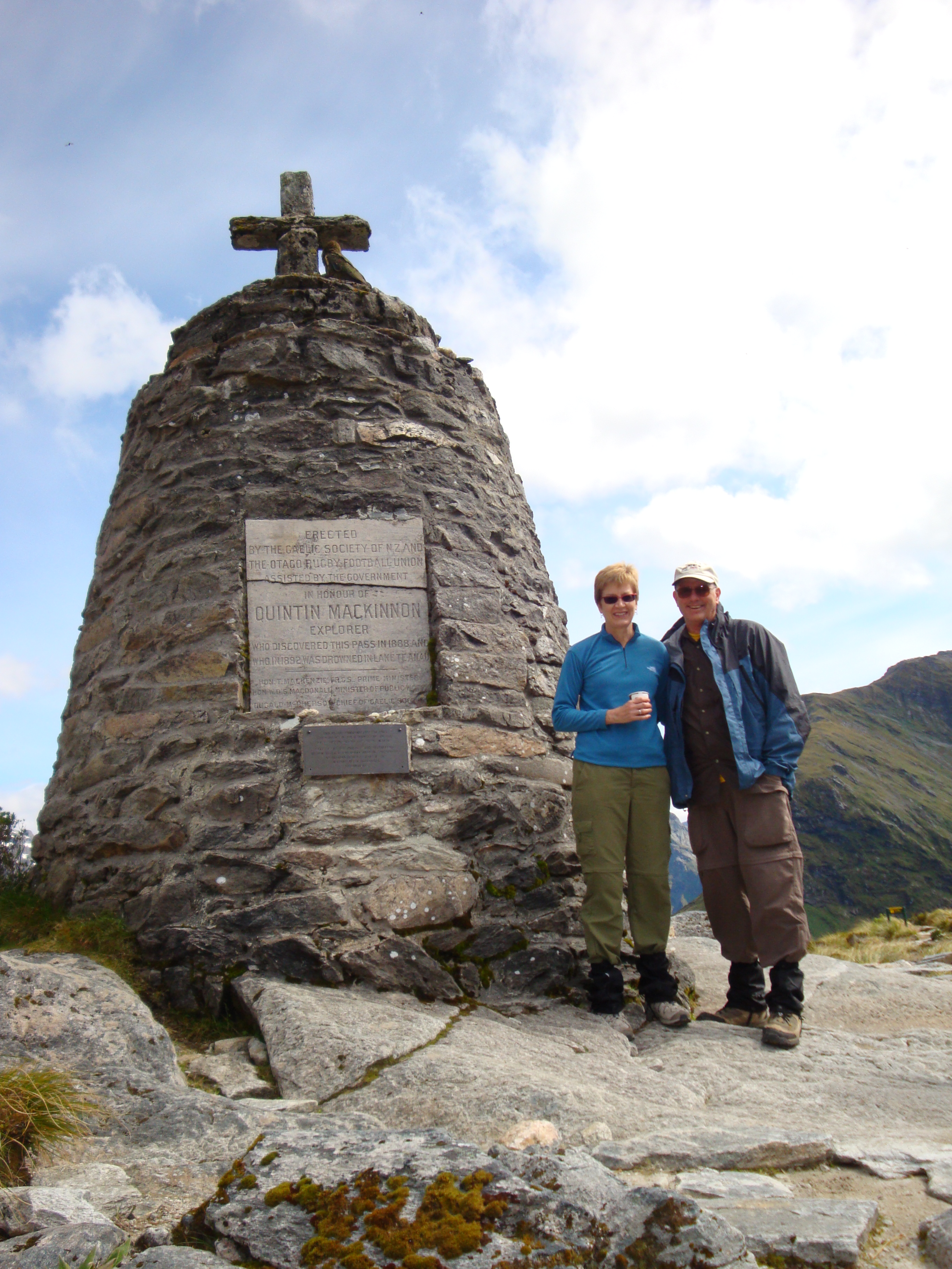 Sandy and Steve at the MacKinnon Monument
And on this day these two tourists were going up lots and lots of switchbacks towards the pass. About half way up the clouds cleared and there was nothing but blue sky and bright sunshine. After a long climb we reached the MacKinnon memorial. One of the guides, Imelda, was there serving hot tea and coffee. Quite a location for a Starbucks. The drinks were very welcome, although I bet they are a real hit when the weather is terrible. It was quite windy on the pass itself but with our jackets on it was fine. And the views were wonderful. Just beyond the monument were some rocks at the top of a sheer cliff. This is the famous "twelve second drop". If you drop something from this point it is supposed to fall for twelve seconds before it bounces. My physics tells me (misspent youth) that x=½at2 so the cliff must be 2300 feet high. Looking over the edge (from as far back as I could be) I could believe it. From there we climbed over one more small hill and reached Pass Hut, which was where our group stopped for lunch.
There were three important activities at Pass Hut. Not neccessarily in order of importance they were: eat your lunch, enjoy the view, chase away the keas. Keas are the only mountain parrots in the world. They are very intelligent birds which use their smarts to get food from people. While I was sitting outside of Pass Hut I saw keas unzip packs left by hikers and get inside to search for food. Smart birds. Just in case they couldn't get the zipper open they have a powerful beak and could rip through the pack cloth instantly. But most of the time they were polite and actually opened the pack and took things out. You had to watch your stuff every second. I did see one person get up to get some water from the hut and in the few seconds they were gone a kea grabbed their lunch bag and made off with it. Everyone yelled at the kea but it completely ignored us, other than to laugh at us.
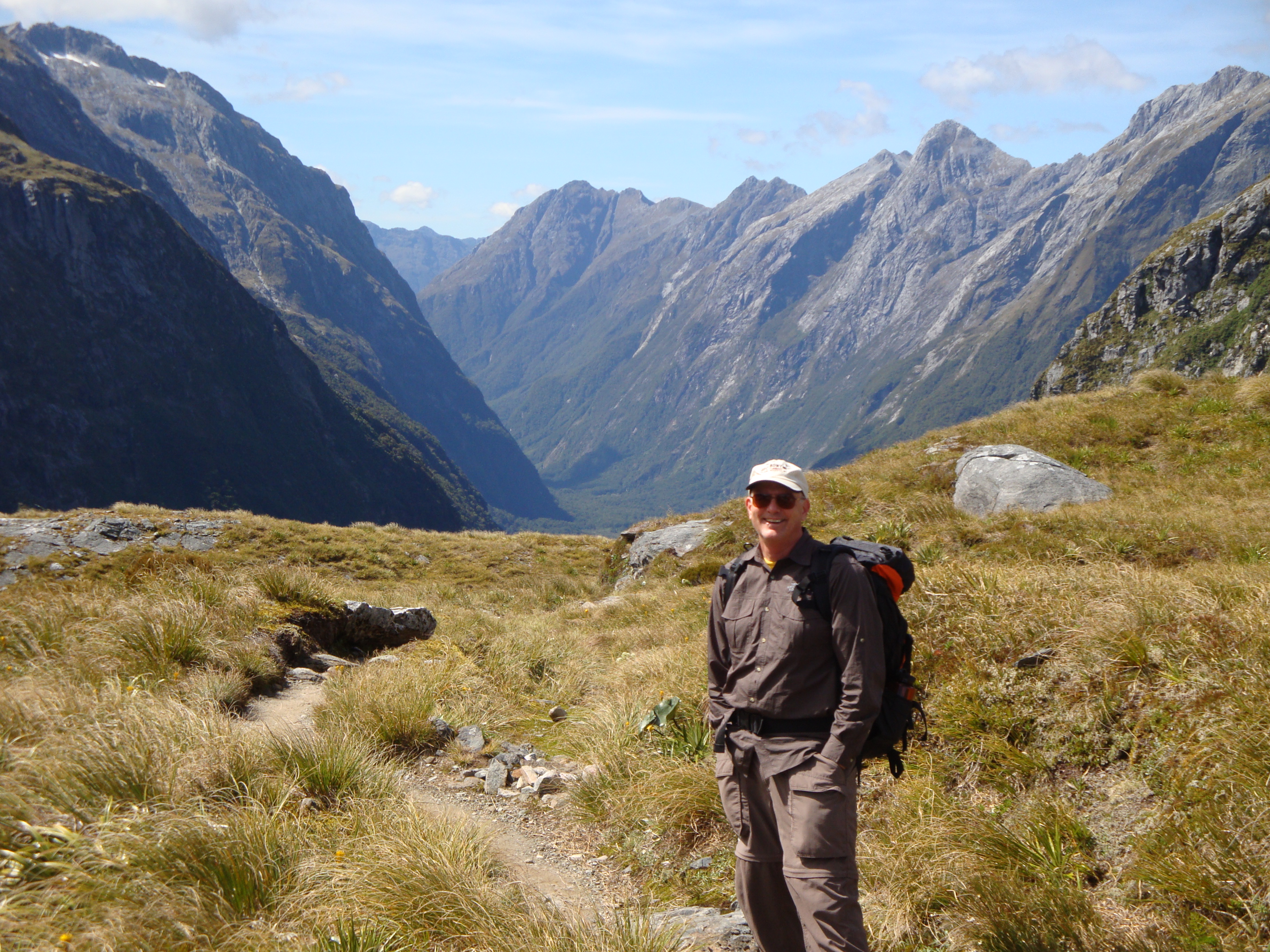 Steve at the summit of MacKinnon Pass
Keas, like most of the birds in New Zealand, have almost no fear of humans. I learned the explanation for this from Tom, one of the guides. New Zealand separated from the ancient continent Gondwana 82 million years ago. This was still during the Age of Dinosaurs before mammals became common. So mammals never evolved on New Zealand. Other than two species of bats (which probably flew there) there are no mammals that are indigenous to New Zealand. Instead there are lots of flightless birds like the famous New Zealand kiwi. There are no snakes either. So there are no mammal predators native to New Zealand and most of the birds have no fear of large animals. This is a major problem today as a few mammals that have been introduced, like stoats, weasels and rats, are decimating the native bird populations which have no defense against them. Many have become extinct. In the meantime, a kea is quite happy to come right up to you while you are sitting and eating your lunch. Given the powerful beak and sharp claws that a kea has, I'm not sure who should be afraid of who.
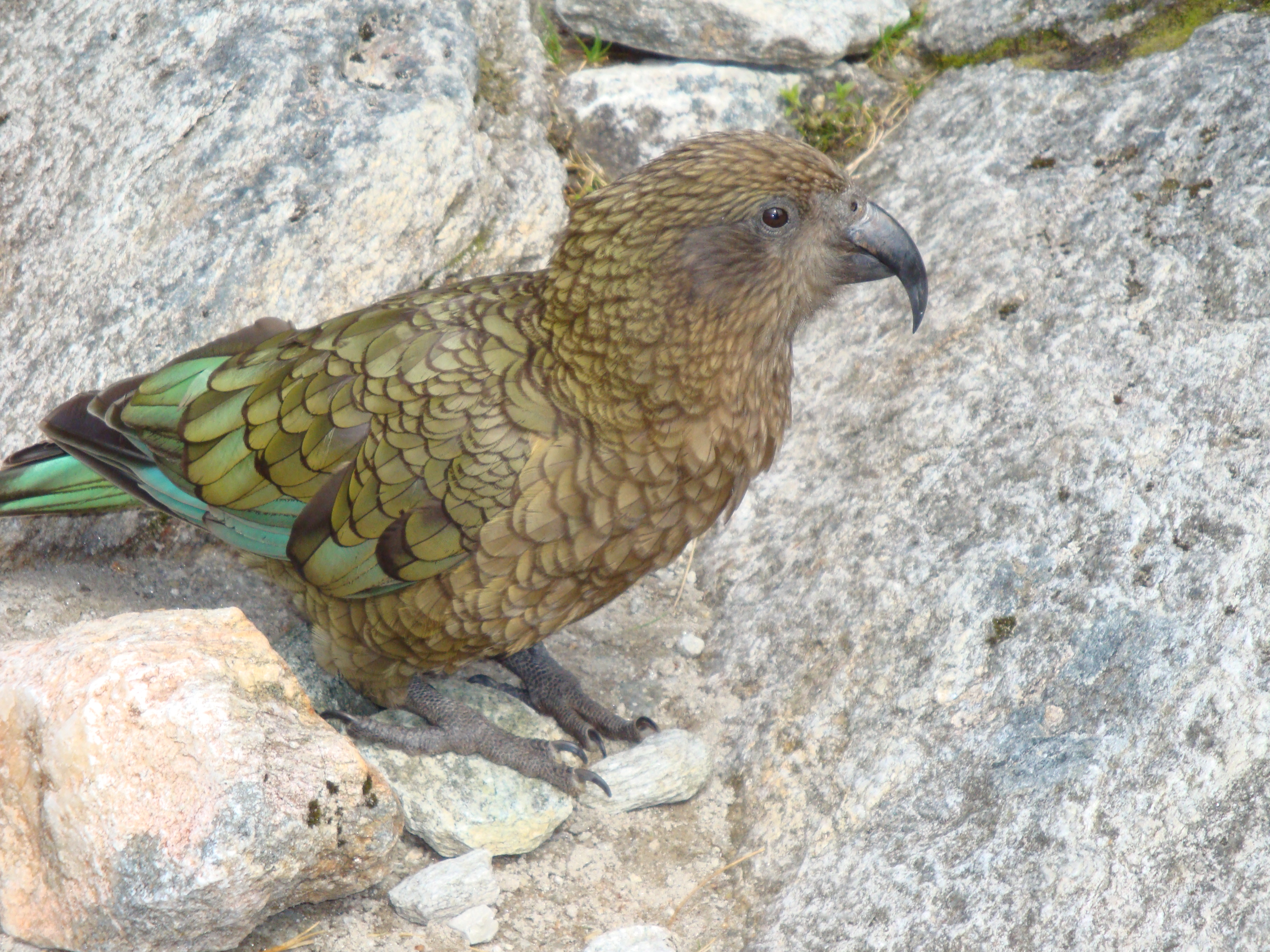 A kea looks for a handout
About a hundred feet from the Pass Hut is another important structure, a chemical toilet. Someone with a sense of humor put a small window in the door of the toilet so that while it is in use the occupant can see out to the surrounding mountains. It is known as the "Loo with a View".
The view from MacKinnon Pass really is spectacular. We could see down the valley of the Clinton River heading back towards Lake Te Anau. We had spent the past three days hiking up that valley. On the other side the Arthur Valley wound towards Milford Sound, thirteen miles away and out of sight behind bends in the valley. We would spend the next day and a half walking down that valley. On one side of the pass rose Mt. Balloon (who the heck named that peak?) and on the other side was Mt. Hart. The mountaineer in me looked at the ridge rising up to Mt. Hart. It looked like a reasonable scramble from the saddle. Tom confirmed my assessment and said that sometimes independent walkers do climb the mountain when the weather is good. I guess I'll have to do it the next time I do the Milford Track if the weather is good again. I'll need to get a much earlier start.
 Sandy starts the descent from the pass
Another thing I learned from talking to Tom the Mountain Guide is just how lucky we had been with the weather. He had done the track with another group just before ours. The guides for Ultimate Hikes usually do the track twice in a row between days off. At the end of the hike when the bus stops in Te Anau for lunch the guides hop off and hop on the bus of the group that is on their way to the start of the hike. Three of the four guides on our trip did that. Tom said that his previous time through it had rained every day, hard. In an earlier post I mentioned that we had read that Milford Sound had received 700 millimeters of rain in the week before we left. The group the previous week never saw the mountains. It was totally foggy when they crossed the pass. Tom also said that he had heard about the groups just ahead of us on the radio as well. The group one day ahead of us had to wade through chest deep water in a few spots because of flooding. The group one day ahead of that needed to be helicoptered seven miles down the track on the last day to get past a section that was dangerous. But we had no rain, sunny skies, great views and a (mostly) dry track. We had certainly won the weather lottery.
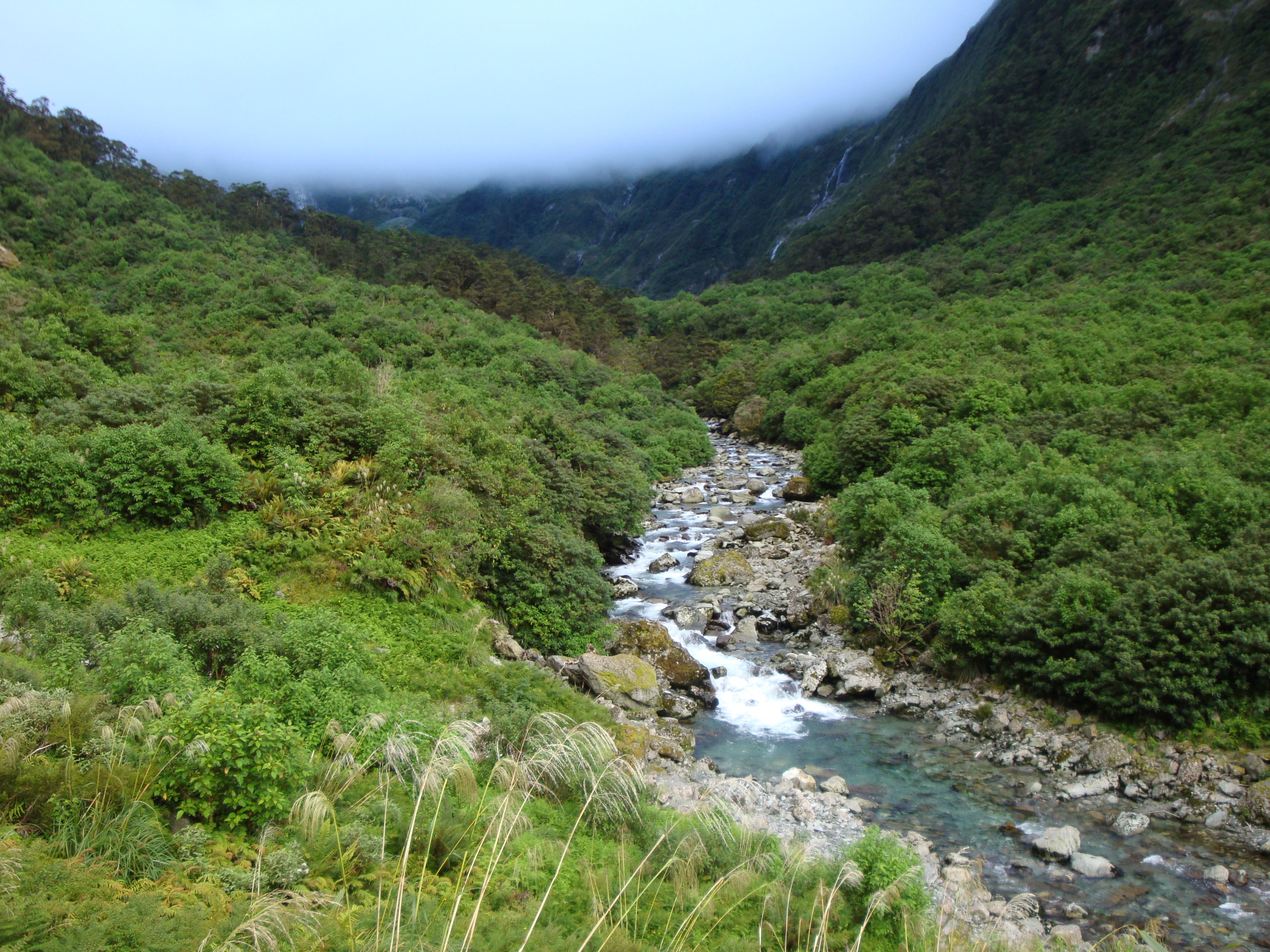
Eventually it was time to head down from the pass. Our destination for the night, the Quinton Hut, was clearly visible from the pass. It wasn't far away but it was 900 meters below us, a long way down. The track traverses quite a distance across the saddle of the pass and then drops down into Roaring Burn. The track is quite steep and rocky. In some sections stairs have been installed to make the going easier. But it is a long, hard descent to reach the hut. It is very pretty descending the Roaring Burn. We hiked alongside cascades and waterfalls the entire way. Finally we reached the Quintin Hut. We were tired but happy.
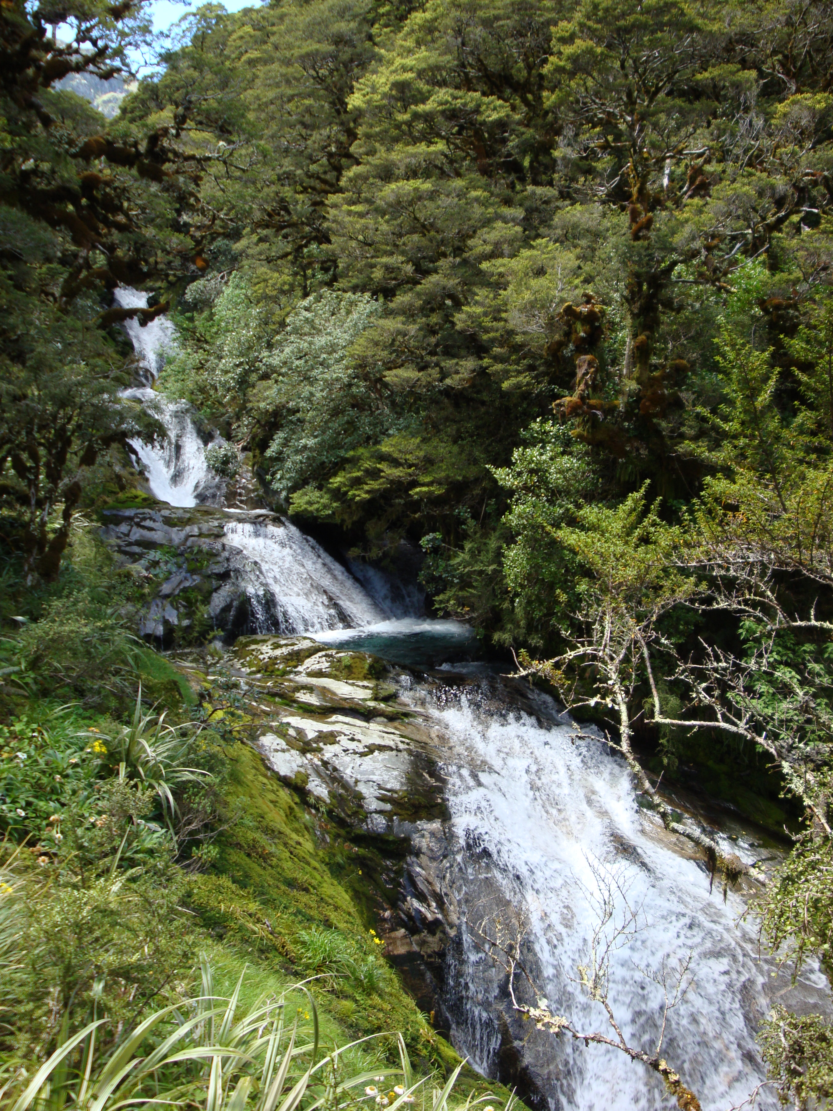 Waterfall in Roaring Burn
There is one additional challenge after reaching the hut. There is a 45 minute side trail to the base of Sutherland Falls, at 580 meters it is the tallest waterfall in New Zealand and the fifth highest in the world. Sandy decided to crash but I went for it. The falls are very impressive when you get close, at least as close as I was willing to get. The air is filled with spray so I stopped about a hundred meters or so from the base. Some hikers wear swimming suits and walk behind the falls but that seemed too cold for me. I was content with how close I got. A picture just can't convey the noise and power when you are right below such a massive waterfall. Sutherland Falls is named for Donald Sutherland, a nineteenth century pioneer who tried to establish a townsite in Milford Sound. Interestingly the falls is named for him because he and a partner were exploring up the Arthur Valley when they discovered a waterfall. He lost the coin toss so his partner got to name Mackay falls after himself. That gave Sutherland rights to put his name on the next feature that they discovered. He hit the jackpot.
We had been lucky too on our hike. Thirteen miles and one more day to go.
Additional pictures
Looking ahead to MacKinnon Pass - still in the clouds


