Canyon Country Fall 2012
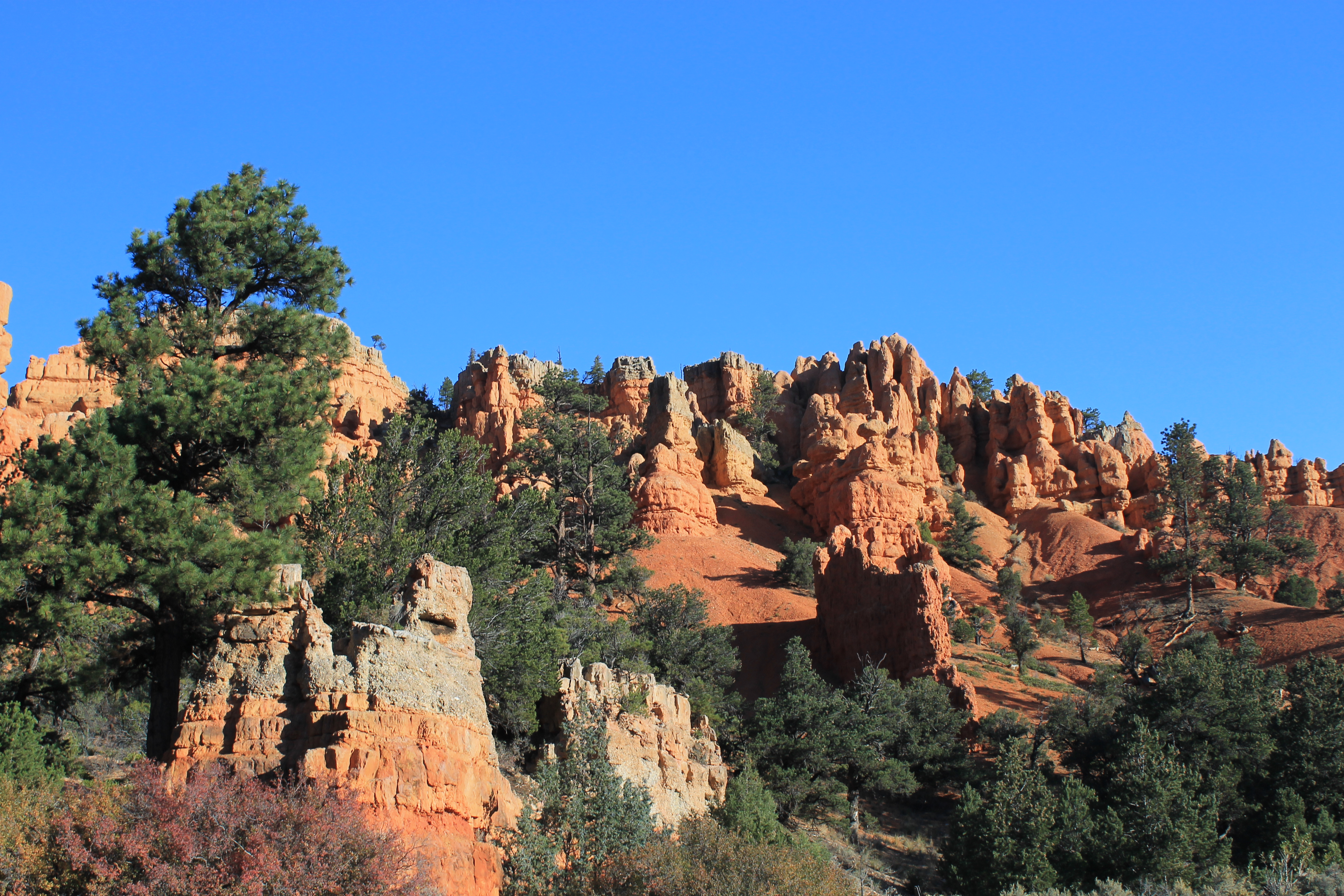 Rock formations in Red Canyon
After my brother's visit in mid-September, the weather was still good for hiking. Unfortunately the smoke from all the forest fires was still really bad. By this late in the season there weren't many options to avoid smoke. Idaho was still covered most of the time. The Cascades, where I had made several trips in August, now had smoke in both Oregon and Washington. The Sierras were mostly clear but way too far to go in a weekend. That left Utah. Since the weather was still quite warm parks like Zion would be very hot. But Bryce Canyon is higher, about 8000 feet on the rim. We had been there many years ago and Sandy really liked it. But we never made it back because the season there is out of sync with the other Utah national parks. In the spring when we go to Zion or Capitol Reef or Arches there is still snow at Bryce Canyon. In the summer when Bryce is feasible the high mountains all over the Western US are clear of snow too and we always seem to go somewhere else. But now it looked like an excellent choice.
 Descending into Fairyland Canyon
To make it even better, Sandy wanted to get some bookcases from Ikea for her sewing room. She had found the perfect size and color and they weren't very expensive - only $59. But we don't have an Ikea store in Boise. The shipping if she ordered them online would be $250! That would just be wrong. But there is an Ikea store in Salt Lake City. Well, Draper actually (burbs south of Salt Lake City), but same thing. It's next to the freeway and we would pass right by it on our way to and from Bryce Canyon. Although I viewed the chance to get the bookcases as a happy bonus of a trip to Bryce Canyon, I have a strong suspicion that it might have been Sandy's primary motivation. But it didn't matter. We were both psyched to do the trip. I didn't have a three day weekend but my schedule this fall was great for weekend hiking trips. Since I worked one evening I got Friday afternoon off. We packed up Thursday night. I came in early on Friday so that I was done for the day at 11:00 am. Meanwhile Sandy had taken Laney to stay with our friend Nancy in Emmett. We met at home and hit the road about noon.
 Lots of rock interesting formations along the trail
We had actually invited a friend along on this trip. Ivan, one of the guys that I work with at the University of Idaho, was fascinated by Delicate Arch in Utah. He says that when he was growing up his father had a picture of it. He always wanted to go to see the real thing. When Sandy and I went to Moab this spring we went to Arches National Park When we came back with pictures taken at Delicate Arch he resolved to make the trip. He and his wife made plans and this was the weekend that they picked. But at the last minute his wife had to attend a class for work on Saturday and they had to abort. Ivan was bummed so we asked him to go along with us. It wouldn't be Delicate Arch but at least he would see some beautiful Utah canyon country. He decided not to go even though he could have learned hiking from The Masters. Now he'll have to experience the scenery vicariously through the pictures here on Darth Dog. (You missed an awesome trip Ivan!)
 Hoodoos in Fairyland Canyon
With a noon departure we got to downtown Salt Lake City almost exactly at five oclock. That was terrible timing, just as on all my other trips to Utah this year, but there wasn't anything that we could do about it. The rush hour traffic was horrible through South Salt Lake, Sandy and Draper. It let up briefly but then we hit major construction in the Utah Valley through Orem, Provo and Spanish Fork. We probably lost almost an hour by having to go through at the time that we did. But finally we were past the Big City and all the traffic. After that we made good time along the interstate. We stopped for a late dinner at a Subway in the town of Beaver. No matter how many times I drive I15 through Utah I just can't go through that town without making some bad joke. One of these days I am going to have to get a tshirt from there. Back on the freeway it was only a few miles till we turned off on US 20 to cross the mountains into the next valley to the east. We turned south again till we reached Panguitch (pronounced "pan-gwitch") which was going to be our base for the weekend.
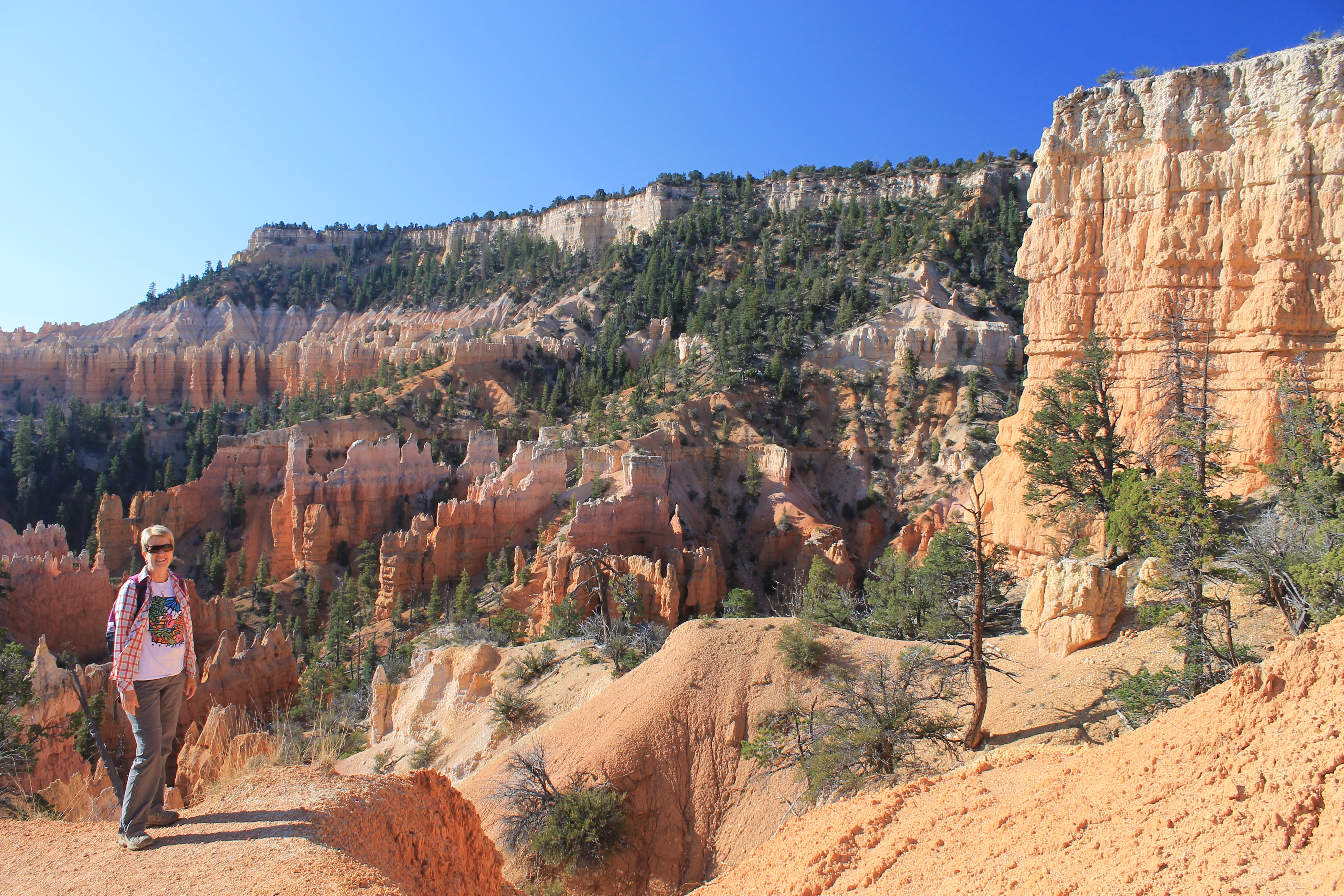
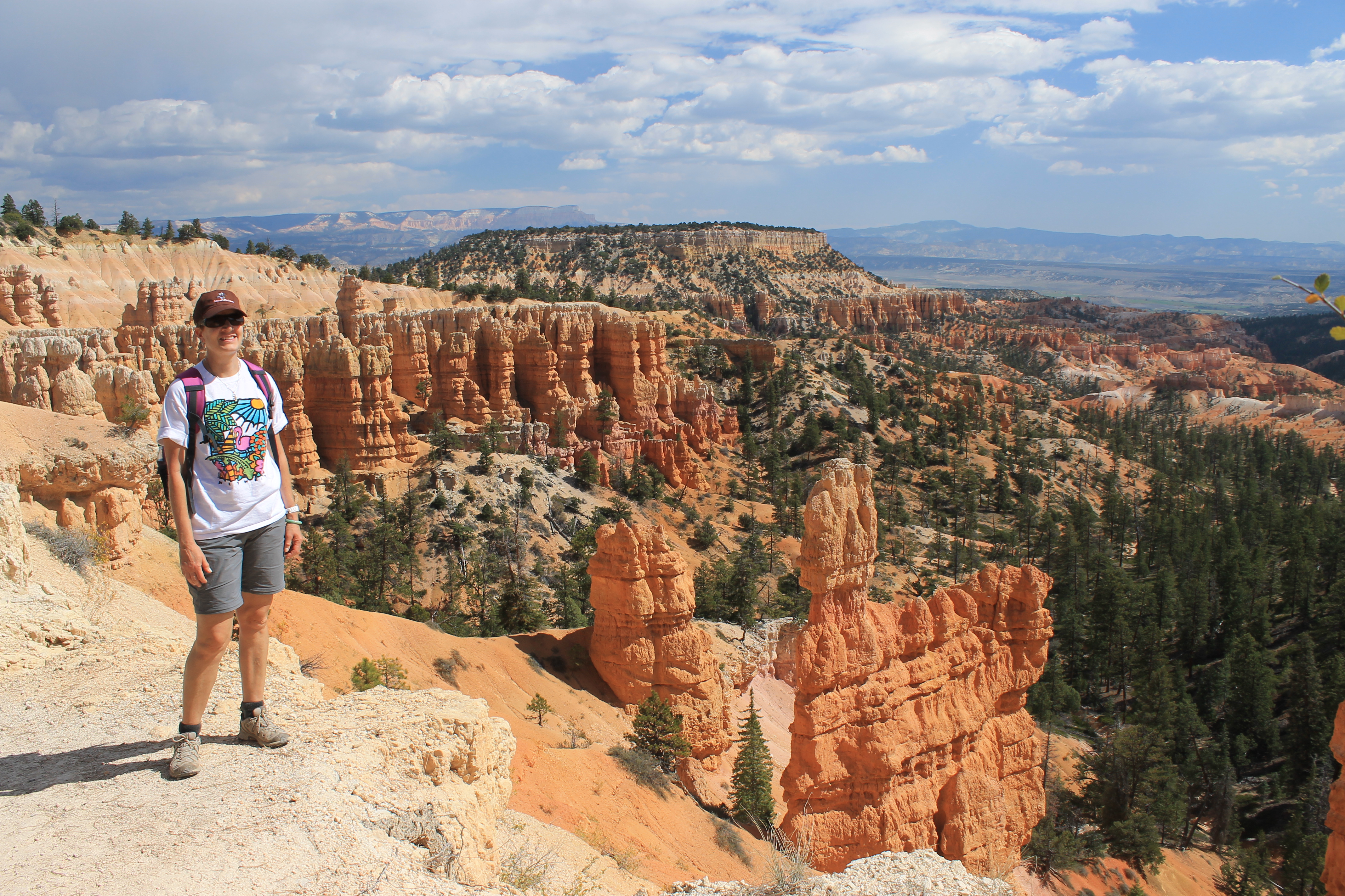
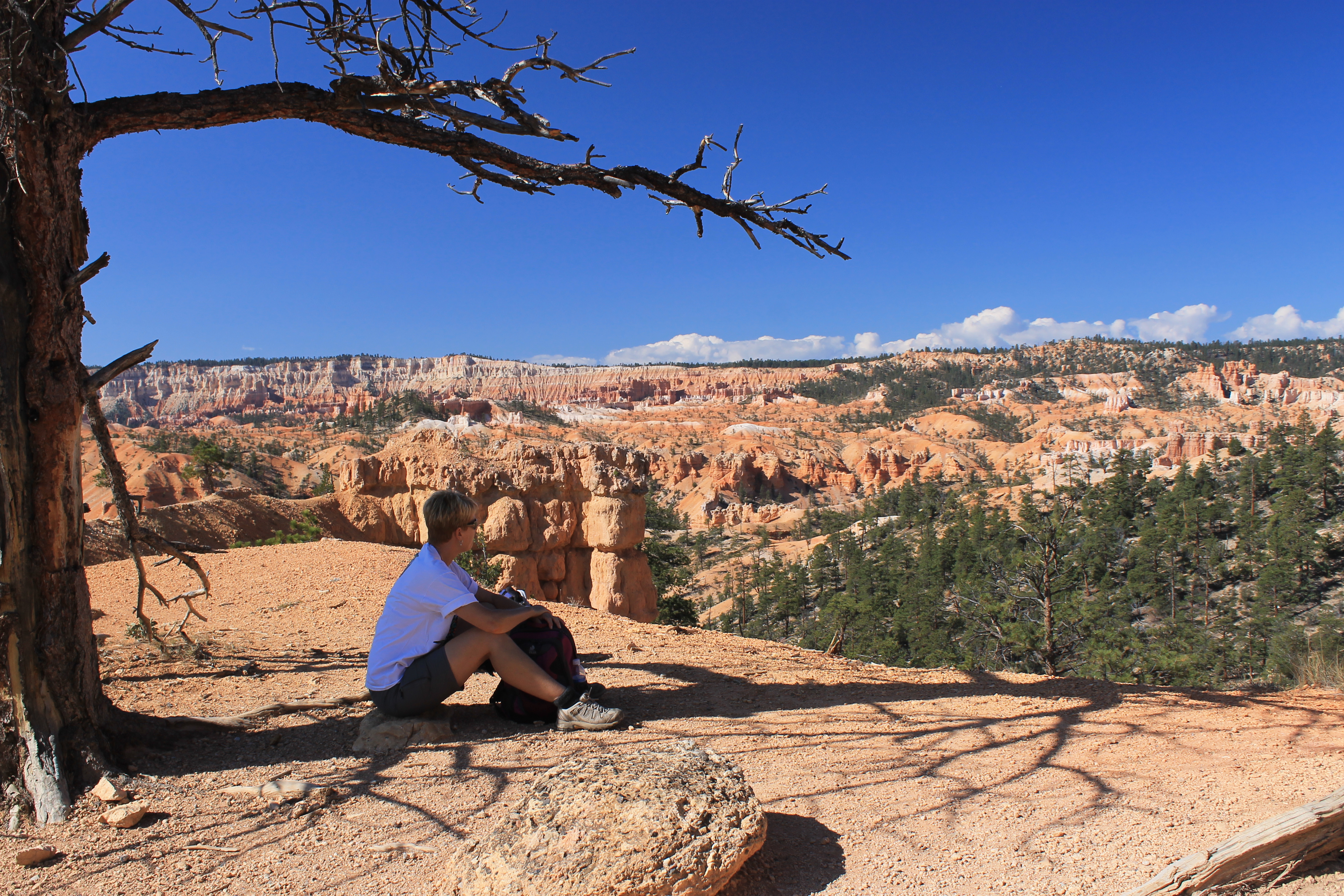 Sandy enjoys the view from a rare shady rest spot
Panguitch is an interesting place. There is a standing joke that when you enter Utah you are supposed to set your watch back a hundred years. But when you get to Panguitch you really feel like you went through a time warp. It's a town of about sixteen hundred people that seems to be right out of the 1960's. Driving along Main Street there are a lot of motels and restaurants because it is the nearest sizeable town to Bryce Canyon National Park. But there are no chains. All of the motels are family owned and look like they they were built in the 1950's. Unfortunately the image that always comes to my mind is the Bates Motel from the old Alfred Hitchcock movie Psycho. The restaurants are all old style diners too - no McDonalds or Pizza Hut. The only "franchise" in town is a big Mormon church. It's required in every small town in Utah. But we were there to visit the park and not the town. The motel was adequate for us to stay for two nights and it was inexpensive. That worked for us.
 Hiking among the Hoodoos
The next morning we filled up with gas and grabbed something to eat at the minimart. I enjoyed a SuzyQ for breakfast, oblivious at the time to the fact that they would be extinct, along with Twinkies, by the time I posted this trip report on Darth Dog. Alas.
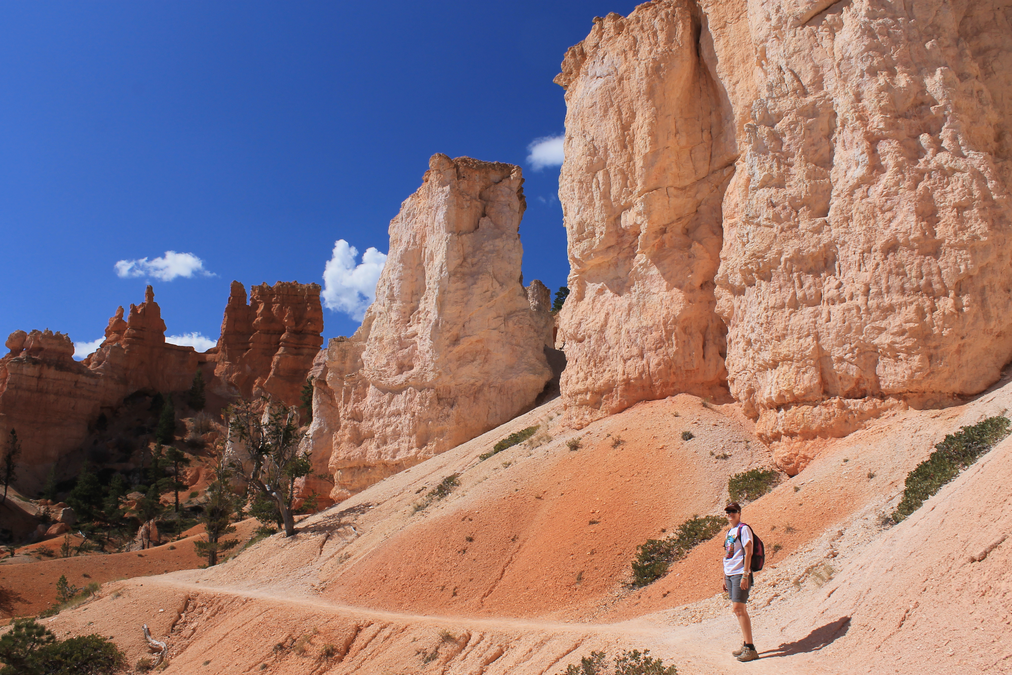
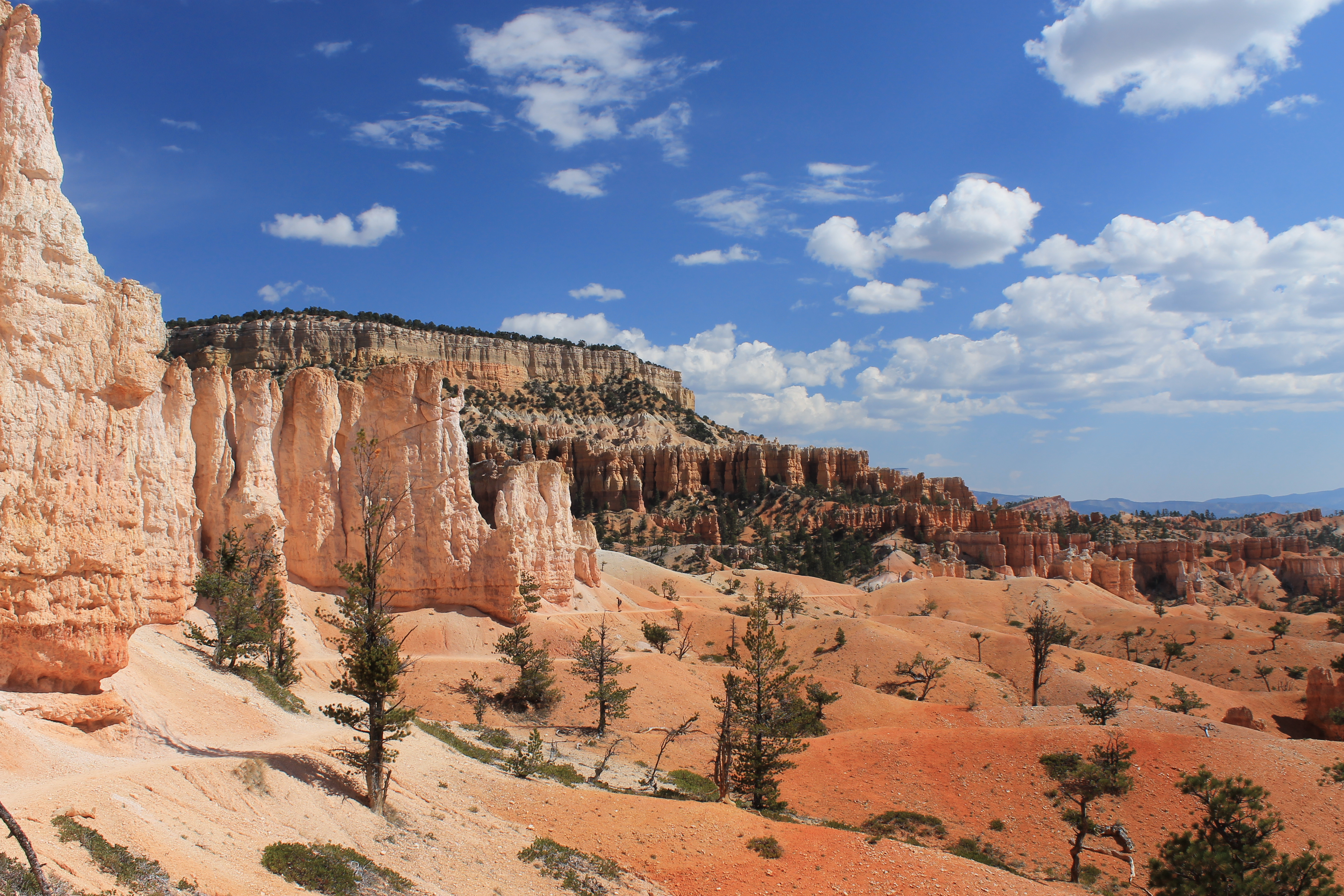
It was only a twenty five mile drive to the park. After traveling south a short distance to Bryce Junction we turned east on US 12. That took us through Red Canyon, a very scenic area in Dixie National Forest. We stopped at a roadside turnoff and took pictures of bright red rock formations which contrasted with the deep green forest. There was a trailhead here and some day I would like to go back and hike the area. But like almost everyone else, we were headed for Bryce Canyon so I snapped a few pictures and we jumped back in the car. Still it was a good warmup to get us in the mood for the National Park.
 Incredible rock formations all along the trail
It was our lucky day. We had picked a "free admission" day for the park. The Visitor Center was just inside the park entrance so that was our first stop. It gave us a chance to fill up our water bottles, use a civilized rest room for one last time, and check out the park tshirts. The last one is important for me because I usually spend the whole hike deliberating over which one(s) I am going to get.
From the Visitor Center we backtracked a few miles to catch the turnoff to Fairyland Point in the very northern corner of the park. Our goal today was to hike the Fairyland Loop trail which is eight miles long. It drops down through Fairlyland Canyon, climbs over several ridges before climbing back up to rim, and then climbs up and over several high points before returning to Fairlyland Point. Of course since it's a loop trail the net elevation gain is zero but the gross elevation gain is 2300 feet. It takes 4-5 hours so it's a good workout. Compared to other trails in the park this one was supposed to have a lot less hikers. It looked like that was true. There weren't many cars in the parking lot. It was a beautful sunny day without a cloud in the sky, pleasantly cool for hiking
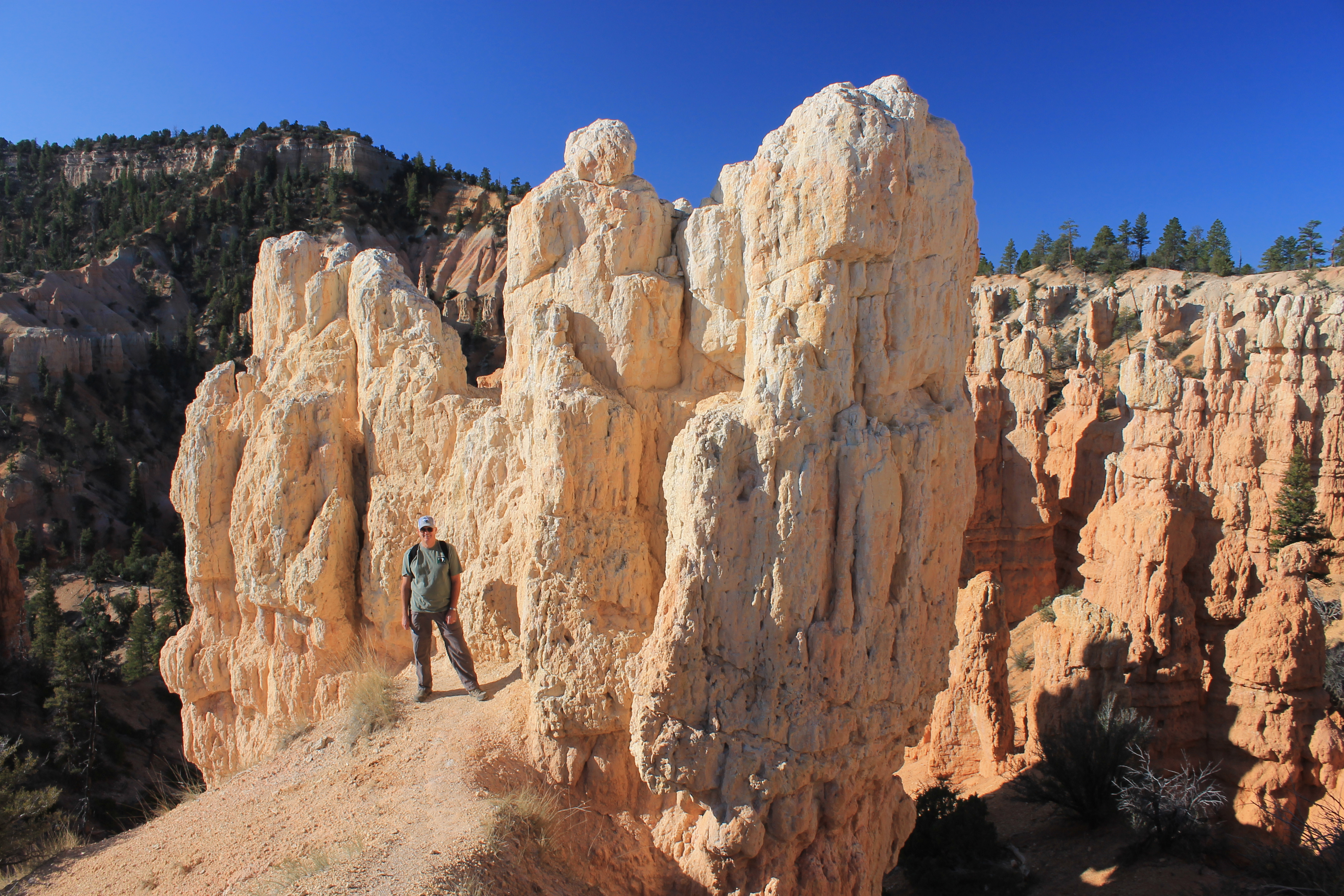
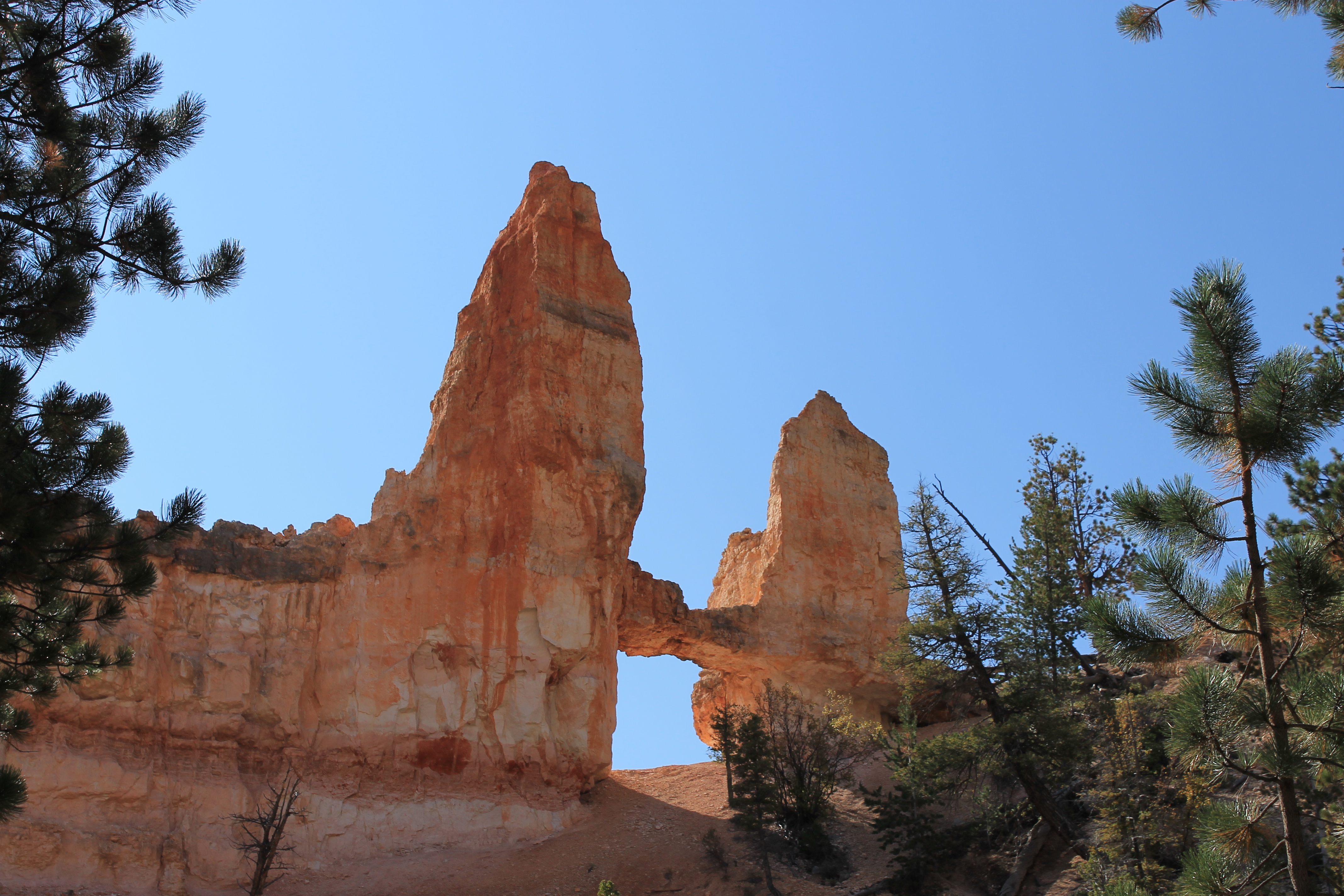 Tower Bridge
The trail descended from the rim for the first mile and half, dropping 600 feet as it traveled through Fairyland Canyon. Although it makes for an easy start I am never completely comfortable descending to start a hike when in the back of my mind I know I have to make up the elevation eventually. But almost all the trails in Bryce Canyon National Park drop down from the rim and then wind up and down along the escarpment. The formation isn't actually that big so there are no monster hills to ascend at the end. It's more just a series of continuous ups and downs which aren't too bad.
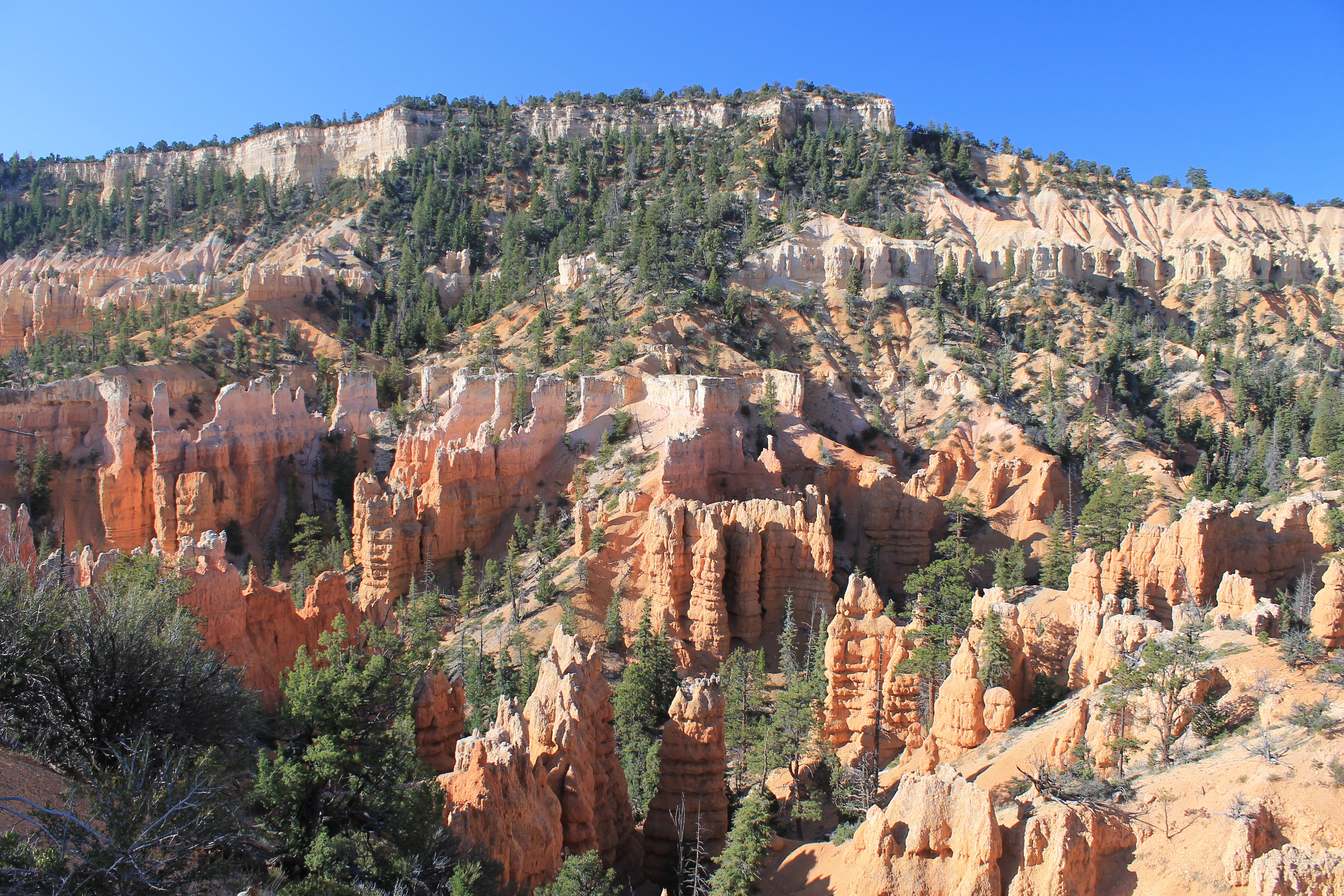
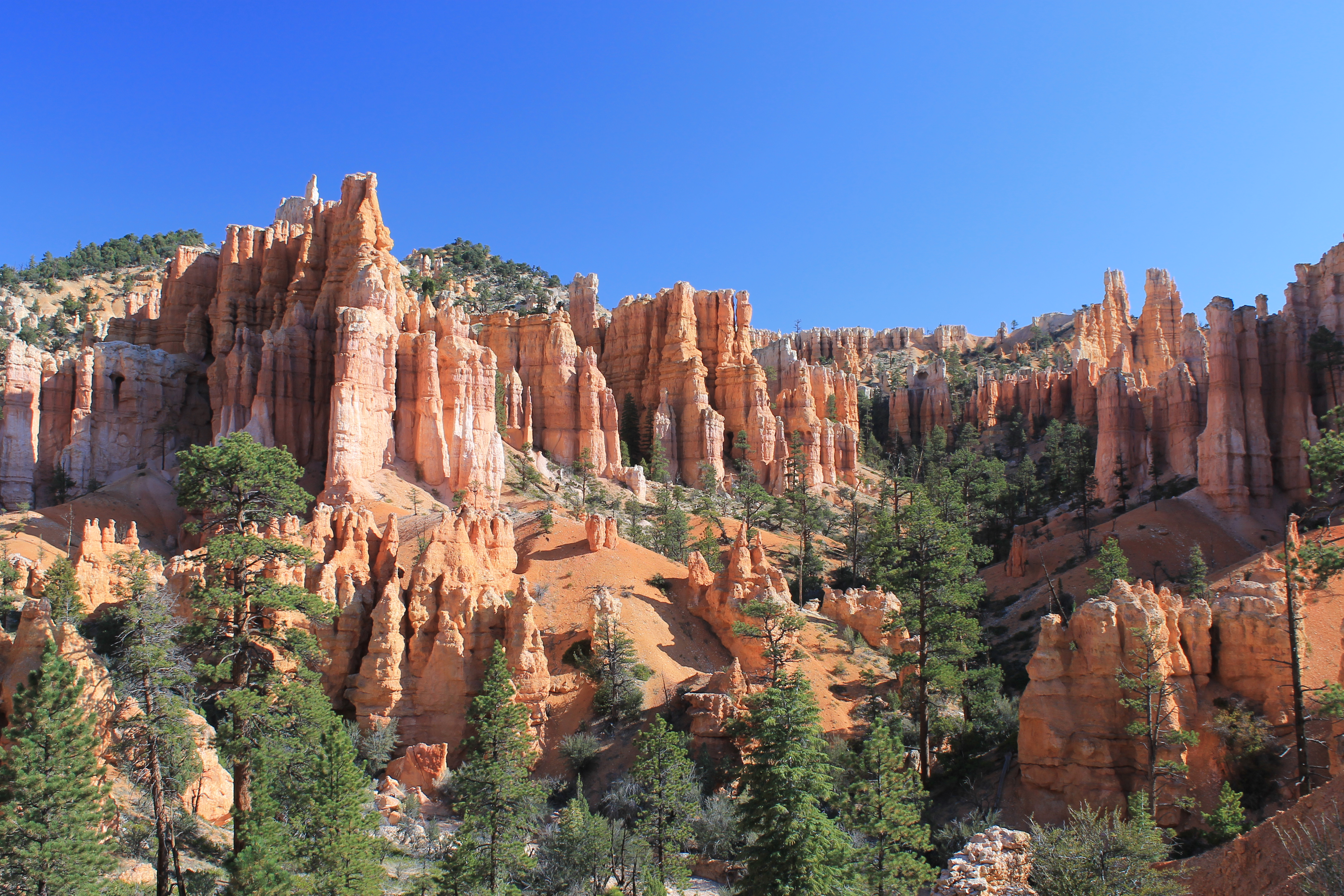
As you would guess from the name, Fairlyland Canyon is filled with incredibly shaped rock formations. They are called hoodoos and are tall, thin rock spires formed by the erosion of soft rock in desert or badland areas. The largest concentration of hoodoos in the world is in Bryce Canyon National Park. Besides their unusual shapes, the sandstone varies from pale yellow to bright orange to deep red. The colors provide a strong contrast to the dark green of the forest and the deep blue of the sky. It's a really beautiful scene.
 Starting the long climb up to the rim
The trail winds around and through the hoodoos and gave us a chance to see them close up. Then it climbed out of Fairyland Canyon to the top of a ridge at 2.25 miles where we got a great view of the rest of Bryce Canyon National Park. There was a single tree there so we stopped in the shade for a rest while we enjoyed the view. Bryce Canyon is really not a canyon at all. It's a steep escarpment that is covered with hoodoo formations. Despite the misnomer it really is a spectacular place. From our rest spot we dropped down to another low point and took the short spur trail to the rock formation known as Tower Bridge. Then the trail climbed up and down and then mainly up to reach the rim at Sunset Point. For most of our hike there had been few people but Sunset Point is one of the main viewpoints you can reach by car. Now we were in the crowds. From there we took the rim trail for the last three miles back to our starting point. Of course it wasn't flat either but went up and over several high points. Eventually we were back at our car, hungry and ready for lunch.
 Lots of views as we climb back up to the rim
Our first try to find something to eat was at the turnoff from US 12, where there is a large hotel, a restaurant and some tourist trap shops. But the restaurant was overrun with tour buses and turned out to be a not-very-appetizing buffet. We got back in the car and drove a few more miles till we found a family diner. We had very good sandwiches there and decided that it was the same place we had stopped years before on our previous visit to Bryce. You could tell you were in Utah - at the counter they had copies of the Book of Mormon for sale in about ten different languages.
After lunch we drove back into the park and did a tour of the rest of the park. The main park road travels along the rim for eighteen miles with a number of parking spots for scenic lookouts. Although the viewpoints are impressive, I find I enjoy scenery far more while I am hiking through it then hopping from viewpoint to viewpoint in my car. While I am hiking the scenery changes slowly and I can really appreciate it. There is also the feeling of having worked to get to a viewpoint that always makes it seem more impressive than any car viewpoint. And even if it isn't, I'll tell non hikers afterwards that it was.
 We've come a long way from Fairyland Point
After taking the car tour we drove back to Panguitch. We stopped at a small bakery/grocery to get cheese and bread. After our late lunch (and a big one at that) we just had light snacks in our motel room that evening. We drank some wine and watched football games and checked out the pictures from the days activities on my laptop.
The next morning it was time to head home already. We had a lot planned along the way so we were up and on the road early. We took a different route back that passed by Cedar Breaks National Monument. Sandy had never been there and I had only been there once back in 1970's. I had passed up my only other chance to visit since then. With our early start we reached the parking area for the trailhead at about 8am. Cedar Breaks is similar to Bryce Canyon, not a real canyon but an escarpment covered with hoodoos. It is even higher than Bryce Canyon. The rim is over 10,000 feet. It's close to Cedar City and I have never been to that town when it wasn't cold and windy there. Cedar Breaks was no different, cold and windy. But it was bright and sunny so we decided to do a short hike. There really aren't any long hikes at Cedar Breaks anyway.
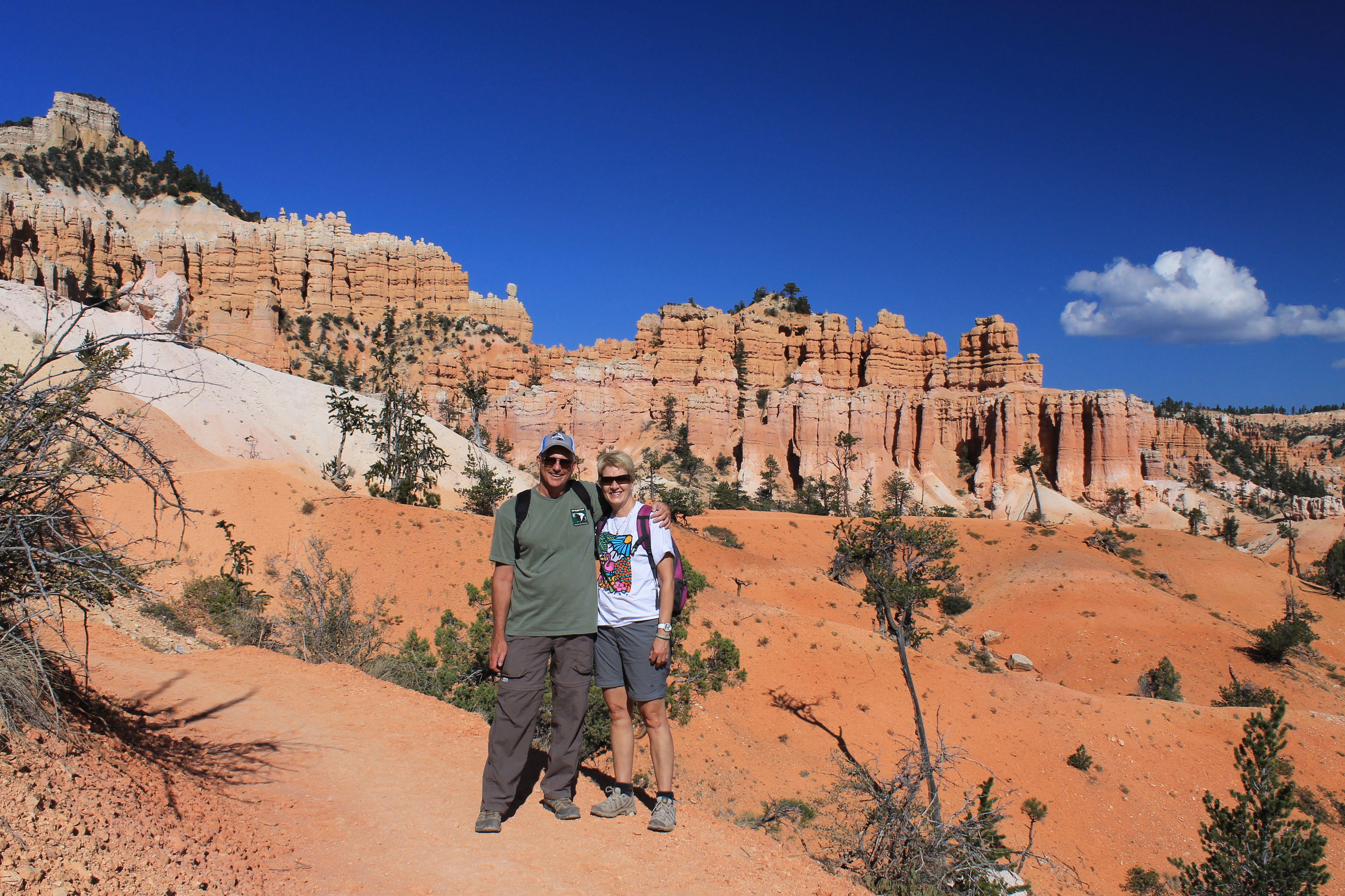 The intrepid hikers
We hiked along the Ramparts trail to Spectra Point. It was about a mile and dropped a few hundred feet to an impressive viewpoint on the edge of a ridge protruding into Cedar Breaks. We didn't stay long because of the cold and wind but we warmed up climbing back up to the trailhead. When we got there some Rangers were setting up displays on tables. Apparently there was some sort of event that day. But we piled in the car and continued on. We had a long way to go to get home and more stops to make. To reach the interstate we drove through the resort area of Brian Head. I had never been through that way so was surprised to see a ski resort there. As we drove down the steep road to reach the highway we had to stop for some cows in the road. While we waited for them we noticed a strong burning smell. I thought it might be our brakes but it turned out to be a forest fire that had just started nearby. In the next few days that part of Utah would be covered in smoke like everywhere else in the mountain west. We had just managed to get our hikes in.
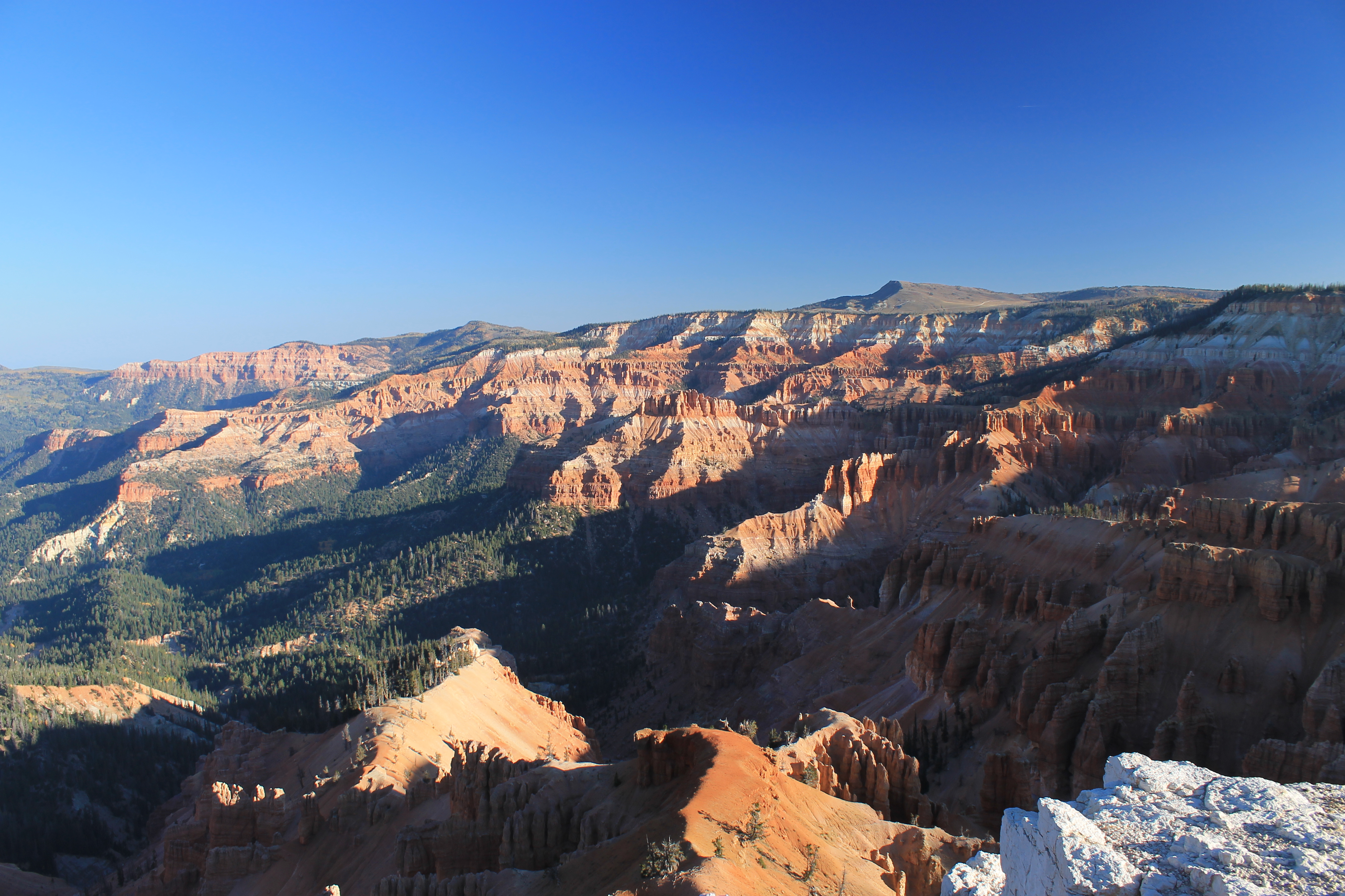 Early morning view of Cedar Breaks from Spectra Point
We stopped to eat in Beaver again, at an interesting place called the Crazy Cow Cafe. It was quite good and since Sandy used to really like cows we enjoyed the theme. We also got entertainment with brunch as the two cooks got in a big arguement while we were there.
After that it was straight to Salt Lake City and a stop at Ikea. We were able to find the bookcases that Sandy wanted. The good news was that we were able to fit them in the car quite easily. They really weren't too much trouble while we were driving home.
That was about it. The rest of the trip home was uneventful. Sandy picked up Laney the next morning. I built the bookcases later that week and they fit perfectly in Sandy's sewing room.
That turned out to be the end of the hiking season this year. It was a short trip but we had a great hike and got lots of pictures at Bryce Canyon. We even hatched a plan to go back to the canyon country next spring for an entire week so we can cover more ground. We are working on the plan for that trip over spring break 2013.
