Moab Hiking part 1 - Arches National Park
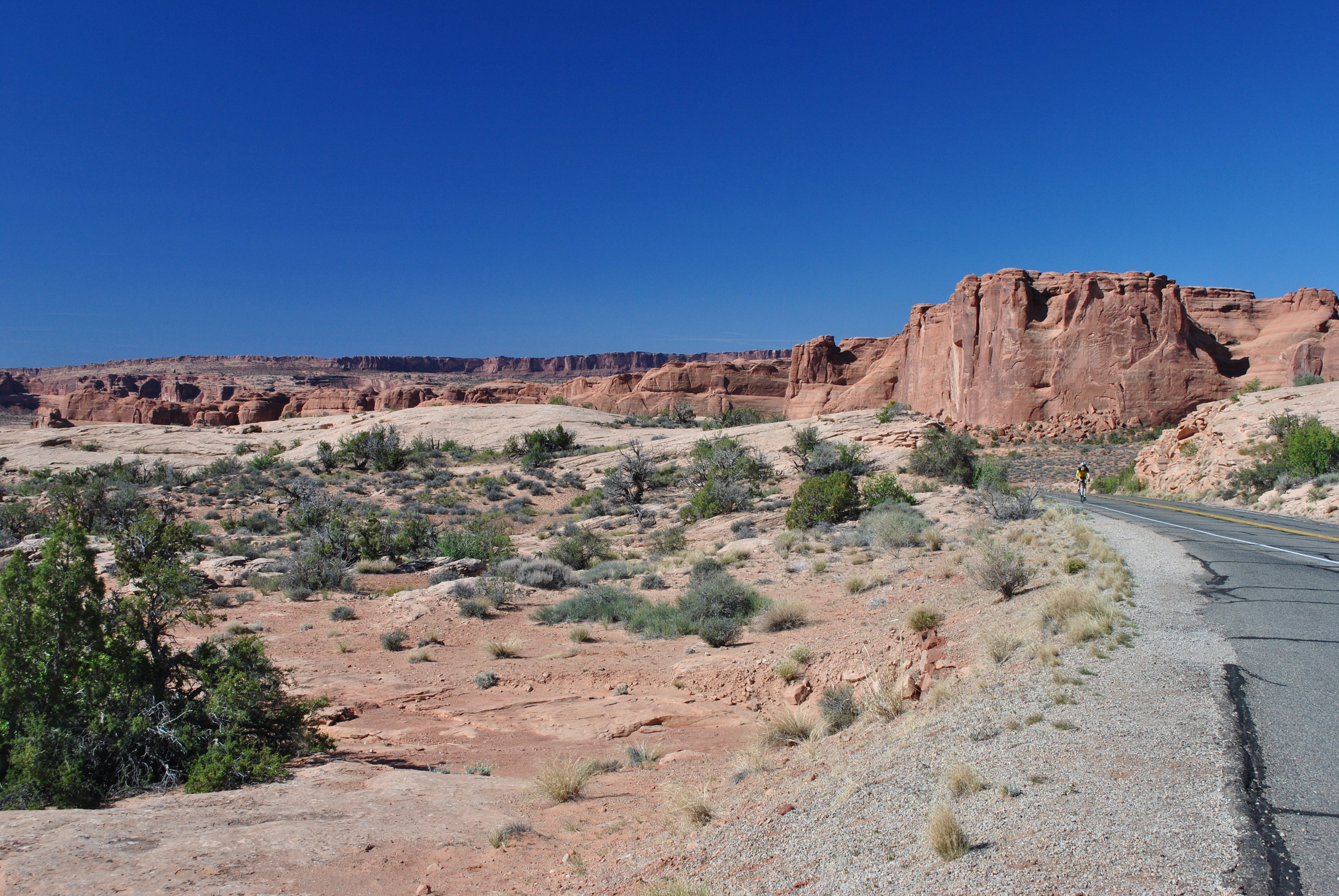 A lone cyclist on a beautiful morning in Arches National Park
I've been to Zion National Park many times, including a solo trip earlier this year. When I got back Sandy and I started to plan a trip to Utah canyon country that we could do together. Since I had just been to Zion that was out. We considered Capital Reef National Park. We had been there last year and really liked it. I had also done a hike there with Dave Thiel on our Utah circuit the previous year. It was tempting but we decided that we wanted to do something different. Moab seemed like an obvious choice. It has not one but two national parks just outside of town - Arches National Park to the east and Canyonlands National Park to the west. We had been there only once before more than ten years ago. We did some good hikes but had only scratched the surface of the possiblities. We had also enjoyed the town which had a variety of places to stay, to eat and to shop. So we quickly agreed that it was time for another visit to Moab.
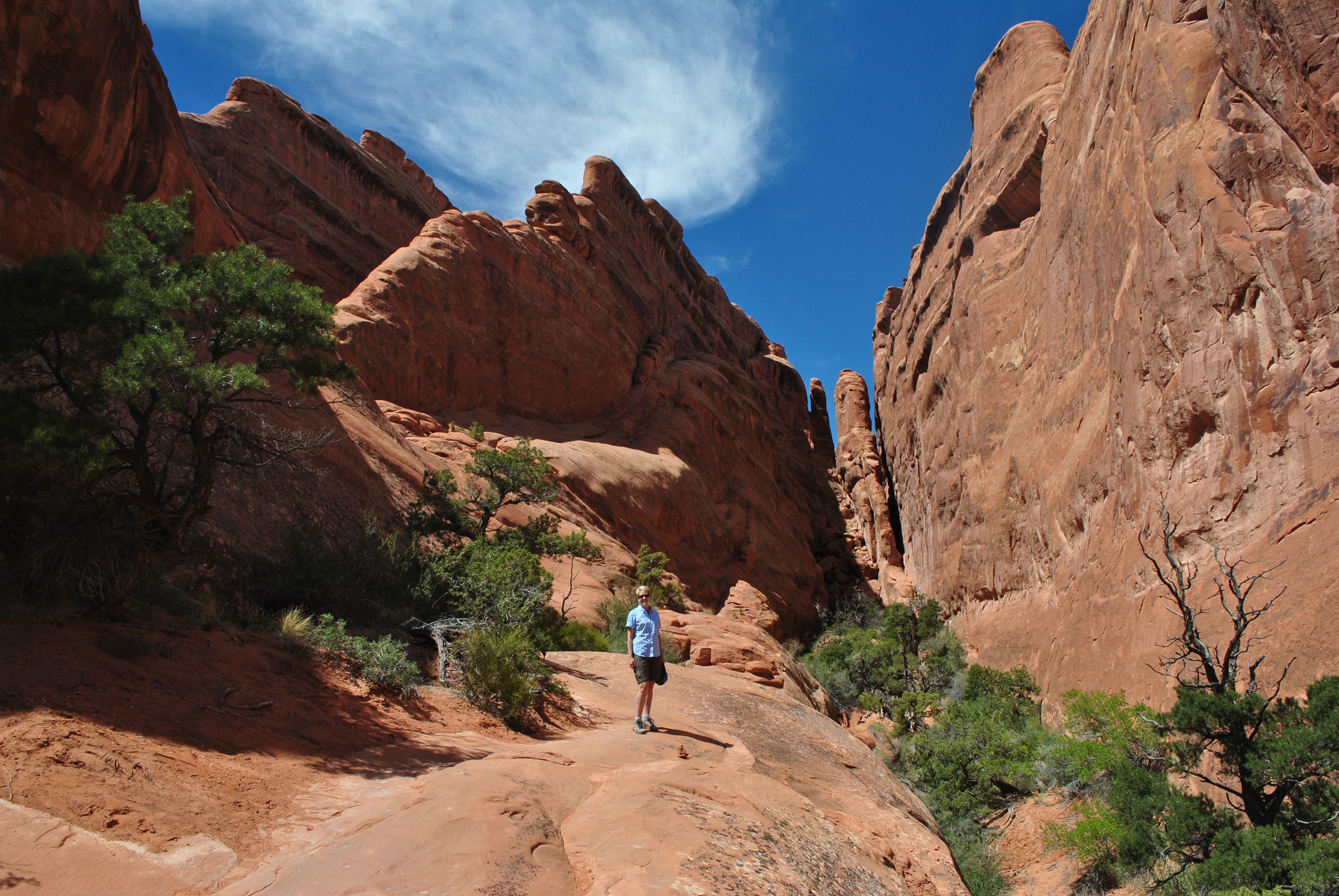
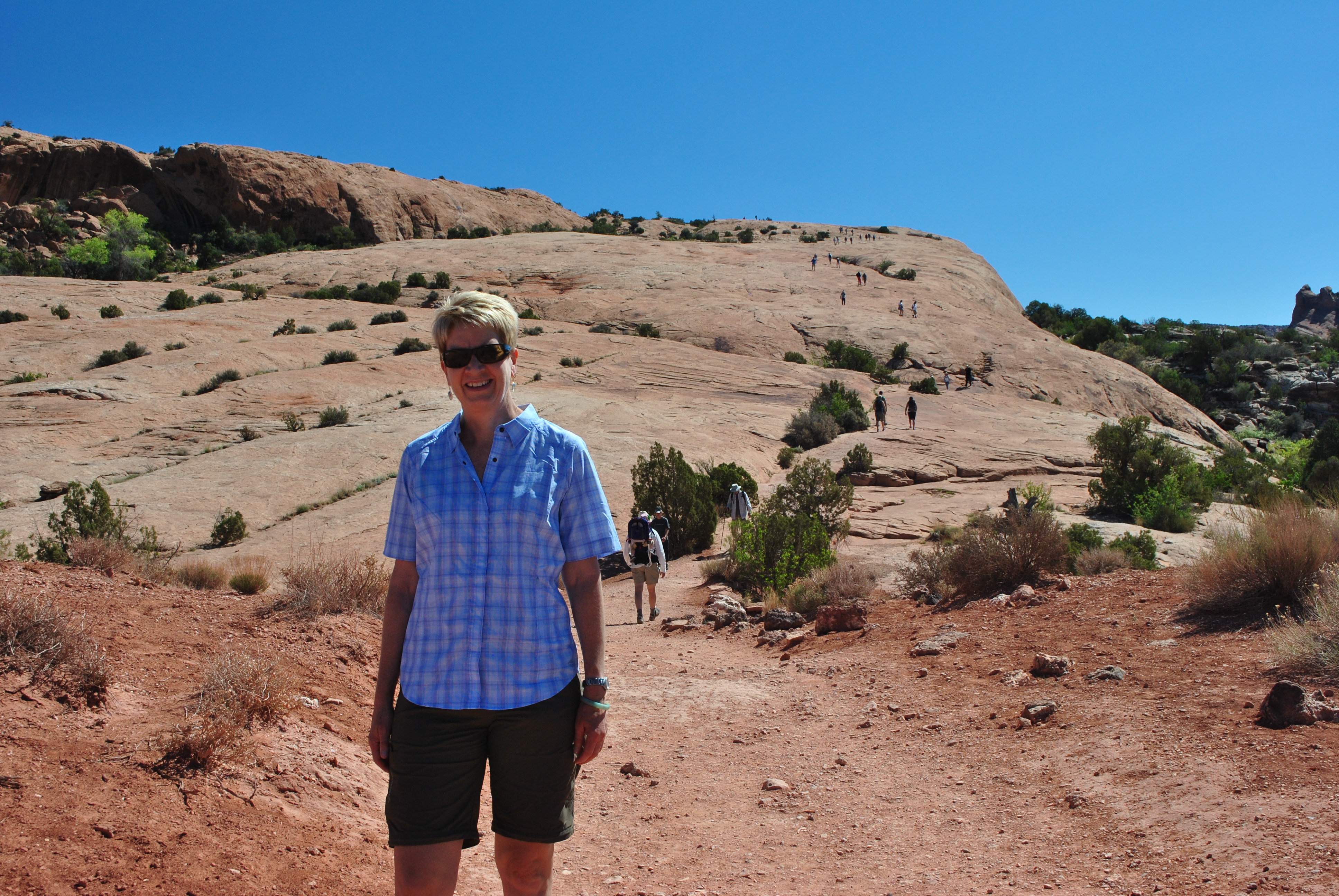 Most of the trail to Delicate Arch is over slickrock
We had a three-and-a-half day weekend planned. We both did a half day of work on Thursday before hitting the road about noon. We had good weather for the drive and made our standard stop for fuel in Burley. Just like my last trip to Zion, we hit Salt Lake City right at rush hour and encountered some significant delays there and in Orem and Provo. But I eventually got through the nerve racking narrow lanes and traffic mess and was able to turn off the interstate at Spanish Fork. From there it was US highway rather than freeway, but the traffic was light and the travel was easy. Our trip was uneventful and we got to Moab at about 9pm. We checked into our hotel and quickly went across the street to the minimart. We were hungry since we hadn't stopped for dinner (or lunch) and were also looking for a bottle of wine for a nightcap. Since it was a minimart in Utah we had to settle for a six pack of beer and some chips and pretzels. But the beer was Corona Lite with lemon that actually turned out to be pretty good. We were hungry enough that the snacks tasted delicious. So our post driving-down-to-Moab party was a good start for the weekend.
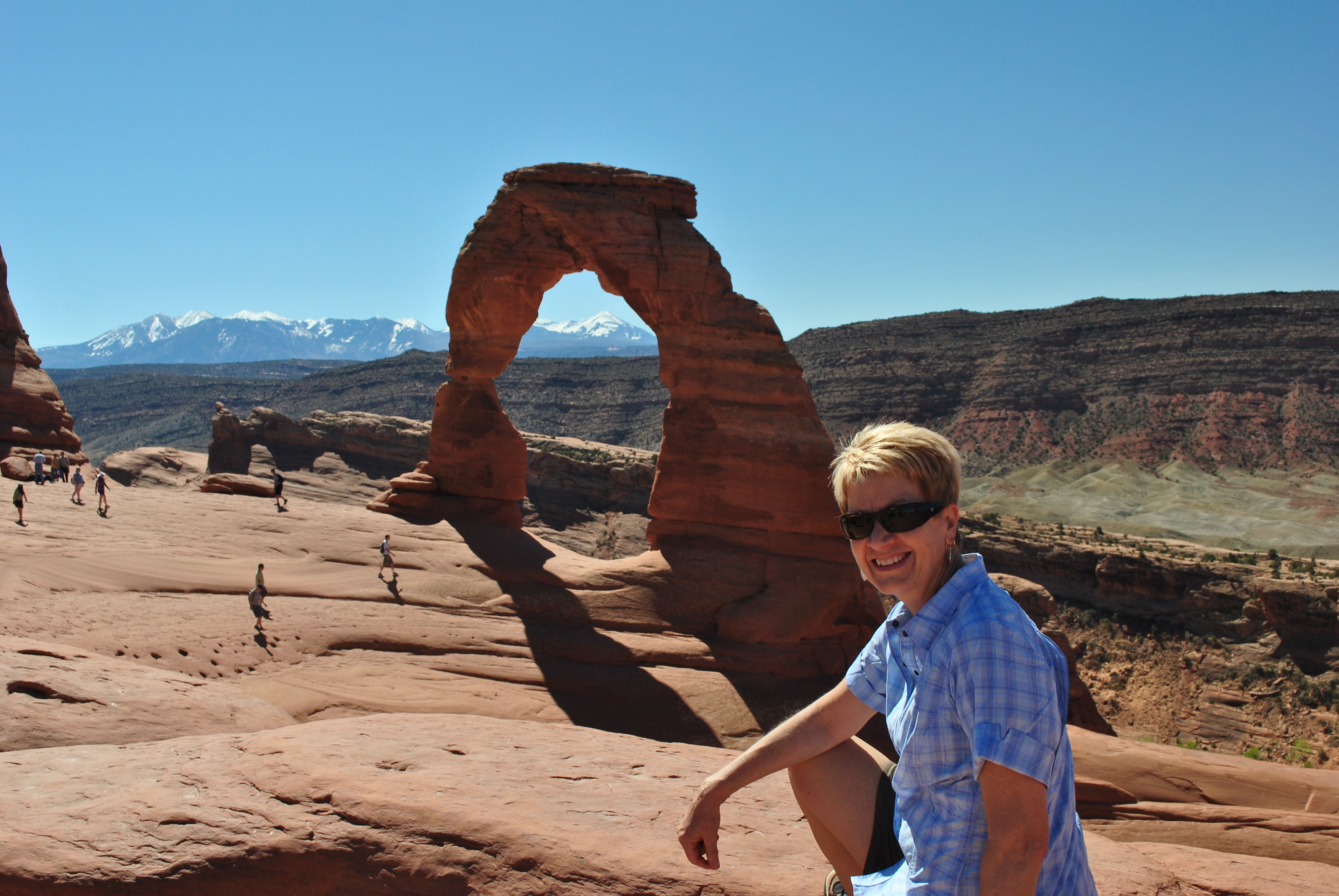
 Sandy poses below Delicate Arch - a Utah icon
Breakfast is Sandy's favorite meal of the day so the next morning we checked out the hotel's inclusive breakfast. It was good but not great. At least we both had plenty to eat to fortify us for the coming day of tough hiking. Then we were off. The weather was perfect. Blue sky, calm and cool but not cold. Great for hiking. We were off to Arches National Park. The park entrance is about a fifteen minute drive from town. Just inside was the visitor center and we made the mandatory stop. I needed to check out tshirts of course although I didn't get any just then. We also wanted to check about the Fiery Furnace hike. We had done this hike the last time we visited and I remebered it as very spectacular. Since the hike goes through a maze of narrow slot canyons hikers must be part of a ranger-led group. We wanted to see about signing up. But although there were several trips a day, everything was full till the middle of next week. Oh well. That made up our minds for us. We had been wondering if we wanted to just repeat what we had done last time we visited or not. I guess not.
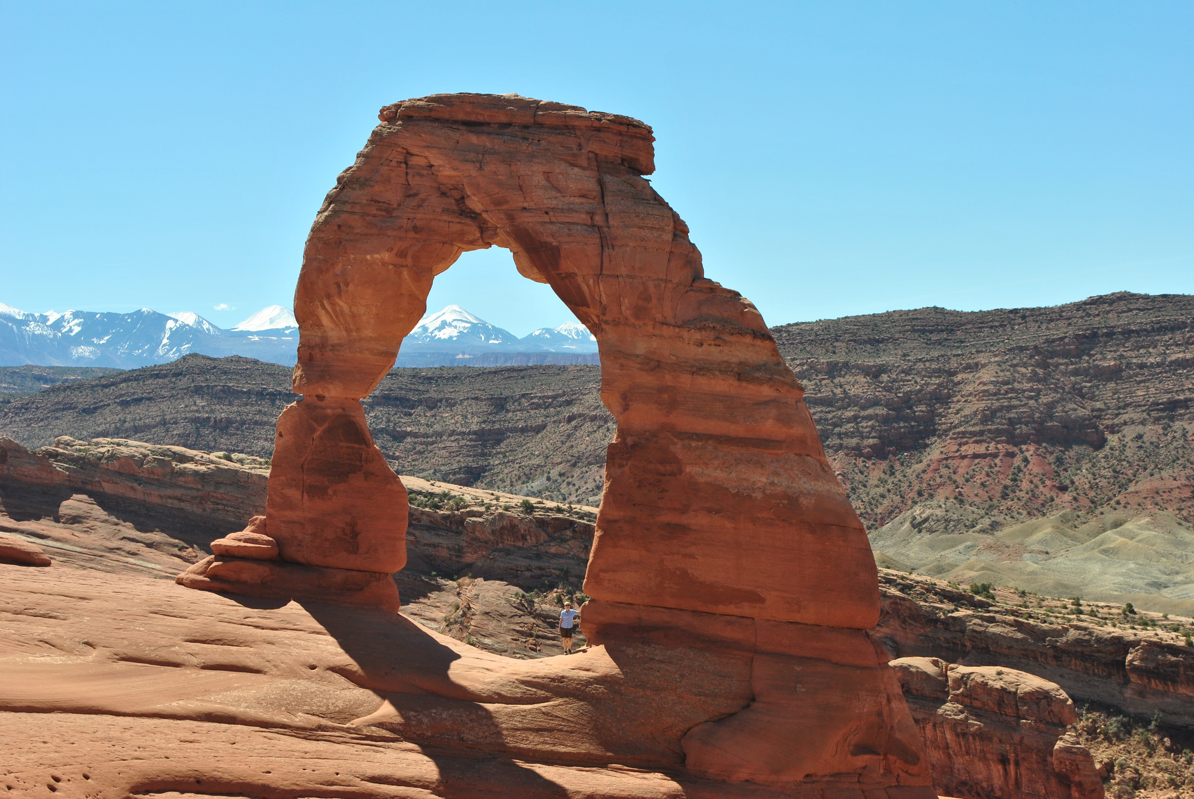
 The classic viewpoint for Delicate Arch
Our first objective for the morning was the hike to Delicate Arch. Yes, we had done that hike the last time that we were here. But Delicate Arch is the symbol of the Utah canyon country. It's even on the Utah license plate. My friend Ivan at work had a picture of Delicate Arch as his wallpaper for a long time. He was impressed when I told him that I had been there. So now I needed a current photo to send to him of us at Delicate Arch.
The drive into Arches National Park is beautiful. There is an escarpment to the west that is very impressive. The whole way as you drive to the various trailheads in the park is very scenic. After about an hour of driving with stops for photos we reached the trailhead for Delicate Arch. The parking lot wasn't that big considering the popularity of the trail. We got almost the last spot left. We took it. We had started early just so we could get there ahead of the crowd and get a parking spot. No categorical imperative for us. Sorry Kant.
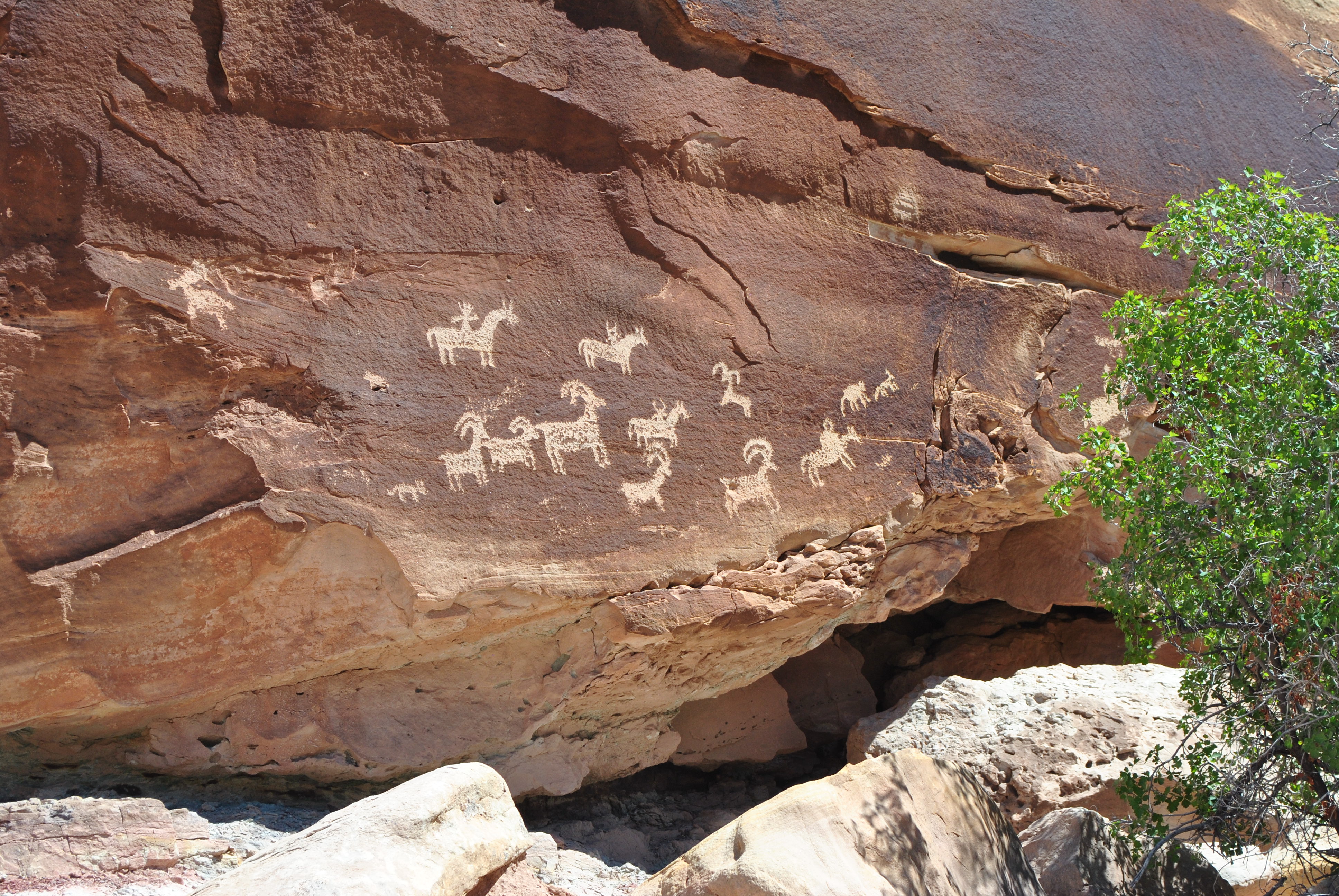 Petroglyphs near the Delicate Arch trail
The trail to Delicate Arch isn't very long - only 1.5 miles each way with 500 feet of elevation gain. But this is a popular trail and there are all sorts of people on it. People watching is half the fun on this trip. After about fifteen minutes on the trail we reach slickrock. From that point on the route is on rock rather than dirt. It's one of the cool things about hiking in Utah. The route is cairned to make it easy to follow - just in case you can't figure out that you should be following the steady line of people heading up the slickrock. After a long gradual climb the trail turns a corner and circles around, eventually coming to the classic view of Delicate Arch with the La Sal mountains in the background. There are lots of people at the viewpoint but not many actually walk the last few hundred feet to the arch. But some do and an unofficial protocol develops where people go one at a time to the arch to get their pictures taken at the arch without anyone else in the view. First Sandy goes over and I take some pictures. Then when she comes back a guy offers to take pictures of both of us at the arch. I give him my camera and Sandy and I scramble over to the arch, waiting our turn as others ahead of us have their pictures taken. When we finally get to the arch we look back and the guy with my camera is gabbing with someone else and not paying attention. We yell and wave our arms and jump up and down. Fortunately a lady standing next to the guy with our camera sees us and pokes him to get his attention. We get our picture taken and yield the stage to the next group of hikers.
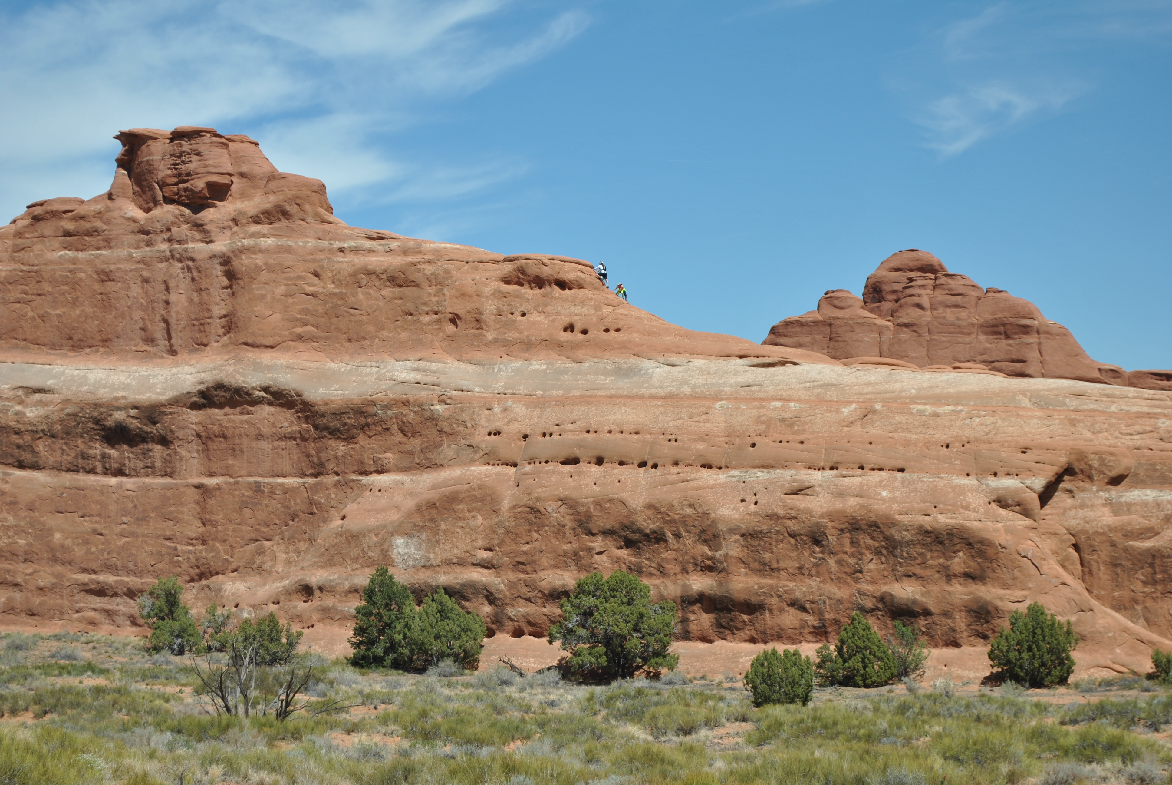 I think those guys are off the trail
When we have taken about a million pictures we head back. Hey, digital film is free. I even take one with my iPhone. It has a terrible camera but I can send the picture instantly to Ivan at work. He immediatly replies that he is envious. After eating a candy bar (a Salted Nut Roll - beloved by hikers because it can't melt) it is time to head down. On the return trip we take a short side trail. It goes by an old homestead where Civil War veteran John Wolf and his family settled in this valley in 1888 and lived for two decades. It must have been a tough life. Eventually in 1908 they gave up and moved to Moab.
Behind the homestead there is also a short spur trail that goes by some petroglyphs that far predate the old ranch. The rock pictures are cool but they are not the thousand year old petroglyphs that are seen in many places in Utah. These are only about three hundred years old and were made by Ute indians. The giveaway? Horses. They were brought by the Spanish. Since the pictographs show horses they must be relatively recent. Still very cool though.
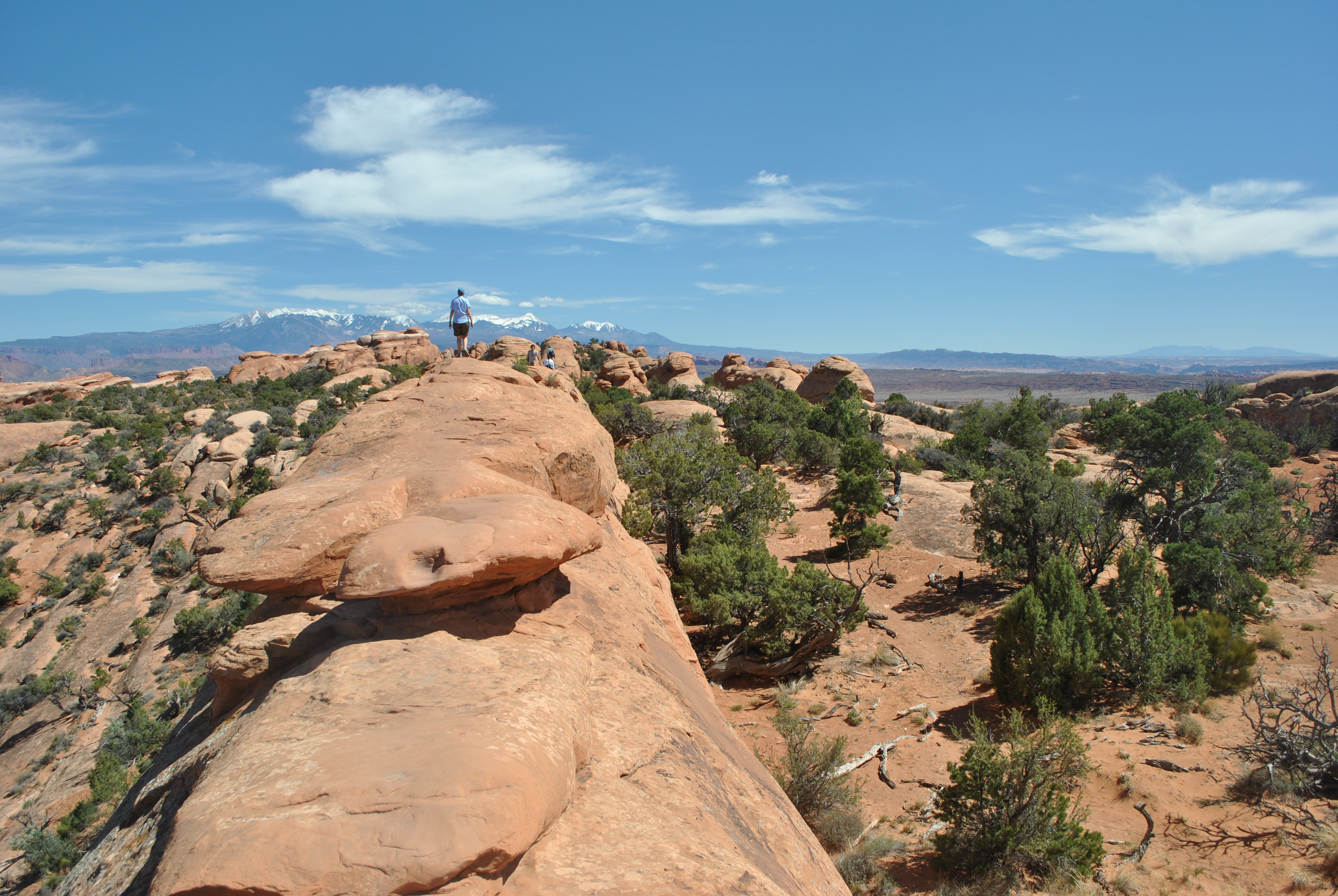
 Spectacular scenary in the Devil's Garden
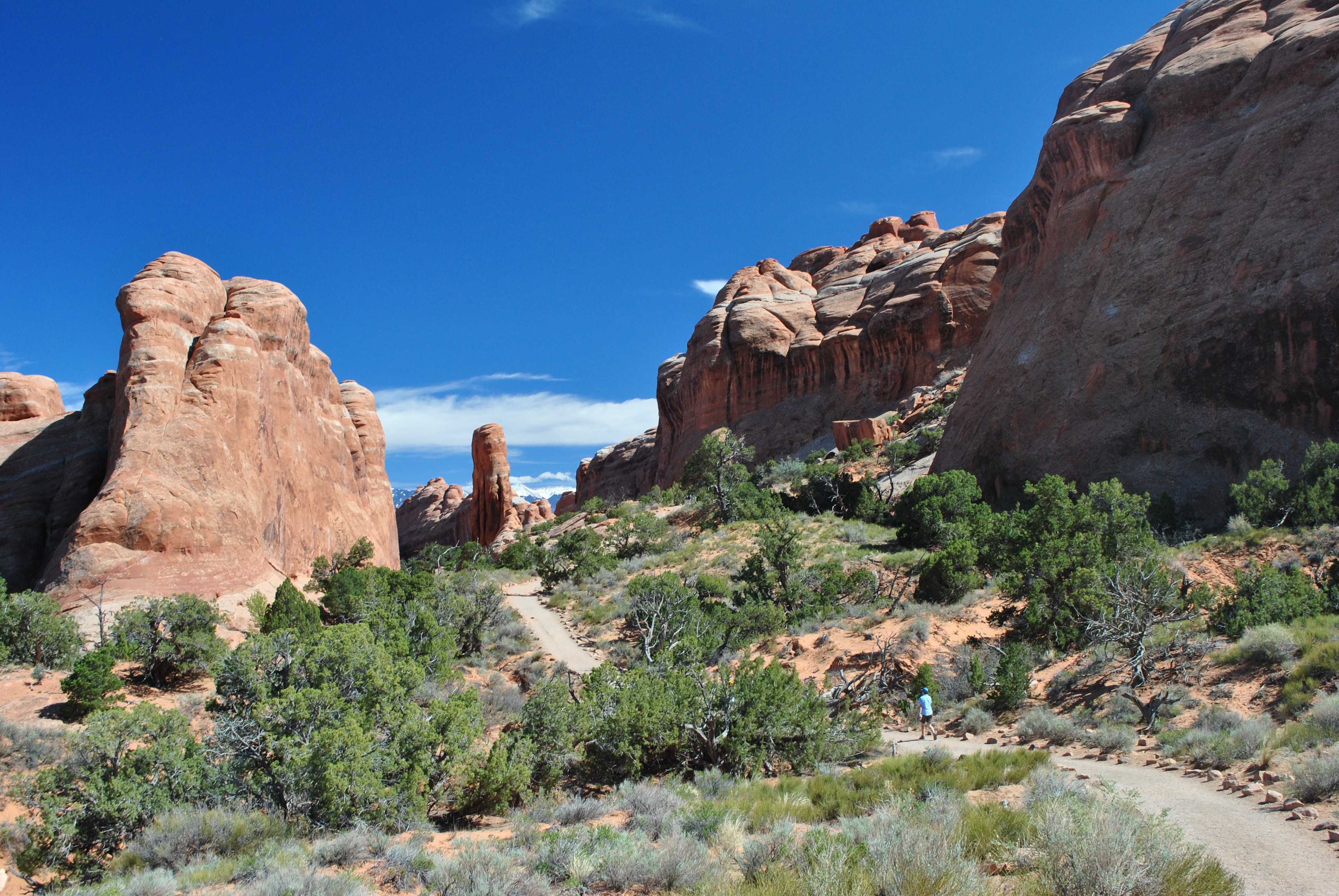
We got back to the car in about two hours even with a long time spent at the arch and time spent exploring side trails. It was still before noon and we weren't tired. Delicate Arch is a great hike but it isn't that long or hard. So we hopped in the car and continued deeper into the park to the Devil's Garden trailhead. It's almost fourteen miles from the visitor center along the main park road. If you go much farther you come out of the park. The parking lot at the trailhead holds 150 cars but it was full and the road was parked along both sides for quite a distance. So we parked several hundred yards from the trailhead by the side of the road. This was obviously a popular hike. By most accounts it is the most popular trail in the park. It was just an extra five minutes to walk to the trailhead and we were ready to start on our second hike of the day - Devil's Garden. It's the longest hike in the park and goes through an area that has the highest concentration of arches of anywhere in the world.
 Just before the scrambling section in the Devil's Garden
The Devil's Garden trail is from six to eight miles depending on which book or map you consult. It features a loop trail and numerous spur trails that lead to viewpoints of a number of arches. We took most but not all of the spur trails so I don't know how long our hike was. It took us three and a half hours so it was probably about seven miles. Added to our three mile round trip to Delicate Arch in the morning we had a pretty good day of hiking. But I'm getting ahead of myself. We started out on the Devil's Garden Trail about noon. It was a beautiful sunny day, just the right temperature for hiking.
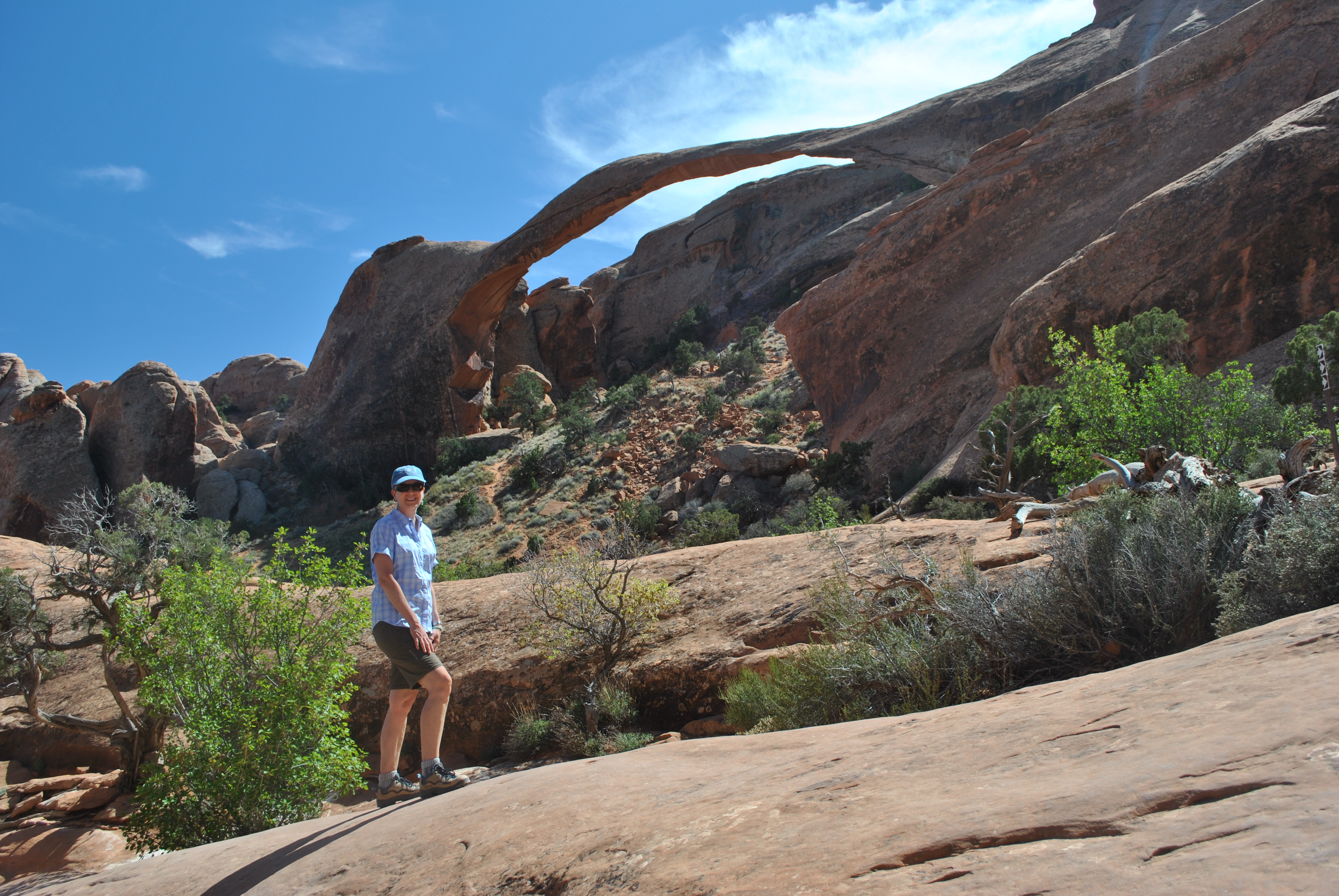
At the start the trail is wide and paved, a real freeway for hikers. That's because it leads to one of the main attractions in the park - Landscape Arch. Our hiking guide claims that it is the longest arch in the world. Quite a few web sites that I checked, including Wikipedia, do too. But according to the Natural Arch Society, it is only the third longest arch. Two arches in China are quite a bit larger. But these have not been visited by many westerners and had not been been measured accurately until October 2010.
 Yes, the trail goes up and across the slickrock
Landscape Arch is still quite spectacular. It beats out Kolob Arch in Zion National Park for the longest arch in North America. I've done the hike to Kolob Arch as well (last year with Dave Thiel as well as another time many years ago) and Landscape is prettier. It's a lot closer to the trail so you can see it much better. It's also very slender and more aesthetic. Kolob Arch is thick and sturdy looking - an industrial strength arch. Landscape Arch looks quite fragile for its extremely long span. And it is. In 1996 a large chunk of rock fell out of the arch. The rubble from it is clearly visible under the arch. Since that rockfall the Park Service doesn't allow people to go underneath the arch anymore because of safety concerns. It does look like the whole thing could collapse any time. It has happened to other arches in the Devil's Garden area in recent history. Wall Arch collapsed on August 8, 2008.
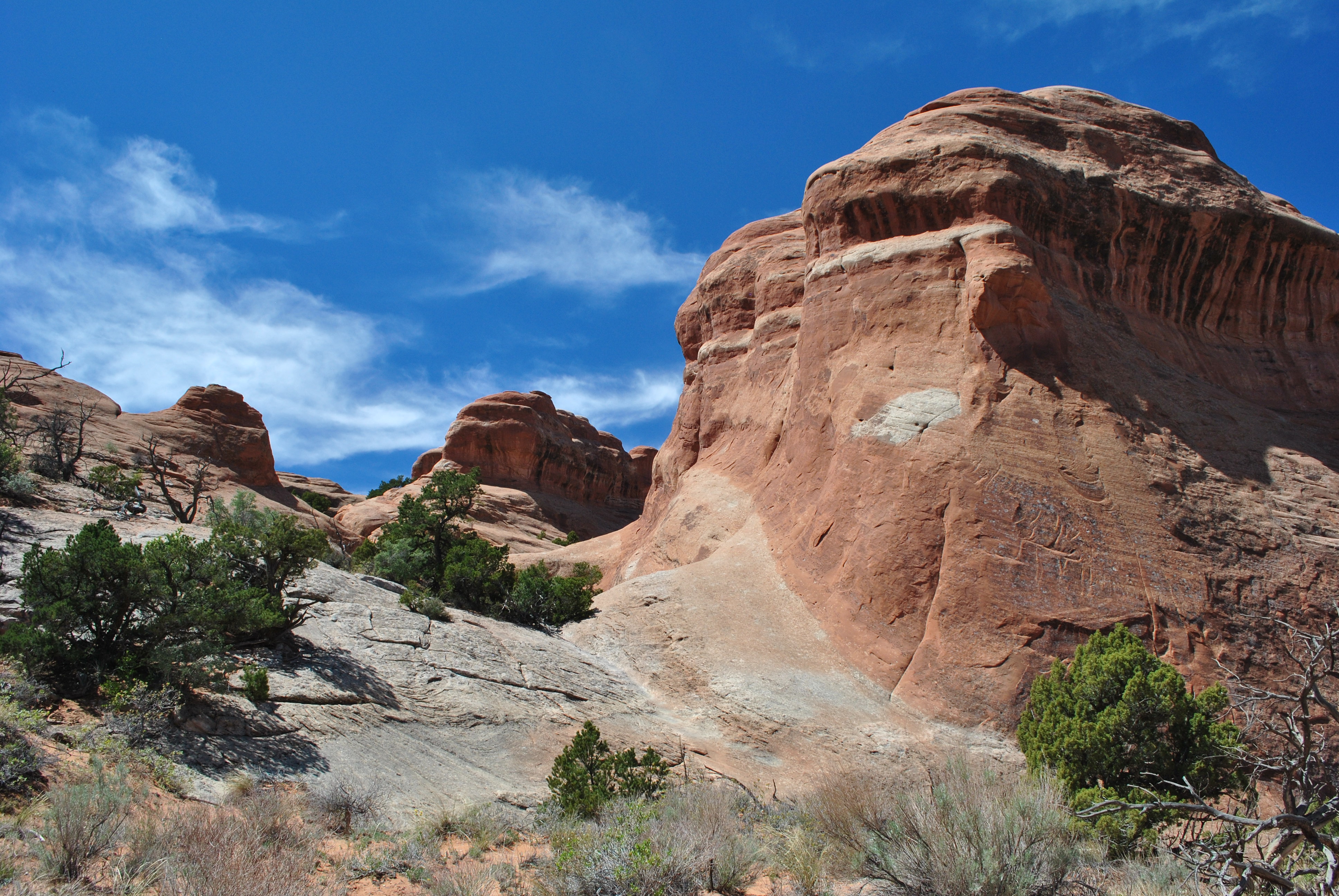
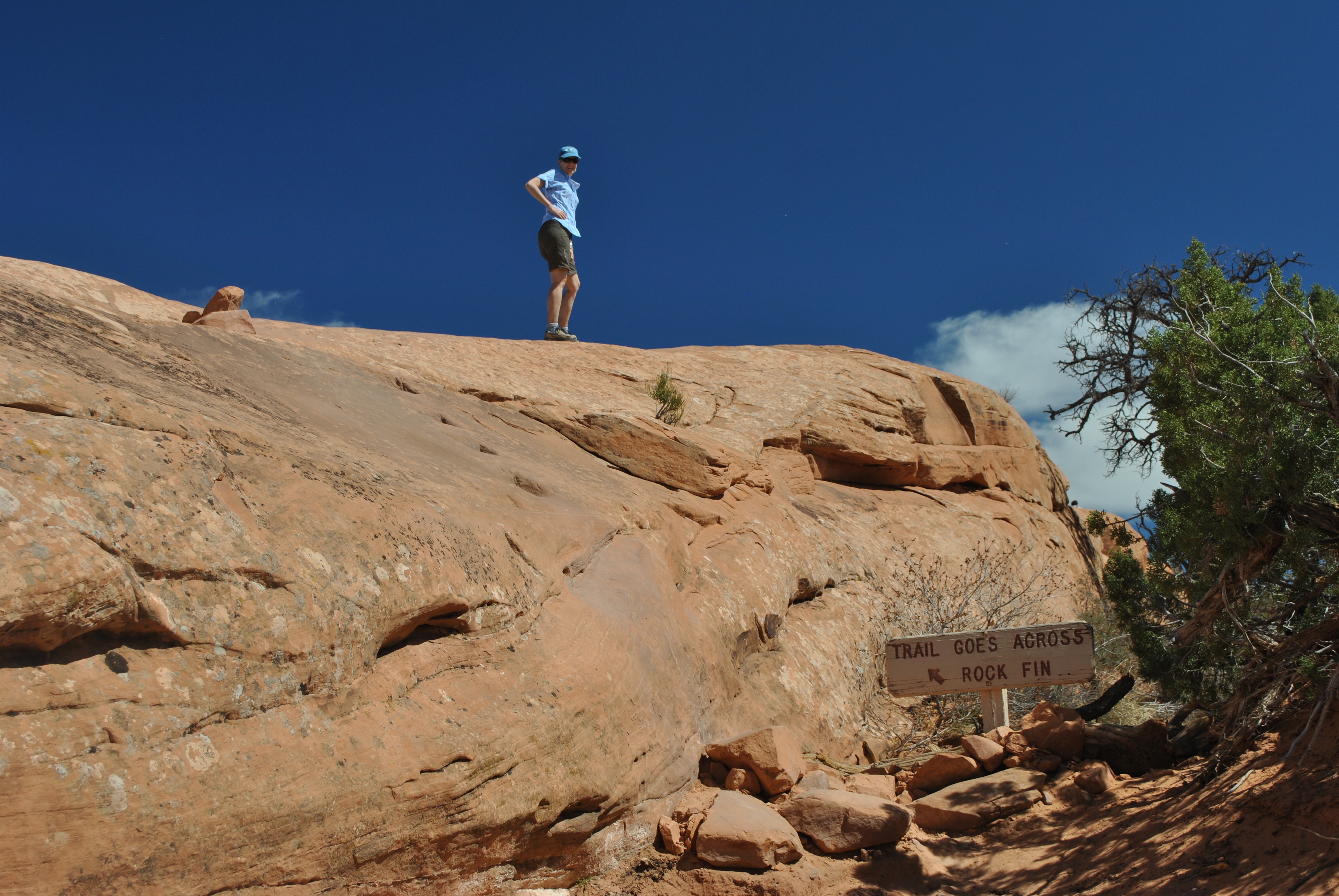
 The route followed the crest of a rock fin
Most people just hike the mile to Landscape Arch and then head back to the trailhead. But the Devil's Garden area is one of the densest concentrations of arches anywhere in the world. From Landscape Arch there is a loop trail that is about four miles long that leads to numerous other arches, each one unique and interesting. The trail is labelled a "primitive trail" which the park service hopes will discourage noobs from the more difficult part of the hike. But it isn't that hard for experienced hikers. The trail is no longer paved. At times it is tough to follow when there are tracks everywhere near a viewpoint. In quite a few places it crosses slickrock and at one spot actually requires a minor scramble. But that just made it more fun. We started out being very diligent and taking every side trail and spur to each new arch. But after about half a dozen arches, and a couple of hours of hiking, we passed the side-trail, arch-viewing opportunities and focused on getting back to the trailhead. Overall it was a fantastic hike on a great day. The red rock contrasted with the bright blue sky and in the distance were great views of the La Sal mountains. With at least a dozen peaks over twelve thousand feet they still had a heavy covering of snow. They provided a scenic alpine backdrop to the desert setting of the arches and slickrock of the Devil's Garden.
 Landscape Arch
Arches National Park certainly lived up to its name. On our first hike we had seen Delicate Arch and another unnamed arch. At the Devil's Garden we had seen Pinetree Arch, Tunnel Arch, Wall Arch, Navaho Arch, Partition Arch and Double-O Arch. And these are just the main arches with signed spurs from the trail leading to them. There almost a dozen more arches in Devil's Garden that aren't signed. There are guidebooks that help you find these additional arches. For a local who hikes the trail numerous times (kind of like me with Sawtooth Lake) it would be fun to explore and find these little-known arches. But we were in arch-overload by the end of our hike. Twenty arches wouldn't really be a better hike than ten arches. So we were content. No need for gluttony. When we reached the car we were tired but not exhausted. An excellent hiking day. Arches is a great national park and well worth visiting. About a million people every year agree.
 Sandy zooming down the trail on the homestretch
We stopped at our hotel to clean up and then headed in to town. First we did some important shopping. Sandy found a nice pair of hiking pants at an outdoor shop. I bought a tshirt for myself (well, duh) as well as a tshirt and hat for the guys at work. For dinner we went to the Sunset Grill. This is a well known restaurant that is very prominent along the highway as you approach Moab from the north. Just a short distance out of town, it is up a rough winding road and perched above a cliff with a spectacular view of the town and the Moab fault. Although Moab had changed a lot since our first visit we remembered this place. We hadn't tried it then so we definitely wanted to eat there on this trip. Since it was a busy weekend we got there early and were surprised that we almost had the place to ourselves. We got a table right next to the window. We both had good steak dinners and enjoyed the view from our table. By the time we were done the place had filled up so it was back to our hotel for a glass of wine. An awesome day.
