Lake O'Hara
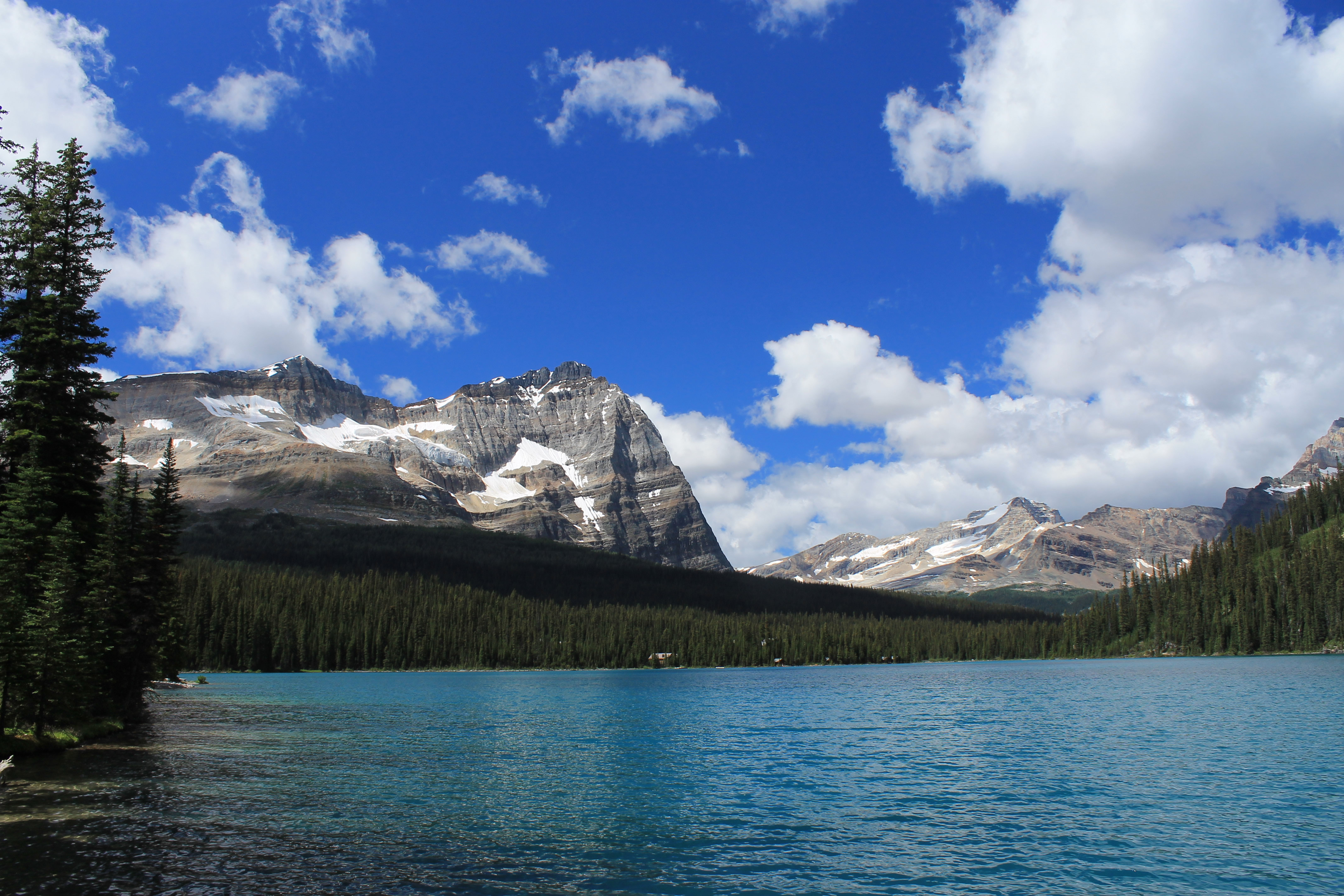
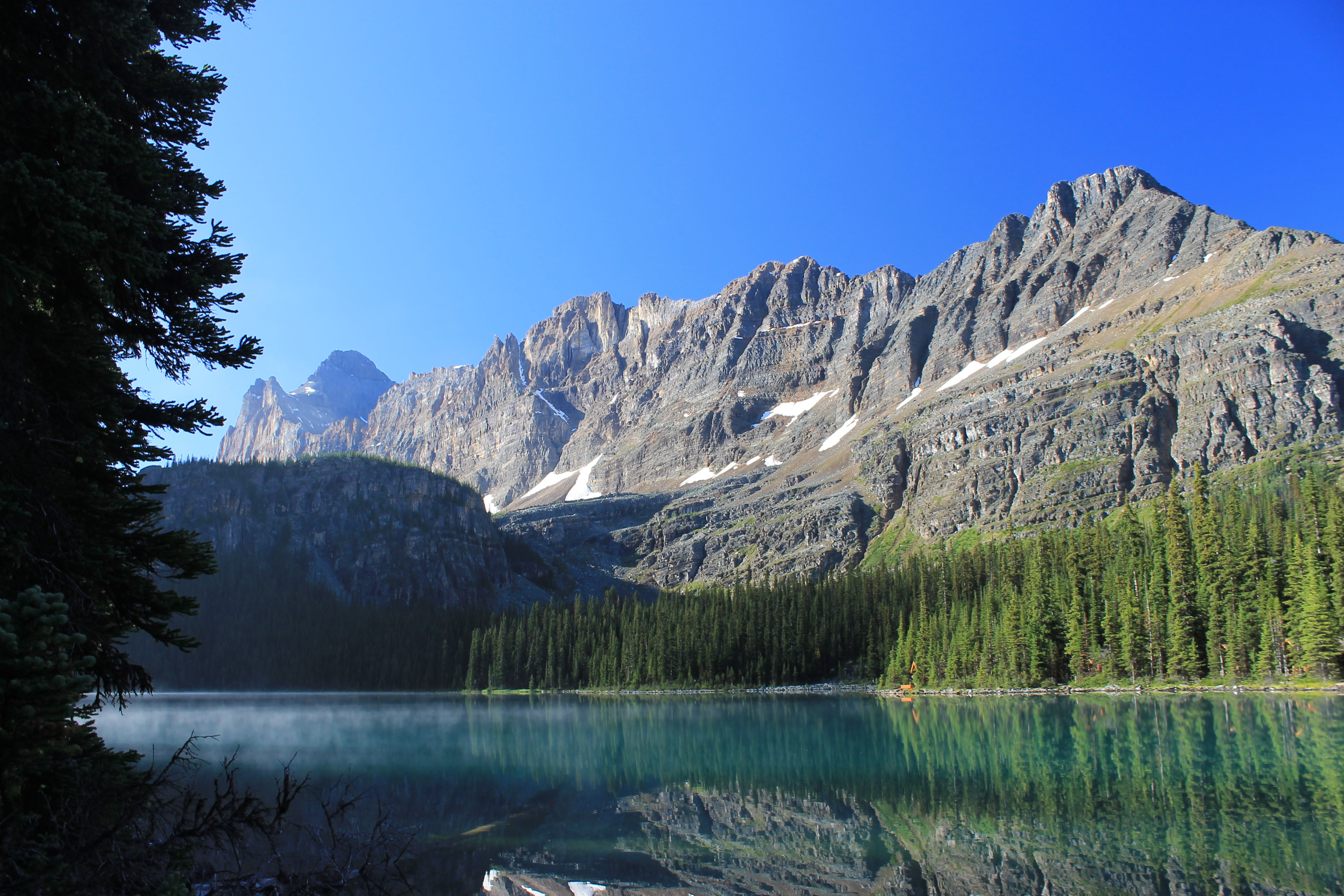 Blue sky and just a few wisps of fog on Lake O'Hara
After our hike to Plain of the Six Glaciers teahouse, we only had two more days left at Lake Louise. The forecast for the next day was rain. Three weeks into our mountain trip we finally had a bad weather day. Since we had done hikes for four straight days we didn't mind a day off. A rest was welcome. It was time for a less strenuous activity like shopping. It was also a chance to enjoy some good food and drink. We were on vacation after all. We drove to Canmore, a mountain town just outside of Banff National Park. Sandy wanted to check out the Sugar Pine Company, a local quilt shop which I had found online. It turned out to be quite a nice store and Sandy spent at least an hour there. Fortunately in our many trips I have learned how to keep myself occupied in quilt shops. (Sandy has developed the same skill in game stores.) She had no trouble finding lots of stuff that she wanted to get. One of the advantages of a car trip is that you can take stuff home with you. In this case it was a good thing that we had a lot of extra room in the car.
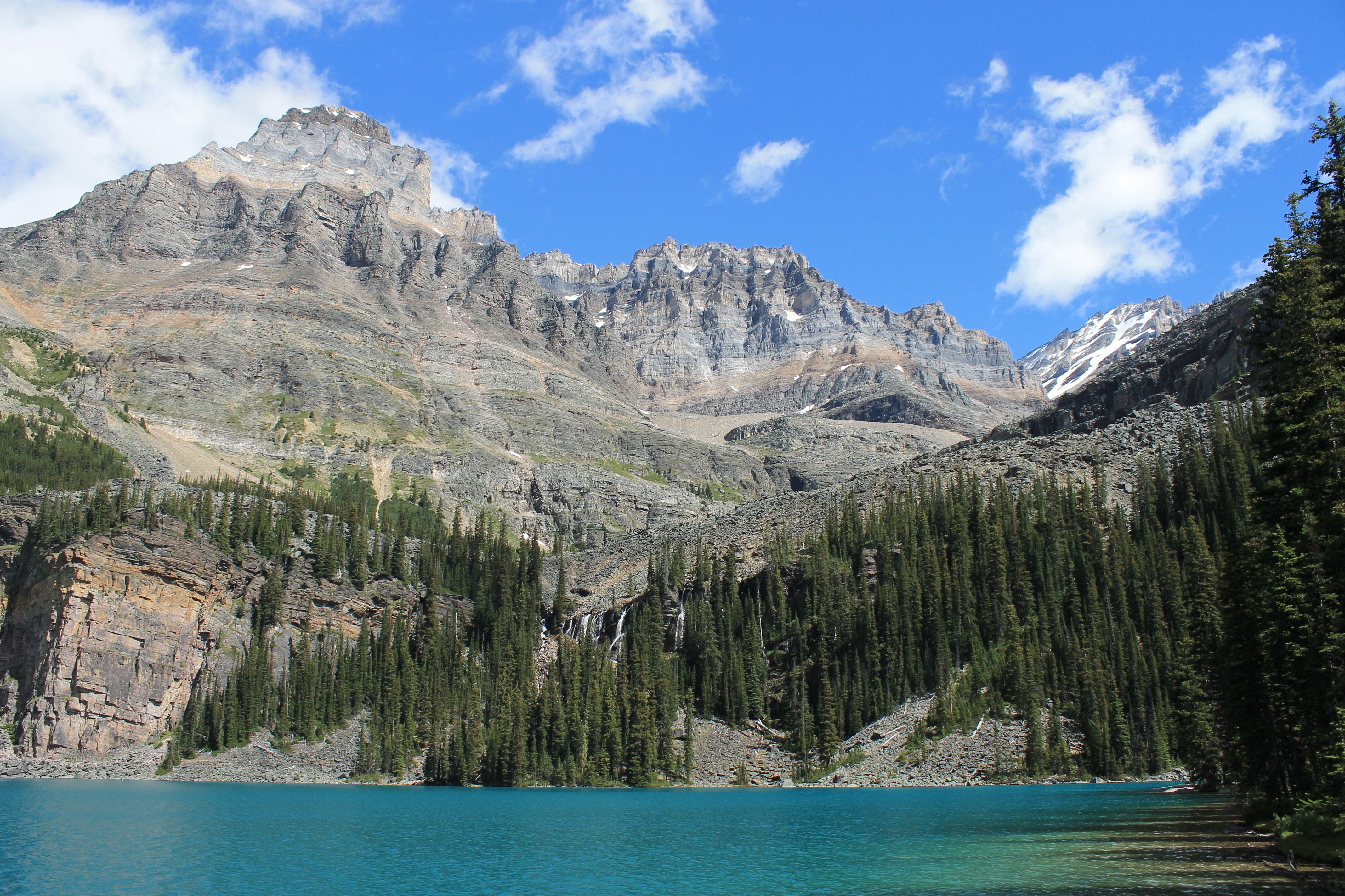
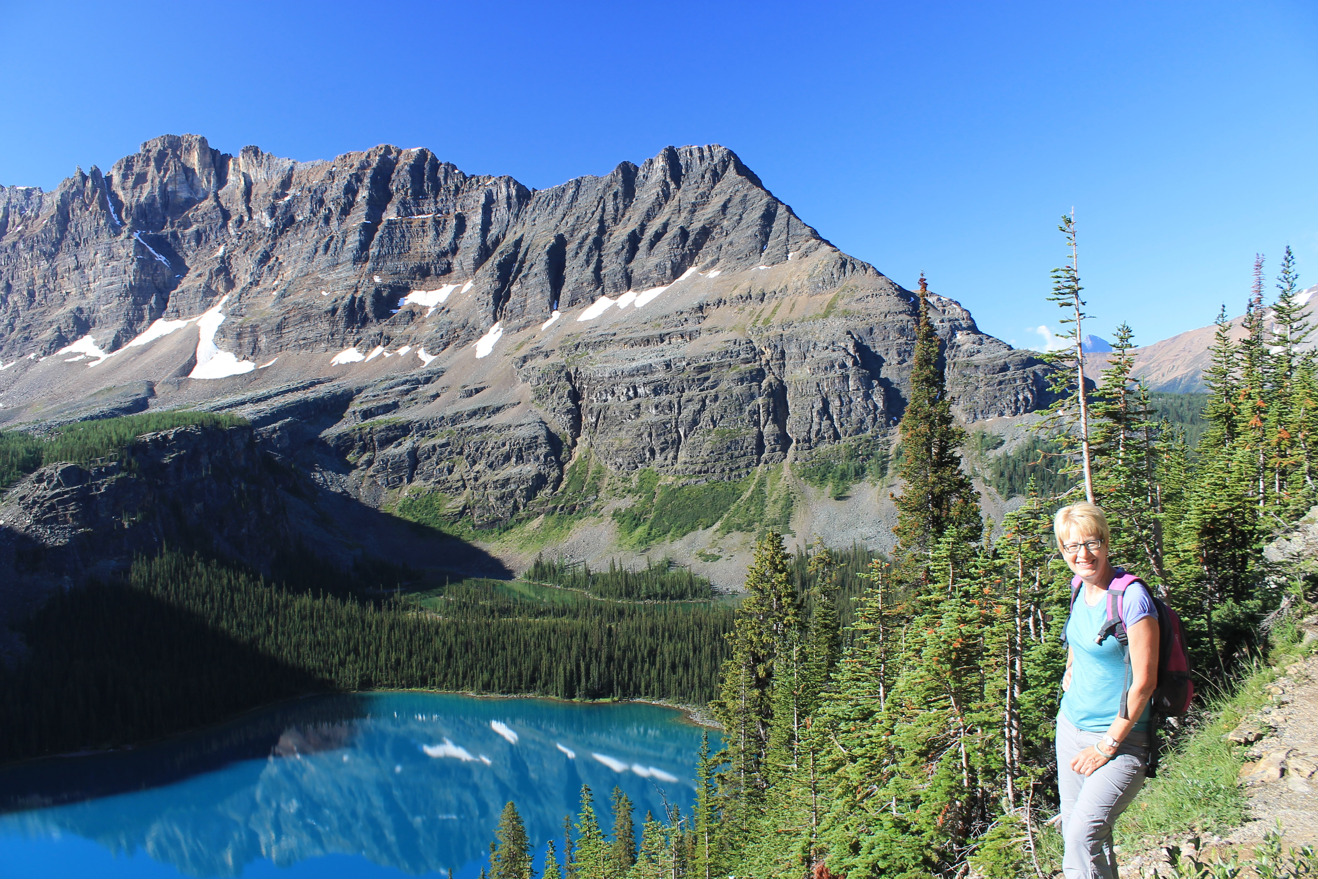 We quickly climbed high above Lake O'Hara
All that shopping really made us hungry. For lunch we went to the Grizzly Paw Brewing Company. It's a small brewery located in Canmore that makes, among other beers, Grumpy Bear Pale Ale, which we had enjoyed with lunch a few days before at Lake Louise. They also operate a brew pub and we had good burgers, and of course, some of their beers. Afterwards we stopped at their store and got some tshirts (of course) and two six packs of Grumpy Bear to take home. Fortunately I was able to squeeze it into the car with our other purchases.
On the way home we stopped in Banff to spend some time in the shops. As usual I was checking out tshirts. Sandy was interested in the jewelry stores. There was a lot of Ammolite, a local gemstone. Ninety per cent of the worlds prodcution of Ammolite is from a single mine in Alberta, about two hundred miles from Banff. Although they looked very pretty and were certainly unique, she got suspicious when she noticed that none of the pieces in the window had prices showing. When shopping for jewelry, it is usually true that if you have to ask the price, you can't afford it. Sure enough, most of the pieces we looked at turned out to be over a thousand dollars, and most were around two thousand. Sandy decided that was a little too much for a part-time college professor. She was happy to get a reasonably priced xxx pendant instead. NOTE: Good husband that I am, I did get Sandy an Ammolite pendant for her birthday. It is much smaller and less expensive than the ones we saw in Banff, but at least she has one for her jewelry collection.
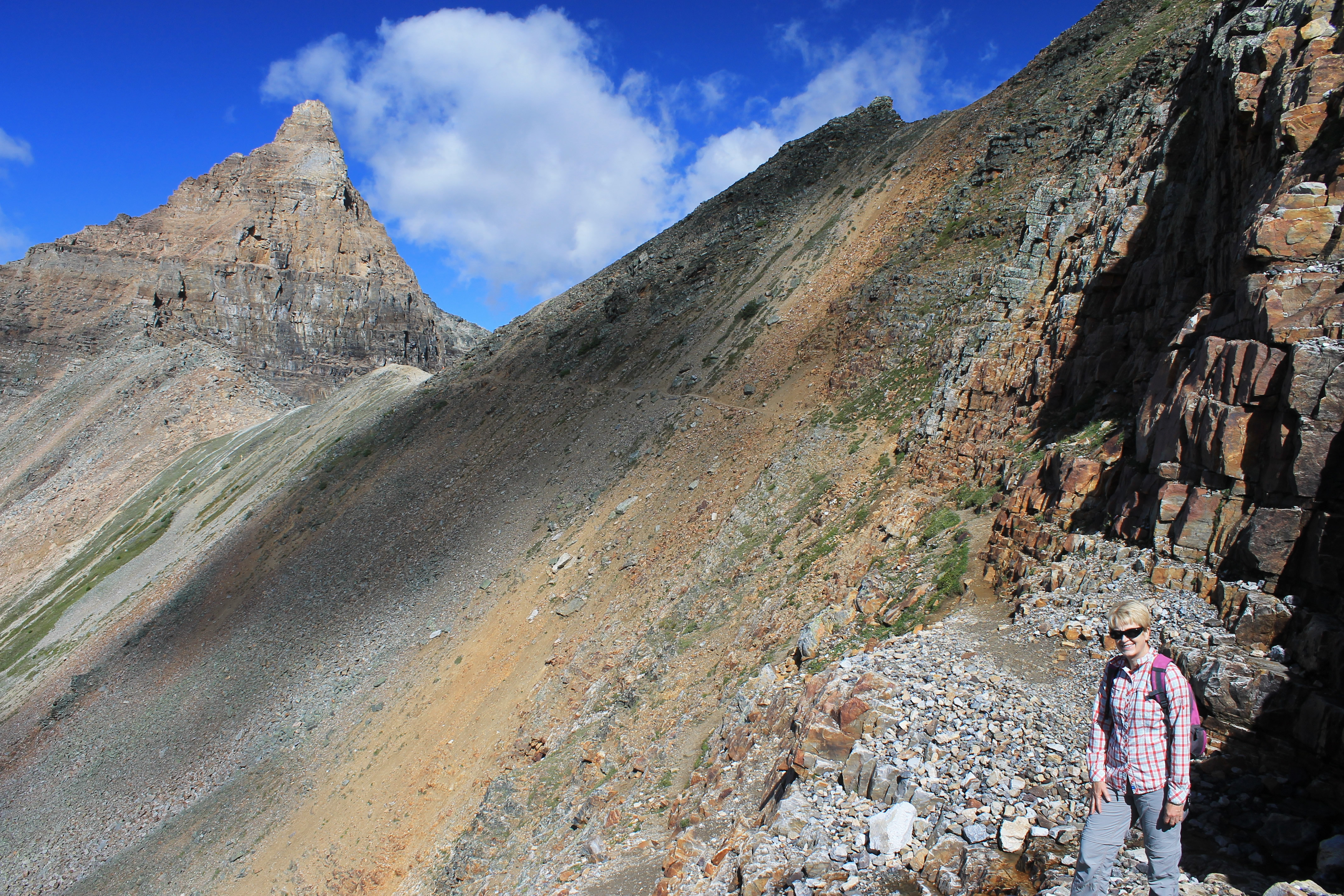
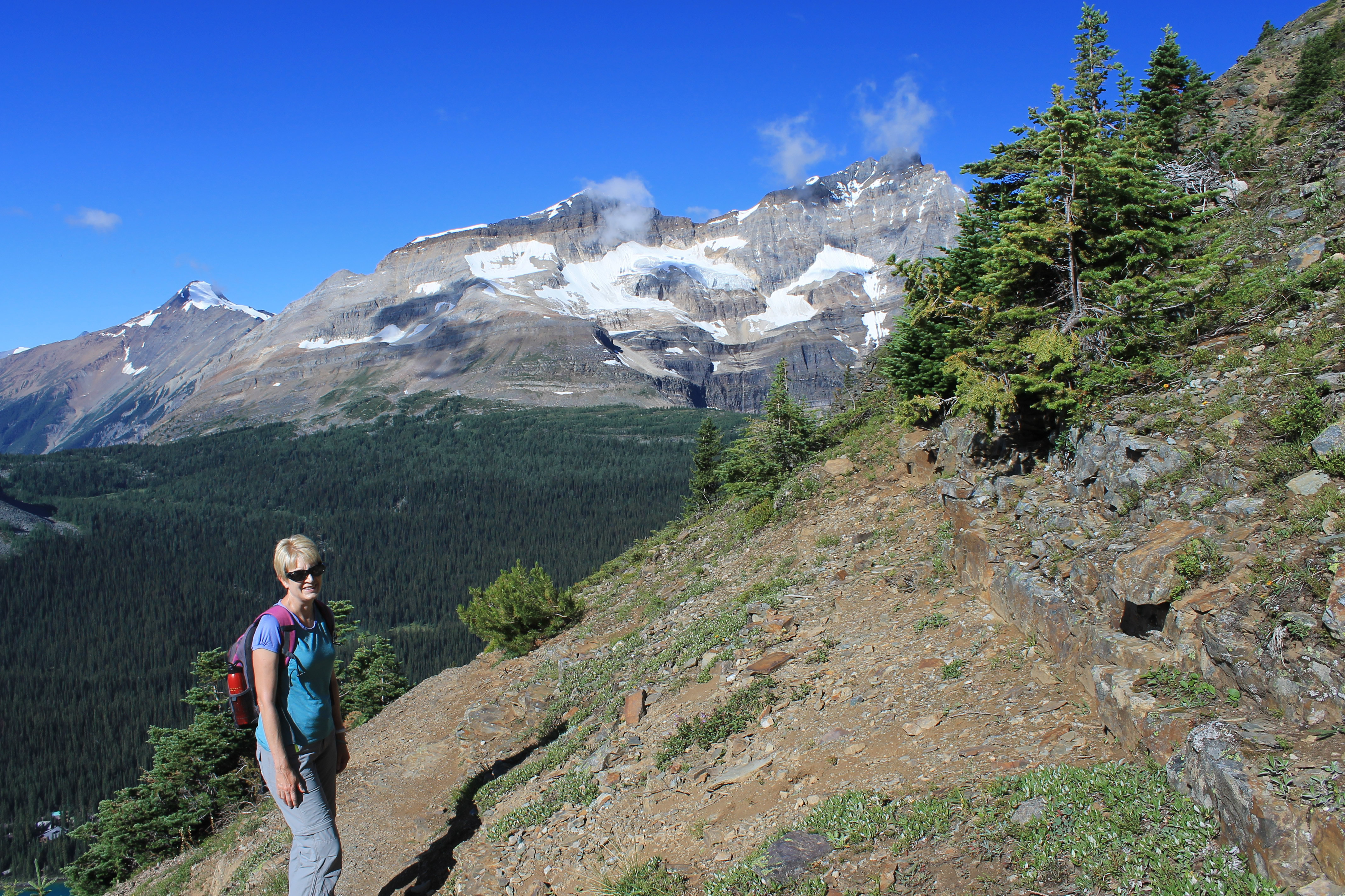 Slowing down but we're almost to the pass
Our last day at Lake Louise had been scheduled way in advance. We were going to hike at Lake O'Hara in Yoho National Park. This is one of the most famous alpine regions in the Canadian Rockies. Access is via a fire road that is about seven miles long and gains 1600 feet of elevation. The Lake O'Hara area itself is very fragile so Parks Canada restricts the area to a small number of visitors per day to prevent major damage. The fire road is closed to private cars. The only way to get to the lake is to take a shuttle bus (very limited) or walk (which doesn't leave much time or energy for exploration). I had read about Lake O'Hara way back when I did my first trip to the Canadian Rockies the summer after I finished graduate school, way back in 1977. Although I was intrigued by the area the arrangements had always seemed too complicated to me to be worth the trouble. Then some friends of Sandy's (Kat and Ziggy) did the hike a few years ago and raved about it. After seeing their pictures I was inspired to figure out how to do it on this trip. I started working on the arrangements months before we left.
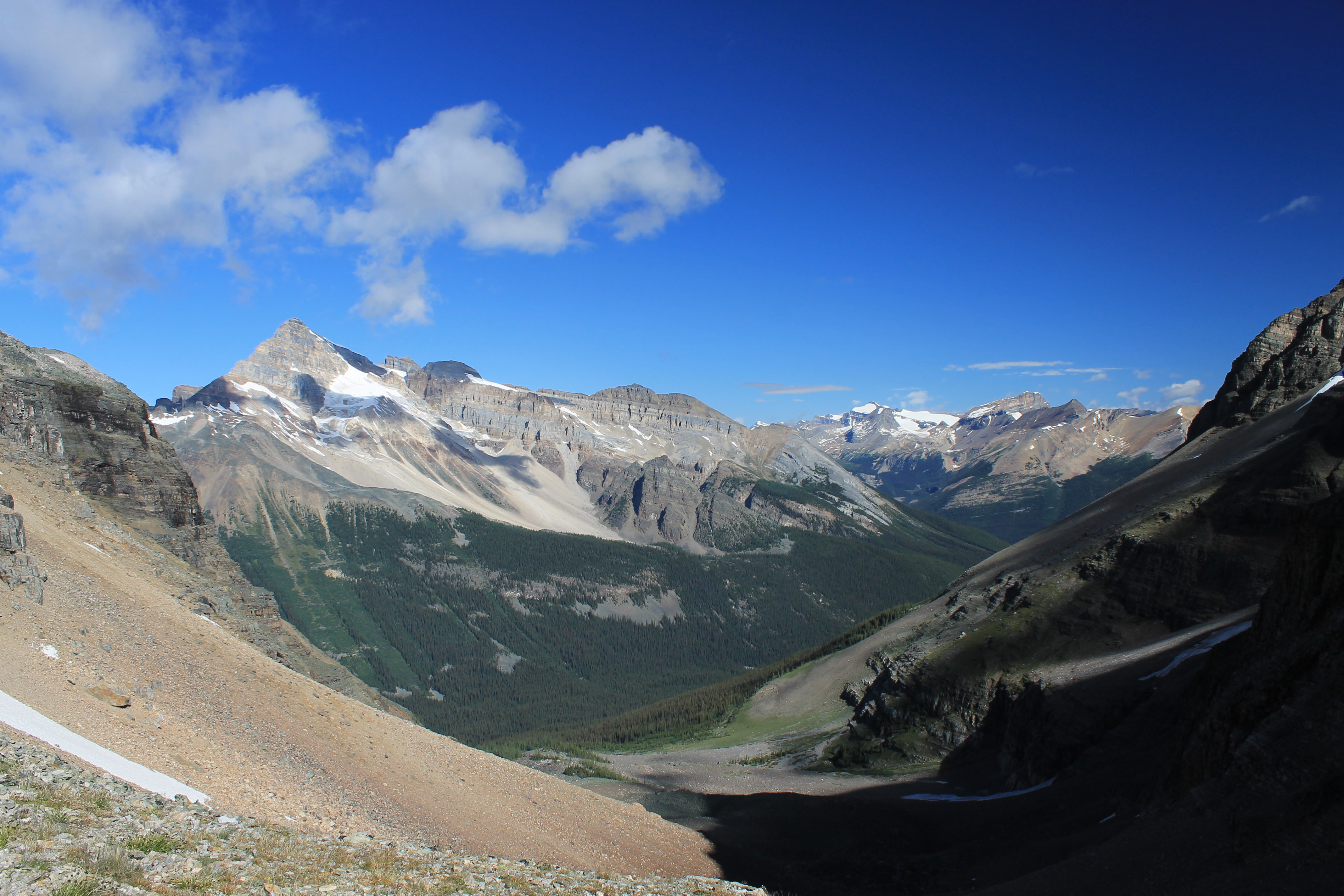 View from Wiwaxy Gap of where we hiked the Iceline Trail
I checked the website for Yoho National Park and it said that you could make reservations for the bus three months ahead of time. So back in April I called the Parks Canada number to make reservations for the shuttle bus. It was a strange conversation. I said that I wanted to make reservations for the bus for a date three months ahead. The lady replied "But it's two oclock!" I knew what time it was, so I asked her what that had to do with it. She explained that every day people called as soon as their office opened to make reservations for the next available day, which would be three months from that day. She suggested that if I was serious I should call at 8:00 sharp when their office opened. All of the spots for a given day usually were booked in the first half hour. If I was lucky I would get through but she said that it was very possible that I wouldn't. Wow. That was certainly discouraging. But being the stubborn type, now I was more determined than ever to make a reservation. Whatever it took, we were going to hike that trail.
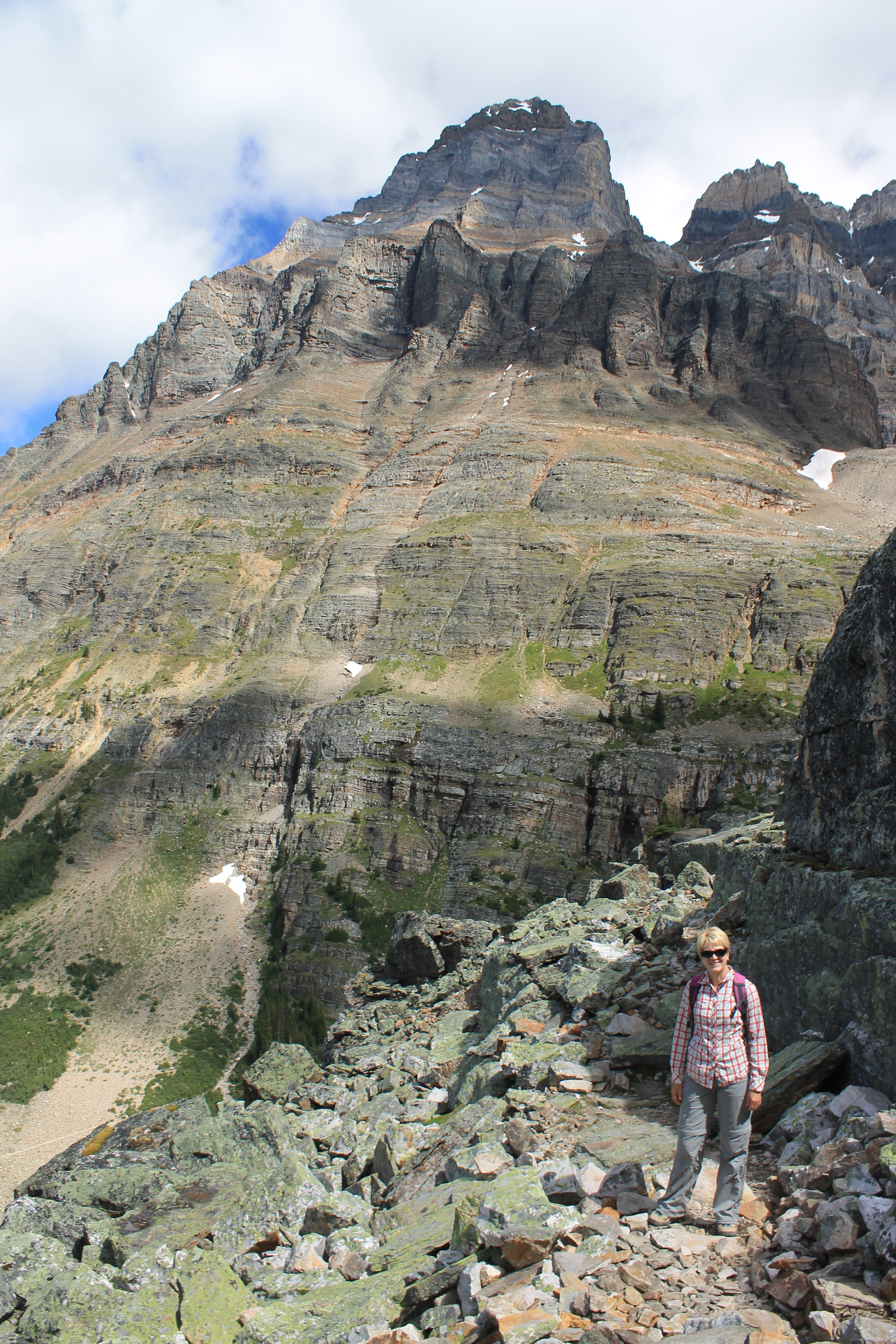
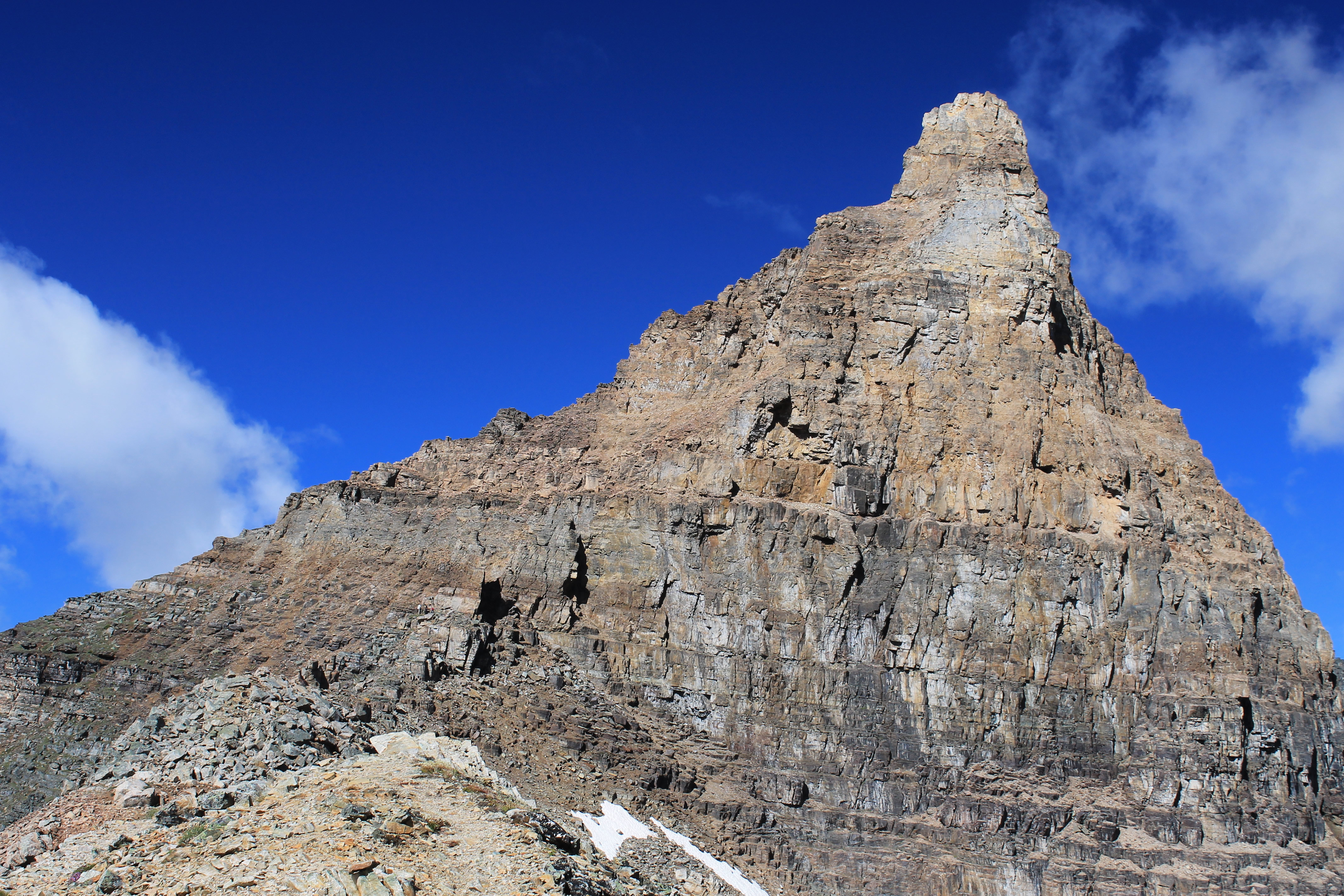 Spot the climbers heading up Wiwaxy Peak from the Gap
The next morning I called a few minutes after 8:00 am. Busy. I called again. And again. And again. As fast as I could dial and get a busy signal, I would hang up and dial again. After about forty five minutes without getting through I gave up for the day. I realized that the lady I had talked to hadn't been kidding.
The following day I wasn't going to let anyone get in ahead of me so I started before 8:00. I kept getting busy signals. Hang up and call again. And again. And again. And again. Then suddenly the phone is answered. It's an automated system, but at least I'm in. I listen to the menu. I press the right number for Lake O'Hara reservations. Then it tells me it's busy and I need to press another number to wait in the queue. Ok I can do that. But I'm a little too quick and my fingers are a little too thick. I hit the wrong key. I hear "Thank you for calling. Goodbye.". Parks Canada hangs up. Nooooooooooooo!!!!!!!!!! It's a good thing my old iPhone 3GS is so sturdy. It survives getting thrown against the wall.
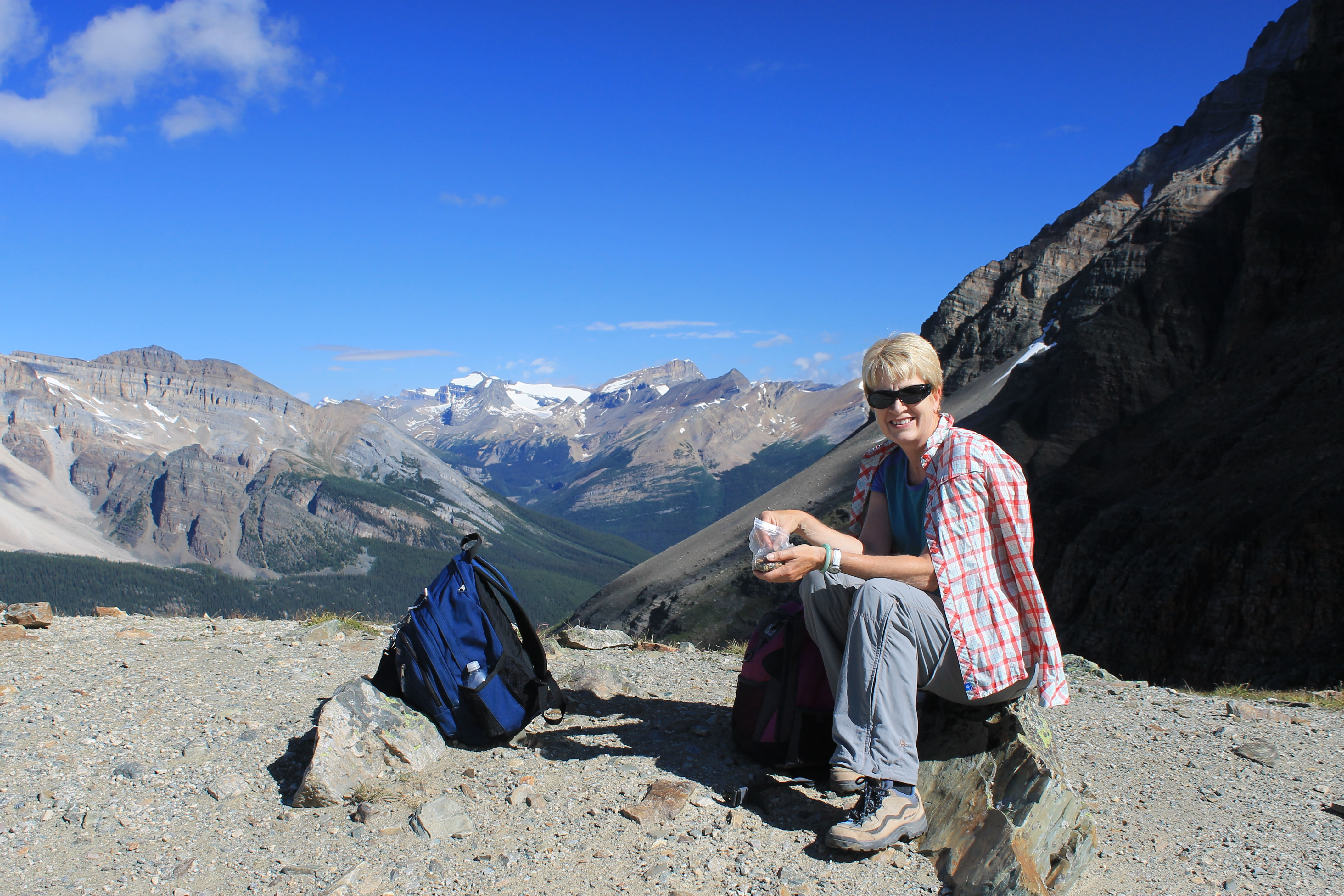 Sandy enjoying a snack at Wiwaxy Gap
Just out of morbid curiosity I check my call log. I discover that it took me 135 attempts to get through to Parks Canada. Ok. It's discouraging but if I got through once I can get through again. My resolve is stronger than ever.
The next morning I call again. And again. And again. I don't get through. After an hour I quit. I try again the next day. And the next day. And the next day. Then suddenly, I get through again. After spending an entire week on this, I was determined not to blow it this time. I listen carefully and am very cautious with every button press. I sit on hold for I don't know how long but I don't get impatient. Then I am talking to a real person! I make our reservations. I give them a credit card number. They send me our bus ticket via email. I print it out and hold it in my hands. I did it. We are going to hike Lake O'Hara. Afterwards I check my call logs. It took me 485 calls to make the reservations. Hiking in the mountains is a sport that requires tremendous endurance, sometimes months before you hit the trail.
 Looking back at the steep traverse along Huber Ledges
Now all we had to worry about was the weather. Since I generally have good luck with weather on major hiking trips I was optimistic that we would be ok. If not, there would always be next year and I could make another 500 calls to Parks Canada to get new reservations.
The night before our Lake O'Hara hike the forecast was ambiguous as usual. I think in the summer the weather forecast for the Canadian Rockies always says "Some sun, some clouds, chance of rain, maybe thundershowers. Some places will have all of the above. All places will have some of the above. Just be grateful that you have any weather at all." They always covered their bases. I had to admit that they weren't wrong very often (how could they be?) but the forecasts certainly weren't very useful for planning purposes. We figured we would just have to see what happened when the time came. The weather had been mostly good throughout our trip.
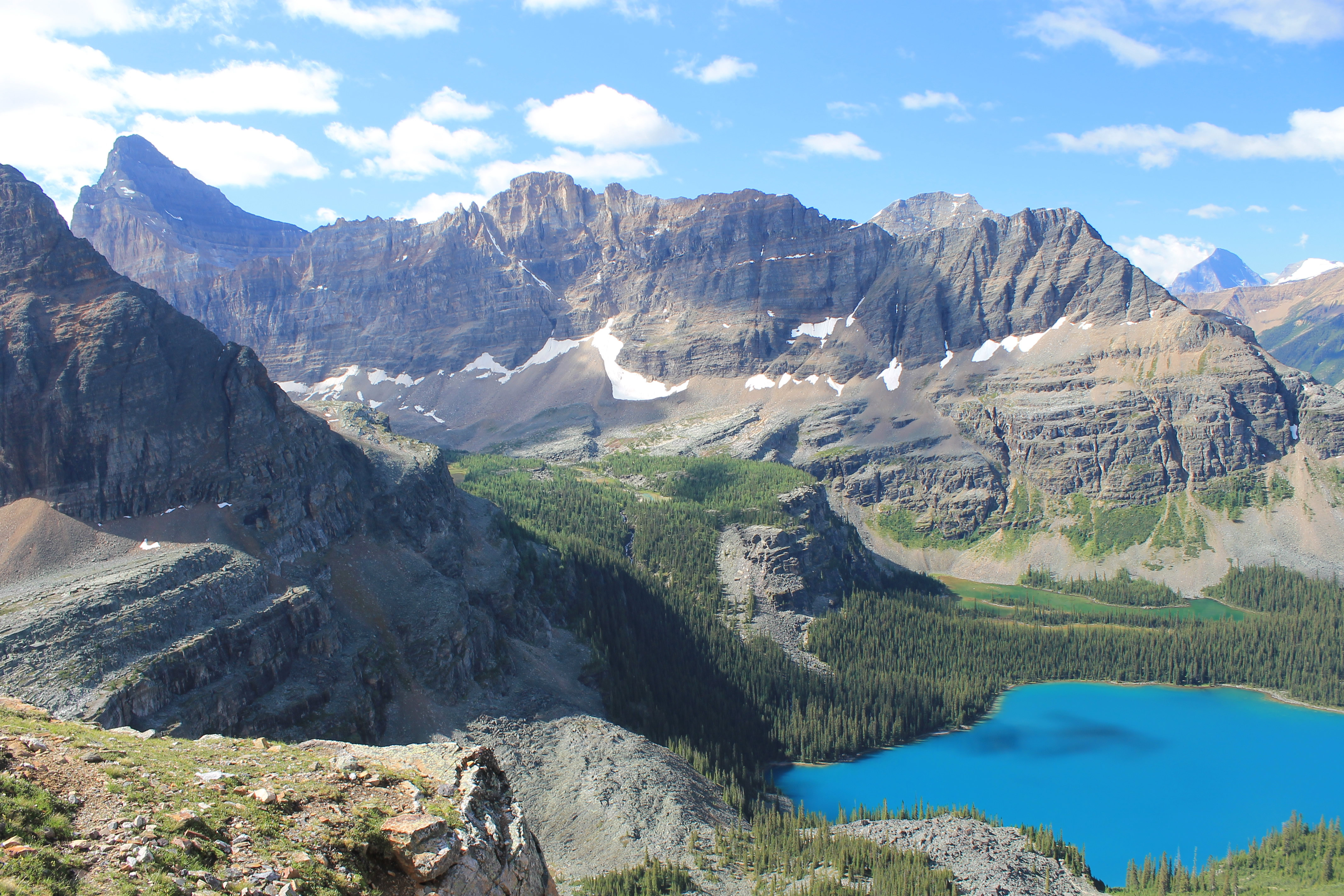
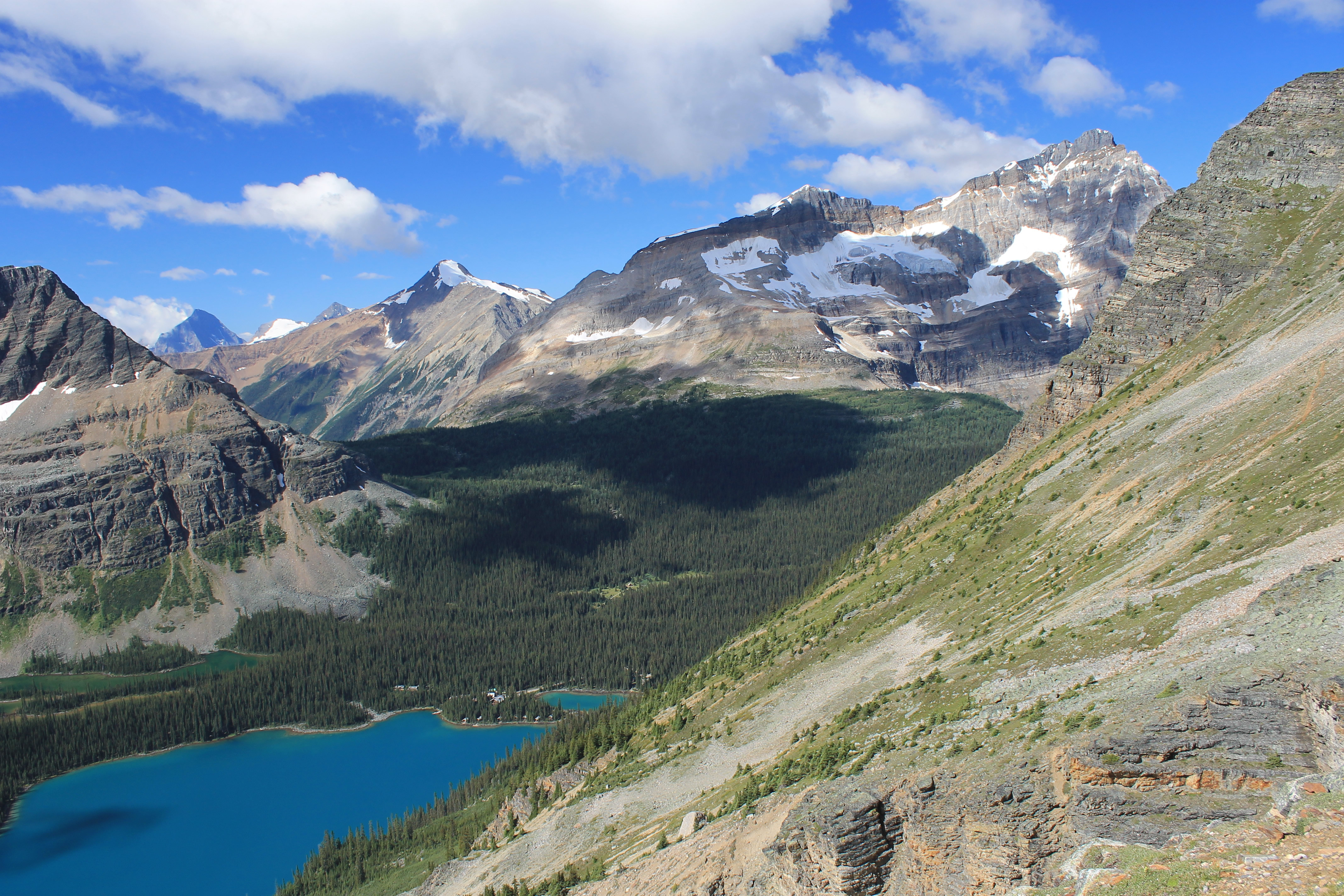 Lake O'Hara and Odaray Mountain from Huber Ledges
When morning came it didn't look good. I peeked out the window of our room as soon as I woke up and it was completely overcast. We packed our gear and drove to the trailhead anyway. By then there was a fine mist falling. We got to the bus stop and checked in with the Parks Canada warden. She tried to be encouraging by saying that when she left her home in Field it had been sunny. We knew that she was just trying to make us feel good. But we were resolved to go to Lake O'Hara as long as it wasn't pouring rain.
We got on the bus and started up the road. The quota for the area was not the number of spots on the bus, but how many people Parks Canada thought it could allow into the basin. So the bus was only a quarter full. That meant that some people who showed up at the last minute were really hassaling the warden to let them get on the bus but she held firm. Not a fun job but an important one. We had our reservation and were on our way to Lake O'Hara, even if it was overcast and misting.
 The traverse across the cliffs of Mt. Yukness looks impossible
But as we drove up the road the mist stopped. Then gaps appeared in the clouds. There was some blue sky. Then more. By the time we reached Lake O'Hara the sky was completely clear. It looked like we had a good day for our hike after all. We piled out of the bus and were ready to hit the trail.
The bus dropped us off at Le Relais, a day shelter for hikers that is operated by the Lake O'Hara Trails Club. It's existence had been reassuring earlier when we thought that we might be taking the bus just to spend a rainy day at Lake O'Hara. It meant that at least we would have a place to get out of the rain while we waited for the bus to take us back to our car. But there was no need for that now. We crossed the road, passed a warden cabin, and walked a few hundred meters to reach the lake. We crossed a bridge over the outlet stream and followed the trail along the lakeshore for about 300 meters to a junction. The right branch of the trail continued beside the lake and then climbed gradually to Lake Oesa. The left branch climbed steeply to Wiwaxy Gap to start the Lake O'Hara Alpine Circuit. Since we had been gluttons for punishment for the entire trip, we picked the steep option.
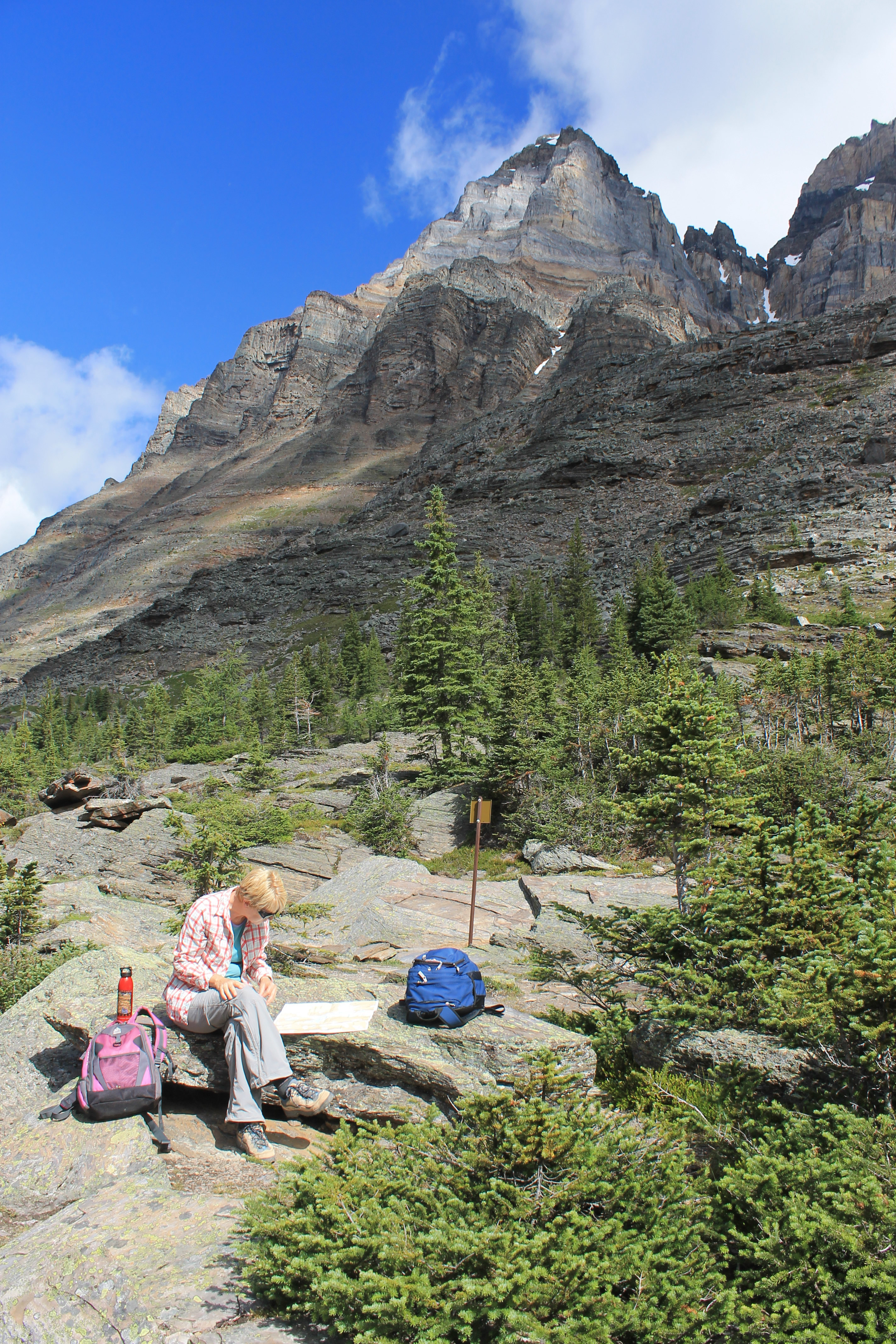 Sandy studies the map before Yukness Ledges
Our ten minute warmup walk was over. It was time for some serious uphill hiking.
The Lake O'Hara Alpine Circuit is one of the classic hikes of the Canadian Rockies. It was built by Lawrence Grassi, an Italian miner who emmigrated to Canada in 1912. He lived in Canmore for many years, working in the mines, building trails and climbing peaks. Later he moved to Lake O'Hara where he was the park warden. He spent years constructing the trails in the area. The Alpine Circuit is an impressive route. It isn't even a trail for major sections which involve crossing boulderfields or scrambling along rock ledges. Looking at the surrounding basin from Lake O'Hara and checking on the map where the trail went, it was not obvious how it managed to cross some of the steep slopes above. In fact, it looked impossible without technical climbing. The views along the way are spectacular but there is some exposure. Scrambling is required in some sections. Sounded like a fun trail. Perfect for us!
From the junction at the lakeshore the trail started to climb steeply towards Wiwaxy Gap. We thought we had done several steep trails on this trip. We were wrong. THIS was a steep trail. It gained 1640 feet from the lake in just over a mile. The first section was up a wooded slope but once the trail climbed above timberline the views back to Lake O'Hara and to the mountains beyond were amazing. The lake is an incredible turquoise color. When you see pictures of the lake you think the pictures must have been photoshoped. But it really looks like that. With each step higher the views became more expansive.
 Sandy on an easy part of Yukness Ledges
Eventually we reached Wiwaxy Gap, the 8315 foot pass between the twin Wiwaxy Peaks and Mount Huber. From here we had views far to the north of across the Kicking Horse River to the peaks around the Yoho Valley. Several days before we had hiked the Iceline Trail among those peaks. We took a well deserved break at the pass to catch our breath and have a drink of water and a snack. It was a spectacular place. We could see the whole Lake O'Hara basin to the south. We could see the trail descending from Wiwaxy Gap to Lake Oesa but from there we could not see how it traversed the slopes of Mt. Yukness even though we knew it went across somehow. It looked way too steep with too many cliff bands to be possible. We would find out later in the day how it got through. But the way down to Lake Oesa was clear along a narrow trail that traversed steep slopes on the side of Mt. Huber. It was an airy walk which provided spectacular views all the way.
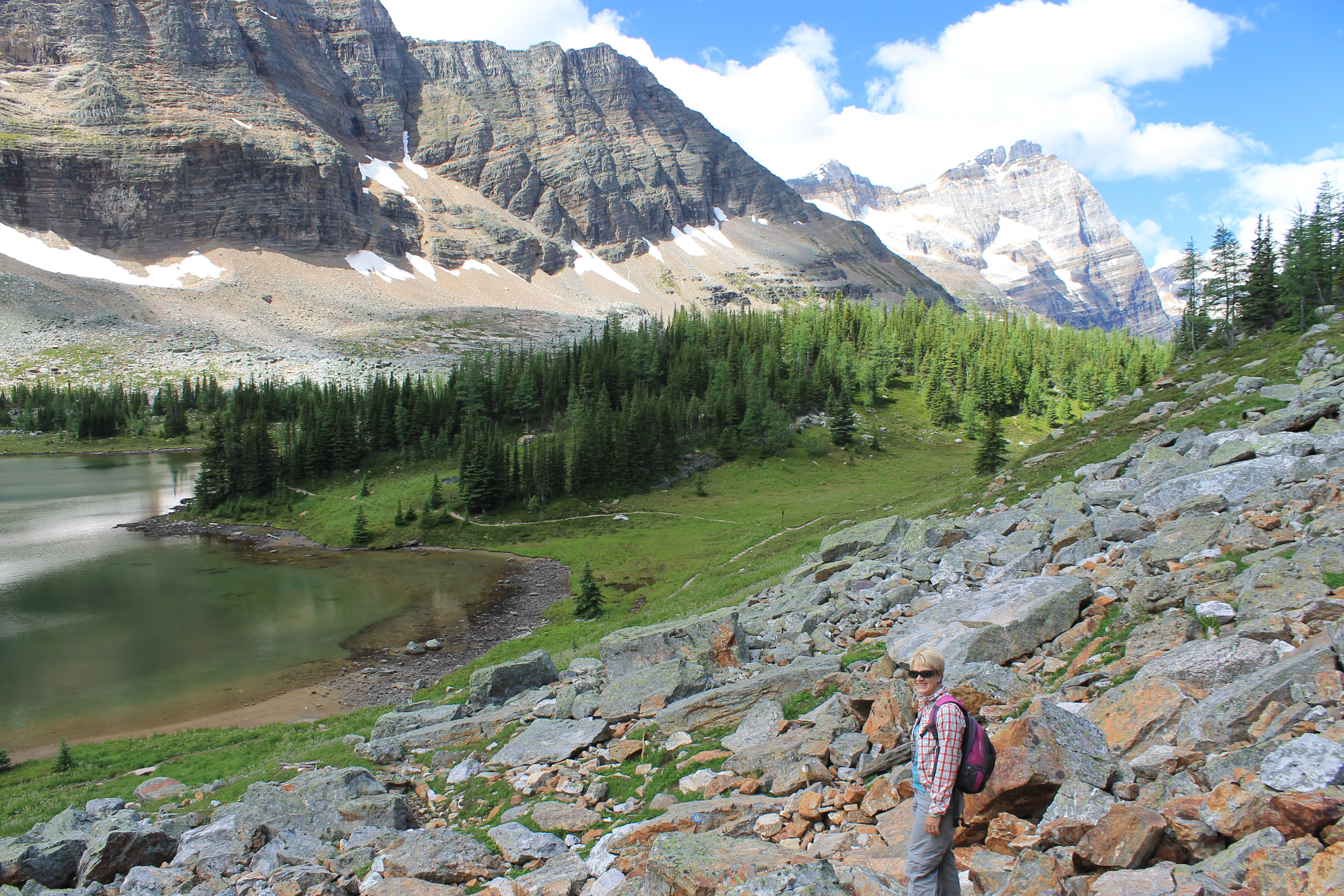
Although the slope it traversed was very steep, the route was very cleverly desinged and it found a way through numerous rock bands and steep sections. It was a bit discouraging to give up so much of our hard earned elevation gain but the views of Lake O'Hara and the surrounding mountains were breathtaking. Eventually we reached Lake Oesa, a small mountain lake set in a gorgeous setting beneath the cliffs of Mt. Victoria. Unfortunately the view of the lake looked right into the sun so none of my pictures turned out. I still have some things to learn about photography.
 Almost back to the trail - just before Sandy slipped
Floating right in the middle of Lake Oesa was a small two-person raft that someone must have carried all the way up from Lake O'Hara. Needless to say the people in the raft had the lake to themselves. It looked like a calm and peaceful place to be. We found our own spot on some rocks where we could sit a short distance from the lake and study the map. It was time to decide if we were going to take the cutoff trail straight back to Lake O'Hara or continue on the next section of the Alpine Circuit, the Yukness Ledges. Since this is the most difficult and most exposed section Sandy wanted to study the description carefully herself. From back at Wiwaxy Gap and along the Huber Ledges, we had not been able to see how the trail could possibly make it through some of the cliff bands on the side of Mt. Yukness. But the guide said it wasn't too difficult. Sandy didn't think too long as there were mosquitoes here that moved in as soon as we stopped walking. She decided we should give it a try.
 Back down to Lake O'Hara
The trail headed straight to a small cliff band at the edge of the plateau we were on...and then went right over. A sharp bend to the right revealed some broken rocks that allowed us to climb down about twenty feet to the next level. From there we traversed various boulder-covered ledges along the steep flanks of Mt. Yukness. There was no trail - we were following paint marks left on the rocks. But clearly Lawrence Grassi had been busy here. Every time we came to an obstacle, like a rock step that we had to go over or go down, there would be a rock or two or three right there, with nearly flat, level tops, that made perfect stepping stones. The route really was a work of art. Although lots of writeups mention exposure on the route I thought it was fairly mild. While not unnerving, it did require that you pay careful attention to what you were doing. I thought that it only got pronounced at one spot. There was a level rock ledge that was above a ten to twenty foot drop - far enough you wouldn't want to fall. It was easy except for one spot where a bulge in the wall on the uphill side forced you out towards the dropoff as you passed. We both made it by without any trouble.
 Seven veils falls and Mt. Huber from Lake O'Hara
The Yukness Ledges were definitely hard work though. Climbing up and down rock bands, scrambling over boulders and following ascending and descending ledges takes a lot more energy than cruising along a wide trail. Eventually we had traversed all the way around Mt. Yukness and were descending the boulder field to a flat grassy area on the Opabin Plateau where we rejoined a normal trail. Unfortunately after all that distance on the boulder fields, we were about twenty feet from the trail when Sandy slipped on a loose rock and fell. She got some nasty scrapes from the rocks but she was a tough hiker. She shook it off and kept going. But that made up our mind for us about what to do when we reached the trail. We had two options. We could continue up to some other lakes and then around on the All Souls portion to complete the full circuit. Or we could head straight down to Lake O'Hara from here. We opted to head down. Even taking the "shortcut" we still had an hour or so to hike to reach Lake O'Hara and the trailhead.
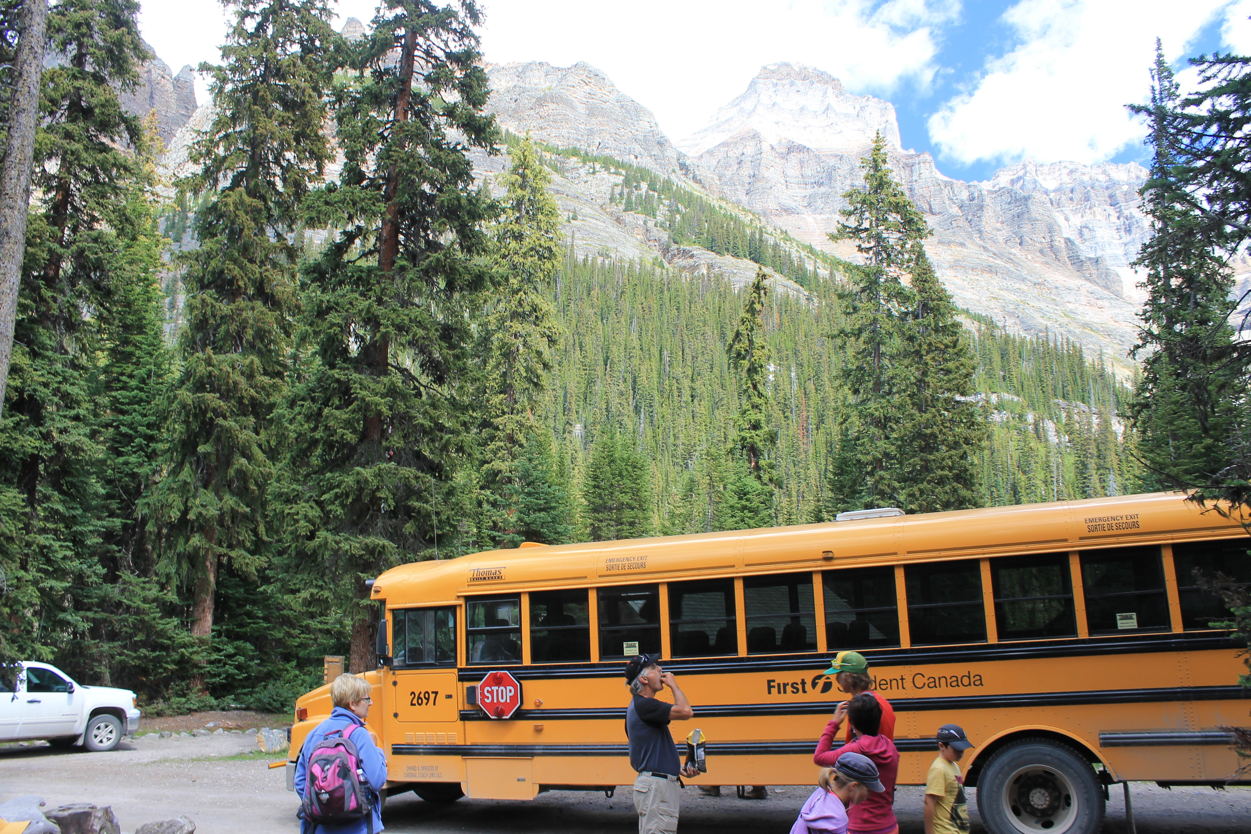 Catching the bus back to our car
After a steep descent the trail finally reached Lake O'Hara, at the far end from the lodge and trailhead. The level trail around the lake was finally an easy walk and we had great views of the lake, the surrounding mountains, and the route that we had followed around the Lake O'Hara basin. At the end of the hike I went to the Le Relais shelter where I bought a cold soda to drink while we were waiting for the bus. Oh yeah, I bought a Lake O'Hara Trail Club tshirt too. Only to support their efforts to maintain the trails and hiker shelter, of course. A very worthy cause.
The bus ride back to the car was memorable for having a candidate for the title of Most Obnoxious Kid in the World sitting right behind us. If we had more energy left one of us probably would have smacked him. Finally we were back at our car. We drove back to the Lake Louise Lodge where thankfully we had a quiet dinner. It was our last night there. In the morning we would head over the Continental Divide and into British Columbia for the last two days of our trip.
