Eagle Cap Wilderness - Twin Peaks
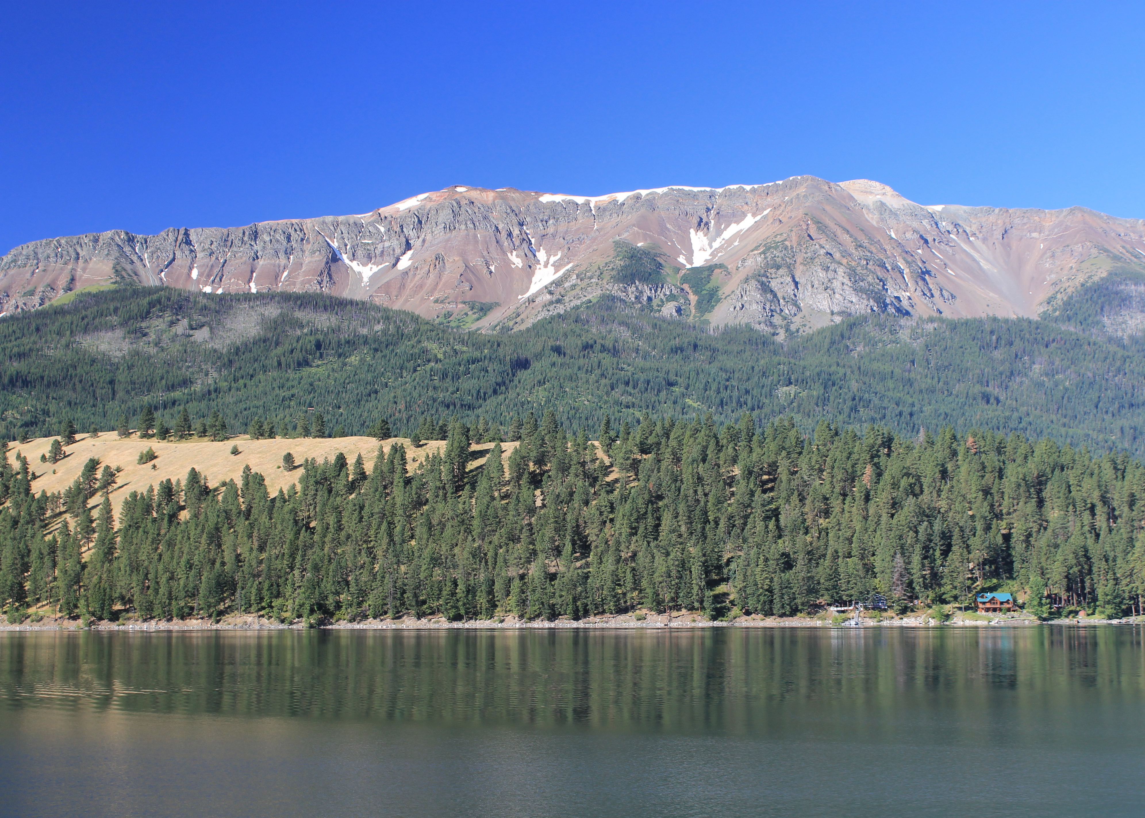 Hurwal Divide from Lake Wallowa - a beautiful morning
My hike to Aneroid Lake the day before had been great. Starting from Wallowa Lake I hiked up a long river valley to a high basin with a beautiful lake and a stunning mountain background. Today I wanted to do something different.
Wallowa Lake has a lot of development. There are lodges, restaurants, stores and campgrounds. There are boat docks and even a small go kart track. It's full of tourists but it is hidden pretty well in the forest. There is the large wilderness area just beyond the lake so there is ample opportunity to escape the crowds.
There is even a mountain tramway that starts near the lake and rises 3700 feet to the summit of Mt. Howard. Normally I'm not a big fan of that sort of thing but I have to admit that the tramway is hard to spot in the trees. In fact I actually had to look carefully to find it. Maybe it's very visible from some of the other peaks in the range but from the road and the area around the lake, the tram is fairly unobtrusive.
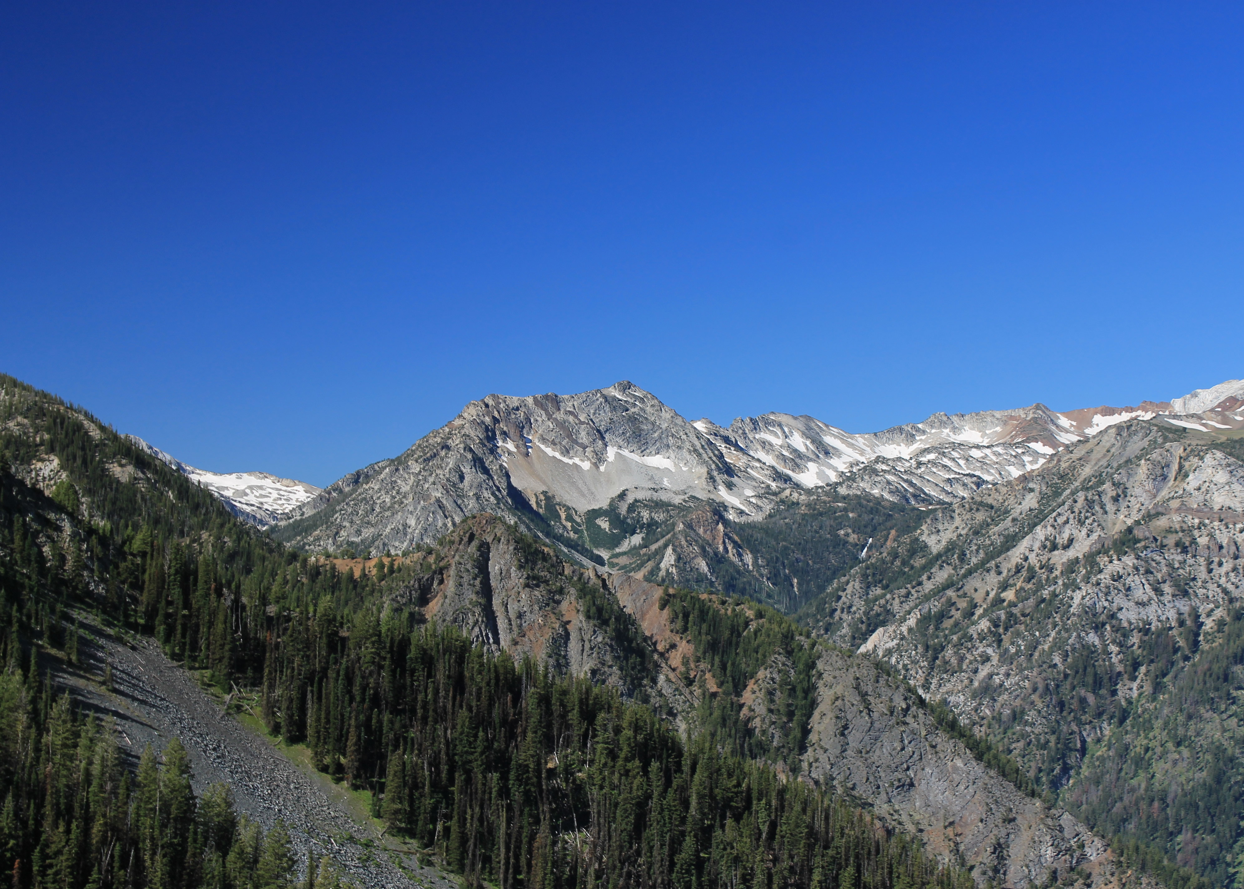 Craig Mountain comes into view from the tram
The upper terminal is near the summit of 8,255 foot Mt. Howard. It's above timberline and high enough to provide spectacular views all around. But the mountain is actually just a minor bump on the far end of the ridge that forms one of the walls of the canyon of the East Fork of the Wallowa. This was the canyon that I had hiked the day before, looking up at the peaks of the ridge. Today I wanted to check out the other perspective. By taking the tram to the top I would be able to hike along the top of the ridge with a chance to climb one or more of its major peaks.
I checked the day before and found out that the tram started at 9 am. That meant an easy morning. No alpine start required - I could sleep in a little. I even had some breakfast, took my time checking out of my motel, and drove to the tram. I was there by 8:55 am and was standing in line. Yes, there was a line. One couple got there before me. But there was just the three of us. The ticket stand did indeed open at 9 am sharp. I paid my $28, well worth it for the 3700 feet of elevation gain, and soon was in the second car headed up to the top.
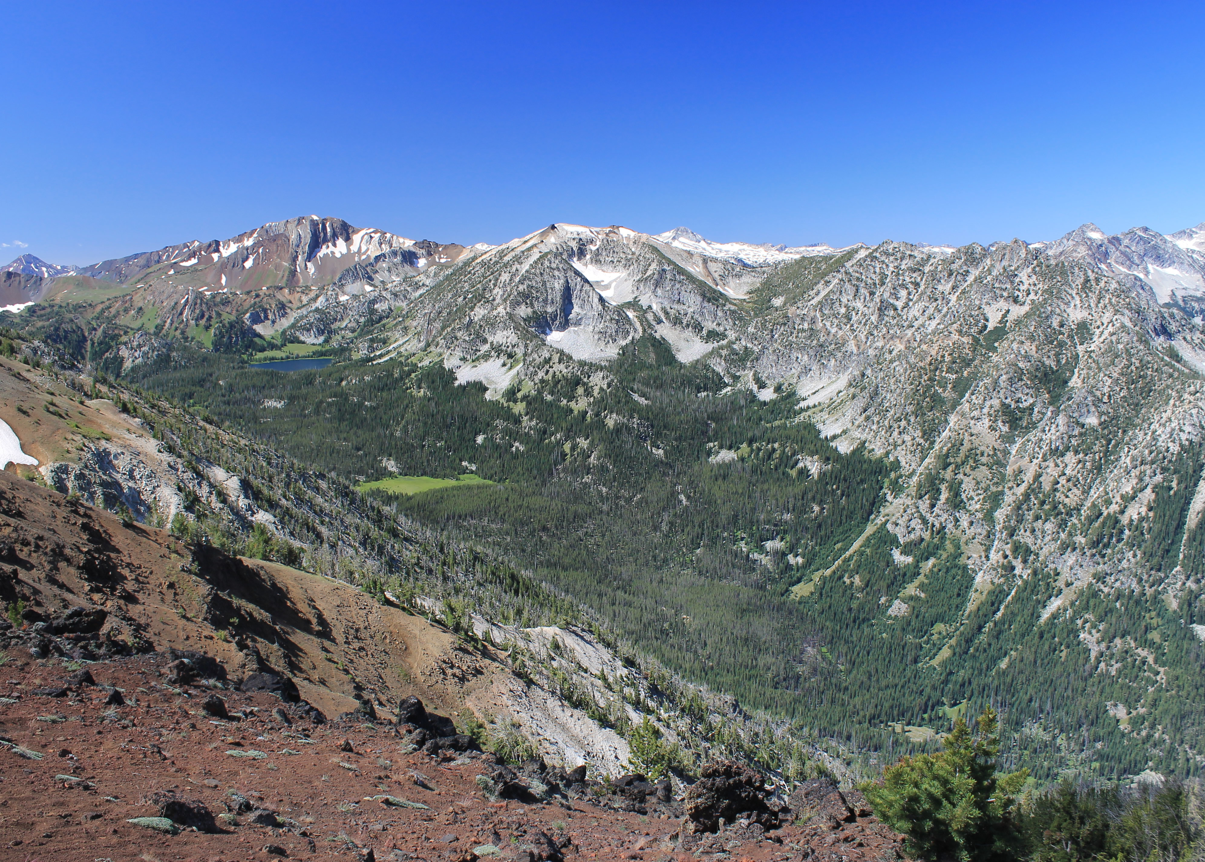 Looking down on yesterday's hike
The view as the car rose was indeed impressive. Wallowa Lake was a deep blue far below. Plains stretched to the north with the towns of Enterprise and Joseph clearly visible. But my eyes were firmly fixed on the mountains to the south and east. As we got higher I could see farther into the interior of the Eagle Cap Wilderness. Craig Mountain was prominent up the West Fork of the Wallowa River. I must have snapped about twenty pictures, trying to get a shot through gaps in the trees, doing my best to hold the camera steady and wait till the car wasn't swinging.
At the tram station on the top there was a small restaurant. There were also some short nature trails for tram tourists. I headed straight for the top of Mt. Howard, only a quarter of a mile away. From there I hoped to find the climbers track that was supposed to head up the ridge. I did, but not where I expected it. I could see it down in the saddle between Mt. Howard and the next point on the ridge, but I couldn't see any track going down to the saddle. I felt badly but rather than spend all morning searching, I just took off down the slope to where I could see the track. It's a bad practice to go off trail in a popular area above timberline because the slopes erode very quickly.
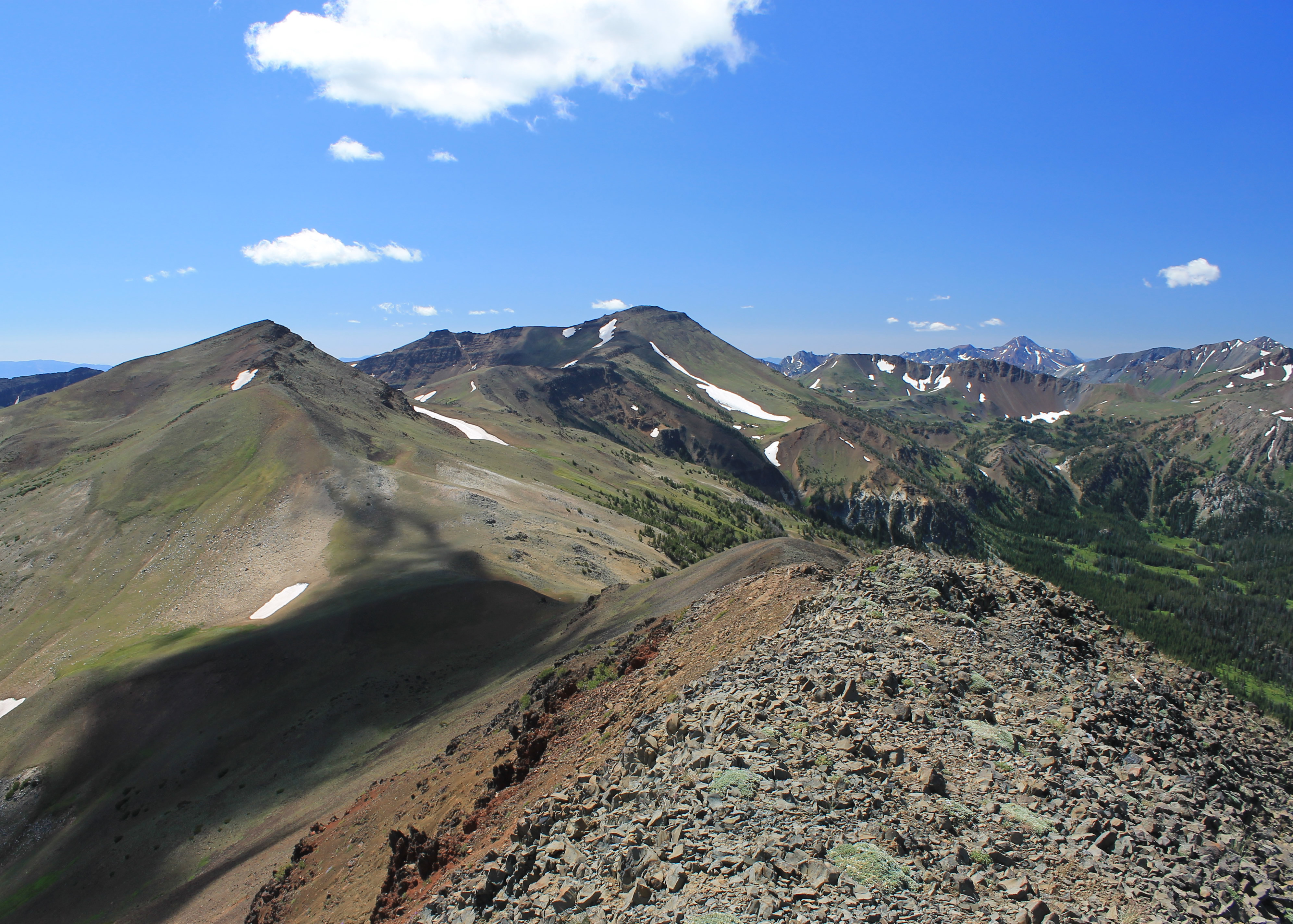
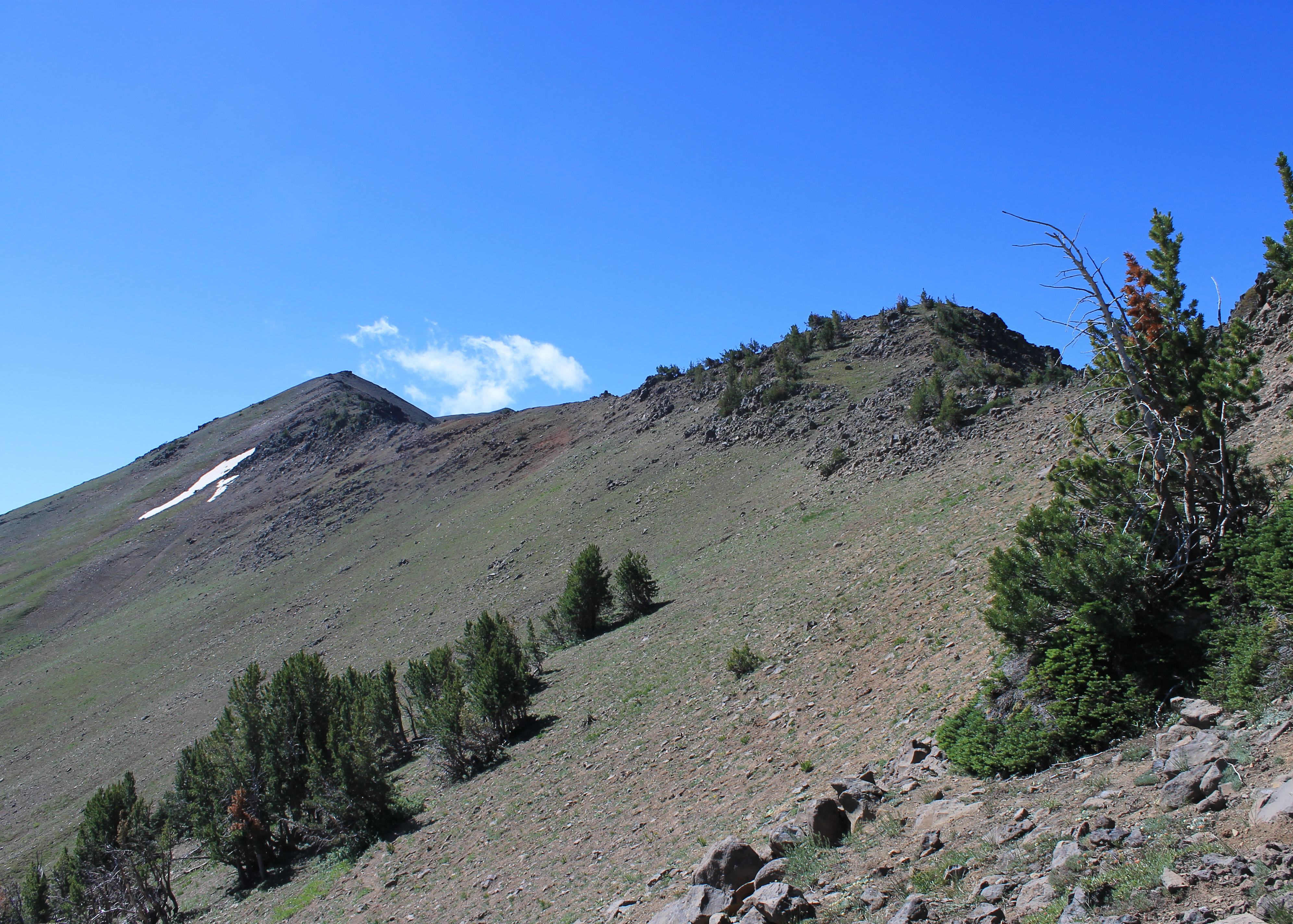 The route follows the ridge up to the false summit of East Peak
My immediate goal was East Peak, two miles away and 1800 feet higher. That doesn't sound like much but the guidebook said it would take about three hours. The elevation gain on ridge hikes can be deceptive because there is often a lot of up and down that isn't obvious from just comparing the altitude of the two end points. This hike would definitely turn out to be that way.
Although there was no maintained trail, the climbers track was easy to follow once I was on it. It climbed steadily upward, passing to the right of the first high point on the ridge, and then to the left of the next high point on the ridge. From there I could see East Peak rising a lot higher. The track climbed to a junction. On the left the track did a mostly level traverse around East Peak. That was the route to Hidden Peak and Aneroid Mountain, peaks further up the ridge. I took the right branch which went up to the ridge crest.
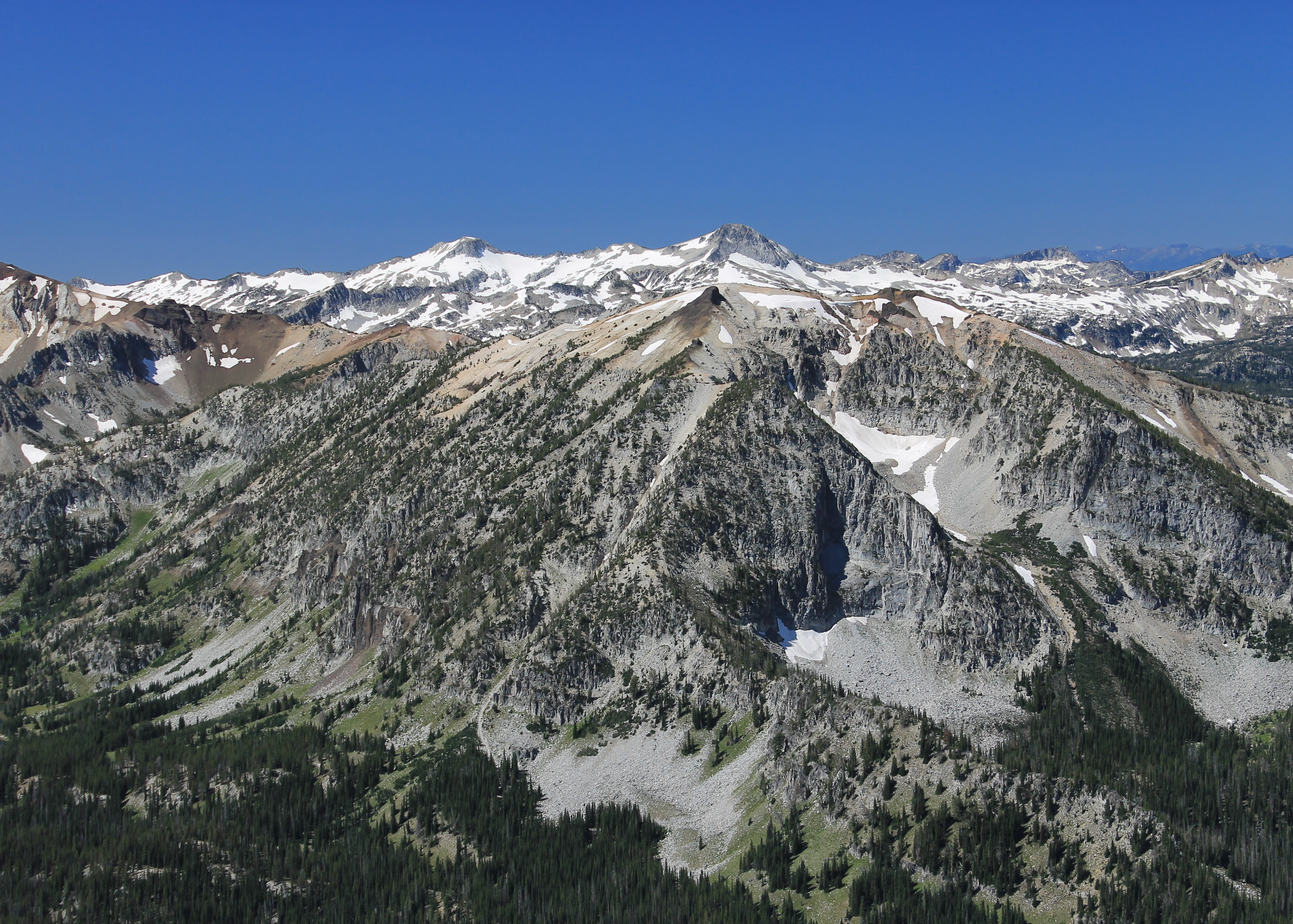 Glacier Peak and Eagle Cap from the summit of East Peak
This was incredible hiking. The weather was perfect. Walking along the crest of the ridge I felt like I was in the sky. To the east I could see Hells Canyon, and beyond it the Seven Devils Mountains and other peaks even further into Idaho. To the west I looked down into the East Fork of the Wallowa, where I had hiked yesterday. I had a great view of the Aneroid Lake basin. Beyond it I could see other peaks deep in the Eagle Cap Wilderness. I recognized Glacier Peak and Eagle Cap. I could see the basin with Ice Lake (a hike I considered and one which I will do some day) with the Matterhorn above it.
I followed the ridge all the way to the summit of East Peak. Or not. When I reached what I thought was the top it turned out to be a false summit. I could see the real summit further along the ridge and considerably higher. The good news was that I was sure that I was finally looking at the true summit. Beyond it I could see the ridge drop a long way to a saddle and beyond that I could see Hidden Peak and Aneroid Peak. Not the first time I was fooled by a false summit. Probably won't be the last.
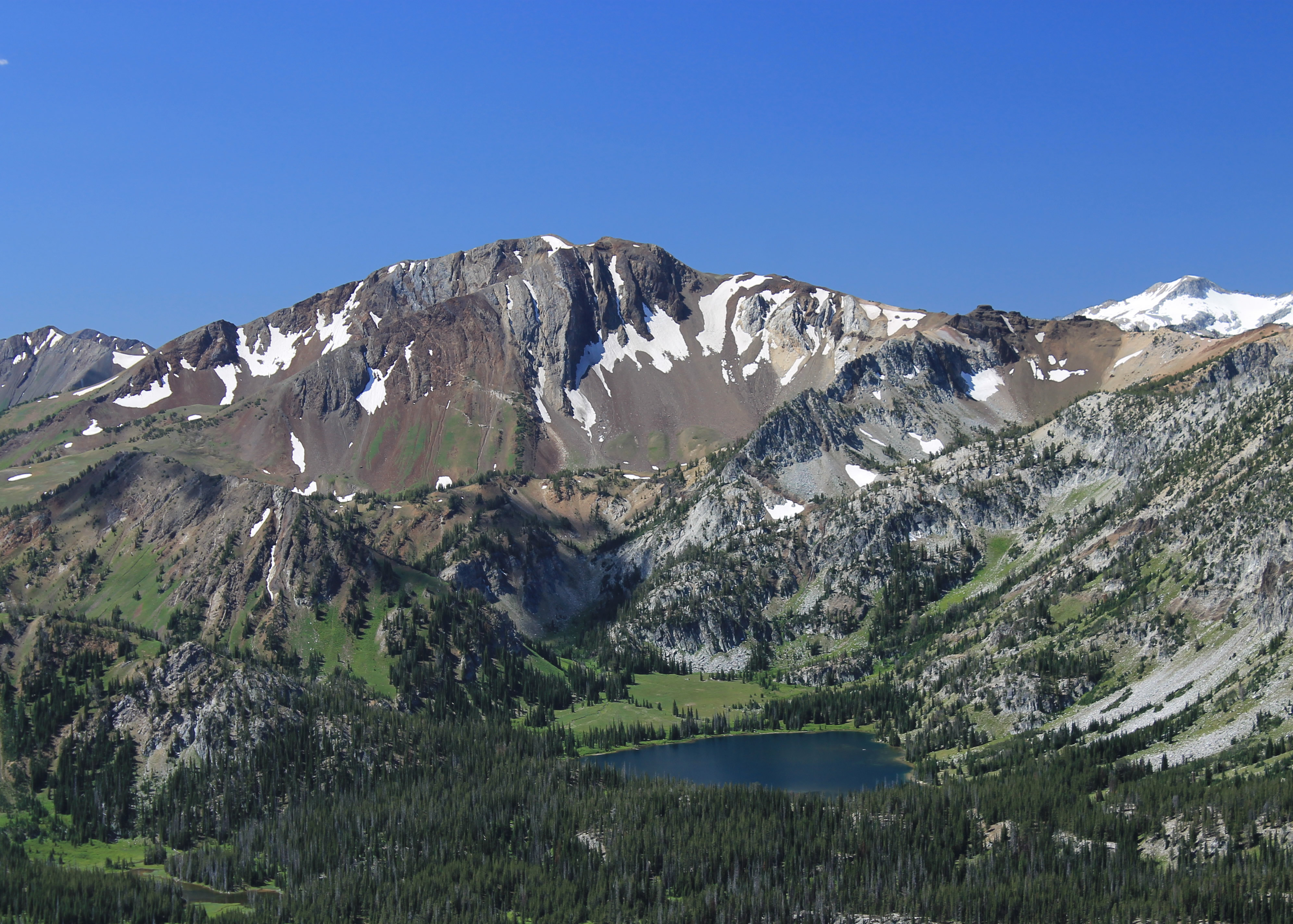
 Hidden Peak and Aneroid Mountain from East Peak
Finally I reached the real summit. It was quite a viewpoint, spectacular in all directions. I had a snack while I enjoyed the view. My eyes kept getting drawn to Hidden Peak. I was estimating that I could get down to the saddle in half an hour and up to the peak in an hour. On the return I could take the traverse route that had split off back at the junction. That should be fairly level and therefore faster on the way back. I didn't want to be too late as I still had to drive home and Sandy wasn't expecting me to be really late. Doing Hidden Peak didn't have any real advantages. It's name comes from the fact that you can't see it from anywhere below. That means the view isn't nearly as good as the one from East Peak. It would be shameless peak bagging. I got up and went for it. My first worry was the descent to the saddle. I couldn't see all of it and there could have been cliff bands. It did get steeper but nothing too tough. In only fifteen minutes I was down to the saddle. Faster than I expected. That doesn't happen often.
 Aneroid Lake basin from Hidden Peak
The climb up to the top of Hidden Peak only took half an hour. Again less than I expected. I was on a roll! As I approached the summit I could hear buzzing, like flies. I don't know why, but there were quite a few right around the top. Weird. They were a minor annoyance, the only time bugs caused any problem at all on the whole trip. I found the summit register and it went back all the way to 1989. According to the register, I was only the fifth person to climb Hidden Peak this season. That seemed amazing to me since it was fairly easy from the tram. I guess it's a tweener. East Peak is closer and a better view point. Aneroid Peak is farther and higher and the destination of choice for those who want a challenge. Hidden Peak sort of gets left out. But hey, a summit is a summit and I felt good about doing it.
I got back down to the saddle between Hidden Peak and East Peak with no problem. Here was where I wanted to pick up the traverse path so I didn't have to return over East Peak again. I could see a very sketchy track leading from the saddle. I wasn't sure how well it would go. Once I was on it, the track turned out to be fine and I did the long traverse in about twenty minutes.
 Looking back to East Peak and Mt. Howard from Hidden Peak
At this point I made my only mistake. The track faded and I managed to lose it. I thought that I was just around the corner and just below the junction with my original route. I forgot that the false summit was in between. So I did a high, rising traverse on the slope when I should have dropped down. It wasn't a problem other than it took me twice as much time and twice as much energy. After about half an hour I finally spotted the correct track about two hundred feet below me. I picked my way down the slope and finally got back on track (back on track - ha ha!).
From there the rest of the way was easy. Compared to a slope of loose dirt, the worn track seemed like a highway. About half an hour from the end I finally met two other hikers. They were the only other hikers that I saw all day. Amazing on such an incredible route that was so accessible from the tram. They asked me if the next high point on the ridge was East Peak. I told them no and pointed out a much higher point just barely visible further along the ridge. I explained that it was a false summit and that East Peak was behind and above that. From their reaction I got the impression that they weren't going to go for it.
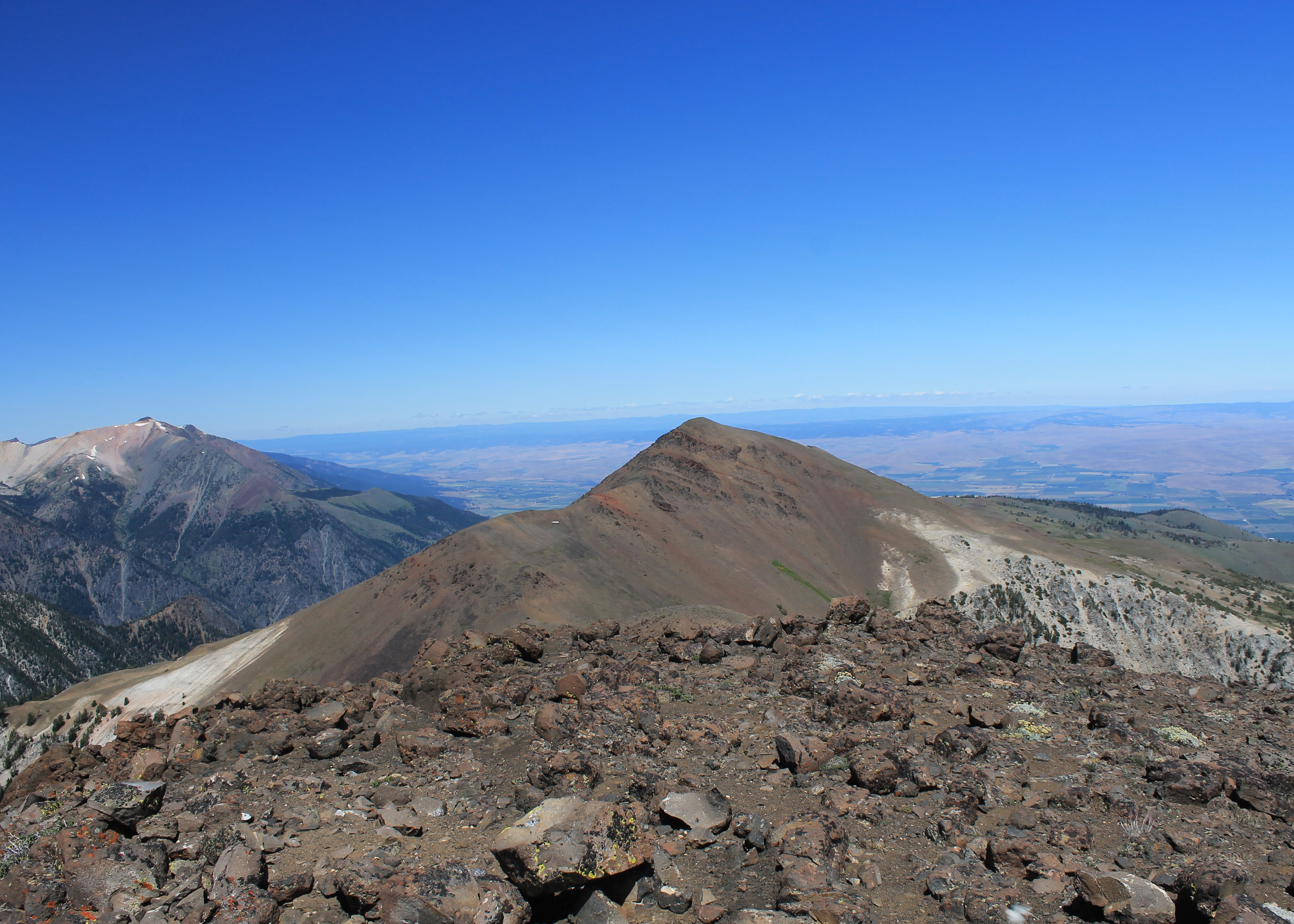
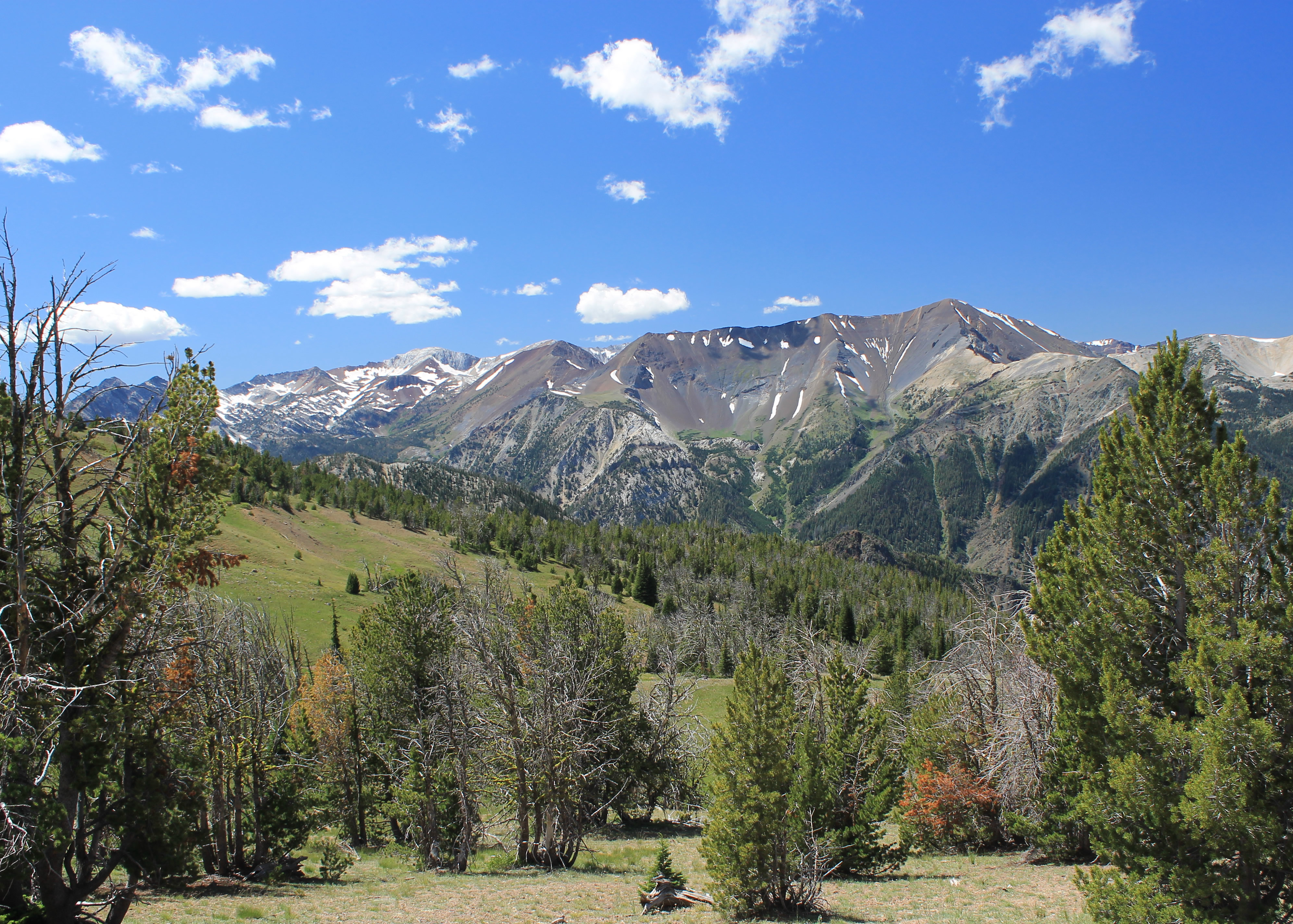 Looking across to Hurwal Divide from near Mt. Howard
Before heading down I stopped for lunch at the restaurant at the tram station. There was a crowd of tourists there and they were very slow, but I had seen that their special was mac and cheese and that sounded really good. They also had cool tshirts there and I was overdue to get something. But they were so crowded and so slow that I gave up on that. Two trips in a row now without getting a tshirt!
The hike had been great. Wonderful weather. Hiking the whole time along a ridge with great views. Two summits. And I did it all in four and a half hours.
After riding the tram down, I drove home in a little over four hours. I really enjoyed my two days hiking in the Eagle Cap Wilderness. The mountains were much more impressive than I had remembered. I'm determined to go back again soon. It's a big wilderness and there is a lot more to explore. There are enough peaks to climb to keep me busy for quite a while, even if I do them two at a time.
