Olympic National Park - Grand Valley
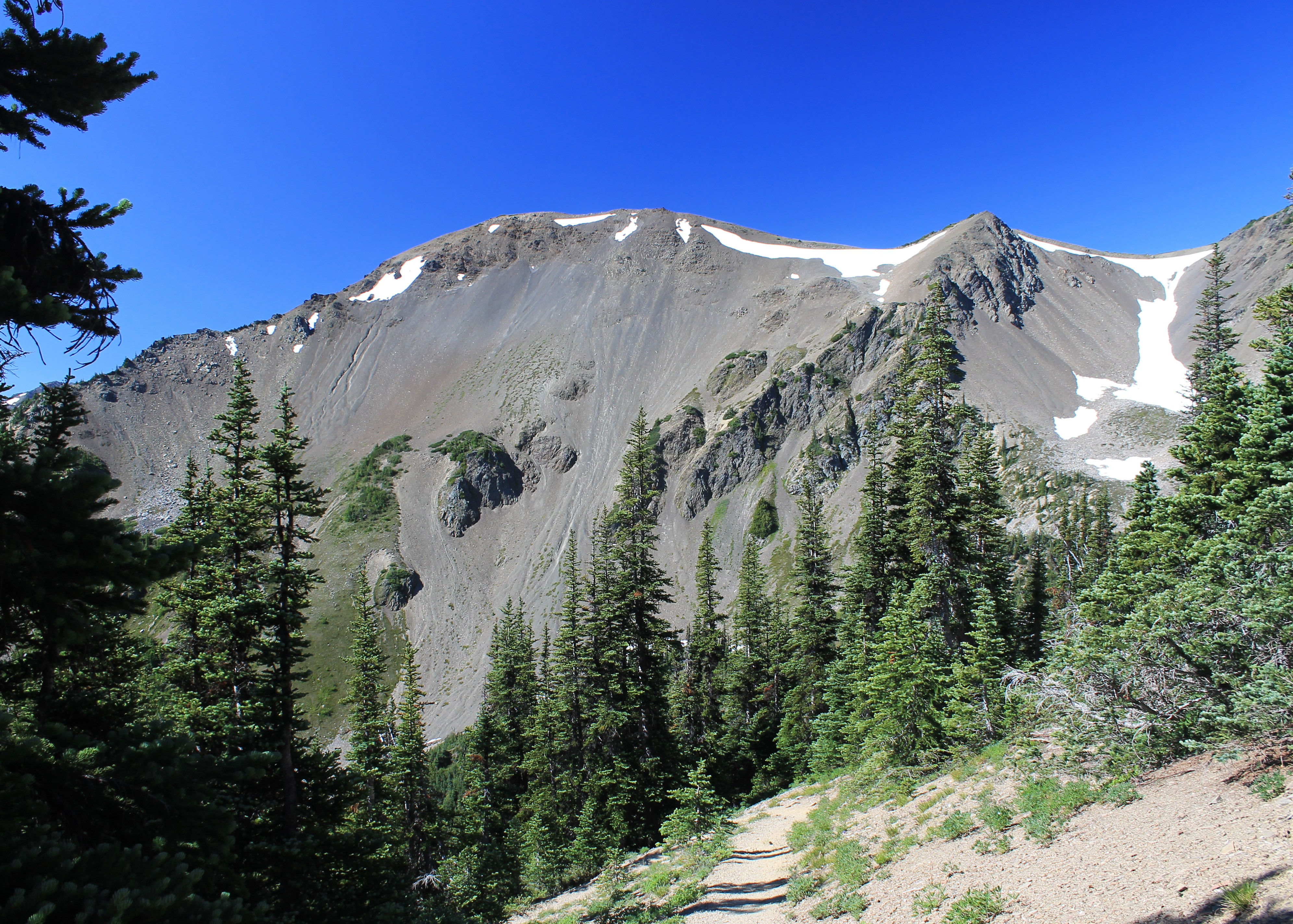
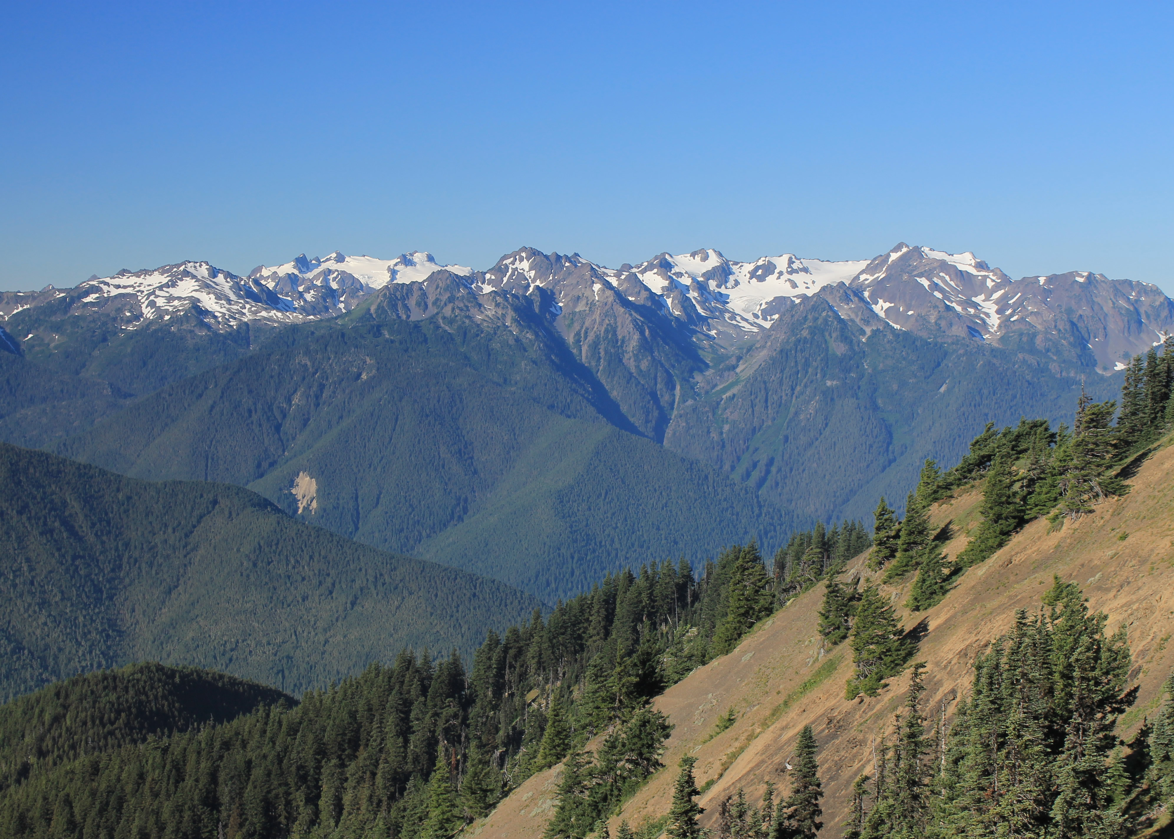 Mt. Olympus from the trailhead at Obstruction Point
The hike to Grand Valley is an upside down trail. Most hikes start low, climb to the high country, and then drop down on the return. On this hike, the trailhead is on a high ridge. After following the ridge for a while it drops down into a deep valley to visit several alpine lakes before climbing back up to a pass at the head of the valley that leads deeper into the wilderness of Olympic National Park. Since I was day hiking, I would have to retrace my steps back to the trailhead, which meant that the end of the hike wouldn't be easy downhill. It would be a steep climb back up to the ridge.
Doing a hard climb at the end of a long day is not my favorite way to end a hike, so I don't usually do trails like this one. But I had already done one upside down trail this spring, Horseshoe Canyon in Utah. And I really want to do the mother of all upside down trails again this fall, the Grand Canyon. I figured I could use the practice. So I decided to do this one.
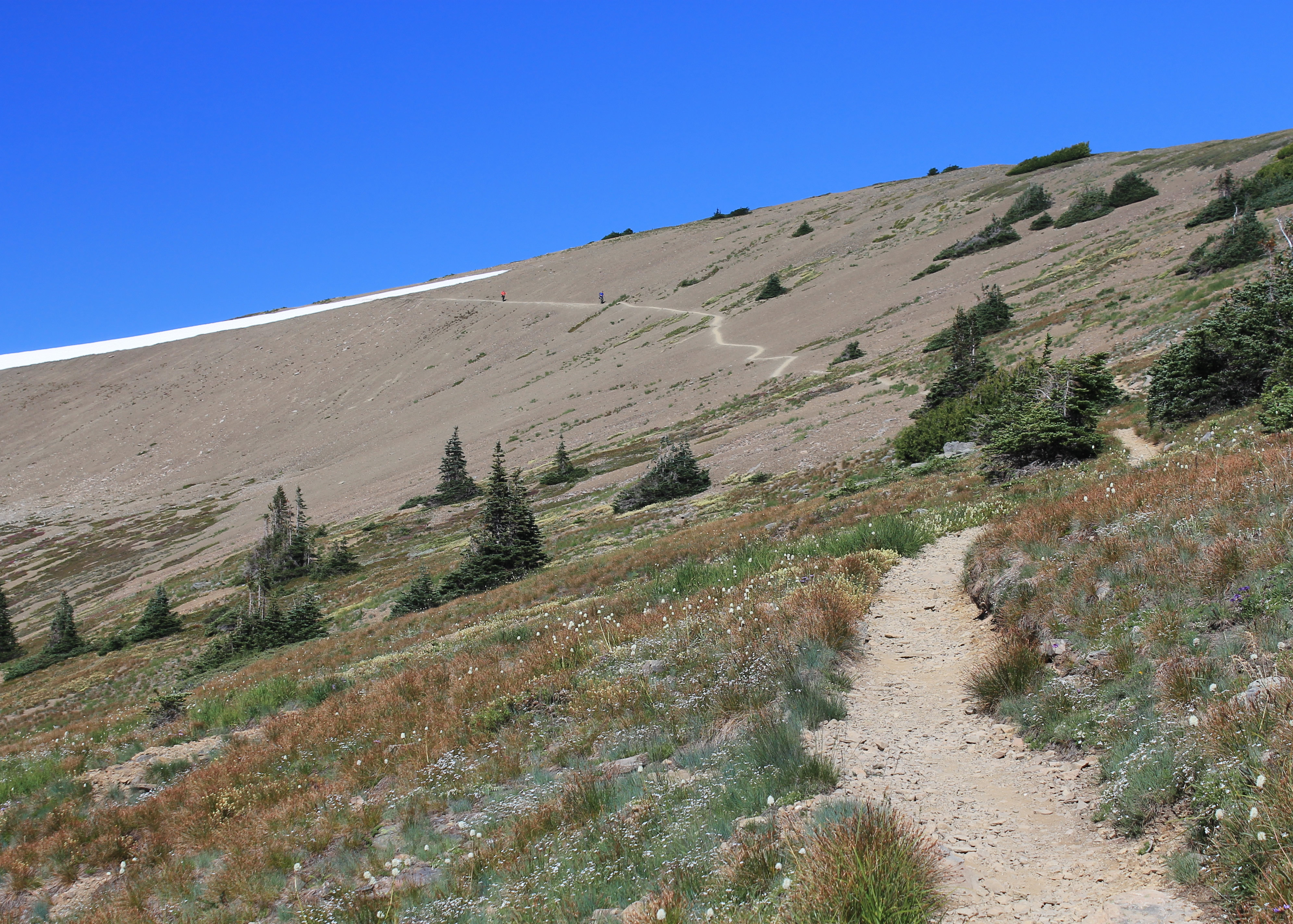
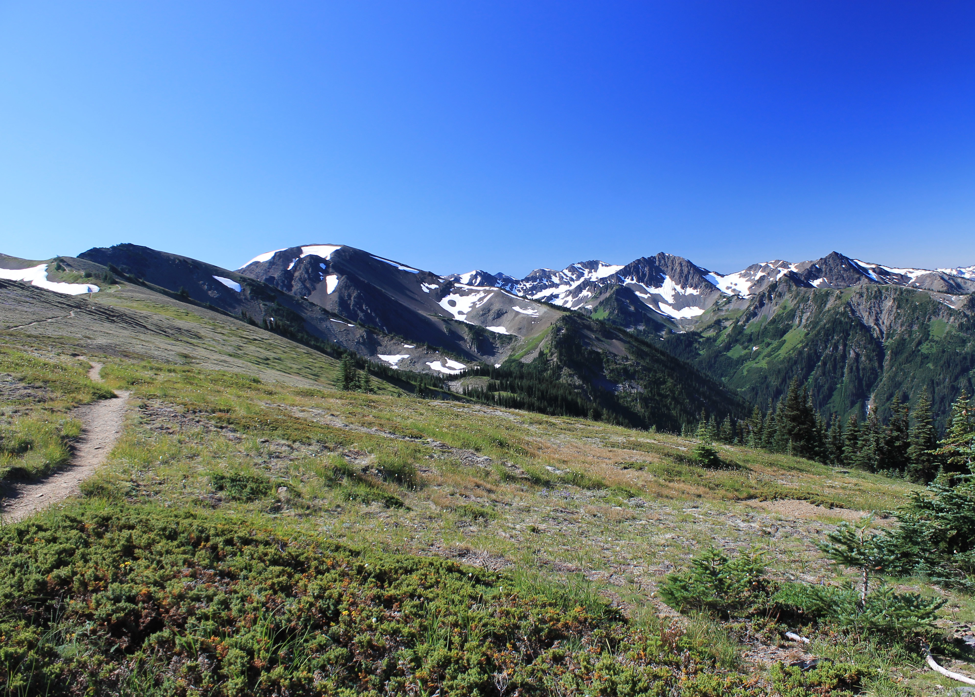 Spectacular views from the trail along Lilian Ridge
I was staying in Port Angeles and had good intentions (I always do) of getting an early start. I woke up at 5:00, 5:30, 6:00. Each time I decided I didn't need to start THAT early. Turns out I didn't get out of bed till 6:30 and with a lot of putzing around didn't get on the road till 7:30. So much for my early start. But I did sleep well and felt good for the hike.
Leaving Port Angeles I stopped at the National Park Visitor Center. It wasn't open yet but I checked their display board for notices. One that caught my eye said that if the visitor center wasn't open, backpackers could get wilderness permits and beer cans at the back of the building. Now that sounds like a fun approach to backpacking! I was even going to take a picture of the sign when I noticed that it said bear cans. Ok, that isn't quite as interesting. They provide bear-proof cannisters for backpackers. It just confirmed that I was still groggy this morning.
I drove up to Hurricane Ridge and the view was spectacular. There wasn't a cloud anywhere in the sky. The weather in the Olympics can be fickle, but when it is good the views are astounding.
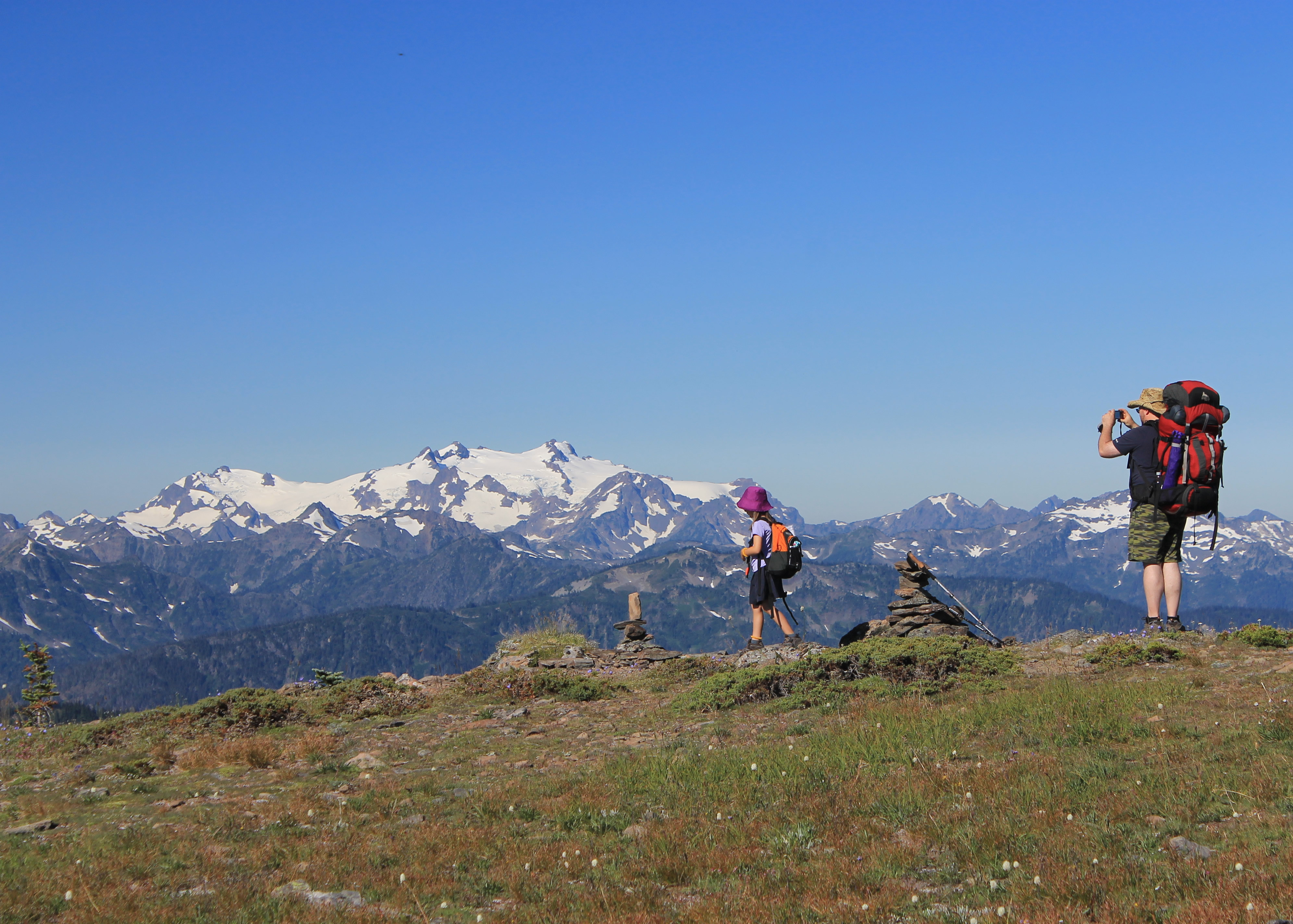 Backpacking dad and daughter share a view of Mt. Olympus
From the Hurrican Ridge Visitor Center I turned onto a dirt road that led in eight miles to Obstruction Point. The road was narrow and traversed a lot of very steep slopes. I was glad that I didn't encounter anyone coming out early in the morning. I wouldn't have wanted to pass on the outside of that road. I'm not a wimp either. I'm a veteran of the most dangerous road in the world from my trip to Bolivia in 2004.
There were a lot of cars in the parking lot at Obstruction Point at 6150 feet. The trail starts out by climbing up Lilian Ridge for about two miles. The views are spectacular into the center of Olympic National Park. As I walked along I passed a pair of backpackers, a dad and his young daughter. They were moving slowly, stopping often, but they seemed to be enjoying the views and having a good time overall. I wouldn't have wanted to move so slowly with a pack as large as the dad was carrying, but he seemed to think it was worth it. I think that he was right.
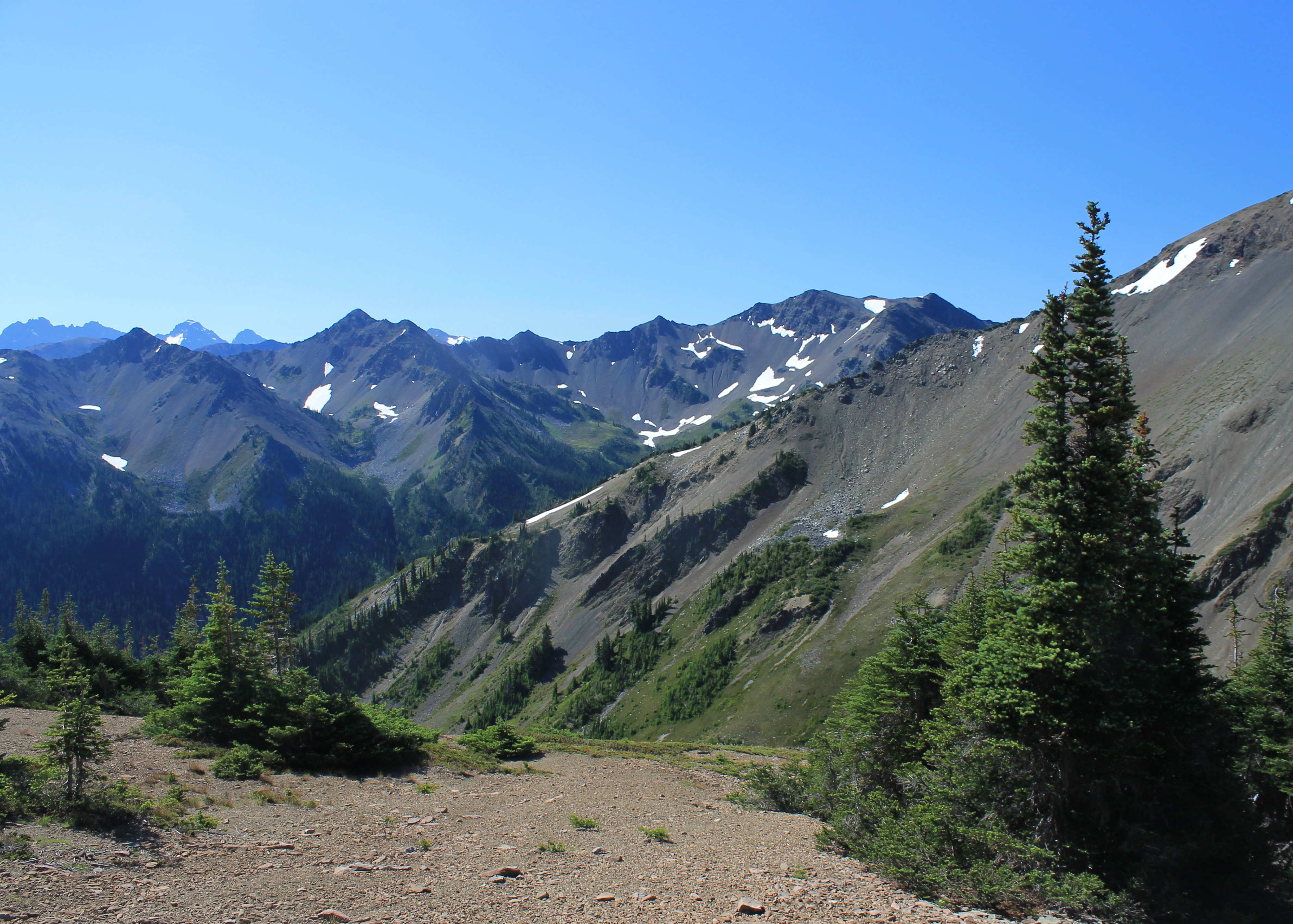
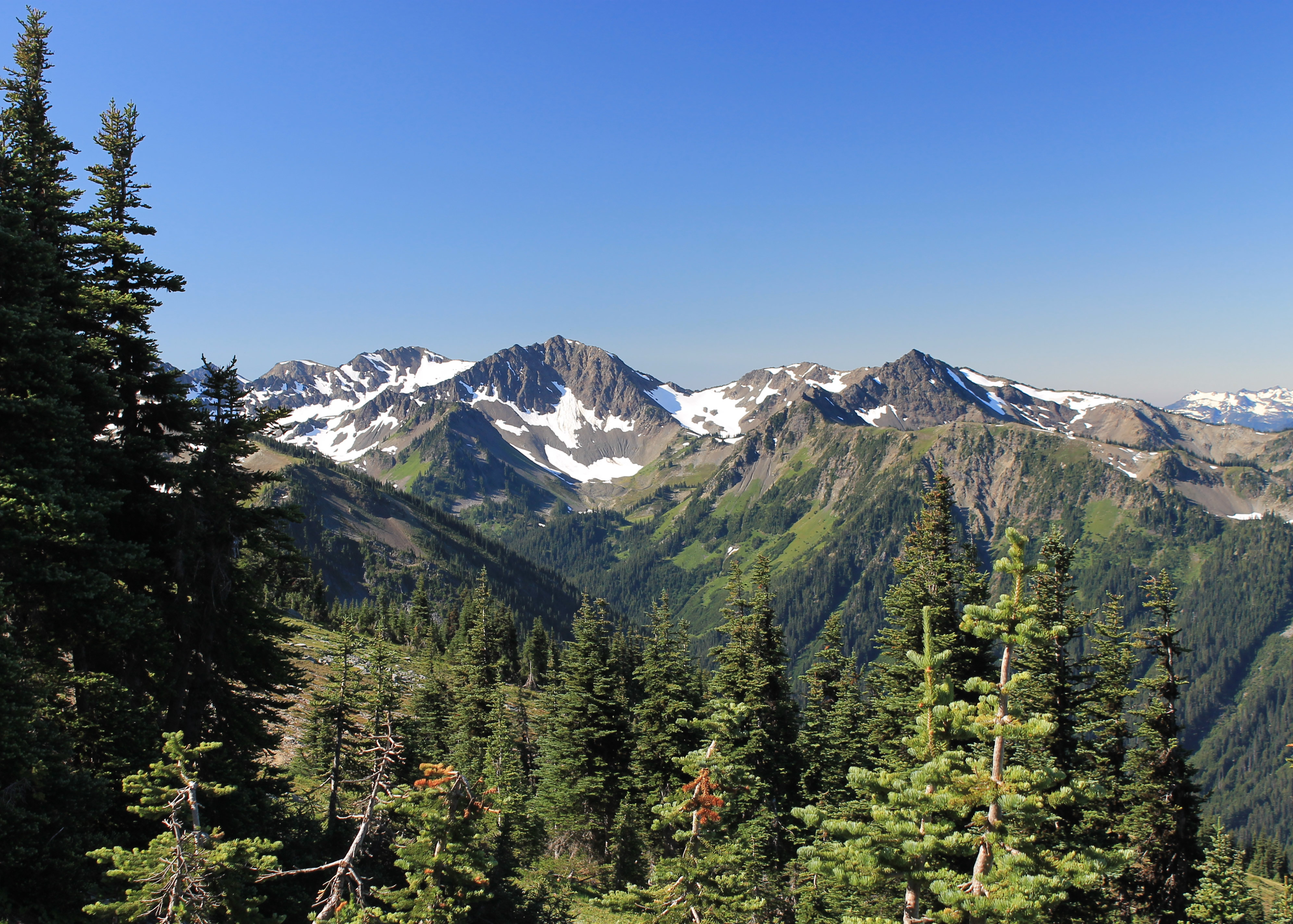 McCartney Peak dominates the Lilian River drainage
After two fantastic miles along the ridge, the trail crossed the crest and headed down. This was tough psychologically. I know, rationally, that it doesn't make any difference if I climb up first, and then back down, or climb down, and then back up. It's the same amount of work. But no hiker or climber ever likes to give up elevation. I could see Grand Lake way down in the bottom of the valley and I followed the trail downward. But all the time something in the back of my brain was screaming NO DON'T DO IT!!! But I ignored it and kept on heading down.
As I was hiking down I heard a strange noise. I wondered what kind of animal would make that sound. It sounded a lot like a human baby. Then I rounded the corner and saw a couple of backpackers climbing up toward me. Dad had a very tiny baby strapped to his chest. I'm not a good judge of the age of babies but it looked to be only two or three months old to me. These people were dedicated backpackers! Mom was heading up with a big pack. Her face was really flushed - she looked like she was working really hard. I told them that they were close to the top and she brightened up. I was impressed though. That was a tough lady.
 Starting the long drop into Grand Valley
Dropping down into the valley went quickly. It was downhill and I was still fresh. On the way down I passed several meadows that were filled with flowers and provided views of the peaks surrounding the valley. Not many pictures turned out as the light was exactly wrong. Most of the impressive views were into the sun so I wasn't able to capture it in pictures. The camera doesn't do justice for the flowers either. The swirl of colors in the meadows that your eye picks up just doesn't show up in photos. So you will have to take my word for it that there were a lot of beautiful scenes on the way down into the valley.
I studied the guide book carefully before starting out. At the bottom of the valley was a junction that passed by nearby Grand Lake and then returned to the trailhead via a longer route through Badger Valley. Instead of that I was going to head up toward Grand Pass, reaching Moose Lake in half a mile. The lake was supposed to be pretty. Further up towards the pass was Gladys Lake, but I wasn't planning to go that far. Moose Lake would be nine miles round trip which sounded like a good hike.
 Moose Peak viewed from the Grand Valley trail
At the junction I met a hiker coming down from Grand Pass. I asked him if it was about half a mile to Moose Lake. He said no, it was much further. The next lake was Grand Lake. Ok, I was messed up. So I hiked to the next lake, which was quite large and had a pretty backdrop of mountains, although I was facing into the sun so pictures didn't work. Then I hiked up to the next lake which was about a mile and a fair amount of elevation gain. It was quite small and there were two guys camped at the lake having lunch. I joined them and chatted while I had my snack. Turned out I was at Gladys Lake. The guy at the junction had given me a bum steer. No big deal. I hiked an extra two miles and saw another lake. I was impressed by the guys camped there. They said they were from Southern California and I guess they were used to hot weather. While I was uncomforably warm and sweating like crazy, they were both wearing jackets! After our collective lunch break I started back while they said they were going to stay at the lake a bit longer.
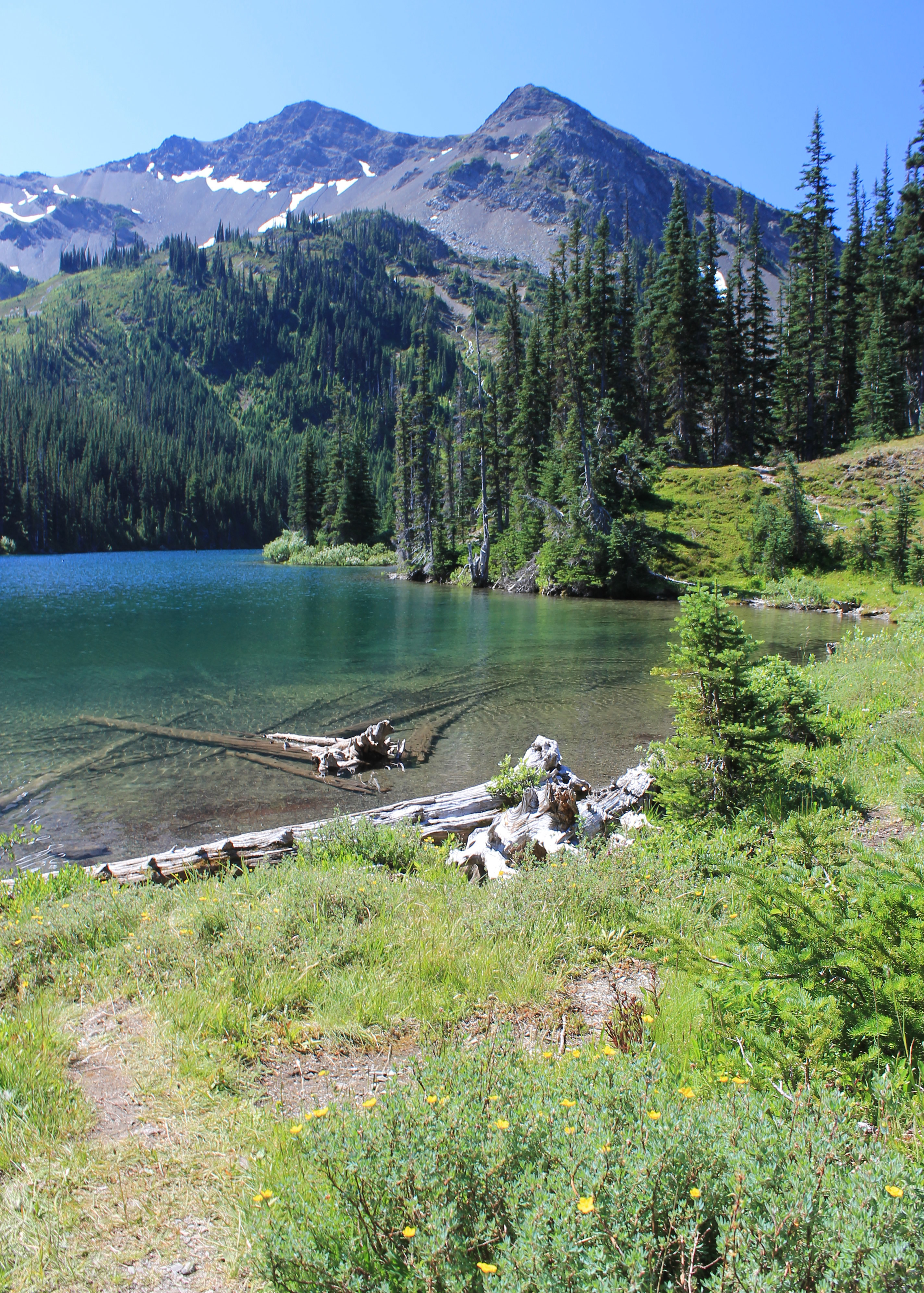
 Looking down into Grand Valley
The hike back was uneventful. I have to admit that the big climb out of Grand Valley back onto Lilian Ridge was just a trudge. Here is where the upside down trail effect comes in. Physically I was more tired so the uphill was tougher at the end. But more importantly, psychologically there was nothing new. There wasn't that motivation to push ahead to see what was around the next corner, what the next view was like. Add that it was hot and buggy and the climb up was just hard work.
Eventually I reached the crest of the ridge. From there getting back to the parking lot was pretty easy, and now there was a cool breeze and beautiful views again of Mt. Olympus and other peaks in the interior of Olympic National Park. I made it back to the parking lot for a total trip time of six and a half hours. Surprisingly it had taken three hours and fifteen minutes each way. I guess I took a lot more pictures on the way down.
 Flower fields in Grand Valley
Although I hadn't enjoyed the drive in to Obstruction Point, the drive out seemed pretty easy, even though I had to pass several cars. Since I was right there, I just had to go to the Visitor Center (and gift shop) on Hurricane Ridge. I got the biggest Diet Coke that they had (and a free refill). And finally I found a tshirt and broke my string of trips without getting one. About time.
As I was checking out the lady asked where I was from. I told her Boise. She said that she was born and raised in Boise. Then she looked at me funny and said "What's with the tshirt?" I was wearing an old Utah Grizzlies Hockey tshirt. I understood her question immediatly, since the Idaho Steelheads and Utah Grizzlies are both in the ECHL. "It's an old tshirt from when the Grizzlies were in the AHL" I explained. Turns out that she used to have season tickets for the Steelheads when she lived in Boise and was quite a fan. She acknowledged that she did remember that the Steelheads and Grizzlies used to be affiliated when they were in different leagues. She still thought it was improper though. "Hey, I can't wear it in Boise anymore." Wow. I was impressed. Not just someone from Boise but a serious hockey fan.
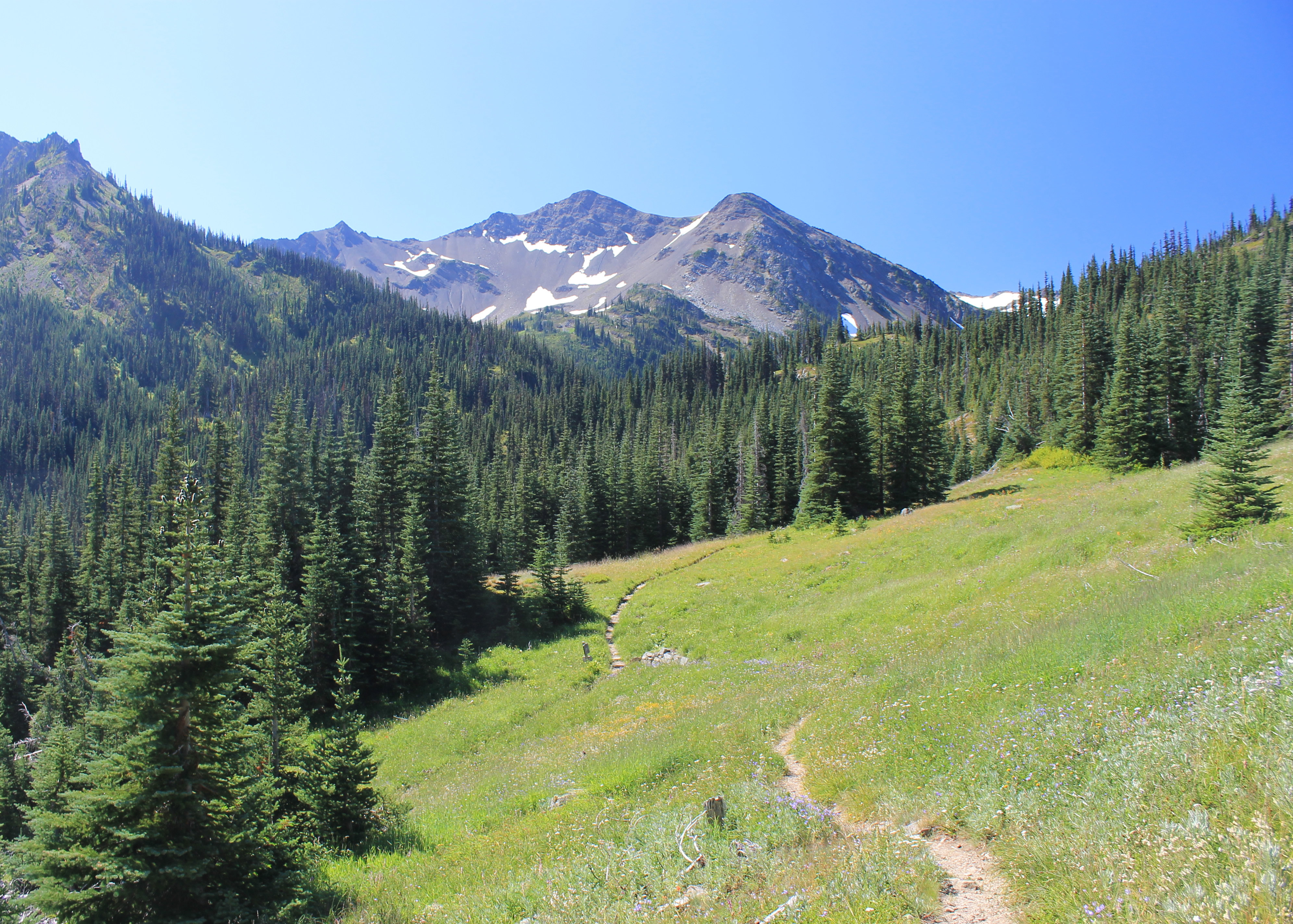
 Moose Lake
After driving down from Hurricane Ridge I stopped at the National Park Visitor Center in Port Angeles. They say that lightning doesn't strike twice. I bought a trail map for the Olympic Peninsula to use for the rest of the week. The lady there commented on my hockey shirt. Turns out that her husband used to play in the AHL back in the nineties and had almost made it to the NHL. She said how much they both missed hockey now that they lived in Port Angeles. They would usually go up to Vancouver once or twice a year to catch a Canucks game.
I would never have guessed that Port Angeles was such a hotbed of hockey fandom.
Then I hit the road. It took me two hours to drive from Port Angeles to Shelton. That would be my base for the next two days for hikes in the southeast corner of Olympic National Park. After checking into my hotel (Super 8) and getting cleaned up, I had a delicious spaghetti dinner at Rooster's Family Restaurant. At least I thought that it was delicious. I was starved!
