Peekaboo
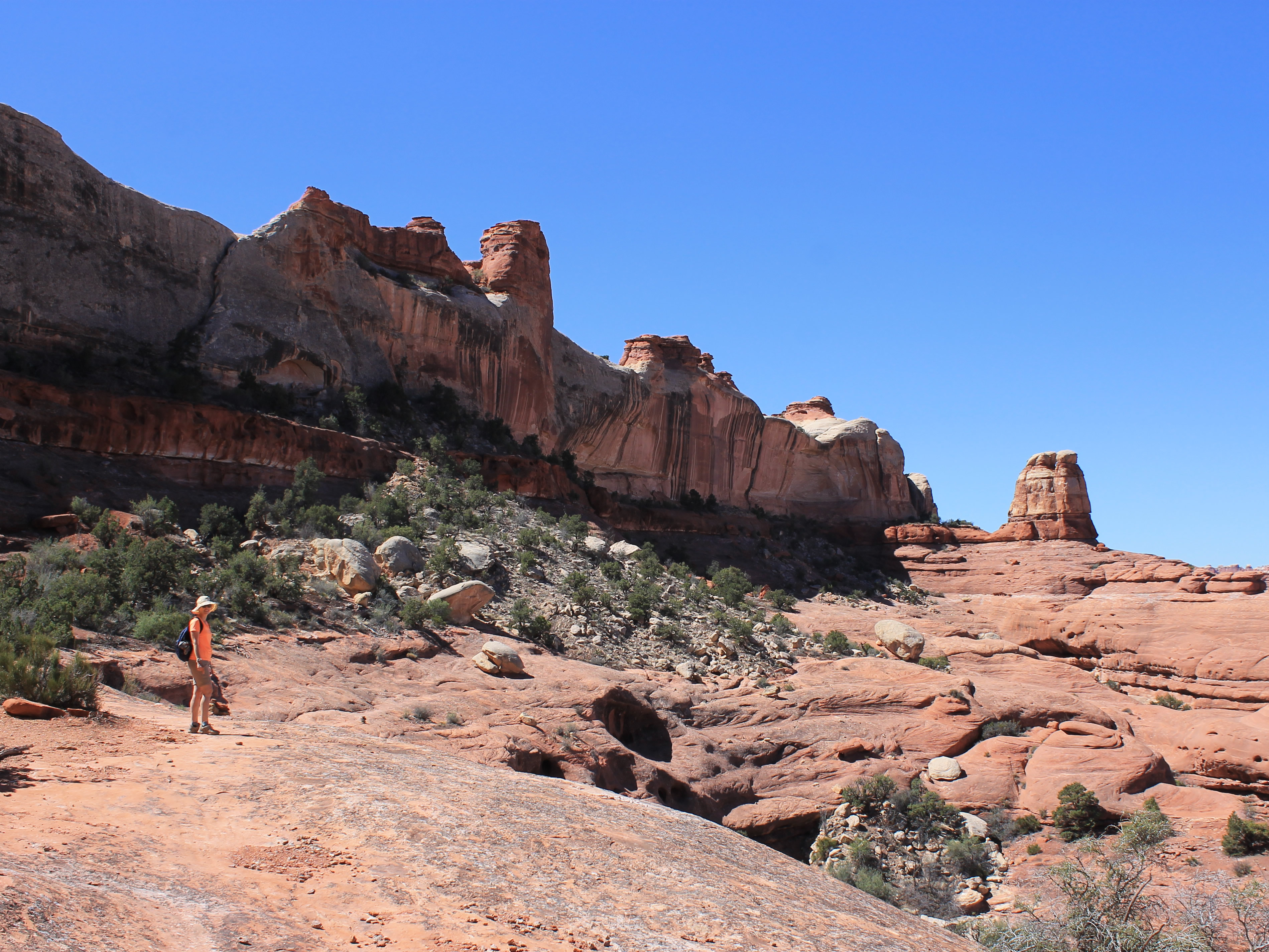
 At the first saddle - it's not obvious where the route goes next
I really like to visit new hiking areas. Yes, there are areas like the Sawtooth Wilderness that I return to time after time. Our early season trip to Zion this year had been like that, a visit to a spectacular area that I knew very well. The hikes that we did there were old favorites. But I always get excited when I am exploring a new area, where I don't know what to expect, where there is new scenery around every bend in the trail. Our spring break trip to Canyonlands was such a trip, a chance to check out an area that I had wanted to visit for years.
Our first hike, the Big Springs Canyon/Squaw Canyon loop, had been great. The weather had been perfect for hiking. The scenery had been beautiful, although it was on a smaller scale than in places like Zion. But that had a side benefit - there weren't crowds of people. Other than very close to the trailhead, we had only seen five other hikers. It actually felt like we were hiking in the wilderness. Too often in Zion, when you are fighting the hordes of visitors, it feels more like Disneyland than a National Park.
 Looking back to the first saddle after climbing down
The route itself had been fun too. About twenty percent of it was on slickrock, with a little scrambling thrown in to make it interesting. Slickrock is a term used for large expanses of exposed sandstone with no soil covering. Although rare in most mountain areas, it's common in the canyon country of the Colorado Plateau, an area which covers most of Utah and parts of Arizona, Colorado and New Mexico. Despite the name, slickrock has a gritty texture so you can get good traction with hiking boots even when the rock is at a moderate angle. That changes of course when the rock is wet, but since slickrock hikes are usually in the desert, rainy weather is rare and you can depend on the rock being dry. And besides, I have to confess that I am a fair weather hiker. When it's raining you probably won't find me out on the trails. On those days I usually sleep in late and then stay inside and work on the Dog Blog.
 Two hikers retracing the route back to the trailhead
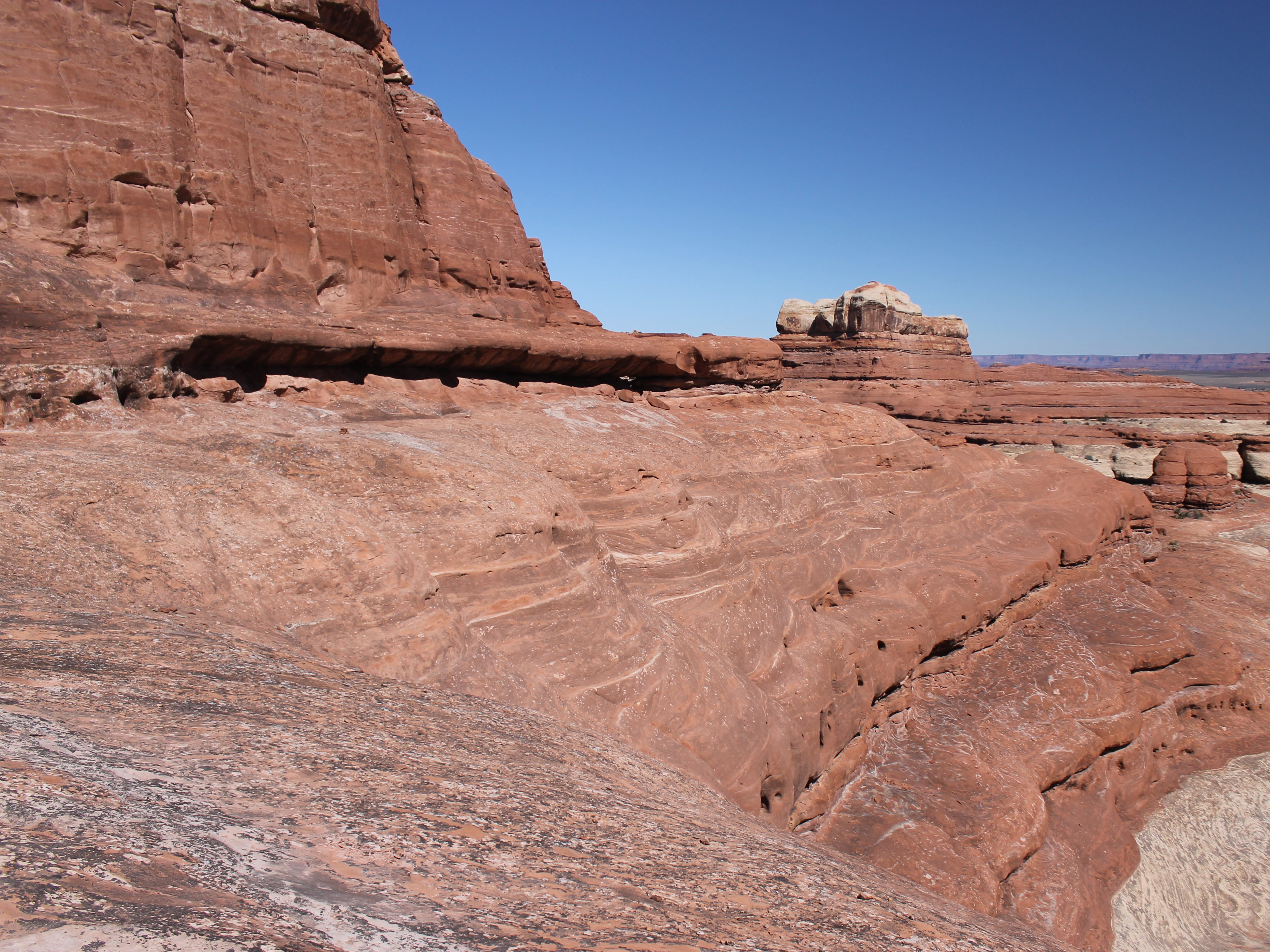
Hiking on slickrock is a different experience. There isn't an easy to follow trail in the dirt every step of the way. The route is usually marked at intervals by cairns, small piles of rocks left by park rangers or previous hikers. Sometimes paint splotches are used instead to mark the route. Whatever markings are used, although it seems like they should be easy to spot, often they are hard to pick out in a huge, barren, rocky landscape. They never seem to be quite as close together as you would like them to be. Often the route can go in almost any direction, so you have to be alert to try to figure out where it might go. Following a slickrock route isn't a mindless activity. You can't just shuffle along with your hands in your pockets following an obvious trail while you stare at the scenery or fantasize about the cheeseburger and coke that you are going to have when you get back from the hike. You have to be actively engaged in routefinding the entire time.
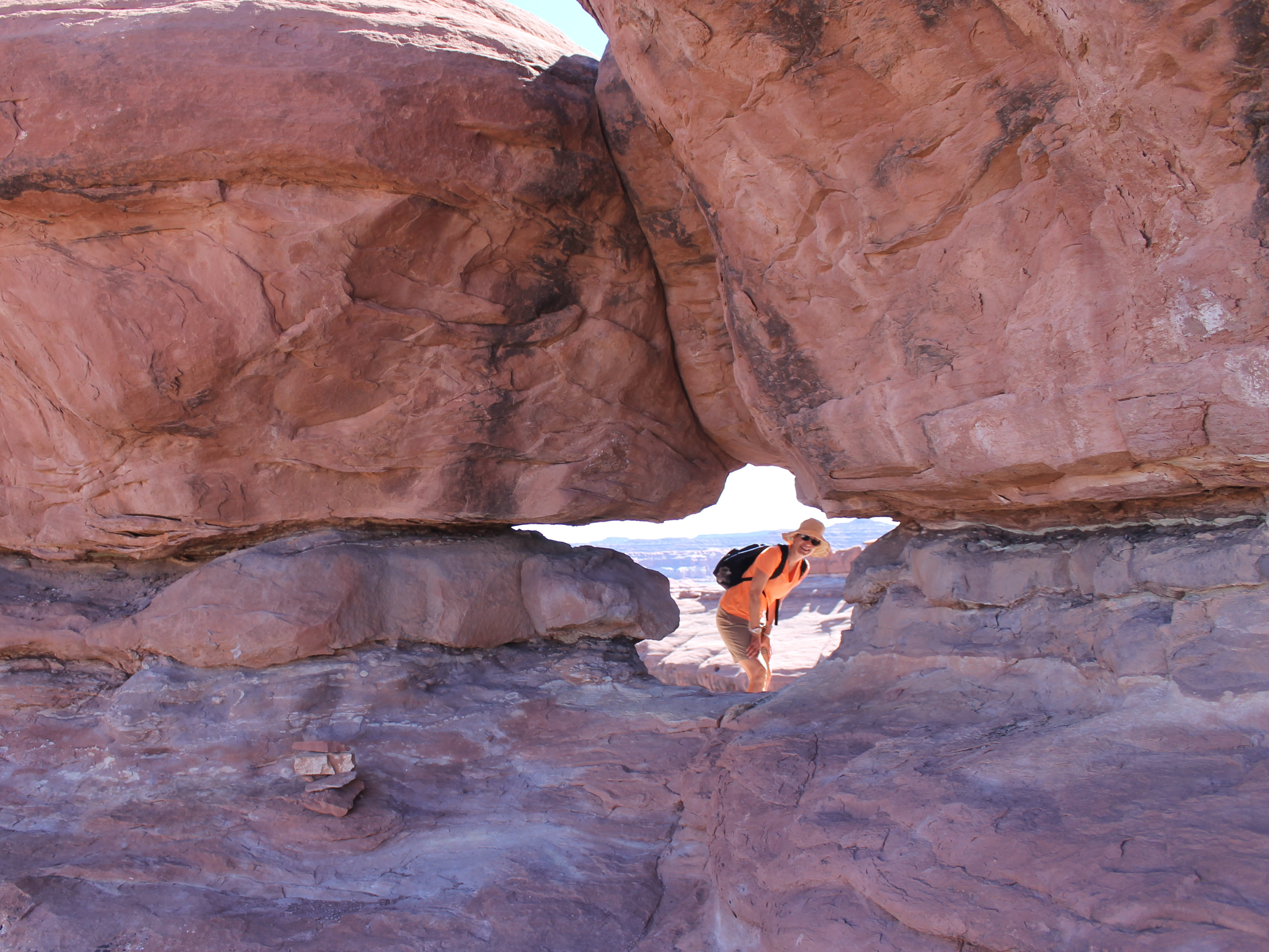 The route goes through the hole for which Peekaboo is named
As an extra bonus, on some slickrock hikes you get to scramble (use your hands and feet) to climb up slopes or over obstacles. I'm not much of a technical climber - scrambles are my favorite type of climbing in the mountains. And they are just as much fun in the canyon country.
But we had a bit of a quandry. Our plan for the day was to do a slickrock route called Peekaboo. The weather promised to be great again, sunny and slightly warmer then on our first day of hiking. We would start from the Squaw Flat trailhead again. But there were other alternatives. Although there had been great scenery on our hike the first day, we really hadn't gotten a close up view of the Needles. All we saw was a distant view from the crest of the first rise at the very beginning of the hike. So we thought about switching to a different hike, one that would go through Chesler Park and then pass right below the Needles. It was pictures of the Needles that had intrigued Sandy when she saw the guidebook and influenced her choice to visit Canyonlands on this trip.
 Looking back along the traverse to Peekabo
Nah. We decided to stick with the slickrock hike. The guidebook said it was "the piece de resistance" of slickrock hikes. High praise indeed. It sounded like too much fun to pass up.
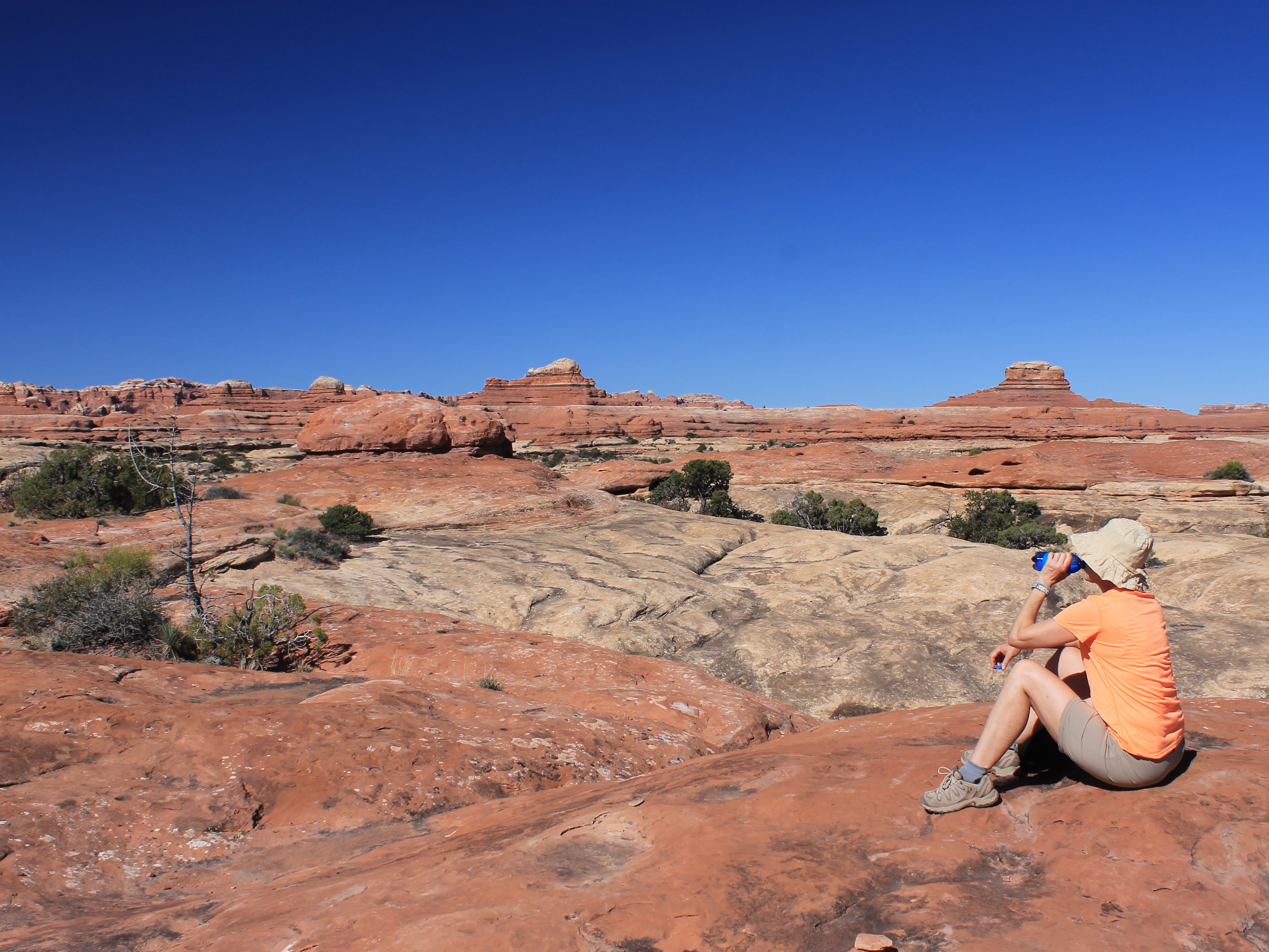
Because it was going to be a warmer day we started early. We were downstairs for breakfast as soon as they set it out. Then we had to repeat the hour plus drive back to the Squaw Flat trailhead. We were hiking at 9am. I was feeling good about our early start till about fifteen minutes from the trailhead when I realized that I had forgotten my sunscreen.
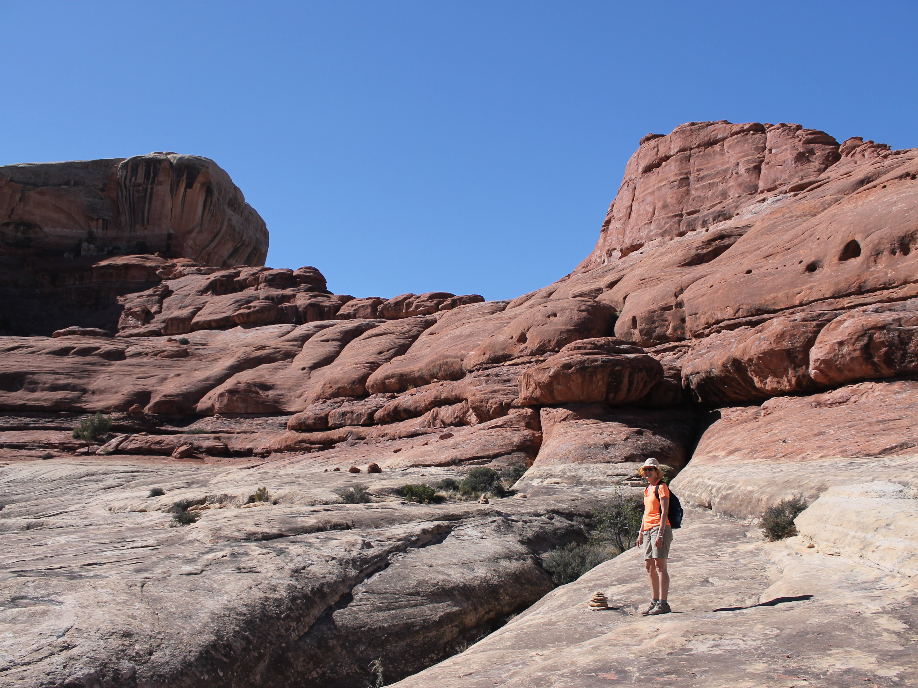
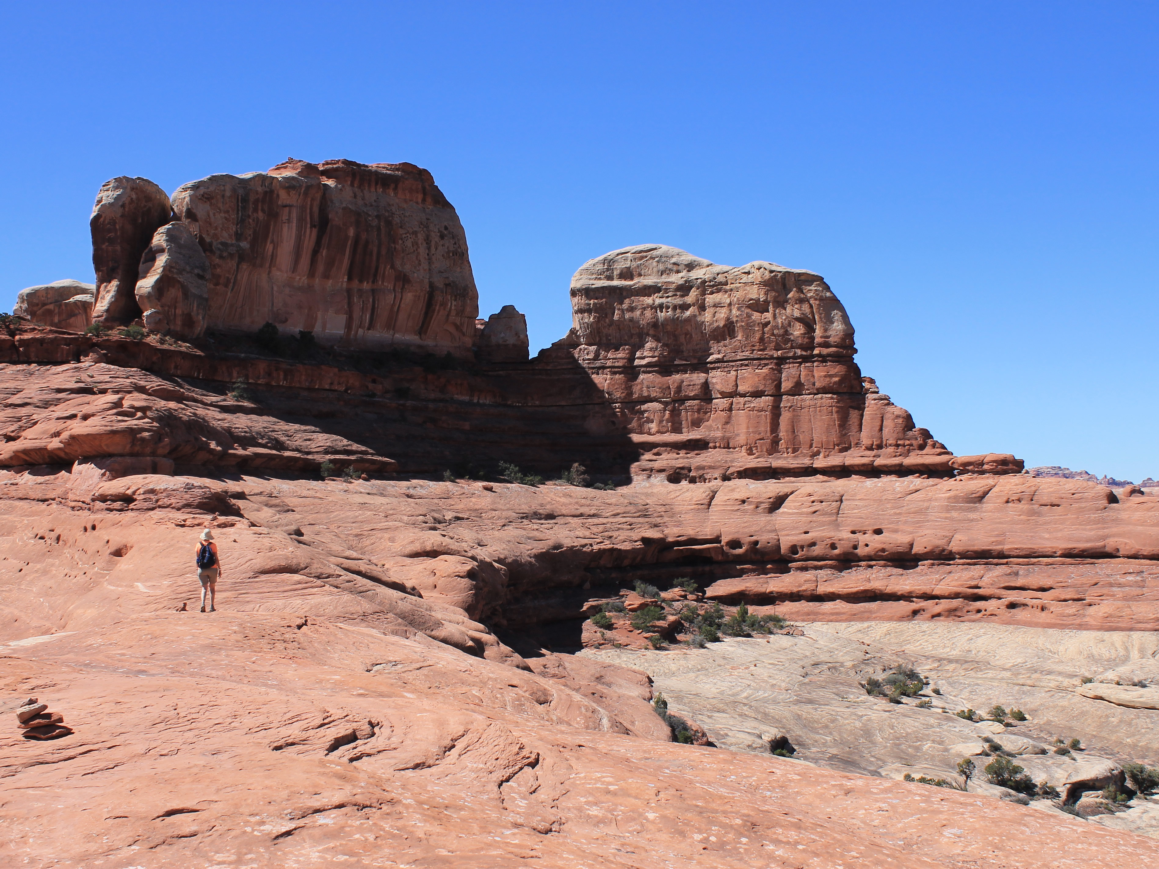
After repeating our long drive to the trailhead, next we had to repeat the last mile of the loop hike that we had done yesterday. Then there was another three quarters of a mile of easy hiking to the first obstacle, a large sandstone ridge that we had to climb up and over. Same as yesterday, although it looked dauntingly steep from a distance, when we approached there were weaknesses that let us climb up to the crest of the ridge. There were some steep bits that did require scrambling, but nothing too hard and no exposure to worry about. After about fifteen minutes of climbing we reached the saddle and could see over to the other side.
 Just enough ledge to continue the traverse
The ridge we had just climbed blocked our view to the east when we started so we had no idea where the route went. I was anxious to get to the crest so we could see where we were going. It didn't help. There was a maze of canyons to the east. Fortunately we had cairns to follow. I can just imagine what it was like for the people who first explored this region.
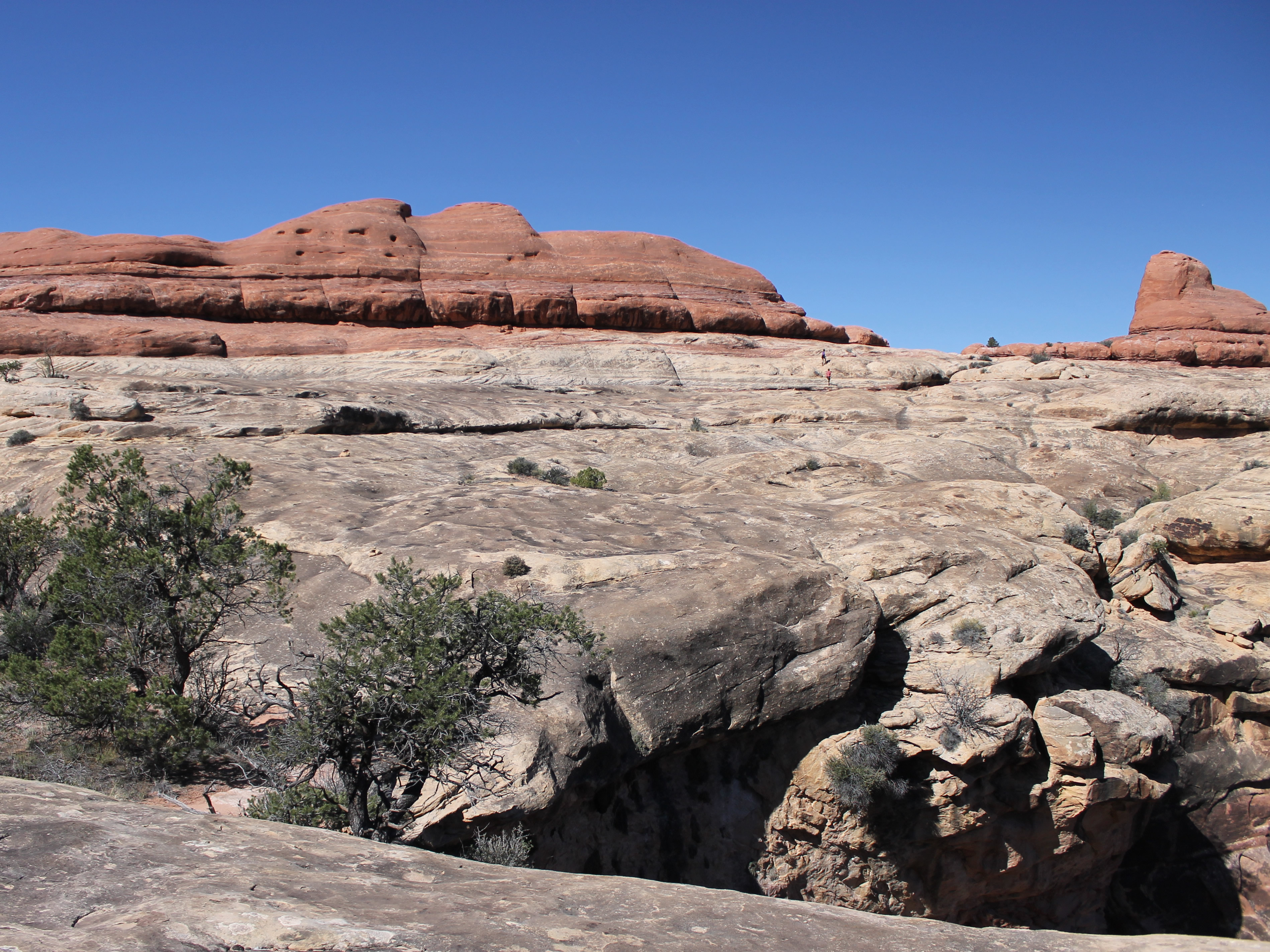
The descent looked steep from the saddle but as we started down, once again we found that if we looked carefully we could always find easy ways to descend. I thought we would go all the way to the bottom but half way down the route started a level traverse along a long, broad shelf. It was easy going for about a quarter of a mile when the route turned downward to descend the last bit to the canyon floor. At one point we reached a short, vertical rock step. There was a metal ladder that helped us to get down, although even with the ladder it required care to descend. Soon we had reached the bottom of a sandy wash and for a while we had a trail to follow again. It would be our last trail till we reached our destination in Salt Creek Canyon.
 Hiking the final ridge above Salt Creek
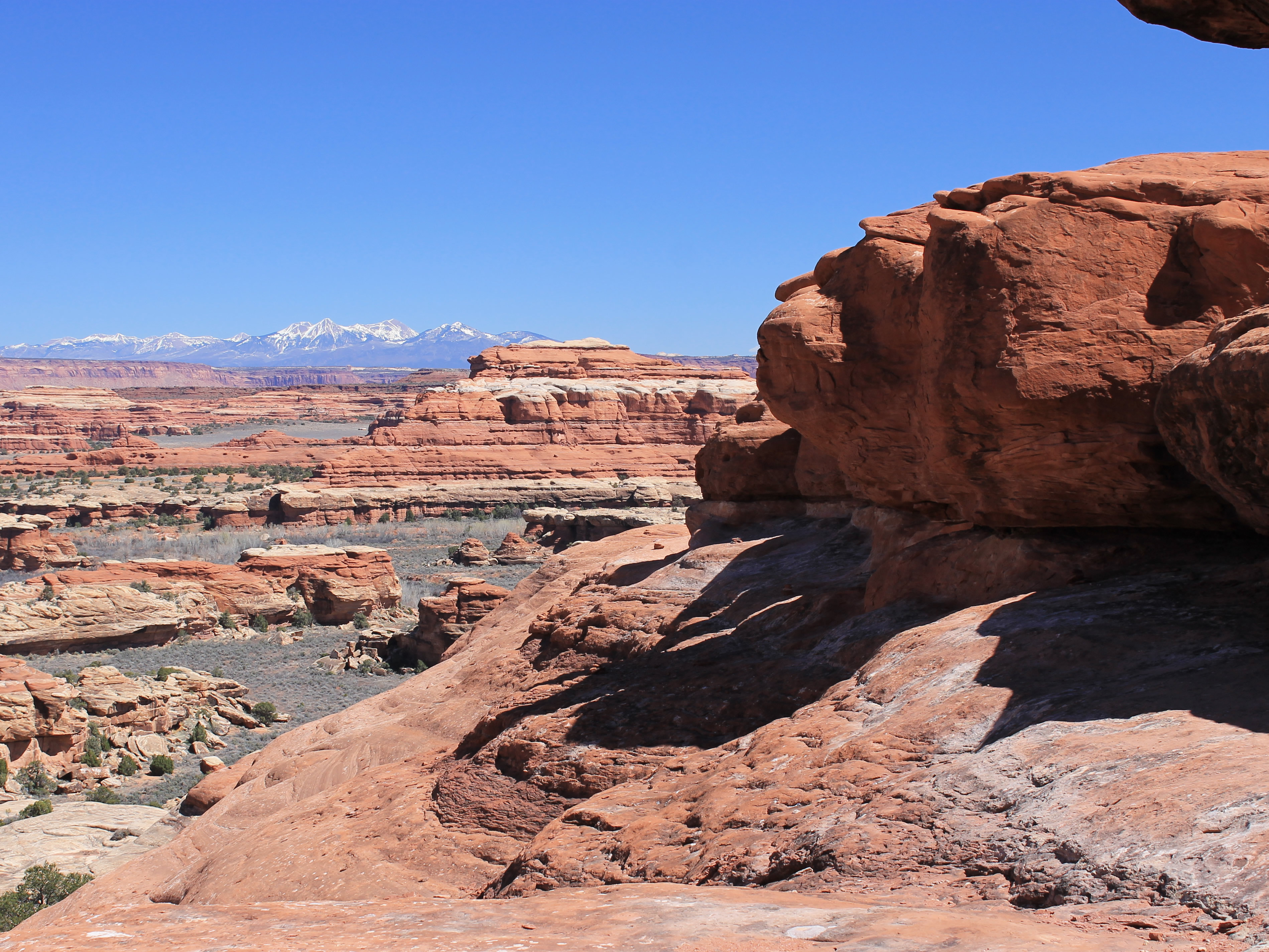
Before long we had reached another rock ridge that blocked the canyon. We went up and over again. Except that this time when we reached the crest the view was different. We were near the head of a canyon, maybe two hunded feet deep, that extended to the north. It didn't look possible to get to the bottom. But as we looked for the cairns that showed the way forward, we saw that instead of descending, they followed a shelf that made a level traverse, circling the head of the canyon all the way to the other side. We started to follow the shelf and about half way around passed two hikers going the other direction. They were the same two women that we had passed the day before on our hike. Since this was an in and out hike and not a loop, they must have had a really early start to be on their way back already. Either that or they had given up well before reaching the end. It didn't seem cool to ask "Hey, are we close to the end of the trail or are you guys total wimps?" so we just said hello as we passed.
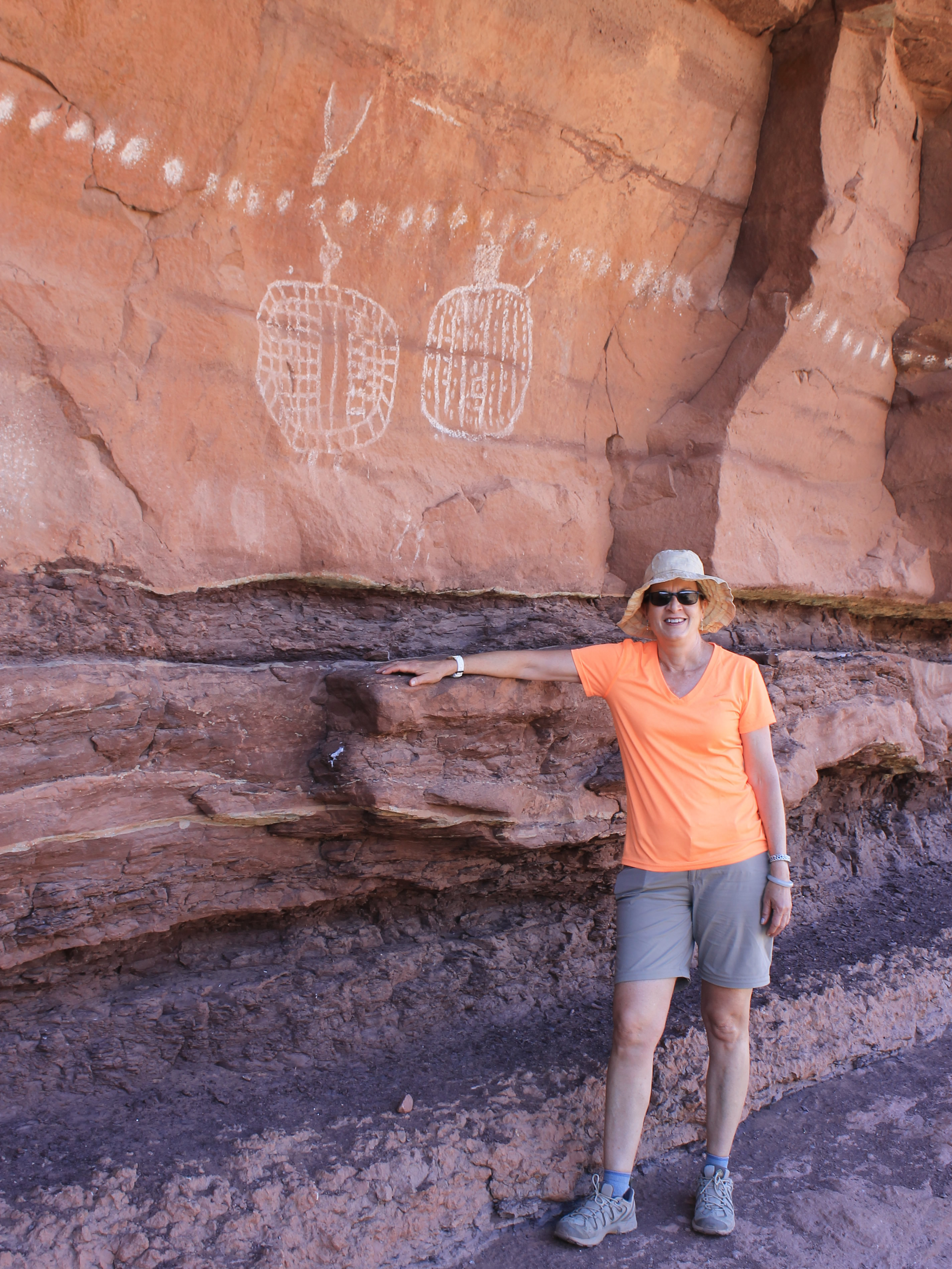 Petroglyphs near Peekaboo Camp
Eventually we reached the opposite side where we again climbed the new ridge to reach another saddle. And saw another identical canyon. Once again the cliffs seemed too steep to reach the floor of the canyon. Once again, the route followed a shelf to the south that circled the head of the canyon around to the other side. I was beginning to notice a pattern here. Sometimes I catch on pretty quickly for an old guy.
Except that this time it was a steeper climb to the ridgecrest. There was quite a bit of scrambling, which was a lot more work but at least there wasn't any exposure...yet. We passed through a slot in the ridge to the other side.
And on the other side was...another identical canyon.
Except that this one wasn't quite identical. Once again, instead of descending we made a level traverse around the head of the canyon. But this traverse was a little tougher. A short distance along, the shelf narrowed and we had to cross a sloping stretch of rock that quickly dropped off into the main canyon. This was the crux of the route. It wasn't long, only about ten or fifteen feet. It wasn't hard but it felt very insecure. If you slipped you would fall quite a ways and would probably be badly hurt. I went first and then Sandy followed, moving slowly and carefully. It only took a minute or two and we were past the scary part.
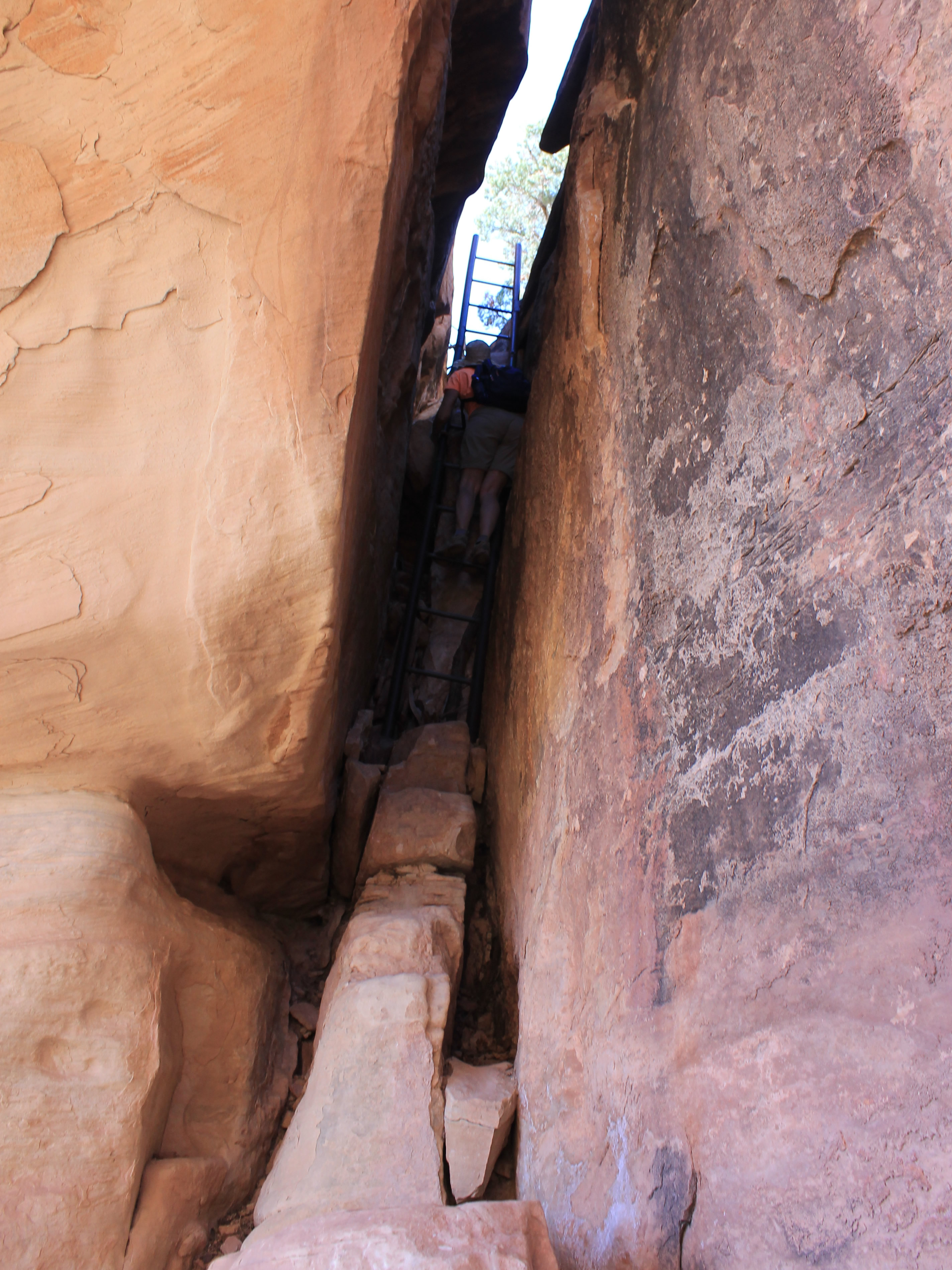 Climbing the ladder out of Salt Creek Canyon
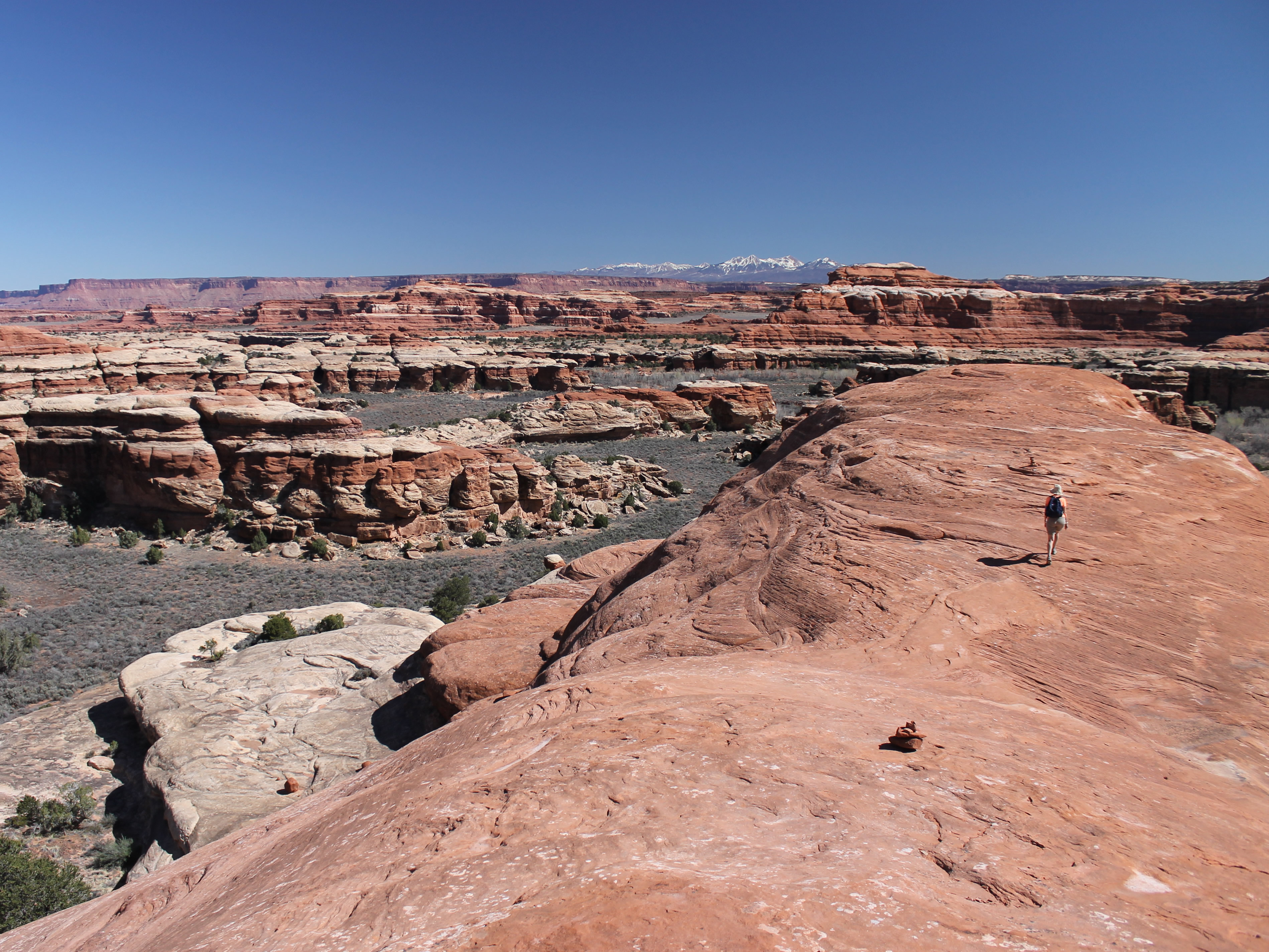
It took quite a while to circle the head of this canyon. It was a lot larger than the others. Somewhere in this stretch, we passed four backpackers heading the opposite direction. I figured that they had probably camped at the end of the trail the night before. Since we were getting anxious to reach the end, we asked them how long they had been hiking. "Four days". Ok, hopefully they started from someplace futher than we were trying to reach.
We spent some time talking to them. All of us were grateful for an excuse to take a rest in the shade. There were two couples, and they sounded German. Rather than hike in and out to Salt Creek Canyon by the route we were taking, they had started far down Salt Creek and were doing a one way hike. I was impressed. I wouldn't want to carry the amount of water that you would need for four days in the desert. And I didn't envy them crossing the narrow traverse just ahead of them, wearing their monster packs. We didn't mention it though. They would find out soon enough for themselves.
We wished them luck (they would need it!) and continued on. It was still some distance till we reached the other side of the canyon. The ridge that formed the canyon wall on the opposite side was much higher and presented a sheer cliff. We weren't going to go over that. So it wasn't clear how we would get past the obstacle. There was nothing to do but to keep following the cairns and traverse along the shelf that extended along the ridge, half way up, half way down, the canyon walls.
 Traversing the head of a canyon on a slickrock bench
It looked like we were heading for a dead end. Then, when we were almost at the end of the ledge, we came to a window in the rock. It was a hole about four feet across and through it we could see the other side of the ridge. This was the feature that gave the route its name - Peekaboo. Although it was a bit of a squeeze, we were able to get through to the other side. I'm not sure how the Germans managed it with their packs though.
On the other side, we found another canyon.
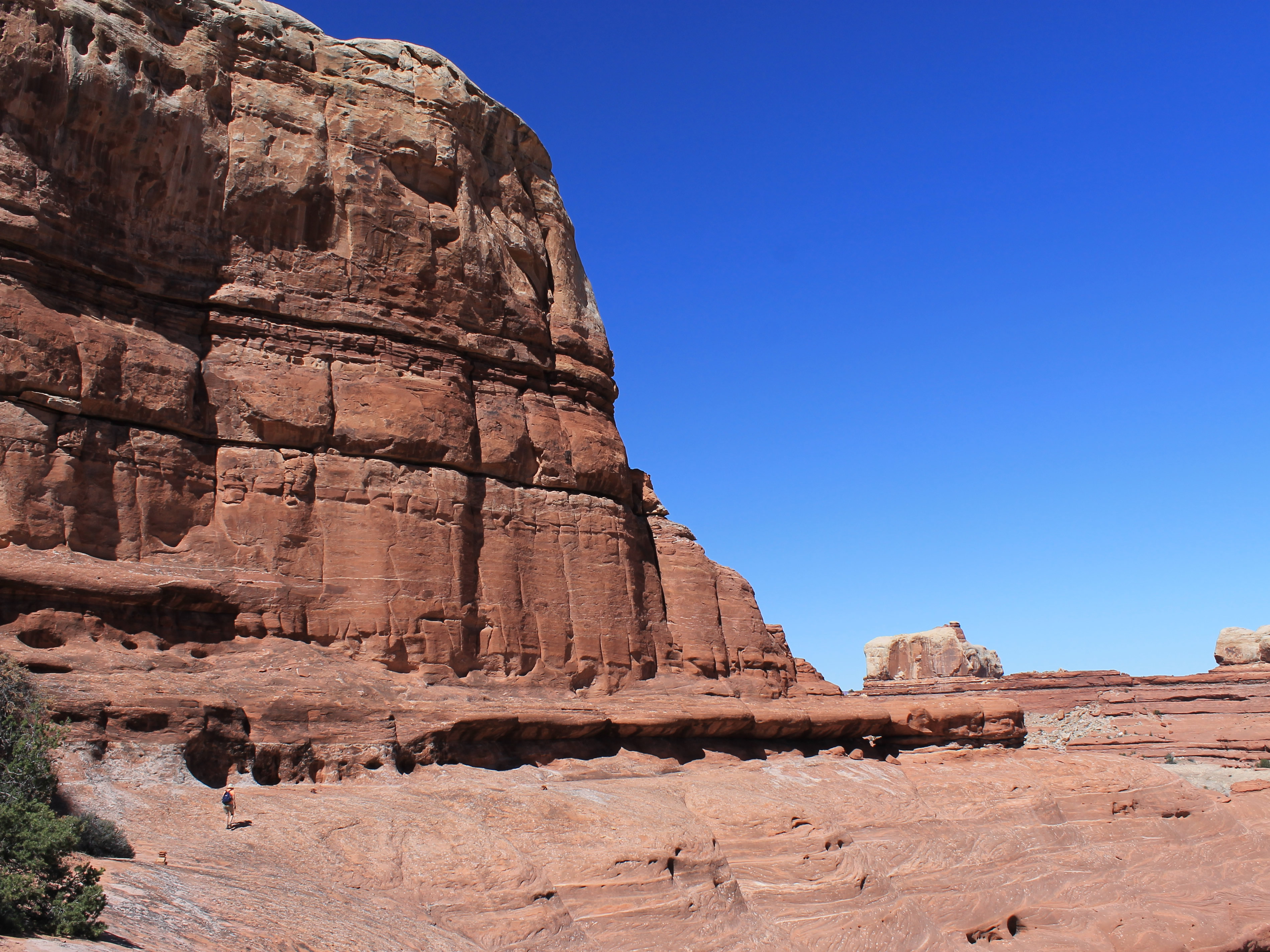
Thankfully this one was smaller than the last. We traversed around again and when we got to the other side, finally, the route headed down. We had reached Salt Creek Canyon. Much larger than the minor tributary canyons we had been skirting, it was 500 feet deep and extended over twenty miles back to a point on the access road that we had driven to reach the trailhead.
 No Photoshop - the rock really is that red
The guidebook said that the route dropped down to the canyon floor and that near that point were some petroglyphs. That was the goal that most people aimed for. We had a short conference. All the scrambling on rough ground had required a lot of effort. We still had a lot of work ahead of us to get back. Did we really want to lose all that elevation and then have to climb right back up? We thought about it for a while and decided to go for it. Hey. We're tough old hikers.
Near the very bottom was a sheer thirty foot cliff band. At one point part of the canyon wall had detached and the gap was partially filled with rubble. There was a fifteen foot metal ladder that allowed us to climb down to where we could downclimb the boulders that filled the gap. It was somewhat precarious but since it was enclosed it didn't feel too exposed. We climbed down carefully. Success! We were at the bottom. Now where were those petroglyphs?
 Approaching Peekaboo - visible at far right
Unfortunately, not right at the bottom of the ladder. There was a path along the base of the cliffs and I walked along it for about two hundred yards. Still no luck. The guidebook said they were near the ladder, before the trail dropped to the sandy wash in the middle of the canyon floor. But we didn't see any sign of it. We were about to give up when I told Sandy to find a place in the shade to sit and wait. I can be pretty determined sometimes (Sandy might use the word stubborn instead.) I decided to walk as far up the canyon as we could see, which was about a quarter mile. That's where I could see a campsite, Peekaboo Camp. Since the guidebook said not to bother continuing to the campsite after checking out the petroglyphs, I figured that they had to be somewhere in that quarter mile. Sure enough, I found them, two minutes before I reached the campsite. I waved for Sandy to come over. She shouted something back which I couldn't make out, but it sounded something like "Oh good! You found it." Either that or "For your sake, this better be worth it!"
 Approaching the narrow traverse on the way back
The petroglyphs were not extensive but were very impressive. There was a small bench there where we could sit and admire the petroglyphs. There was a book chained to the bench that explained about the rock art. It said that the prominent, light colored petroglyphs were made by the Anasazi people and were about 800 years old. The darker, fainter ones were 2000-3000 years old. Yes, it was worth it.
After taking photos and having a snack it was time to start the long trip back. The route seemed harder on the return. Maybe it was more difficult in that direction. Maybe we were more tired. Maybe it was hotter and we had been out in the sun for hours. The exposed traverse seemed spookier, but we both made it across ok. The Germans must have made it too - we didn't see any bodies at the bottom of the cliff. The steeper sections climbing over the ridges seemed to be tougher too. By the time we reached the car we were both wiped out. But it had been an awesome trip, probably my favorite slickrock hike ever.
 Beautiful scenery but we are starting to get tired
We stopped at the Needles Outpost again just as I had promised the lady there the day before. Sandy bought a cool hat and I got a nice tshirt. I also picked out a hat that I really liked but somehow it didn't get included when we checked out. Oh well. I guess that means that I'll have to go back to Canyonlands again. At least we did get our cold drinks which once again were essential for rehydrating on the long drive back to the Monticello. Then it was time to clean up and head into town for something to eat. We had dinner at Thatzza Pizza. There was a huge takeout order ahead of us (probably for a Mormon Church group) so we had to wait a long time for our pizza. But it sure tasted good when it came. When we finished it was back to the hotel to open one of the bottles of wine we had brought with us, to celebrate another great day of hiking.
