The Needles - Canyonlands National Park
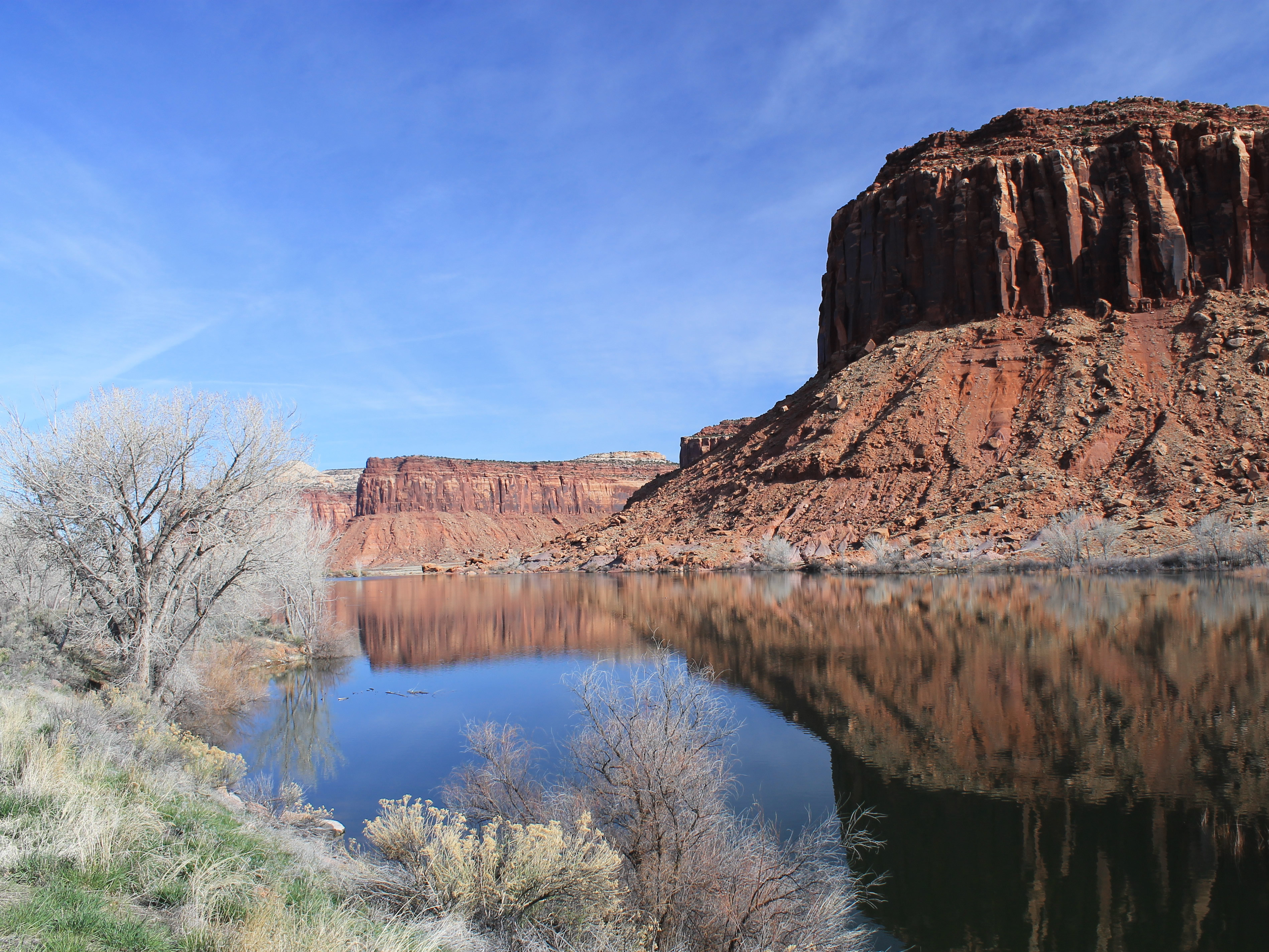 Early morning at Dugout Reservoir on the drive to the trailhead
Sandy and I like to take time off over spring break and go to the canyon country to hike. Sometimes this requires careful planning because spring break can be early in the hiking season. But this year the winter in Utah was extremely mild. We had already done a trip to Zion National Park in February over President's Day weekend, so we knew that we could go anywhere we wanted without having to worry that there would still be snow on the trails.
Unlike last year at this time, we needed to find a dog sitter again. Our friend Sarah was also on spring break from BSU so we arranged for a five day weekend. Our first thought was to go to Mesa Verde National Park. But as I studied the Park Service website, it turned out that most of the really impressive ruins were only open in the summer. That seemed strange, since it would be really hot then, but that was the way it was. So I started to think about possibilities for Plan B.
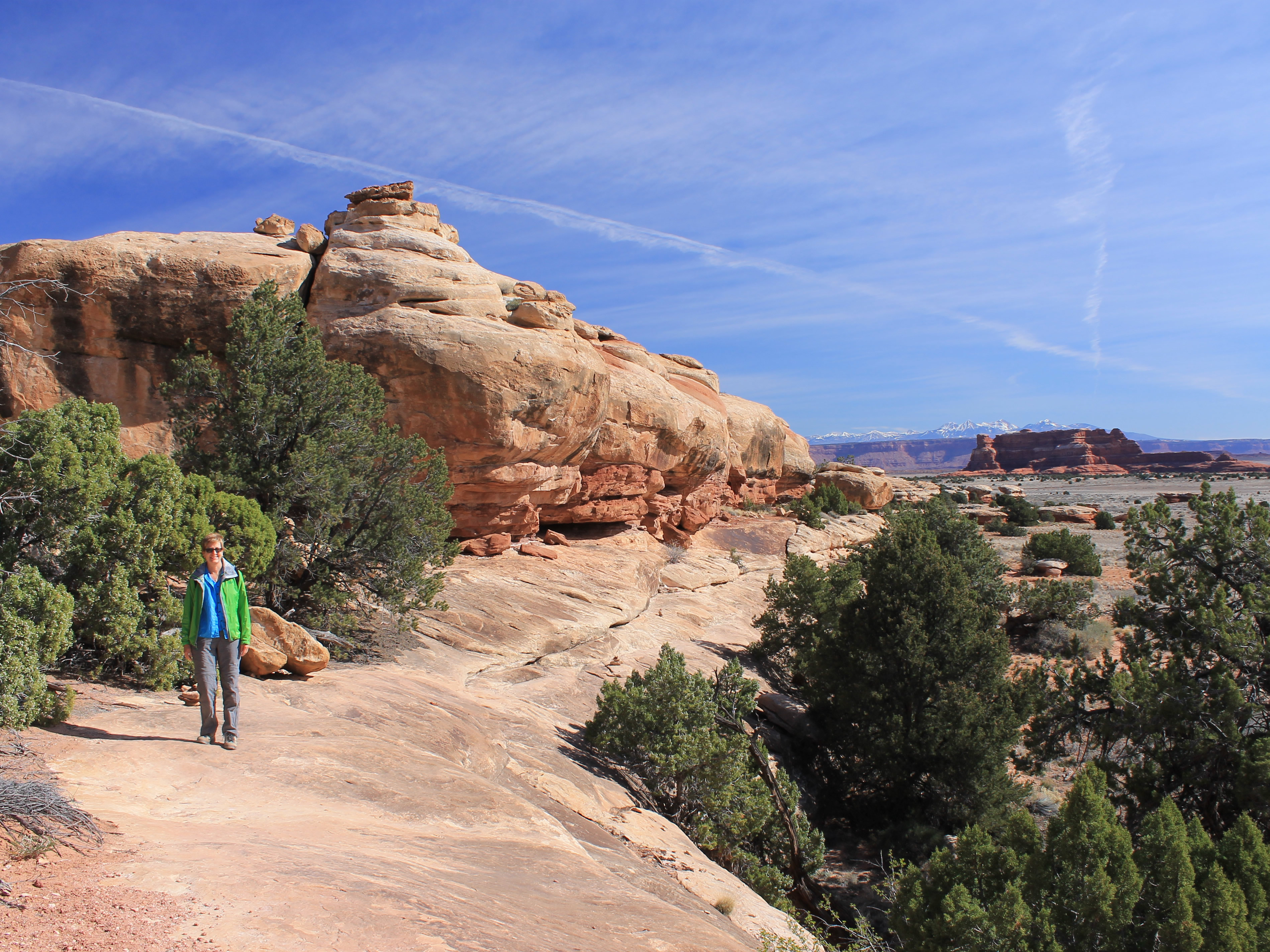 We were hiking on slickrock almost right from the start
Since we had enough time to get to south eastern or south central Utah, I came up with two proposals. One was to stay in Escalante and/or Boulder Utah and hike in Grand Staircase/Escalante National Monument. I had been there once before several years ago, but it is a vast area and there is a lot of it that I haven't explored with a lot of good hiking. The other option was to stay in Monticello, Utah and hike in the Needles district of Canyonlands National Park. I had never been there at all. Sandy glanced at the hiking guides and some of the pictures and quickly selected Canyonlands.
The week before we left I was playing wargames with Erik and Brady, both avid hikers who I knew had hiked in the Needles district last year. They gave me some suggestions on which trails to take. It turned out that they were also planning a trip over spring break (Erik teaches at BSU) and they were going to Escalante, as well as doing Horseshoe Canyon in the western part of Canyonlands, a trip that I had done the year before. We were about a year out of sync!
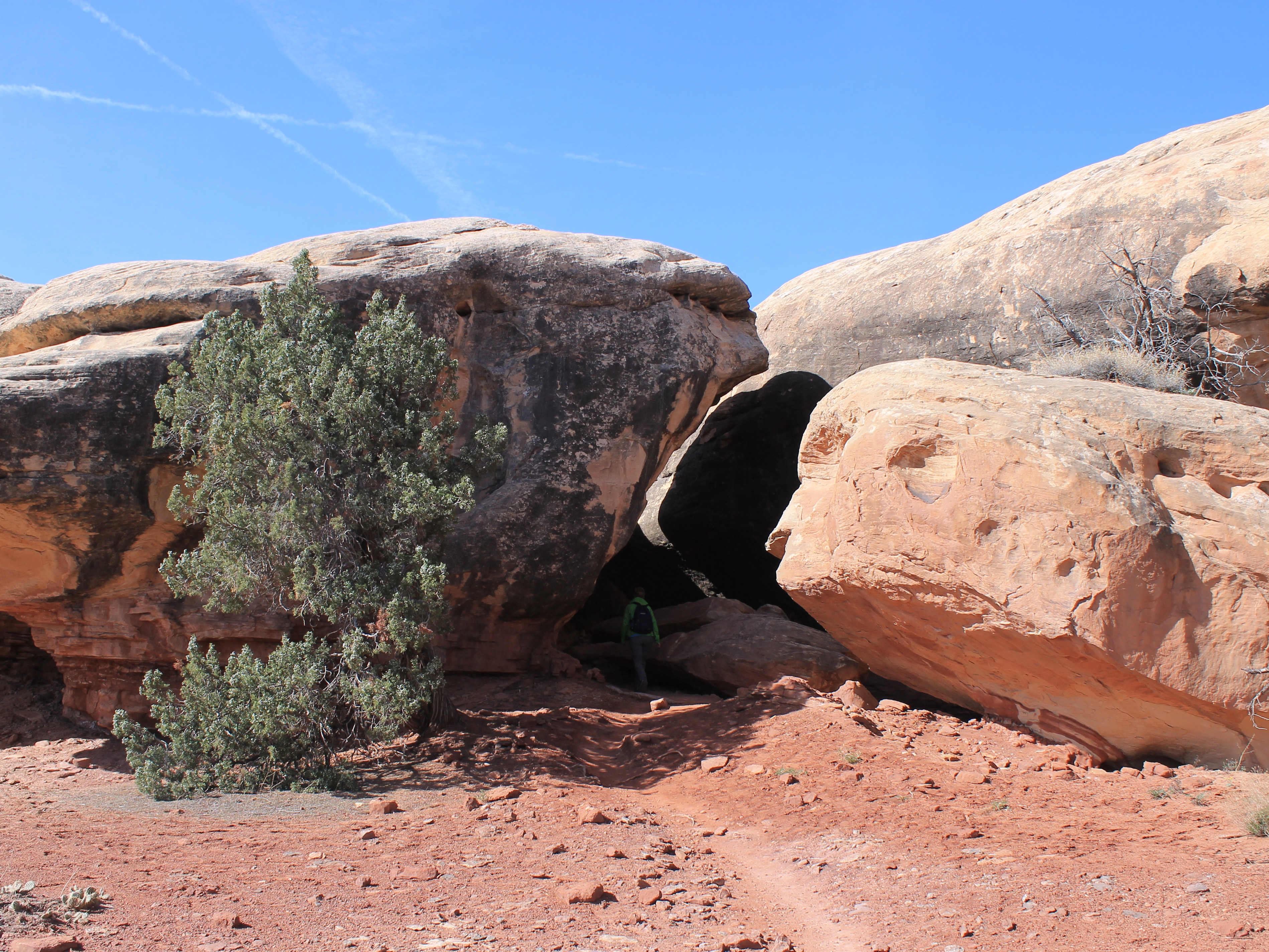 Sandy follows the trail down the rabbit hole
When we left Boise on Wednesday morning the weekend forecast for Canyonlands National Park was perfect - mid to high sixties with sunny skies. It took about ten hours of driving to reach Monticello, our base for the weekend. Monticello is a small town, with a handful of hotels and two or three restaurants. Since we wouldn't have much variety for dining, we stopped on the way to have dinner in Moab, only fifty miles from Monitcello. We ate at Pasta Jay's, one of our standard places to eat when in Moab. Because it was spring break week, there were a lot of people in Moab and a lot of people at Pasta Jay's. But we were impressed by their organization. They moved a lot of people and a lot of food through their restaurant. It might make a good case study for one of Sandy's project management classes. Our dinner was good and after we finished we were back on the road. We made it to Monticello by eight oclock, just as it was getting dark. We found our hotel (it wasn't hard) and settled in for the night.
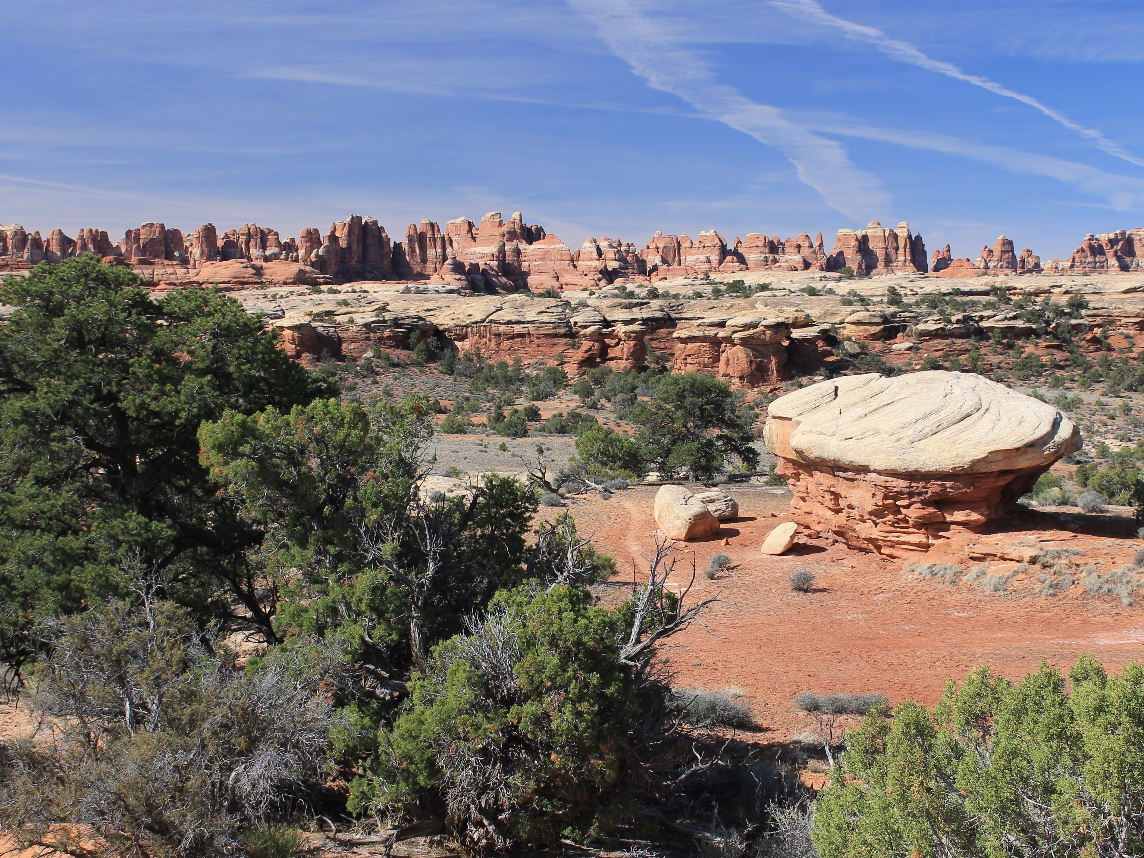 Trail through Big Spring Canyon - Needles in the distance
It was sunny but cold the next morning. Monticello is quite high, so after a clear night it was only in the high thirties. Not very pleasant but we were hoping it would be much nicer when we got on the trail. After a quick breakfast we were ready to go. Brisk winds made it feel very chilly as we walked out to the car.
Even though Monticello is the closest town to use as a base, we still had a long way to drive. The trails in the Needles District of Canyonlands are quite remote. First we had to backtrack about fifteen miles of the highway we had driven from Moab last night. Then we turned off to the west, onto a (long) spur road that provided access to Canyonlands National Park. Fortunately the road was paved, but it was still forty more long miles to the trailhead. It took us an hour of driving from the hotel to reach the park visitor center. After a quick stop there to check on local conditions (and to let me pick up a tshirt for the Needles) we were back in the car to drive the last few miles to the trailhead.
 View towards the head of Big Springs Canyon
Finally we reached the Squaw Flat trailhead. We put on our boots, grabbed our packs, and were ready to go. The conditions were a lot nicer than when we left the hotel. We were a lot lower, the wind had died down, and it was warm, sunny and pleasant hiking weather.
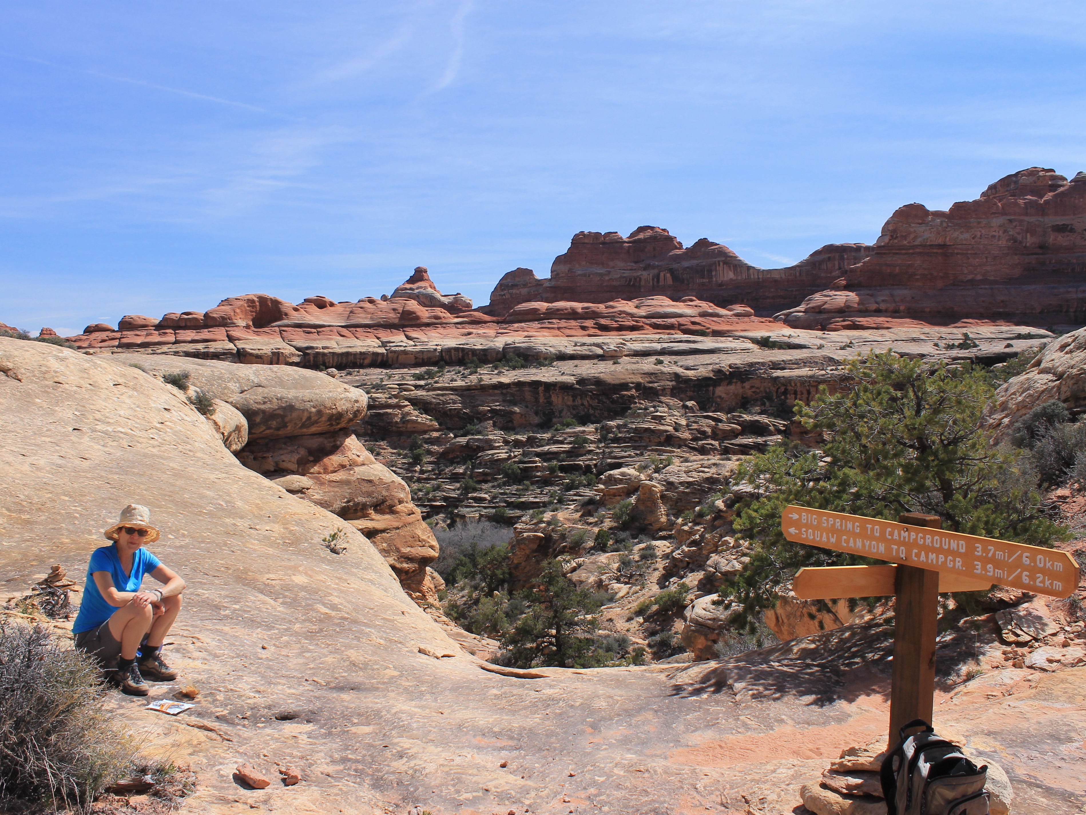
The Squaw Flat trailhead gives access to numerous trails that lead into the backcountry of the Needles district. Lots of loops are possible by hiking up one canyon, crossing over to the next, and then returning. That was what we chose for our hike today. We would hike up Big Springs Canyon, the westernmost of several parallel canyons. After about four miles we would cross a divide into Squaw Canyon and follow that back to the trailhead. The total trip would be about eight miles, with about a thousand feet of elevation gain. A good hike but certainly nothing that would wear us out. We had more days to hike and the weather was fantastic.
 Starting to climb toward the headwall in Big Springs Canyon
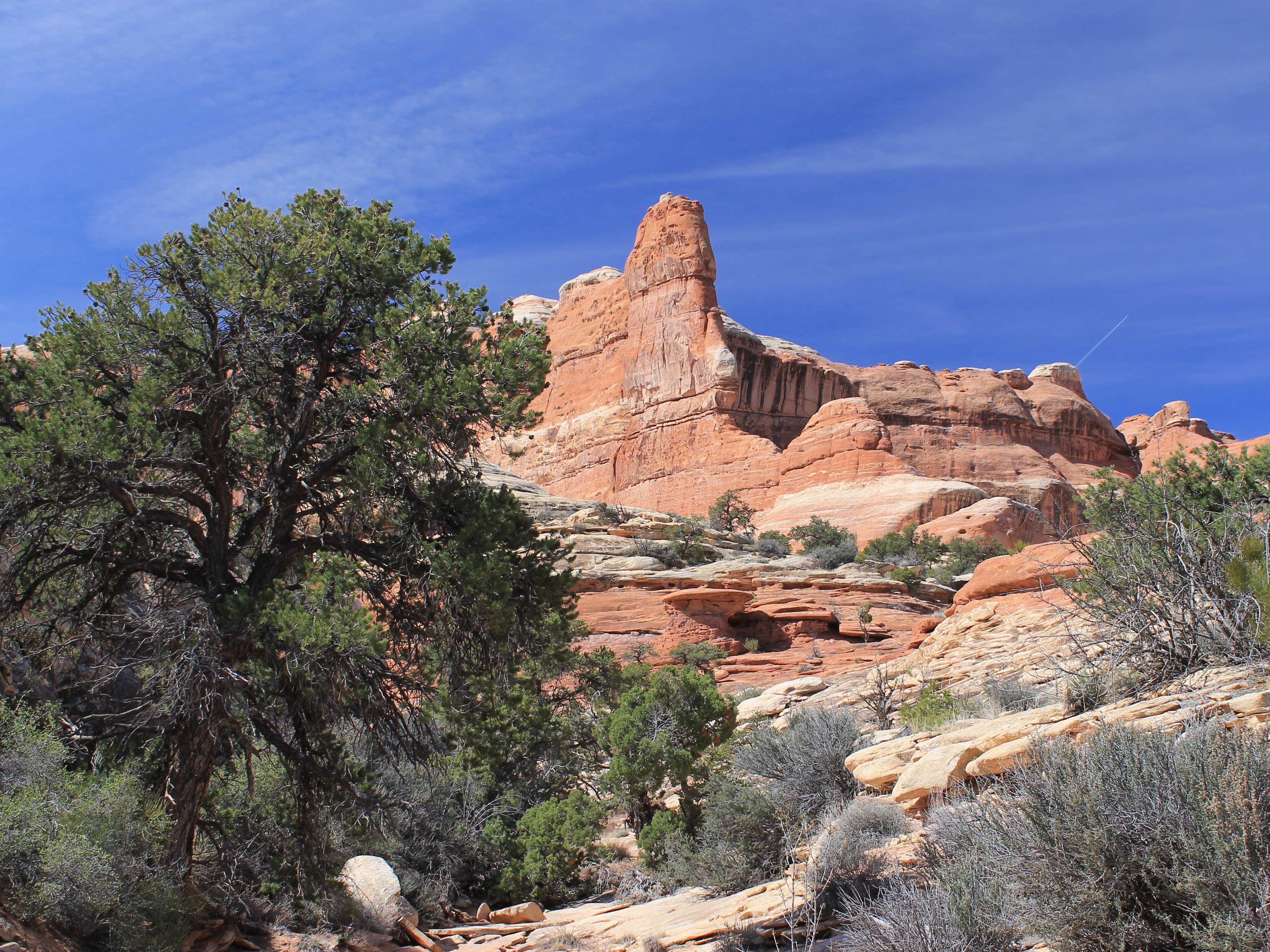
The trail started out through open, sagebrush-covered desert. But not even fifteen minutes into the hike, it turned abrubtly to cross a rock rib to get into the lower part of Big Springs Canyon. Instead of trail we were following cairns to cross slickrock, sometimes with a little scrambling to get over rock barriers. At one point the trail went into a narrow cleft between large rocks - it looked like we were descending into a dark cave. Eventually we crossed the rock rib and reached descended to good, old-fashioned dirt again where we could follow the trail up Big Springs Canyon.
We followed the trail for about an hour and a half of easy walking. To our right we could see the Needles, a long ridge of spectacular, serrated rock formations that give the area its name. Eventually we were getting to the head of Big Springs Canyon and the headwalls that enclosed it. Although it looked like a dead end, the map and guidebook claimed there was a route over to the next canyon and back to the trailhead.
 The final climb to the saddle - visible at left
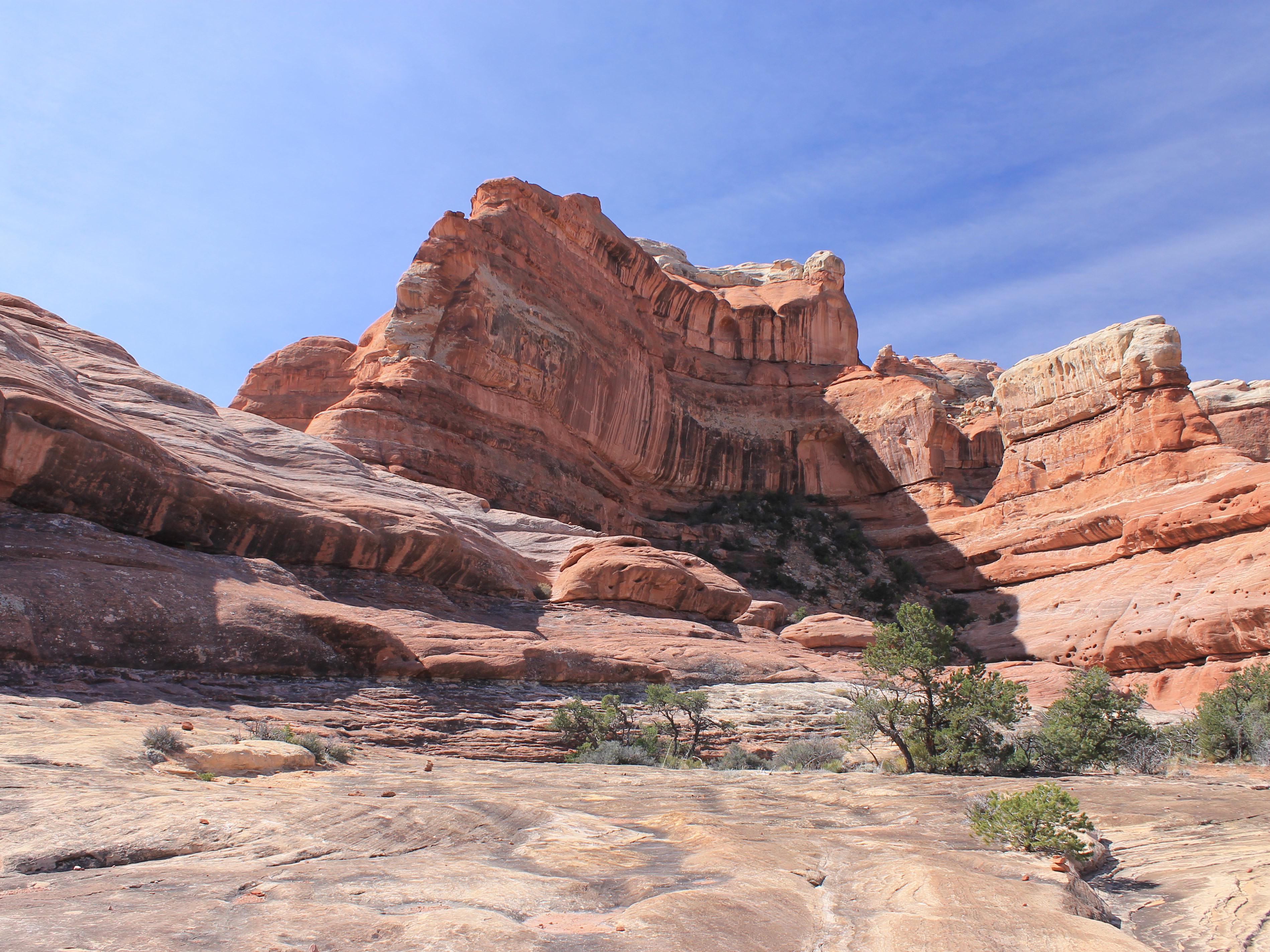
Eventually the trail ended as we climbed onto the slickrock. We followed cairns up towards the headwall. The going on the slickrock was easy but it still looked like we were headed for a dead end. Eventually the route cut behind a large rock formation where a smooth gully provided a weakness that got us part way up the headwall. Once we topped out of the gully, we could climb the crest of a series of rock ridges that led us to the saddle on the main ridge that separated the two canyons. It took some scrambling but there hadn't really been any exposure. It was nothing for a couple of hard-core hikers like us.
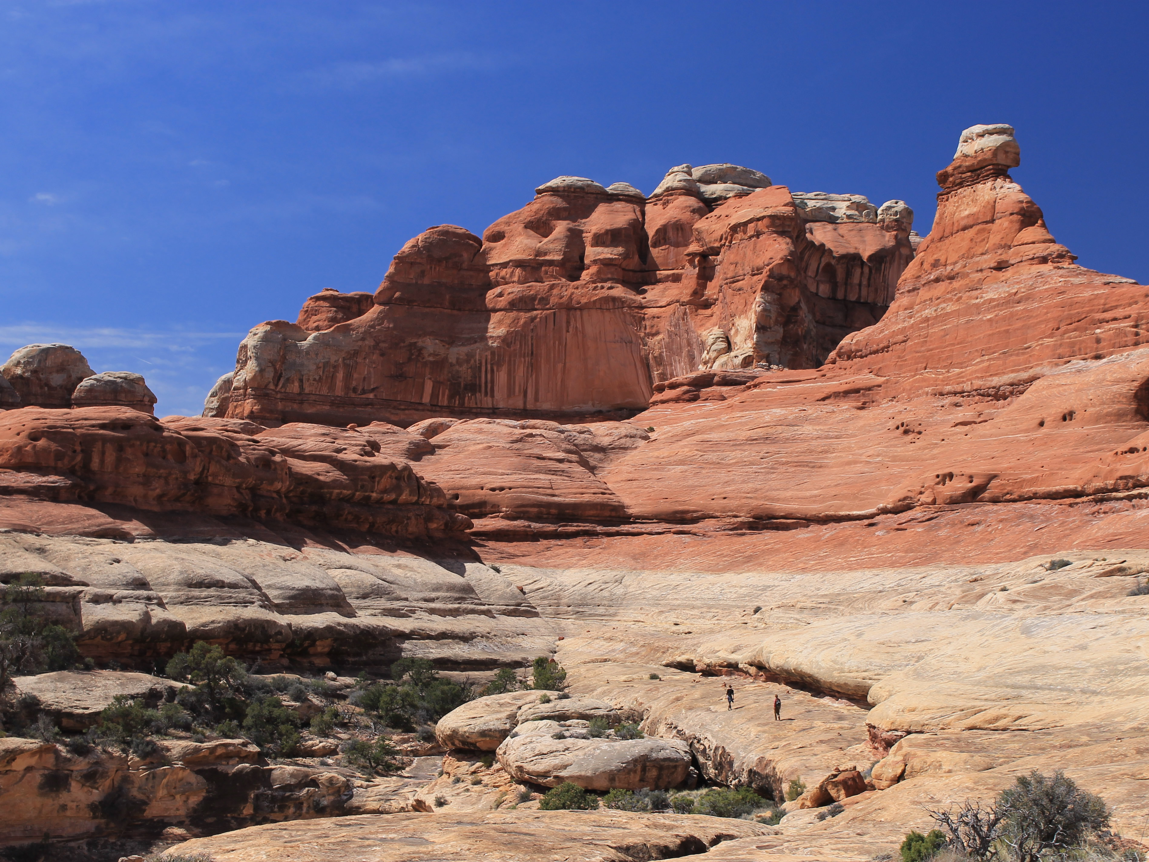
The view from the saddle was spectacular. There were large rock formations to the south of us at the head of the various canyons coming up from the north. The steep cliffs of red rock against the bright blue sky made a beautiful scene. We stayed at the saddle for a while, taking pictures and enjoying the view. It also let us put off the problem of how we were going to get down on the other side.
 Enjoying the view from the saddle - now how to get down?
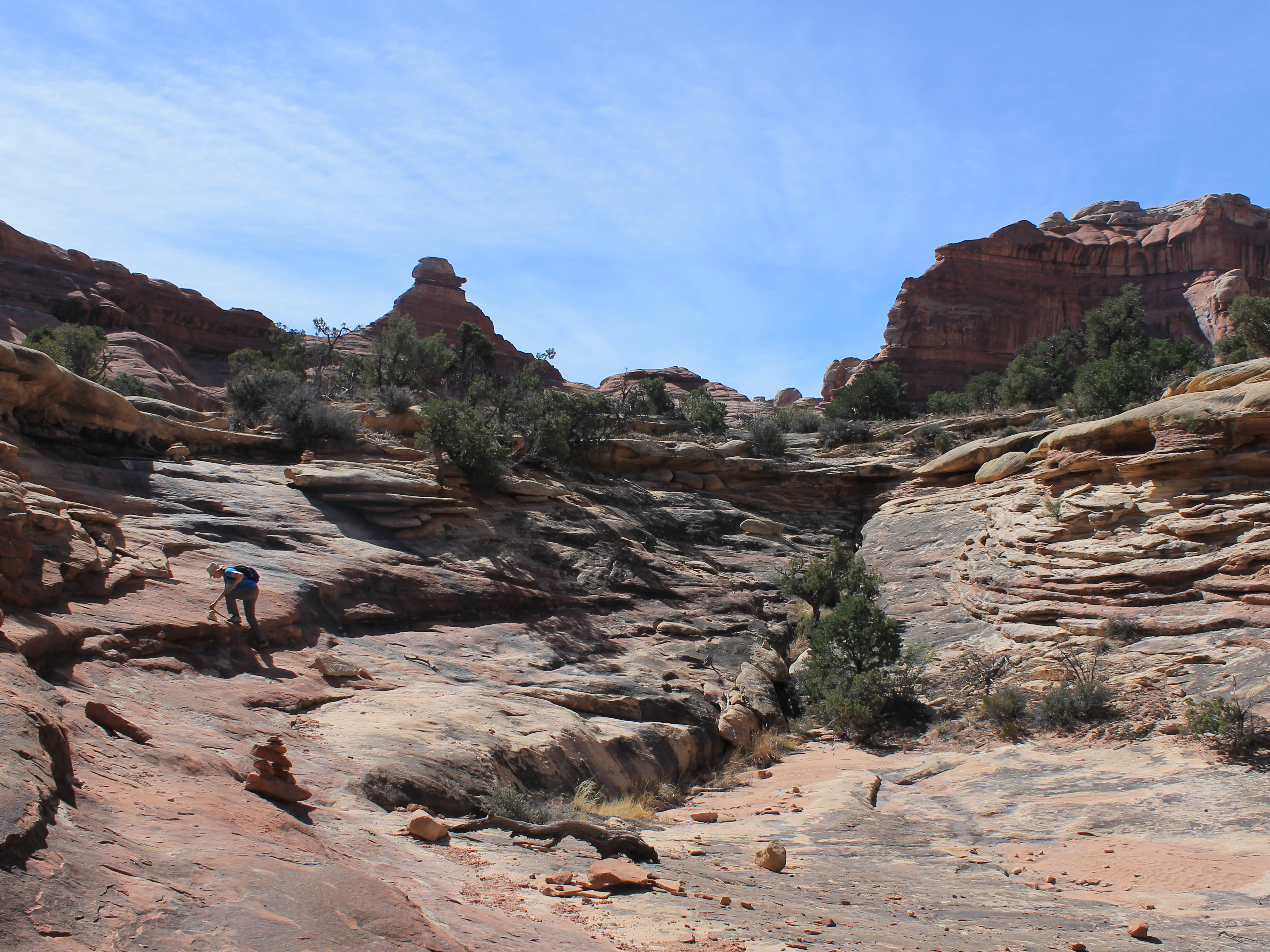
Although somewhat steep it wasn't too bad on the other side. We found the cairns marking a route down but with care it would have been possible to get down just about anywhere. In about ten minutes we reached the floor of Squaw Canyon - and lost the trail!. This was weird. The floor of the canyon was loose sand. Tracks would be easy to see, much less a trail. We backtracked to the slickrock and noticed that at the very last the route took off downcanyon on a slickrock ledge rather than descending all the way to the canyon floor. We were back on track.
We followed the route as it contoured along the ridge we had just climbed over. We continued along on slickrock for almost a mile. In this stretch we saw the first other hikers we had seen. Two women passed us doing the loop in the opposite direction. It was amazing to us that we had been hiking for three hours, in a national park, on a great trail with awesome scenery, during spring break, and hadn't seen a single other person up to that point. It wasn't quite like the crowds in Zion on our trip the previous month!
 Taking a break at the half way point
Eventually we dropped off the slickrock and followed a trail through the middle of the canyon. Although the rock formations were pretty, the walls were probably only a hundred feet high or so and the canyon was quite wide. Nice, but not spectacular. Still, the weather was perfect and the walking was pleasurable. Gradually the canyon got wider and wider and eventually we were out in the desert again. We reached a junction with the Peekaboo Trail, which we planned to do the next day. From here it was only a mile to the trailhead. We were finally feeling a little tired but we didn't have just an easy trudge to the car. We had to climb up and over two rock ridges, never welcome when you think you are just about done with the hike. But the hike only took us four hours total and we were still feeling strong when we reached the car.
 Other hikers head up the route we had just descended
Our first thought was - something cold to drink! A few miles from the trailhead, as soon as you cross the national park boundary, is the Canyonlands Needles Outpost. It's a small gas station, campground, grocery store, restaurant, souvenir store in the middle of nowhere. My friend Erik had told us that it was the only place around to buy beer or wine. Monticello is in a dry county but the Needles Outpost is just across the county line so they could sell alcohol. But right now, after hours of hiking in the desert, we were more interested in cold drinks. Sandy got a large ice tea while I bought a gigantic Diet Pepsi. It was pricy, but it's not like they had a lot of competition. It sure was worth it though. At least we didn't need gas - that was $6.50 a gallon. And they even had a nice selection of tshirts and hats. I checked them out and promised the lady that I would be back the next day. That way I had the whole night to decide which one(s) to get. Of course when I came back the next day, I still hadn't made up my mind.
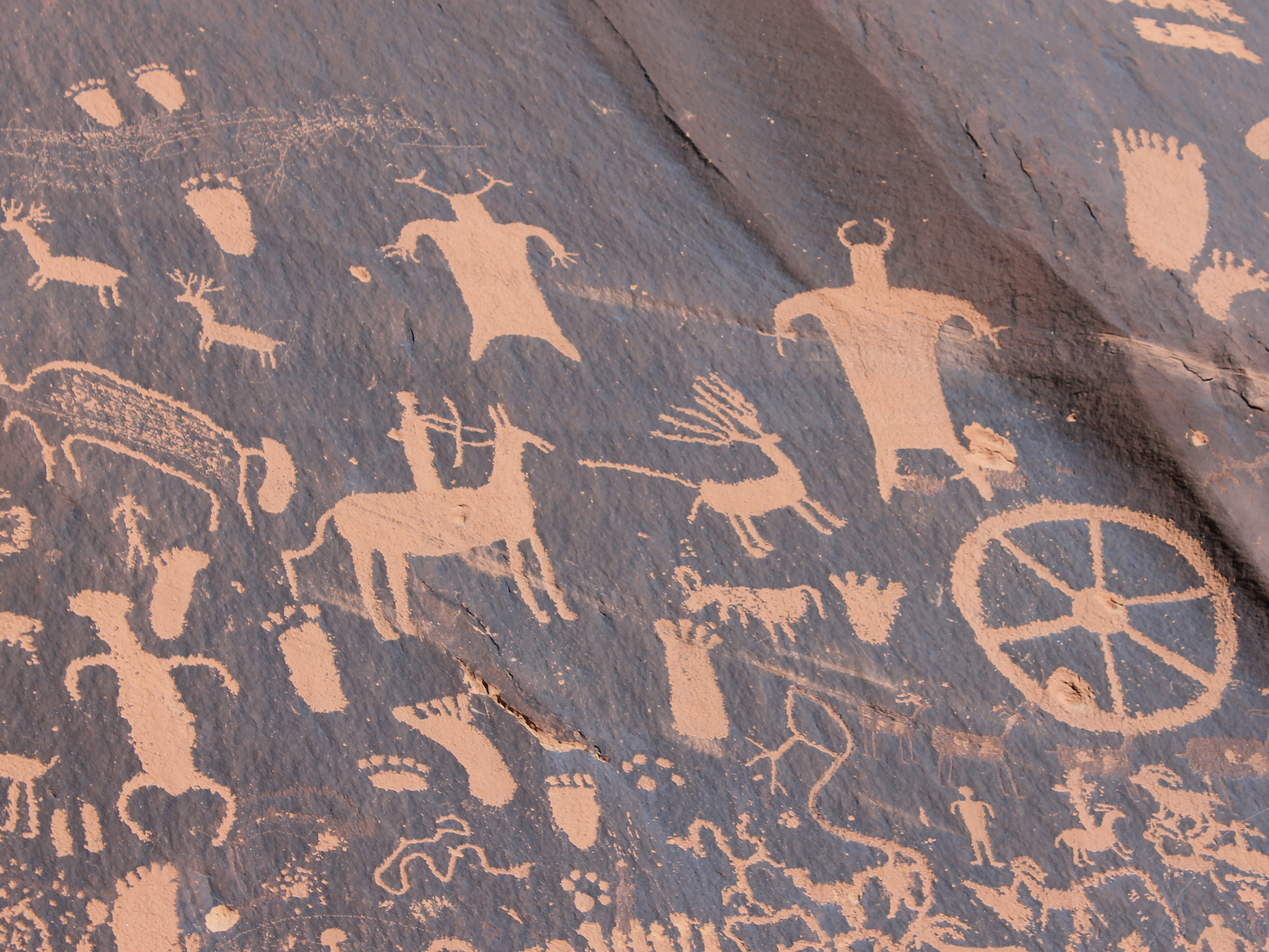 Some of the beautiful petroglyphs at Newspaper Rock
On the way back we stopped at Newspaper Rock. This is a large rock near the road with many spectacular petroglyphs. We had stopped briefly on the way in but the rock had been in shade. On the way out the sun had moved and we could get good photos of the rock. Sadly, there was modern grafiti on the rock as well, although not as much as we had seen in places like Capital Reef National Park. For some reason the Mormon settlers in Utah seemed to always feel the need to add their names to ancient monuments like this one. Definitely not cool.
Even with the long drive to and from the trailhead we were back relatively early. We cleaned up and went to the Horse Head Grill. There weren't many choices in town! We were there at five and beat the crowd - we were the only ones there. They had an ok salad bar and we had good hamburgers. After a quick dinner we went back to our motel. We opened a bottle of wine that we had brought along with us and watched Wisconsin play North Carolina in the NCAA tournament. The Badgers won (on their way to the championship game). That, with an awesome hike, made for a great day.
