Big Pine Lakes
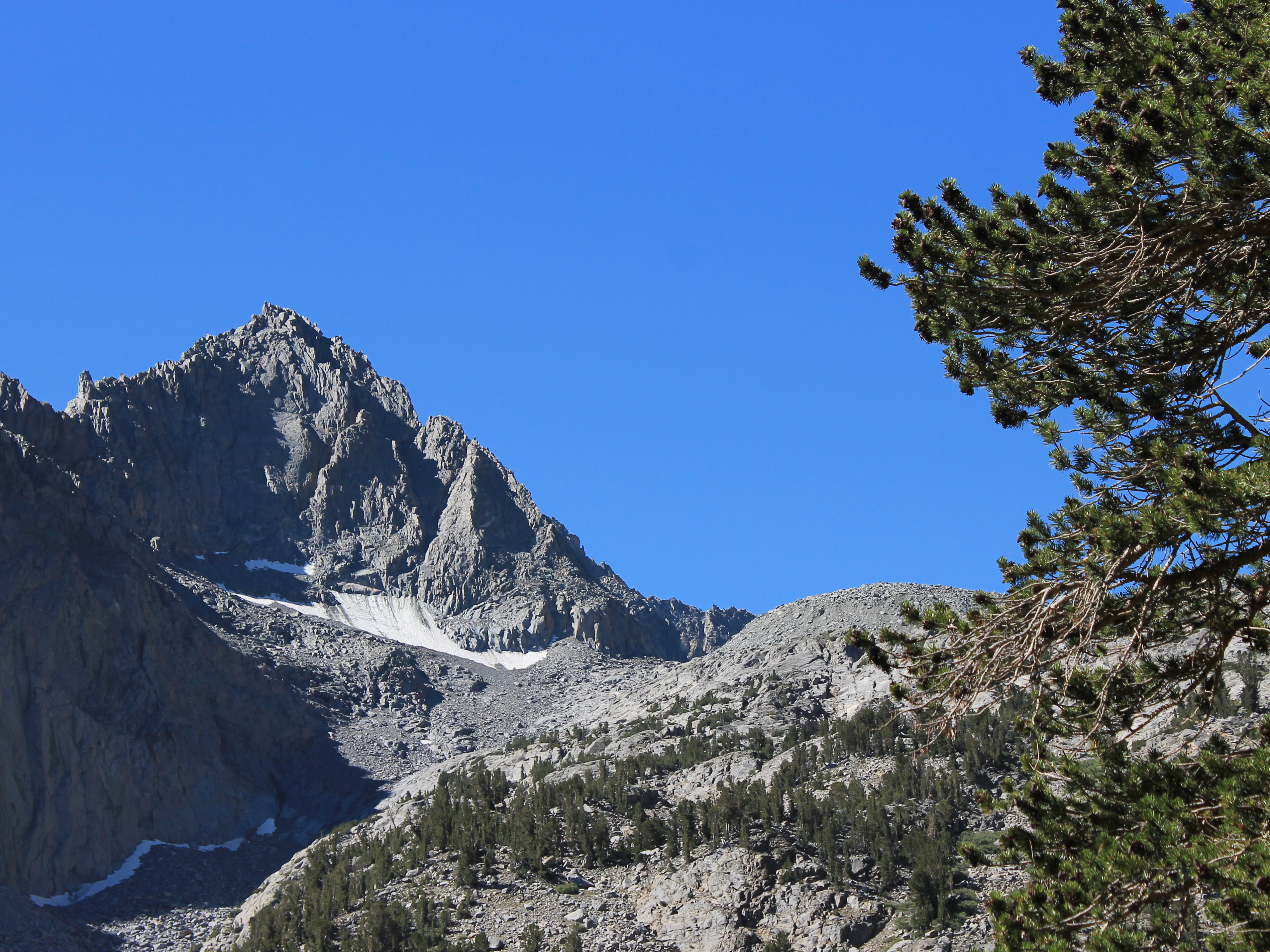
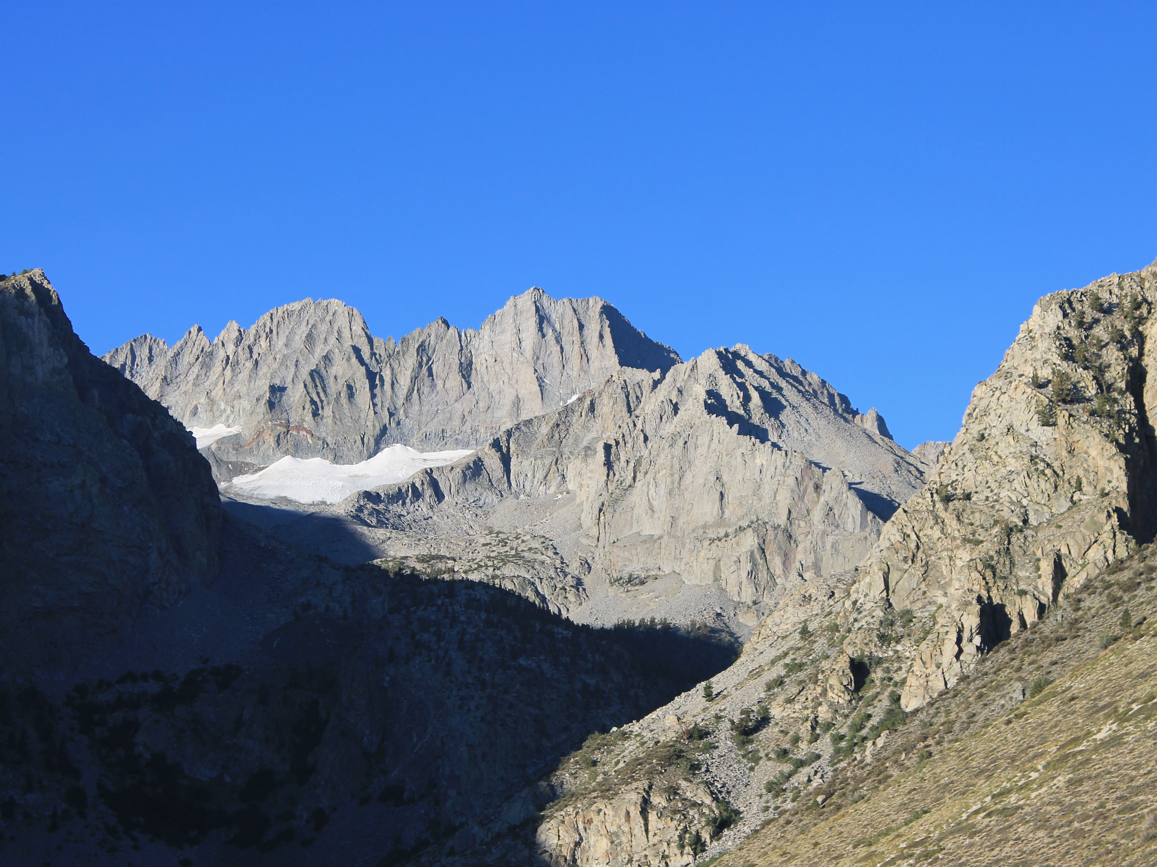 Early morning sunlight hits the peaks of the Sierra crest
I felt good after my hike to Thousand Island Lake, even though it was long. For my last day of hiking on this trip, I was planning to do another long hike, to Big Pine Lakes Basin. There are a number of lakes there, with the possibility for various routes and loops. But whatever I chose it would be a long hike. Most of the guide books listed it as fifteen to twenty miles, depending on which lakes were visited, with an elevation gain between 3000 and 4000 feet. It was a long haul, distance and elevation wise, just to reach the basin. But the scenery at several of the lakes was supposed to be wonderful. It also gave a view of the Palisades, a group of fourteen thousand foot Sierra peaks that had always intrigued me. I had never seen them other than from a great distance, so this hike would be my chance to get a really good view of them.
This trailhead was lower than the day before, hence the elevation gain. I also was worried that it would be even hotter in the afternoon on the hike out than it had been the day before. So I wanted as early a start as possible. But I didn't set an alarm. I figured that if I overslept after a big hike, I needed the rest. In that case I'd come up with something short and easy.
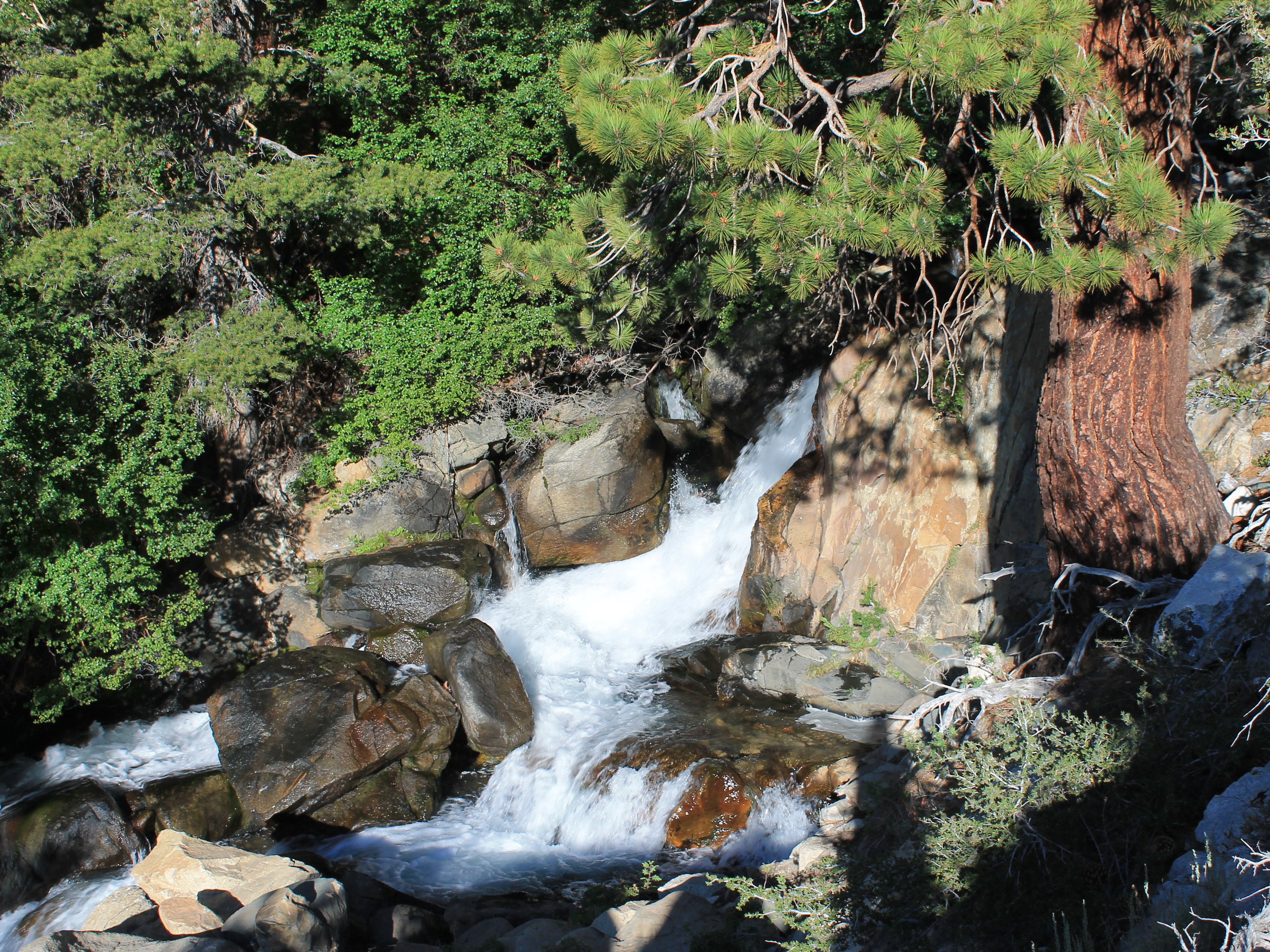 Hiking beside the North Fork of Big Pine Creek
I needn't have worried. I woke up at 4:30 am and was on the road by 5:15 am. It was still dark out, with the sky just begining to lighten in the east. Something was wrong with me - I was getting started earlier each day.
It took half an hour to drive to the trailhead. It was a good thing that I was starting early. It was already warm in Bishop when I started out, only 68 degrees. Bishop is a lot lower than Mammoth Lakes, but that still seemed warm for so early. Even at the trailhead at 7,750 feet it was 54 degrees. A lot warmer than the past two days. It was definitely going to be a hot day. I decided to make the best of it - I didn't bother to take my long-sleeve shirt so my pack would be lighter today. All I had was my goretex shell. I never do a serious hike without it.
I started hiking at sunrise which was right at 6 am. The sun was just starting to hit the tops of the high peaks, although the valley I was in was still deep in shadow. The trail started to climb right away. The main trailhead parking is not at the very end of the road, but the extra half mile made the trail less steep at the start. It climbed steadily, contouring along the side of the valley above Big Pine Creek, for about three quarters of a mile. Where the valley forked the trail turned right to follow the north fork and continued to climb, all the time contouring the hillside. The climb was steady but not too steep. Since I knew that I had a long way to go, I went slowly. According to my GPS, after an hour I had only gone a mile and a half. That's slow even for me. But I had steadily gained elevation. The problem was, I still had lots more to go.
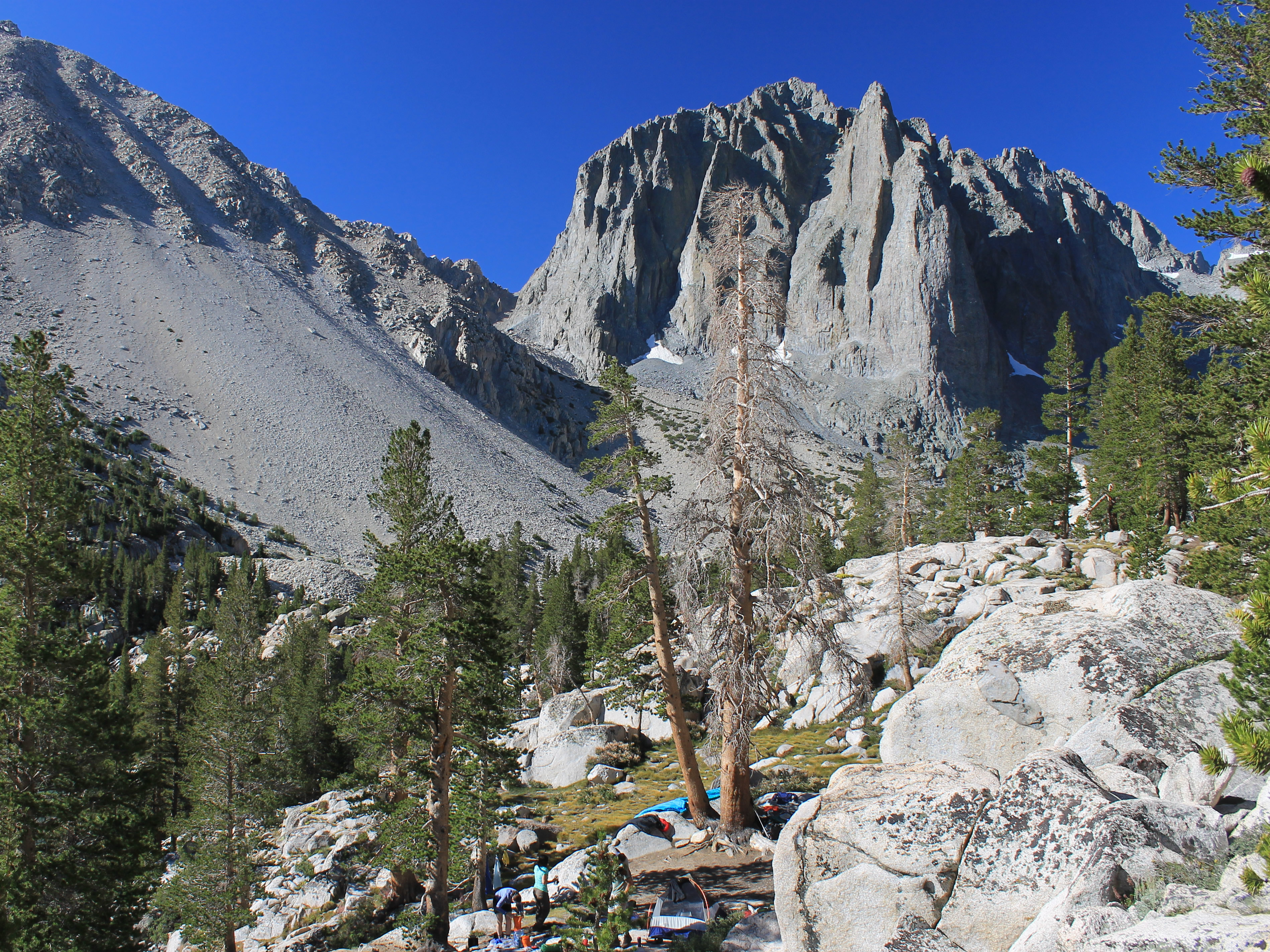 Backpackers camp below Temple Crag
I had several options for the day. The basic hike to the basin was about eight or nine miles round trip. Then there was a loop trip to First, Second, Third and Fourth Pine Lakes and Black Lake that was another four or five miles. Off of the loop there were multiple spur trails to higher lakes: Fifth, Sixth and Seventh, and Summit Lake. I was just going to go slowly and see how many I could visit before I ran out of energy, remembering that I had a long way to go back to the car.
At the end of the second valley there was a waterfall coming from a higher, hanging valley. I could trace the line of the trail climbing most of the way to the entrance to the higher valley. At the top I could just make out a tiny spec that looked artificial. When I finally got there, it turned out to be the sign to mark the boundary of the John Muir Wilderness.
According to the map, there was a long trudge up this third valley. It followed the North Fork of Big Pine Creek, which was quite pretty, so it was more interesting than yesterdays approach hike. So far I hadn't seen anyone, but then I heard voices. I assumed they were people camped but soon a group of trail runners, four people and two dogs, came up from behind and passed me. It didn't look like they even noticed the scenery. It seemed pretty crazy to me. One of the guys even had his arm in a sling. Soon they were out of sight ahead of me.
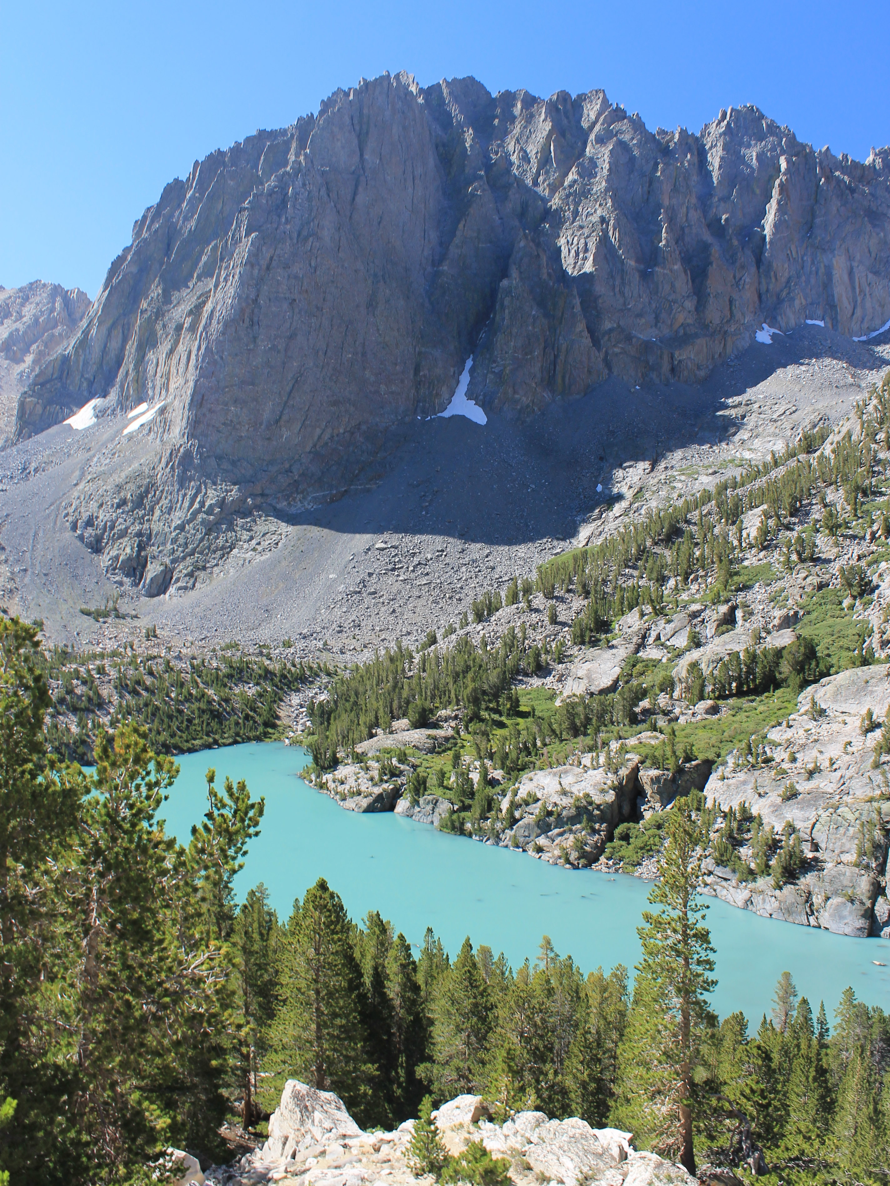
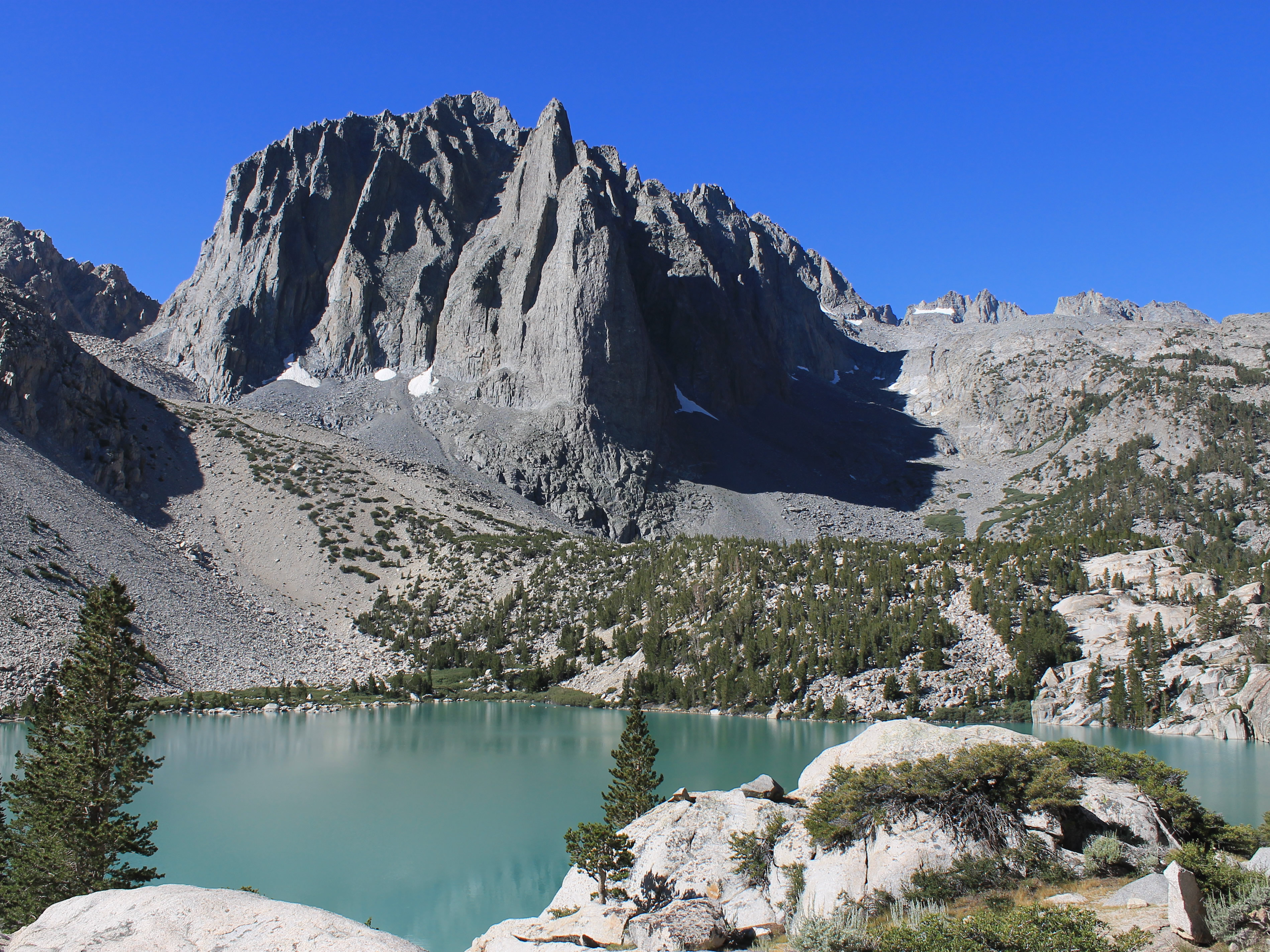 Temple Crag from above the first lake
About fifteen minutes later, suddenly something zoomed right past me, brushing my leg as it went past. I jumped about a mile in the air but then noticed that it was a dog. I turned around and there was another dog. They were the two trail runner dogs. A minute later the four people came from behind and passed me again. I didn't even have to ask them how the heck they had gotten behind me again. It must have been obvious from the look on my face. One of them mumbled something about "being distracted" as he went past. Now it seemed even crazier.
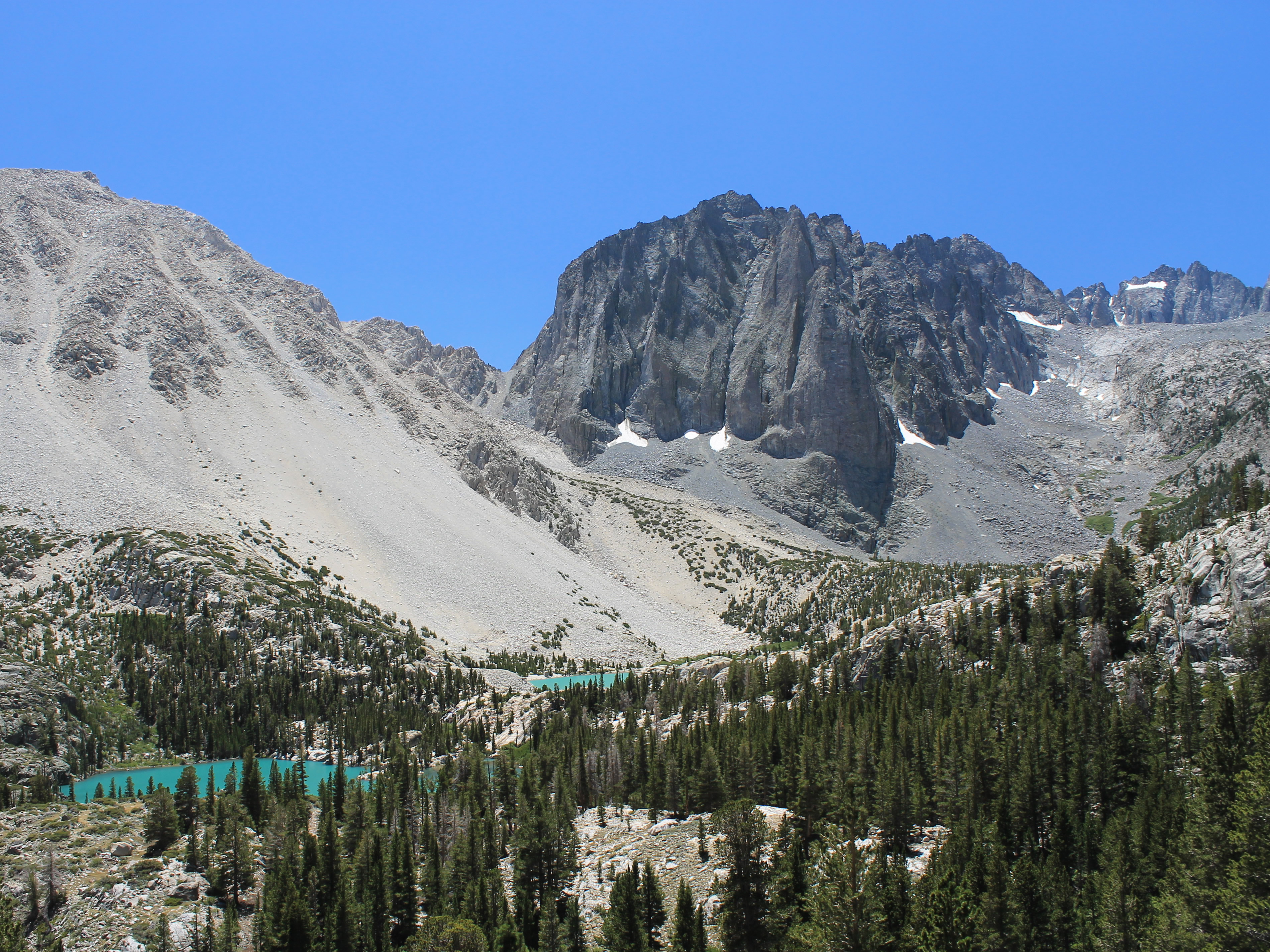
I kept going, slowly but steadily. No trail running for me. After about three hours I started to get views of Temple Crag, the spectacular mountain that is the backdrop for the first three lakes. Then I came over a rise and the First Lake was below me. It was indeed a beautiful view. The lake was a fantastic milky green color because it was fed by the melting of the Palisade Glacier. I found a rock and sat down for my first break of the day. I took pictures. I drank some water and munched on my snacks. I studied the map. But mainly I enjoyed the fantastic view.
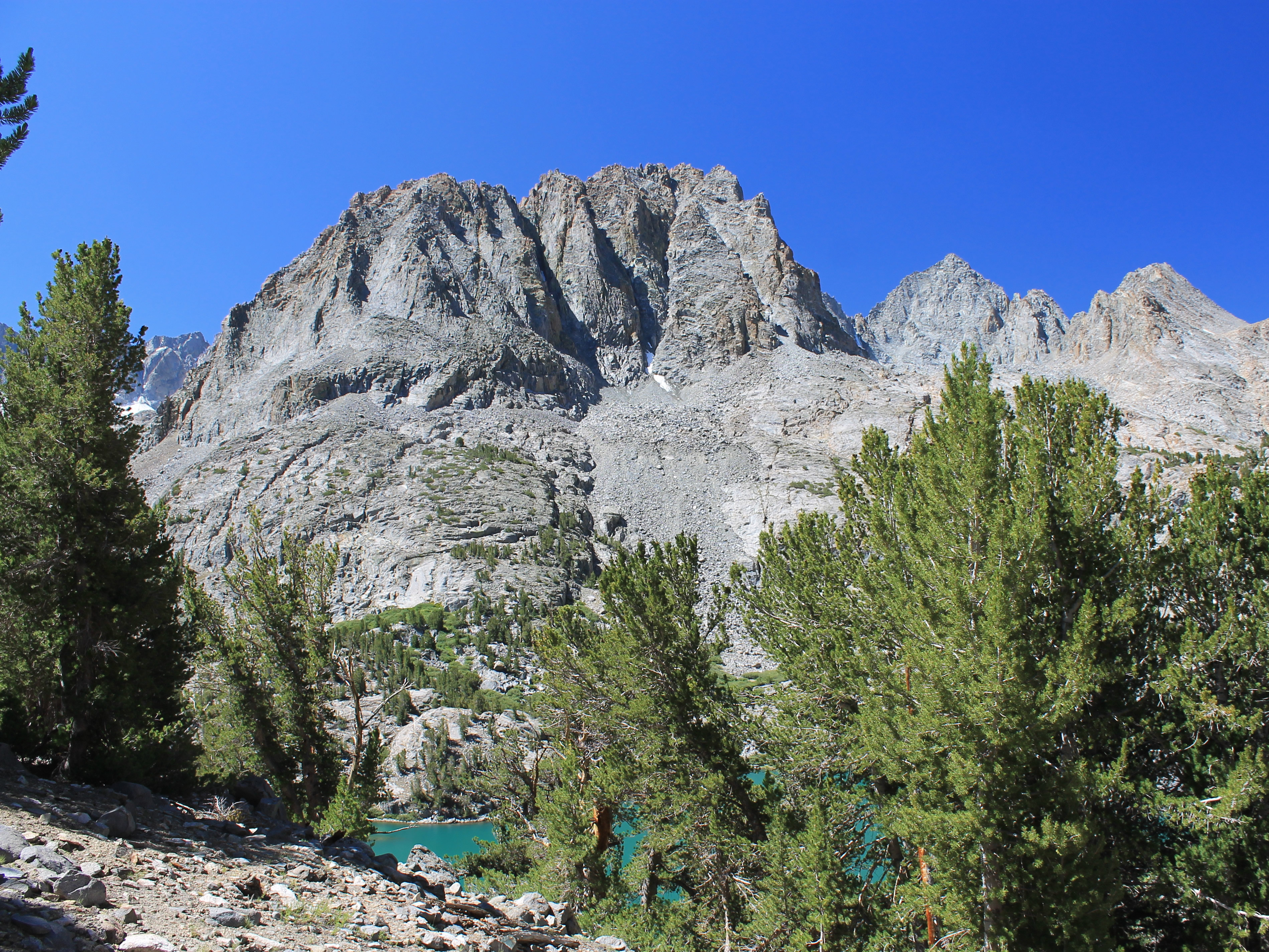
 13,516 ft Mt. Gayley from above the third lake
There was one problem I could see looking at the map. I should have passed the intersection for the loop around the lakes before I reached the First Lake but I hadn't seen one. Maybe I just missed it. Maybe there was a problem. I would find out by the end of the day.
There were still lots of lakes to visit so eventually I got going again. The trail went back into the woods and continued to climb. It wasn't long till I came to a viewpoint over the Second Lake. It was even prettier than the first. I found a spot to sit on the edge of a steep granite cliff that fell to the lakeshore. It was quite a viewpoint, and I spent a longer time enjoying the view. Temple Crag is an impressive mountain that dominated the view, although some of the peaks of the Palisade Crest could be seen behind it. In my younger days I would have studied all the technical climbing routes on the sheer granite face of Temple Crag, but my rock climbing days are long behind me now.
 Temple Crag and Third Pine Lake
Above the second lake there were still more views. As I gained elevation the color of the lake became even more pronounced. Then there was another climb through woods until I reached the Third Lake. It was another pretty glacial-fed lake dominated by Temple Crag, although now I was around to the side that was still in shadow so the pictures weren't as good. But it was still worth another break. Then came yet another climb up to the Fourth Lake. At least on the way there, the side trail that the map showed really did come in and join the main trail. And when I reached the lake, there was a junction signed for the loop return via Black Lake. That was a good sign (pun intended). Maybe the map was right after all.
The Fourth Lake was the least interesting lake so far. It was set in a small basin. It was pretty, but there were no expansive views. No monster peaks as backdrop. There were flat areas around the lake so there were people camped there but I didn't bother to stop. There were lots of lakes on this hike.
It was decision time. Should I just take the trail back the way I came? Complete the loop? Or should I go to some of the higher lakes? I still felt good so I decided to keep going. One trail went to the Fifth Lake. But that looked to be in an isolated basin, like the Fourth Lake. I passed on that. I took the trail that went around the Fourth Lake and climbed higher. It climbed to a junction where it split, one branch continuing around the Fourth Lake, the other going to the upper lakes. I wanted to get higher to get a better view of the peaks of the Palisade Crest.
 My turnaround point - the view from the saddle
Soon I reached another trail junction. One branch went to Sixth Lake and Seventh Lake. The other went to Summit Lake. I think. It was in the right spot, according to the map, but the trail that split off was very sketchy. I followed it for a while and it climbed to a saddle. From the map it looked like the trail to Sixth and Seventh Lake, but they were still at least a half mile away. The trail dropped down sharply after crossing the saddle which meant it would be a lot of work climbing up on the way back. That combined with the fact that the trail was getting to be hard to follow made me decide that I had gone far enough. I figured that the view from the saddle was probably the best I was going to get from this trail so I took some photos and headed back. I rejoined the trail that went around the Fourth Lake and continued around it.
After a short distance another trail split off. This one was much better defined than the last. But according to the map, it wasn't in quite the right spot. It was certainly in the wrong spot with reference to the inlet stream for the Fourth Lake. But I followed it anyway, uphill of course. After a short climb, the trail forked again. This wasn't on the map at all. I took the branch that went steeply uphill, cynically figuring that anyplace worth getting to would be along the harder of the two trails.
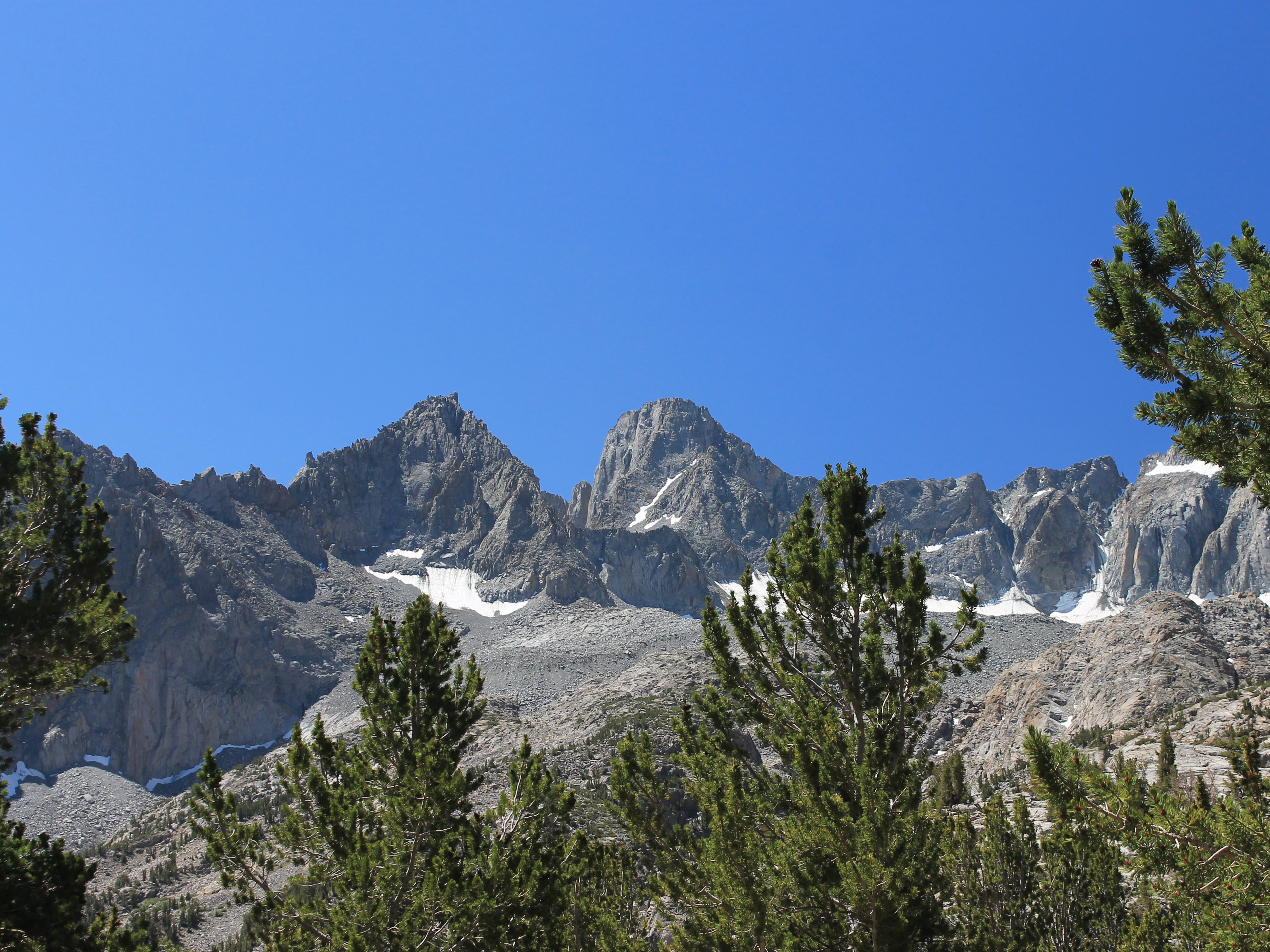 Mt. Gayley and Mt. Sill from near Summit Lake
Finally I reached Summit Lake, which was quite small and not very impressive. It was in a sheltered basin with no views. It was quite disappointing after all the guidebooks had raved about exploring the upper lakes. The lower ones were much prettier.
There was a better view of the Palisades from here but it was not as impressive as I had hoped. They were quite far away, and there was an intervening ridge that partially blocked the view. So after a few quick pictures I headed down. I had a long way to go to get back to the trailhead, and at this point I was a little nervous about whether the trail I was on would actually connect to make a loop. But it was in all the guidebooks (well, two of them) so I figured it was probably there even though I hadn't seen the junction on the way in.
Back at the original junction where I had first reached the Fourth Lake, this time I took the trail to Black Lake to complete the loop. I figured I was on course, but I was glad when I finally came to Black Lake. Another pretty lake, but also in a small, isolated basin with no expansive views.
 Temple Crag and the first two lakes from the high trail
There was a couple sitting at the lake and I chatted with them for a while. They were the first other day hikers that I had met. Everyone else up at the lakes had been backpackers. They had come up to the lake from the other direction, so that confirmed that the trail did indeed go through. That was good news.
I found a spot at the far end of the lake where I could sit by myself and rest for a while before the final push home. I was enjoying the peace and quiet when I heard a commotion and down the trail came the group of trail runners from this morning, dogs and all. "You haven't been running since this morning, have you?" I asked as they went by. The lead guy said "No" and that was all the explanation that I got before they went past and then were gone. I guess they must have really got distracted somewhere.
Time for the long push to the trailhead. Not far from the lake I came out of the woods. The trail did a long, descending traverse on an open hillside. The map made it look like it was in the woods but instead there was a fantastic view of the first two lakes from above, Temple Crag, and the Palisades Crest in the distance. It was probably the best view of the day. So although I was tired, the hike down was enjoyable. At one point I stopped for a photo (one of many) and I saw a large cloud of dust rising from the face of Thunderbolt Peak. There must have been a huge rockslide. I hope that there were no climbers on that face when it let loose.
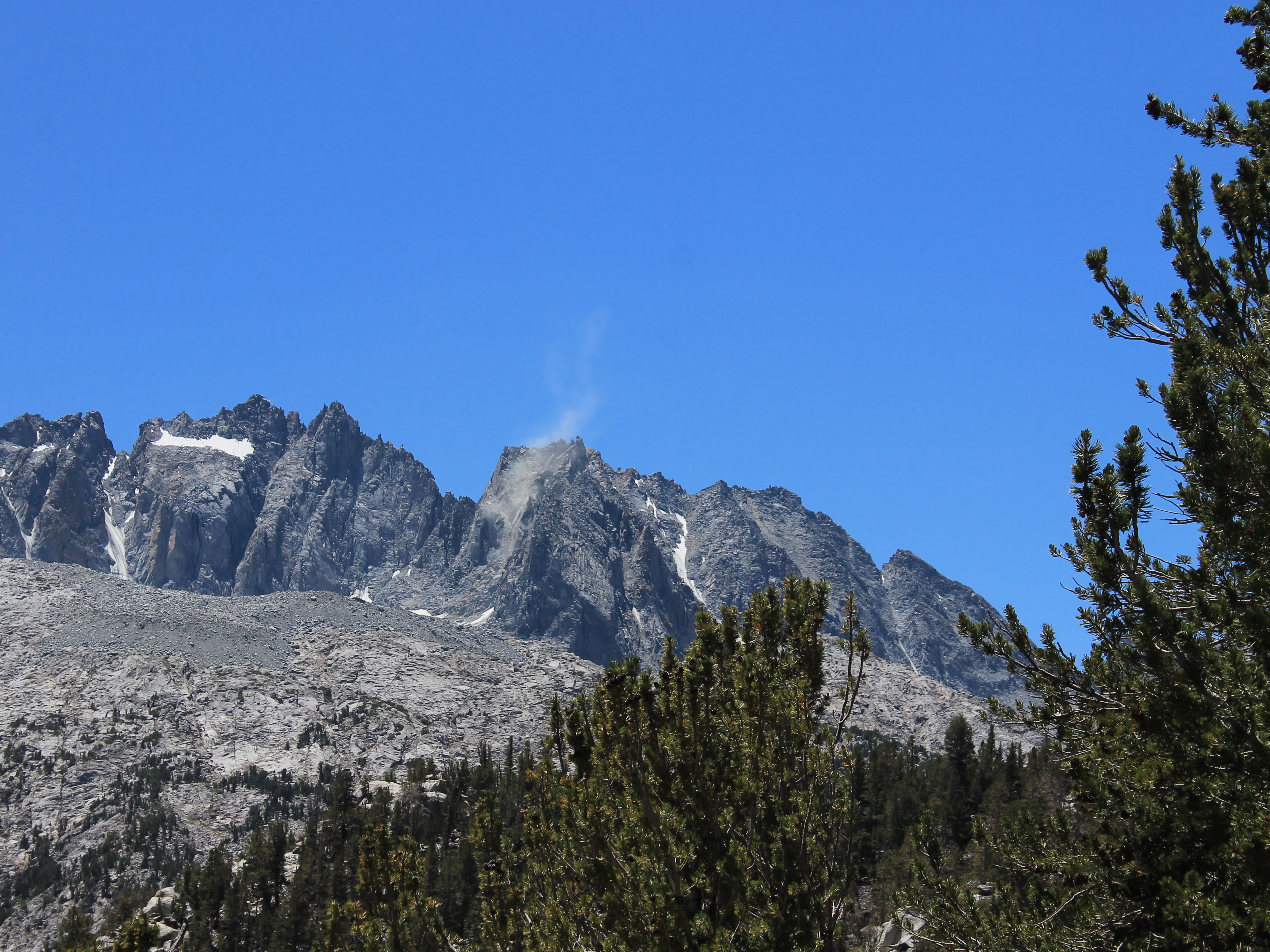 Massive rockslide onThunderbolt Peak
Finally I reached the bottom of the slope. There were no more views, but the mystery of the trail junction was solved. The loop trail came in at a brushy spot, at an acute angle, that was almost impossible to spot when you were going in. Good thing that I hadn't intended to hike the loop in the other direction. I totally missed the trail junction on the way in.
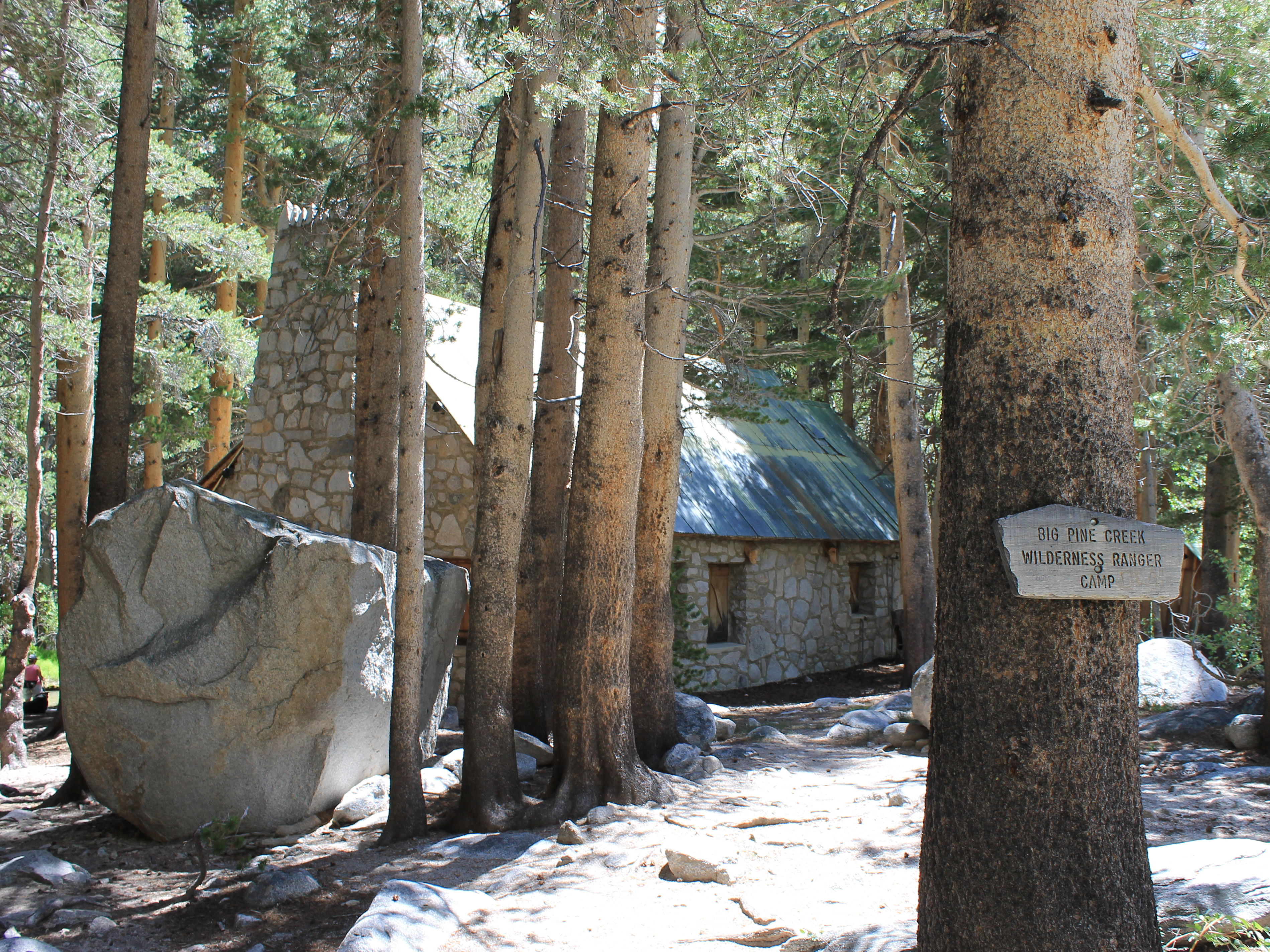
I was back hiking along the North Fork of Pine Creek. From here on I was retracing my steps coming in. On the way out I noticed something else that I had missed. Just off the trail was a stone building. It was originally owned by the famous silent film star Lon Chaney. It was built in 1930 with a special permit from the Forest Service. When the permit expired in 1980, ownership reverted to the federal government and today it is used by wilderness rangers patrolling the John Muir Wilderness.
As with most long hikes, the last part was just a slog. Unlike the day before, it wasn't that warm. There weren't any bugs to speak of, so I could stop and rest whenever I wanted. There was even a bit of a breeze blowing up the valley. There were a lot of backpackers heading in at this time of the day and they looked pretty hot going uphill with heavy packs during the heat of the afternoon. I was glad to be going down.
 Lon Chaney's wilderness retreat - now a ranger station
I reached the trailhead at 3:30 pm. I had been hiking for nine and a half hours. My GPS said that I had gone slightly less than fourteen miles, a long hike but quite a bit less than the guidebooks had said. But it also said I had done over 3400 feet of elevation gain, a hard day's work to be sure. The lower lakes had spectacular scenery, and although I had been disappointed by the higher lakes, I did finally get good views of the Palisades. A good hike.
It was time to head back to Bishop for a cold Diet Coke, a salad and a pizza. I was already looking forward to the fact that I didn't have to get up early to hike tomorrow. I had plenty of time to drive to Irvine for the Rush concert. I could be decadent and sleep in till seven or eight in the morning! The concert would be a great finish to the trip.
