Hell Roaring Lake
 Abby is ready to start out on the trail
Our trip to the Oregon Coast had been a lot of fun. Going to Northern Idaho had allowed me to visit my mom and Sandy to meet with people on campus. But it meant a lot of driving. On a five day trip, we spent most of three days traveling - and I did all of the driving. I was ready to enjoy a few days at home without spending a lot of time in the car, especially since we only had a week before we would leave on our trip to Montana. Which meant more driving.
At the same time I was still hoping I could get up to the Sawtooths to do a hike or two before the season ended. Because of the smoke from the Pioneer Fire I hadn't been able to hike there since early July. Now that it was fall and the fire was out, the weather had been unseasonably wet and cool, even snowy. It looked like winter was coming early this year . I didn't think that I would have many more chances before the high country would be shut down for hiking till next summer.
I had been watching the forecasts while we were away on our previous trip. It looked like there was only one day that the weather was going to be clear in the mountains and it was going to be Friday - the first day that we were back. So even though we got home about eight pm on Thursday evening, as soon as I unpacked the car and put things away, I packed up my hiking stuff so I could leave for the Sawtooths the next morning. I have to admit that I was not excited about getting up early, or about driving five or six hours again so soon after getting home.
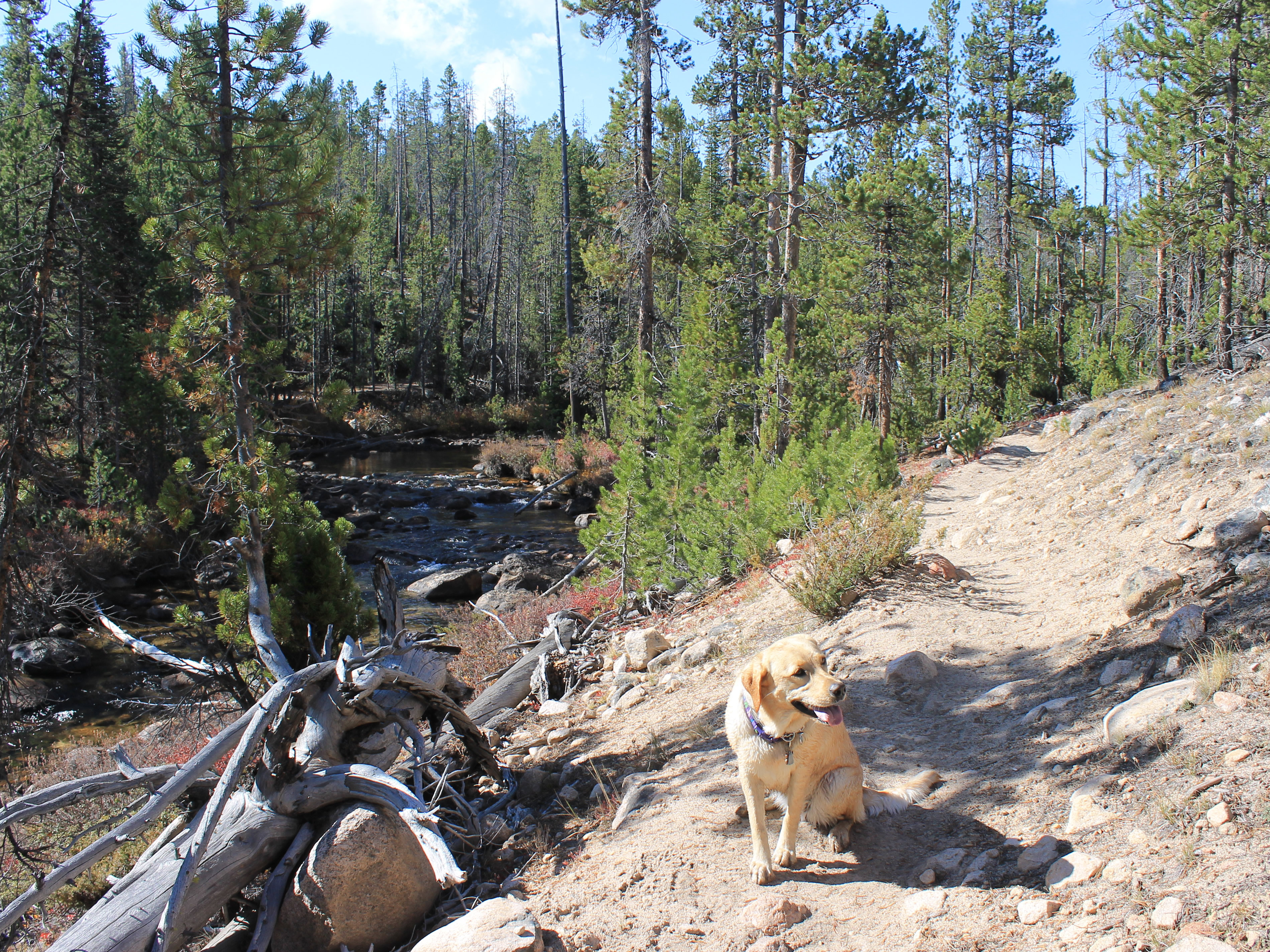 Abby hiking beside Hell Roaring Creek...
At least I didn't have to leave as early as I usually would for a day hike in the Sawtooths. Since it was fall it didn't get light as early as in summer and since it was cold in the morning, it was good to give it a little time to warm up before starting to hike. Still, Abby and I were in the car and rolling at 8 am. At least Abby seemed enthusiastic as we started out. All I could think was "wasn't I just in this car and driving all day?"
Once we were going though it turned out that the drive wasn't that bad. I was interested in seeing the effects of the Pioneer Fire along Highway 17, the Banks-Lowman road, and along Highway 21 from Lowman to Stanley. While there were some burn areas, I had actually expected to see a lot more. I guess that the fire didn't burn that badly in the South Fork of the Payette River Canyon. It turned out that a small fire just north of Stanley this summer actually caused a lot more damage that was visible from the road.
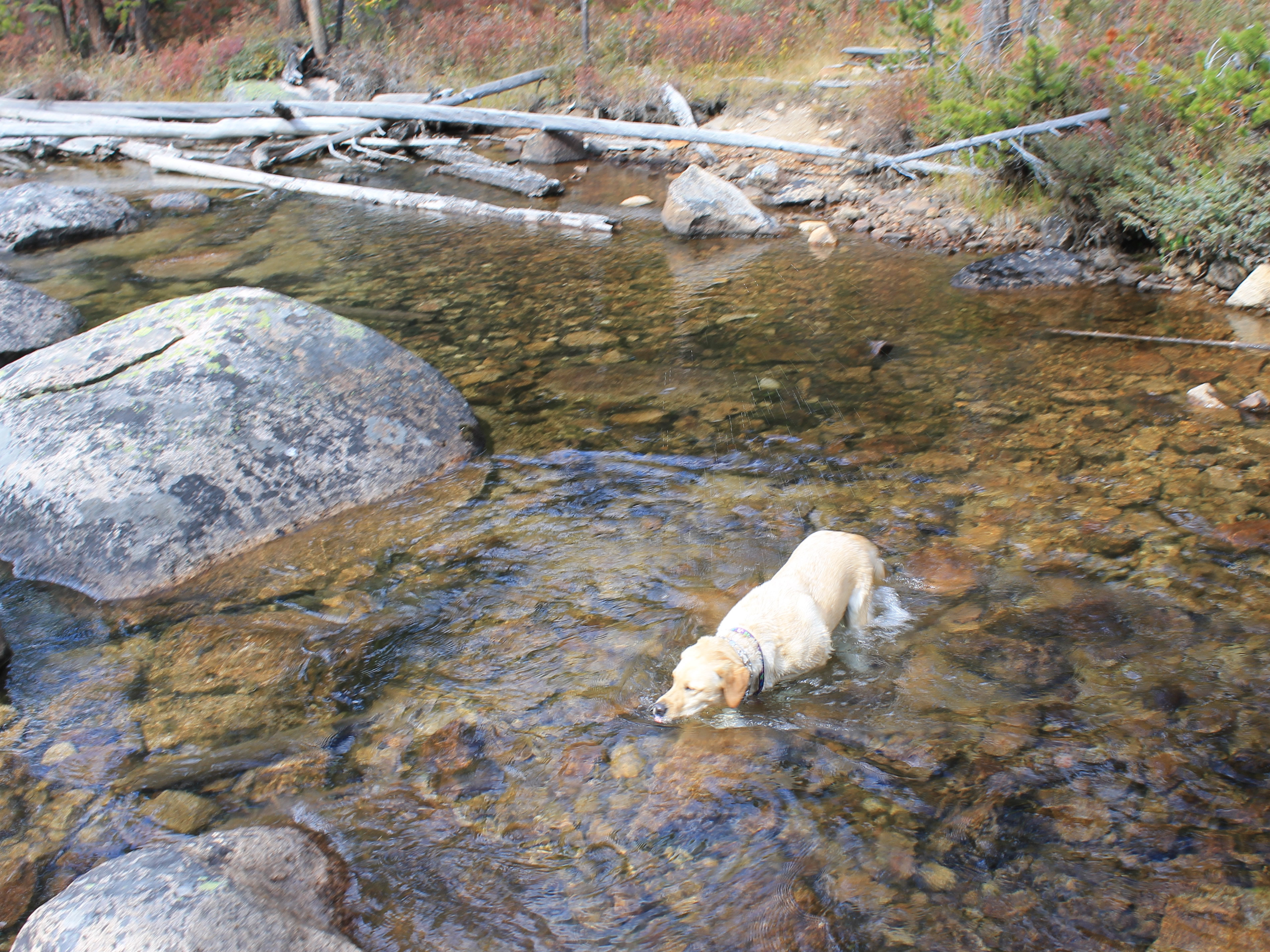
 ...and in Hell Roaring Creek
The hike that I picked out is one that I have wanted to do for a while - Hell Roaring Lake. Back in the 1980's when I was climbing in the Sawtooths a lot, I used to hike in to Hell Roaring Lake because it's upper trailhead was higher and closer to the high country than most other Sawtooth trailheads. It was accessed by a low-grade dirt road that was always a challenge to drive. But someone noticed that due to a survey error, the road actually extended quite a way into the Sawtooth Wilderness, which made it illegal, so five years ago the Forest Service closed the road. They planned to improve the trail that started at the Lower Trailhead, which requirs a longer hike and more elevation gain to reach Hell Roaring Lake, and to move the Upper Trailhead and narrow part of the access road to just a trail. Since then I had read various things on the web but none of them were really clear about what the Forest Service had actually completed. I wanted to go and do the hike and see for myself what the situation was.
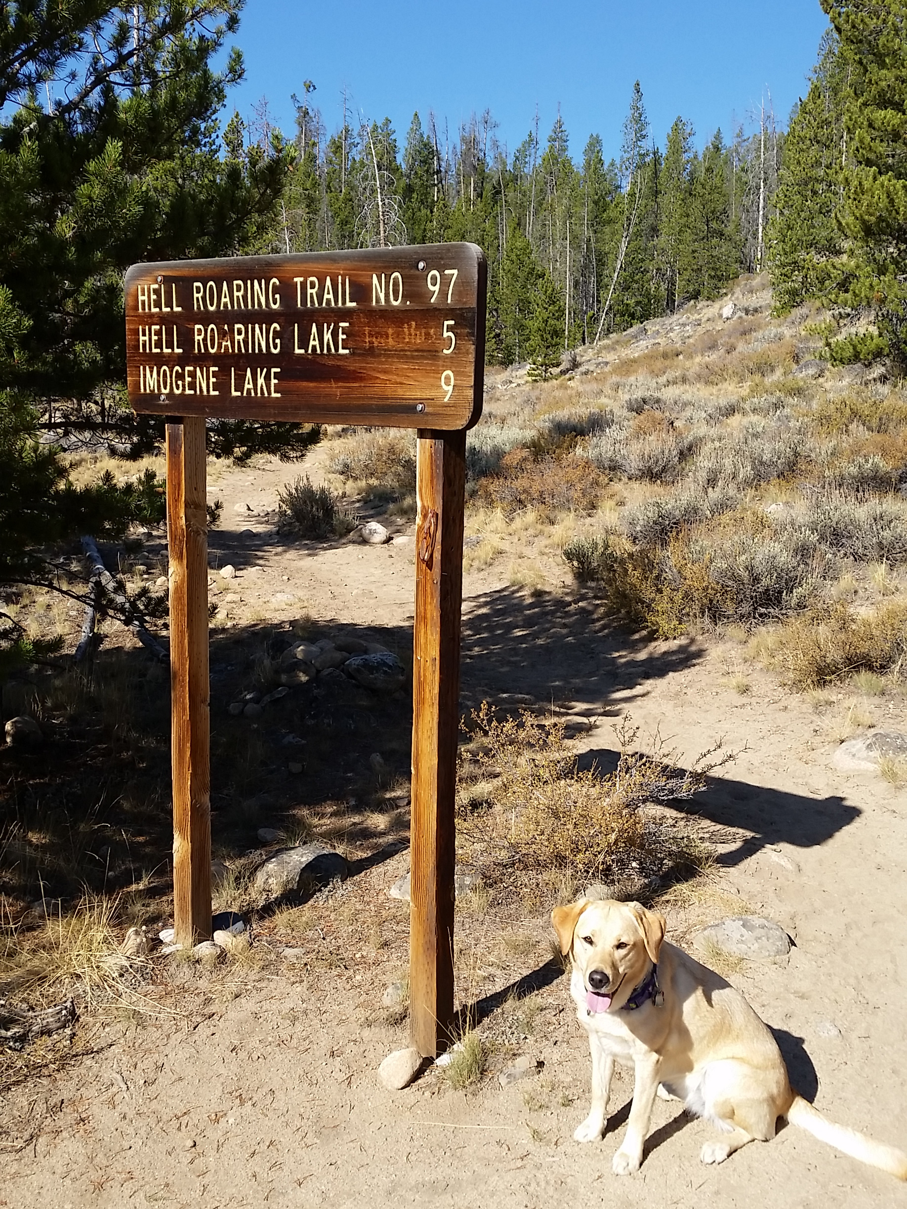
 The strange three-and-a-half-miles-from-the-road trailhead
First I had to find the trailhead. I drove south on Highway 75 through the Stanley Valley and turned onto a dirt road at Decker Flats. After crossing the Salmon River there was a large parking area. I think it was for people with horses to park their trailers and unload. I expected to find the Lower Trailhead here but saw no signs of it. From the parking area a dirt road continued to the north while Forest Road FS310 continued to the south and west. At first I didn't know which way to go until I noticed that below the main sign for FS310 another small sign had been added that read "Hell Roaring Trailhead 1/4". That sounded like what I was looking for. I drove along FS310 slowly and spotted where the trail left the road. There was an inconspicuous trail sign, more for hikers than someone driving by, that gave mileages to Hell Roaring and Imogene Lakes. It would have been very easy to miss. About a hundred feet past that was a small parking area that might hold three cars. Fortunately there was only one other car there so I had room to park. Then it was time to put on my boots, grab my pack, and hit the trail with Abby.
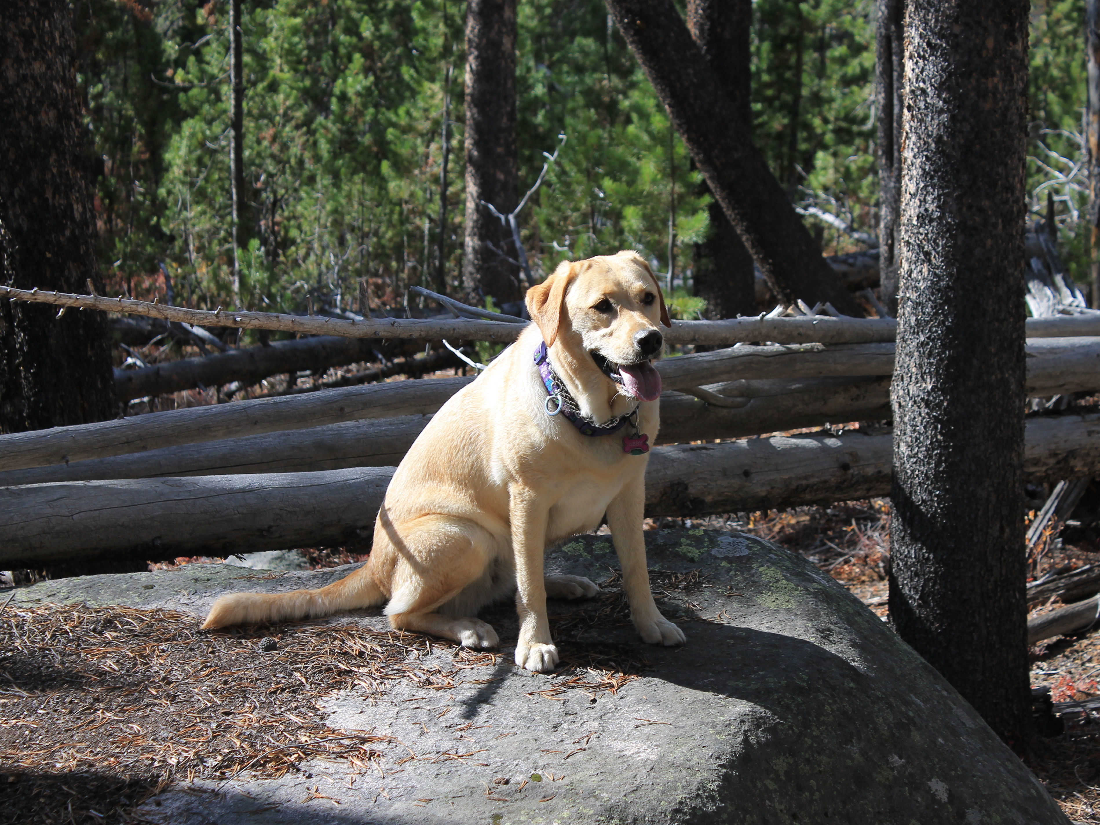 Abby takes a break on the hike in
The hike to Hell Roaring Lake is easy. It's five miles but only about 600 feet of elevation gain to the lake. It starts with a short climb onto a moraine and then follows Hell Roaring Creek for much of the way. It was pretty hiking beside the river and Abby definitely enjoyed it. She seemed to be in the water every few minutes.
It was late in the season so Abby and I pretty much had the mountains to ourselves. We only met one other party on the way to the lake, a couple hiking with their dog. They were off the trail a bit taking a break. The two dogs raced towards each other to play. There was a small pond between our two groups and the other people yelled for their dog to stop. Surprisingly, he did. Not Abby. She plowed right through the water. Then each species did it's thing. The dogs sniffed each other for a few minutes while I chatted with the two people. Then Abby and I continued on.
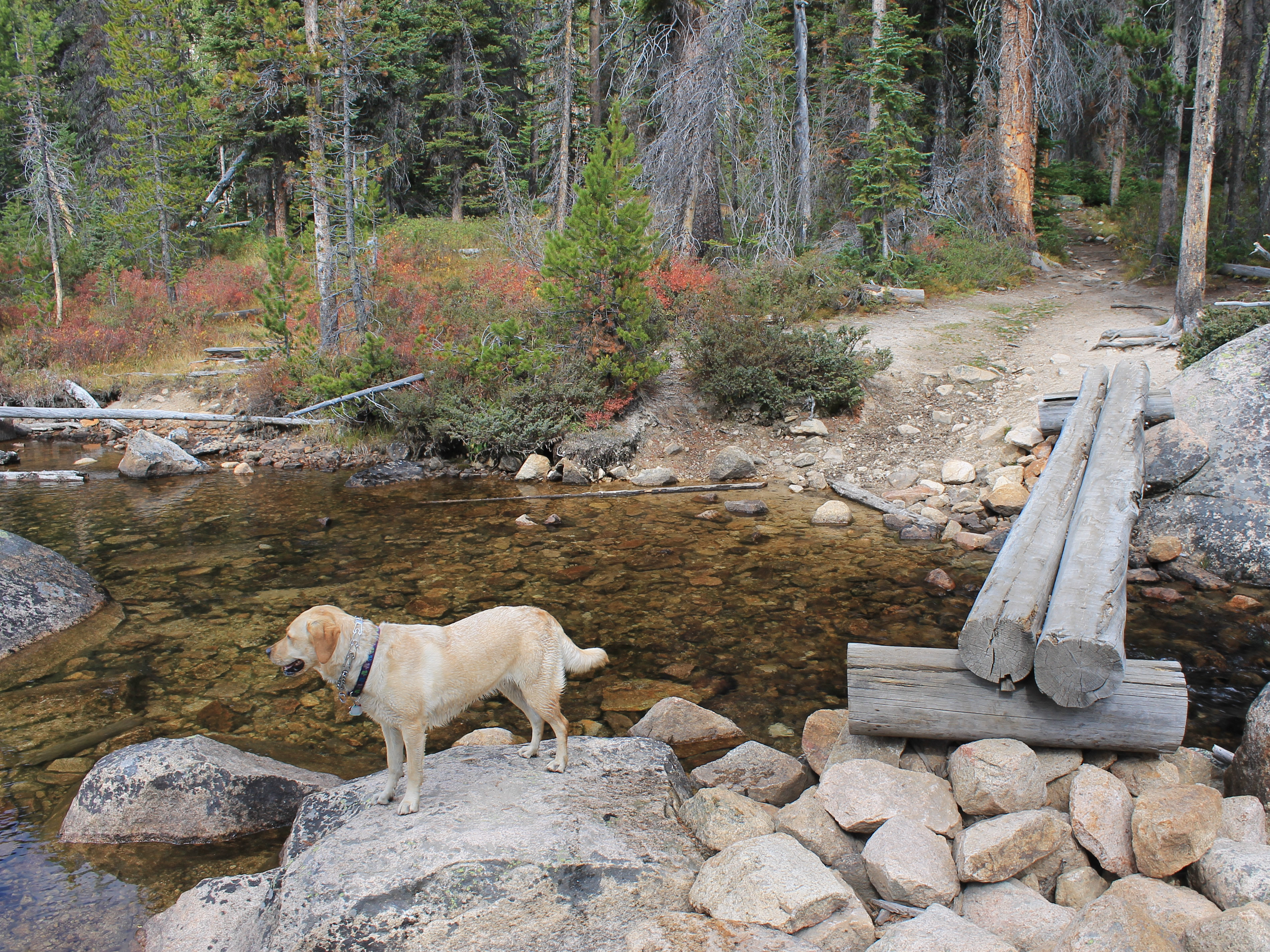 Crossing the outlet stream for Hell Roaring Lake
Just past the boundary for the Sawtooth Wilderness, about three miles from the start of the hike, there was a large display for the "Hell Roaring Lake Trailhead". That was downright weird. I've never seen a "trailhead" that's three miles from where the trail starts! All the other trailheads in the Sawtooths are signed at the parking area, not the wilderness boundary. It wasn't because of the trail from the Upper Trailhead joining at that point either. We reached that junction another mile further on. It didn't make any sense to me.
After the trail junction it was just one more easy, level mile to the lake. Just before the lake was another junction with a trail that goes north to the Redfish Lake Inlet Campground. I've never hiked that trail. It doesn't seem very interesting. It mostly goes through woods below the high peaks and doesn't have any interesting lakes or viewpoints. So we continuted the short distance to Hell Roaring Lake.
 Abby takes the most direct route across
Just as it reached the lake, the trail crossed the outlet stream. On the other side was a clear area that offered the best view while the trail continued along the south side of the lake before climbing to Imogene Lake and points beyond. There was a bridge, if you call two logs a bridge. It was pretty high above the water so I crossed carefully and watched to see what Abby would do. She didn't even hesitate. She went right through the stream. She is a lab after all.
I found a rock big enough for the two of us where Abby and I could sit together and share a candy bar. It was the only food that I had brought along. By now some clouds had formed so I didn't have bright blue skies or good light on the mountains for pictures, but it was still good to be back at a mountain lake that I had visited many times years ago. I had a great view of the Finger of Fate, an impressive rock tower which dominates the skyline beyond the lake.
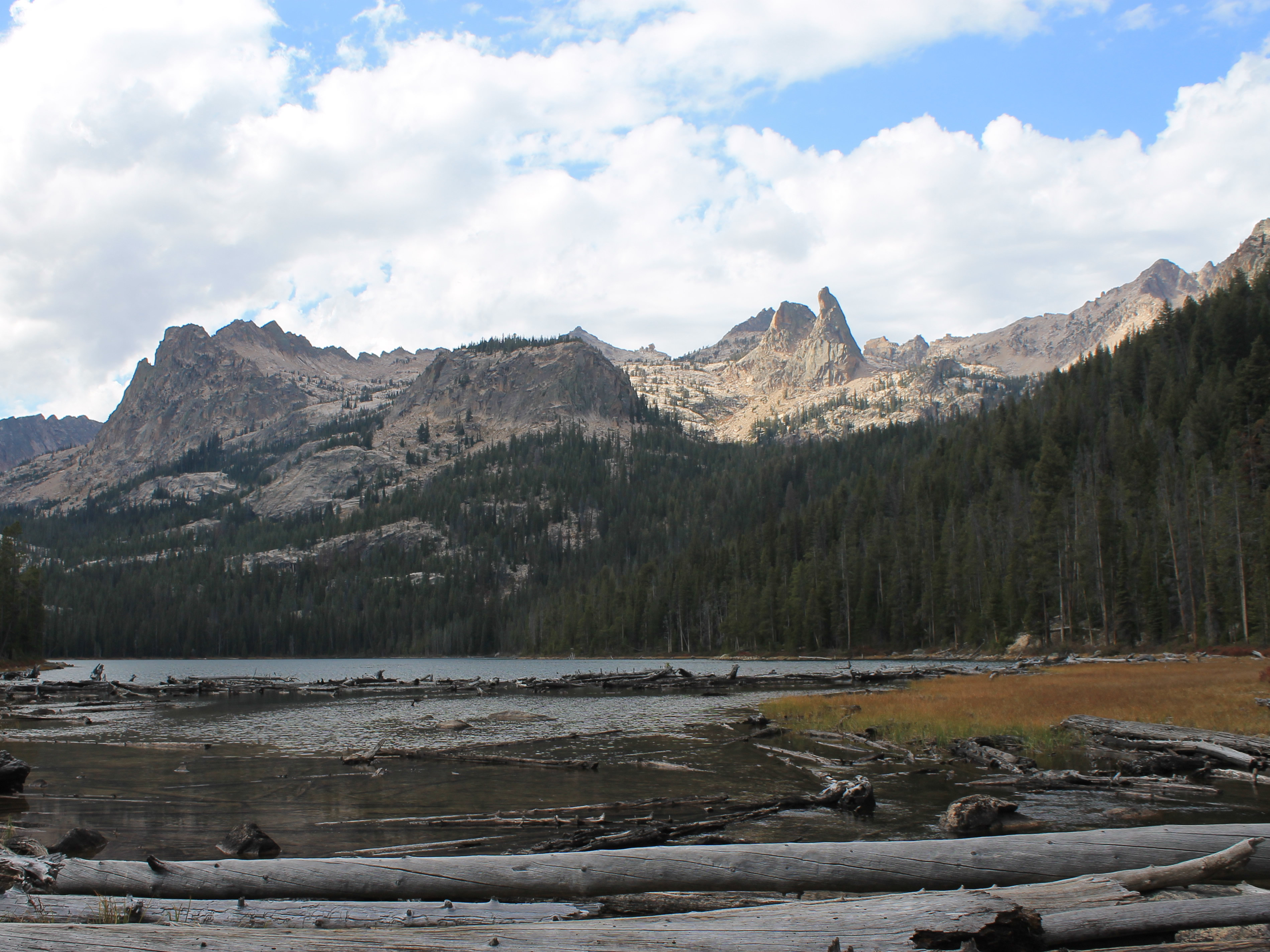 Hell Roaring Lake and the Finger of Fate
The Finger looks like it would be impossible to climb, but an old climbing magazine that I bought when I first moved to Idaho said that there was a "surprisingly easy fourth class route to the summit". Back in the 1980's my climbing partner Brian and I had hiked cross-country up above Hell Roaring Lake several times to approach the Finger, looking for that easy route. We never found it because it doesn't exist. Checking the web now it turns out the easiest route, Open Book, is Grade III, 5.8 or 5.9. But it was a lot of fun exploring. There were no guidebooks for the Sawtooths so we would just study the USGS topo maps and then head for the mountains. Once we backpacked and camped at Clarice Lake, a beautiful, off-trail lake that is just below the north face of the Finger. When we couldn't climb the Finger, we climbed Decker Peak instead, a fun scramble and an impressive mountain that is the third highest in the Sawtooths.
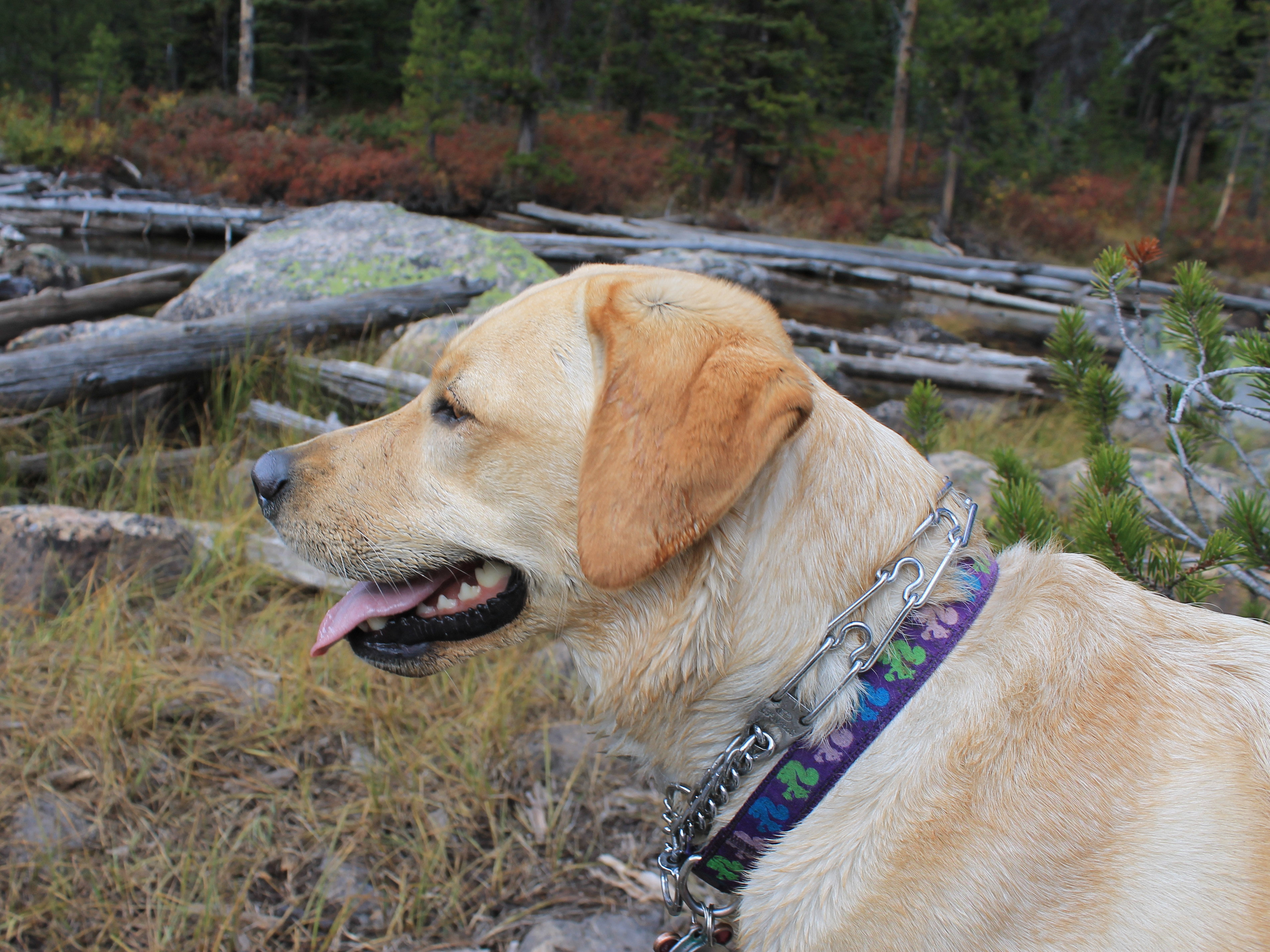 Abby admires the view at Hell Roaring Lake
On the hike back I decided to return via the Upper Trailhead. I wanted to see how rough the access road was so that I knew if it was an option on future trips to save two miles of walking on the way to Hell Roaring or Imogene Lake.
The Upper Trailhead had been moved back so it was no longer in the Sawtooth Wilderness. It used to be only a few hundred yards from the junction with the path from the Lower Trailhead. Now it was well over a mile. On the way out we passed three guys with backpacks heading in. They were only the second party we saw all day. Their pickup truck was parked at the Upper Trailhead so obviously it was possible to drive in. Walking out on the road was a little longer than the hike in but was easy enough. The road did look very rough but I think I could probably get in with my Ford Escape. I'm not sure it would be worth it to save the two miles of walking though.
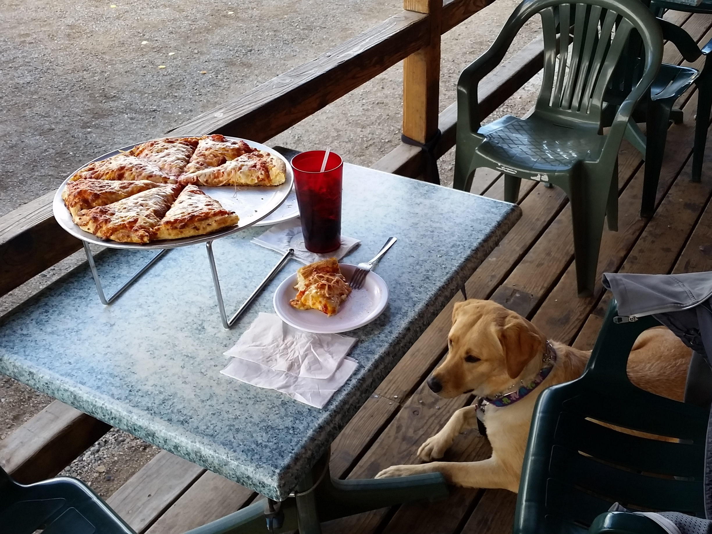 Abby and I share a post-hike pizza at Papa Brunee's
After we got back to the car I made three stops before driving back to Boise. First I went to Redfish Lake Lodge. Since the lodge was closing the next weekend all of their stuff was 40% off. I got a tshirt for myself and one for Mickey. Next I stopped at Riverwear in Stanley and got another tshirt, since I figured it would be the last time I would be up there this year. Then it was time for our traditional stop at Papa Brunee's for dinner. I ordered a pizza and garlic cheese bread for Abby and I to share. After a hard day of hiking it tasted really good. With a full tummy, Abby slept all the way home in the car.
It had been a beautiful fall day and a good hike. It was tough to get up and hit the road right after getting home but I was glad that I did it. Abby had a blast too although she might have regretted it later. The next morning she had a bad limp and could barely move for the entire day. She must have overdone it and been really sore. She was fine again two or three days later though so all was well.
