Nepal Pt12: Hiking Downhill
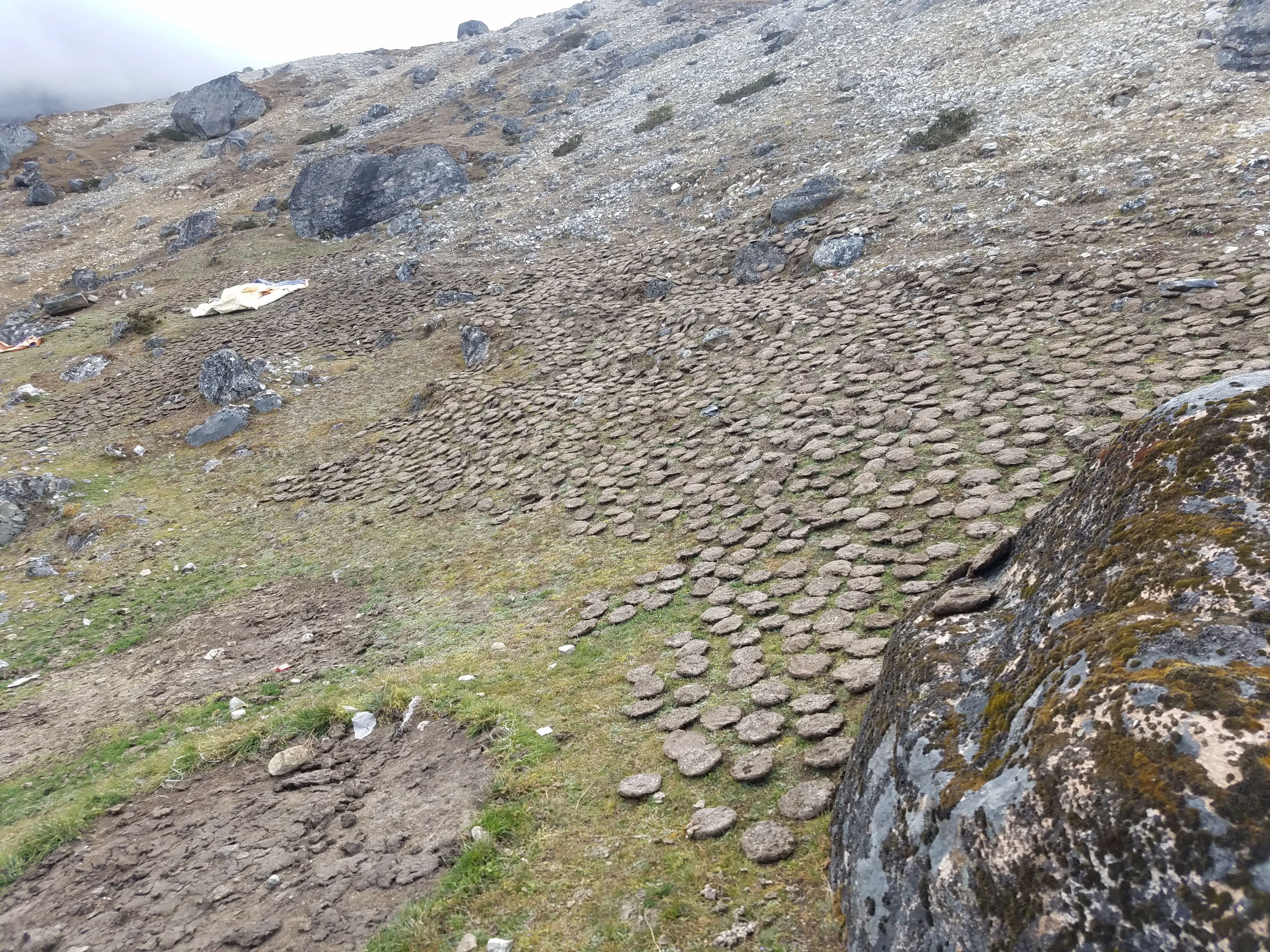 Drying yak dung for fuel
After crossing the Cho La pass, we spent the night in Dzongla. Before that we had crossed the Renjo La. The final part of the Three Passes Trek would be the Kongma La but unfortunately we had run out of time. We had to get to Lukla in three days to catch our flight back to Kathmandu and we would need three full days of walking to get there. We wouldn't have time to do the last pass but hey, two out of three ain't bad.
We wouldn't have time for the side trip up to Everest Base Camp or Kala Pattar either. I didn't care much about EBC. People make a big deal of going there but from what I have read it is so close to the mountain that you really can't see anything. Yes, that is where climbing expeditions camp when they attempt the mountain but that just means that it's an overcrowded tent city. Discarded equipment and trash are such a problem that every few years expeditions are organized just to fo and clean up the mountain. So no, I didn't care that I would miss Base Camp.
 Another wonderful morning to hike
Kala Pattar is another matter. It's a high point on the ridge leading to Pumori, a beautiful peak near Everest. It's a famous viewpoint. The classic view of the southwest face of Everest which is in so many photos is taken from Kala Pattar. I did make it up Kala Pattar on my first trip to Nepal so I have been there. But it is such a fantastic place that I would have liked to go again. This time I would be armed with digital cameras to get lots of great pictures too. I needed to make a decision between Kala Pattar and Gokyo Ri when we were delayed by weather at the beginning of the trek. I picked Gokyo Ri and was ok with that.
Because of our early start when we crossed the Cho La we arrived in Dzongla not long after noon. After the hard hike I was hungry for a change and ordered spaghetti for lunch. A lot of teahouses, this one included, listed it on the menu as spaghetti with tomato sauce and cheese. After the experience I had with eating cheese on the second night of the trek I had learned my lesson. I always made a point of ordering it without cheese.
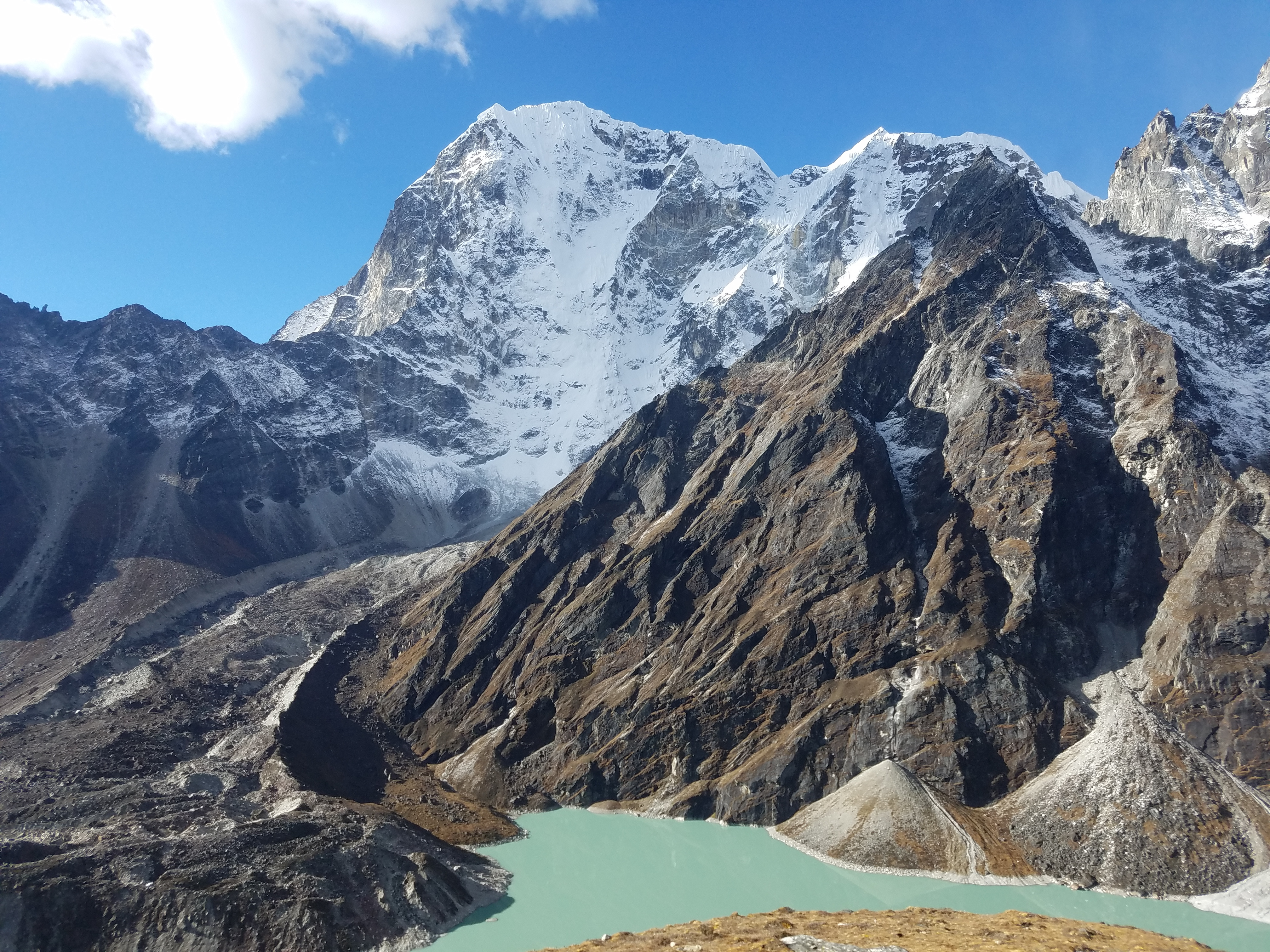
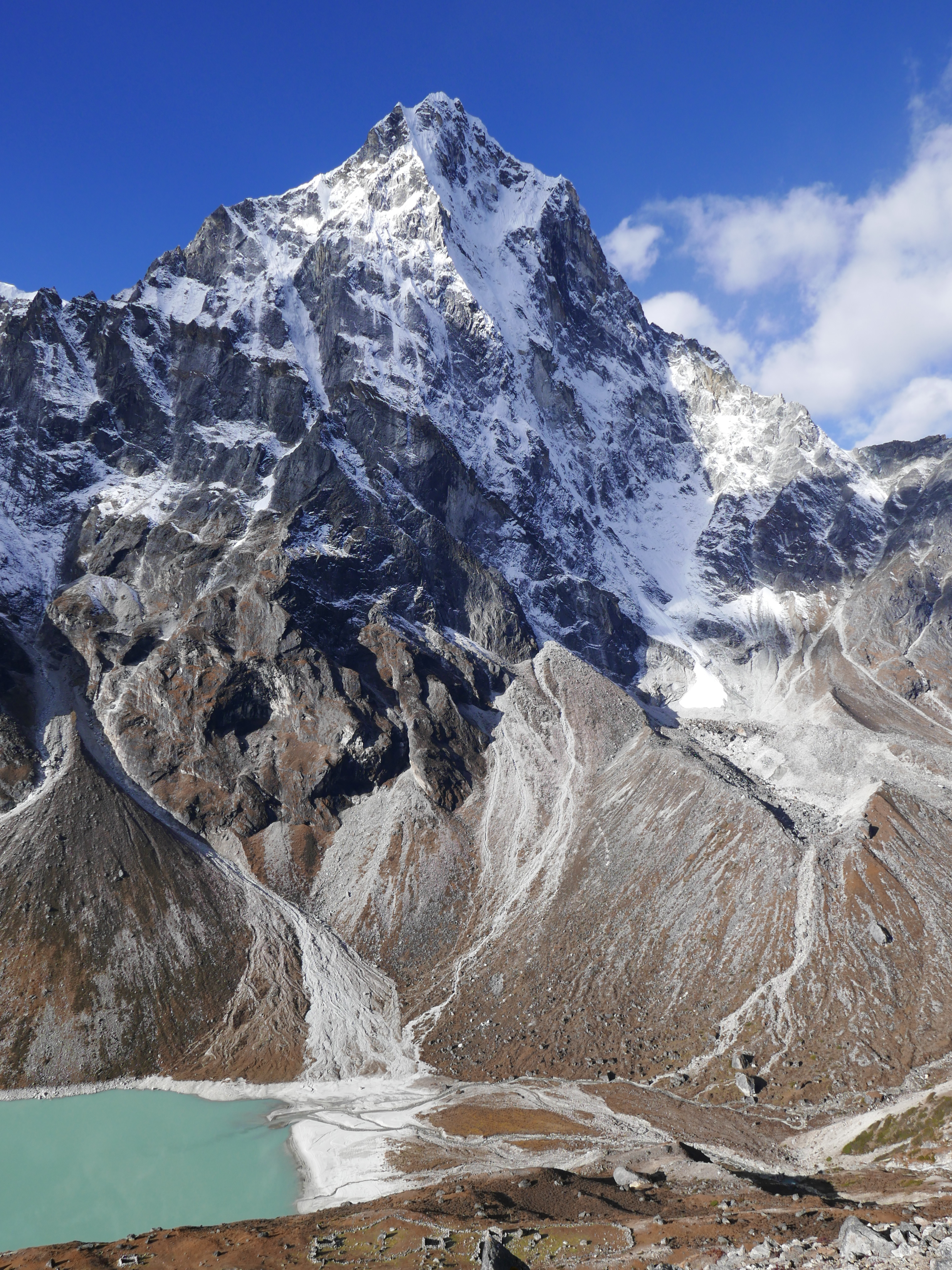 Cholatse towers over Chola Lake
Unfortunately when my lunch came it was covered with cheese. Since I gave my order to Shambu who translated it for the innkeeper, it could have been any one of us who made the mistake. It didn't matter. I really didn't want to take a chance and eat it so I sent it back. In a country as poor as Nepal, where a lot of people don't have enough to eat, I felt terrible about it.
At Dzongla we were at 15,846 feet. That's pretty darn high for a sleepover. In fact it was the highest place we stayed overnight. This would be the last night that we would be up so high. Starting tomorrow we would be heading down from the high country and would get successively lower each day.
For being so high and so remote our lodge, the Maison Sherpa, wasn't bad. My sleeping room was ok. As usual I was by myself in a double room so that meant that I had double blankets and would be plenty warm at night. There were two toilets, one western-style and one not. They were shared by the whole building but at least they weren't as bad as the night before.
There was no shower. I had a chance to get one the night before in Dragnag. They had a shower there and several of the other trekkers had taken advantage of it and said it was great. But it was what's called a bucket shower. They heated up water and dumped it in an overhead tank. It would probably be fine but I was paranoid about running out of hot water. In cold weather at high altitude, finishing a shower with ice cold water would not be a pleasant experience.
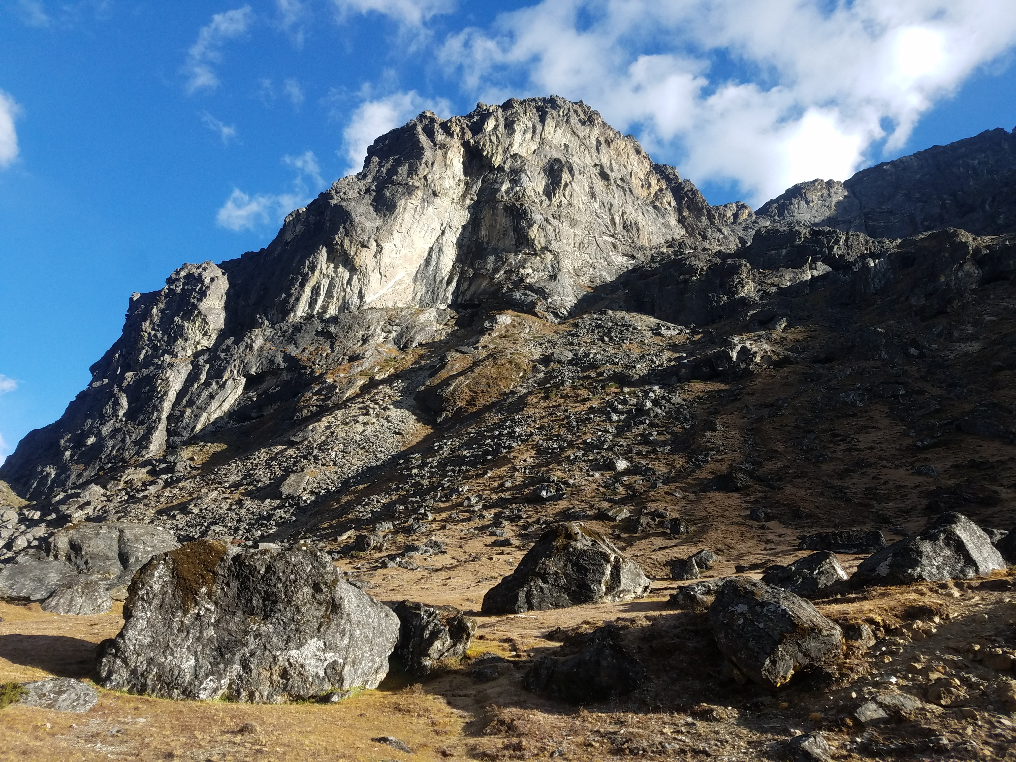 A nameless hump that's a major mountain anywhere but Nepal
At some of the places we stayed lower down I had used the shower. They all had a gas heater for the water that worked really well. In the early part of the trek, when we had been a lot lower, the weather was warmer so I needed a shower more often. At high altitude, where it's cold and you are bundled up, you don't need to bathe quite as often, which is good because it's difficult and you aren't so inclined. When you are hiking your feet are usually the worst odor problem so in Dragnag I settled for a foot bath. Even doing that, outside in a cold running stream behind the lodge, took some courage.
Here in Dzongla I didn't have a choice since there was no shower. I went outside and did another foot bath. There was a hose beside the building that carried water down from a spring on the hillside above the lodge. Let's just say that it was very refreshing. That and a change of underwear were going to have to be enough for tonight. I was hoping that tomorrow I could get a real shower when we stayed someplace at lower altitude.
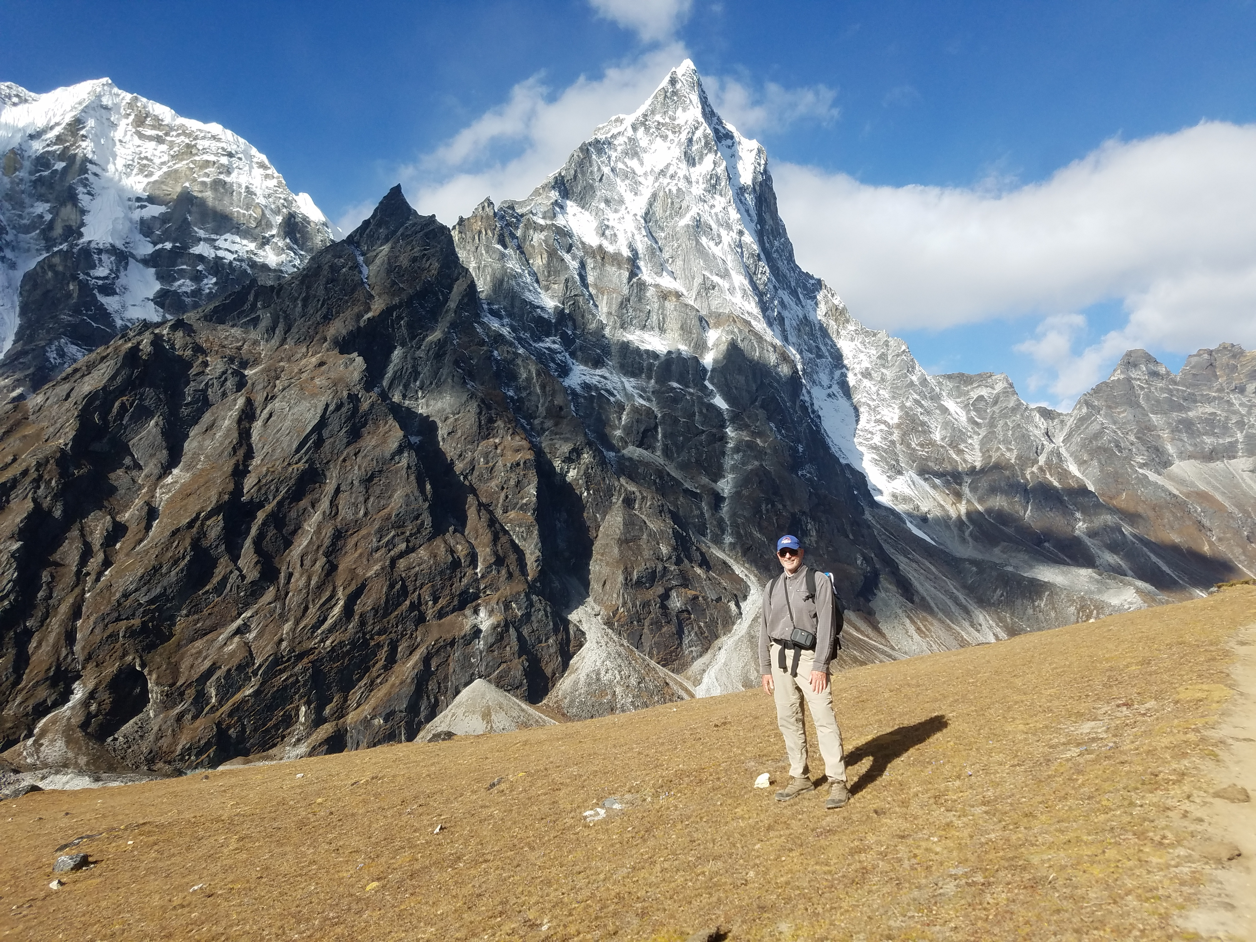
 Tabuche towers above Chola Lake
I spent the evening in the dining room again. There was a fire in the iron stove and a lot of people in the room so it was warm. To keep the fire going they kept feeding it fuel. Up this high we were far above timberline. To get wood you would have to walk for days. Instead they used an alternative fuel - dried yak dung. It's standard practice for Sherpas in the high country. There was a big stack of dried dung just inside the front door of our teahouse. Outside there was a whole field dedicated to drying out yak turds.
Although it sounds kind of gross it was actually a pretty good fuel. Surprisingly I didn't think it smelled at all. My dog Abby would probably say I can hardly smell anything but my nose isn't bad for a human. I never noticed any unpleasant scent from the fire. It didn't seem to leave a lot of ash either. The Sherpa people have been using yak dung as a fuel for ages and all of the high lodges that we stayed at burned it in their stoves. I never did want to ask them about their cooking fires though.
 Cholatse is spectacular from any angle
My new friend Tom was staying at the same teahouse again tonight. When Shambu and I turned to go down tomorrow Tom would head up on the trail to Everest Base Camp. We resolved to keep in touch via email but so far I haven't done a good job. Sounds like the basis for a New Year's resolution.
The teahouses where we stayed were family operations. It was very common for young children to be playing in the dining room while mom or dad or gramma would be working there. The kids I met in Nepal were usually really cute and well behaved. You can tell I enjoyed meeting them by the number of pictures of kids that I took on the trek. This place was an exception. The kid here was a brat. After dinner I couldn't take the little monster any longer and went to bed early and read.
I didn't sleep very well that night. Even though I had acclimatized and was much stronger when I was hiking, I was still having trouble sleeping. That wasn't surprising. It's common to have problems sleeping at high altitude even if you are acclimatized and we were certainly high. I figured I would sleep a lot better tomorrow night when we were down lower.
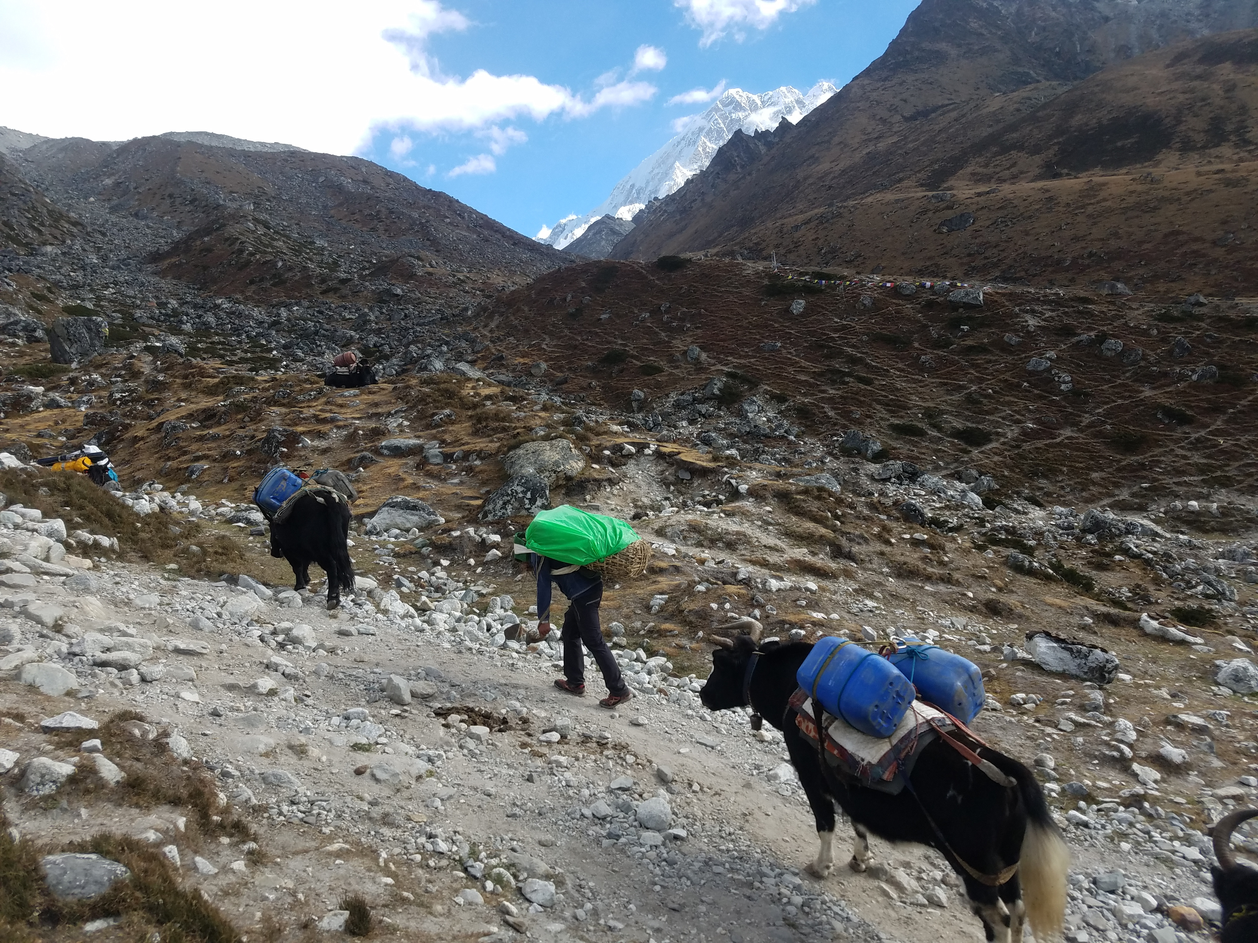 Loads of supplies bound on their way to Dzongla
Overnight the clouds dissipated and the next morning was perfectly clear. Just south of Dzongla, the dawn light was shining on the impressive north face of Cholatse. I was outside before breakfast and spent a lot of time admiring the fantastic view and taking pictures (which I'm sure you remember from my last post.)
Probably not as much time as I spent trying to figure out the name of the mountain. I had been to Dzongla on my first trip to Nepal in 1990 and remembered the peak as Cholatse. When I got home and started working on blog posts about this trip, I checked the trekking map that I had picked up in Kathmandu. I was surprised to see the peak labeled as Arakam Tse, a name I had not heard before. According to the map, Cholatse was further south and behind the mountain that I could see from Dzongla. Tobuche, another famous mountain and very beautiful mountain, is also nearby.
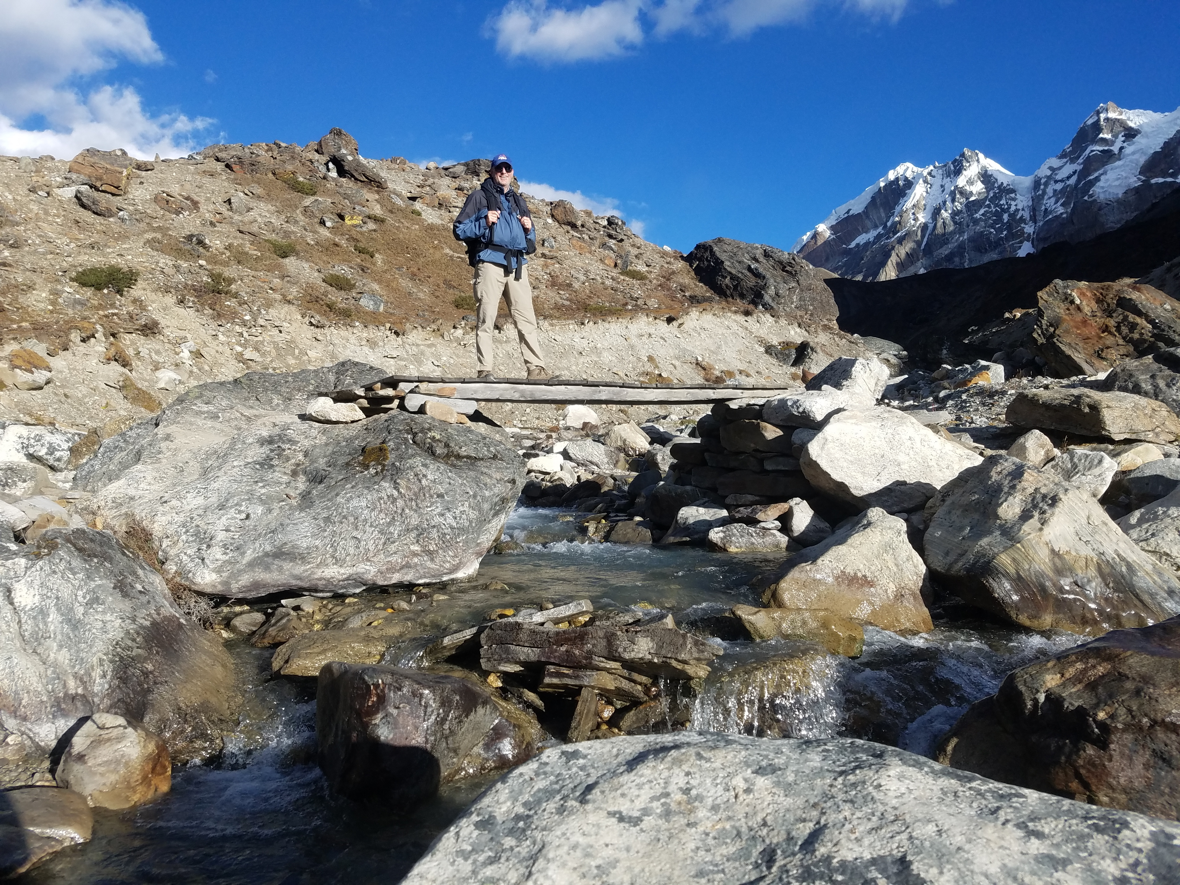
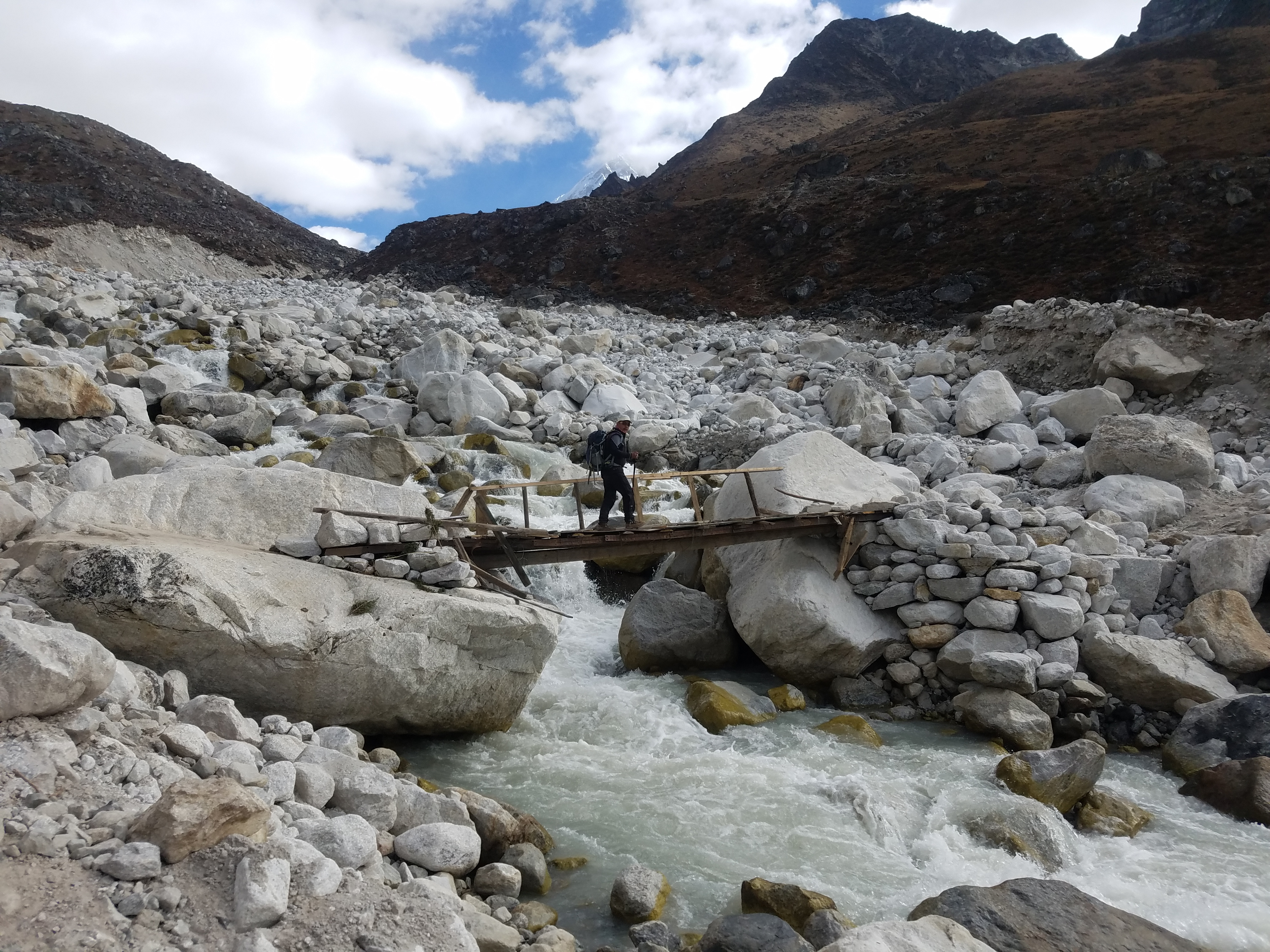 Shambu crosses a shaky bridge - I let him go first
I spent a lot of time using Google. I found a lot of photos, articles and blog posts by climbers and trekkers who had visited the region. I saw views of the mountain from Gokyo Ri, from Dzongla and from the trail down to Pheriche. Different people identified the same mountains with different names. It was very confusing and it wasn't clear what the definitive source was.
After a lot of research (seriously, I spent way too much time on this) here is what I concluded. The trekking map is just wrong. What it labels as Arakam Tse is really Cholatse and what it labels as Cholatse is just a subpeak of Tobuche. I found at least one article about climbing on Cholatse that called out the exact same error. Google maps agrees too. One thing that made it really confusing is that the map shows three peaks while all the pictures I found show only two peaks. I kept thinking that one of them was hidden in each photo so I kept trying to figure out angles that would cause that. But it was just wrong - there is no third peak.
 A little too regimented for me
Whatever the name of the mountain was, it was a spectacular sight on such a beautiful morning. A rose by any other name. Or as Richard Feynman pointed out, the name of a thing is not really important.
If you are into names, in Tibetan "Cho" means lake. "La" means pass. "Tse" means peak. So the Cho La pass is literally "Lake Pass". The lake in the valley below, Chola Lake, is "Pass Lake". Cholatse is Pass Lake Peak. I guess the big question is whether the mountain is named after Lake Pass or Pass Lake.
The Sherpa people may be tough but no one ever said they were very creative with names.
I said goodbye to Tom when he left. He was heading up to Lobuche and Everest Base Camp. We were going down to Pheriche and ultimately out of the mountains. Even though we were starting to head back there was still a lot of wonderful hiking left. At 6:45 we were ready to rock and roll.
 Nice day for a helicopter ride
We started down the valley. While it was mostly downhill, I'm convinced that there is no trail in Nepal that doesn't have a lot of ups and downs. It's the only place where the old joke about "it was uphill both ways" actually seems to hold true. There are no easy hiking days. Still it was as close to a perfect day of hiking as you can get.
As we hiked we crossed several side streams that were roaring down from the mountains. Usually we crossed on rickety bridges because every spring the bridges get washed out by floods. The locals don't put too much effort into replacing them since they know they're only temporary. Some of them were actually scarier than the big, high suspension bridges we crossed that spanned the major rivers.
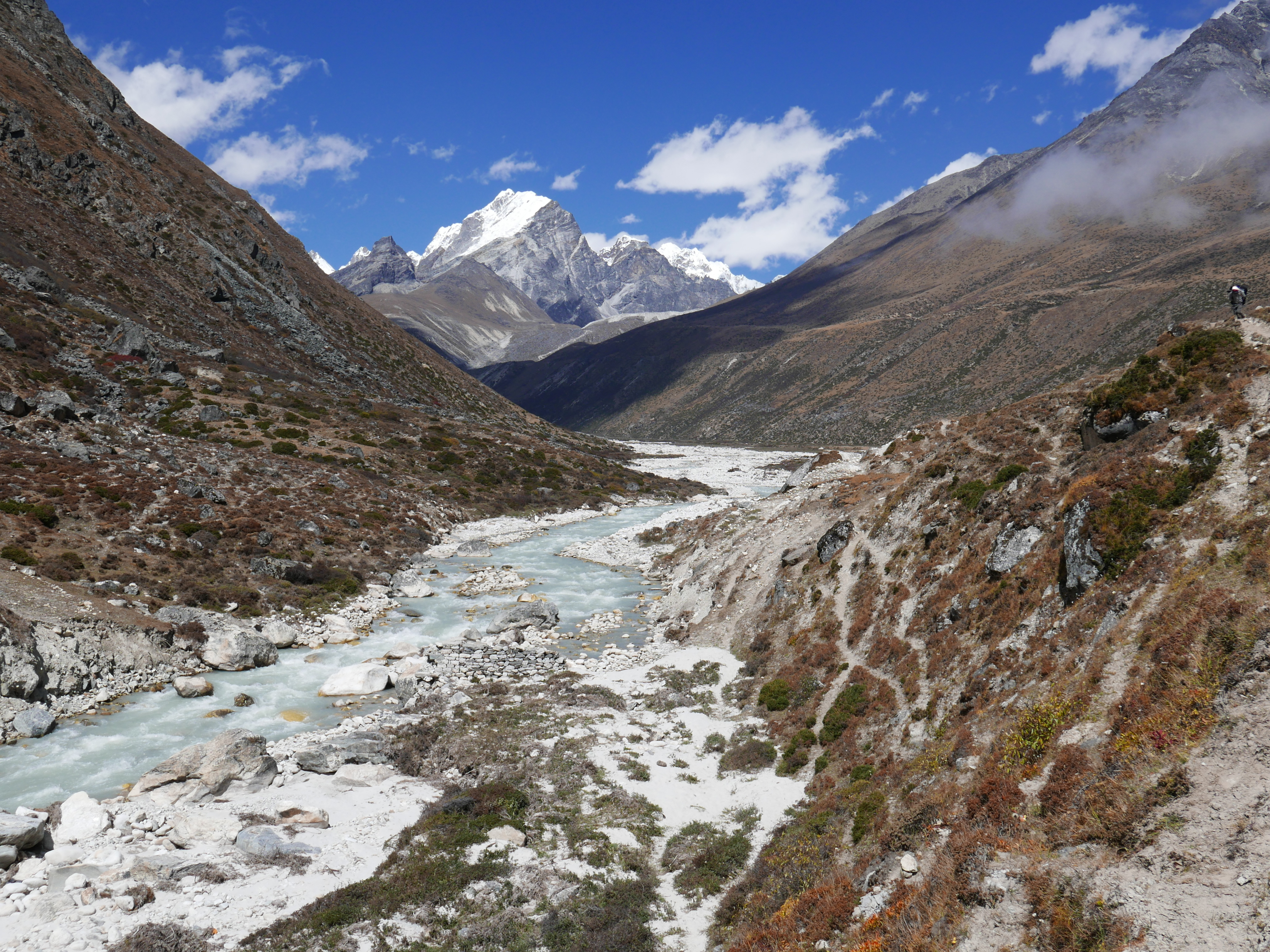
As we walked we circled around Cholatse. As the angle shifted the appearance of the peak constantly changed, but it was very steep and spectacular from every angle. The mountain has no easy side and is a serious and difficult climb by any route. I could see more of Tobuche, an almost equally beautiful mountain, as it emerged from behind Cholatse. Far below us, Chola Lake came into view. It's a glacial lake that is a stunning green color Sitting at the base of the big mountains it made for great photos.
 Lunch stop in Pheiche
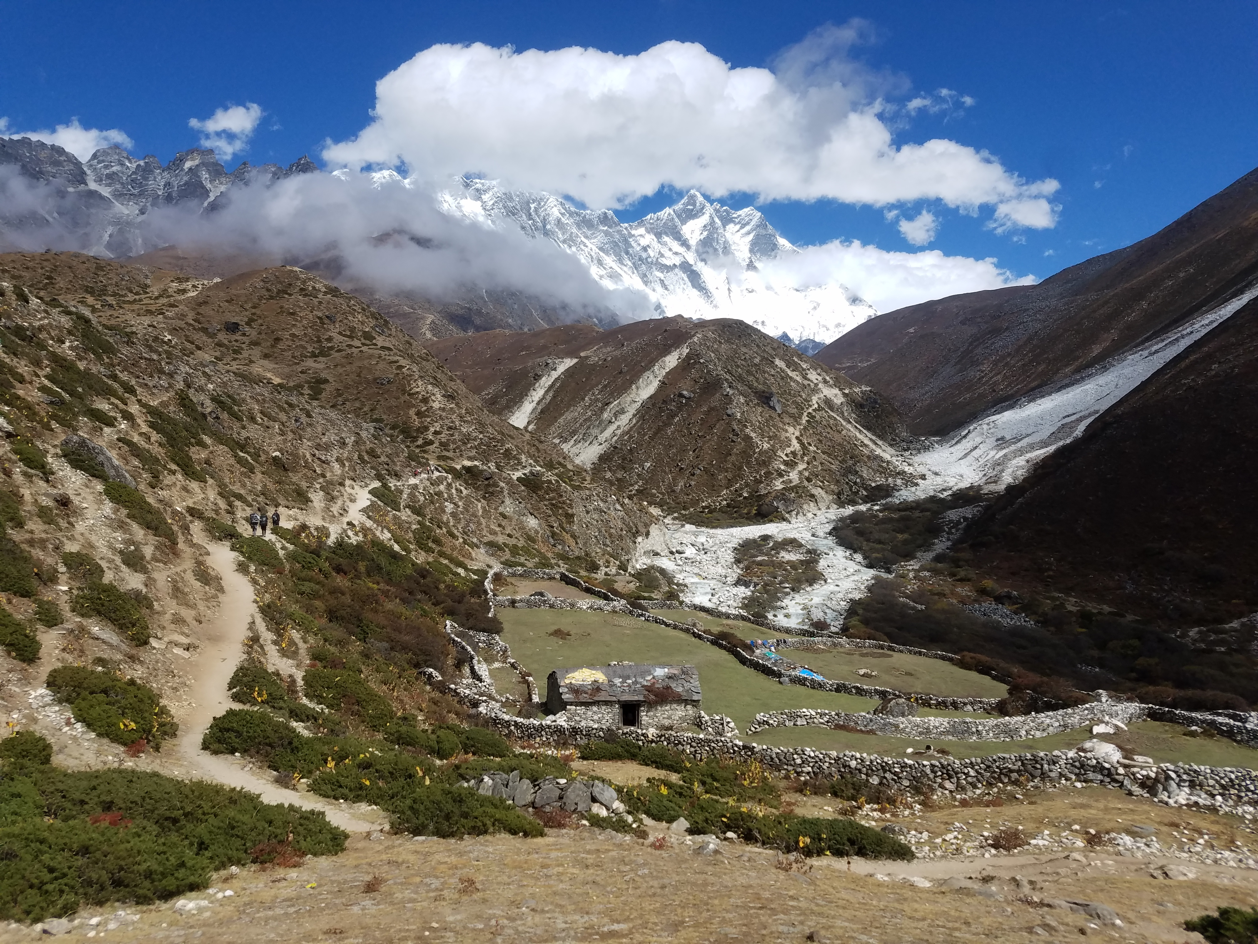
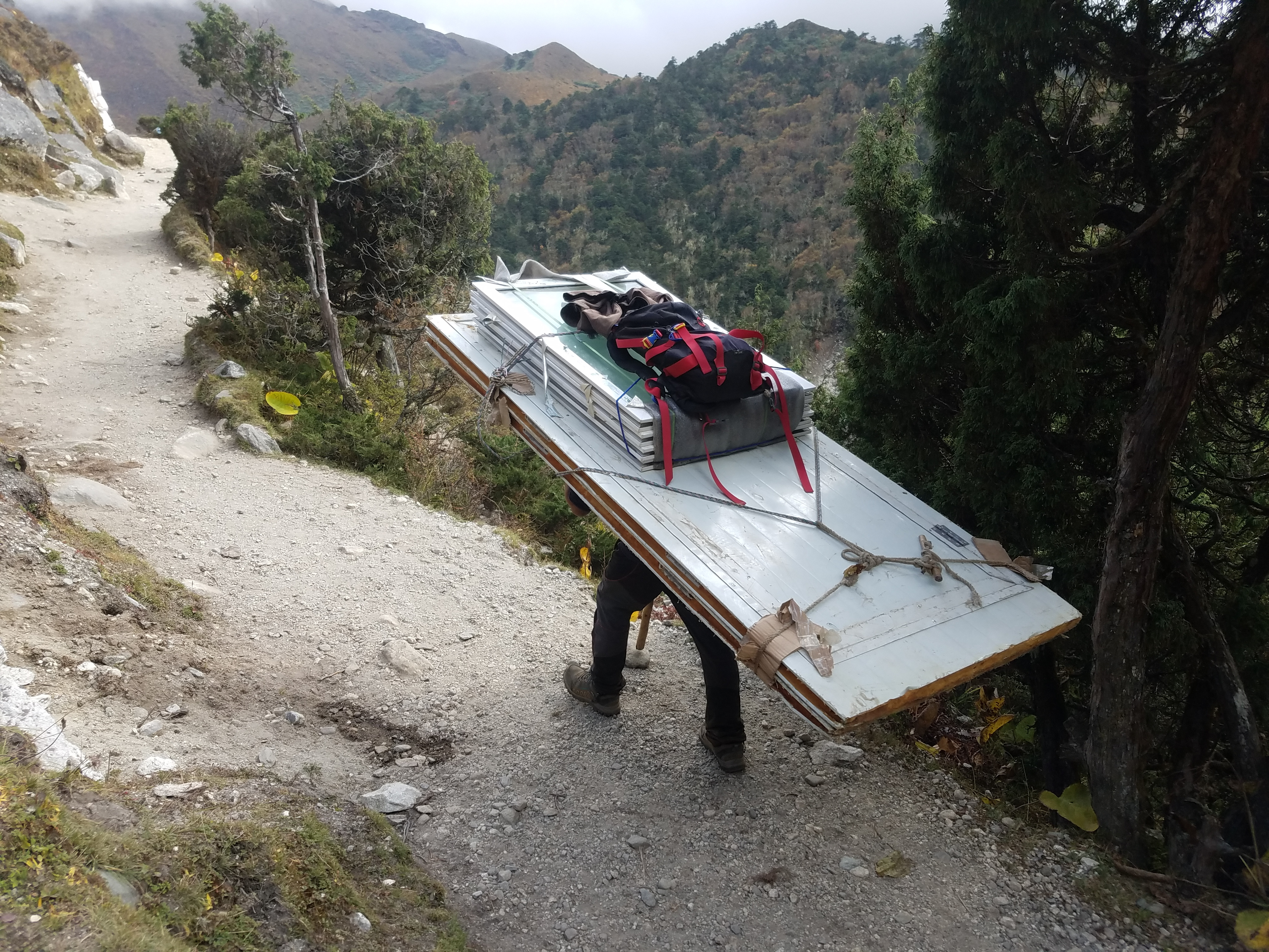
After about two hours we reached a junction where we merged with the trail coming down from Mt. Everest. After that there was quite a bit of traffic on the trail. There were many trekkers heading up to Everest and a few to the Cho La. There were also a lot of supplies going up to the high villages, some carried by yaks and some by human porters. Some of the loads being carried were quite impressive.
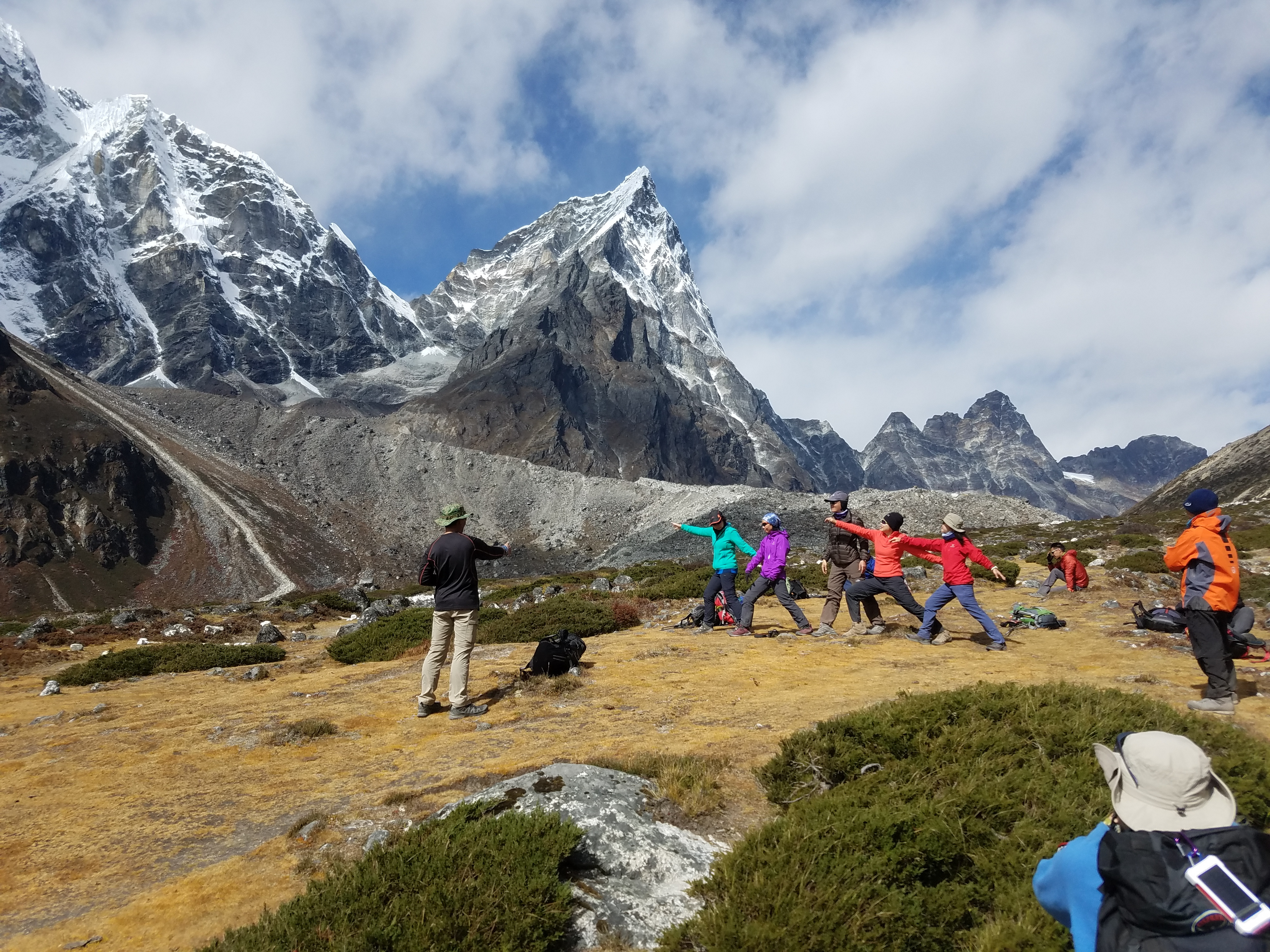
At one point we passed a bunch of trekkers who were doing some kind of group yoga or tai chi session. Personally I thought it was weird. I thought that all the walking I was doing constituted a sufficient health regimen. The group thing seemed way too regimented for me anyway. I was even doing my trekking solo after all. They all looked to be asian, probably Japanese or Korean. I think group exercises like that are kind of a cultural thing. It would have made a good workout video though with the scenic mountain backdrop.
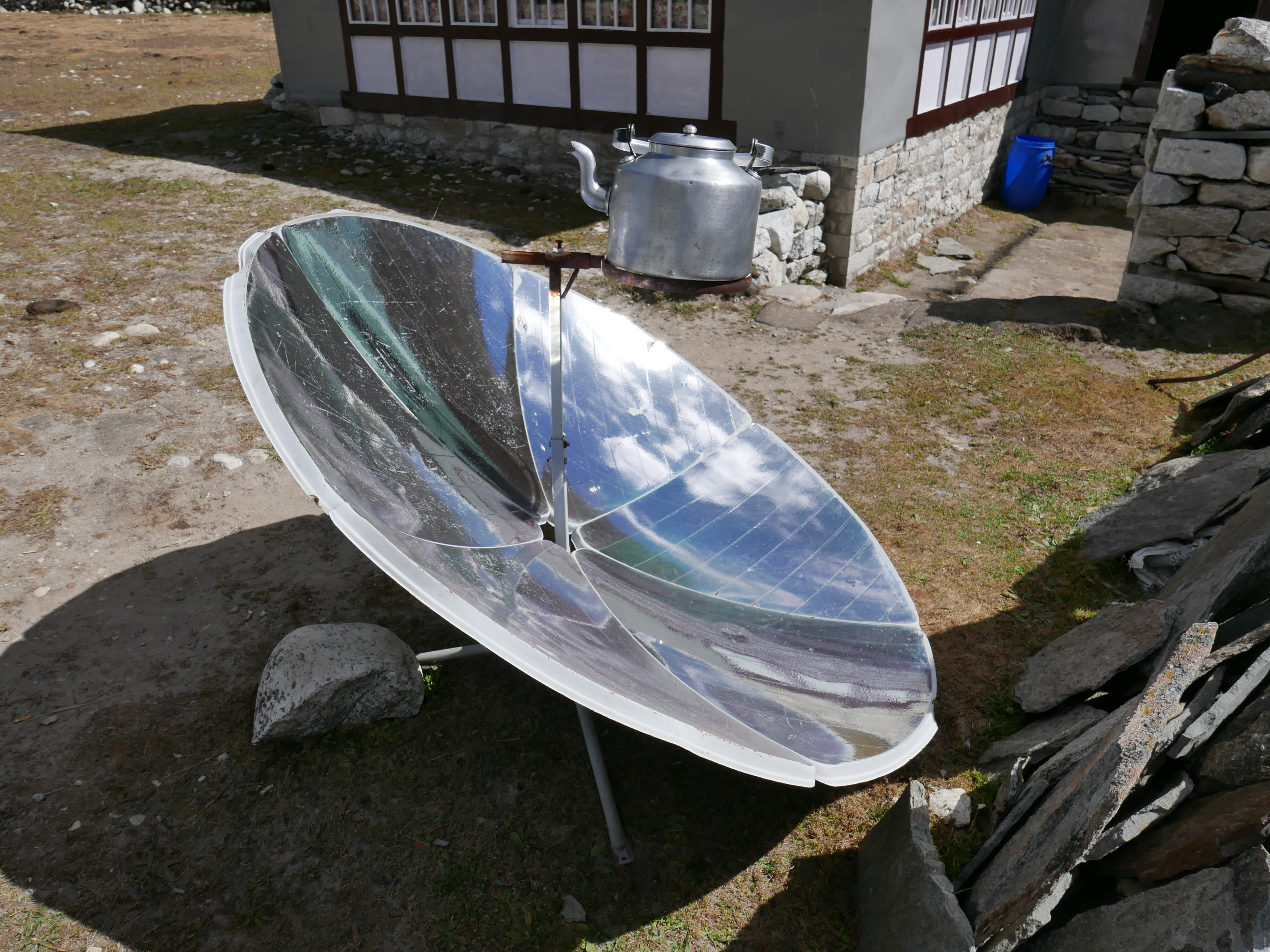 Solar powered tea kettle in Pheriche
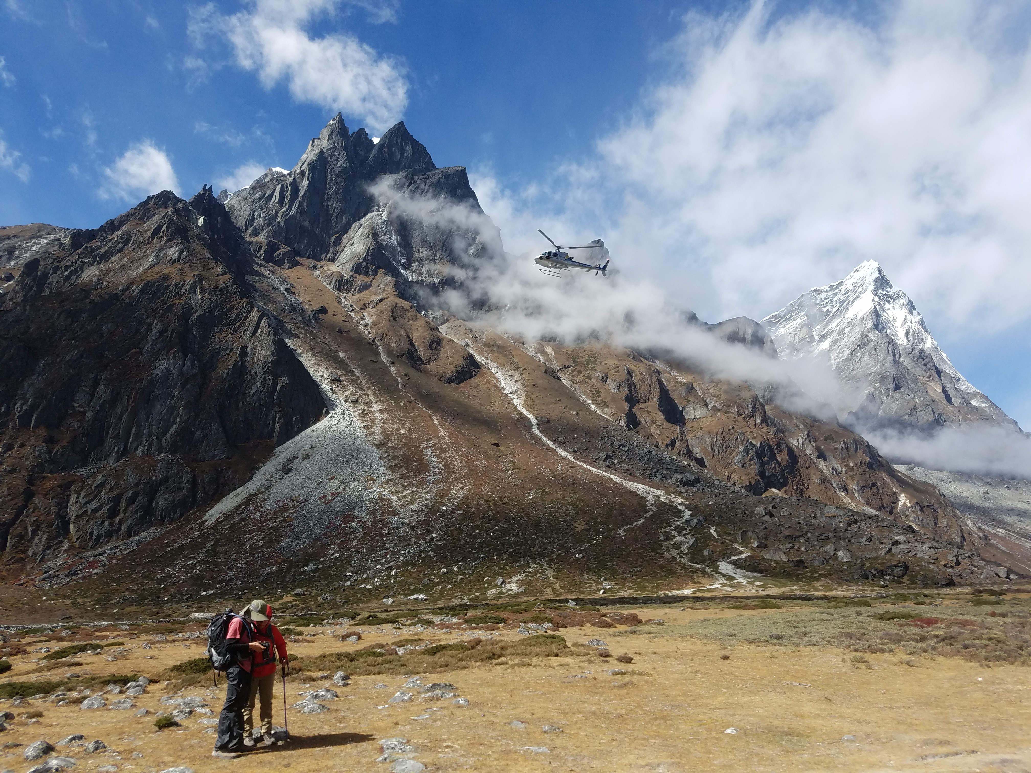
With the nice weather there were helicopters flying up and down the valley. It would have been an awesome day for a scenic flight. It would be awfully expensive though. I figured that they were probably carrying rich folks who didn't want to take the time or effort to walk to Everest.
Shambu said that a lot of the helicopter flights were evacuations. It's common for trekkers to get acute mountain sickness, especially going to Everest. They are traveling on a tight schedule and go very high and they do it quickly, without taking the time to acclimatize properly. Some of them aren't in the best of shape either. I had definitely seen that when we first got on the "Everest Highway" at Lukla. Since most trekkers get travel insurance (I definitely made sure to get it before I left for Nepal) the cost of an expensive helicopter evacuation is covered if they need it.
I didn't need a scenic helicopter ride anyway. I was ok with walking. The hiking couldn't be better and I got to spend the whole day in these wonderful mountains instead of just a short helicopter ride.
 Down to the Imja Khola
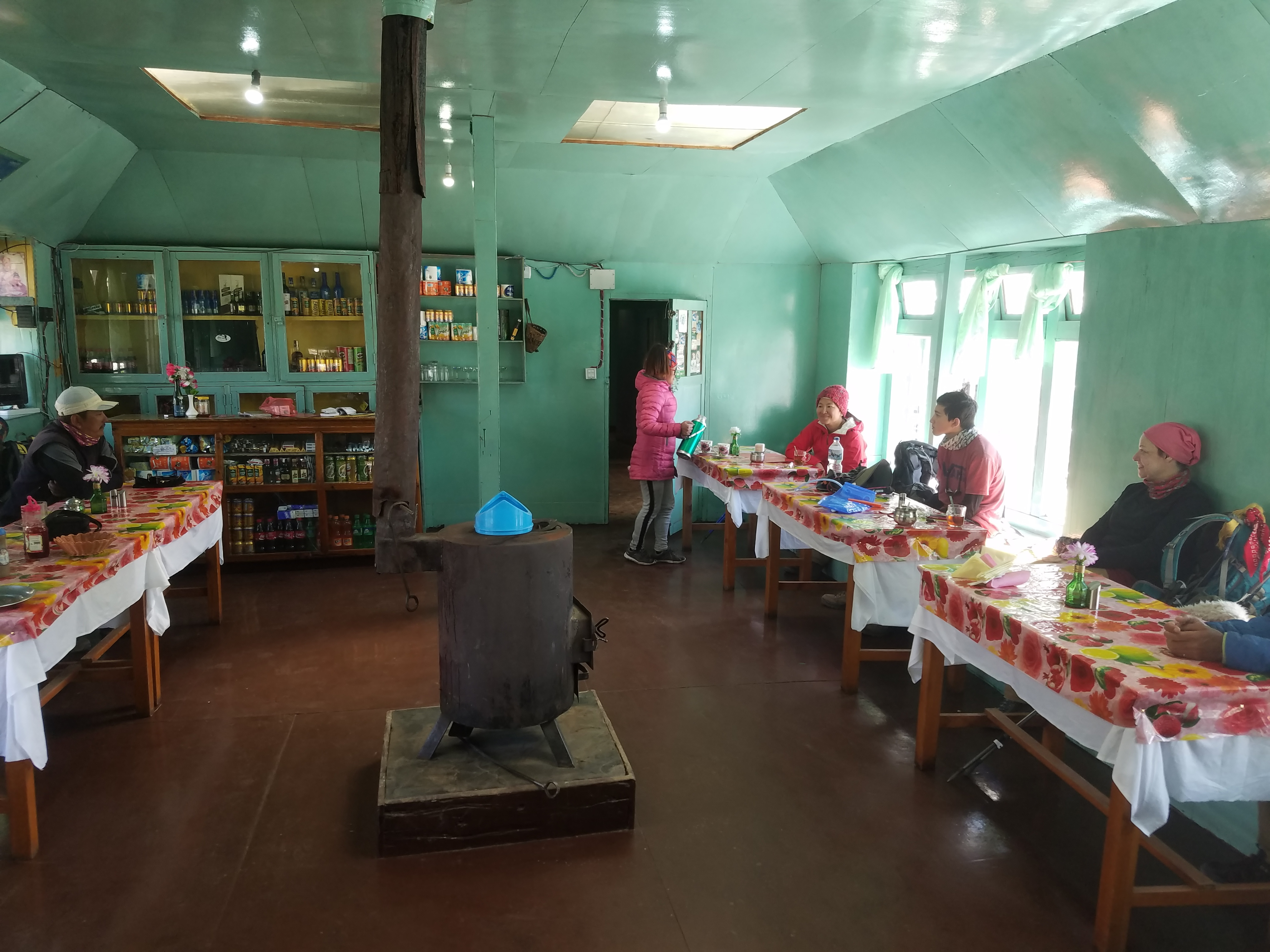
It took us four hours to reach Pheriche, the first large village that we had been in for a week. We stopped for lunch at a teahouse there. Three other Americans, two women and a teenage boy, were having lunch too. I heard one of the women speak to the innkeeper in Nepali when she ordered her food. I asked her about it and we started to talk.
Her name was Lisa and she was originally from Lexington, Kentucky. She had come to Nepal eleven years earlier as a Christian missionary and had stayed in Kathmandu ever since then. I have to admit that I was impressed. As much as I love visiting Nepal, there's no way I could live in Kathmandu for that long.
After her mission work was finished, she founded a school to teach cosmetology and said that she had basically started a whole industry for women who did hair care for vistiting tourists and western expatriates in Kathmandu.
 Sherpa house with Lhotse wall in the distance
She said that in all her time in Nepal she had never been in the mountains because she used to be very overweight. A year ago she invited a friend and her son to go trekking and used that as motivation to get herself in shape. Since that time she had lost 130 lbs (wow!) and dropped from 310 lbs to 180 lbs (double wow!). They were on their way down after making it all the way to Kala Pattar and she was very excited and proud of what she had accomplished. Good for her.
She also told me that the Nepal government had just instituted a new policy and eliminated permanent resident visas. She couldn't live in Nepal any longer and had to move back to the US after they got back from the mountains. The three of them had such a good experience on their trek that they were already planning a trip to Africa for next year to climb Mt. Kilimanjaro.
After lunch Shambu and I got back on the trail. As we were leaving Pheriche a helicopter came in and landed just outside the village. Two westerners walked over and got in and the helicopter took off and headed down valley toward Namche and Lukla. Yup. Looked like another AMS evacuation.
 After giving him a cookie Shambu has a new best friend
From Pheriche we followed the Imja Khola river. While the river descended slightly, the trail did it's usual thing. Climb up one hill then descend back to the river. Descend into a side canyon and then climb back out again. Cross over the river and then later cross back. It felt just like the early days of the trek. In the words of the great American Zen philosopher, Yogi Berra, "it's like deja vu all over again".
Our plan was to hike to Tengboche and stay there for the night. Based on our difficulties the past few nights Shambu was worried that we might not find a place to stay. There is a famous monastery there as well as great views, so all trekkers going to Everest stop there. He tried calling ahead since he had cell reception again. No one would save a spot for us because there were only two of us. They would only reserve for a large group. As much as I like solo trekking, it did seem that it had a downside during peak season.
 Porter with a huge load - don't ever say your job sucks
The scenery had changed since this morning but was still amazing. Up the valley we could see Lhotse, the fourth highest peak in the world, and the huge Lhotse wall, one of the most impressive mountain faces in the Himalayas. Even from far away it looked massive.
We were also right beneath Ama Dablam, although we were seeing it from a different angle than the day before or even earlier today. Clouds had formed in the afternoon but not as many as on previous days. The wind must have really been blowing hard up high because the clouds were moving extremely fast across the mountain. They would cover Ama Dablam for a moment. Then the mountain would come clear again. Sometimes you could only see part of the mountain while the rest was obscured. I took a video because it was a beautiful effect that you couldn't capture with just a photo. (NOTE: It's a big file.)
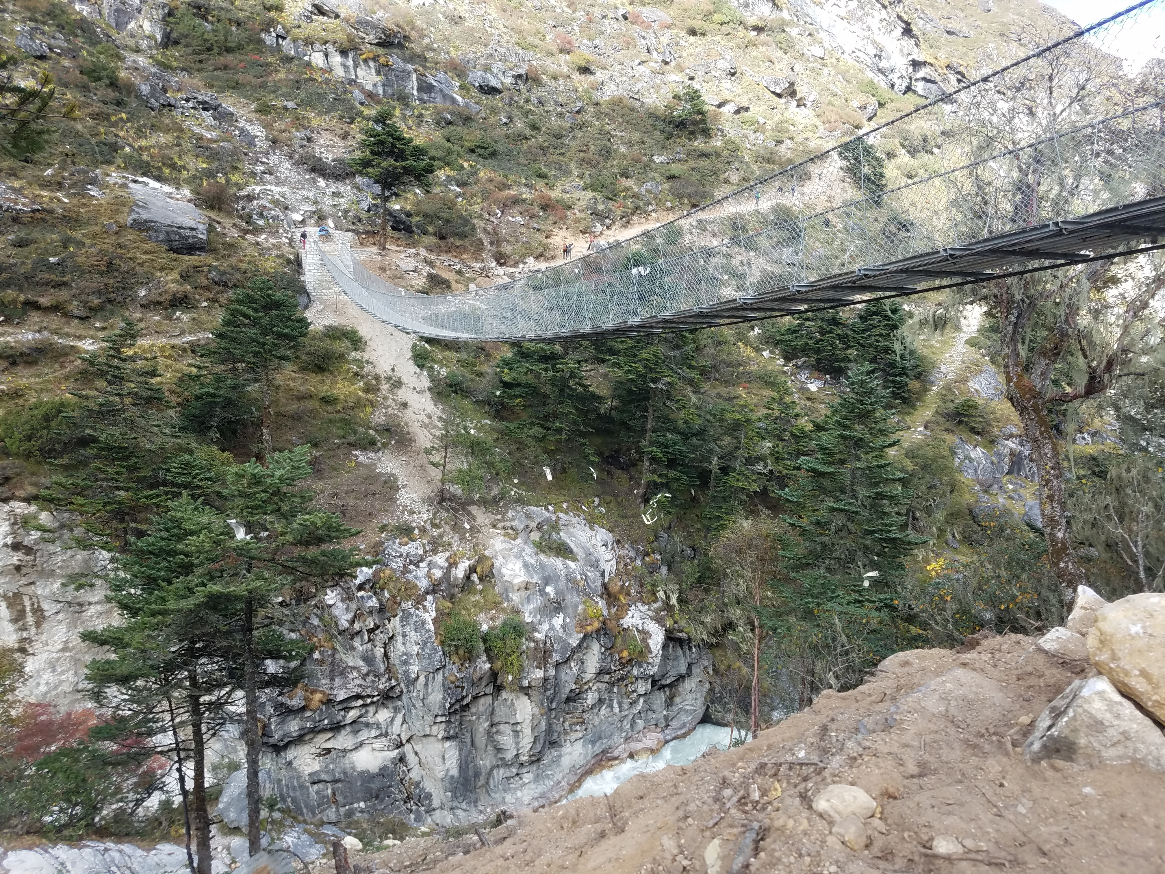 Another high suspension bridge crosses the Imja Khola (again)
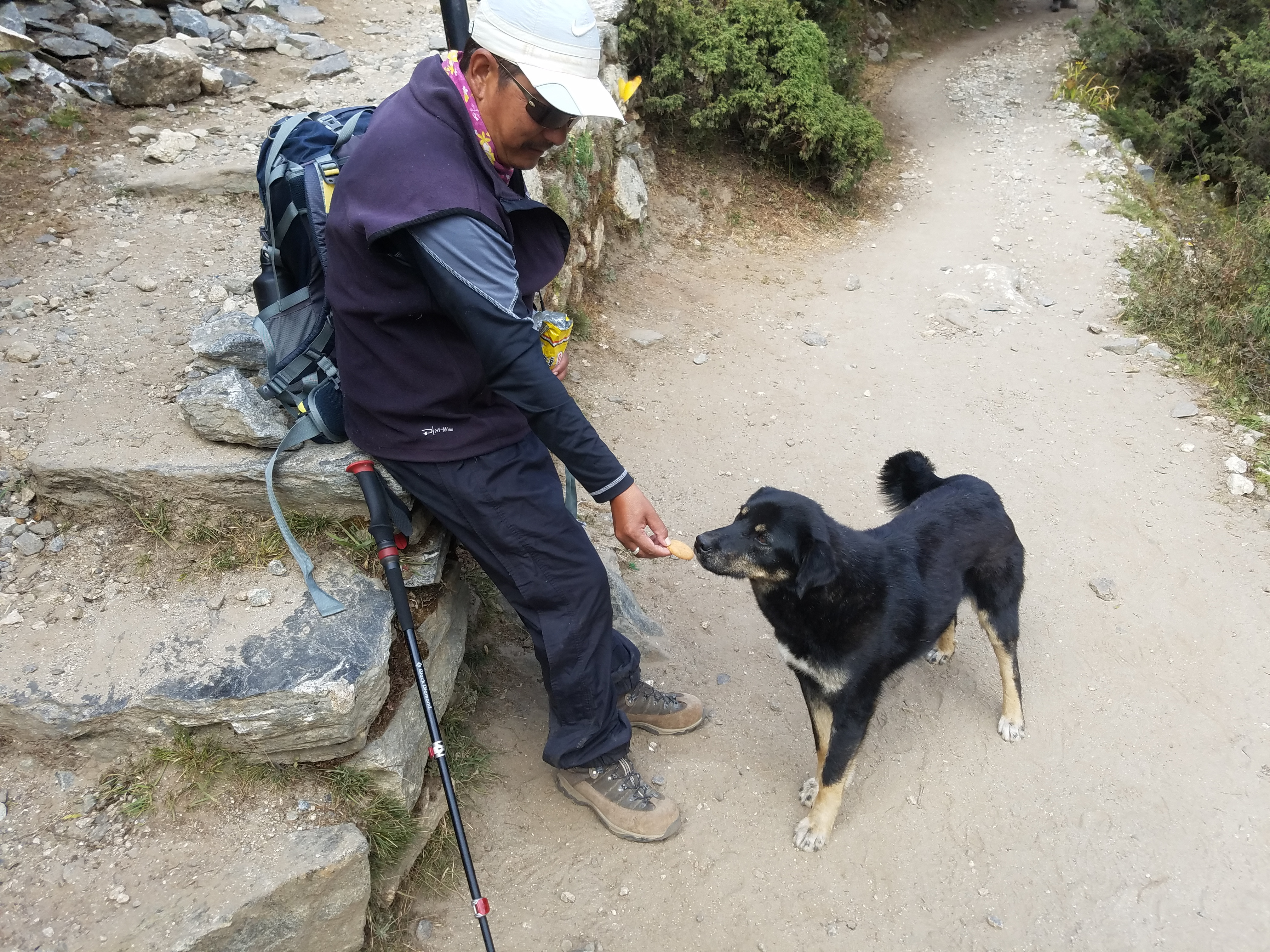
At a rest stop in a small village late in the day, a friendly-looking black dog came up to us. We were eating some cookies so the reason for his interest was obvious. Shambu gave him one of his cookies and he was very gentle as he took it. Now Shambu had a new Best Friend. The dog followed us when we started up again. In fact, he followed us for well over an hour, almost all the way to Tengboche. Finally when we had to cross yet another big suspension bridge over the Imja Khola, he decided to head back. He seemed like a really nice dog. I hope that he made it back home ok.
After the bridge, of course there was one last long uphill stretch. Tengboche is an exceptional viewpoint, perched high on a hill above the river. Which meant that we had to climb up to it. It was a nice trail though and I just took it slowly. Bistari, bistari. Even after a very long day I felt good. The hill was higher than I expected but eventually we made it. We had been hiking for four hours since leaving Pheriche but now we were finally in Tengboche. And I've been writing for longer than I expected so I will end this post here.
