Longbow Arch
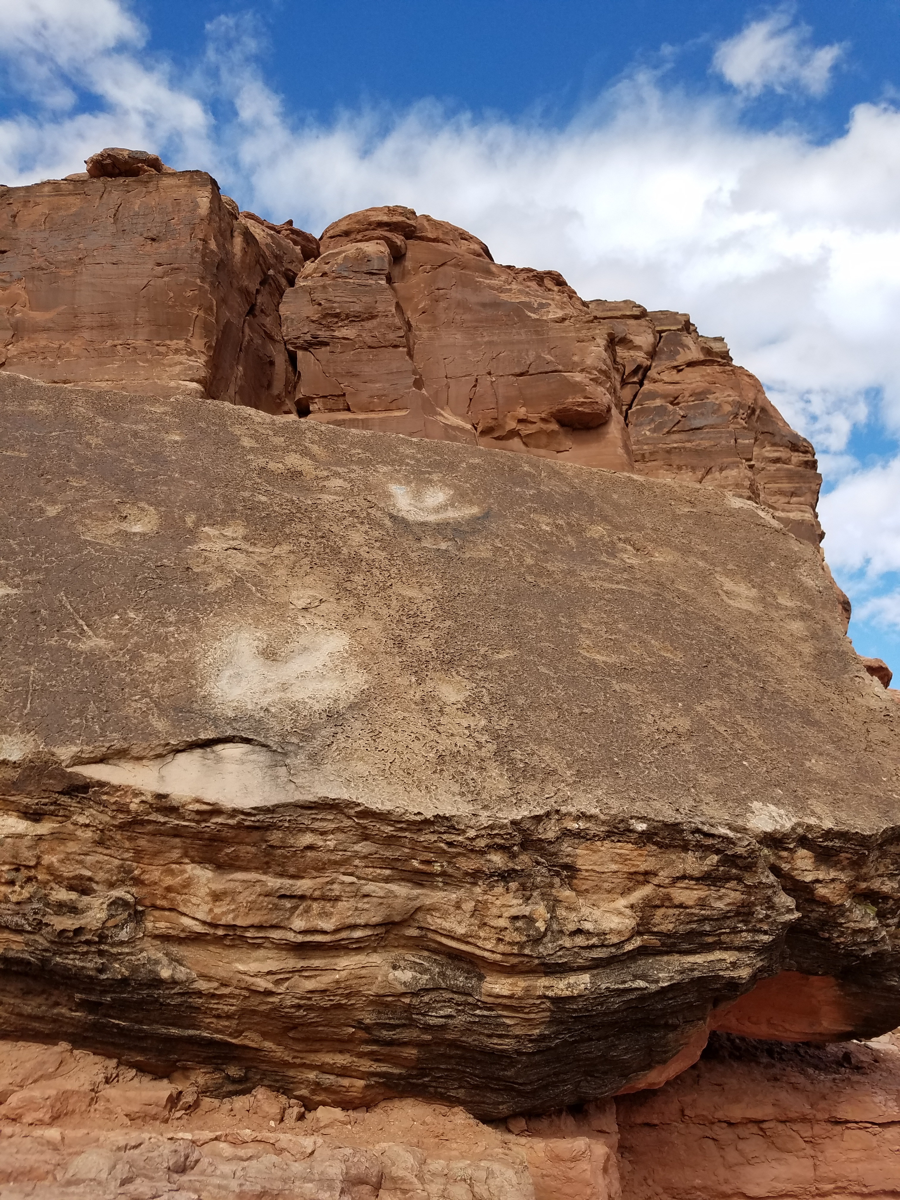 Dinosaur tracks near the start of the trail
Because this was my first hiking trip of the spring after a long winter, I was anxious to make the most of it. It was a beautiful morning so I got an early start. In my last post I described how I was stopped from doing a hike by a flooded road in Arches National Park, got a hard-to-get permit to hike in the Fiery Furnace, and hiked to Corona Arch.
Although it clouded up during the Corona Arch hike, it had cleared up by the time I was back to the trailhead. I already knew where I was going next. When I was at the visitor center in Arches National Park that morning, I had seen a map showing where various fossils could be seen in the area around Moab. They called it the "Dinosaur Trail". Mostly they were footprints preserved in the rocks. I thought that sounded pretty cool and was tempted to buy the map but eventually decided against it. I'm a poor retired guy, after all. Later on the way to the Corona Arch trailhead, I saw a sign for a turnoff that said "dinosaur tracks". Who needs a map? I had stumbled on one of the locations purely by accident. It's better to be lucky than good.
Now I was done with my morning hike to Corona Arch and came back to check out the dino tracks. When I reached the sign I turned off the paved highway that followed the Colorado River onto a dirt road. After a very short climb there was a small parking area for the trail to the dino tracks. The dirt road continued on to the Poison Spider trailhead, the starting point for a popular ATV and mountain bike trail that climbs up onto the mesa. The scenery is supposed to be impressive but I didn't really want to spend the afternoon dealing with the dust and noise from ATV's. I parked at the first lot where there was a sign with a photograph pointing out the location of the dino tracks. They were only about a quarter of a mile away on a rough trail that required a little scrambling. It wasn't too hard though. There was a family with two young children who climbed up just ahead of me.
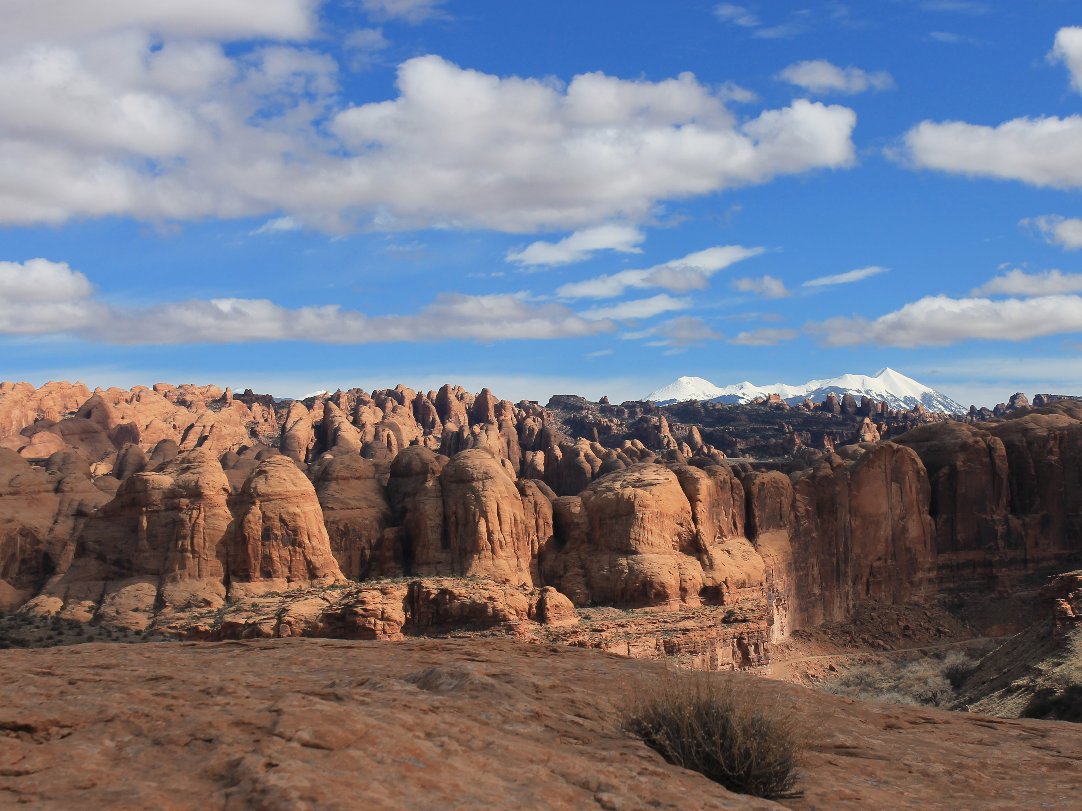 The Behind the Rocks area from the Longbow Arch trail
The tracks didn't look that impressive. Two of the largest tracks looked like people had scraped and scratched the rock to enhance them. While meaning well, it made them look kind of fake. There were a number of smaller tracks but they were very faint. There was a sign giving some background about the tracks. While they didn't look like much, it was still mind blowing that I was looking at footprints made by animals walking along the beach 190 million years ago.
The trail continued beyond the fossils and a sign said "Longbow Arch 1.2 miles". I had never heard of the arch or the trail. I have lots of maps and trail guides at home and usually I carefully research all my hikes ahead of time. But this time I decided to be wild and crazy and see where the trail went and what Longbow Arch looked like. It wasn't that far so if it turned out to be a bust I wouldn't have lost much.
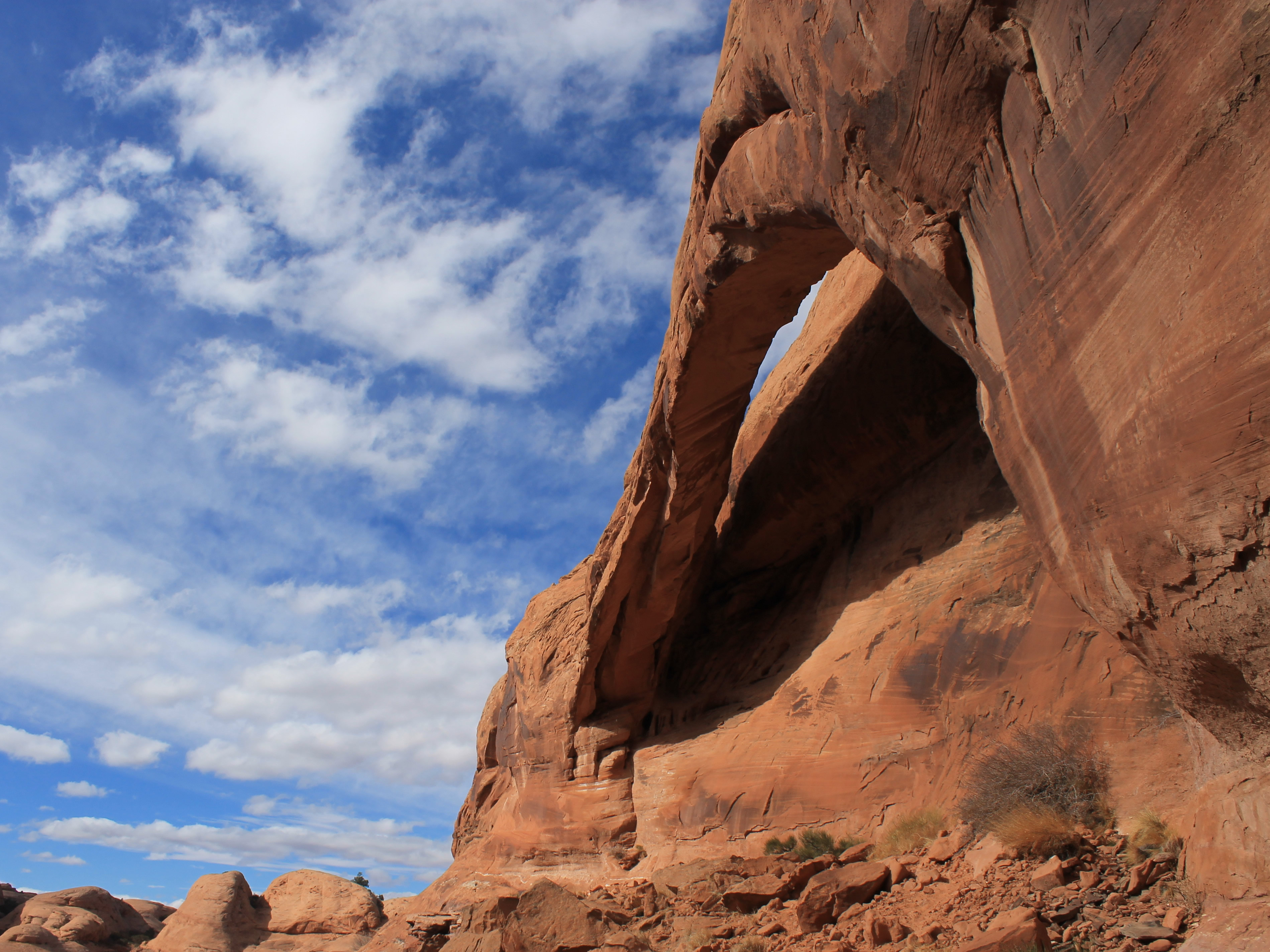 Longbow Arch from below
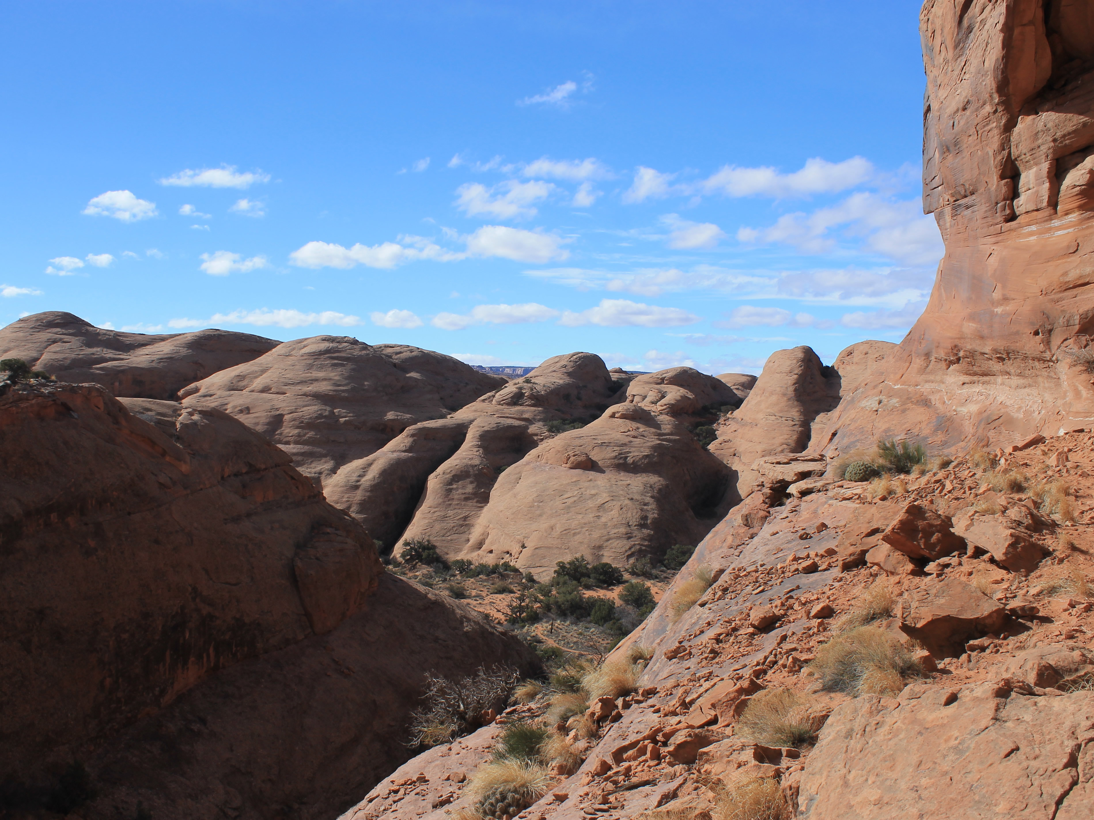
The trail turned out to be a pleasant surprise. It climbed steeply up a narrow draw, out of the Colorado River canyon. In one spot, there were metal handholds placed to help climb over a steep rock step. Good sport. When it reached the top of the mesa there was a nice view of the Behind the Rocks area visible across the river. I hiked up some slickrock domes from the trail to get a better view and take some pictures. Once on the mesa the route was about half trail, half across slickrock. At first I had trouble following the route on the slickrock because there were not many cairns to mark the route. Then I noticed that instead the route was marked with dark paint streaks. The direction of the streak pointed to where the next marking was. Once I had it figured out, the markings were easy to follow.
After about a half hour of hiking I spotted an arch high up on the wall of a side canyon. It was close to the canyon wall, not freestanding like Corona Arch had been. It didn't look that impressive. The trail turned and started climbing up the side canyon. I figured I would follow it to see if it led to a good viewpoint for the arch.
 The flat rock where I perched above the canyon
The trail led up right under the arch. Up close it was quite impressive. Hard to photograph without a very wide angle though. The setting was beautiful. I found a large flat rock at one end of the arch that stuck out over the cliff that formed the canyon wall below. I felt like I was perched in a high eyrie, with a view of the canyon I had hiked up and the waves of slickrock beyond. Corona Arch in the morning had been beautiful but there had been crowds of people. I had this all to myself.
For a while anyway. After a while a man and his son climbed up to the arch as well. But that was ok. Three people isn't exactly a crowd and we chatted and agreed that it was a fantastic spot. I stayed a while longer even when they headed back. They were the only people that I saw on the trail.
I got one more bonus on the way back. Near the end a short spur trail led to some beautiful petroplyphs. When I got back to my car, I felt that for an unknown hike I had certainly gotten my money's worth.
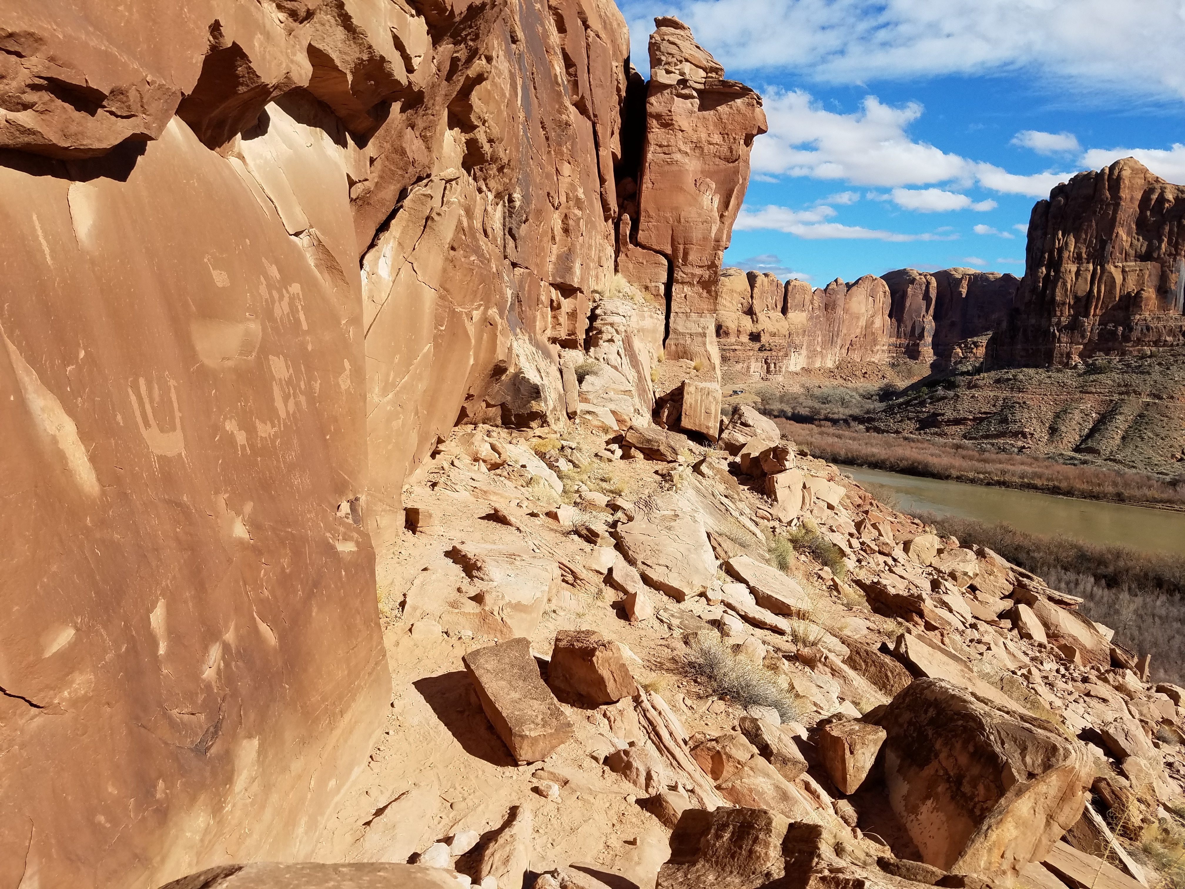 Petroglyphs near the Longbow Arch trail
By now it was late afternoon but I thought I had time to do one more thing before heading back to town. I wanted to check out Mesa Arch. It's in the Island in the Sky district of Canyonlands National Park. I have seen lots of pictures of sunrise over Canyonlands taken looking out through the arch. One was on my Windows login screen. I was thinking that I might get up very early the next day and be there to try to get my own version of that sunrise shot. Mesa Arch is close to the road, less than half a mile by trail. But I wanted to check it out before I tried to get there in the dark. That required some driving. I had to take the Potash Road back almost all the way to Moab. Then I had to drive northwest to Canyonlands National Park, about thirty miles just to reach the park. My plan was to stop at the Island in the Sky visitor center and then continue on to Mesa Arch. Sandy and I had done a hike in Dead Horse Point State Park in that area a few years before, so I knew that even though the road was paved, it was winding for most of the way and would take a while to drive. Sure enough. For the first part, I was behind someone who was creeping along. When I finally managed to pass, then I had someone riding my bumper all the way. I guess no two people drive the road the same way.
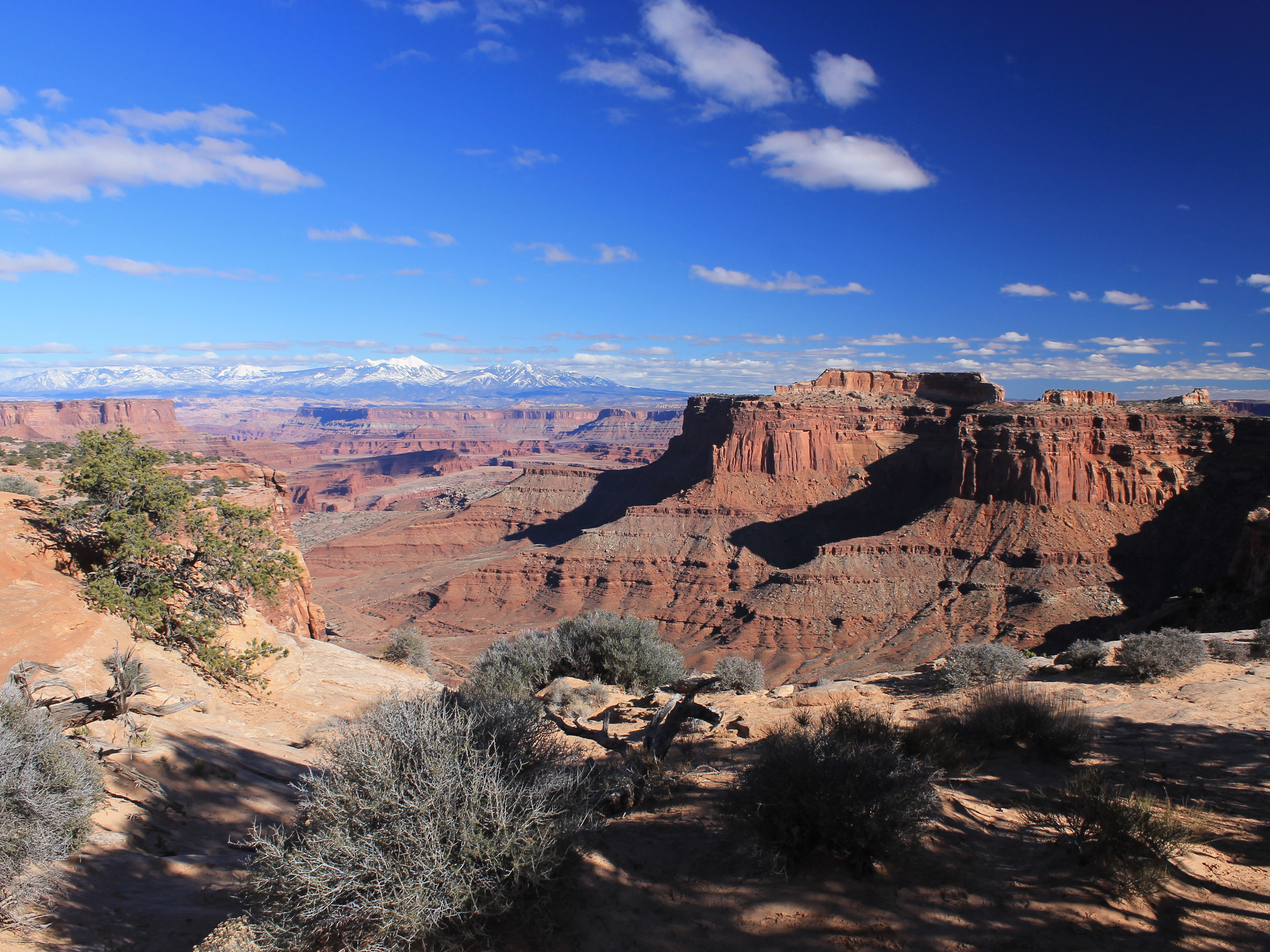 Colorado River Canyon from Island in the Sky
When I finally got to the visitor center and pulled in to the parking lot, the guy who had been following me pulled in right next to me. He came over and I thought, oh boy, road rage incident in the national parks.
"Are you from Milwaukee?" he said and pointed at my Brewer cap.
"Grew up there."
"That's where we're from too!" And voila, we were best buddies. We talked for a while about the Brewers chances this summer, which we both agreed were slim to none.
It turned out that the visitor center was a waste of time. It was closed for the season. The lady from Milwaukee mentioned that she was hoping to ask a ranger how to get to Delicate Arch. She wondered if I knew.
"Yeah, I've done that hike a half dozen times. You're in the wrong national park. It's in Arches, not Canyonlands." I explained that it would probably take an hour and a half to get to the Delicate Arch trailhead from where we were. Then it was still at least a half hour hike to the viewpoint for the arch. She decided that they weren't going to see it today.
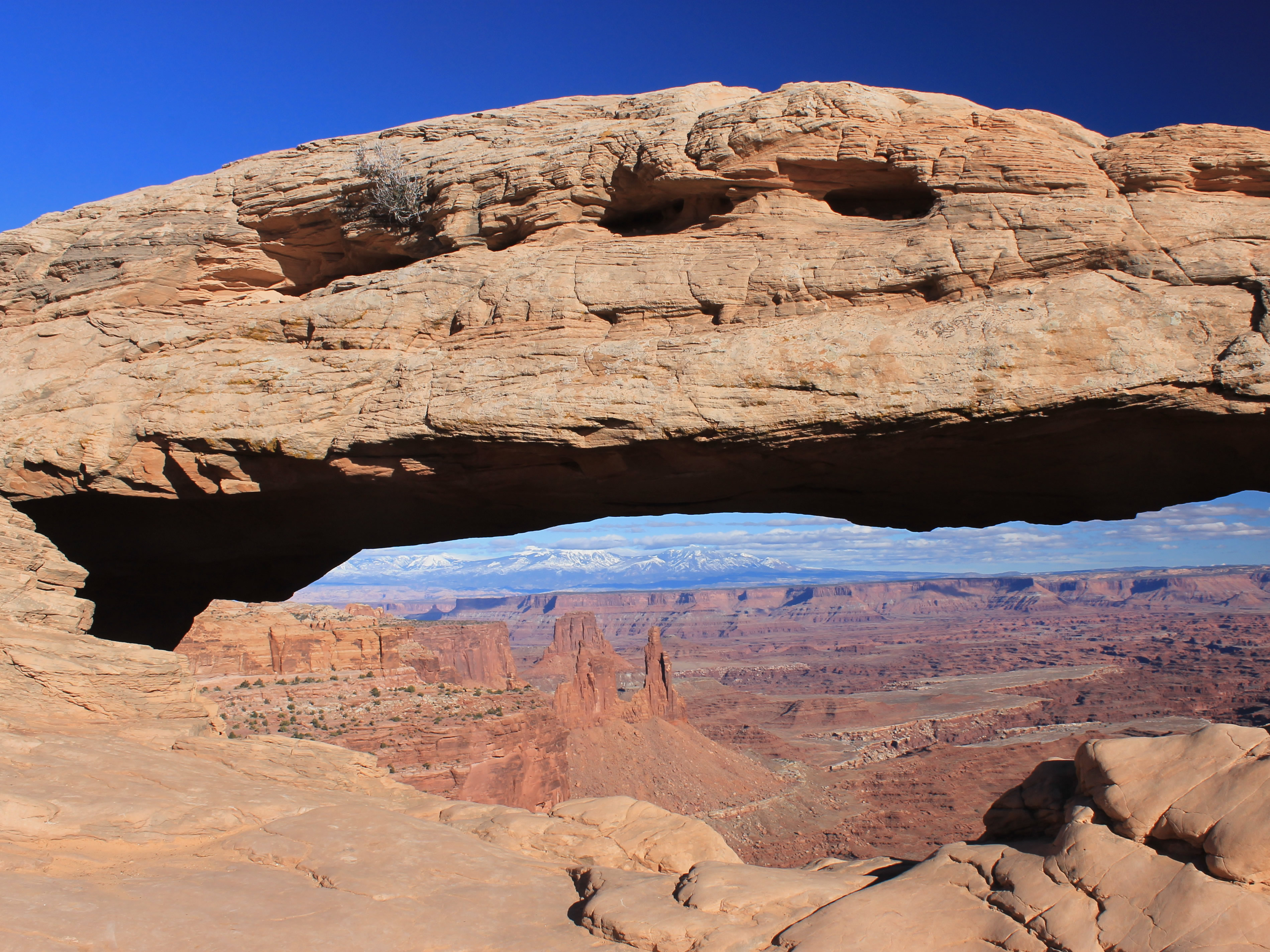 Looking through Mesa Arch
Even though the visitor center was closed, it wasn't a complete bust. Besides having met friends from Milwaukee, across the road there was a spectacular viewpoint over the Colorado River Canyon with the La Sal mountains in the background. I got some nice photos before continuing on to Mesa Arch.
The hike to Mesa Arch was over a small ridge, easy but it was very windy. Not pleasant. I have to admit that it wasn't at all what I was expecting after all the photos that I had seen. The arch was fairly small and the "window" through to the other side was small as well. I took some pictures but decided that I definitely was not getting up early and driving all this way in the dark for sunrise shots.
Woohoo! I didn't have to get up ridiculously early tomorrow.
After a long drive back to Moab I cleaned up and headed in to town. I was starving. I had a huge burger and fries at Moab Brewery, washed down with a Porcupine Pilsner. It had been a very busy and productive day.
