Corona Arch
 First light on a beautiful morning in Arches National Park
It's been an unusually long and cold winter in Boise this year. While places like Chicago and Denver were recording record highs of seventy degrees in February, we had snow on the ground and temperatures in the twenties for over two months. All I could do blog posts about were Abby playing in the snow and me shoveling the driveway. Although Abby and I did our walks in the neighborhood, usually two every day, I didn't have a chance to get out and do any real hiking. But this week everything finally came together. Sandy has been traveling a lot (which means I have dog duty) but she was going to be home for over a week between her trip to St. Lucia and a quilting class in Montana. The snow finally melted so that travel by car wasn't too challenging (although that turned out to be not quite true, as I will get to later). When the weather forecast predicted several sunny days in Utah canyon country, I was anxious to hit the trail. Sandy encouraged me to go, and it didn't take much encouragement.
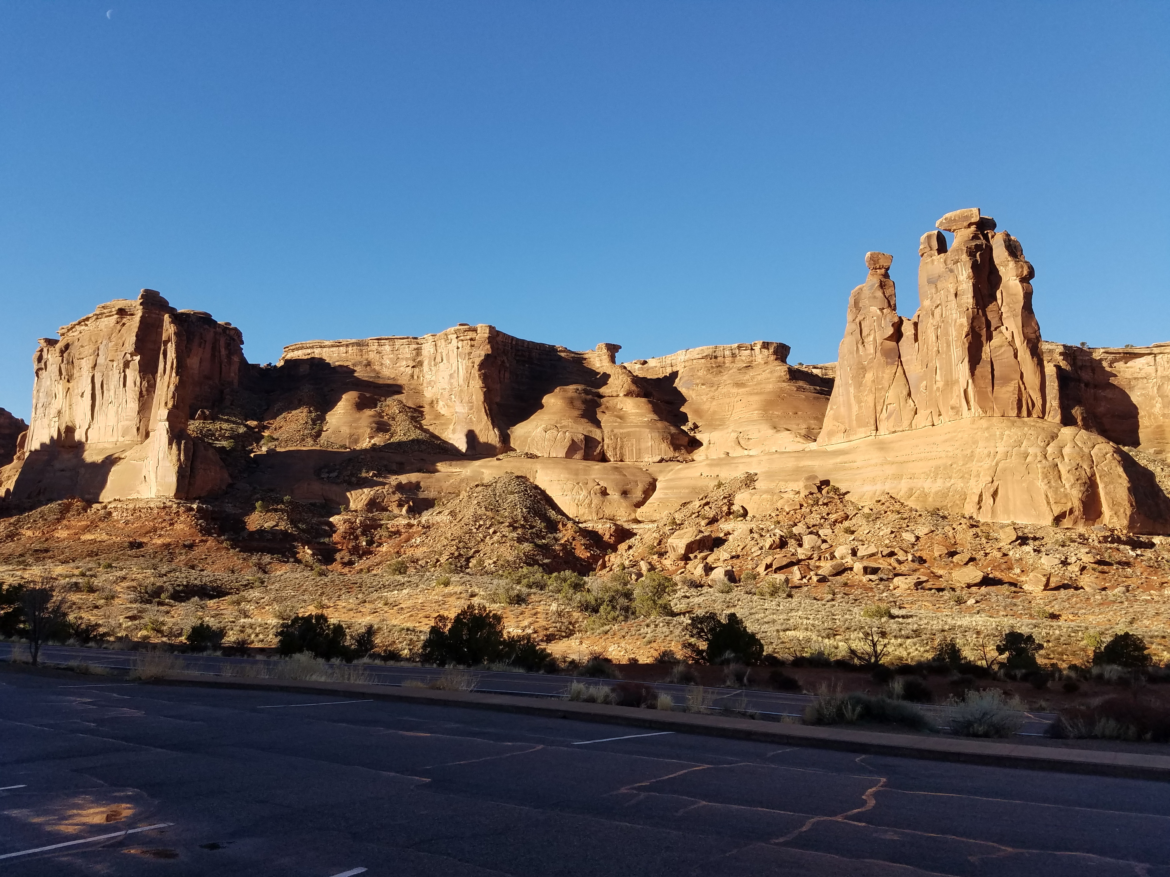
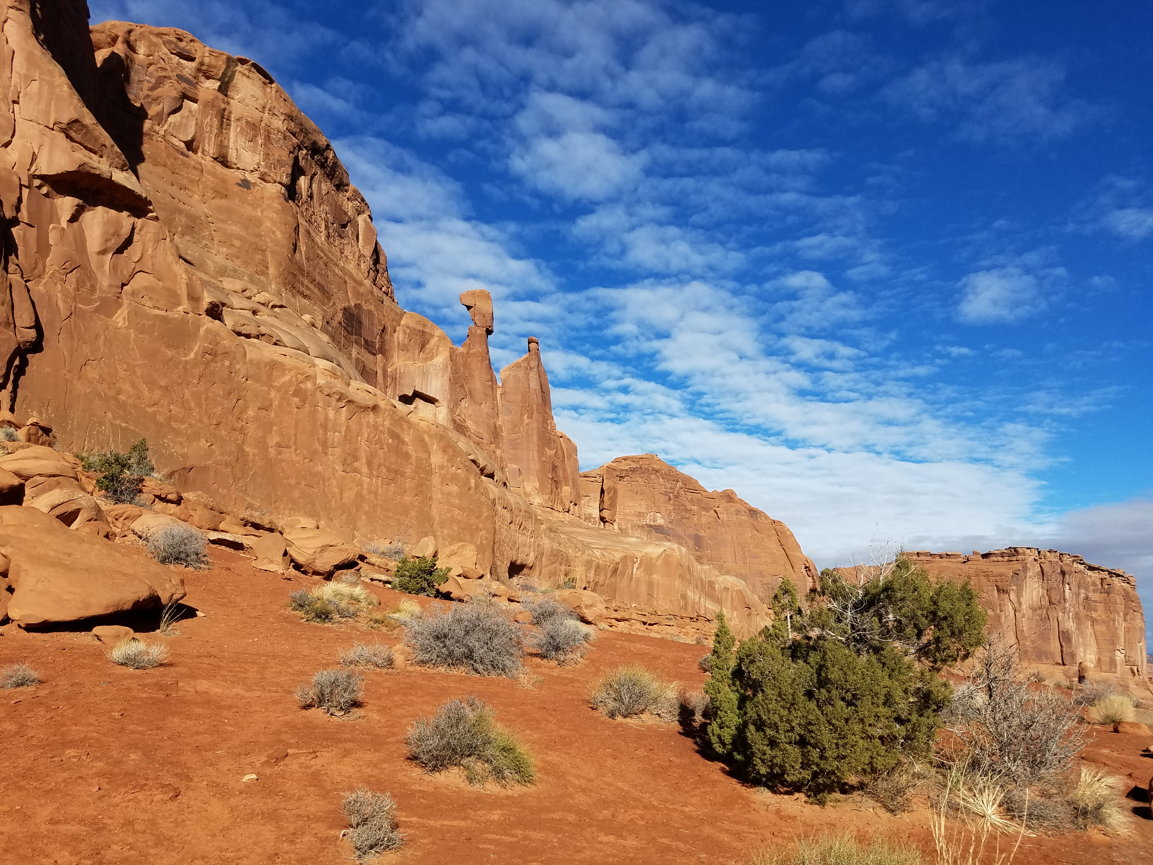 Looking down Park Avenue
I left early on Sunday morning of President's Day weekend. I had plenty of time so I made a quick stop at Game Night Games, the game store in Salt Lake City. I picked up a copy of Against the Odds 2009 annual issue. It has a game on the Battle of Verdun (WWI), as well as one on the Battle of An Lac (Vietnam). It's out of print and difficult to find but I got it for 40% off. The trip was off to a good start.
After that I got a bit of a surprise. I hit a full-fledged blizzard when I crossed the Wasatch mountains on US 6 between Spanish Fork and Price. Snow was starting to accumulate on the highway and it looked like it could be a problem. Fortunately it was just for a short stretch. It warmed up quickly as I descended after crossing Soldier Summit and the snow turned to rain. There were no problems the rest of the way. But it was a good lesson. When planning the trip I had checked the weather forecast for Boise, for Moab, and for the mountains near Snowville, Utah (from the name you can guess why). But I had forgotten about crossing the Wasatch mountains. Soldier Summit is almost 7500 feet high and can have wintry weather when the surrounding valleys are quite mild. There is a reason that some of the best ski resorts are in that part of the Wasatch.
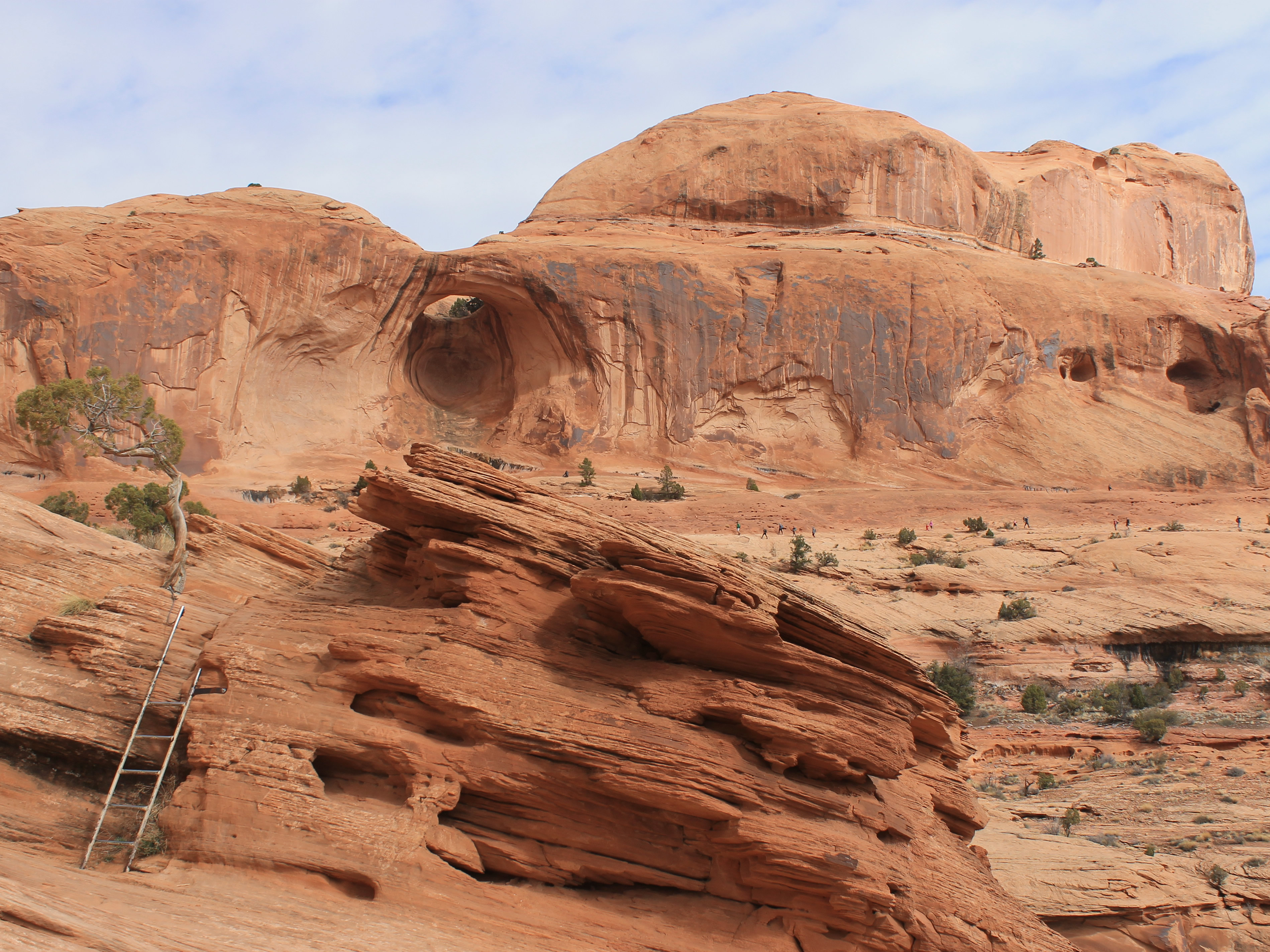
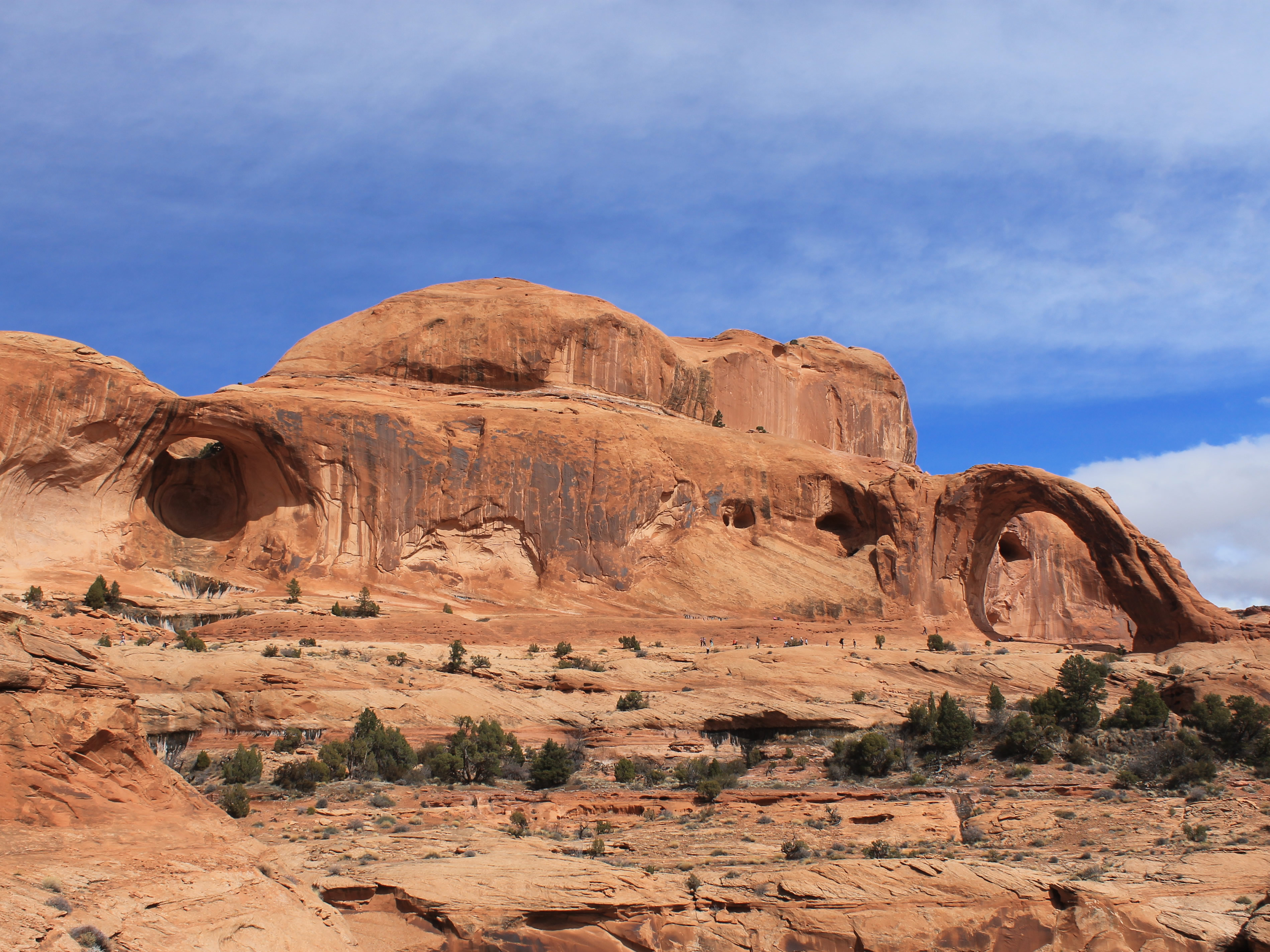 First view of Bowtie Arch and Corona Arch
I made it to Moab around 5 pm and checked into my motel. Even though it was President's Day weekend, I didn't have any trouble finding a place to stay. It's still off season for canyon country and there weren't many people in Moab, especially since it had been raining for the past two days. I tried the Inca Inn as an experiment. It's a budget motel with good prices, rather than a chain. Moab can be a pricey place to stay so I was hoping this would enable me to save some money. I'm an old, retired guy, after all. Trip Advisor gave it excellent ratings and I had to agree. The room was small but clean. It had a mini fridge and a microwave. It turned out to be a good choice. After getting settled I went into town and had dinner at Eddie McStiff's. I had never eaten there before and was hoping that besides a pizza I could find a good logo tshirt. The pizza was good but I couldn't find a tshirt that I liked. Oh well. One for two. Probably the more important one at that.
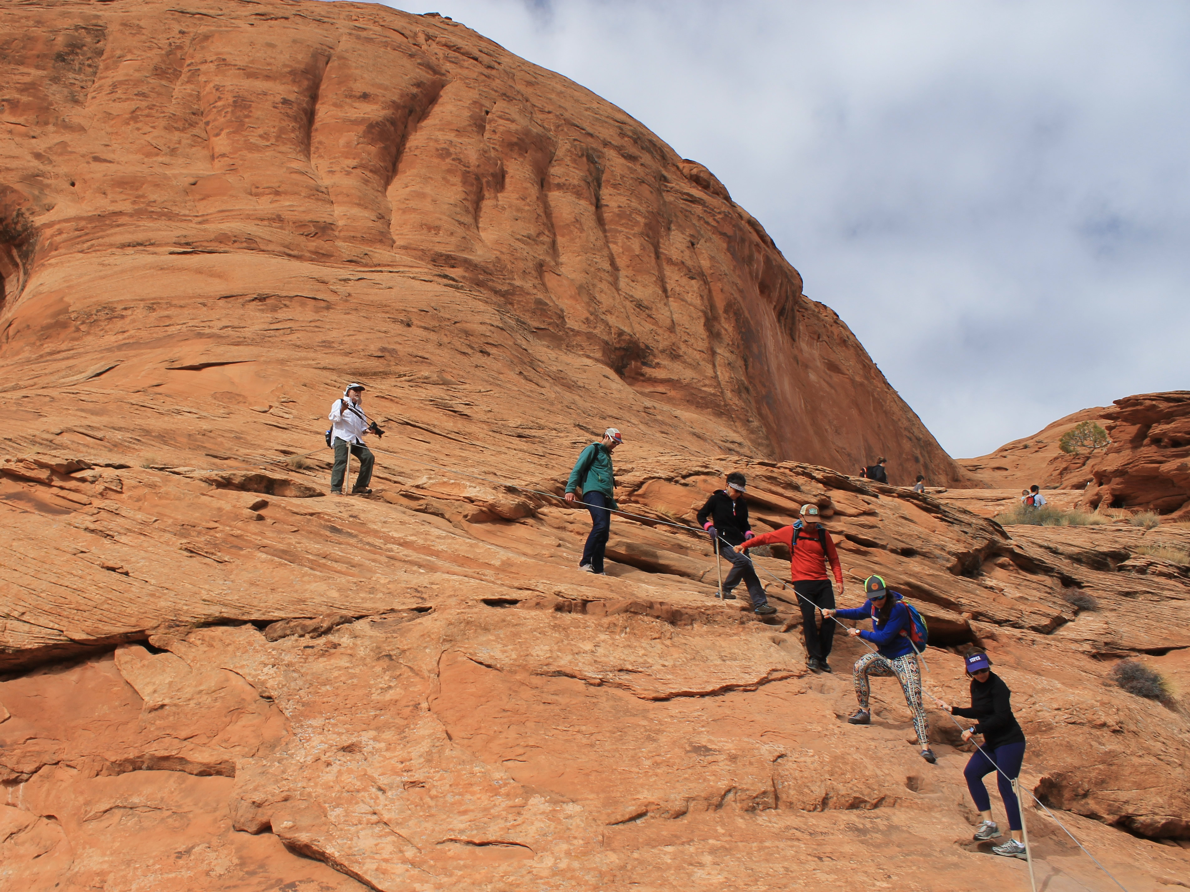 A cable helps on some slickrock that's steeper than it looks
I didn't have much luck after dinner either. I was hoping to look around for maps, hiking guides, and yes, caps and tshirts. I'm used to spring high season when all the shops in Moab stay open till nine or ten oclock. I found out that during winter everything closes at six. Nothing to do but head back to the hotel and read. Fortunately I had a good book with me.
When I got up next morning the clouds had all disappeared and the sky was bright blue. I quickly grabbed a very light breakfast and headed for the trails. My plan was to do several shorter hikes rather than to spend the whole day doing one long one. First stop, Arches National Park. My friend Ivan is fascinated by Delicate Arch but has never visited the park and seen it. I've probably hiked to the arch five times before. This time, instead of the main trail, I wanted to hike to the lower, more distant viewpoint and send Ivan a picture. Unfortunately when I got to the main Delicate Arch trailhead, the road beyond was closed due to flooding. Swing and a miss. Strike One.
 A ladder provides access to the terrace leading to the arch
On the way out of the park I stopped at the visitor center to ask about hikes in the Fiery Furnace. The Furnace is a maze-like area of rock fins and narrow passages. Because the area is such a labyrinth, the Park Service allows hiking only for ranger-led groups or by special permit. In the spring the guided hikes fill up days or weeks in advance. Since it was off season, I was hoping that I might get a spot. I probably would have too, but they don't do the guided hikes in winter.
I did have the option of doing the hike on my own. The park service only issues twenty permits per day. There were none for today but I could get one for tomorrow. I had to go for it. To get the permit, I had to watch an orientation video, listen to an orientation talk, then pass an oral test from a ranger on what was covered in the orientation. Fortunately I always was a good student. I passed my oral exam and got my permit for the next day.
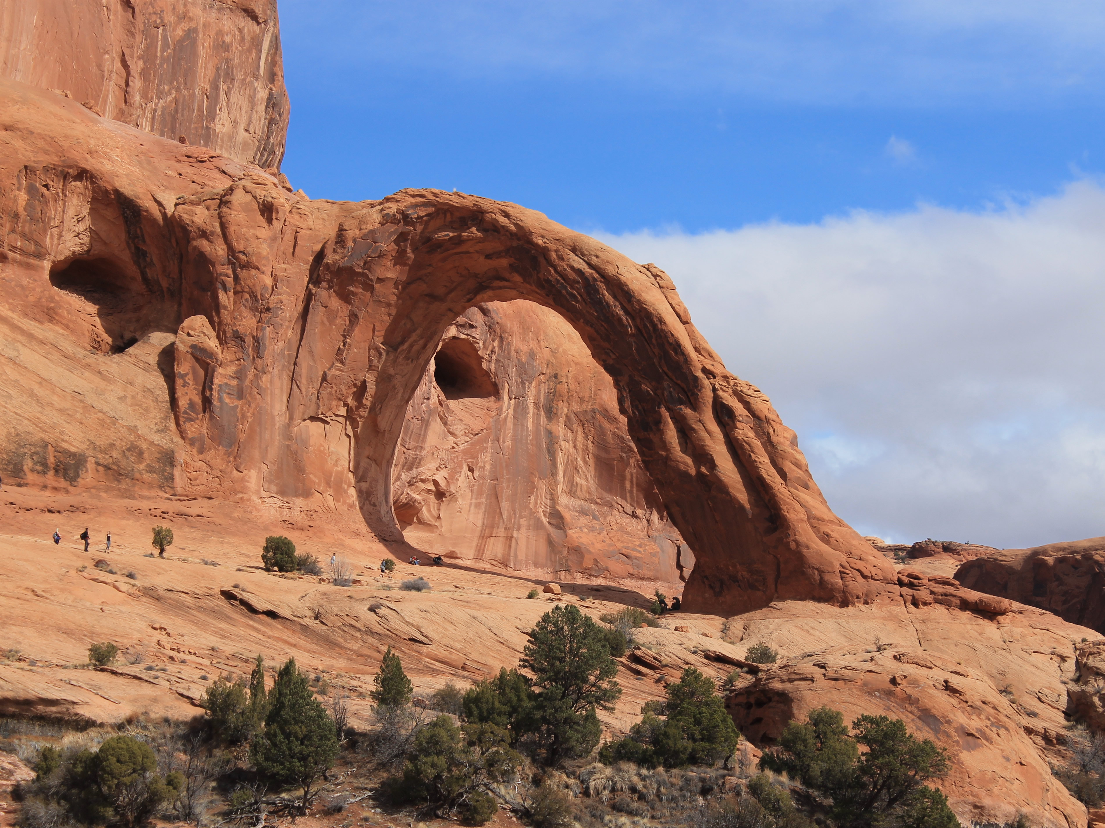 Corona Arch
I made a quick stop at the visitor center gift shop and got a hiking guidebook (Arches and Canyonlands National Parks), a map (Canyonlands National Park) and a tshirt (Arches National Park). Then I was on my way. By now it was midmorning and definitely time to hike. When I left the park I drove about ten miles west of Moab along the Colorado River. I reached the trailhead for Corona Arch at about 10 am. It's a popular hike so the lot was already completely full even though it was offseason. Fortunately there was a large picnic area beside the river that was just across the road. It had a parking area with plenty of space and only added a few hundred yards to the walk. The trail started with a short, steep climb before leveling off to cross some railroad tracks that led to the Potash mine. From there it turned into Bootlegger Canyon, a high valley with beautiful cliffs on each side. On one canyon wall, below a future arch-to-be, I could see what looked like a small Anasazi ruin. I thought about hiking up to it. It was only about a quarter of a mile off the trail. But I didn't really see a track going up there and I knew that the cryptobiotic soil in the area is extremely fragile. The orientation for Fiery Furnace had repeatedly driven home the damage caused by disturbing the crust on the soil. I guess it was effective because after going about fifty yards I decided against it and turned back to the trail.
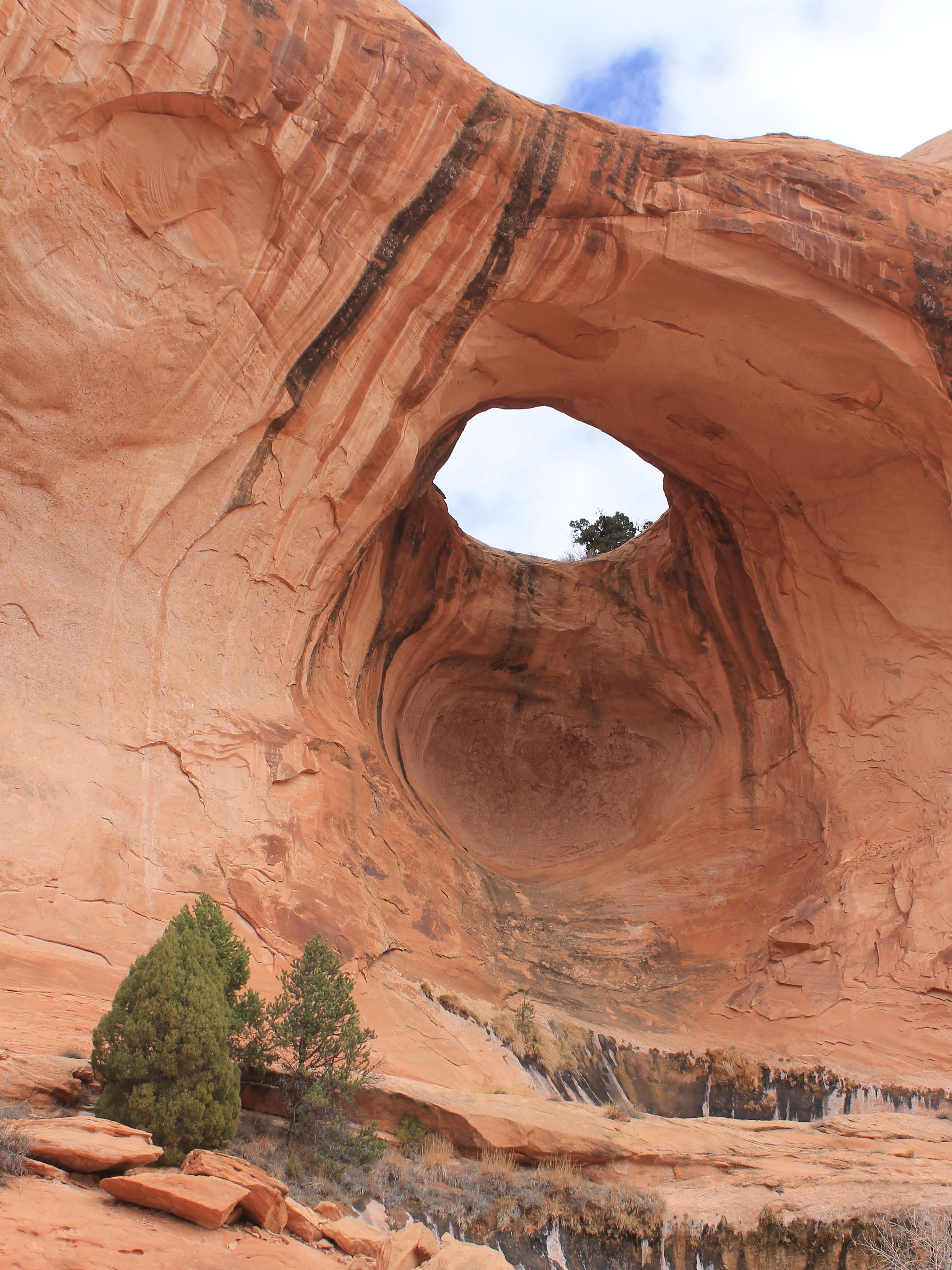 Closeup of Bowtie Arch
The hike was short, only two miles, but fun. The trail led up the canyon, eventually climbing onto slickrock. At one point it was steep enough that there was a cable for security. At the top of the cable the route turned a corner, climbed a short ladder over a rock step, and there were Bowtie Arch and Corona Arch. Bowtie was beautiful but Corona was fantastic. After Delicate Arch, it is probably the most impressive arch that I have ever seen. When I saw it all I could think was, why haven't I done this hike before?
The route followed an easy slickrock terrace around an ampitheater to below Bowtie Arch. From there it went to the base of Corona Arch and then through to the other side. There were a lot of people, and since it was BLM land rather than a national park, lots of dogs too. But it was spectacular enough that I didn't mind the crowd.
I do have my limits though. As I approached Corona Arch I heard an incredibly loud buzzing sound. At first I thought I was going to be attacked by some mutant killer wasp swarm from a horror movie but it turned out to be a drone that someone had brought with them. In the steep canyon with hard rock cliffs on all sides the sound echoed and reverberated. It was incredibly loud and annoying. I'm a tech enthusiast but this was the wrong place for it. Unfortunately the guy flew it around for about twenty minutes. When he finally stopped, cheers and applause went up from hikers all along the route. Not exactly a wilderness experience.
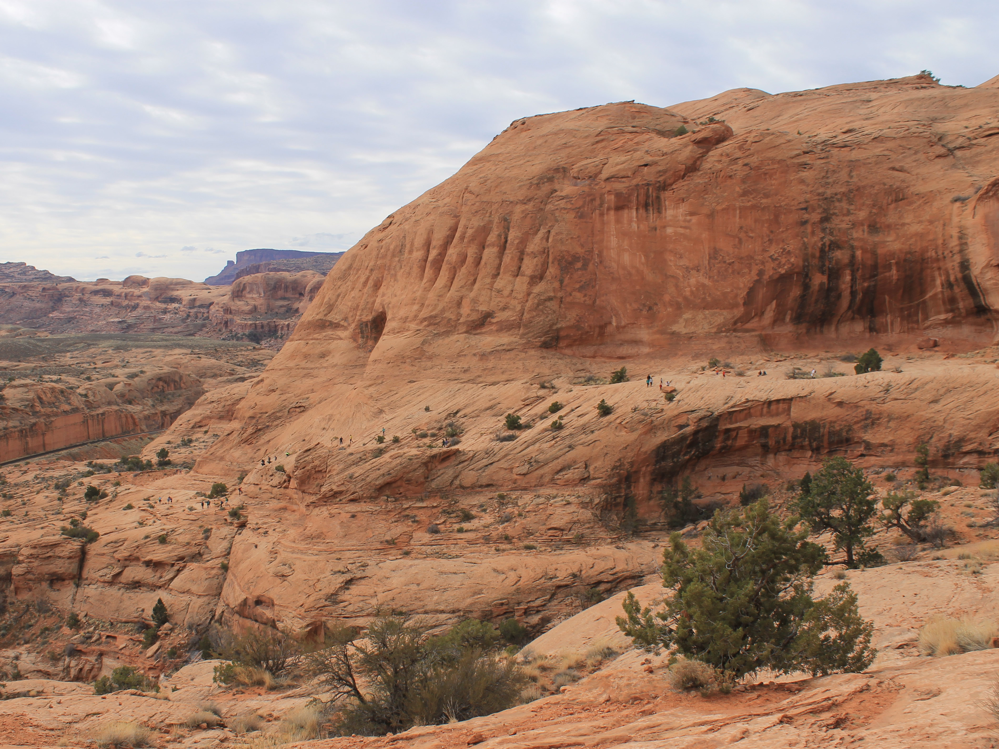 Looking back - lots of people on the route to Corona Arch
So now I have a new thing that I hate - drones in the backcountry. And the obnoxious jerks who fly them. Sure, there are a lot of people who hike a popular trail like Corona Arch so it isn't a pure wilderness experience. That just makes it more important for everyone to be considerate and try hard to preserve the values of such a special place.
As I got close I noticed that some people who had managed to climb up to the top of the arch. After I went through the arch I found that there was a way up from behind that climbed some very steep slickrock. In Arches National Park the Park Service has banned climbing on all of the arches to help preserve them. But this was on BLM land where the rules are a bit looser so there wasn't a similar ban. Yet. Still, I thought it was best not to climb up myself. That and it looked scary.
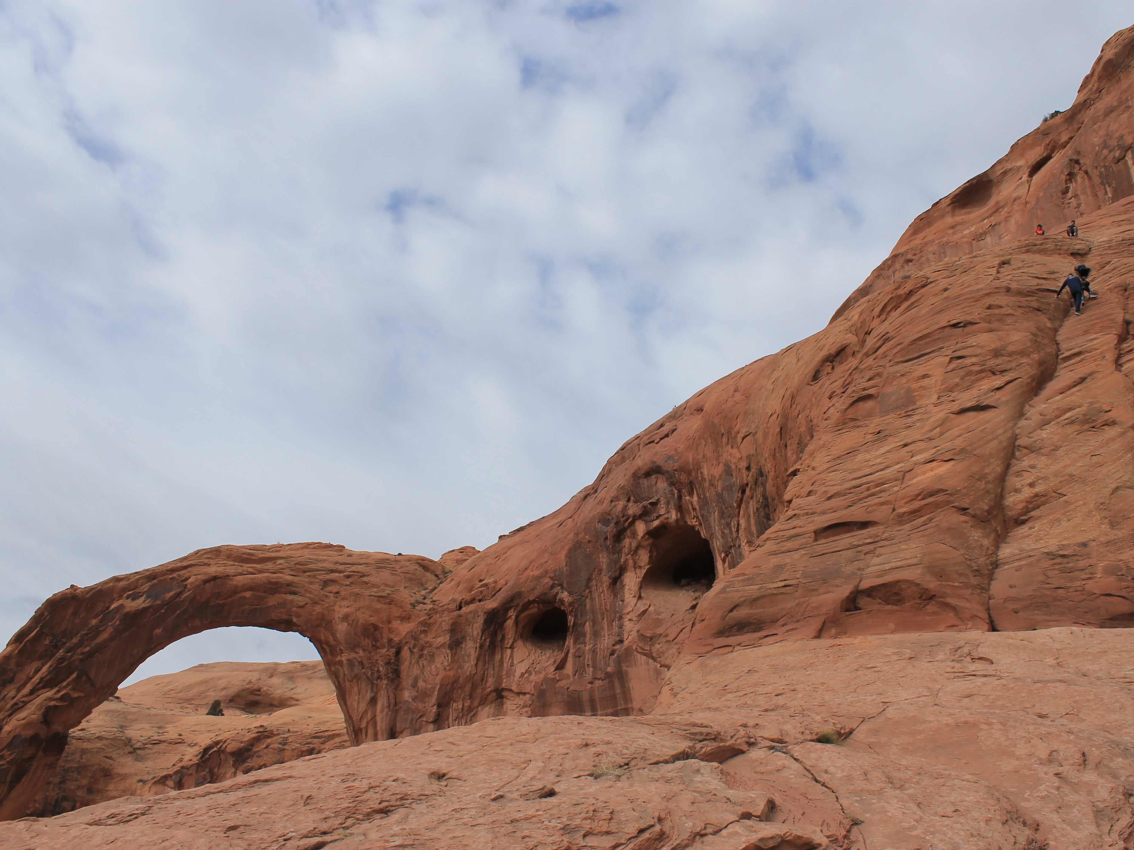 Climbing up the back side of Corona Arch
I took a break below the arch and spent some time just admiring it. It really is one of the most impressive arches that I have ever seen. I couldn't believe that I hadn't heard of it before, much less not hiked here. At least I was here now.
Eventually it was time to head back. It had clouded up while I hiked to the arch but started clearing as I hiked back. I did manage to get some good photos (although I will leave the final judgement to the reader). It wasn't long and I was back to the car. It was mid afternoon. There was time to do more and I'll cover that in the next post.
