NZ pt4 - Starting The Routeburn Track
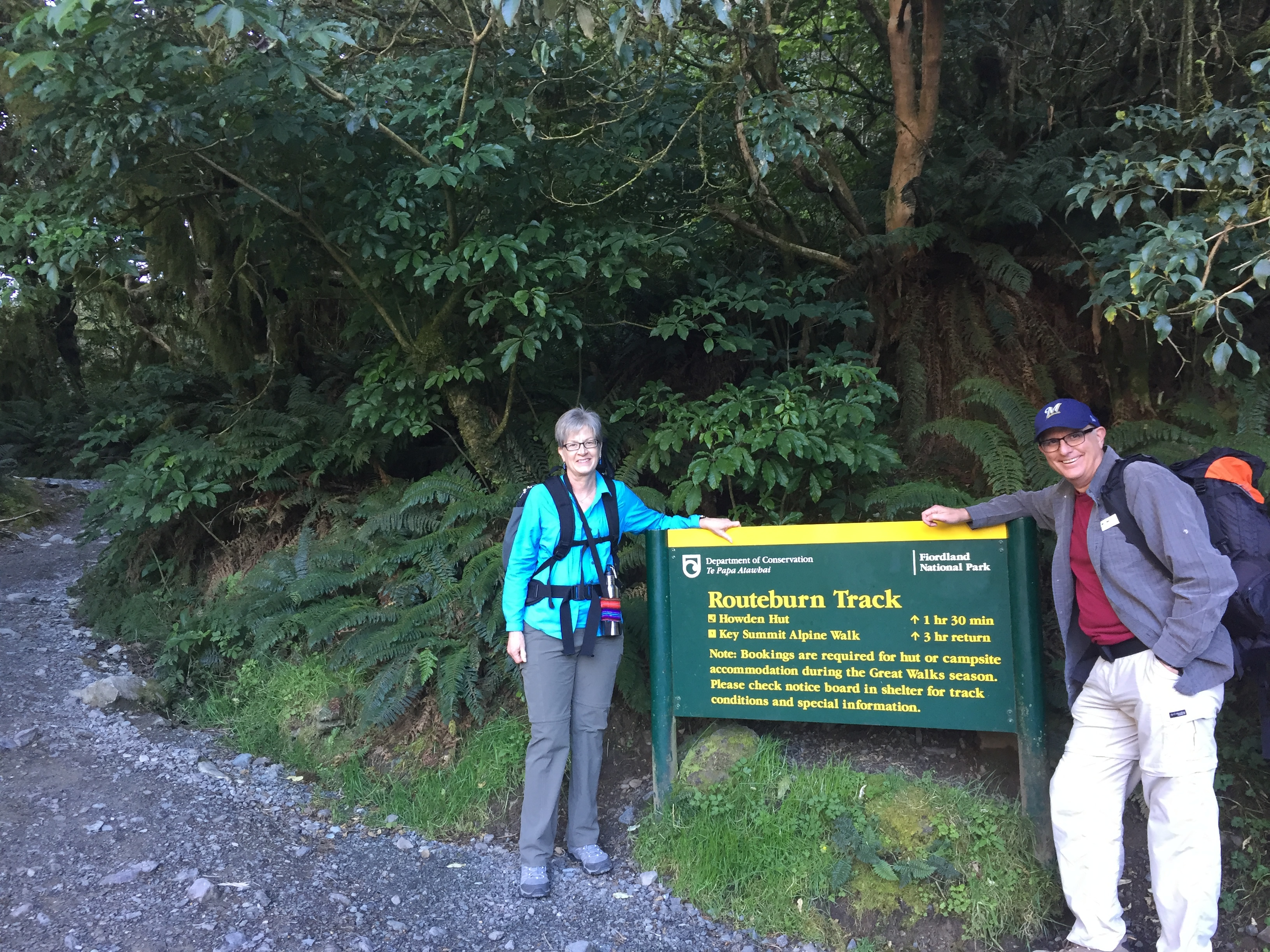 The Divide - the starting point of the Routeburn Track
New Zealand is one of my favorite countries, and I have traveled a lot. It has beautiful scenery - jagged mountains and glaciers, rugged coastline and beaches, and impressive fiords. It is sparsely populated so much of the country is still wild. Almost thirty percent of the land area of the country is under the control of the Department of Conservation, in national parks or preserves of various kinds. And one of the best things for hikers is the system of Great Walks.
There are nine Great Walks in New Zealand. Each focuses on an environment found in New Zealand: mountains, fiords, beaches, forests, river valleys. Each is a multiday walk, with maintained trails and a system of huts and shelters for hikers. The two most famous are the Milford Track, which Sandy and I hiked in 2009. It starts with a boat ride to the end of Lake Te Anau. Four days and thirty three and a half trail miles later it ends with another boat ride across Milford Sound.
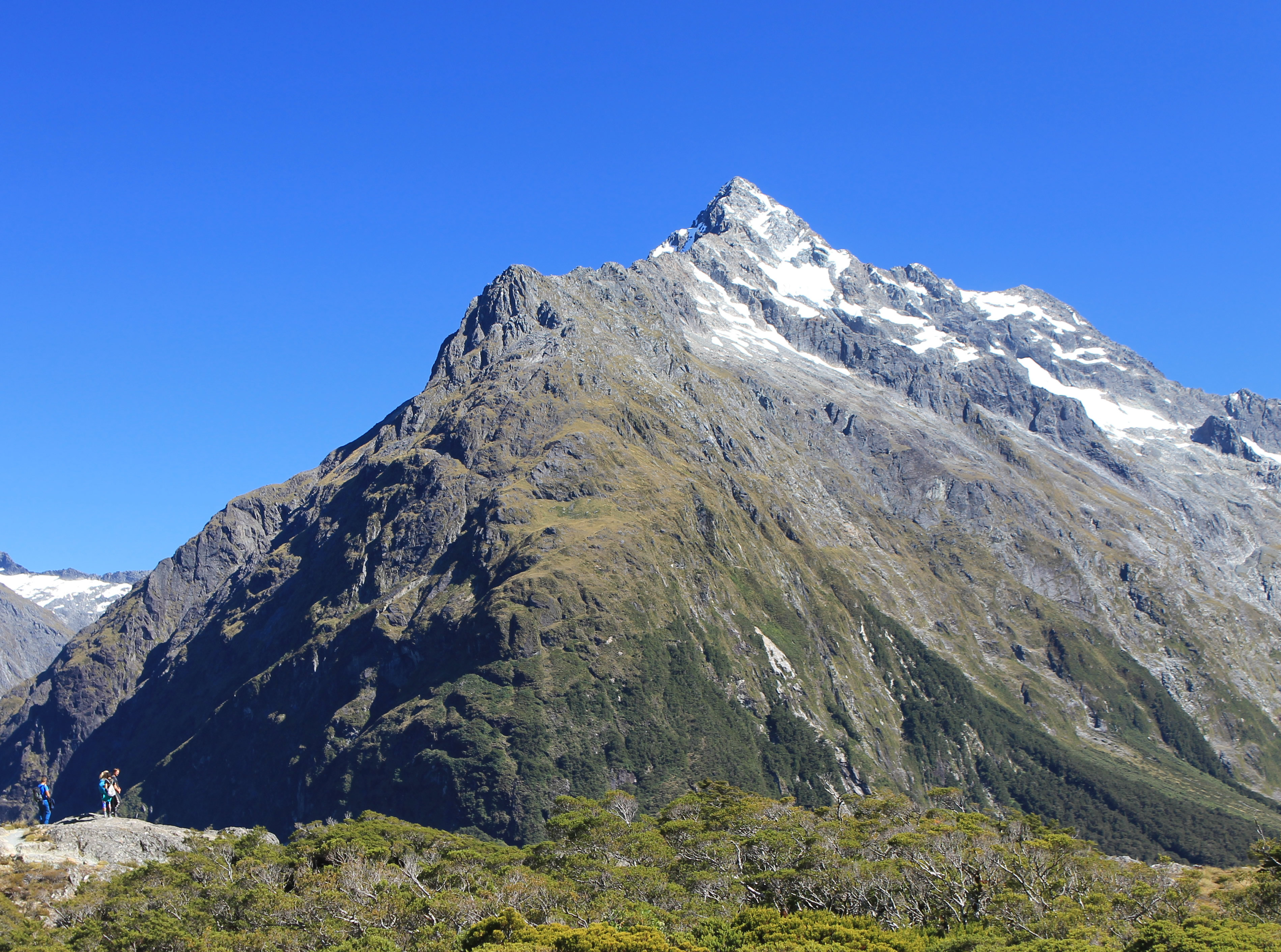
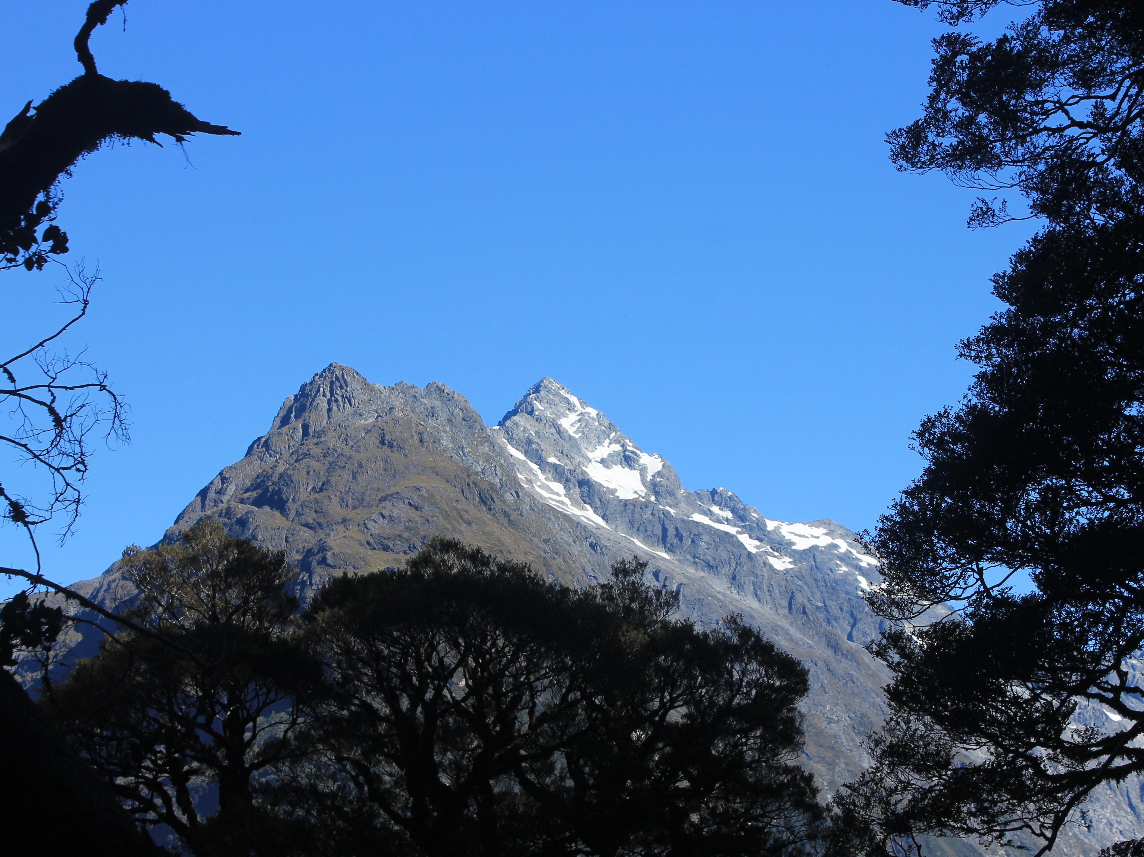 First view of spectacular peaks through the trees
The Milford is billed as "The Finest Walk in the World". I'm not sure that I would go that far but I do agree that it is a world class hike. The most spectacular section was the day that we went over McKinnon Pass and we were fortunate to have excellent weather that day.
All of the Great Walks have huts that are maintained by the New Zealand Department of Conservation where hikers can stay overnight. That eliminates the need for carrying camping gear on the multiday hikes. It also provides effective shelter should the notorious New Zealand weather really go bad, which it does all too often. While a lot better than camping in a tent, the huts have dormitory sleeping areas, communal toilets (which often are outside some distance from the hut) and no bath or shower facilities. It's not really Sandy's idea of appropriate mountain lodging. She is a strong hiker but she's not much of a camper or backpacker. Fortunately there is another option.
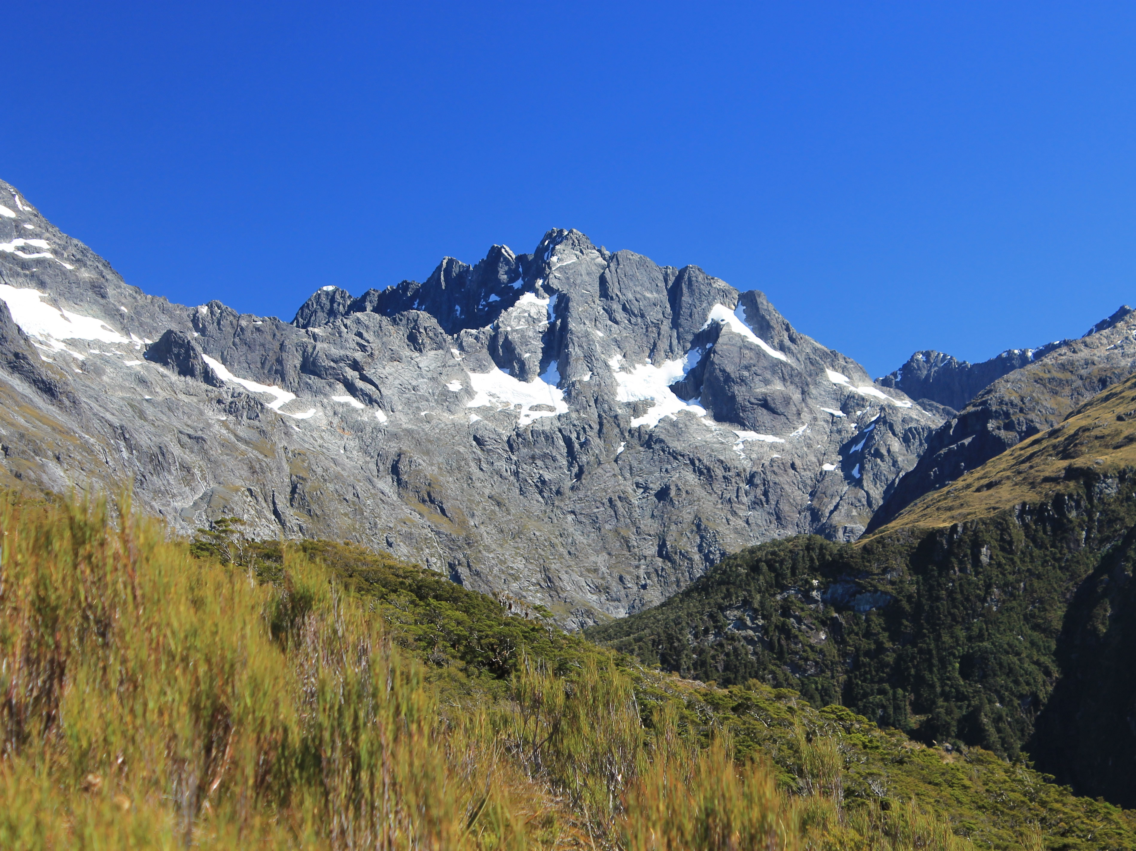
 Climbing higher the peaks of the Darren Mountains emerge
Ultimate Hikes is a company that operates their own lodges on the Milford and Routeburn Tracks that have private rooms with ensuite bathrooms. Good meals are provided and even drinks are available. Relaxing with a glass of wine after a hard day of hiking certainly is nice. They are definitely pricey but very luxurious for being in the backcountry (or in the bush, as they say in New Zealand). We did the Milford Track with Ultimate Hikes and thought the lodges were excellent. The hiking is still hard work but there is always a nice place to stay at the end of the day.
To stay in the lodges you have to sign up for a guided hike. That really isn't my thing. The trails are well marked and there is a lot of information on them. Sandy and I have hiked all over the world and we certainly don't need a guide to do either the Milford or the Routeburn. But it's the only way to stay in the nice lodges. You can't book them independently. You have to be on one of their guided hikes.
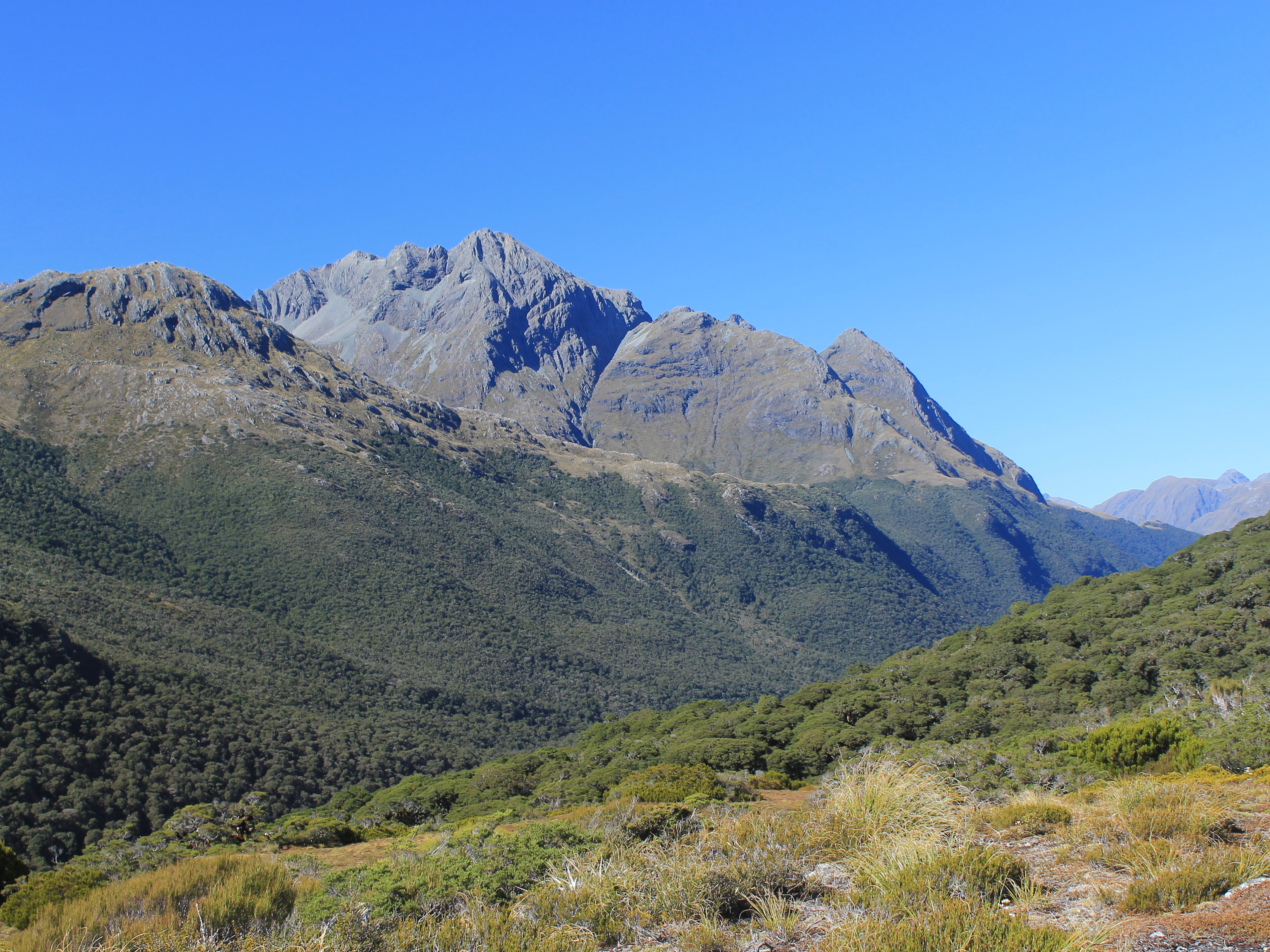
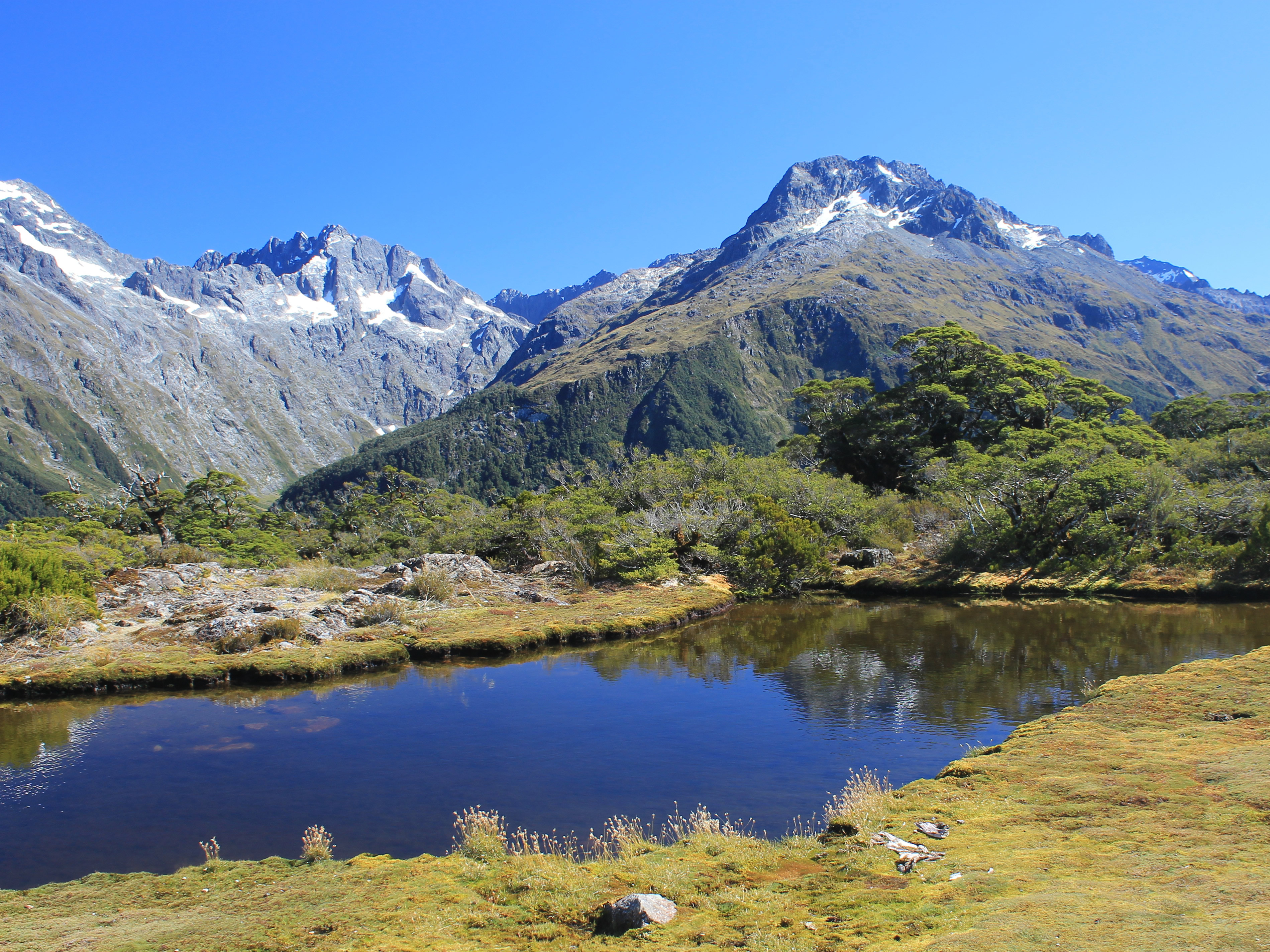 Classic view from Key Summit
Turns out that it's not too bad though. The guides are pretty low key and the hiking isn't regimented. Everyone can hike at their own pace and the group tends to spread out quite a bit on the trail. Usually one guide is at the front, one is somewhere in the middle and one brings up the rear to make sure that no one has any problems. There really isn't any handholding if you don't want or need it, so I don't mind too much.
On this trip I really wanted to do the Routeburn Track and Sandy was willing to give it a try. Way back last fall when we were making our travel arrangements I checked the Ultimate Hikes website for availability. They were already almost totally booked for spring break week. That was was Sandy's only opening to go to New Zealand during the school year. We were just in time and got the last open spot on a trip that week. The Routeburn is very popular (and the Milford is even more popular). We were lucky to get anything even scheduling six months in advance.
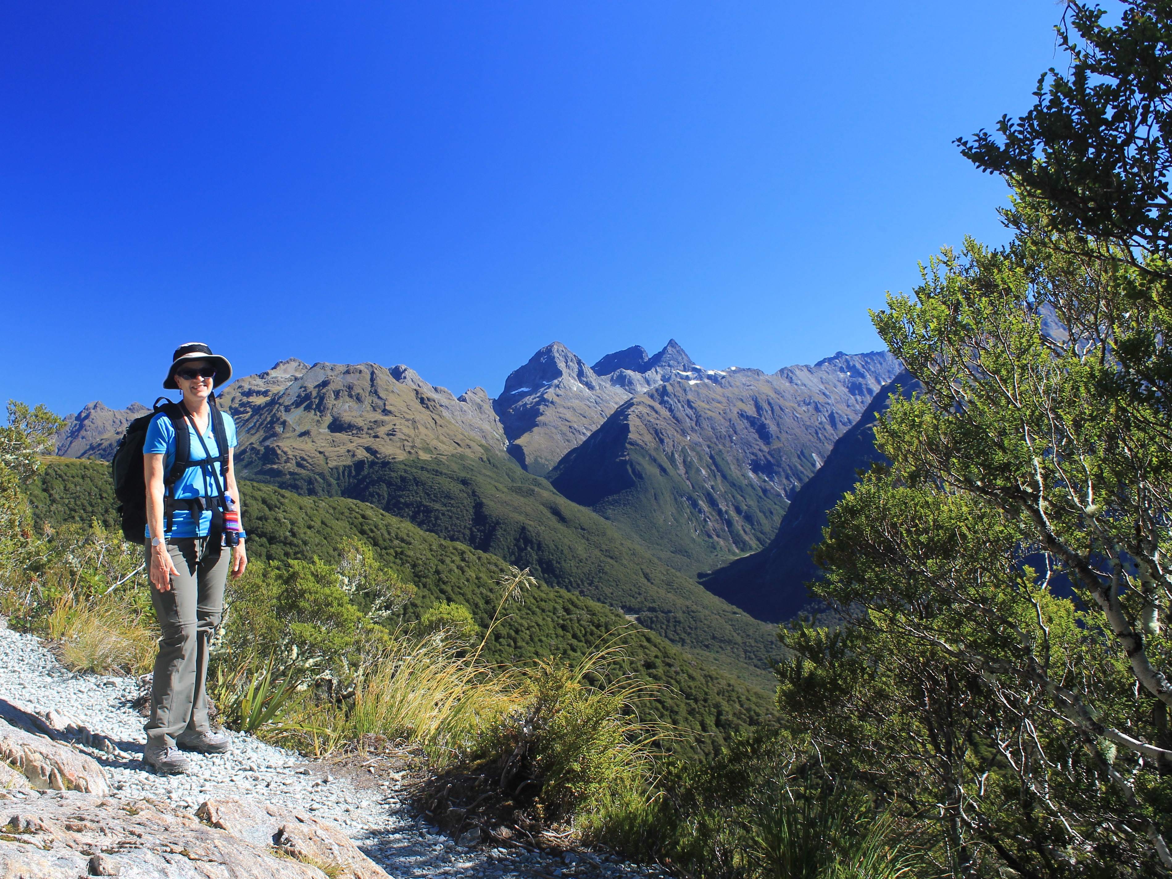
 Hikers are dwarfed by the view of Mt Christina
Once we booked we were committed. There is no flexibility. No matter what the weather was like, we would be going. And once on the trip, you have to keep moving. Each day there is another group coming behind you. You can't wait out bad weather by staying at one of the lodges for an extra day. No matter what the conditions, you have to keep moving. You have to hike every day.
As our trip approached, I constantly monitored the weather forecast online. As you would expect for New Zealand, the weather was variable. When we finally got there, the weather was fair to poor. We had rain one day and overcast the rest of the time that we were in Te Anau. But the good news was that as we headed back to Queenstown to start the Routeburn, the weather cleared. The forecast was ok to good. Of course, you can never tell with the weather in Fiordland, but things looked about as good as they could.
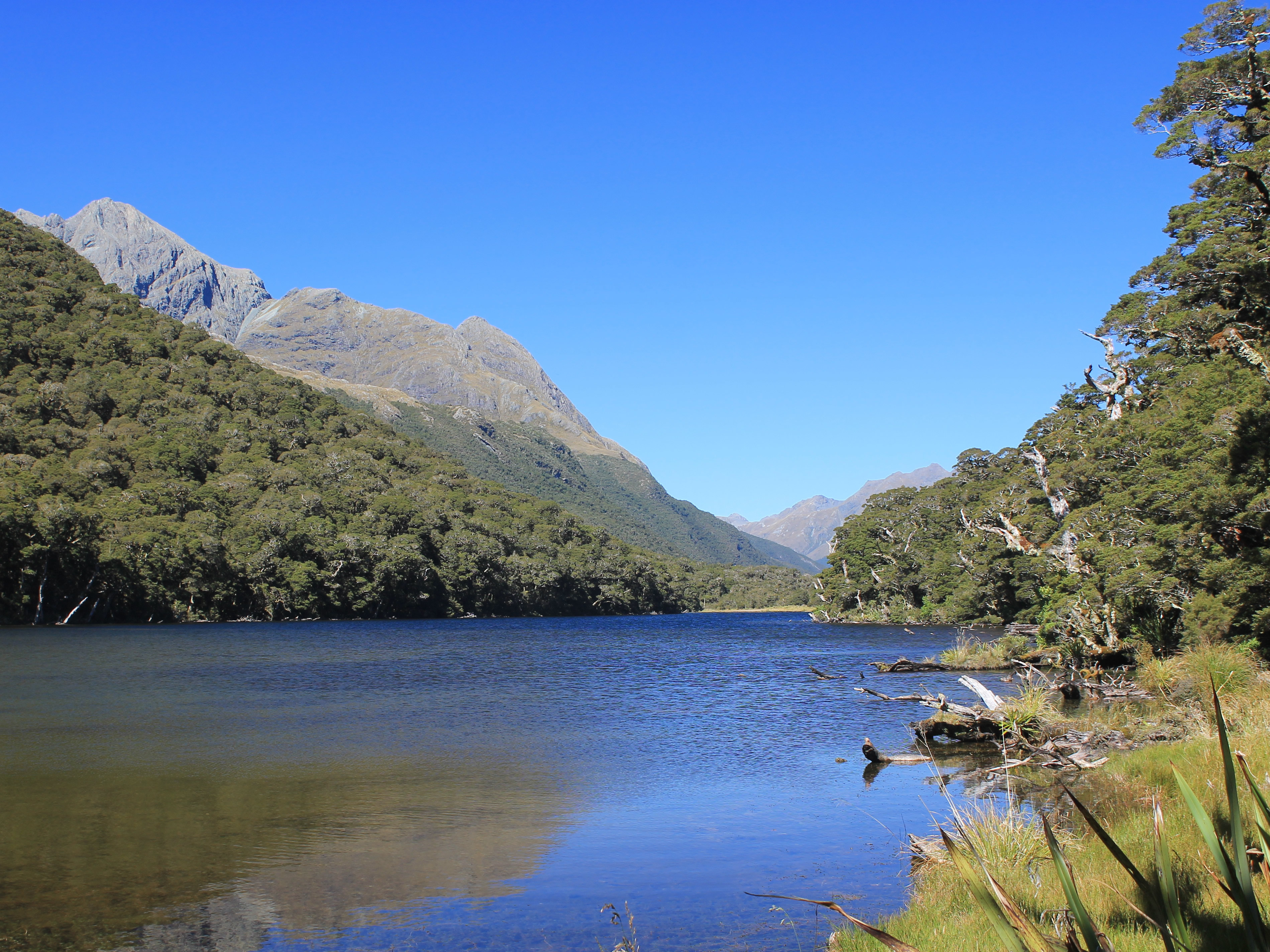
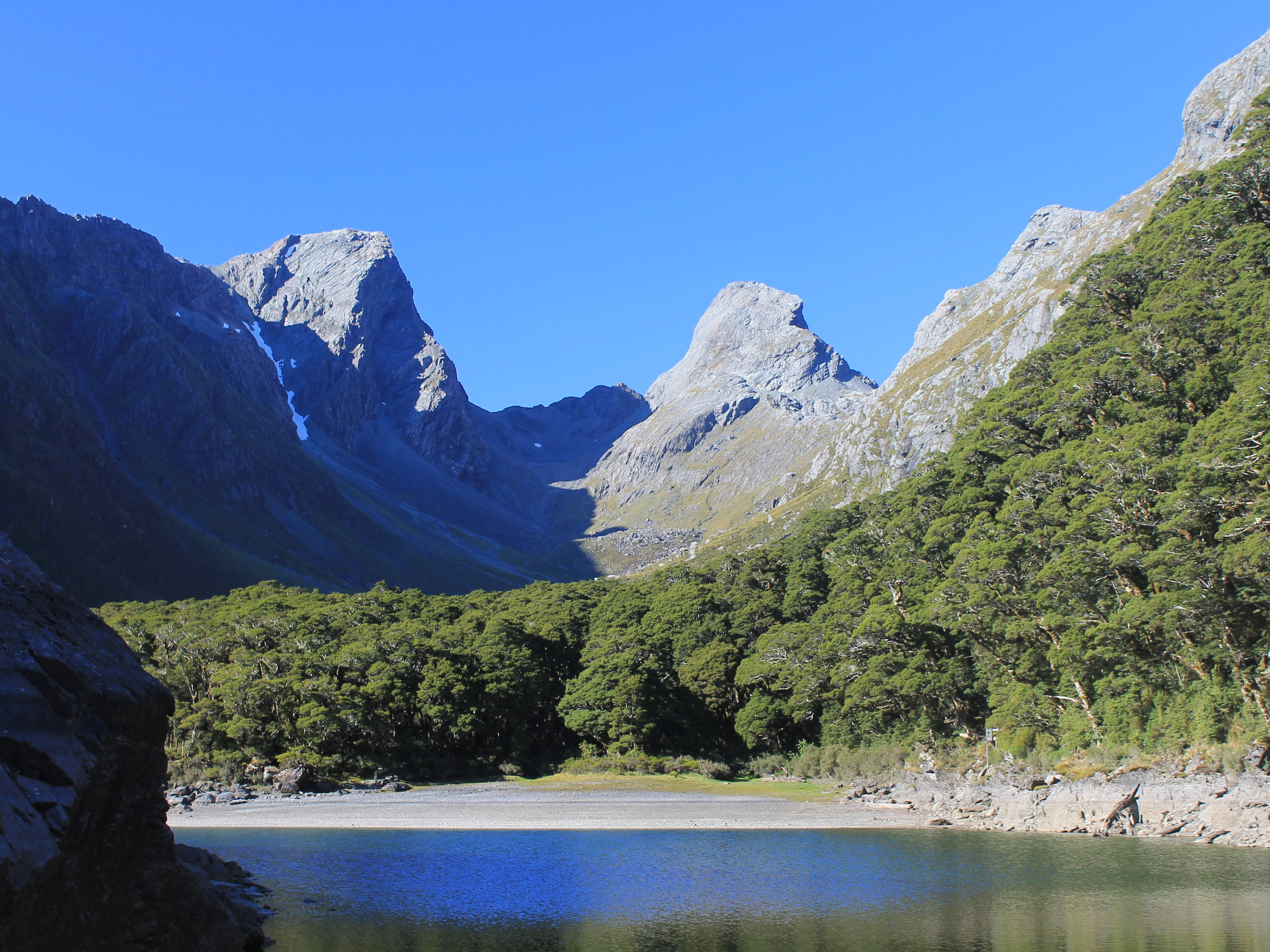
 Mt. Crosscut at the back of the Lake Marion basin
It seemed like we got up in the middle of the night on the day that our trip started. The bus was scheduled to leave at 6:30 am from the Ultimate Hikes office and we were advised to get there a little early. We figured that we would shoot for 6:15 to give us some margin. We had to walk, with our packs, so we planned to leave our hotel at 6am. That meant that we had to get up really early so that we could get ready, check out and leave our luggage with the concierge in time to leave by 6.
It was pitch dark and there was no one around on our walk over. It only took five minutes so we were there plenty early. It turned out that it didn't matter as one group was late anyway. Everyone else was there by quarter after but there is always someone in any group who doesn't listen to instructions. They finally cruised in at 6:40. To top it off, they need before we were finally on the road.
 The Greenstone Valley and Jean Batten Peak
The reason for the early start was that it would take us about four hours to reach the trailhead. We wanted to get there reasonably early because when we got there we still had a full day of hiking.
We started with the two hour drive to Te Anau. Since Sandy and I had driven there and back in the past few days, it was pretty familiar. It was like deja vu, all over again. But this time I didn't have to drive so I could just relax. I watched the scenery or just closed my eyes and tried to sleep.
In Te Anau we stopped at the Hollyford Cafe. We had been there before when we were in Te Anau. I even had bought a tshirt there. There was a mini Ultimate Hikes office and they served us morning tea - drinks and treats from the bakery. We hadn't bothered with breakfast earlier but I was hungry now so I grabbed two brownies. I figured that I could indulge since I was going to be doing hard hiking for the next three days.
 Lake Howden - lots of brush and lots of bugs
There were also two more hikers who joined our group. They had just come off the Milford Track the day before so didn't return all the way to Queenstown just to come back today. Although both the Milford and the Routeburn are great hikes, doing them back to back would be hard work. Not to mention that you are seriously challenging the weather gods if you hope to get an entire week of good weather in the fiordland mountains.
After half an hour we were back on the road. Then it was another hour and a half until we were at The Divide. It's only 532 meters high (or 1745 feet if you are from a backward country like Liberia, Burma or the United States). It's the lowest pass across the Southern Alps, which run for three hundred miles, almost the entire length of the South Island. It may be the lowest pass, but it's the highest that the road goes, so it's the start of the Routeburn Track. It was a nice sunny day and both Sandy and I were ready to start hiking. We grabbed our packs, got a quick picture of us by the sign at the start of the trail, and started off. There were twenty six hikers in the group plus three guides and we were the first ones on the trail.
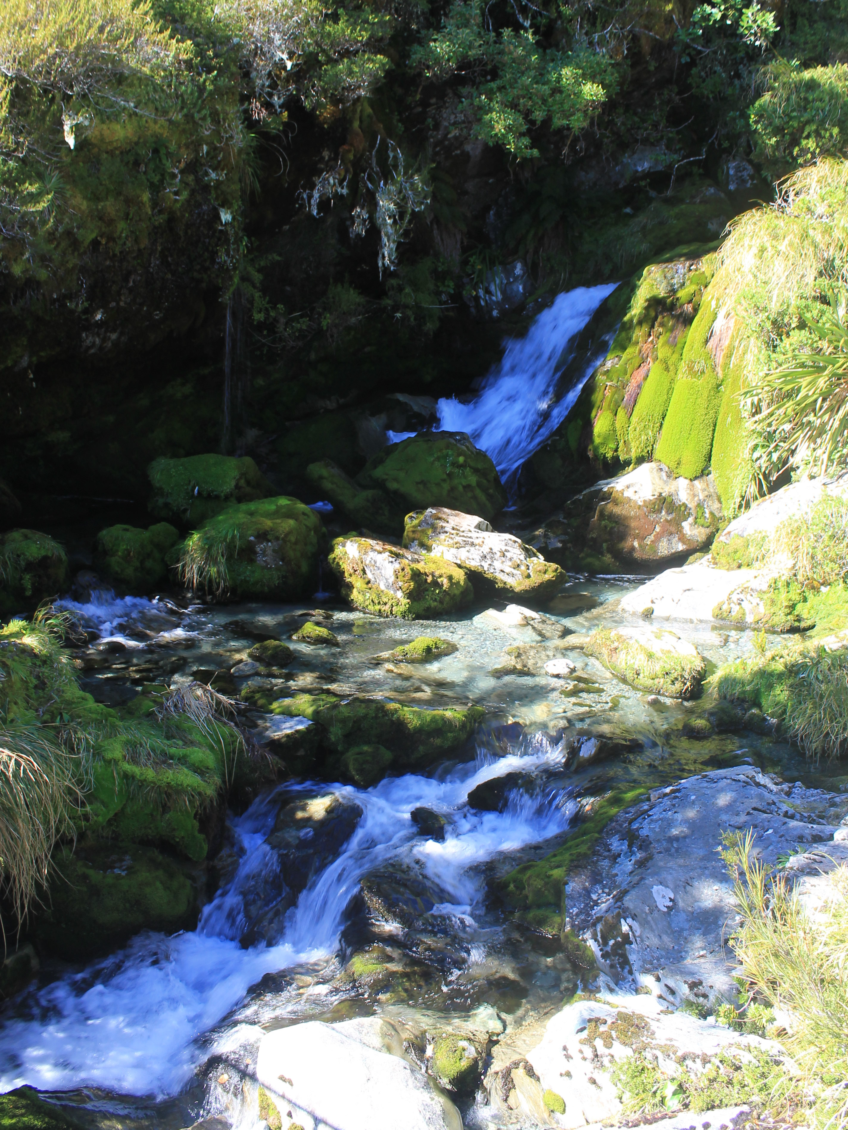 There were lots of cascades beside the trail
That didn't last long as the trail was uphill right from the start so Sandy and I set a slow, comfortable pace. Pretty soon we were being passed by others who seemed to be in more of a hurry than we were. Or maybe they were in better shape than we were.
Nah.
The trail climbed steadily through dense beech rainforest. This was fiordland, on the west side of the mountains near the coast, so the area got a lot of rain. It was a warm, sunny day so the shade was actually welcome. Occasionally we could see and hear traffic on the highway through the trees but it wasn't long before that was left behind.
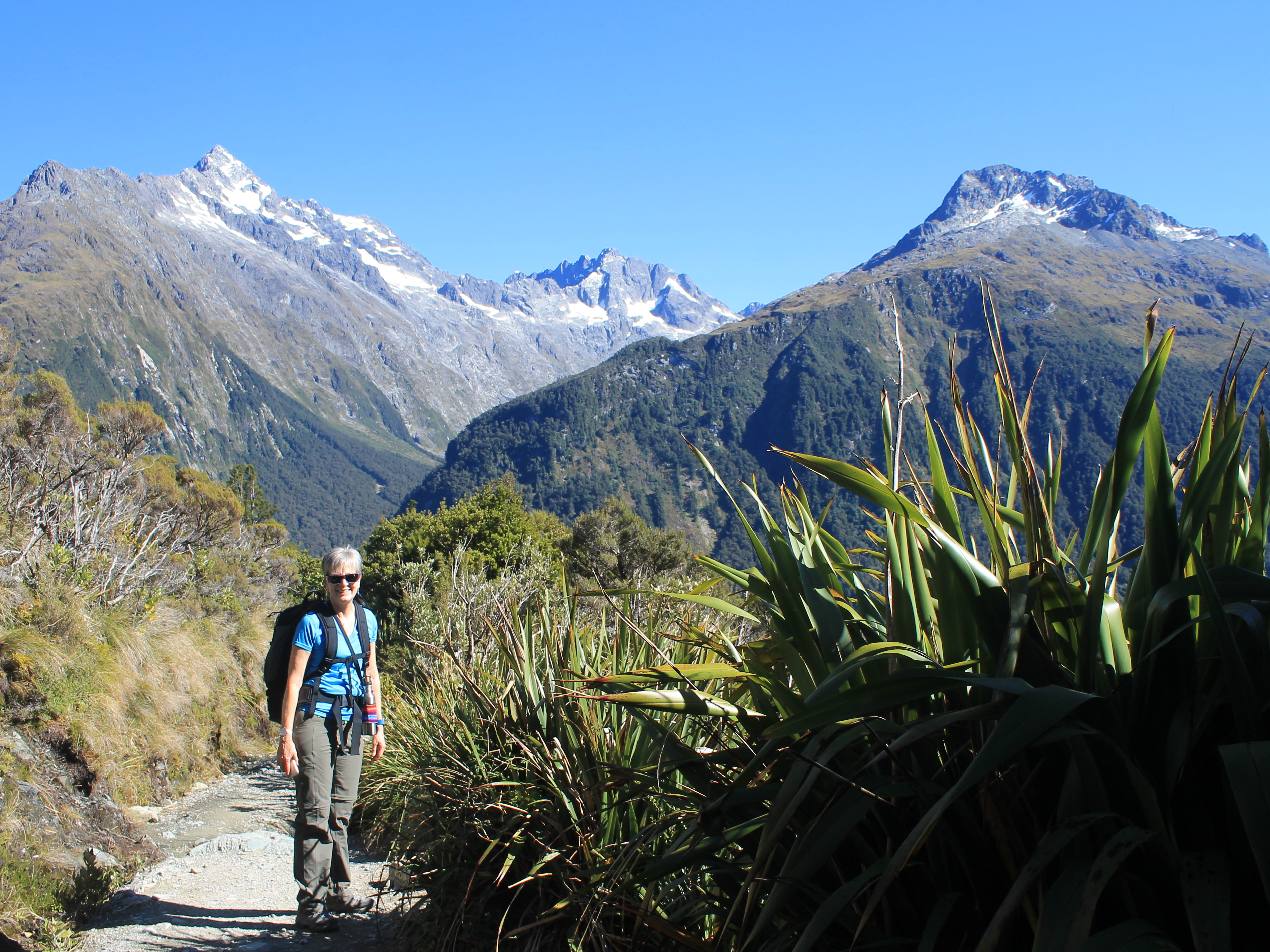
After forty five minutes we were getting close to the treeline. Through gaps in the forest we could see spectacular peaks across the valley. After an hour of climbing, we reached the junction for the spur trail to Key Summit. We dropped our packs for the climb up while one of the guides, Greta, stayed at the junction to keep an eye on them. Even though the trail steepened it was a relief to be hiking without a full pack. It took about a half an hour from the junction to reach the top. It's not even a real summit, just a bump on the ridge that rises from The Divide. But it's at the junction of three major glacier-carved river valleys: the Greenstone, the Hollyford and the Eglington. The view of the valleys and the peaks that line them is incredible. To make it even more photogenic, there are some small tarns that look great in the foreground for photos of the surrounding mountains.
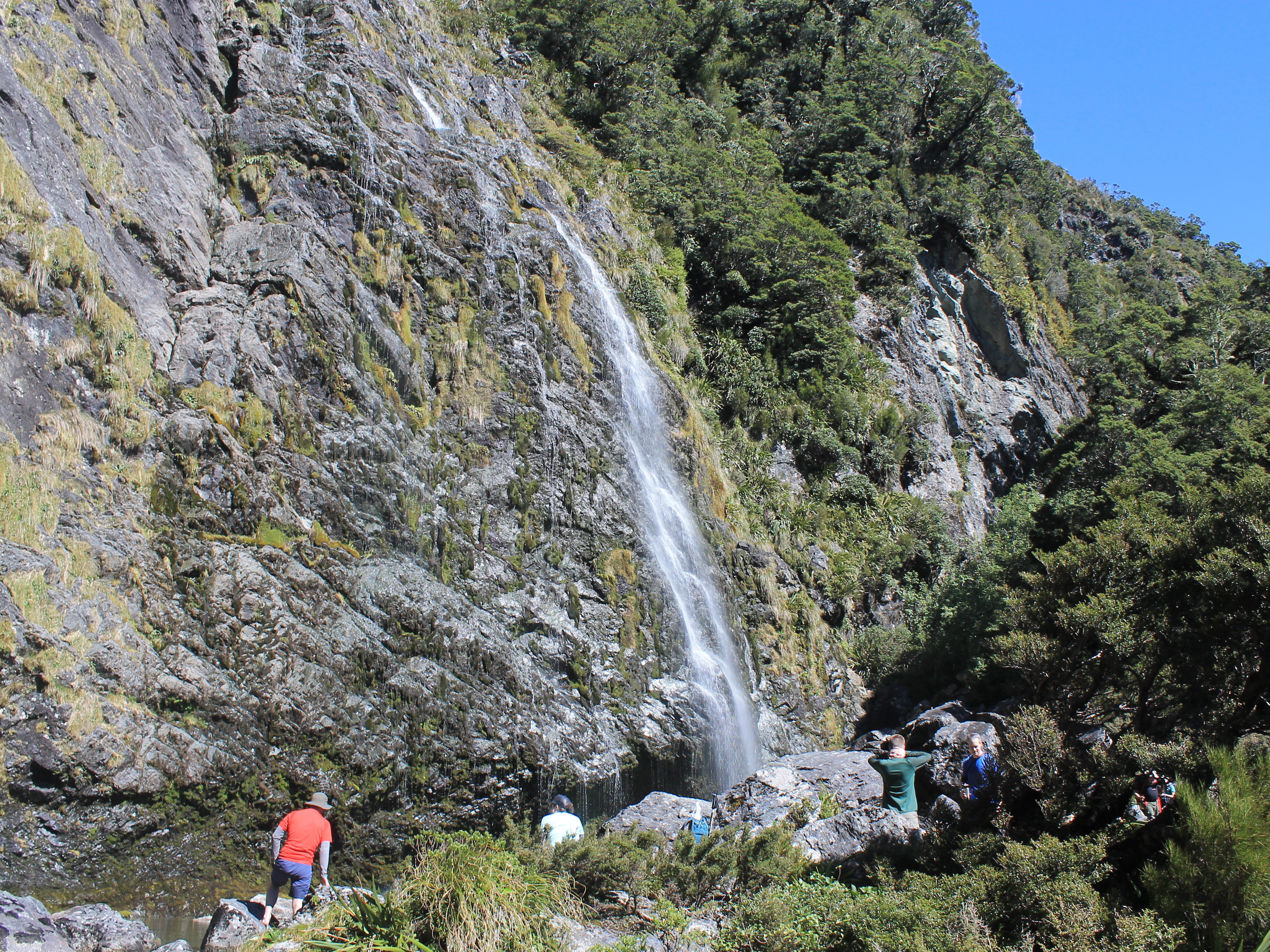 Taking a break at Earland Falls
We took lots of pictures before hiking back down, which was a lot quicker than going up. Our packs were waiting for us at the junction. That was a good thing, although I had hoped that maybe somehow they would have managed to move further along the trail while we were gone to Key Summit. No such luck though.
Next we had a long traverse, then a descent to Lake Howland. That would be the pattern for a lot of the Routeburn. Steep climb. Long traverse. Descend. Repeat. Those descents were always discouraging, giving up hard won elevation gain, especially when you knew that you would have to regain it again soon. But now we had reached Lake Howland an the DOC hikers hut, where it was time for lunch. This is where a benefit of a guided hike became obvious. One of the guides, Sam, had reached the hut ahead of us and prepared drinks: tea, juice and soup. Nice service! I began to think that maybe this guided hiking thing wasn't so bad after all.
 Starting to get tired but Sandy is still smiling
I am paranoid about bugs so I found a spot in the eating area of the hut. Sandy was brave and stayed outside to eat her lunch. Briefly. In a few minutes, she came hustling into the hut, chased in by the sandflies. This was the only spot on the whole hike that they were bad.
Before we started out we had been given bag lunches prepared by FergBaker, sister store of Fergburger, the best burger place in Queenstown. Mine was a turkey sandwich. Usually I am not a fan of meat sandwiches but my lunch was delicious. Maybe the hike had just made me really hungry.
We still had a long way to go. We were only a third of the way to the Lake Mackenzie Lodge, our destination for the night. We started off again and right away the trail climbed. Again. Eventually we reached Earland Falls, one of Fiordland's most impressive waterfalls. It's over 500 feet high in two stages. The trail goes right past the base of the falls, close enough that you feel the mist from the falls as you walk by. We found some comfortable rocks to sit on far enough away that we could keep dry. It was time for a break after climbing that big hill up from Lake Howland.
 Lake Mackenzie
As we were getting our packs on to leave Sandy discovered a problem. She didn't have her toilet kit in her pack. She figured that she must have left it at the Lake Howden Hut when she hustled inside to get away from the bugs. I didn't think it was that big a deal but Sandy was very upset. I guess it's a female thing. We considered me going back to try to find it (note: I was willing to go but not excited at the prospect). One of the guides radioed back but the other guide had already left the hut, although he was willing to go back as well. Sandy was venting her frustration when someone passed her and she had to move out of the way. When she did she happened to notice something in the rocks. Her toilet kit had fallen out of her pack when we stopped here and it fell behind a rock out of sight. Whew! A major disaster had been narrowly averted.
We still had one more long stretch to go before we were done for the day. By now we were both starting to get tired. We weren't used to hiking with heavy packs. I I could certainly feel it in my lower back.
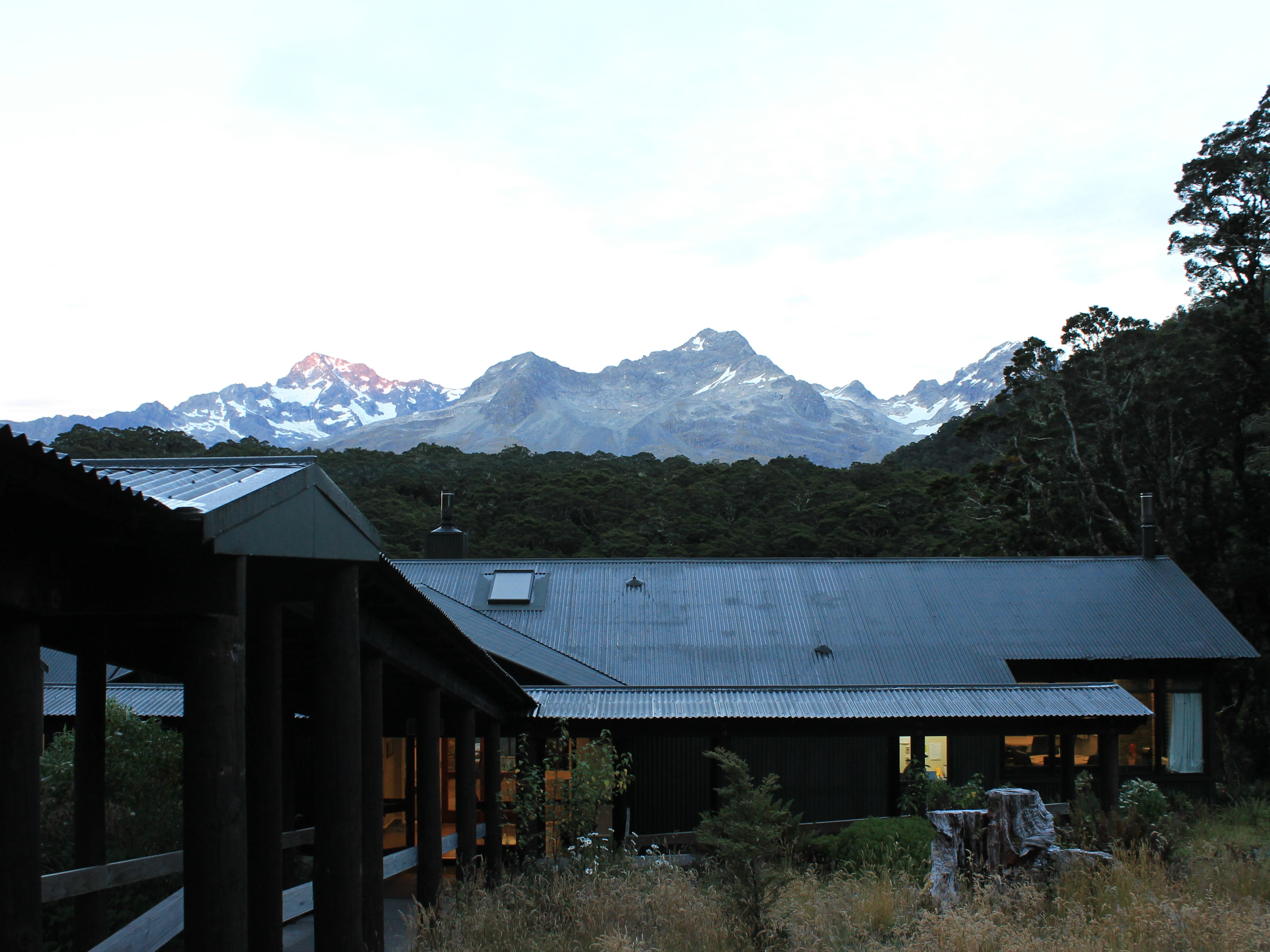 View at dusk from our room at Lake Mackenzie Lodge
The last stretch was a steep descent to Lake Mackenzie. This was especially tough for Sandy. She has been having foot problems the past year that has affected her hiking. She has found better boots that really help. But a steep descent on a rough trail, with lots of rocks and exposed tree roots, was causing her pain in her foot, especially after a long day of hiking. She toughed it out though and eventually we were down.
After a level stretch, we arrived at the hut. One of the workers was waiting at the door with drinks and snacks. Soon we were in our room and could finally take our packs off for the last time today. It wasn't long before we had showered and changed. Feeling refreshed, we headed to the lodge, ordered a glass of wine, and found a spot on the patio where we could admire the mountains. We had done the first day of the Routeburn Track and had perfect weather. Life was good.
