NZ pt5 - Harris Saddle
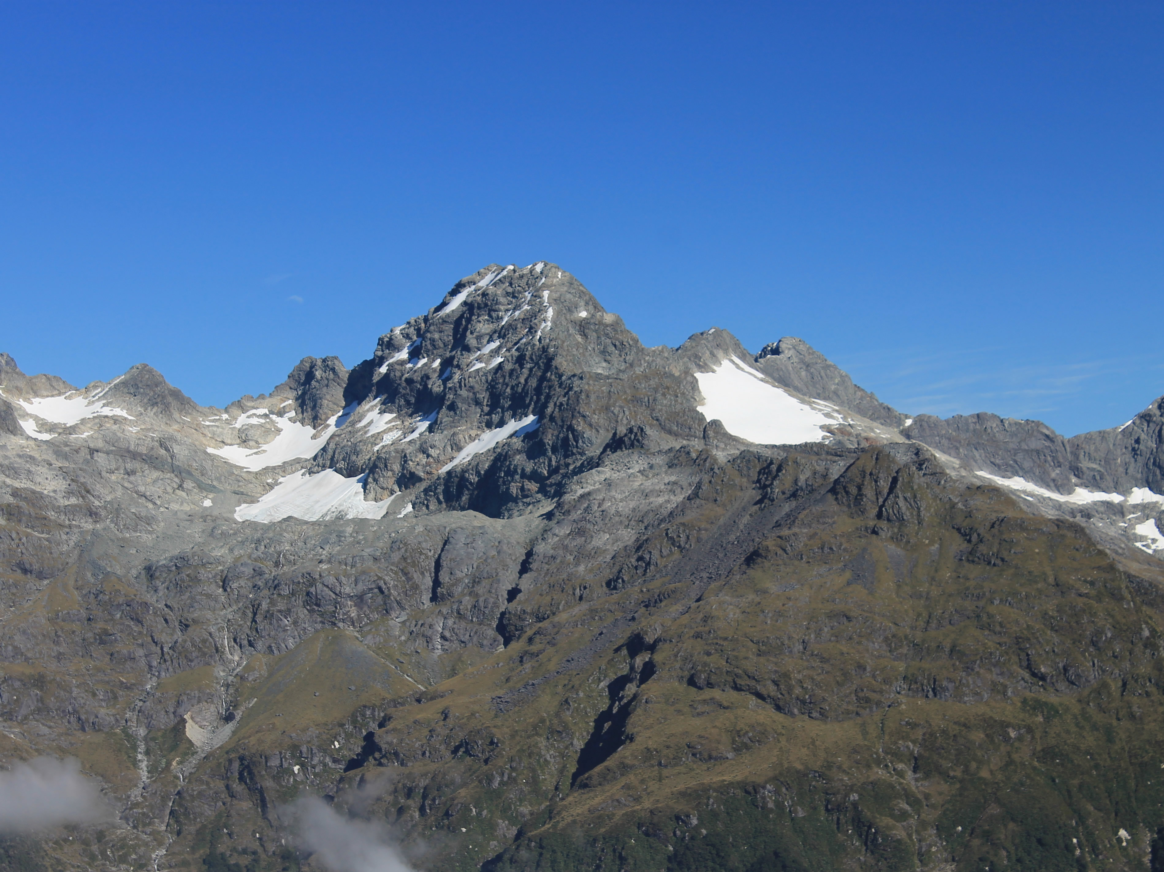
 The Ailsa Range from far above Lake Mackenzie Lodge
Our first day of hiking on the Routeburn Track had been great. We had perfect weather and the scenery had been beautiful. The hiking was a lot of work, especially since Sandy and I were carrying heavier packs than usual. I certainly could feel the difference in my lower back by the end of the day. But the views were so incredible that the effort was well worth while.
After the days hike we were at Lake Mackenzie Lodge. We showered, changed and got a glass of wine. We sat outside on the patio where we could enjoy the warm, sunny weather and meet some of our fellow hikers. They came from all over the world. One couple (only one) was from New Zealand. There were quite a few Americans, but there were also people from Canada, Singapore, Hong Kong and Japan. One of the fun things about a trip like this is the opportunity to get to know people from all over the world. Many of them are quite widely traveled (that's why they're in New Zealand doing a big hike) and they have lots of interesting stories to tell.
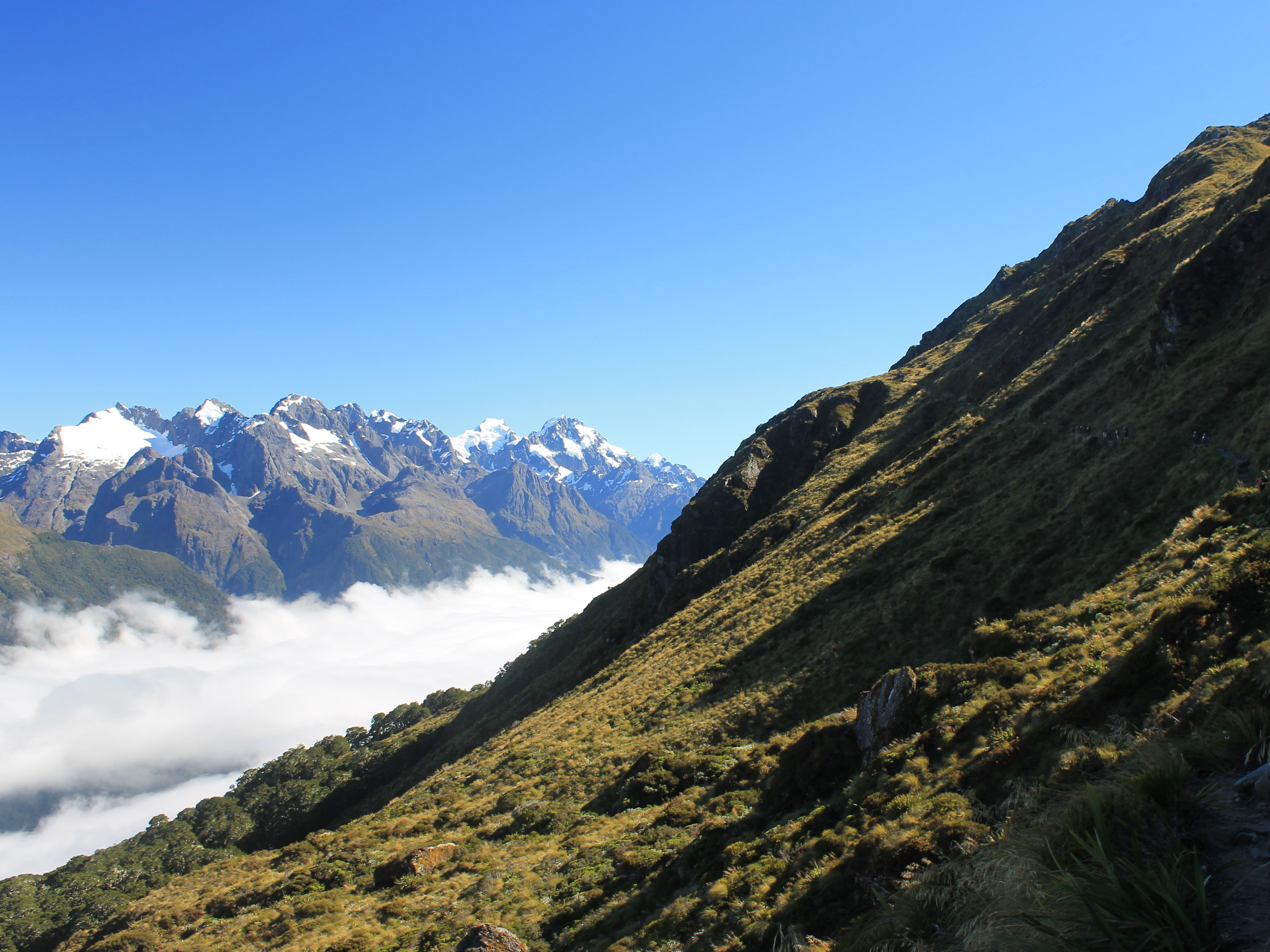
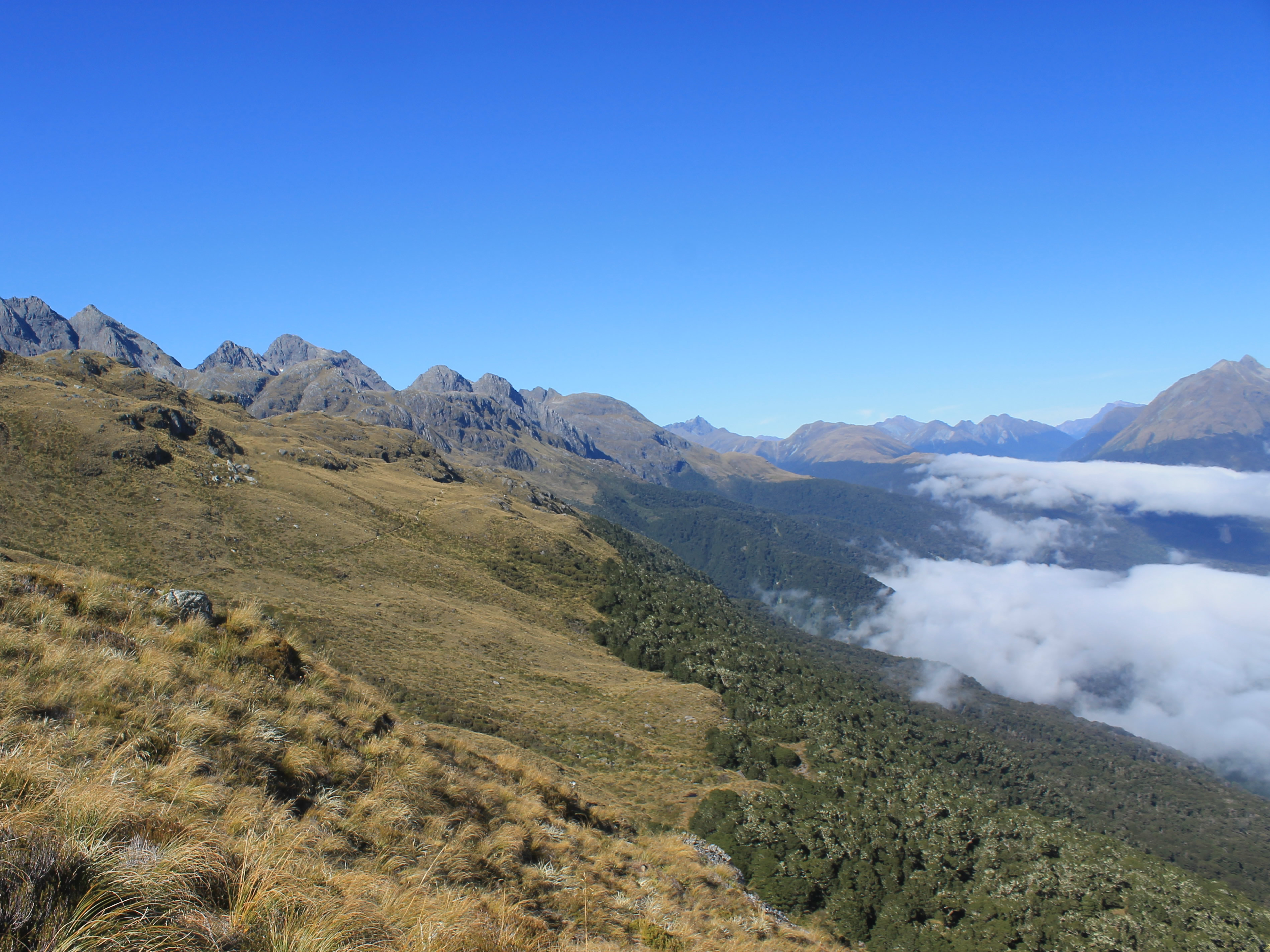
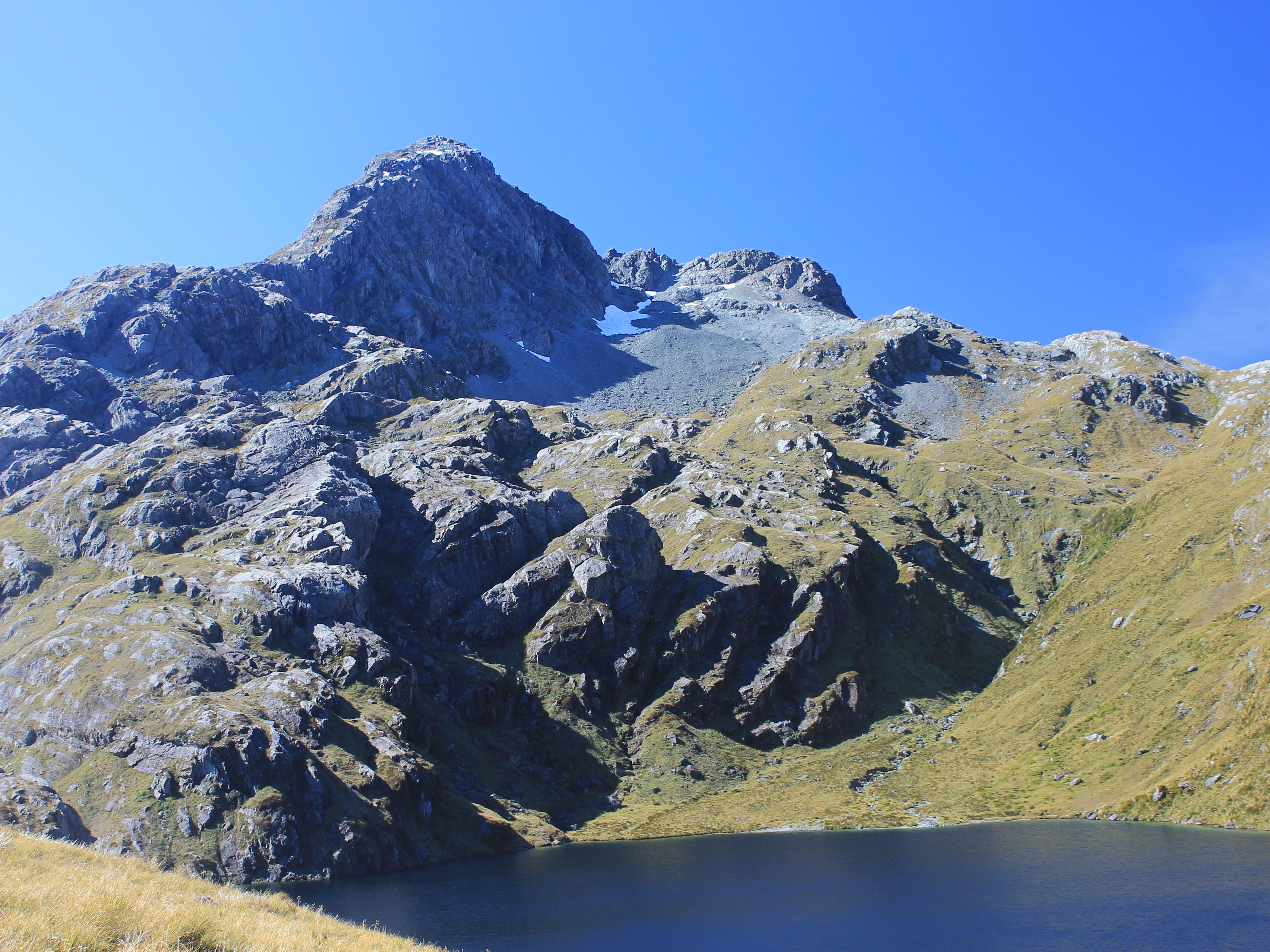
 It was a lot of work climbing out of the Lake Mackenzie basin
Later we went inside for dinner. We could choose from three different main dishes. Actually, we had made the choice on the bus that morning and our choices were radioed ahead to the lodge. I chose the steak and my meal was very good.
The dining room had round tables that could accomadate six to eight people so we split up into smaller groups. At our table there was a couple from Toronto, Karen and Michael, and a couple from Auckland (the group's official kiwis), Marilyn and Lindsay. They were nice people and we had some interesting conversations. On other trips like this people tended to switch around at each meal. That wasn't the case on this trip. For some reason, we just tended to sit in the same groups at each meal, dinner and then breakfast, at both of the lodges. That enabled us to get to know the people that we spent time with better, although the down side was that we didn't meet as many people.
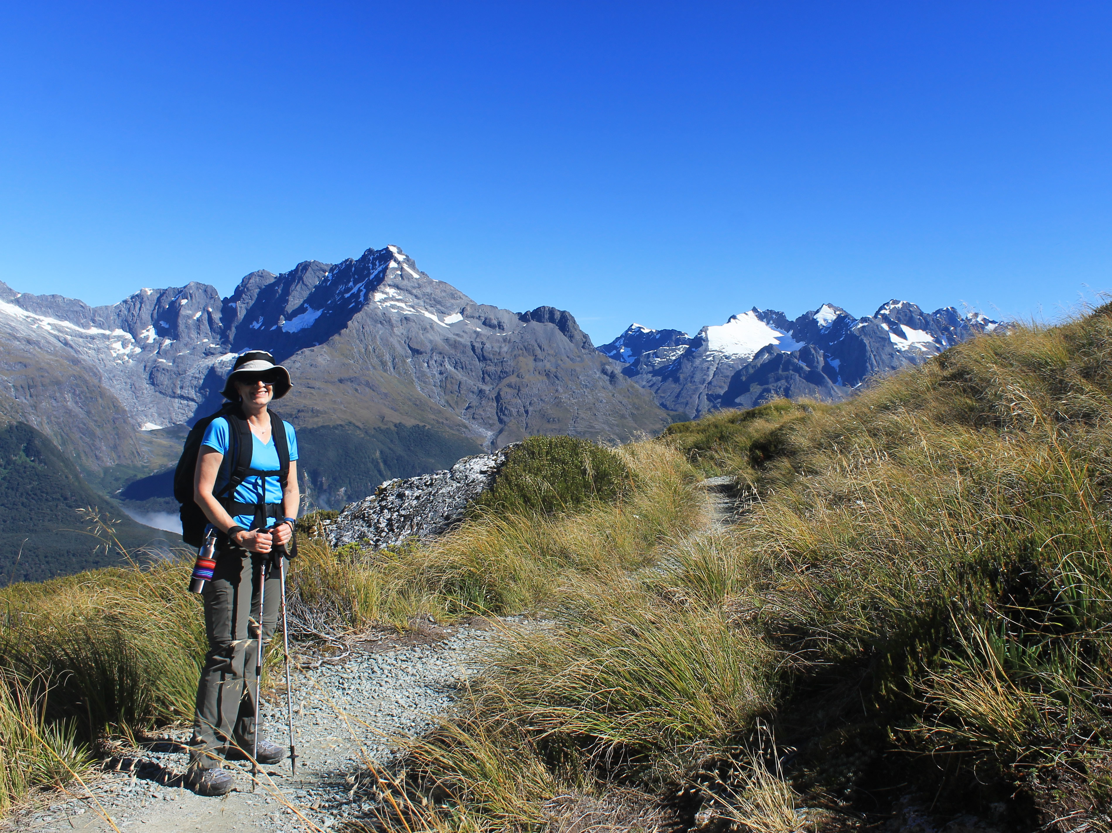
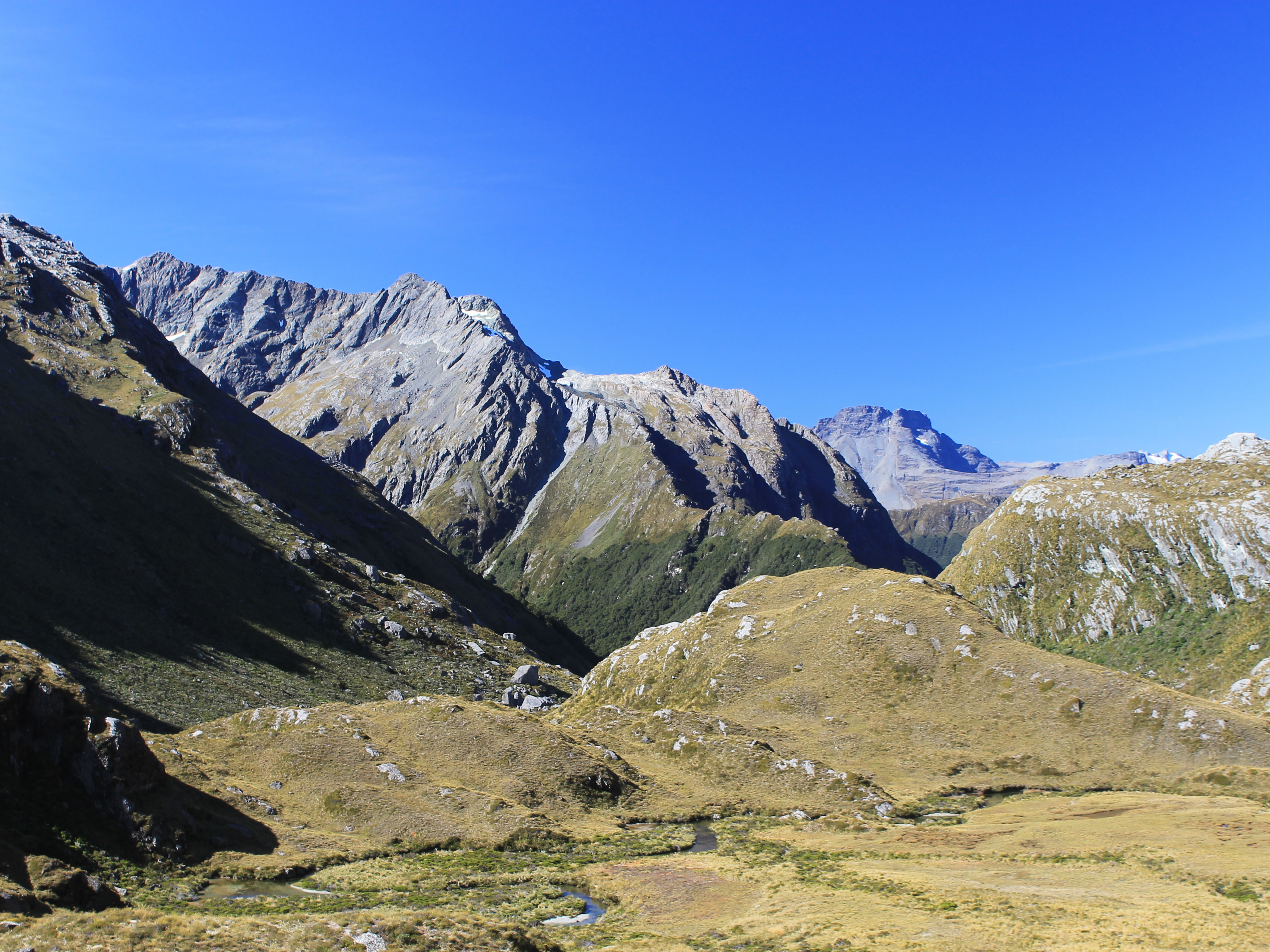
 The group stops to admire the view at Ocean Peak Corner
We talked about things back home - weather and kids and dogs. We talked about various places that we had traveled and hikes in the mountains that we had done. People on trips like this one tend to be well traveled so there were lots of good stories.
Although we all approached it cautiously, conversation inevitably turned to politics. Virtually everyone who wasn't an American had the same question - what the hell happened in the presidential election? When they got to know us better, the real question was, are you people crazy? Since neither Sandy nor I are fans of Donald Trump, we very quickly joined in the Trump bashing sessions. It was interesting to see that people from all around the world, who weren't caught up in nationalism or other campaign rhetoric, really couldn't understand what the attraction was that Donald Trump had for US voters. All we could say was that we were there and we didn't understand it either.
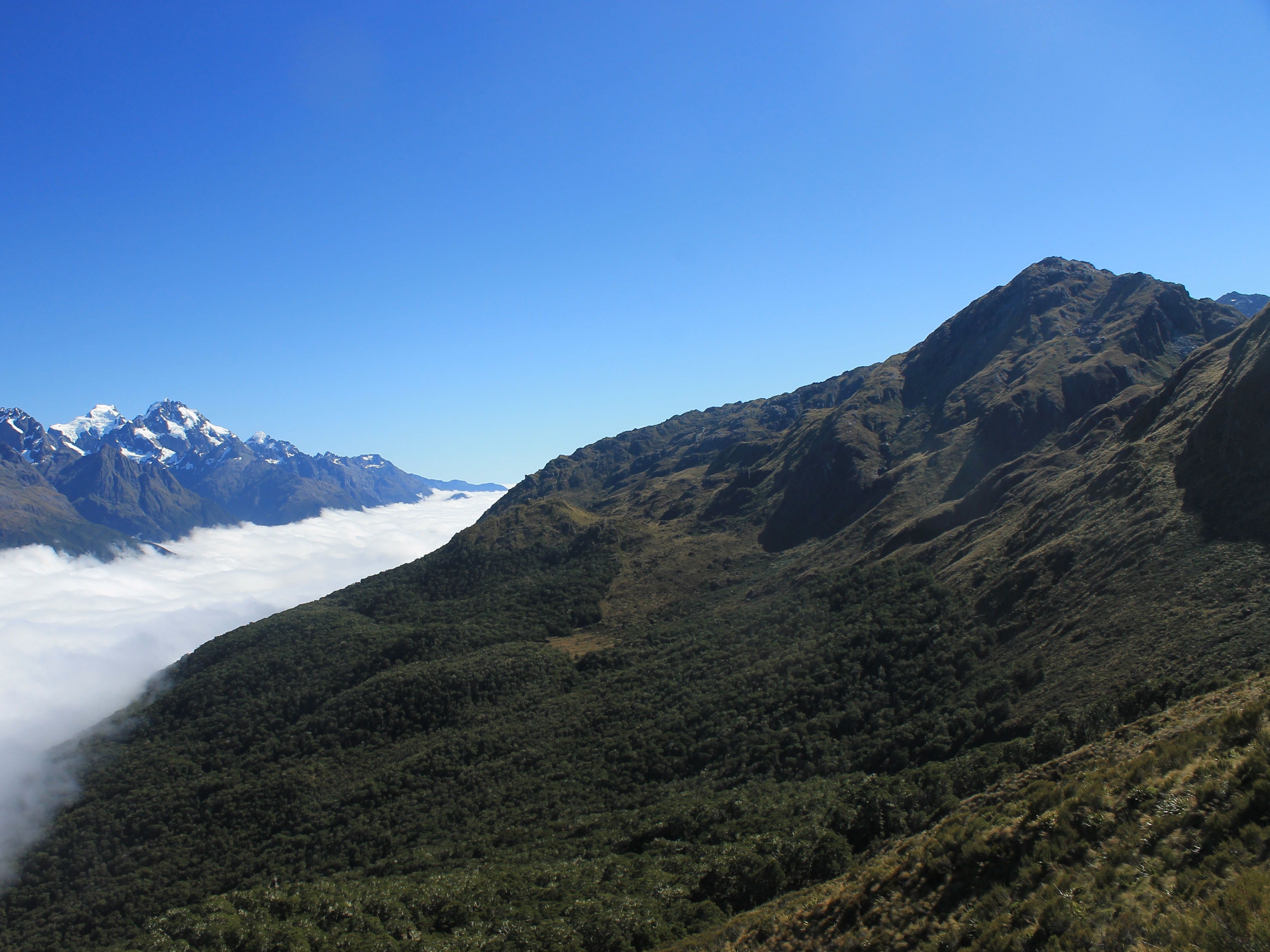
 Fog rolls in from the Tasman Sea and up the Hollyford Valley
After dinner we had a briefing from the guides. What time the lights would fo off. What time the lights would come on. When breakfast would be served. What time we would leave. What to expect on the hike the next day. Then we went back to our rooms. At 10 pm it was lights out. This wasn't a request. They shut the generator down. We had brought a headlamp along in case we needed to take a middle-of-the-night bathroom break.
After lots of fresh air and hard hiking we slept well. We were already up when the power came back on. We met in the dining room for breakfast. There was fruit and cereal, which was plenty for me. I'm not much of a breakfast person. There was also cooked breakfast which made Sandy happy since she loves breakfast. After eating we made our lunches. There were lots of sandwich fixings, fruit, cookies and candy. My lunch consisted of a cheese sandwich and as many hokey pokey bars as I could get.
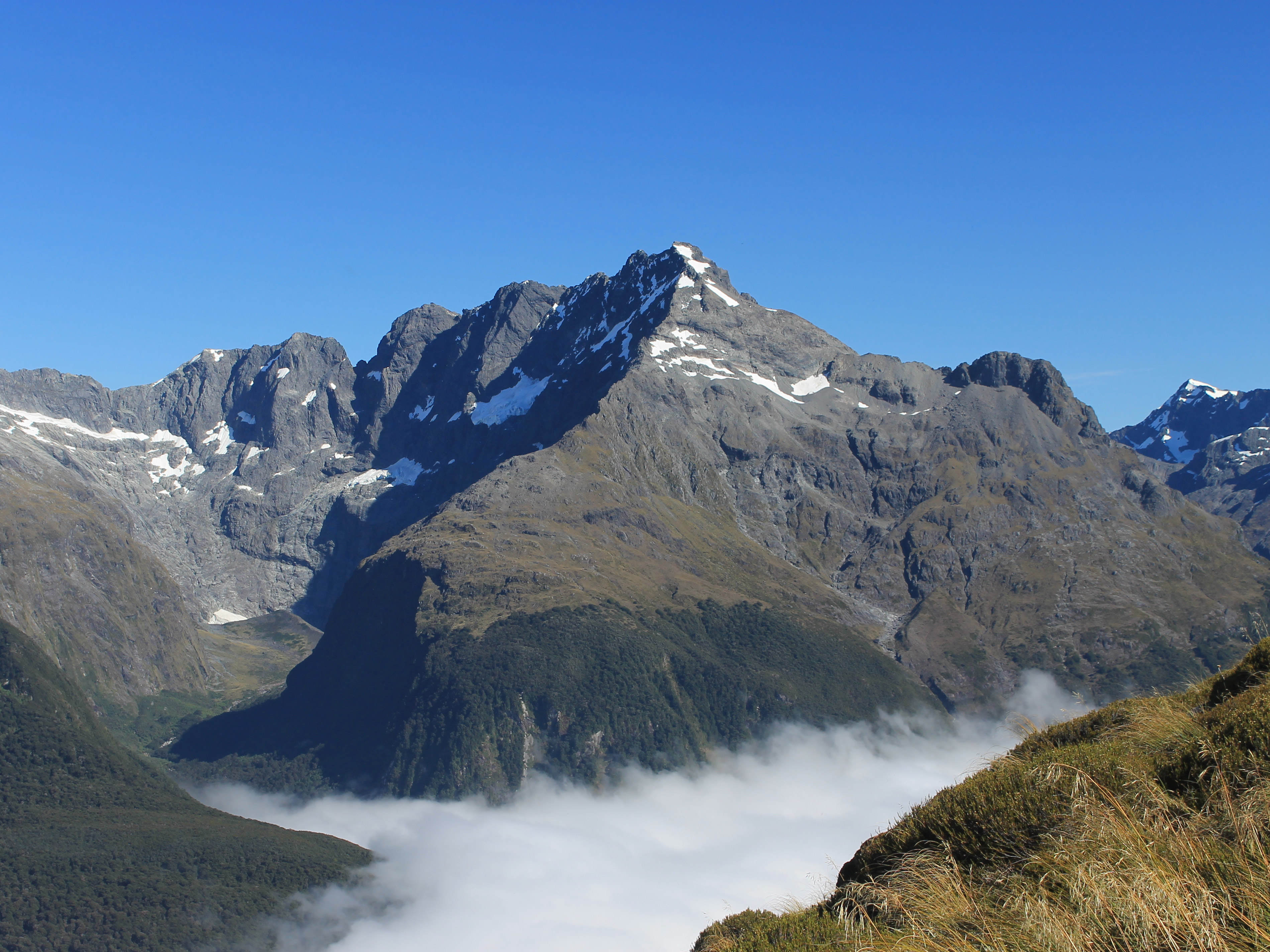
 Mt Gunn
Hokey pokey has nothing to do with the song. It's a type of toffee that is popular in New Zealand. They put it in candy and in ice cream. We had chocolate bars with toffee in them - hokey pokey bars. I became seriously addicted by the end of the trip. They gave me lots of energy for doing the Routeburn.
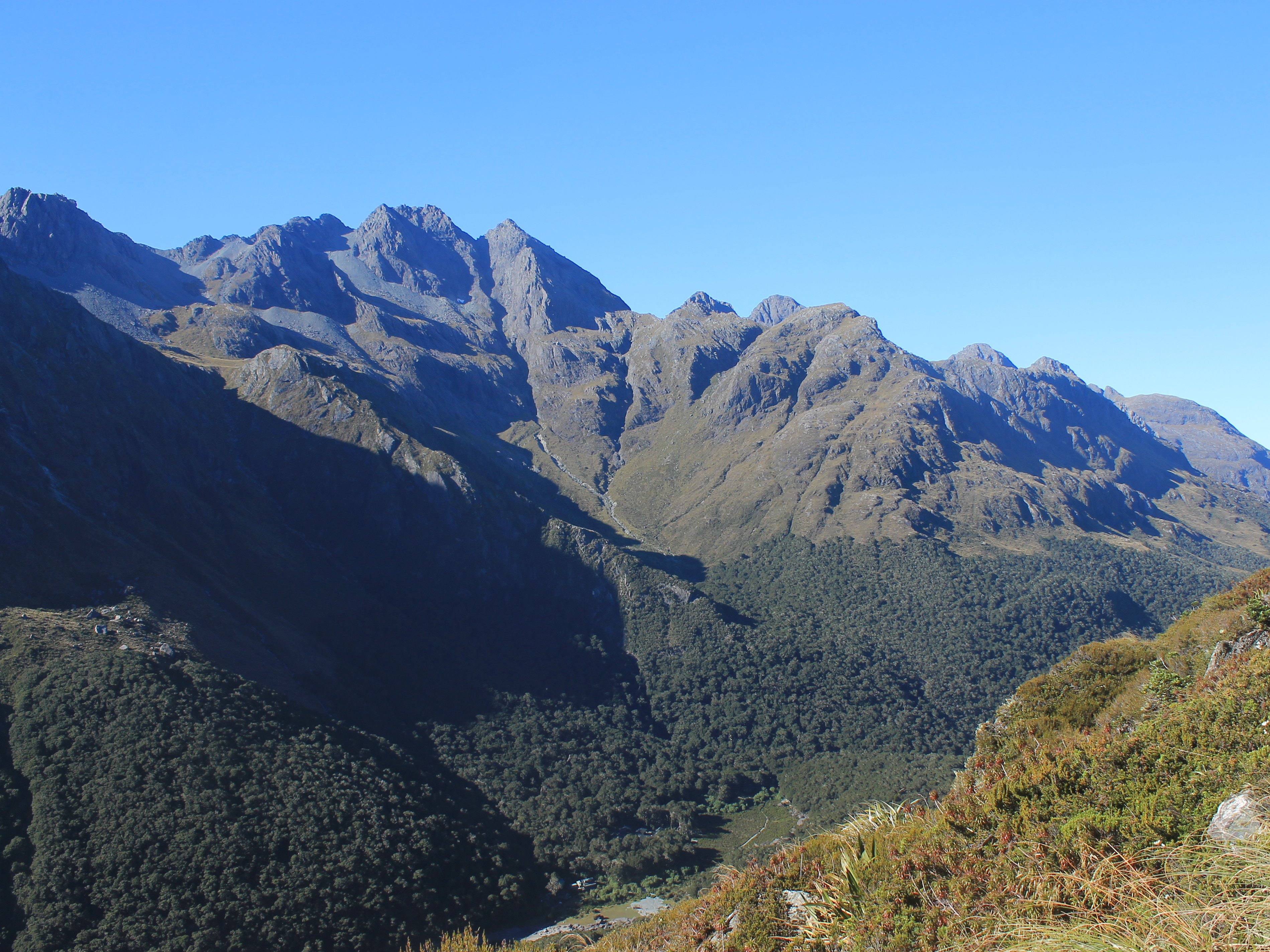
It was time to hit the trail. We passed by Lake Mackenzie where we all stopped for a group photo. Then it was, surprise, straigh uphill. We had a long climb out of the Lake Mackenzie basin. At first we were in dense beech forest with no views. But the forest was pretty and unlike forests back home in North America. Eventually we climbed above treeline and could see the lake below and the DOC hut and the lodge where we had stayed the night before. The sky was gloriously clear and we could see mountains all around. The higher we climbed the more expansive the views became.
 The track (in shadow on right) traverses the Hollyford face
Finally we reached Ocean Peak Corner where the view opened up in all directions. We could see up the Hollyford Valley towards The Divide where we had started yesterday. In the other direction we could see all the way down to the Tasman Sea. Or we could have if it were clear. Although the sky was a perfect blue there was a layer of heavy cloud that filled the bottom of the Hollyford Valley. It created a beautiful effect, with blue sky above, clear views of the mountain peaks, and dense white fog filling the valley. One of our guides, Sam, told me that he had done the Routeburn twenty five times this season and this was the prettiest view that he had seen from Ocean Peak Corner. I certainly had to agree that it was beautiful. The group stopped here for a long time. Everyone was taking pictures, or just lying back and enjoying the view. This was definitely worth traveling seven thousand miles to see.
 Mt Gifford
Off to one side I could see all the way down into the Lake Mackenzie basin to the lodge where we had spent the night. As I was watching a helicopter flew by and headed for the lodge. It had a pallet slung beneath it which it dropped off at the lodge. I suspected that they needed to restock the beer and wine after our group left although the guides said that this was the daily eleven oclock resupply of the lodge. Ultimate Hikes owns its own helicopter and uses it to fly in all the supplies for their lodges. It's an effective way to supply backcountry lodges but has got to be very expensive.
No wonder our trip wasn't cheap.
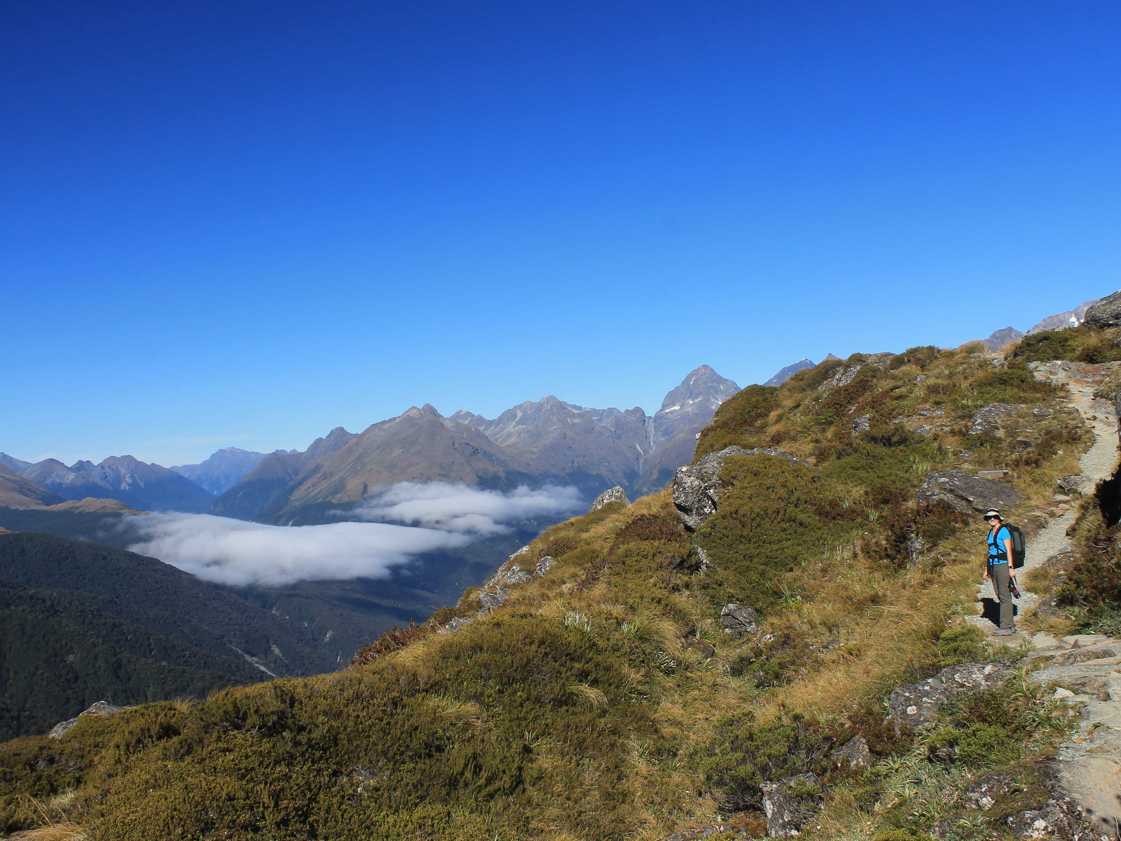
Eventually it was time to get moving again. The next section was a long traverse along the Hollyford Face. It was a gradually rising traverse so the hiking wasn't too difficult. The views were spectacular the entire way. As we walked we had an incredible view of the mountains on the opposite side of the Hollyford Valley, from Mt. Christina at one end to Mt. Tutoko, the highest mountain in Fiordland, at the other.
 Walking in the sky
This has got to be my favorite kind of hiking. High up, traversing along a slope or ridgetop with expansive views all around. Instead of just hiking to a viewpoint as a destination, spending a short time there and then returning, the whole hike is a viewpoint. You can savor it over time and watch as the view slowly changes as you make progress. Given the speed that I hike at, it changes very slowly. But that's ok.
It's like hiking in the sky. This is what made the Routeburn Track a world famous hike.
After the long, gradually rising traverse along the Hollyford Face, the trail steepened for the last bit up to Harris Saddle. In fact, at one point there was a steel staircase put in to get up and over a rock band. A short distance later we were at the saddle. There are two emergency shelters there for hikers who are caught out in very bad weather conditions, one for the paying customers and one for the hoi polloi. There were no worries about bad weather today, although the fog in the Hollyford Valley had been rising steadily through the morning.
 Looking back at the long traverse
Our third guide, Charlotte, had prepared hot drinks for us before we got there so we could relax, admire the view, and enjoy a drink. There was a mix of people outside the huts. Some were from our group. Some were independent hikers. Sitting next to us were two German women. We had been hiking along with them off and on all morning because their pace was similar to ours. That is to say, slow. An American was talking to them, explaining all about his travels in Germany, and especially about all the things to see in Munich at Octoberfest. Finally one of the women said "That is funny how you explain all about Germany to us, when we live there." Whoosh! The comment sailed right over his head and out over the mountains. He didn't even slow down with his stories or notice that Sandy and I were both laughing. Yes, when you travel internationally you sometimes still do encounter an Ugly American. Worse, I have to admit that he was with our group.
 Conical Hill rises on the right
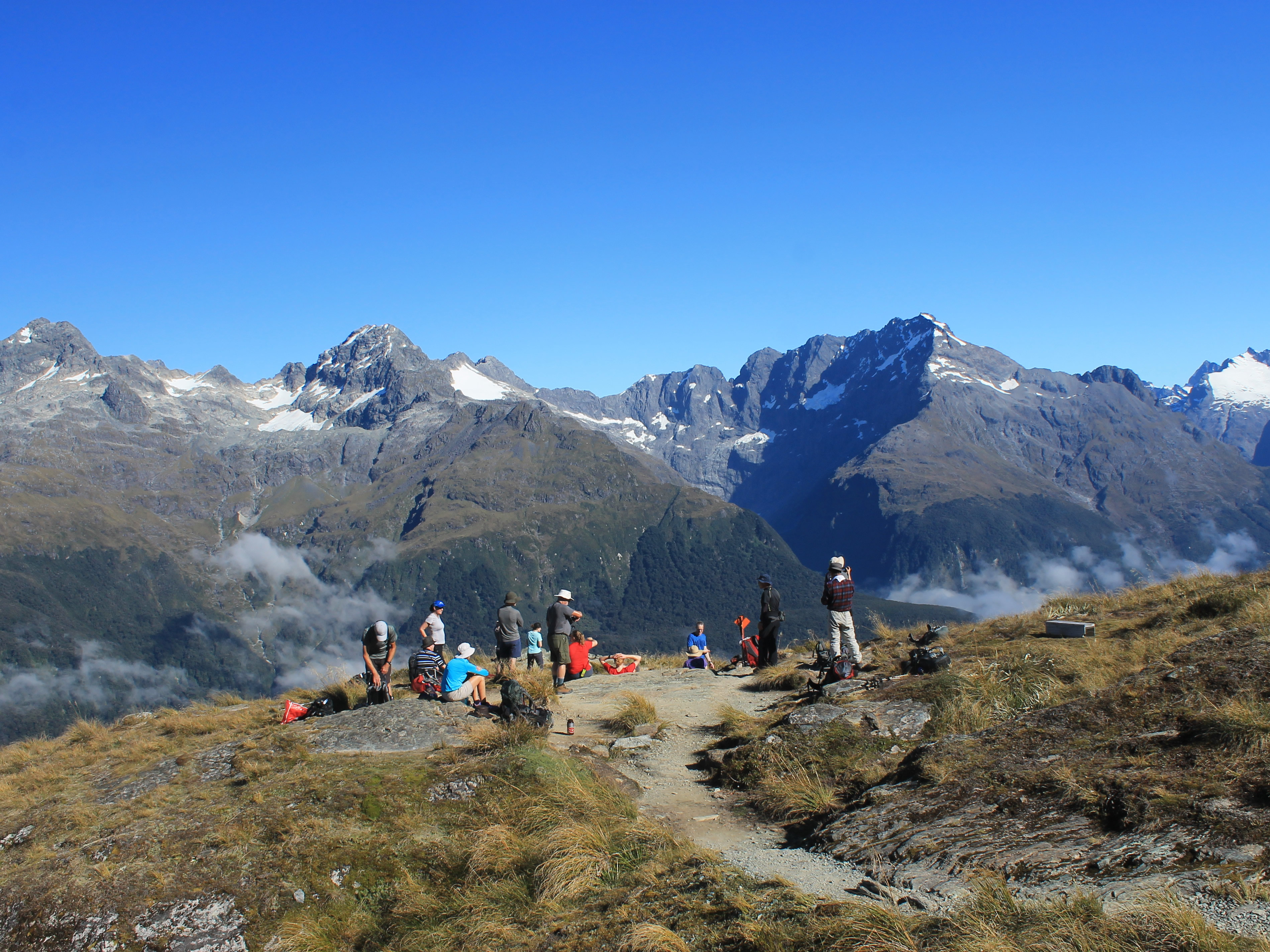
We had a decision to make. From Harris Saddle, it was still another two hours or so of hiking to reach Routeburn Falls Lodge, our destination for the night. We could head straight there. There was also an option to climb to the top of Conical Hill, which rises 850 feet higher on one side of Harris Saddle.
Sandy was content with hiking to the lodge. On the other hand, I'm a shameless peak bagger. So I headed up Conical Hill while Sandy stayed at the saddle. Sam had left for the top with some people from our group about five minutes earlier. I could see them ahead of me so I hustled to try to catch up. But I'm not a fast hiker. I'm a slow and steady hiker, especially when going uphill. Needless to say, I didn't catch anyone. At least not until I got to the Lake Harris viewpoint. This was a spot with a spectacular view out over Lake Harris that Sam had said was about three fourths of the way up. Most of the group had stopped here, deciding that it was enough. I kept going.
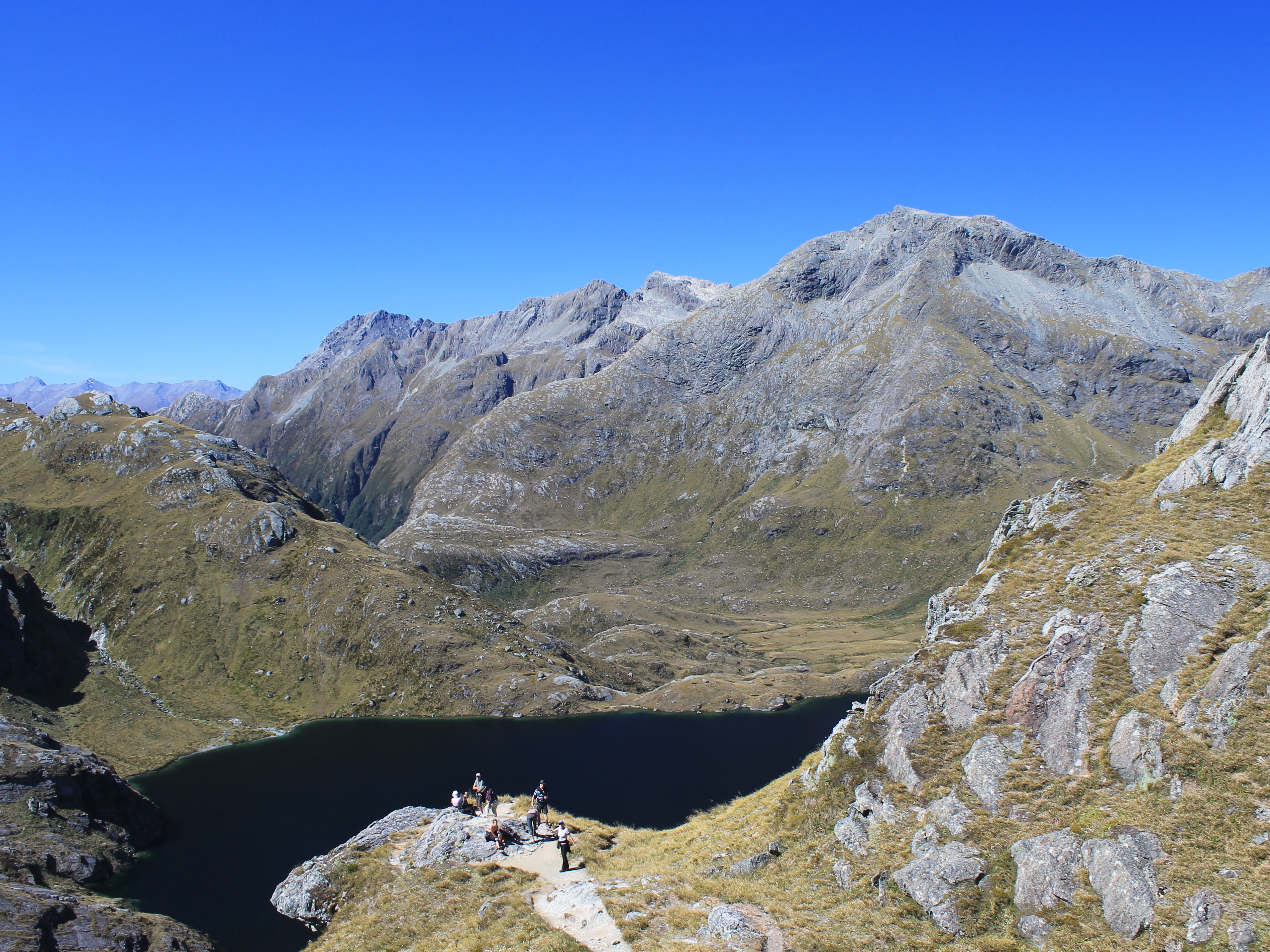 Most of the group stopped at the Lake Harris viewpoint
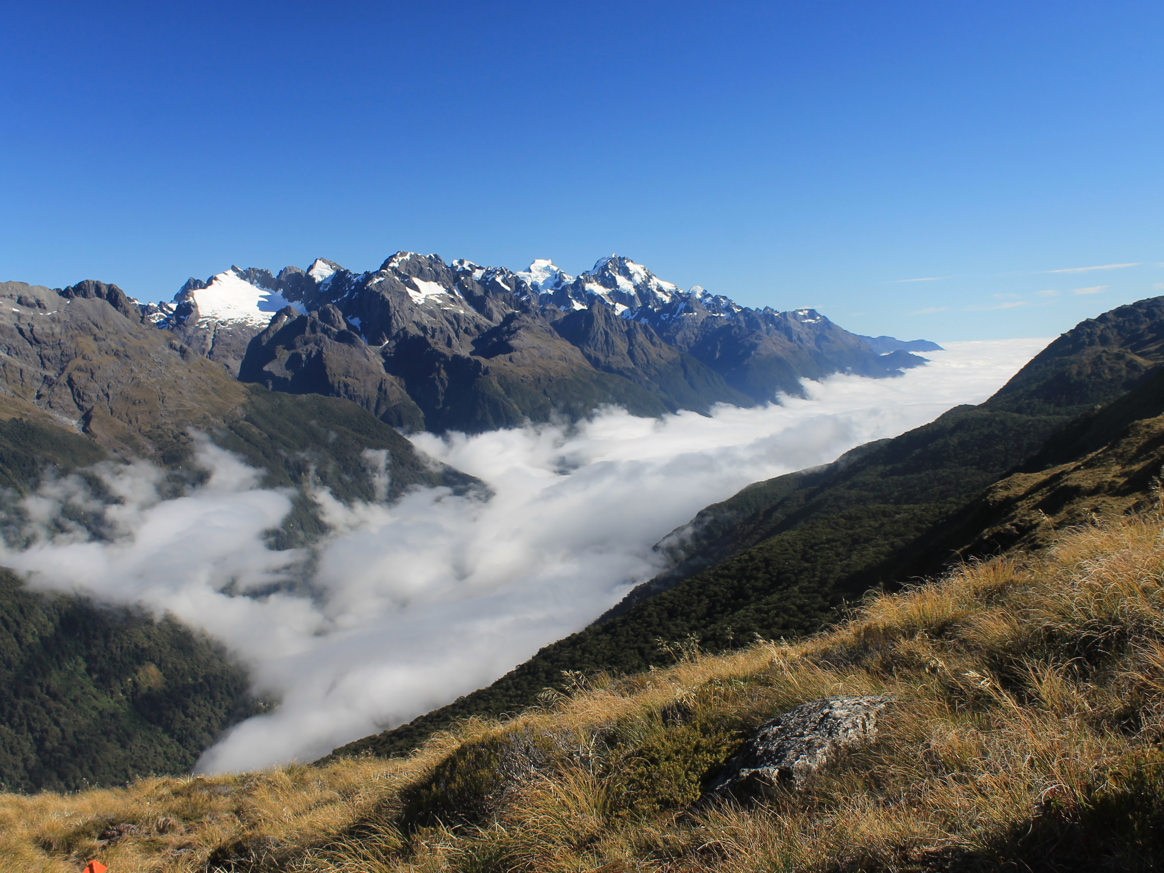
Finally I was on top of Conical Hill. The view was even more spectacular, if that was possible. The cloud in the Hollyford Valley had been rising all day, and now was starting to get close to the level that we had done the Hollyford traverse. It was even approaching the level of Harris Saddle. The contrast of the blue sky all around, the mountain peaks in the clear, and the valley filled with white cloud, was beautiful. Sam, one of our guides, had found a rock where he could lie and enjoy the view. I was taking pictures in every direction, marveling at the great weather we had. Eventually I asked all three of the guides how often they had weather like this on the Routeburn. Charlotte said four of her trips out of twenty - that's twenty percent. Greta said maybe ten percent of the time out of twenty five trips. Sam said five percent of the time out of twenty five trips. We had obviously been very lucky with the weather.
 The trail contouring above Lake Harris
As he was lying on his rock looking out at the spectacular view, Sam said that he had the best job in the world. Right at that moment I had to admit that I couldn't disagree with him. But if this weather only happened on five percent of his trips on the Routeburn, I couldn't help but think that his job might not be so much fun on the other ninety five percent of the trips.
I tried to burn the view into my memory. I took lots of pictures. But eventually I decided to head down. The clouds had continued to rise and looked like they would be reaching Harris Saddle soon. It was time to go.
I reached the saddle about the same time that the clouds did. That was quite beautiful too. The clouds rising from the Hollyford Valley were spilling over the pass into the Harris Lake basin. As they did they quickly dissipated. I didn't have to worry about the weather turning bad, but it was a neat effect to see.
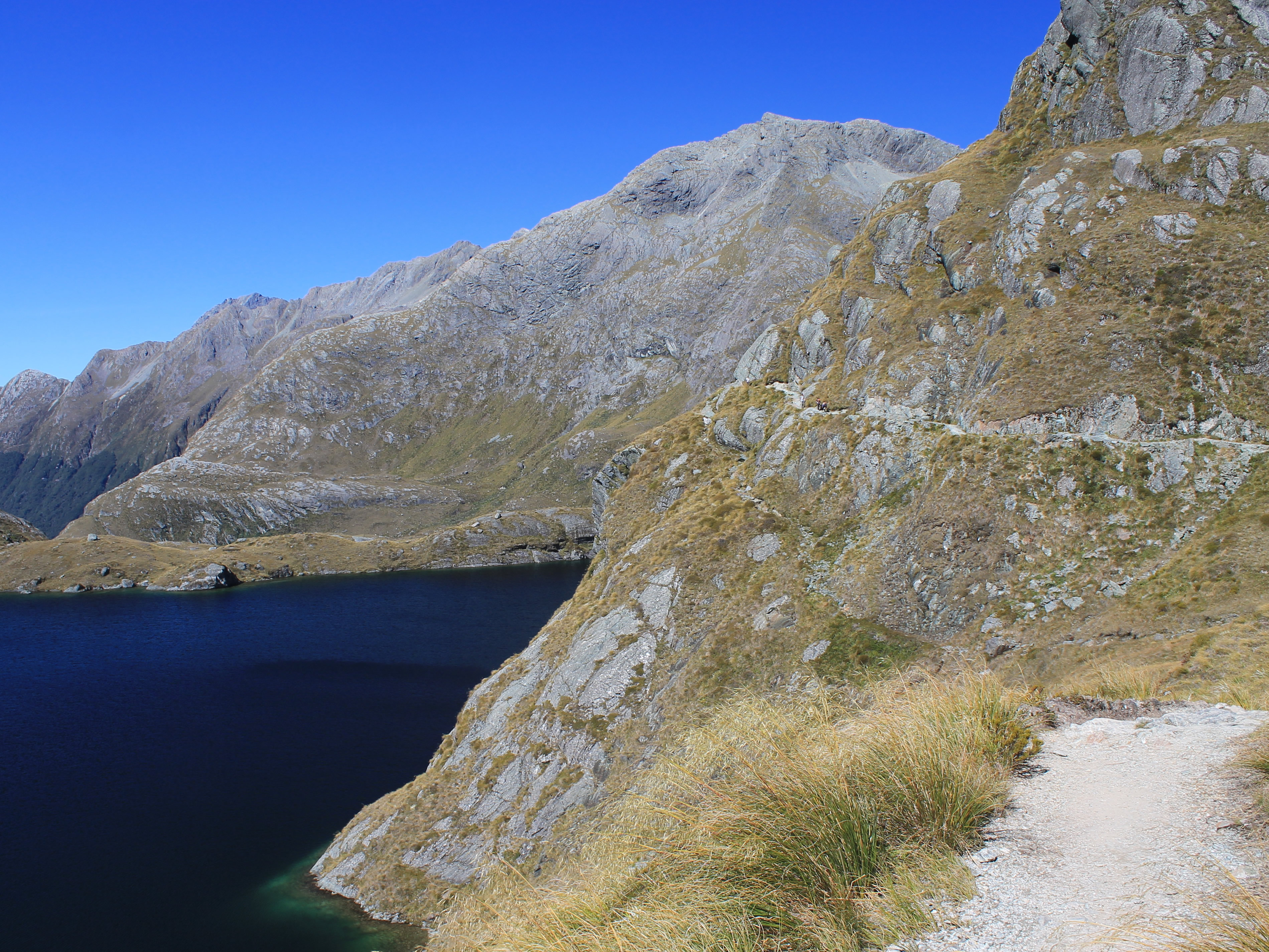
 Mt Xenicus and Lake Harris
I didn't see Sandy outside so I looked in the shelter. Charlotte was just cleaning up from lunch. I asked if Sandy had waited for me. She said that she had, for maybe two minutes. Then she took off for the lodge. In fact, she was the first one of our group to leave. I took that as a strong statement of Sandy's confidence in my abilities to get up and down the mountain.
The hike down was beautiful too. The views were not as expansive as in the morning. But the trail contoured on a steep slope high above Lake Harris. The clouds from the Hollyford were spilling over Harris Saddle into the basin and dissipating as they fell toward the lake. Mt. Xenicus rose behind Lake Harris. Not the same scale as the view in the moring but it was pretty in a different way.
The trail was quite spectacular. In some places it was verye narrow, with a steep drop to the lake. Sam told me that on a trip earlier in the year there had been so much snow that they didn't think it was safe. They had to call for a helicopter to shuttle people from Harris Saddle to just above the lodge. He said again that he had the best job in the world. He got a free helicopter ride. I couldn't argue with that. I worked many years in R&D and IT and although I enjoyed my job, I have to admit that I never got a free helicopter ride in the mountains out of it.
 Approaching the dropoff to the Routeburn Valley
As pretty as the views were, I was starting to get tired. It was a long descent. Eventually I reached the level of Lake Harris. From there the views opened up to the Routeburn, the valley that we would be descending tomorrow. In the distance I could see Momus, a beautiful peak with sheer cliffs falling to the valley floor. I just took my time. I even took a couple of breaks. The weather was perfect and I was in no hurry.
Eventually I reached a point where the valley ahead fell away steeply. I knew that meant that I was close, that I was approaching Routeburn Falls. Finally I spotted the lodge below. The trail made a steep descent beside the falls, but it was quite easy. Soon I was there. Sandy had reached the lodge two hours before me so she was waiting for me. She showed me the way to our room and I could finally set my pack down for the last time that day.
It had been another incredible day of hiking.
