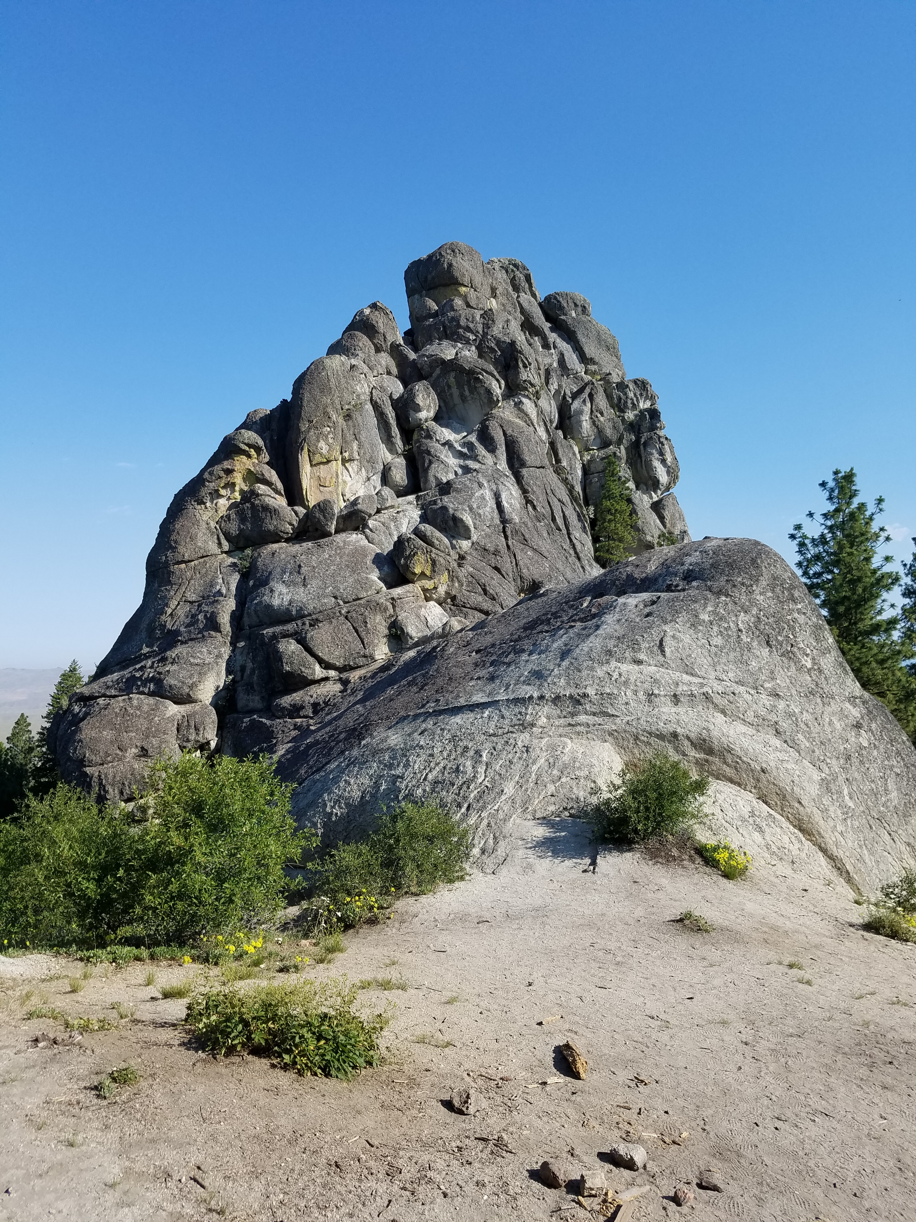
Stack Rock
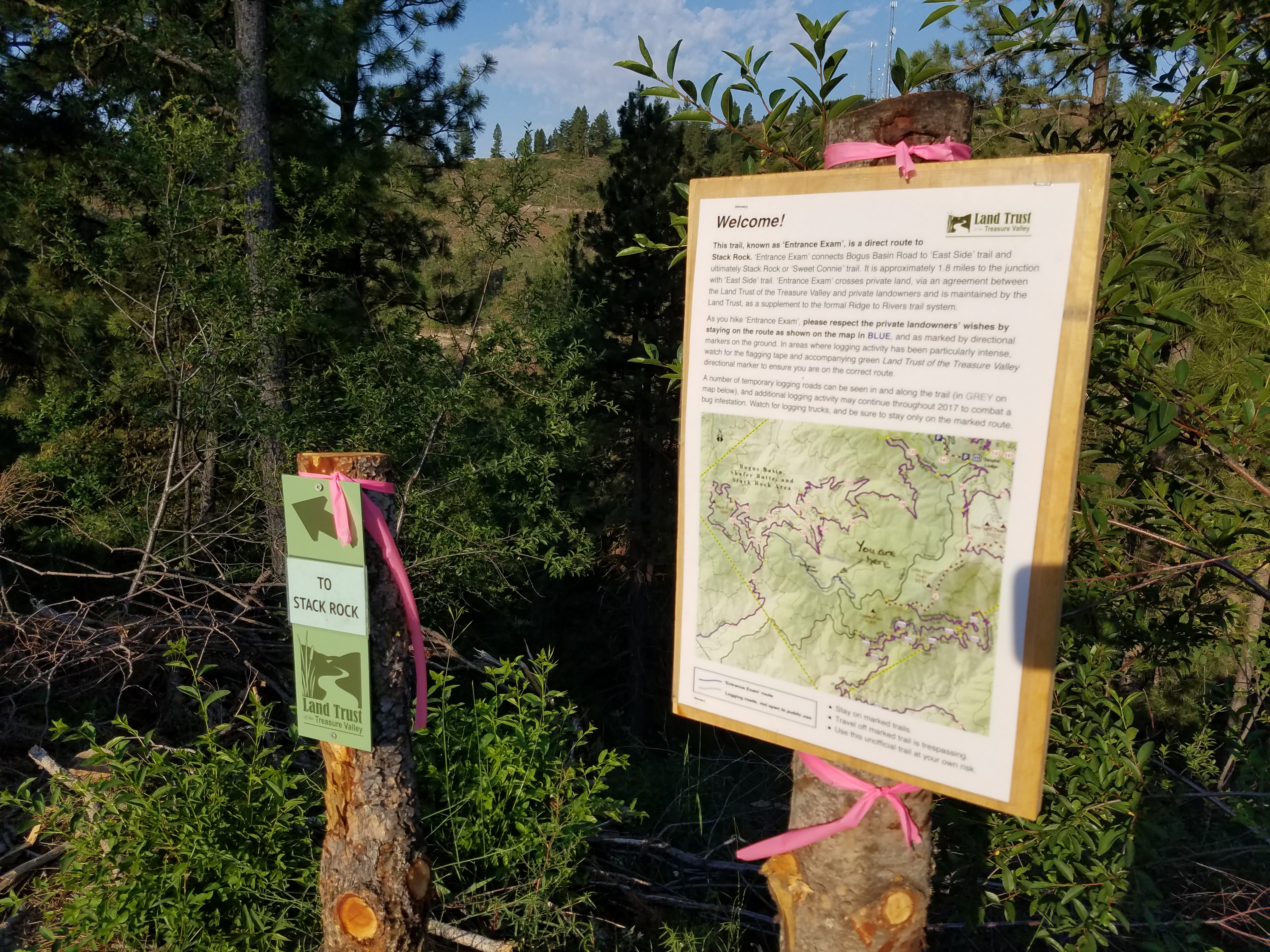 Hard to get lost - nice new trail signage
This summer I have been going back to hike a lot of places that I haven't been to for a while. One of them was Stack Rock. It's a granite outcrop near Bogus Basin that is clearly visible from Boise. When I used to do more rock climbing my friends and I did some easy routes on it. But there is also a scramble route that we found that we would always use to climb to the summit whenever we went there. There is a beautiful view of the whole Treasure Valley from the top. The summit area is small and has the feeling of being on top of a rocky, alpine peak.
It's been a long time since I climbed Stack Rock. I hiked there two years ago with Abby but since she couldn't go to the top I didn't either. I didn't want to leave her at the bottom all by herself. Normally I take her along whenever I go hiking but this week she was recovering from a skin infection on her paw and couldn't hike. As long as I had to go hiking by myself I figured it was a good time to go back and try to climb Stack Rock.
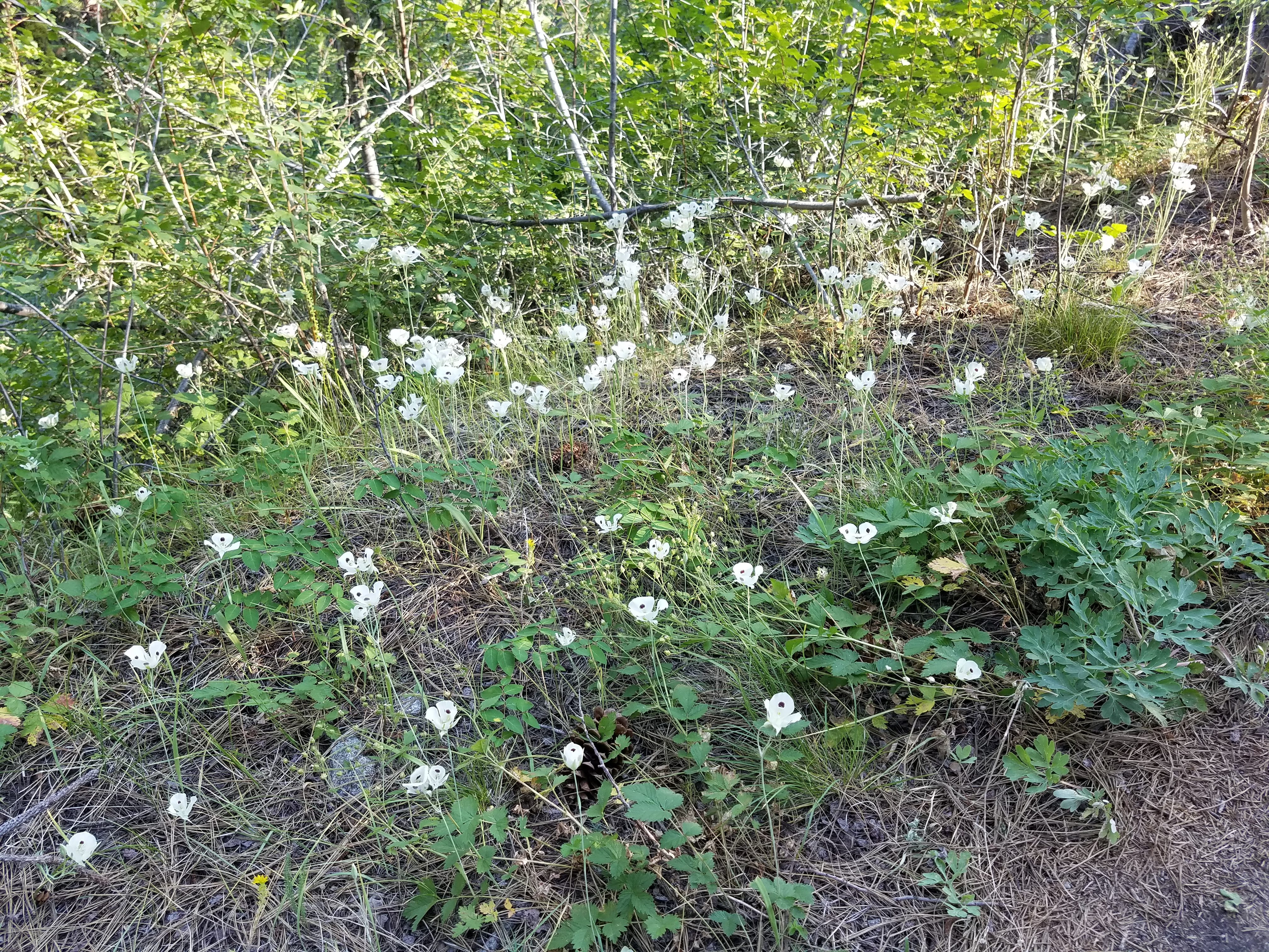 Lots of White Mariposa Lillies beside the trail
In the old days it wasn't easy to find the way to Stack Rock. We would get there by a combination of old logging roads, unmaintained trails and cross country travel. The last time I went there in 2015 it was much easier. There were nice trails, part of the Ridge to Rivers system.
It was going to be a hot day so I decided to leave early to beat the heat. I was on the trail by 7:45 am - a good start. I found there had been even more changes in the last two years. The first trail, called Entrance Exam, used to be very steep. It dropped pretty much straight down from Bogus Basin Road to an old logging road. It's been improved, lengthened, with switchbacks and with more contouring along slopes so that it isn't crazy steep anymore. It's a little longer but the hiking is much more pleasant.
It wasn't long before I was in an area that had been recently logged. It wasn't a clear cut. It looked like about 50-80% of the trees had been taken out. The thinning was done to remove down timber and beetle-infected trees. Hopefully the forest will grow back to be healthier than before. It did mean that the first part of the hike was in the sun. Now I was really glad that I had an early start. Climbing back up to the road with no shade during the hot afternoon wouldn't be pleasant. Hopefully I would be back before it warmed up too much.
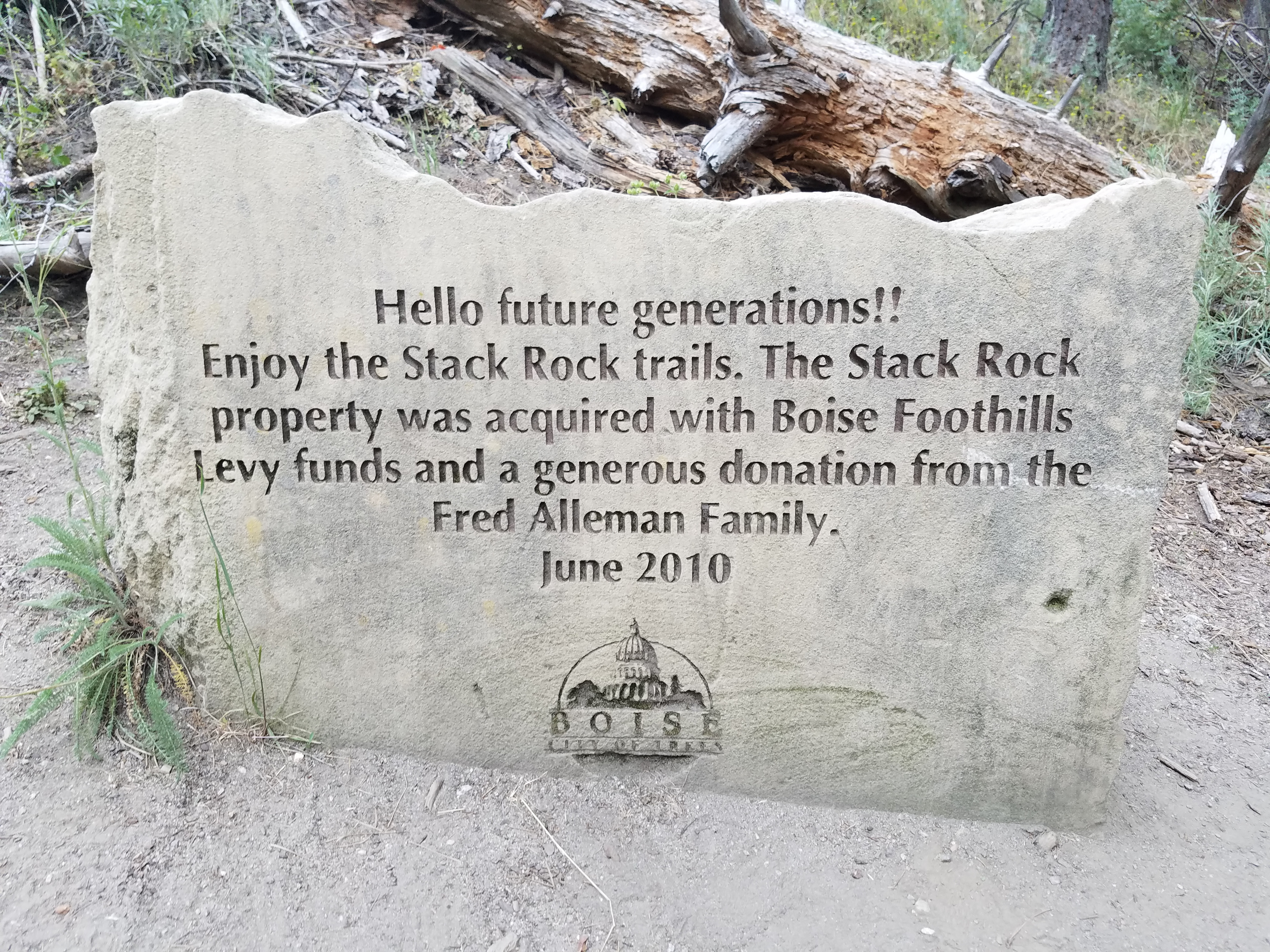 Dedication sign on the way to Stack Rock
It was only after I got home that I learned that the trail had been closed for a whole year while the logging was being done. It only opened up a few weeks before my hike. Just more proof that it's better to be lucky than good!
Logging was still going on in the area, just not right along the trail. For the first hour that I was hiking there was a chain saw going constantly. It was annoying but hey, at least the trail wasn't closed.
On the positive side, there was an impressive number of wildflowers. Abby and I hike at Bogus Basin a lot in the spring and there are usually a fair number of wildflowers there in May. But there is no permanent running water anywhere in the area so the flowers are long gone by the beginning of July. This year we had a very heavy snowpack and a cool spring, so even this late there were still lots of flowers. Some I recognized: Mariposa Lillies, Indian Paintbrush, Blue Flax, Yellow Salsify, Lupine, Firecracker Penstemon, and lots more that I couldn't identify. Sandy knows her flowers a lot better than I do and she wasn't along. Whether I knew what they were called or not, they were still all really pretty.
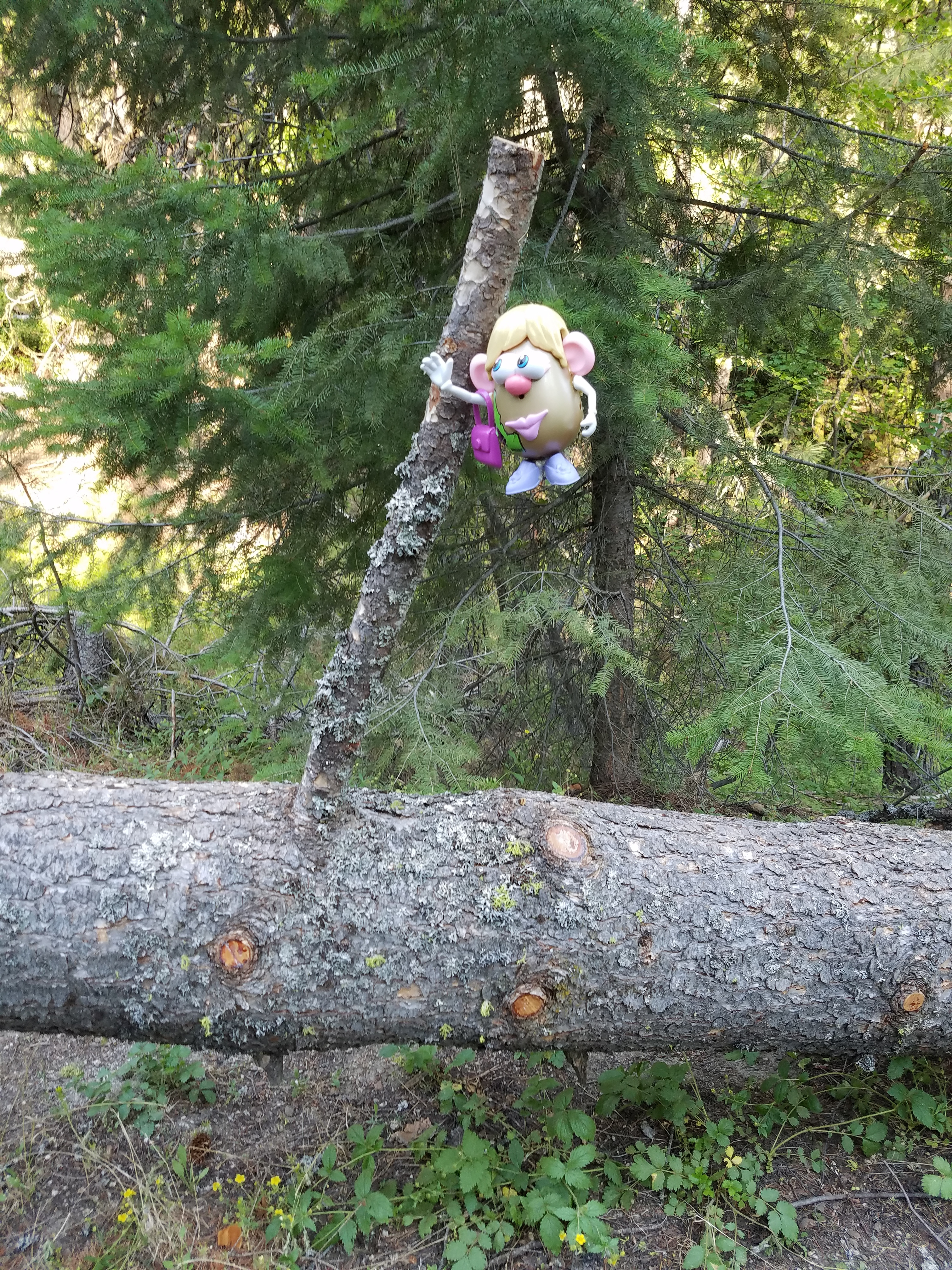 Trail sign - only in Idaho
Finding Stack Rock was easy. Unlike the old days, now the route is well signed. It could have been confusing, especially with all the new trails and roads cut for the logging operation, but every junction was clearly marked. There were even signs at times along the trail, pointing ahead at the way to go, just to let you know that you were still on course. Once there was even a Mrs. Potato Head figure hanging on a tree, waving you on in the right direction.
Further along there is another sign, a huge rock etched with a dedication message. It acknowledges the family which contributed a million dollars to Ridge to Rivers for purchase of private lands to allow public access to Stack Rock. No more climbing over fences or sneaking around gates like we did in the old days. The new trail is named Freddy's Stack Rock Trail in honor of the primary donor.
With my early start I had the trail all to myself...until I reached Stack Rock. Just as I got to the short spur trail that goes to the base, about a hundred yards from Stack Rock, I heard loud voices on the trail behind me. I took the spur and went to the start of the scramble route. While I studied it I waited to see if the other party would pass by on the main trail or come over to Stack Rock. Sure enough they turned off and found a spot to take a break with a clear view of where I was planning to climb. It was four young women hikers. Great. Just what I needed. I wasn't totally sure that I could get up the route and now I had an audience. They hadn't seen me off to the side yet so I just waited to see if they would leave quickly. No such luck. Eventually I decided to just go for it.
 Start of the route up the east side
The first time I went to Stack Rock my friends and I didn't know anything about it. We just tried to climb it and found a route up. My recollection is that it was a hard scramble. There was a little exposure but not on the hardest part, which was just below the summit.
Now we have the internet and I could find lots of info. Most people made it sound a lot harder and scarier than I remembered. I read that some people even rope up to do the climb. The standard climbing guide for Idaho mountains rated it class 4 and the hardest move 5.8. That's a lot harder than I remembered. So as I started I didn't know how it would turn out.
It was harder than I rembembered at the start but I made steady progress. I got about two thirds of the way up...and got stuck at the crux. I tried for about ten minutes but couldn't do it. Eventually I scratched up my arms pretty good on the rock trying to chimney up so I decided to quit and go down. To add insult to injury I discovered that besides getting all scratched up, I smashed the lens on my phone's camera (it was in the pocket of my cargo pants). I've ordered a new lens and my friend has said he thinks he can repair it. Pappy Ivan can fix anything.
That was certainly discouraging. Maybe I didn't find the easiest way. Maybe I'm getting old. Maybe my rock climbing skills are just too rusty. I haven't been this discouraged since the time that I was out of shape and failed to climb Thompson Peak. After that I worked hard to lose weight and went back the next year and was able to climb Thompson. On the hike back from Stack Rock I had similar thoughts. I am going to have to practice but I am determined to go back and get up that rock. If I do, you'll certainly read about it in the Dog Blog.
