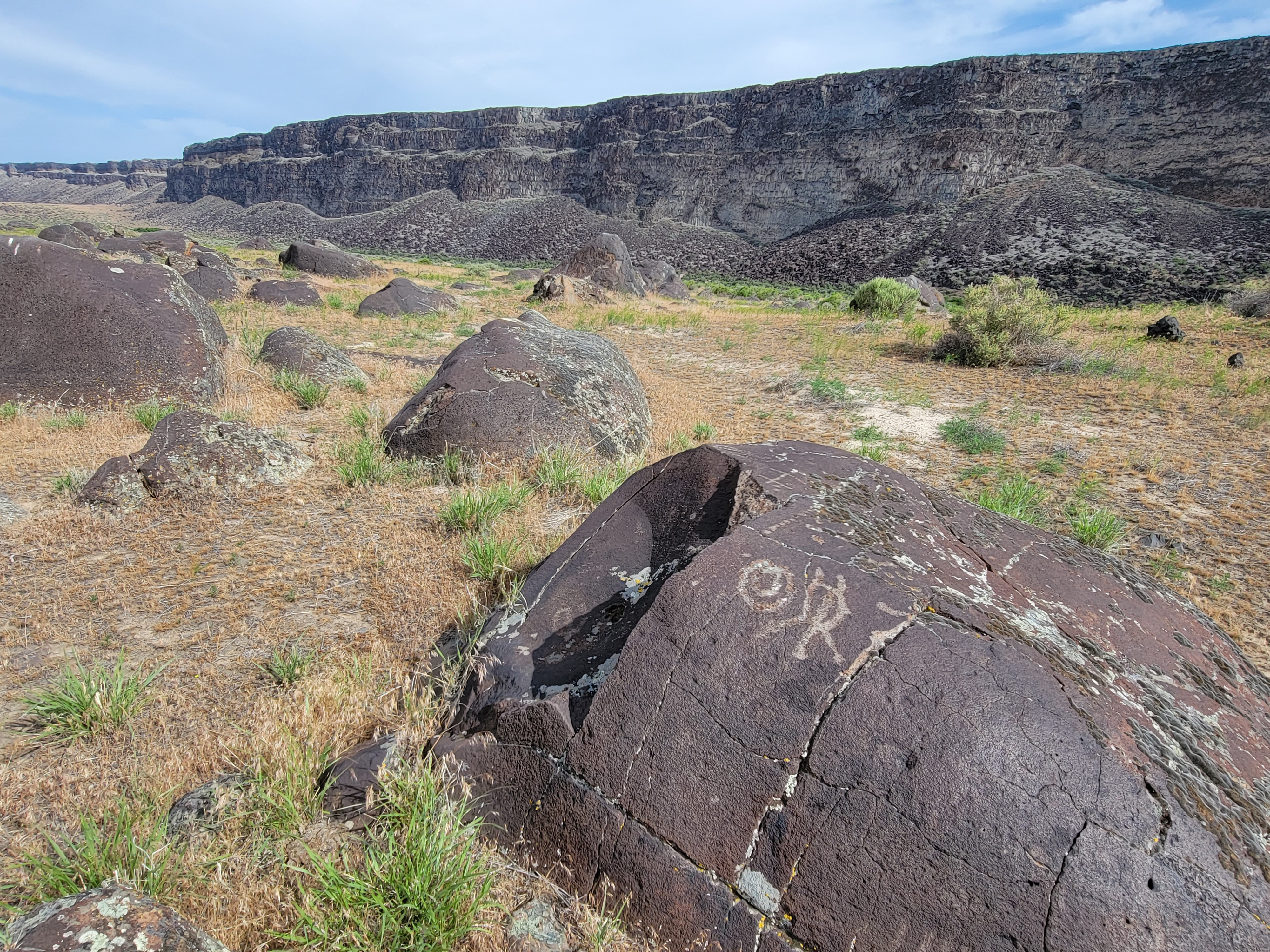
Wees Bar Petroglyphs
 The deep canyon of the Snake appears very suddenly
I like to hike, and when I'm not hiking, I like to talk about hiking. When I worked at the University of Idaho, the other two guys in IT weren't hikers, but usually they listened politely while I carried on about hiking. They didn't have any choice because I was the boss. One day Eric, who definitely wasn't a hiker, said there was one hike that he really wanted to do. I was curious what had captured his imagination. A spectacular peak? A trout-filled stream? A traquil lake? When I asked he said it was the Idaho petroglyphs.
Wait! What?
I think petroglyphs are really cool. I've seen them many times on hikes in Utah canyon country. The most recent time was just this spring when I hiked the Hidden Valley Trail near Moab. But I had never heard of petroglyphs in Idaho. I looked it up and sure enough Eric was right. There is a hike that you can take along the Snake River to see ancient petroglyphs. I was definitely interested but time went by and we never arranged anything. But it stayed on my list of "hikes to do" and I've always intended to get there some day. Well, today was the day.
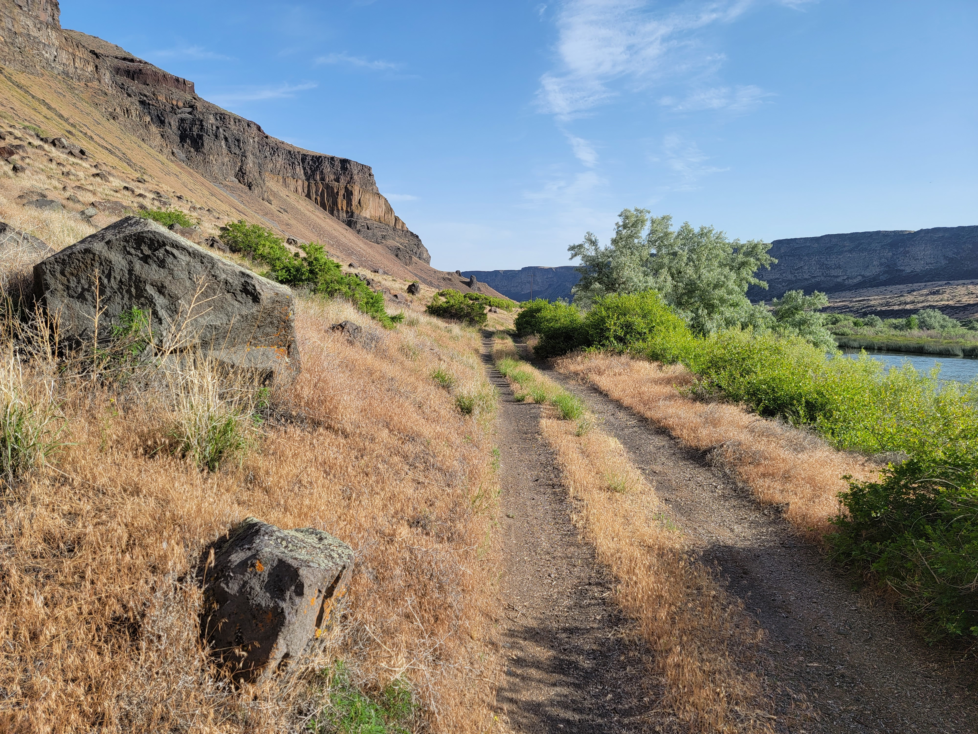 A beautiful day for hiking in the Snake River Canyon
When I looked up detailed information on the hike, I found that there are actually two sites where petroglyphs are found near the Snake River. One is at Wees Bar. It's reached by a twelve mile roundtrip hike from Swan Falls Dam. That was the one that I was interested in. The other is at Celebration Park, which is easily accessible by car. Maybe I'll do that one another day when my energy level is low.
To reach the begining of the hike to Wees Bar I drove almost straight south until I hit the river. On the way I passed through the city of Kuna. I remember it as a sleepy little town far south of Boise (Meridian actually). I was amazed to see how much it has grown. Looking it up afterwards, I found out that it tripled in population between 2000 and 2010 and has continued to grow. It's current population is estimated to be 29,000 people. Wow. It is solid houses now from Meridian to Kuna. Meridian Road heading south is four lane divided highway. No wonder there is so much traffic in Boise now.
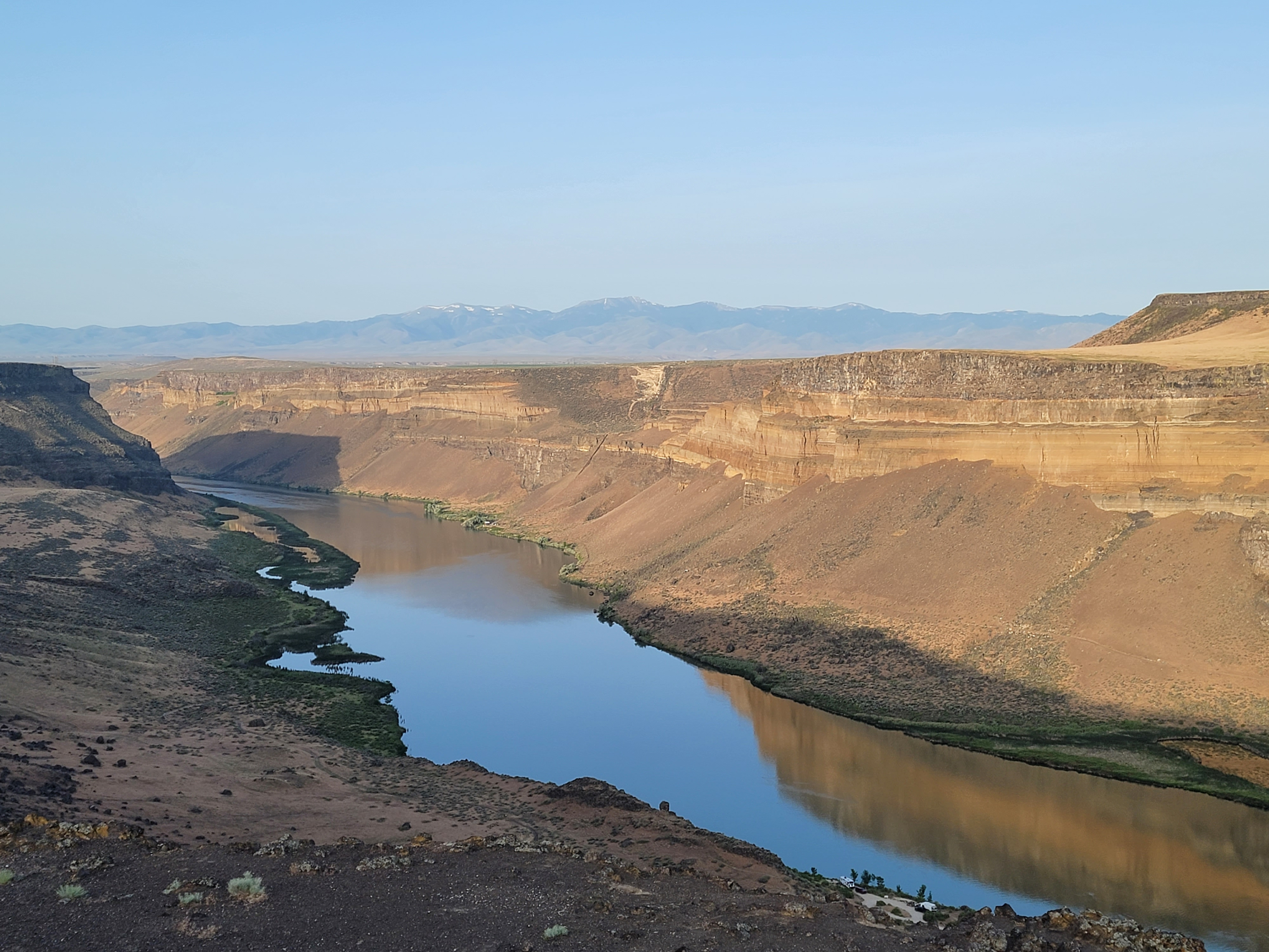
 The canyon widens about a mile above Wees Bar
South of Kuna the urban sprawl ended and soon I was driving through a desolate landscape. No buildings. No trees either. Just nothing as far as I could see. Then suddebnly I reached the rim of the Snake River Canyon. There wasn't any warning that there was a huge hole in the ground ahead of me until I was right at the edge.
It was an impressive view. After snapping a couple of pictures, I drove down to the bottom of the canyon and parked where the road ended at Swan Falls Dam. Built in 1901, Swan Falls was the first hydroelectric dam on the Snake River. The old power station was still standing but empty. In 1994 a new generating station was added which is still operated by Idaho Power.
The forecast was for warm weather - a high of eighty degrees. The route I was planning to hike is entirely in the Snake River canyon which would be even hotter. An early start was the best way to beat the heat so I made sure that I was up early this morning. I had parked my car and was starting to hike at 7:30 am.
 Six miles from the trailhead I found the petroglyphs
From the descriptions of the hike that I had read, I knew that it started by crossing the dam to reach the other side of the river. It wasn't clear how to do that. There was a lot of fencing around the dam and from the noise it was obvious the power plant was operating. I just kept walking towards the dam and finally spotted a small sign that said "museum access" which pointed to a small gate. Going through led onto the dam and across. The rest of the hike was on the far side of the river.
Although Wees Bar is downstream from the dam, the trail started off by going upstream right next to the river. That was understandable since the bank was fairly steep just below the dam. The trail descriptions that I read had mentioned it too. The river was lined with wild geranium shrubs, but I kept my eyes on the uphill side to make sure that I didn't miss the turnoff. After ten minutes the trail made a sharp hairpin turn onto a very rough road and started to climb steeply to the west. I shouldn't have worried. I couldn't have missed the turn if I wanted to.
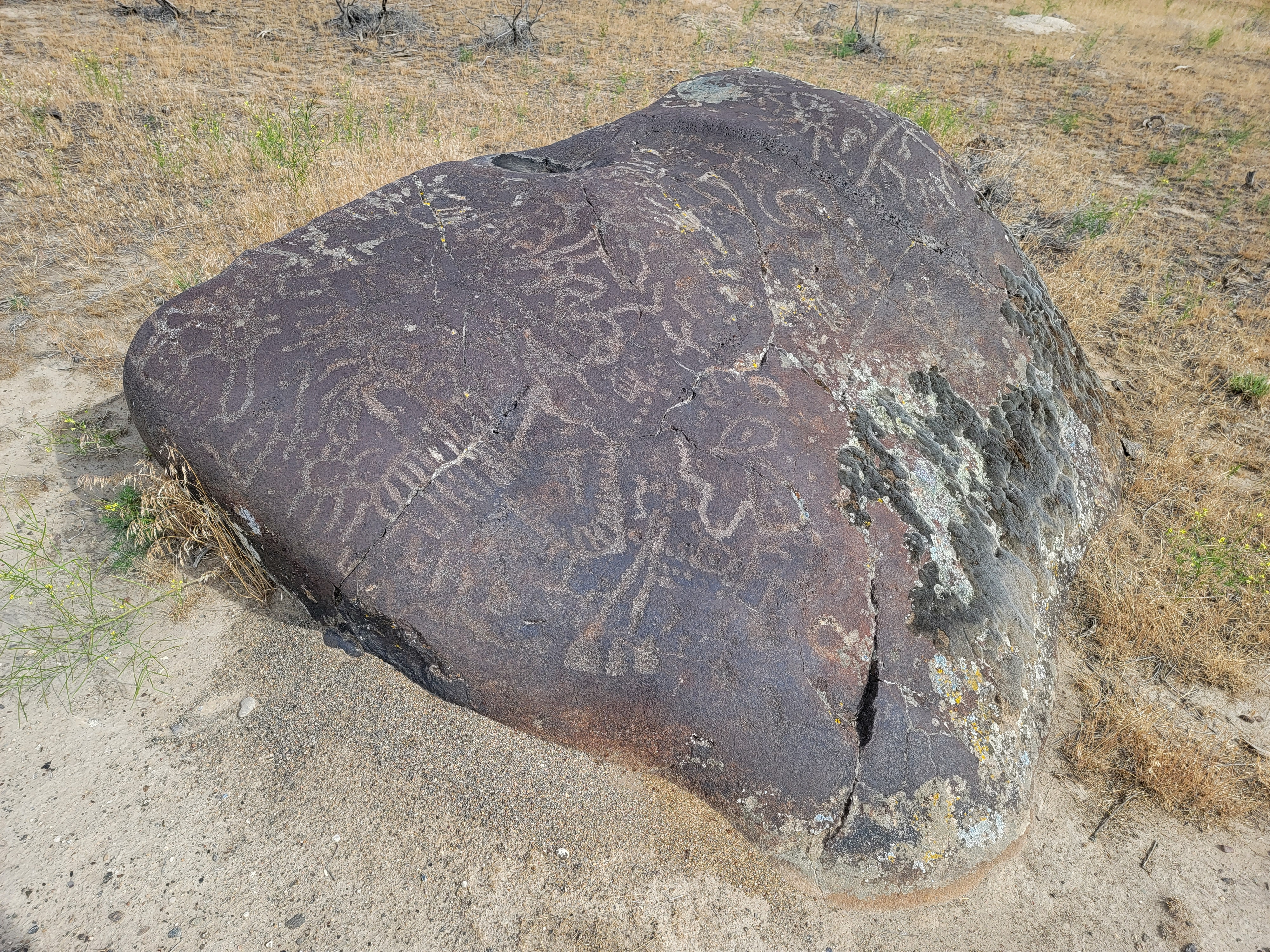 Some rocks had a LOT of petroglyphs
Now on an ATV trail, I followed it to the top of a broad bench about half way between the rim and the river. It was only about three hundred feet of elevation gain and this was most of the climbing on the route. There was only one more climb of about a hundred feet near Wees Bar. Still, three hundred feet plus a hundred feet, doubled since I had to climb it and descend in each direction, made for a reasonable amount of elevation gain. Not a totally flat trail. It added up to a good workout.
I could see that up ahead the track that I was on climbed up the side of the canyon and out over the rim. I knew that wasn't where I wanted to go, so I trusted that there would be an alternative. Sure enough, just before the track started to climb again, there was another track that peeled off across the bench to the west. Usually when you are hiking and come to a junction, it seems like the trail you are supposed to take is always the one that heads uphill. This time I was happy to turn away from the steep uphill and continue on the level.
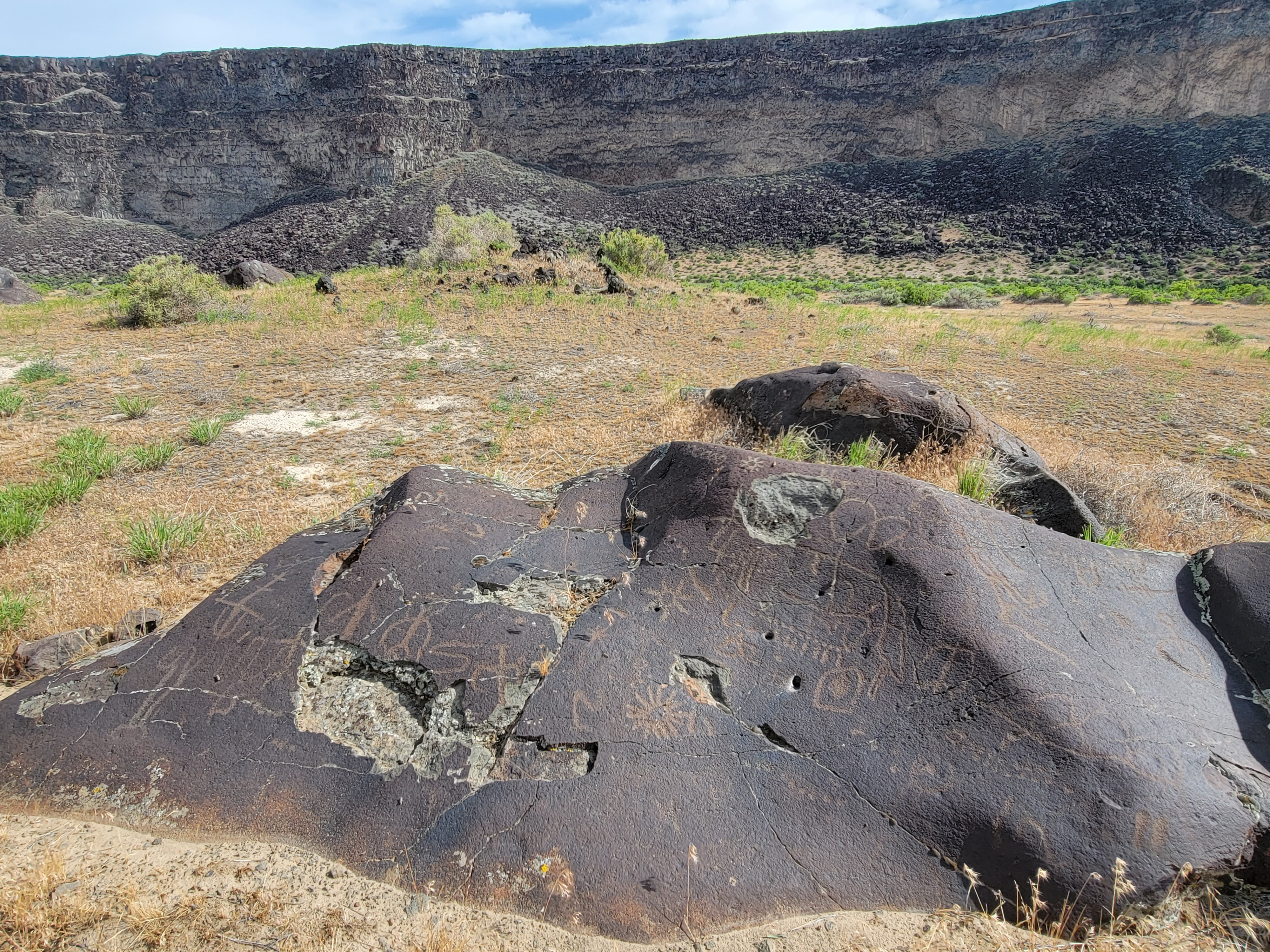 Some of the rocks had significant damage - maybe intentional?
I wasn't really sure why there was a 4WD/ATV road here. I couldn't imagine why anyone would be driving though here. But as I walked along, I heard a rumbling. Looking back, a pickup truck was coming down from the rim on the road I had just turned off of. He continued off to the east along the river. Where he came from and where he was going I had no idea. There isn't anything nearby on this side of the river. No towns. No roads. Nothing.
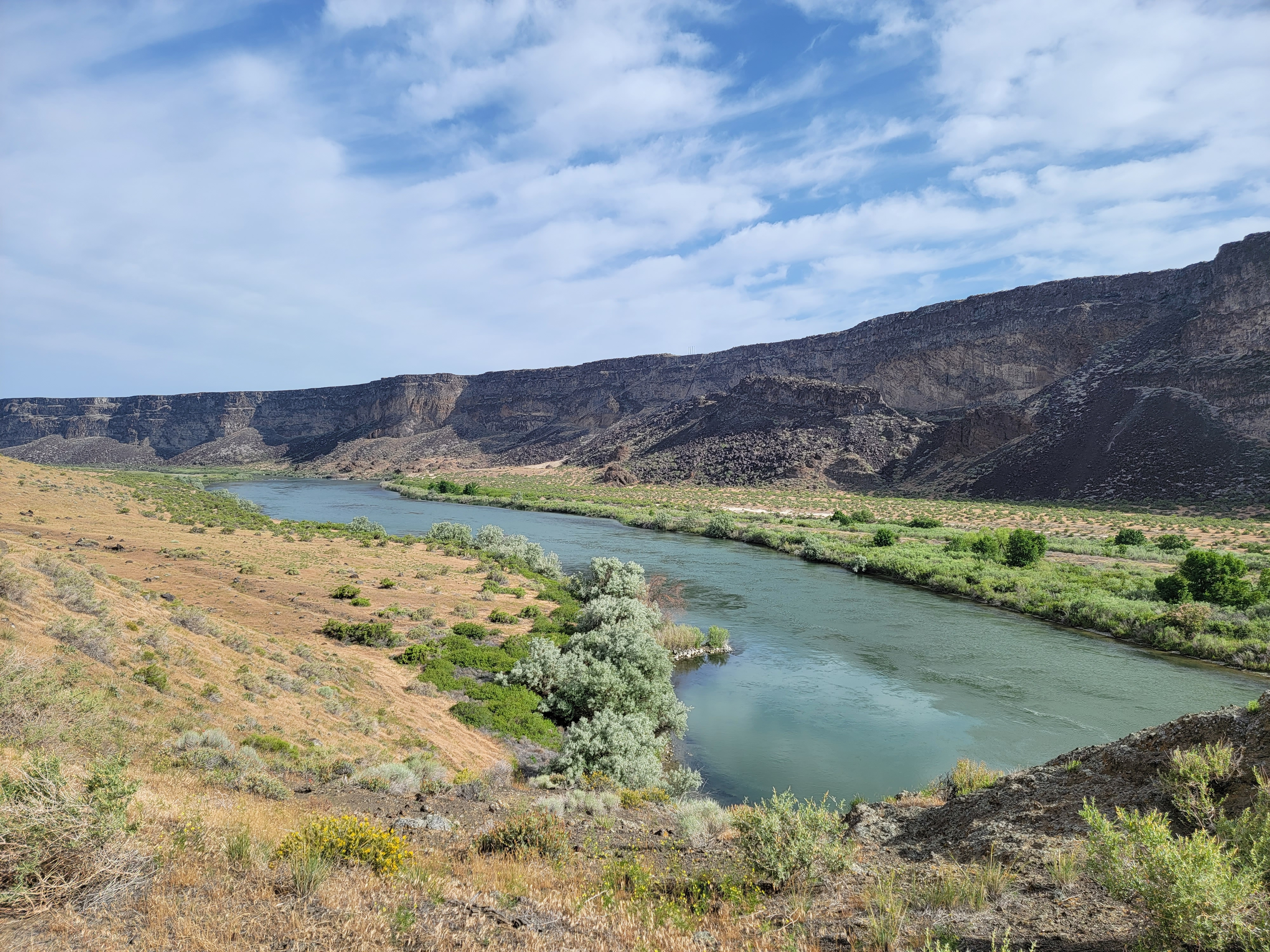
Eventually the bench ended and the track dropped back down to the level of the river. Now it was easy going. Across the river I occasionally saw a truck or camper. They had driven up a dirt road that came from Swan Falls Dam. There wasn't a single person on my side of the river. I had it all to myself.
It was a sunny morning and as I walked it started to warm up. There was a wind from the west that I was walking into so I never got too hot. It occurred to me that this was perfect rattlesnake country, desert grasses, hot and dry, so I made sure I was watching where I was going. It wouldn't do to step on a snake. In forty five years of hiking in Idaho, I've never seen a rattlesnake. I thought this would be my chance. No such luck today, although I did see dozens of lizards scuttling across the trail to get out my way.
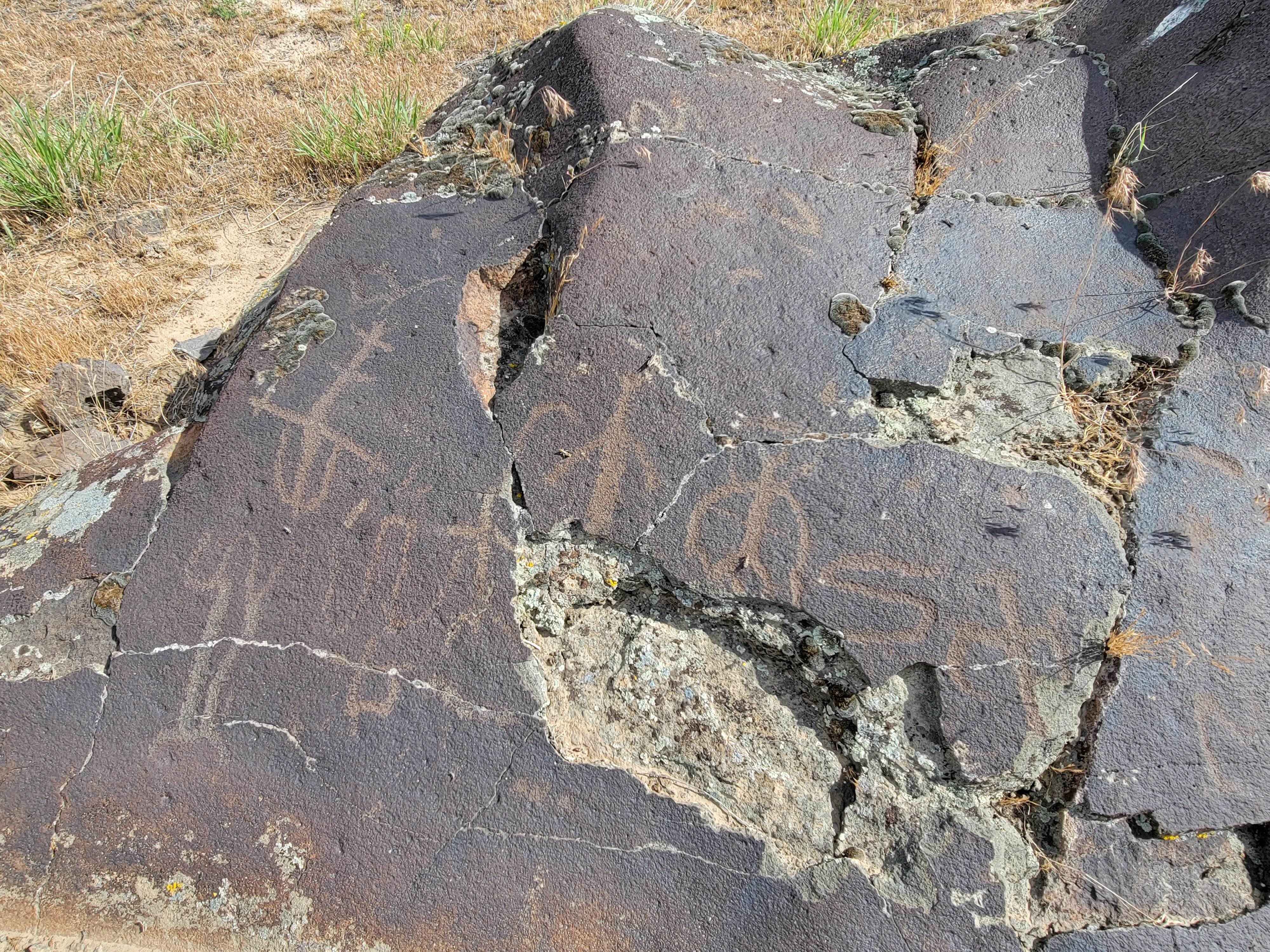 Close up of petroglyphs and damage
About the only decision I had to make was about five miles from the trailhead. The track took another sharp hairpin turn and started to climb in the other direction. A sketchy tread continued west towards a bluff that appeared to block the route ahead. Which is the right way? I stayed on the main track. Sure enough, it switchbacked again and headed west, above the rocky bluff. The light tread ran up to the rock and disappeared. Correct decision. It added about a hundred feet of elevation gain in each direction. No big deal.
After passing the bluff and turning a corner, the canyon opened up again on this side. The ground was littered with boulders of the type I was looking for. None of them were right by the trail so the question was, when do I leave the track to start looking? I kept on going until a slight side trail vered off towards the boulders. My GPS said I was 5.75 miles from the trailhead, so that seemed about right. I walked to a group of rocks and bingo, there were the petrogpyphs.
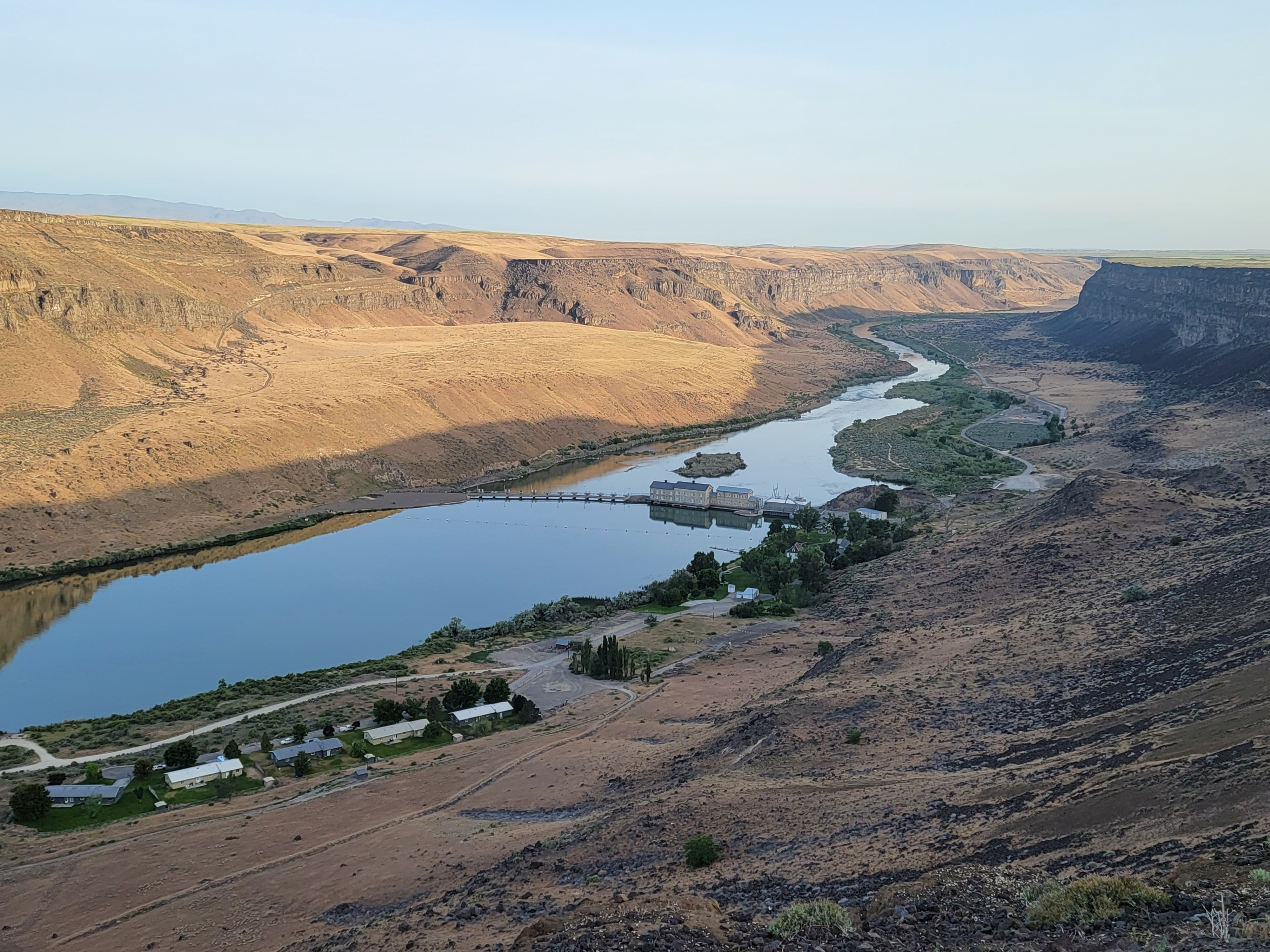 Swan Falls Dam - Wees Bar out of sight beyond farthest bend
I had seen pictures of some of the petroglyphs at Wees Bar and didn't think they looked like much. In real life they were impressive, although compared to others that I had seen in Utah, the figures were quite crude. Experts believe ithat they were carved by the ancestors of the Nez Perce and Shoshone tribes, but no one really knows who carved them, why they carved them or what they mean. Their age is unknown. Some could be as much as ten to twelve thousand years old. Others may have been drawn as recently as four hundred years ago. No one knows for sure. It was humbling to stand there looking at the stone art and remember that some of it may have been ancient long before the pyramids were built.
I wandered through the field, checking out twenty or thirty rocks. I didn't even scratch the surface. There were hundreds, perhaps thousands of boulders scattered over the area. But I had gotten a good sense of the site and the petroplyhs. I started back.
The return hike was straighforward. I was worried about being warm, but clouds covered the sun and it actually cooled off. Not enough to make me cold, but I was cooler hiking back than out. I saw the only other hiker of the day about an hour before I finished. He said he was surprised to see anyone on the trail. I told him that I hadn't seen anyone else and he could have the trail to himself the rest of the day. Since the hike was pretty level, it took about the same time in each direction. When I got back to the car, my GPS app said the hike was 11.83 miles and took me almost exactly five hours.
It was a good hike. Seeing the petroplyphs was well worth the effort. I should have done this hike a long time ago.
