Hidden Valley
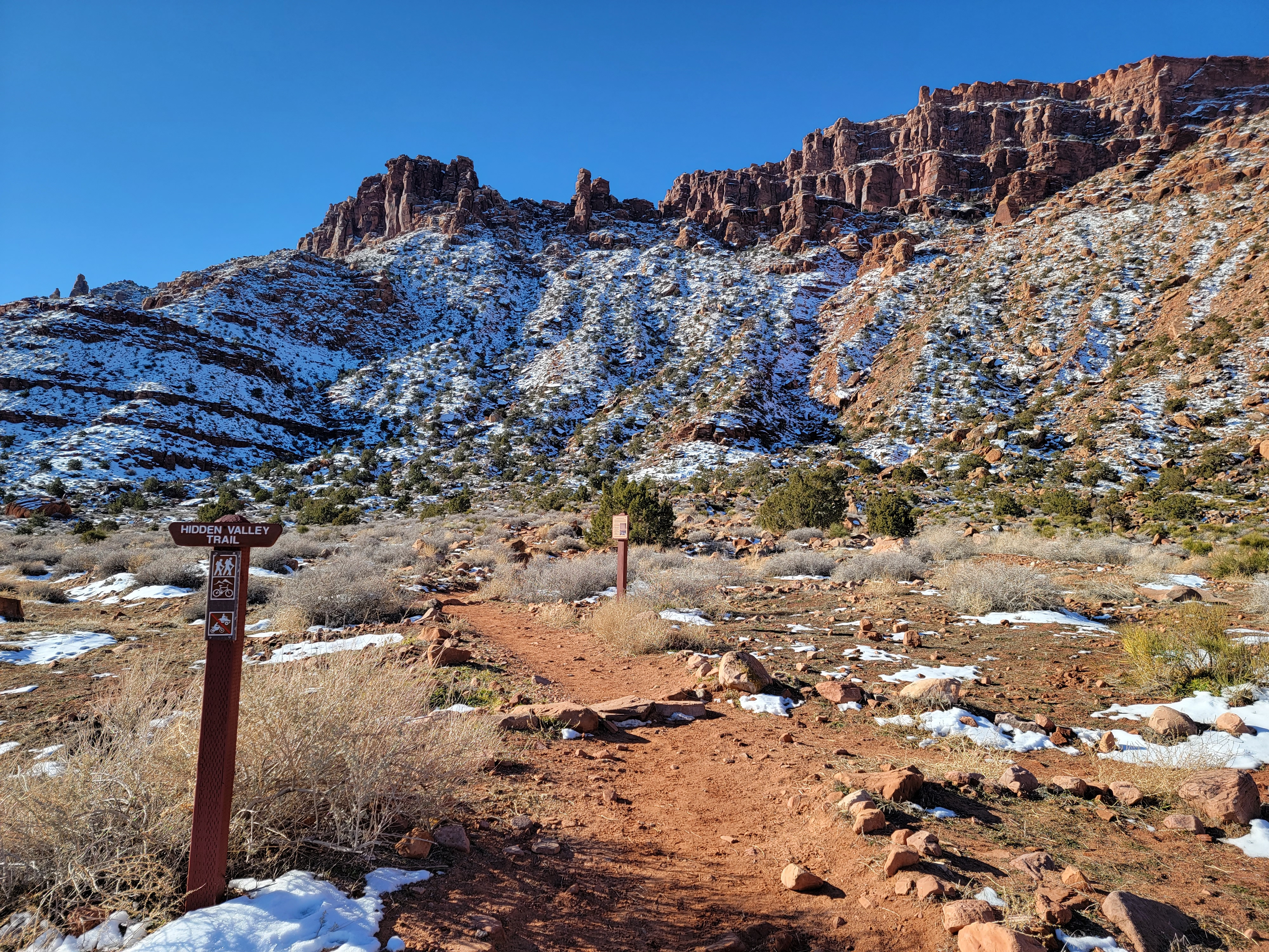 A beautiful morning and I'm the only one at the trailhead
I've always enjoyed spring hiking trips to the Utah canyon country. The scenery is fantastic and the hiking is best in spring, when trails in the high mountains are still buried in snow. Unfortunately others have realized this too and over the years some of my favorite areas have become more and more crowded in spring, and more and more expensive too. In response I've started to go earlier and earlier in the year. Much of the weather is bad during the winter but sometimes there are spells of fine weather - sunny and relatively warm. Now that I'm retired, I am in the habit of checking the ten day weather forecast for much of Utah during the winter. When I see a spell of good weather coming I can make plans quickly for a trip.
This year I had a great trip to Moab in February. I did some excellent hikes, including the Moab Rim Trail and Grandstaff Canyon, two trails that had been on my list to do for quite some time. It was also my first hiking trip outside of Idaho since the pandemic started. Instead of satifying my urge to get out and hike, it just made me anxious to do more. As soon as I got home from that trip, I started watching the weather again for another fine spell.
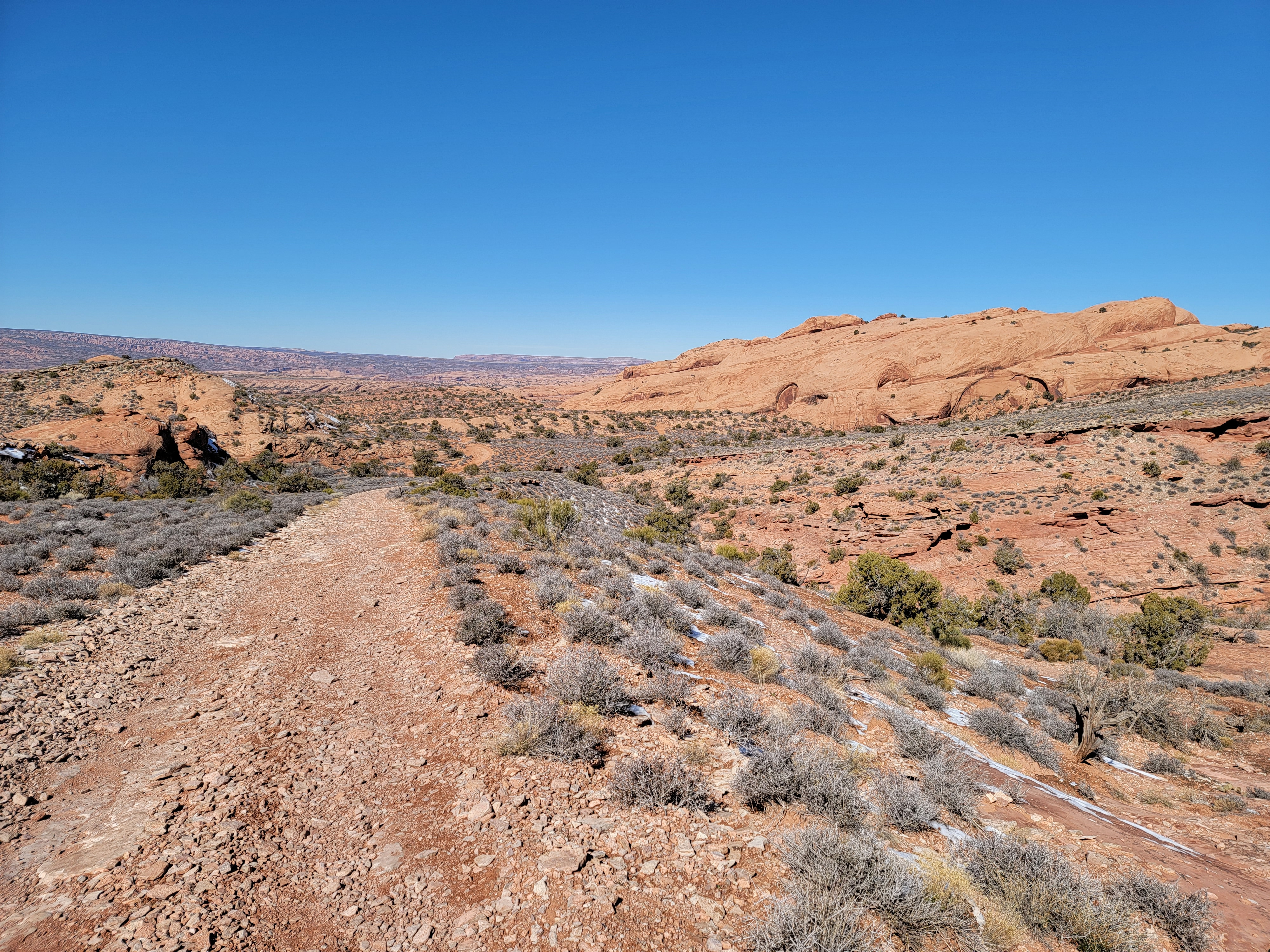
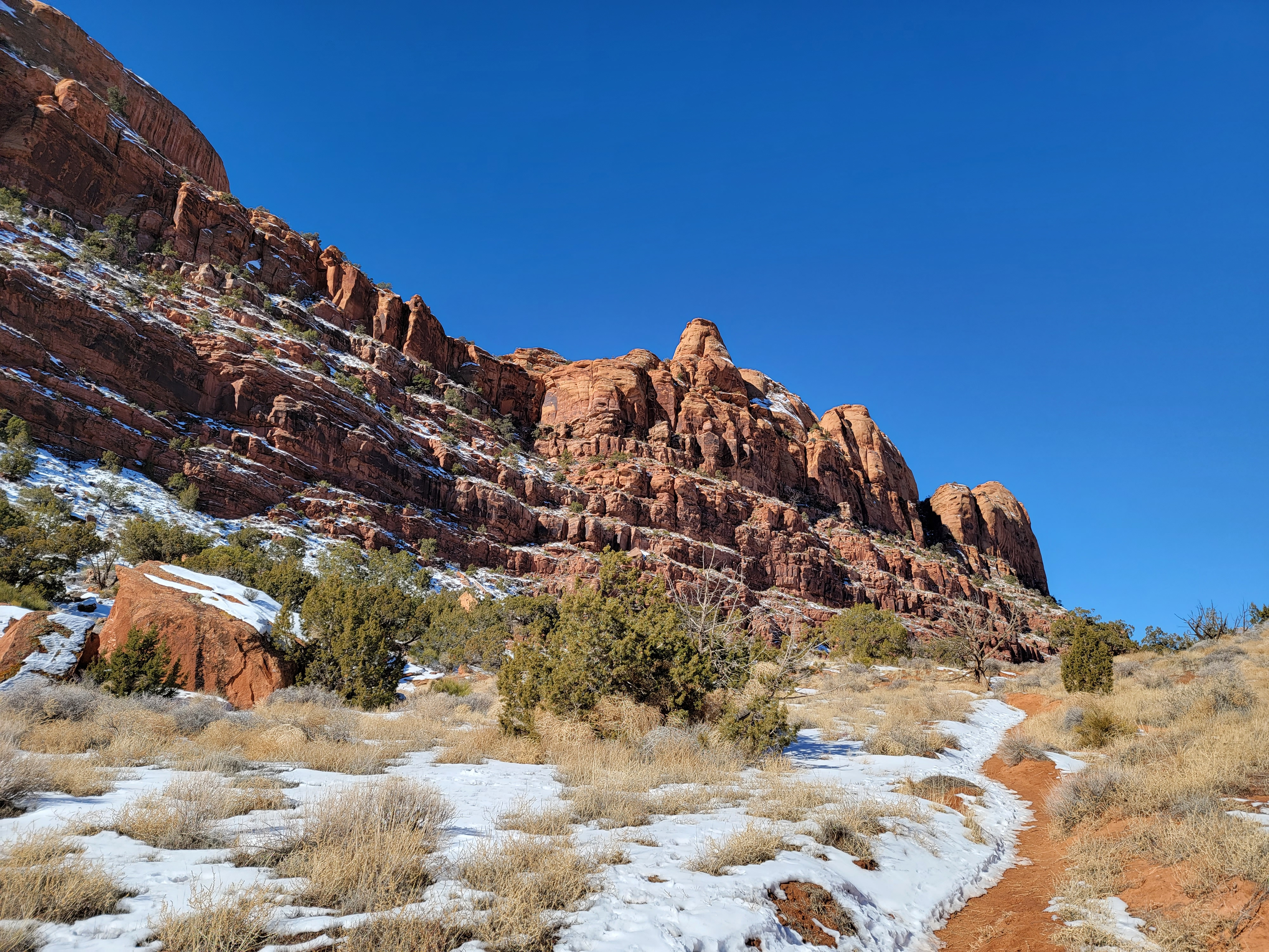 Approaching the low pass between the two terraces
Sure enough, one showed up in the forecast in early March. I talked to Sandy about going but she had been very busy, first with a trip to Wisconsin to see her parents and then with a four day quilting retreat. We also had a big trip to Fiji coming up in the middle of the month. With all that activity she was anxious to spend a few days at home relaxing, but she encouraged me to go.
Besides the fact that it was off season, the best weather was going to be in the middle of the week. That was perfect for an old retired guy like me who was looking to avoid crowds. I drove down on Monday and planned to spend the next two days hiking before driving home on Wednesday night. Those days were supposed to be bright and sunny with temperatures in the fifties and sixties. You can't ask for better for hiking weather.
My first hike would take care of some unfinished business from my last trip. To the west of town the boundary of the valley is the Moab Rim, a steep cliff a thousand feet high. Beyond it is an area known as Behind the Rocks. There is a trail that starts at the Colorado River, climbs up onto the Moab Rim, travels through Behind the Rocks, and descends to a trailhead south of town. The distance is only about seven miles but without a shuttle I couldn't do it as a through hike. Hiking the whole trail and then turning around and hiking back wasn't an option either. Climbing a thousand feet up, then down, just to climb back up again and then down again, was not appealing.
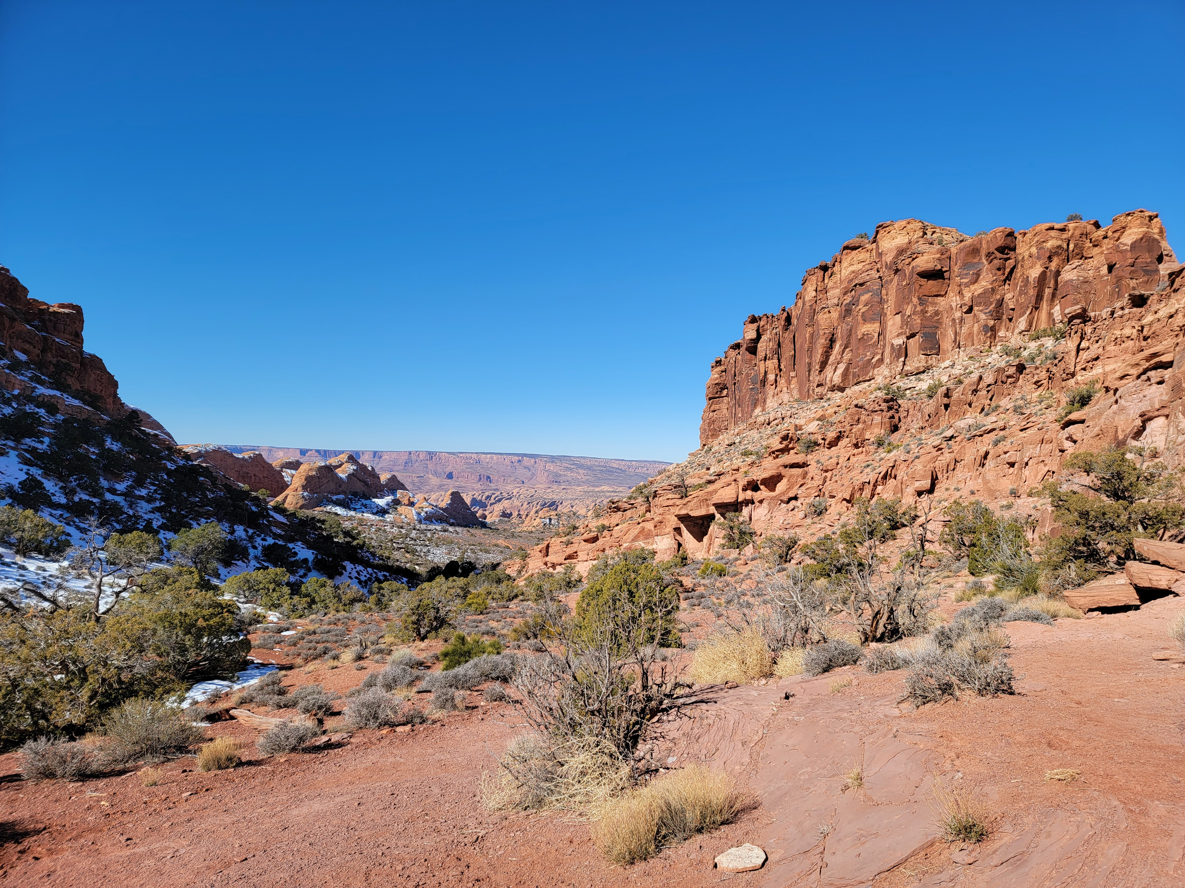 Looking into Behind the Rocks from Petro Pass
On my previous trip to Moab three weeks before I had hiked a portion of the trail. I started at the north end at a trailhead along the Colorado River. From there I hiked what is primarily a 4WD route for the first four miles known as the Moab Rim Trail. My favorite hiking guide to the area suggested a good turnaround point at about two and a half miles from the trailhead. I think ATV's are obnoxious and normally wouldn't hike an off road vehicle trail, but in February it worked out ok. In three hours, I only saw one ATV and that was only a few hundred yards from the start. It was a good hike but I had only done about a third of the route. I still had unfinished business. As I drove home from my last trip I resolved that I would start at the other trailhead and complete the rest of the route on my very next trip to Moab. I had thought about it a lot over the past three weeks. But don't get the wrong idea. It's not like I was obsessed or anything.
I'm NOT obsessive compulsive!
I'm not! I'm not! I'm not!
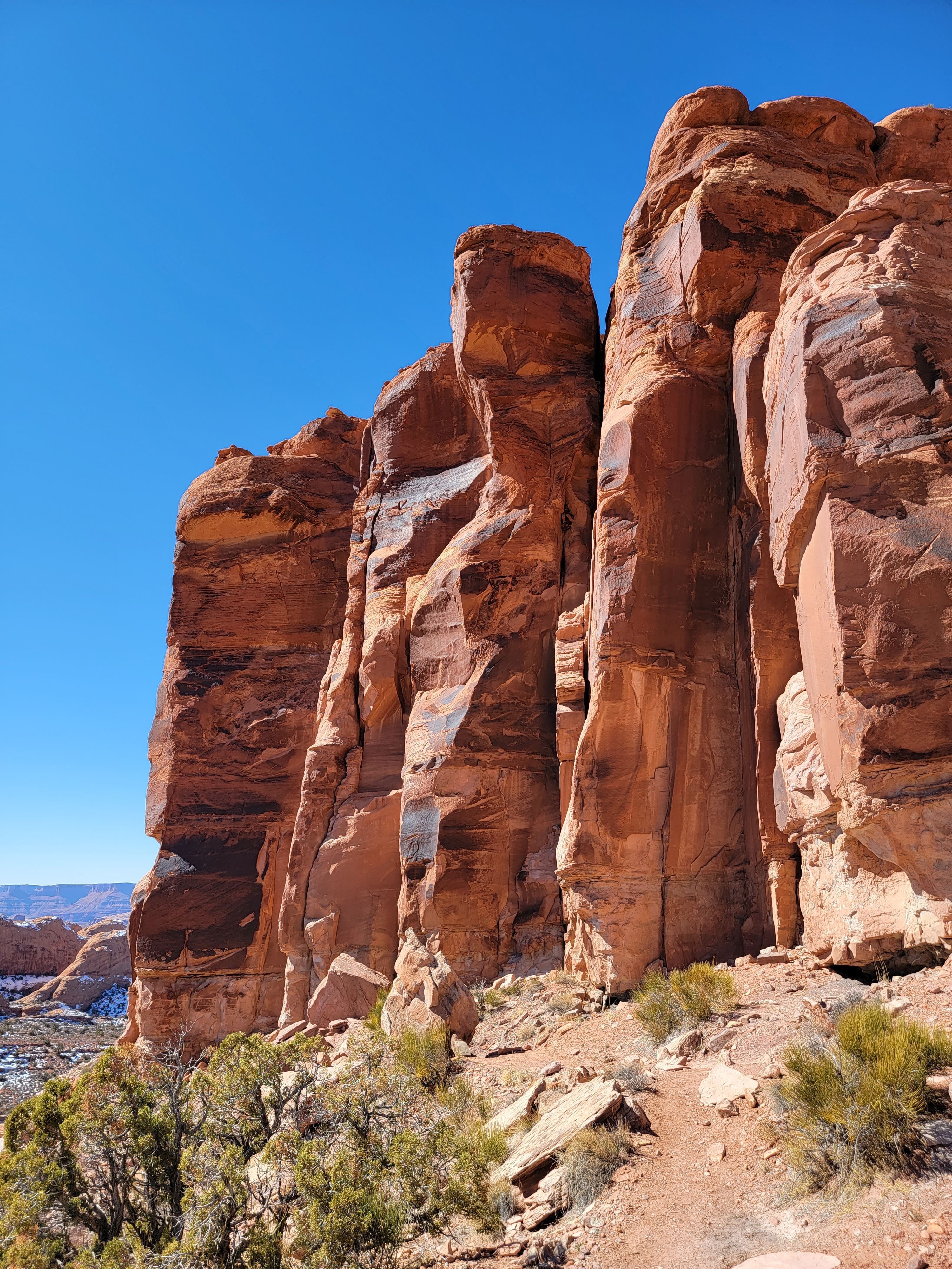
 Spectacular sandstone dome in Behind the Rocks
Well the good news was that I was back in Moab. I didn't have to agonize over what hike to do first either. I was going to do Hidden Valley, the name for the southern end of the Behind the Rocks route. I must have been anxious to get going. Normally I'm a night owl but I was in bed and asleep by 10 pm and up before 8 am the next morning. I took my time getting going as it had been a clear night and the temperature was only in the mid-thirties. With bright sunshine it was warming up fast though and was supposed to hit a high in the mid-fifties.
I saw an odd thing as I left. A car parked a few spaces away from mine at the hotel had two completely flat tires on the left side. I hadn't noticed it the evening before but it was a few spaces away and there might have been another car in between. I checked the other side and the tires were good. I wondered if maybe there had been vandals in the night so I checked my tires. They were fine. When I got back from my hike, the car was still there and the tires were still flat. Same the next morning when I left. I thought that was strange since the car was reasonably new, not an old beater. It was a strange place for a car to be essentially abandoned.
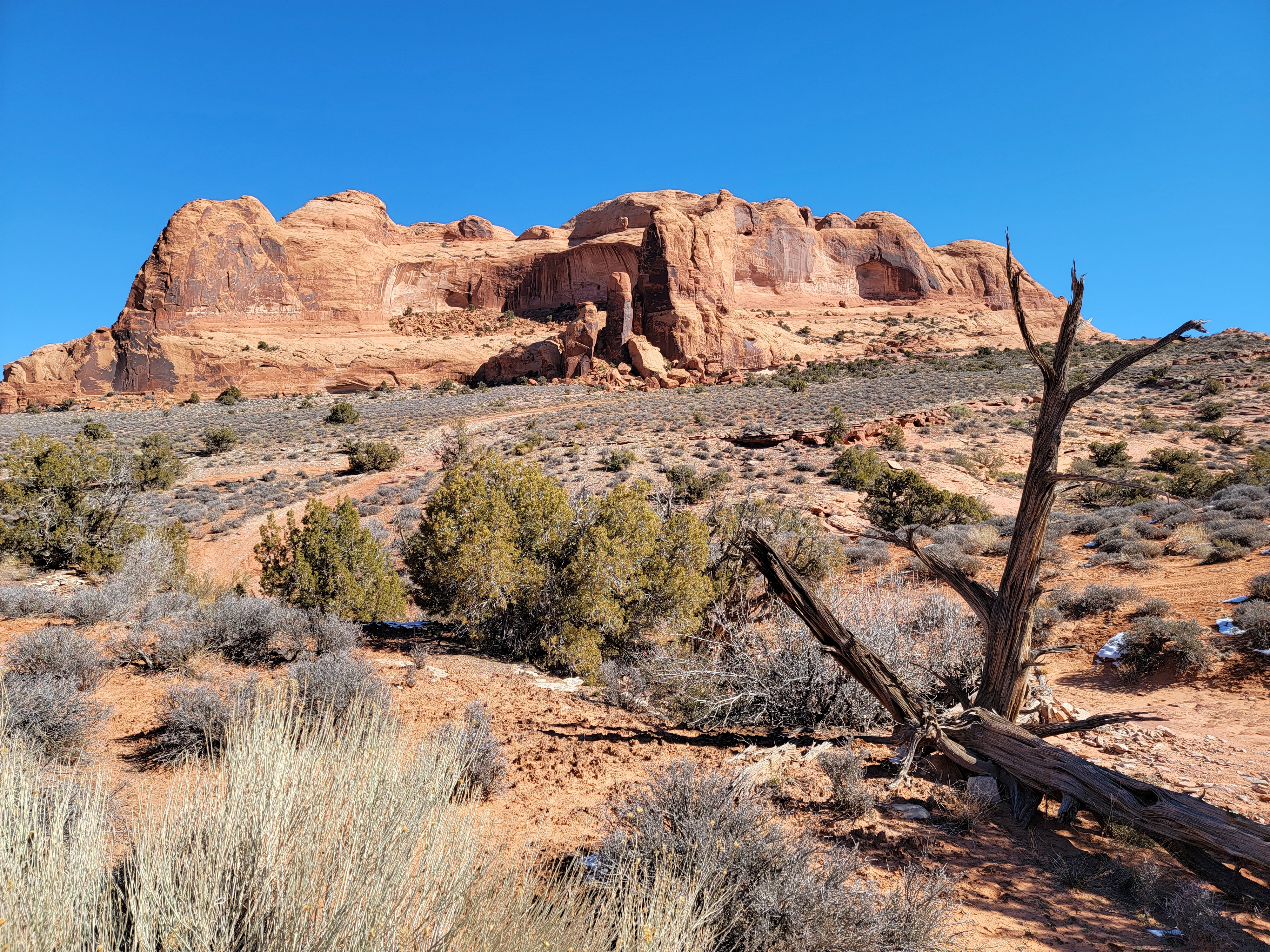
 Top of Tire Test Hill just barely visible on far left
Ok, back to today's hike. To reach the trailhead I turned off the main drag, Highway 191, a few miles south of town. When I got to the parking lot a little before nine, it was completely empty. A beautiful day, a popular trail, and I was the only one there. Things were looking good. Although there was snow on the ground in a few spots, it had already started to warm up and I left my pile vest in the car. As I started out, I was warm enough in just a gore-tex shell and a warm hat and gloves.
I didn't have to worry about getting cold. The hard work started almost immediatly. The trail began with a tough climb, about seven hundred feet of elevation gain in the first half mile. From the very begining I could see the notch that the trail was heading for. My trail guide said twenty minutes for that section but the writers are hiking studs. I took it slowly and topped out on the steep section in thirty five minutes. I was fine with that. I felt pretty good, especially since I knew that was the hardest part of the whole hike.
 Island in the Sky and Dead Horse Point in the distance
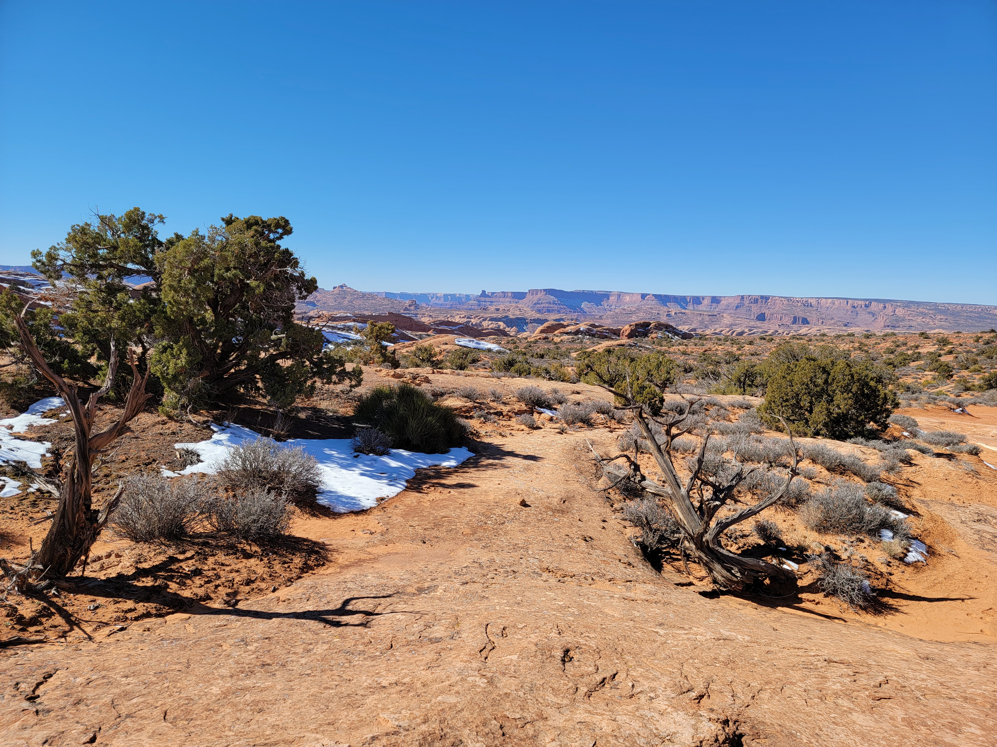
After going through the notch I was in Hidden Valley. It isn't really a valley. It's more of a terrace - two terraces actually. It's a long, nearly level meadow running roughly north and south. To the west it was bounded by cliffs several hundred feet high. To the east was a slight rise, maybe fifty to seventy feet. Beyond that, hidden by the rise, were steep cliffs that fell away to Moab. It was was easy to understand the name though as hiking along it felt like being in a valley that was hidden away from the rest of the world.
Here the hiking was easy on the mostly level trail. The weather was sunny and the termperature was rising. First my winter hat came off and was replaced by a baseball cap. Then I unzipped my jacket. Pretty soon that came off too and before I was an hour from the trailhead I was hiking in just a long sleeve tshirt. Not bad for a winter hike.
 The Moab Rim ATV track was easy to follow
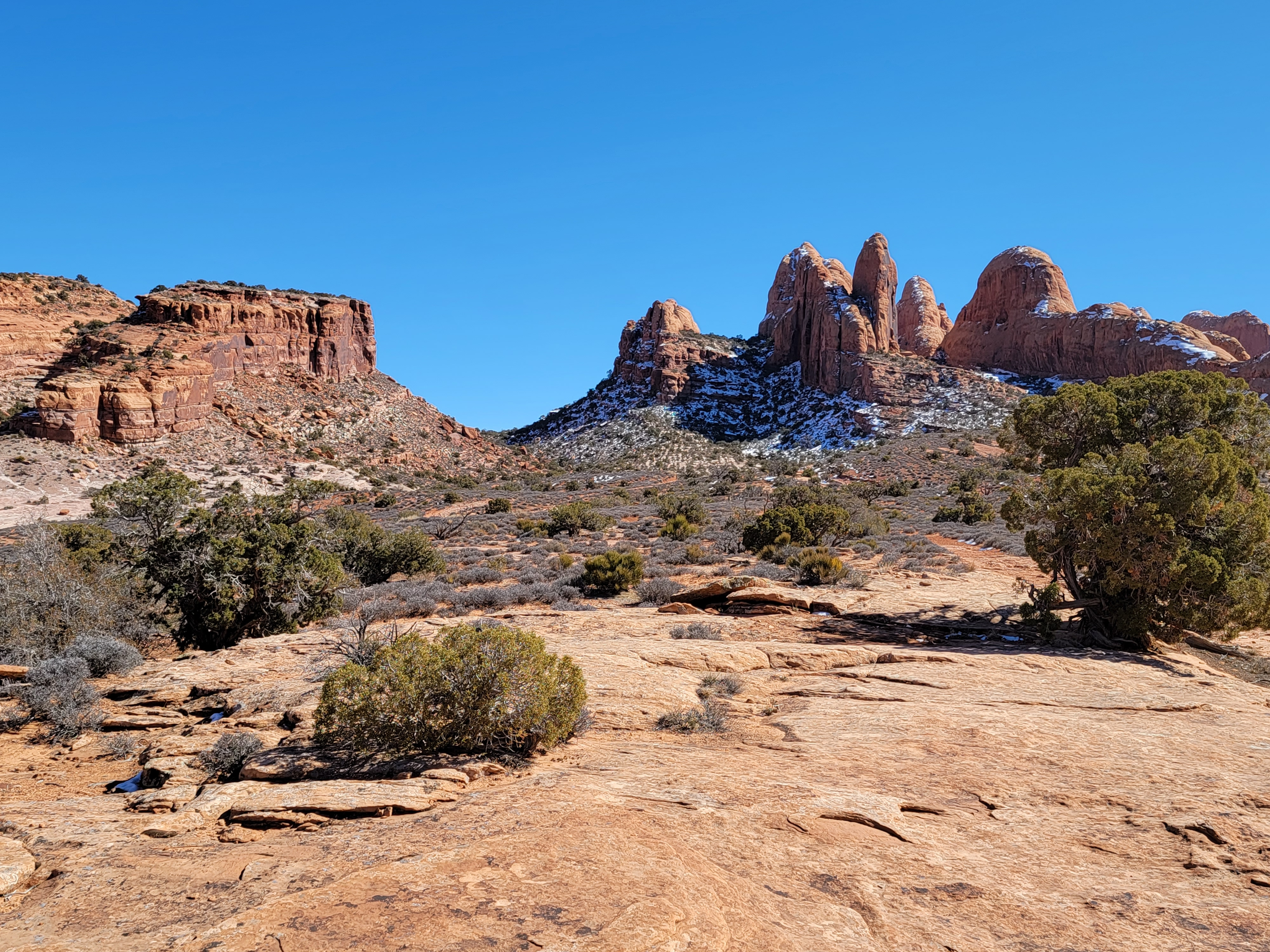
At the far end of the first terrace there was a short, gradual rise that took me to the second terrace. It was not quite as long and the cliffs to the west were even more spectacular. They were broken up into individual peaks and domes rather than just presenting a solid wall. At the far end was another easy climb to 5314 foot Petro Pass, two miles from the Hidden Valley trailhead and the high point of the through hike. Here there was a side trail that climbed up one side of the pass to some ancient rock art. It was highly recommended in the hiking guide but I decided to save it for the way back to see how much energy I had left. My number one priority was to reach my turnaround point from my previous hike and complete the whole through hike. I started down into the broad basin on the other side of the pass.
Most hikes involve a climb to some destination, a lake or pass or viewpoint or summit. The return is downhill and easier. What I call "upside down" hikes are the opposite. These are tougher because they start by descending and then require a climb on the return, when you are already tired. An example is the hike to the bottom of the Grand Canyon, probably the granddaddy of all upside down hikes. But sometimes even worse is the up-and-down-and-up-and-down hike, which is what I was doing now. After working hard to gain the elevation to Petro Pass, I had to hike downhill and give up all that elevation, knowing that before long I would be climbing back up again. I was determined to reach my previous turn around point though so down I went.
 Heading back to Petro Pass - a long way off
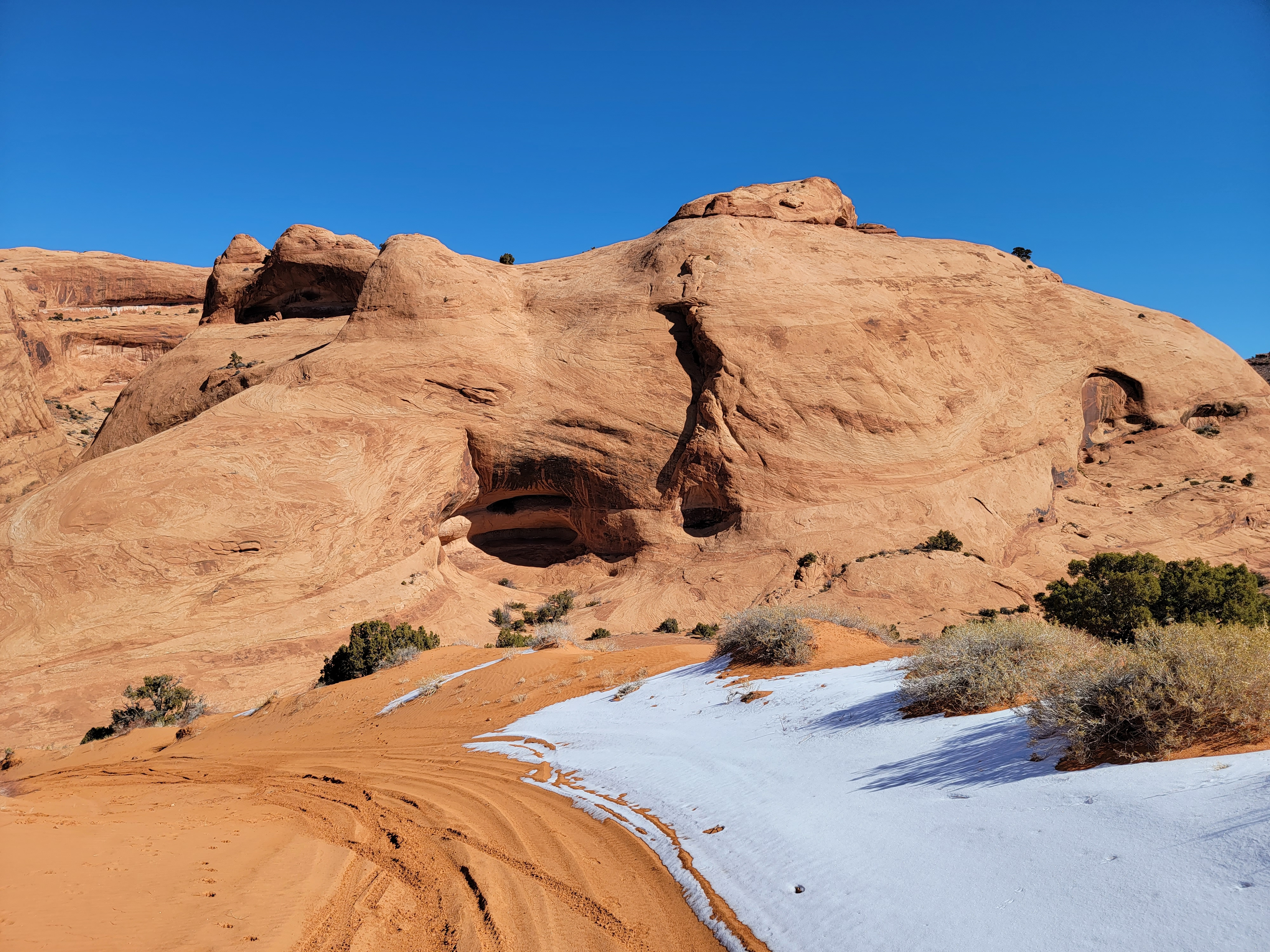
At first the trail leading down from the pass was a wide dirt track. After a while it hit slickrock and was tougher to follow. I had to stop a few times to look around and figure out where it went. I wasn't worried about getting lost though. With high cliffs on both sides even Alex Honnold couldn't get too far off track. Still, I didn't want to get off the "official" trail for fear of causing environmental damage. In the desert lands of Southern Utah, most open ground consists of crytobiotic soil, a thin crust of micro organisms and dirt that protect against erosion. It's actually very delicate. A single footstep can damage it and when destroyed it can take decades to recover. So I was being careful to avoid trashing the area where I was hiking. One spot where the route took a sharp hairpin turn backwards and upwards was a little tricky to figure out, but I always managed to find the correct route.
Eventually I reached the end of the Hidden Valley Trail, a hikers-only trail, and connected with end of the Moab Rim ATV Trail, which started from the other end. Now it was easy to follow the route as there was a wide trail with tire tracks in the sandy areas and paint markings on the slickrock. There were still a few junctions though. There was one where a dead end side trail led up to a viewpoint over the valley, another where a dead end led into a side canyon, and a third with a track that led down into a sandy wash that provided ATV's with a loop back to the Moab Rim Trailhead. I was able to keep on course though and eventually reached the sandstone dome known as Tire Track Hill. I climbed to the top which had been my turnaround point on the previous hike. I took a break on the top of the dome to eat a candy bar and drink some water. Now I had hiked the entire route.
 This view reminded me of the mountains of Patagonia
The view was impressive. To the east were several spectacular sandstone domes which were the backside of the Moab Rim, much larger and more impressive than the one I was on. As far as I can tell, they are nameless but are impressive none the less. To the southeast I could see the pass I came over on my previous hike up from the Colorado River. To the south were more sandstone domes, the backside of the Colorado River Canyon. To the west was a maze of sandstone fins. Above them in the far distance was the mesa which was the Island in the Sky district of Canyonlands National Park and Dead Horse Point State Park. And to the north was the trail back to Petro Pass, which was framed by beautiful cliffs and peaks. The sandstone formations to one side of the pass reminded me of the Towers of Paine in Patagonia, although on a much smaller scale.
Hiking back to the pass wasn't as bad as I thought it would be. I had to gain back quite a bit of elevation but the climb was gradual and I took it slowly. It was my second time over the same ground so the route was easier to follow on the way back. The weather was perfect and the scenery was fantastic. I was enjoying the hike.
 Approaching the cliff with the rock art panels
A weird thing did happen when I got back to the hairpin turn in the trail. I heard a sharp, single dog bark. It sounded fairly close by, maybe a hundred yards or so away. I assumed it was another hiking party that had a dog with them, although I hadn't seen anyone all day. I looked all around but didn't see anyone. Then a minute later I heard another bark. Ok, I wasn't imagining it. I thought maybe someone had gone off route - the hairpin turn had been tricky to follow - but I didn't see anyone. When I didn't see anyone as I continued along the trail, I eventually decided that it must have been a lone animal rather than a dog with hikers. Maybe it was a feral dog. Maybe it was a fox or coyote. Do they bark? I don't know. I resigned myself to the fact that it was a mystery.
When I reached Petro Pass again I still had energy so I decided to take the side hike to check out the rock art. A worn track left the pass and climbed up to the base of a large cliff face to the east. It wasn't far. It took me less than ten minutes. From there the track followed the base of the cliff. I followed it and came across several impressive rock art panels. According to the guidebook the panels continued along the wall for quite a distance but I turned around after a few hundred yards and headed back.
Just before I reached the pass again I heard noises behind me. I turned around and saw two guys, younger and faster than me, catching up. They were the first people that I had seen all day. And with them were two dogs. One of them raced up to me. He seemed very friendly and I bent over to say hi.
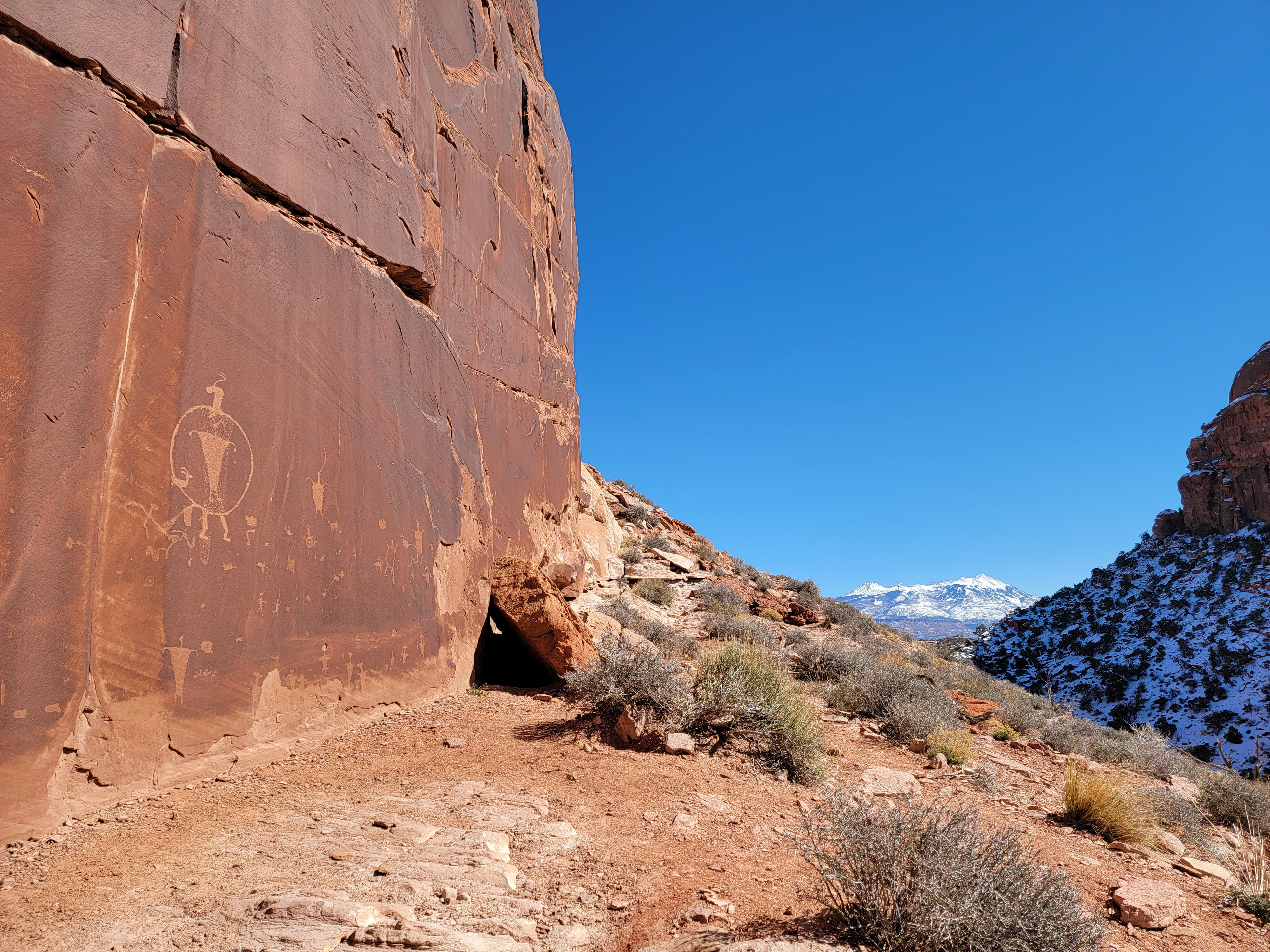 Ancient rock art in an impressive setting
"Be careful. He'll jump up on you" one of the guys said.
"Oof!!!" was my involuntary reply.
Yup. He had just jumped up and kicked me in the stomach. He surprised me but no real harm was done. He was just a puppy and very excited. I talked to the two guys for a while. They had explored quite a way along the cliffside, reaching a gully and looping behind. They said there was a lot of very impressive rock art.
The mysterious dog bark was explained too. It was one of their dogs (probably the rambunctious puppy). They were hidden out of sight above me but the sound probably reflected off a cliff wall and sounded to me like it was coming from a different direction and close by.
Mystery solved.
Two minutes later, back at the pass, there was another hiker. Over four hours of hiking and I hadn't seen a soul and now two parties in two minutes. We chatted for a while and then he headed up to check out the rock art while I headed down towards the trailhead.
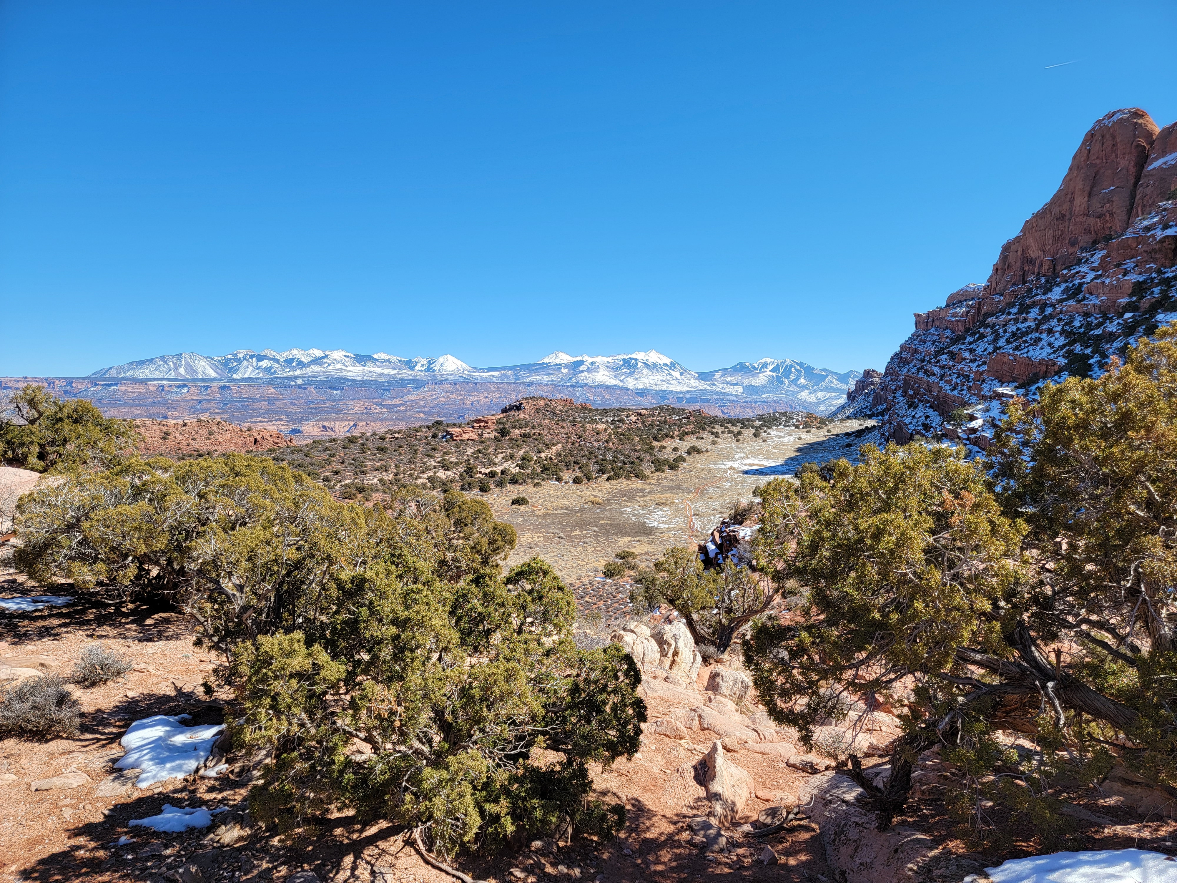 Looking over Hidden Valley to the La Sal Mountains
The trail through the terraces was a minor nuisance. The warm sun had melted a lot of the snow and the trail was very muddy. Although the trail was mostly flat, it was awkward trying not to step in the mud but also trying not to wreck the vegetation alongside the trail. I was careful too because while a slip in the mud or snow wouldn't be dangerous, landing on my butt in a quarter inch of water covering an inch of mud did not seem like a good thing.
I passed another hiker heading up. It was a young guy, hiking along with no shirt on. I thought it was a warm afternoon but not quite that warm. Maybe I don't have as high a metabolism as him. Or maybe I'm just not as proud of myself as he is.
Eventually I reached the top of the final slope. I could look out over the Spanish Valley and Moab with the La Sal mountains in the distance. This section was in the shade of the Moab Rim at this time of day, so there was still quite a bit of snow and ice on the trail. I had to be more careful about slipping while going down, but I just took my time. There were quite a few hikers just starting out too. After not seeing anyone else for hours, now I passed several parties just starting up. Apparently in winter most hikers wait till the afternoon when it has warmed up.
I reached the car at 2:30. I'd hiked about nine miles, including the side trip to the rock art. Net elevation gain was only 750 feet but it was at least twice that with the repeated up and down. It took me five and a half hours but I had taken my time (and taken lots of pictures). I felt good even at the end of the hike. It had been a great hike on a beautiful day with fantastic scenery. I was ready to head into town and get a pizza at Pasta Jays to take back to my hotel room.
