Slickrock Trail
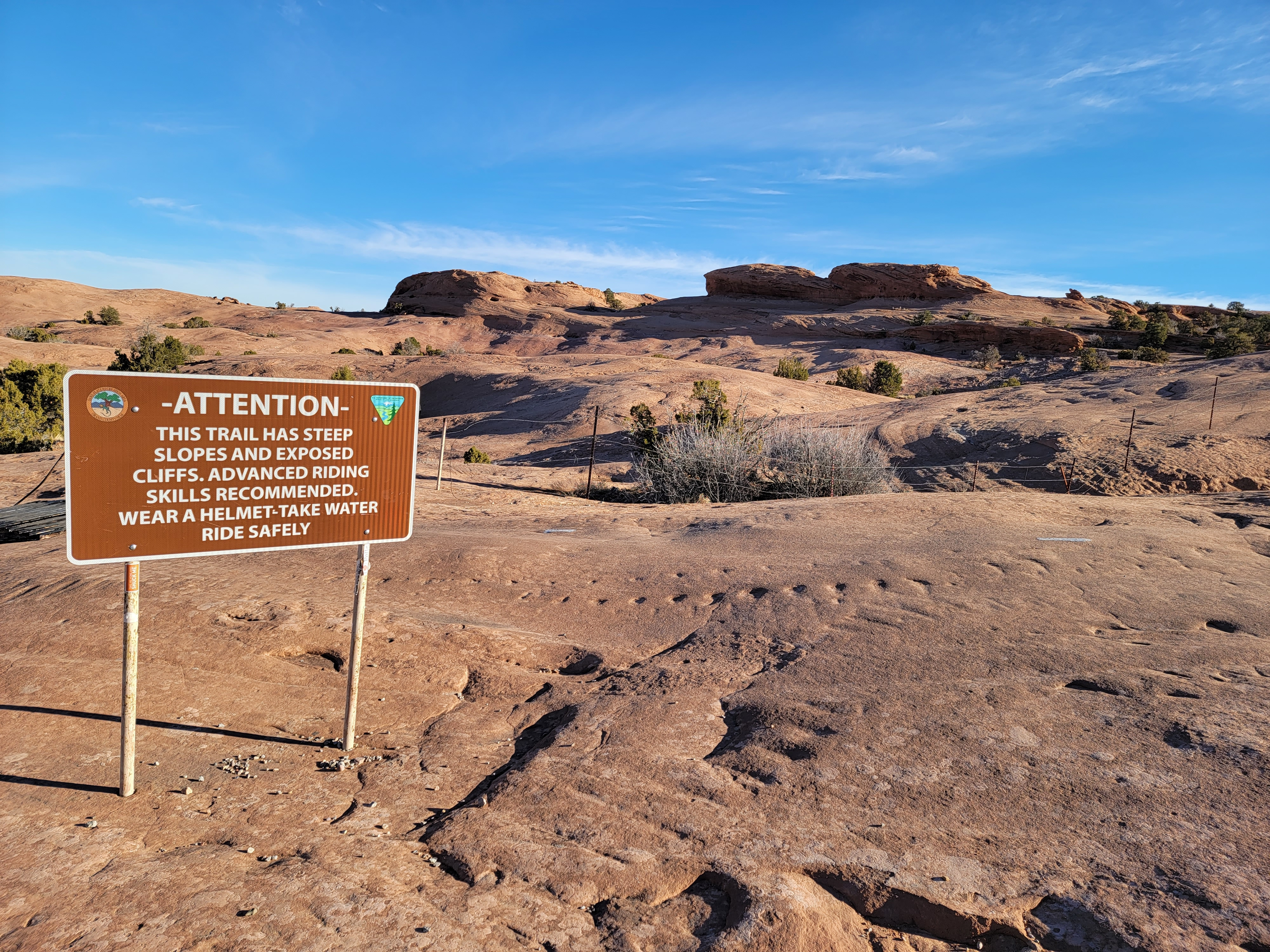 Start of Slickrock Trail - you've been warned!
I was on a quick trip to Moab, my second one this winter. I had done an excellent hike my first day - Hidden Valley in Behind the Rocks. I had one more day before I planned to head home. The weather promised to be even better than on my first hike, sunny with highs in the sixties. It was hard to believe that it was still winter.
I had a hike in mind too. I wanted to do the Slickrock Trail. It's actually a mountain bike trail, and a very famous one at that, but I had read that it is a great hike as well. I didn't know how well bikers and hikers would mix though if the trail was busy. That made winter the best time to do it. I had seen very few hikers the day before, and very few ATV's when I did the Moab Rim ATV trail three weeks earlier on my previous trip. I figured that there weren't many mountain bikers around either.
I wasn't even sure that I could hike it. The trail is in the Sand Flats Recreation Area, which charges a fee for entry. Within the area are several mountain bike trails as well as ATV trails. I looked at their website and while they mentioned hiking in the area, they only mentioned it with regard to some short, dedicated, hiker-only trails. So first I had to find out if it was "legal" for me to hike the Slickrock Trail, or if it was designated for mountain bikers only.
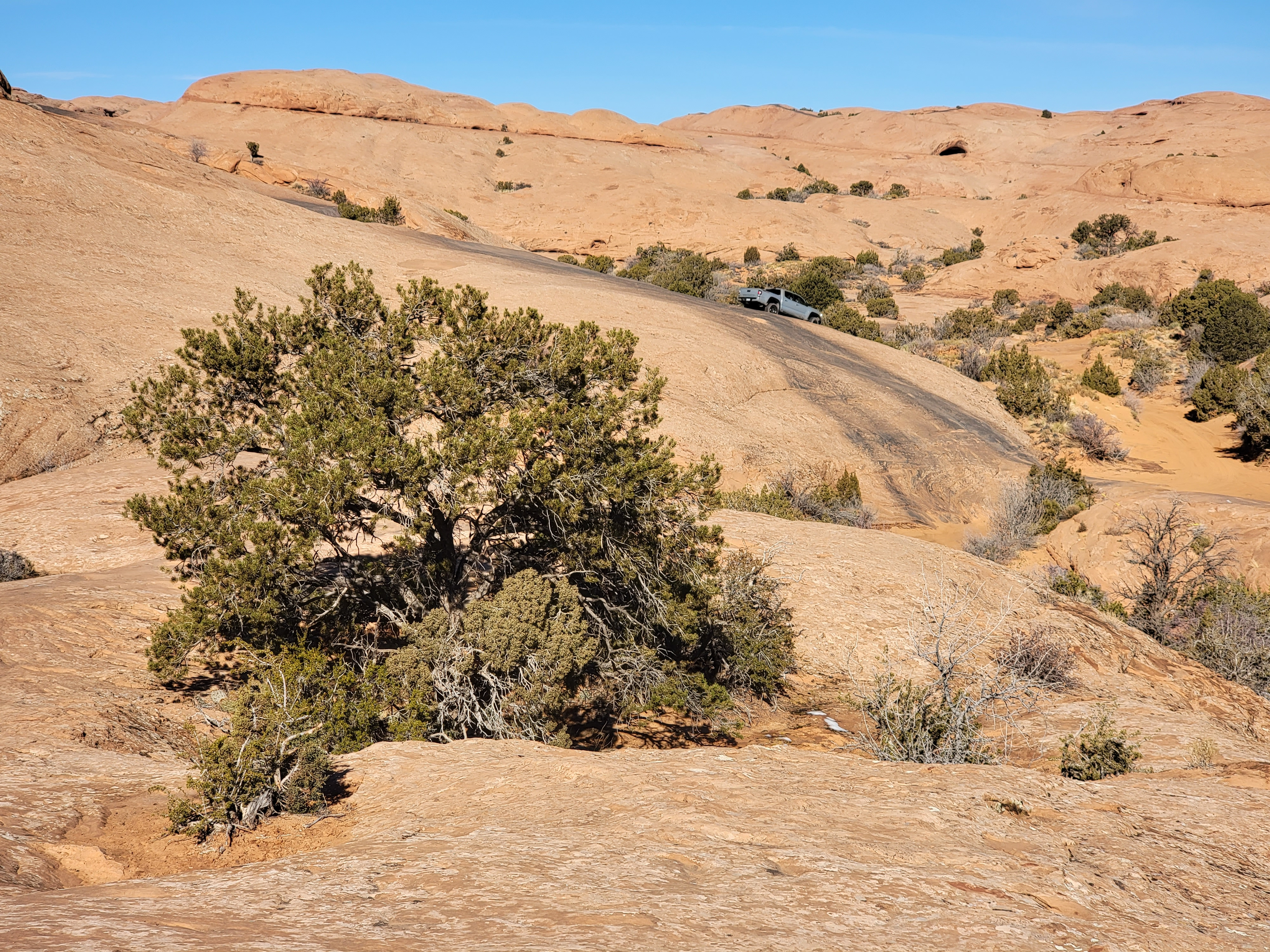
 Follow the yellow brick road - or the tire tracks and paint marks
I finished my hike the day before in the middle of the afternoon. I had time to return to my hotel and get cleaned up before going into town, where I headed for the Information Center. The lady there assured me that hikers were ok on the trail and gave me a map of the area. She also agreed that there would probably be very few riders at this time of year so it was a good time to hike it. Now I had a plan for the following day and my last hike of the trip.
Conveniently, my favorite restaurant in Moab, Pasta Jay's, was right across the street from the info center and that was right where I had parked. Whenever I come to Moab,whether for a week or just passing through, I always try to eat at Pasta Jay's at least once. I ordered a pizza for carry out and took it back to my hotel. After a healthy workout on my hike that day I was really hungry and the pizza tasted extra good. Afterwards I packed up all my stuff so I just had to load it in the car the next morning and check out. I planned to drive home the next day right after I finished my hike.
 Looks like he's driving off a cliff
Next morning I was up at seven and it was another beautiful day. When I got to the entry station at the recreation area, there was no one there to collect fees. I suspected that would be the case, especially since I was there early on a day in the off season. There was a self-pay station though. I doubted that anyone would come around later to check but I paid the fee anyway. Since it goes to pay for maintanance of the trail which I was going to use, I thought it was fair. It was only five bucks anyway.
When I got to the parking lot for the Slickrock Trailhead, I was disappointed to see that there were several cars there. On my hike the day before the trailhead parking lot had been totally empty when I arrived, even though some people had shown up later. I didn't know if the trail was just that popular or if mountain bikers were tougher than hikers and more likely to be out in the winter. It turned out that it was neither. Some people camp at the Sand Flat area because it's cheaper than anyplace in town and it turned out that the handful of cars had been there overnight. I parked next to a guy in a camper who had just woken up. He was playing with his dog, which he had just gotten two weeks before. I spent some time talking to the guy and playing with the dog before I finally hit the trail. It was just before 8 am when I grabbed my pack and started off.
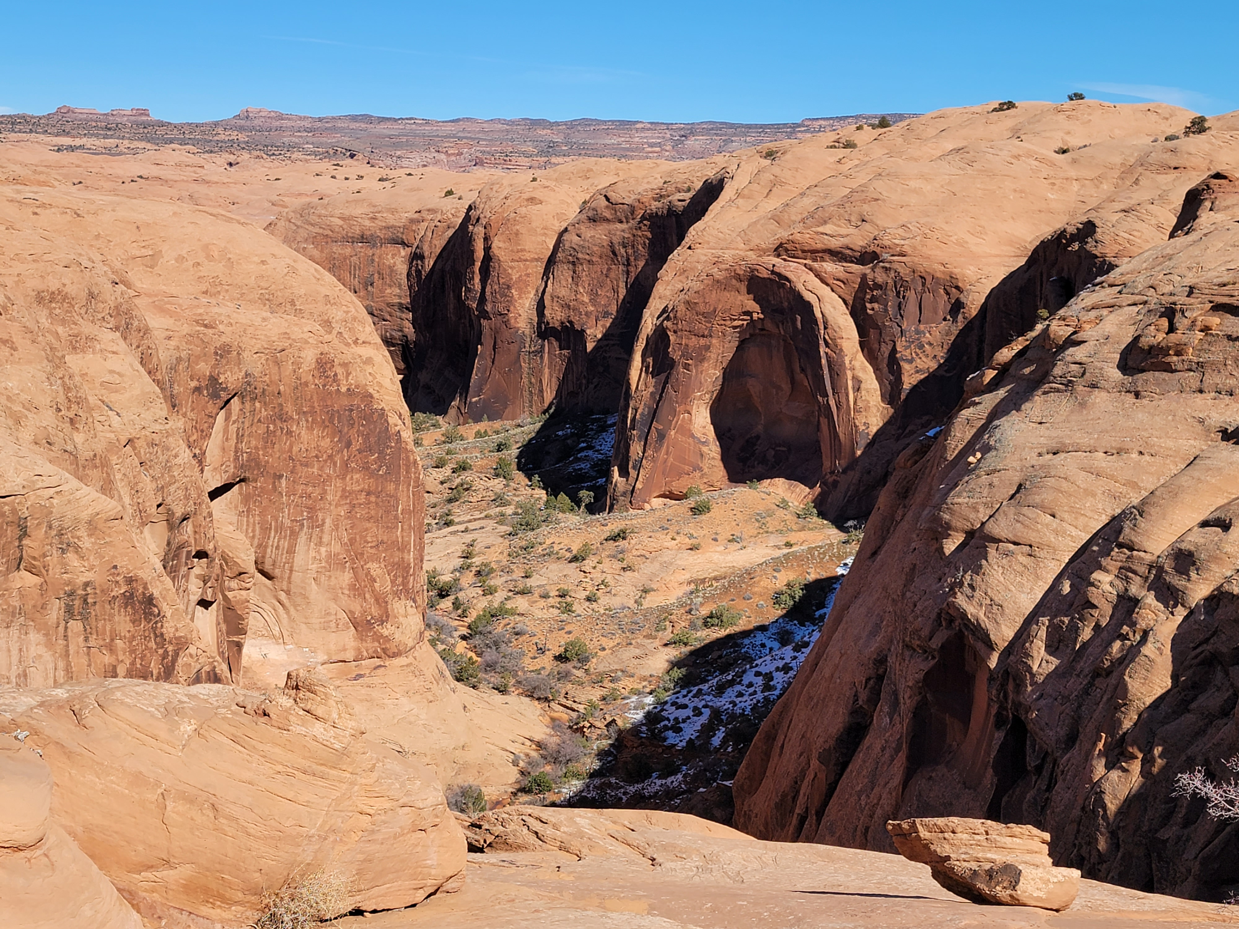 The Abyss
The sign at the start of the trail was ominous. "Steep slopes". "Exposed cliffs". "Advanced riders". Cool. Sounded like my kind of trail!
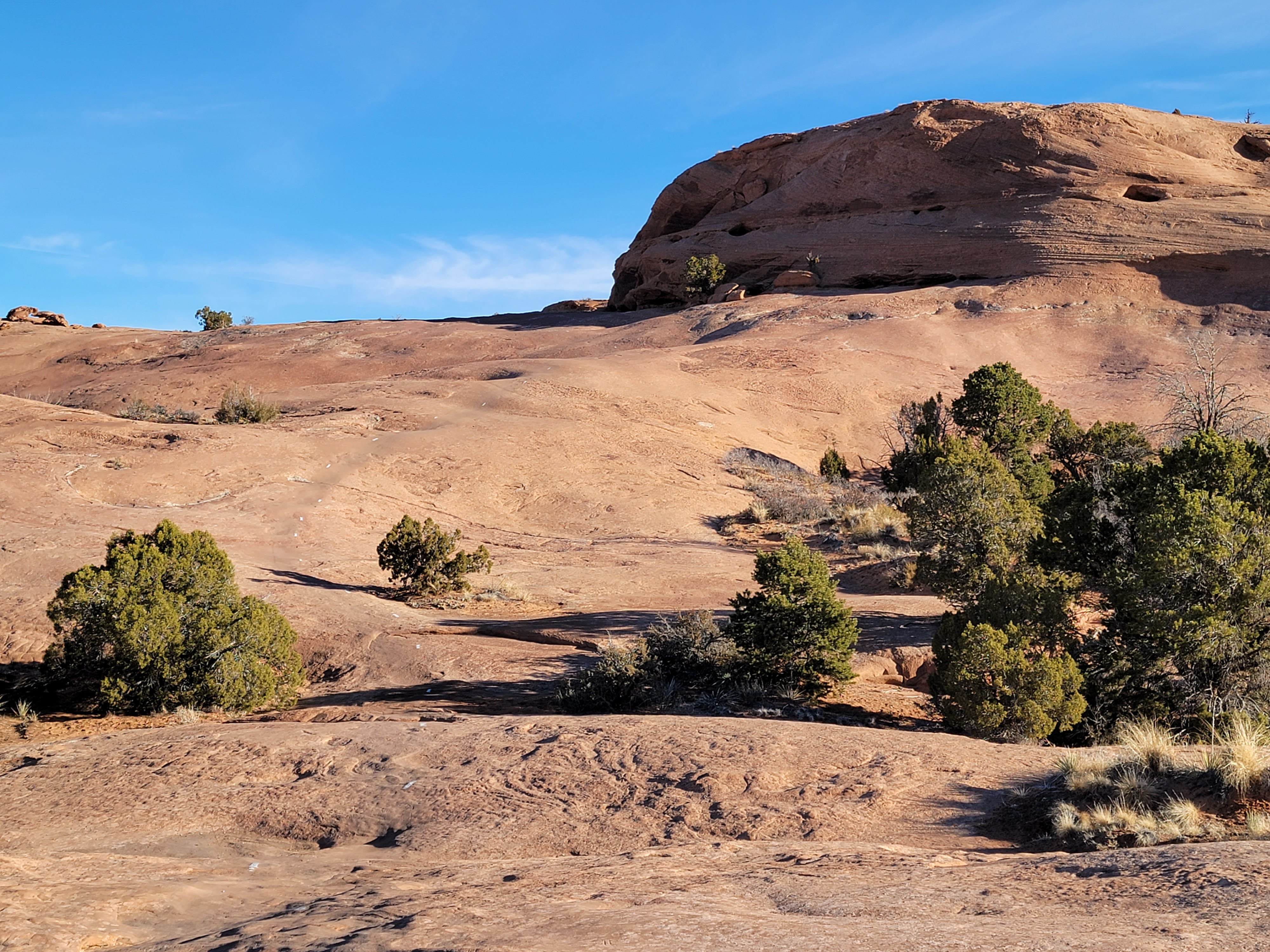
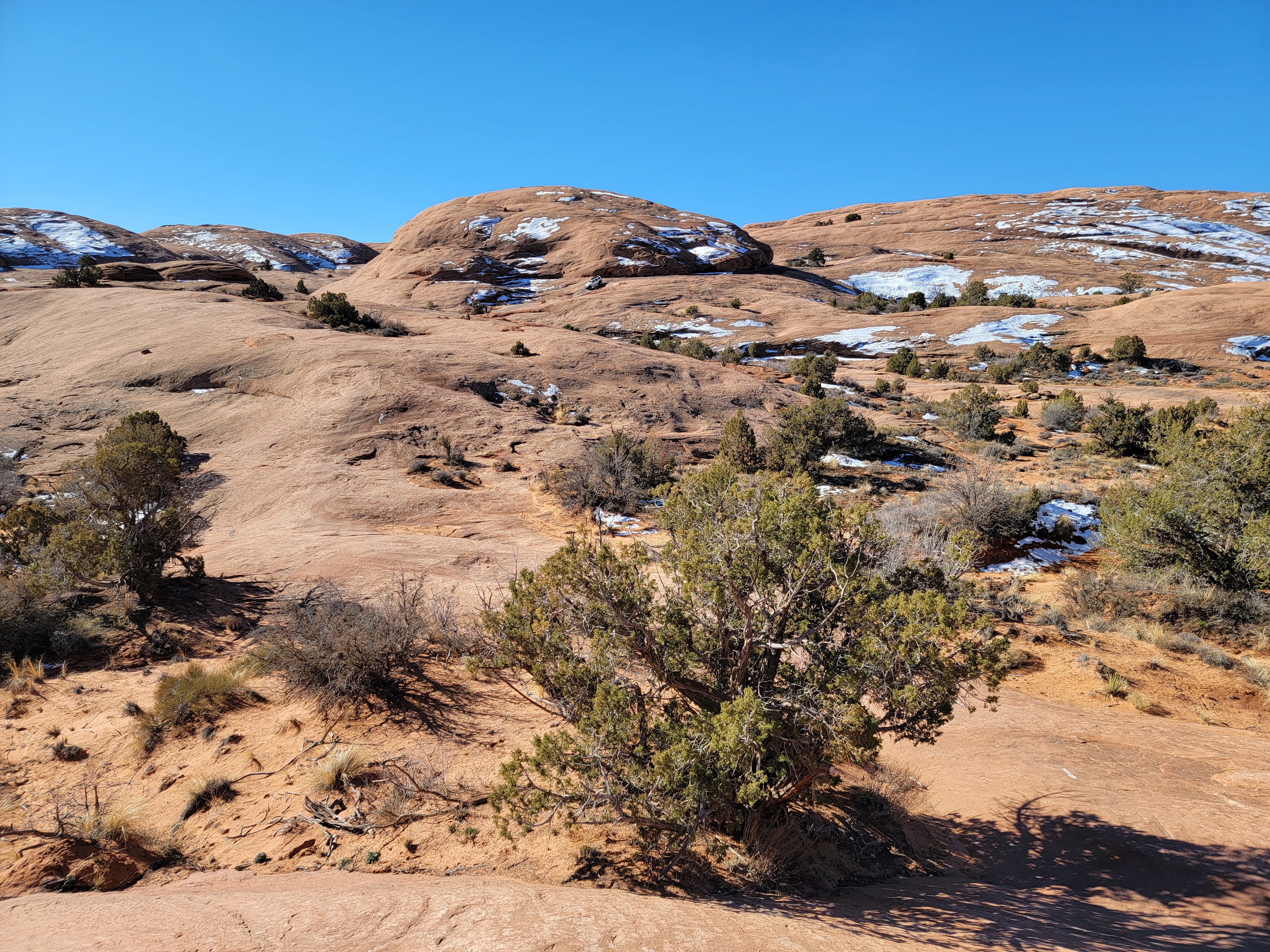
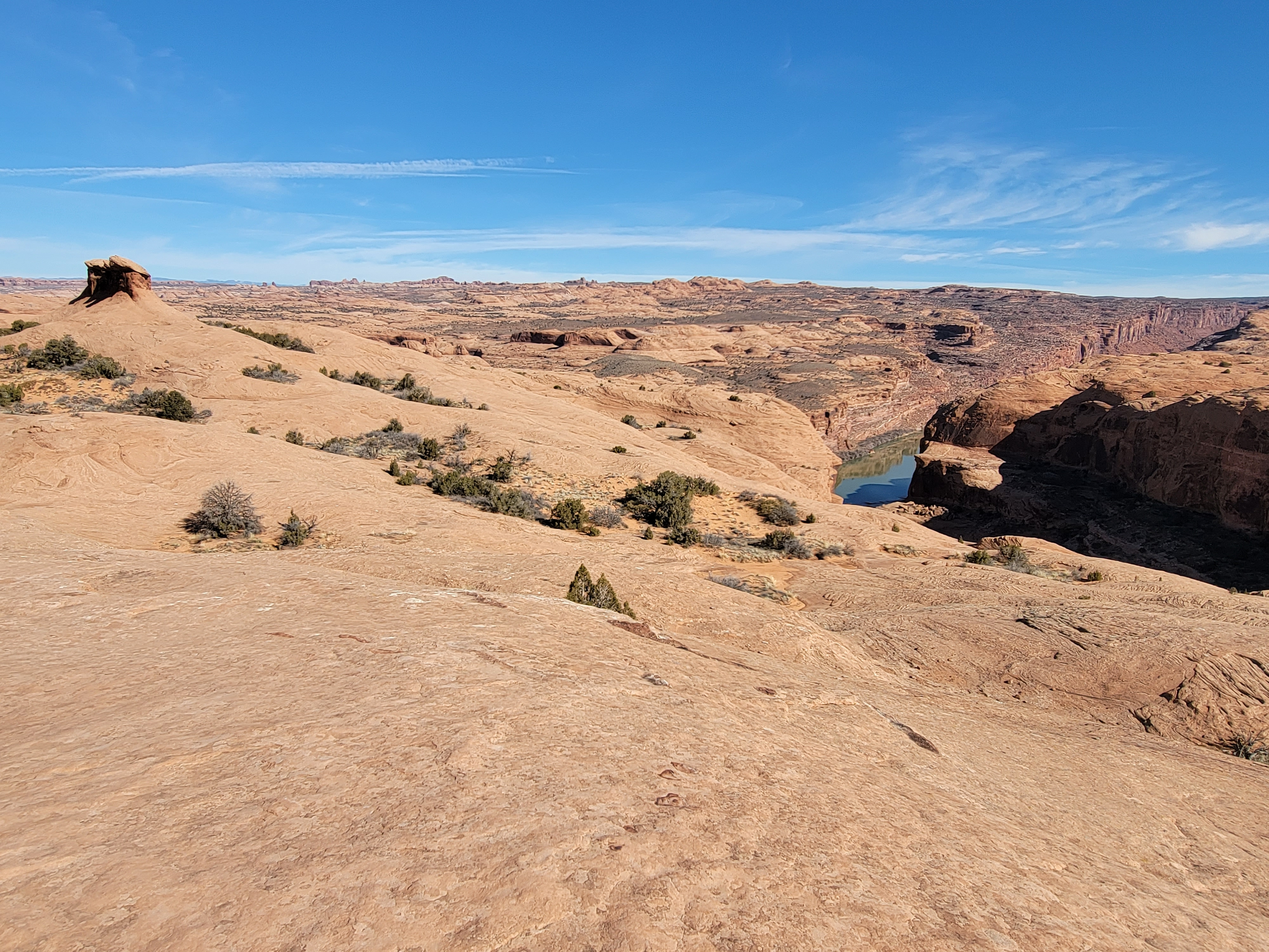
Right from the start, the route was on slickrock. The area was a high mesa and most of it was exposed sandstone. And virtually none of it was flat. All I could see were rolling sandstone domes and ridges everywhere. It looked like a great desert of petrified sand dunes. There wasn't a lot of vertical relief. A few of the domes were one or two hundred feet high but most were less, maybe fifty to seventy feet. The landscape was incredibly convoluted and it was hard to imagine how it would be possible to navigate through it. Once I got going though it turned out to be quite easy to follow the route over the rock. Most of the time the tire marks of countless mountain bikes were clearly visible. There were also white paint stripes to mark where to go. Since they were intended for bike riders, who often go a lot faster than hikers, the stripes were closely spaced, only about ten feet apart on average. From almost any spot you could see several markers ahead indicating where to go. Yeah, it kind of defaced the rock but it was limited to just the Sand Flats Recreation Area. The cyclists and four-wheelers get to have one place to do their thing. There is still a lot of pristine hiking territory around Moab. And the Slickrock Trail is an amazing route. I don't know how else it would have been possible to follow it.
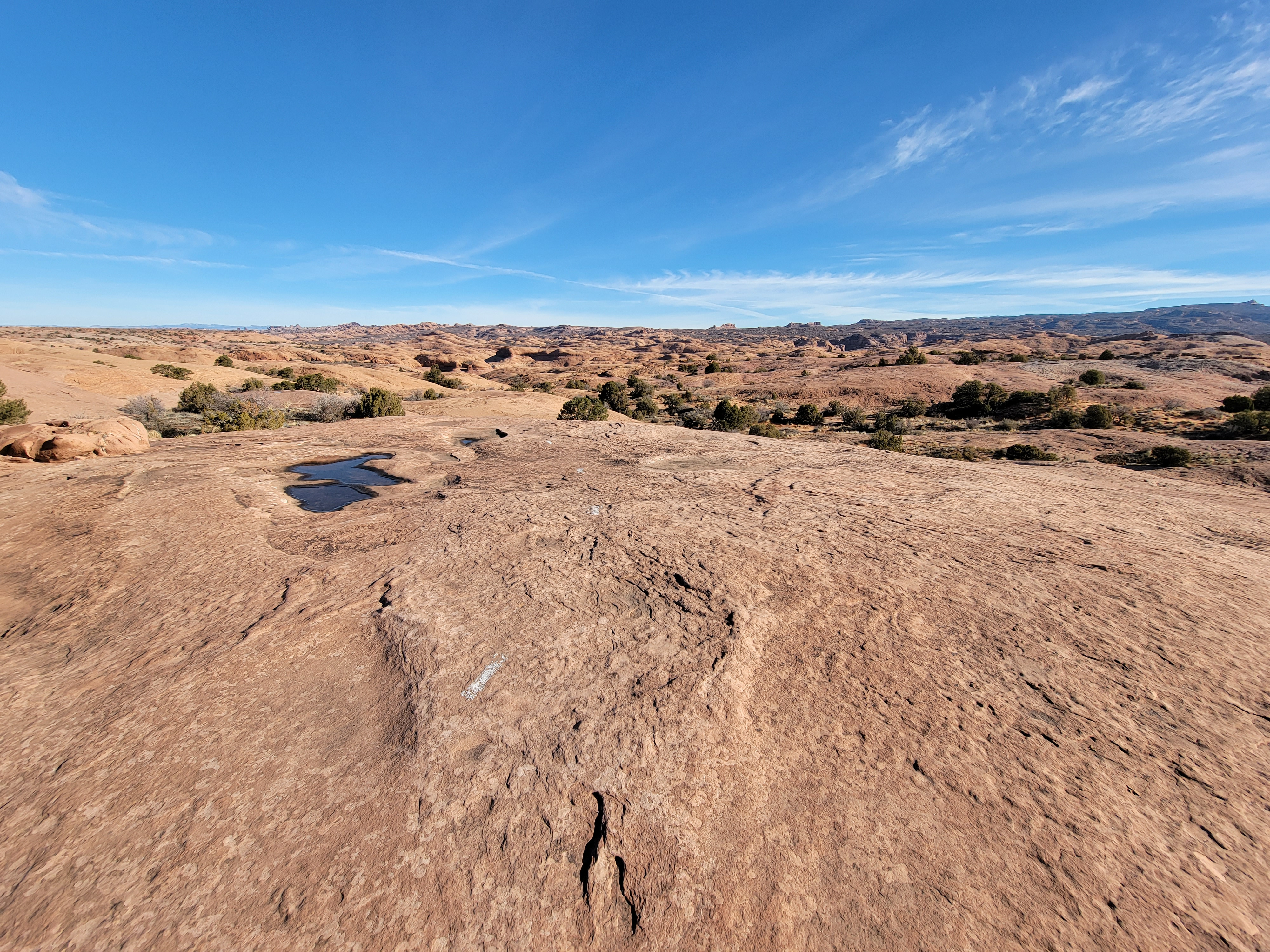 Petrified sand dunes as far as the eye can see
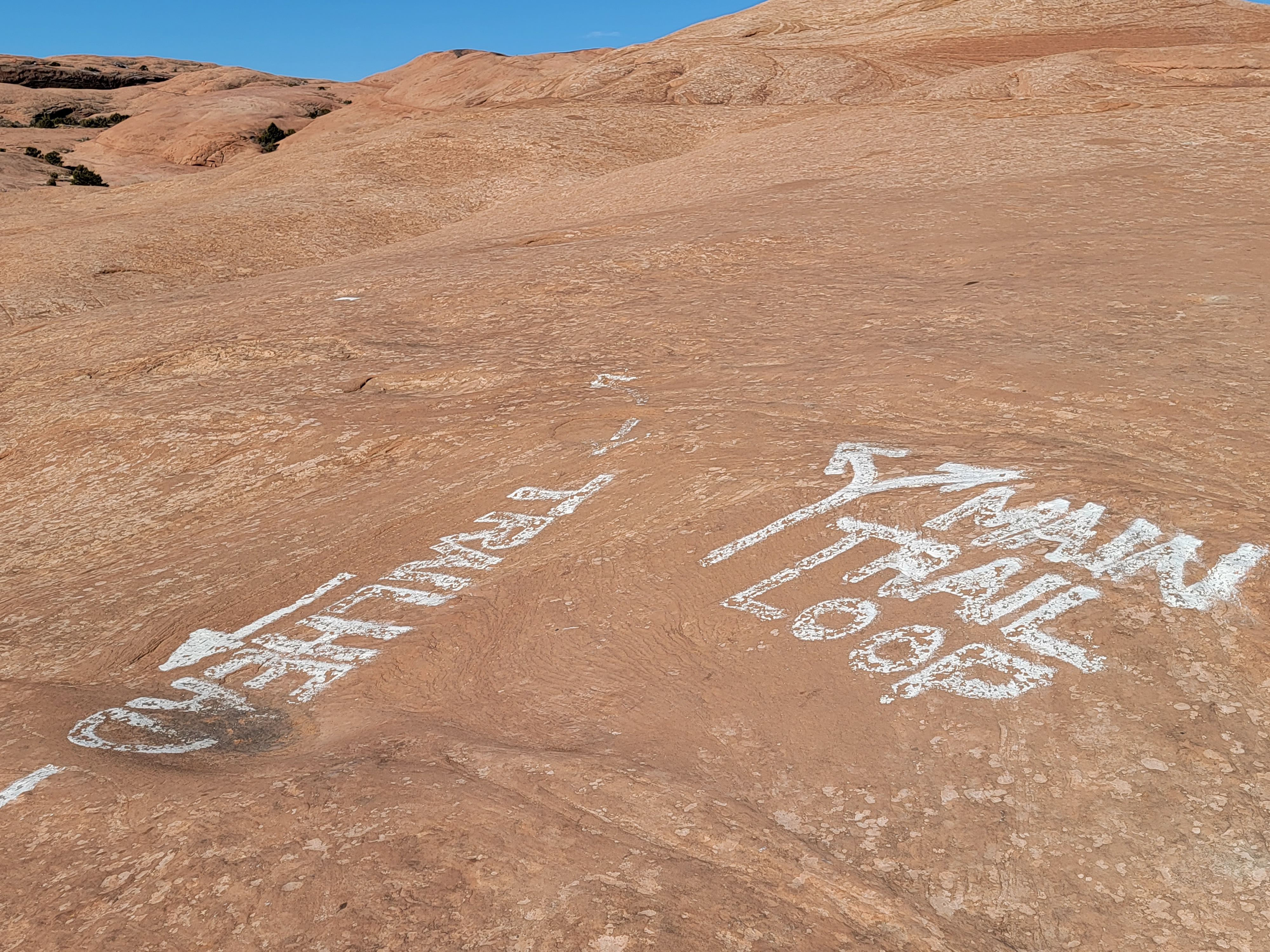
The Slickrock Trail is a "lollipop" trail. I hate that term and rarely use it, but it is descriptive. It starts by going in a little over two miles. Then there is a six mile loop. Then you hike out on the original two plus mile segment. The total distance is ten and a half miles. Besides just weaving through complex terrain, to make navigation more difficult the route intersected many other mountain bike and 4WD trails. Rather than drill holes in the rock to mount signs, the junctions were clearly marked by painting on the rock. It worked well and I never had trouble finding my way.
I quickly found out why this was considered an advanced trail for mountain bikers. The route was often on sandstone slopes, some of which were quite steep. Sometimes going up, sometimes going down, sometimes just traversing, I was glad I was on foot instead of on a bike. The traverses, where the slope was at right angles to the direction of travel, looked like they would be the toughest, but then I'm not a mountain biker. It seemed like it would be easy for the tires to slip resulting in a crash. To add to the excitement, often the traverses were near even steeper dropoffs, . Maybe it helps if you are going faster, the gyroscopic action of the tires keeping you upright, but that would make it even more scary/exciting. Your tires still have to stick to the side of the hill and if you took a curve too fast you could take quite a fall.
I had a map with me that I got at the Moab Information Center the day before. It was kind of nostalgic. No one seems to hike with a map anymore. They just use GPS. This time as I hiked, I used the map to tick off the various points I passed along the way. At .3 miles, a 1.8 mile long practice loop split off. While it is still quite difficult, it's much shorter. It's for those mountain bikers who don't feel that they are ready to tackle the full route. Then a half mile further along, the practice trail rejoined the main trail.
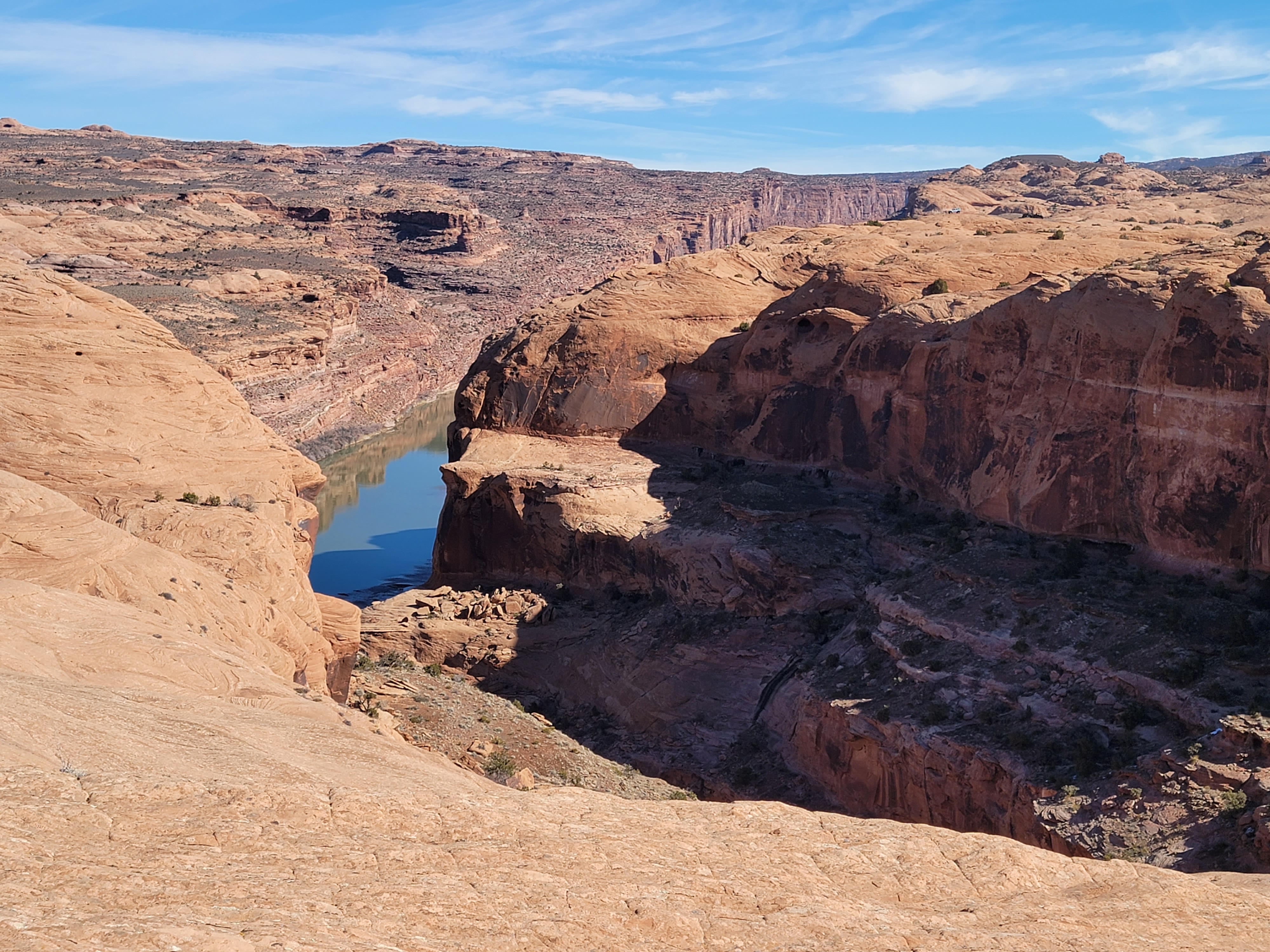
At 1.5 miles I reached the Abyss Viewpoint. On most of the route, while there is a lot of up and down, there isn't that much vertical relief. The Abyss is an exception. It's an offshoot of Grandstaff Canyon, which I had hiked back in February. It's about five hundred feet deep and the walls are not rounded sandstone, but shear, vertical cliffs. The view was spectacular but fortunately I knew better than to gaze too long into the abyss.
 Another jeep rumbles along in the distance
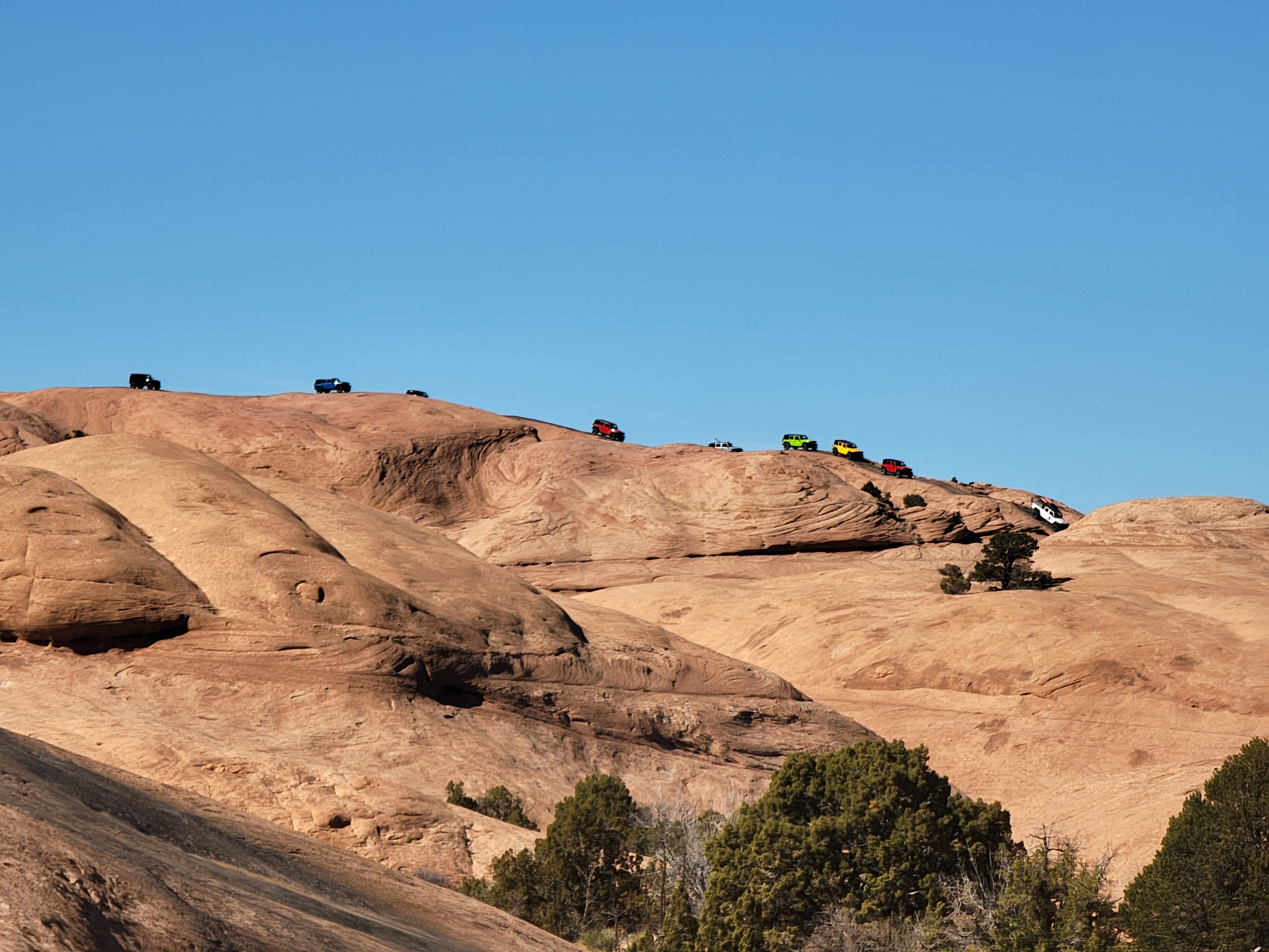
As I approached the Abyss Viewpoint I encountered the first negative aspect of the trail. It crosses the Hell's Revenge 4WD trail several times, and I could hear loud engine noises. Eventually a jeep and a pickup truck came into view a few hundred yards ahead. Up to that point I had not seen or heard anyone - no hikers, bikers, motorcyclists or jeepsters. Throughout the day I saw more 4WD vehicles than people, although fortunately they were usually some distance away. The bad news was that even when I couldn't see them, I could still hear them.
Those things are just obnoxious. There's no peace and quiet or wilderness solitude when they're around.
After crossing Hell's Revenge I reached the spot where the trail split in the two directions for the loop. Since I planned to do the whole loop it didn't really matter which way I went. For once I could follow Yogi Berra's advice. "When you come to a fork in the road - take it."
 "When you come to a fork in the road - take it."
Actually I did have a slightly preferred direction. People on bikes are encouraged to do the loop in a clockwise direction. My guidebook suggested that for hikers, it was better to go counterclockwise so that you would see mountain bikes approaching you rather than have them overtake you from behind. Besides, the guide said the scenery was better when you went counterclockwise. So I went right at the junction.
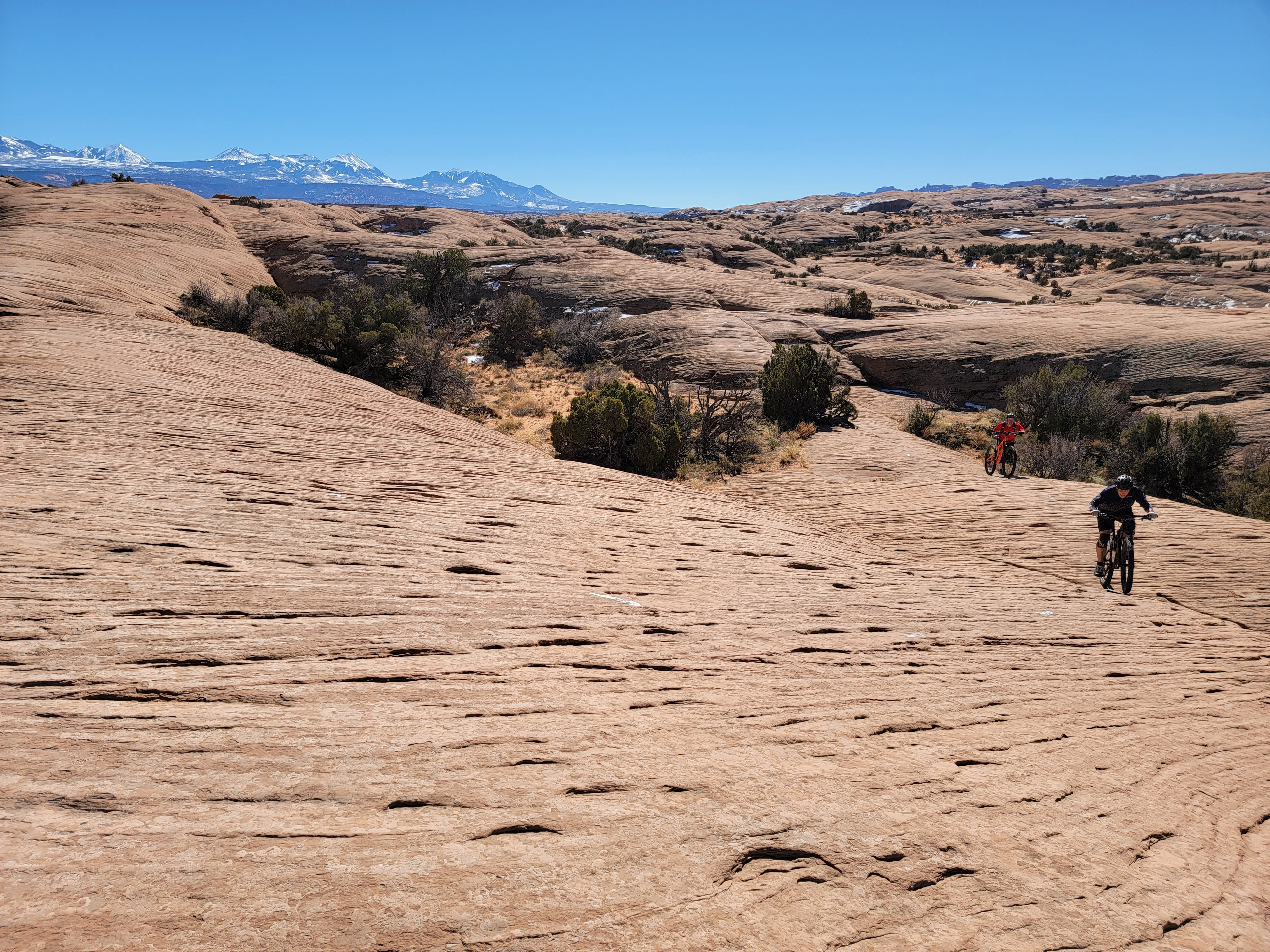
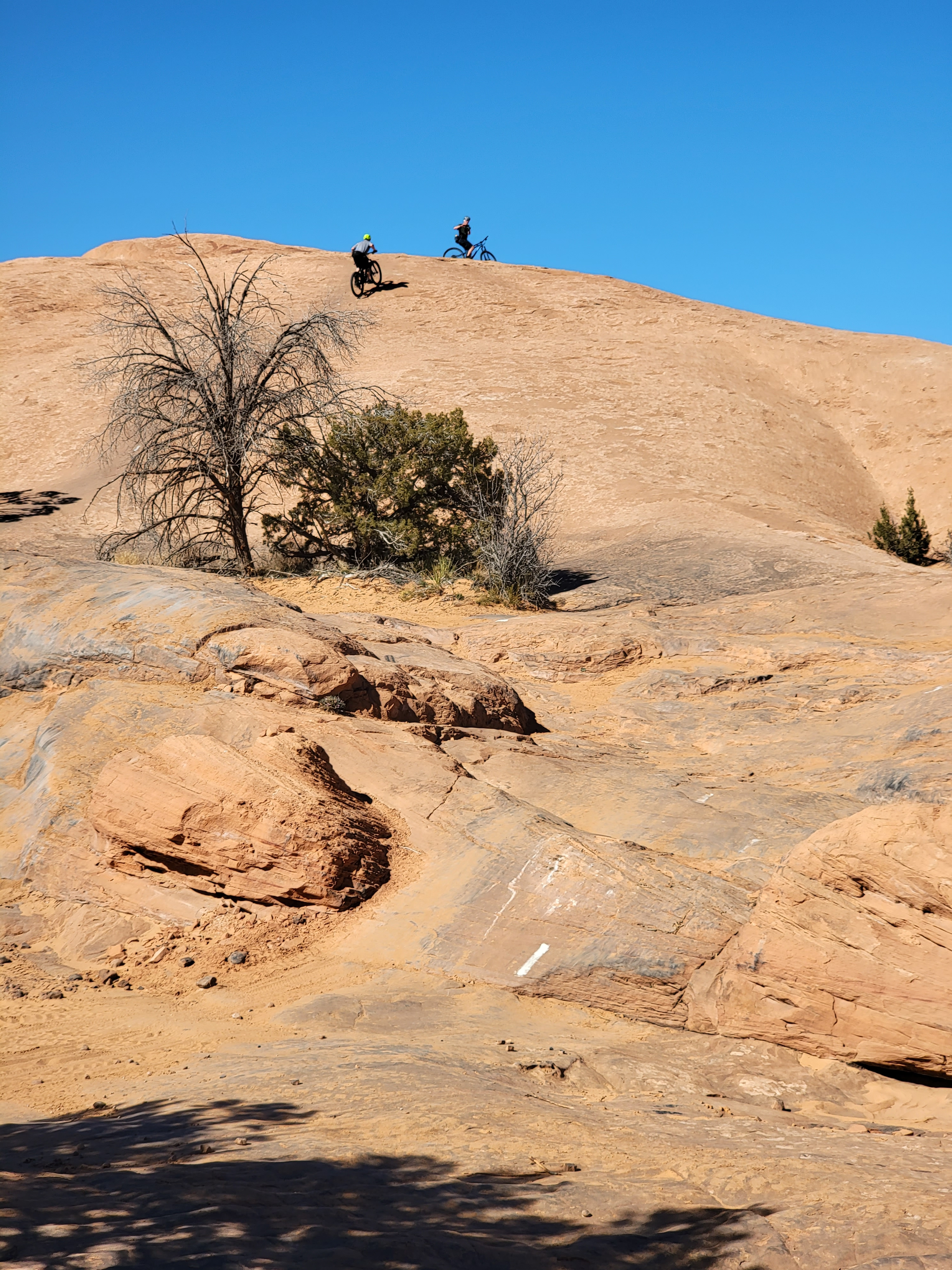
Not long after starting on the loop, I heard a noise behind me as I was climbing a sandstone dome (I was always either climbing or descending a sandstone dome). It was a guy on a mountain bike. An hour and a half from the trailhead, he was the first person I saw on the trail. I stepped aside so he could go through, but he was going pretty slowly up the hill. He stopped, probably glad for an excuse to rest, and we chatted for a while before he continued his climb. As soon as we crested the dome and started down, he zoomed ahead and out of sight.
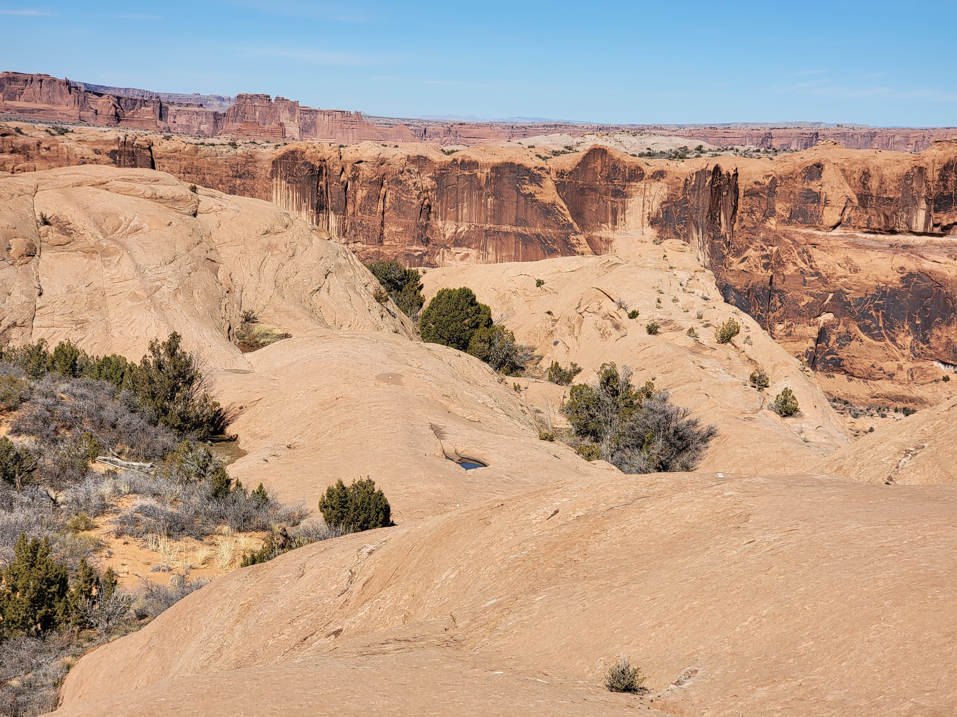
 Shrimp Rock (L) and Colorado River Canyon (R)
As I continued around the loop, I passed a view into Iceberg Canyon (impressive), a minor tower called Shrimp Rock (unimpressive) and approached the edge of the Colorado River canyon (very impressive). About half way around, at the far point of the loop, the view was spectacular. I could see down to the Colorado River. Far to the north were the rock formations of Arches National Park. I could even see blue sky through Turret Arch, about four miles away. To the southwest were the snow-covered La Sal mountains. A beautiful, warm, sunny day.
About this time two guys came by on mountain bikes. At least they read the brochure and were going the "correct" way around the loop for cyclists. I waited at the top of a slope to let them pass. When they reached me they also stopped to chat. Like the other guy, I wasn't sure if they were naturally friendly or just wanted an excuse to stop and rest. Steep uphill on a bike looks like a lot more work than it is on foot. You can only slow down so much on a bike.
 Icebox Canyon and the Colorado River
The two cyclists were from St. Louis and it was their first time in the Moab area. We talked about various trails and I mentioned one that I had done three weeks before. "So you're from Moab?" one of the guys asked.
"No. I live in Boise. But I'm retired, so even though I was just here, when I saw that the weather was going to be perfect this week I couldn't resist and drove down to hike some more."
"Wait a minute. You saw that the weather was going to be good so you just took off and drove down here to hike?"
"Yeah, pretty much."
The guy just shook his head. "Wow. That's what I want to do when I retire. You're my new hero!"
Hey, what could I say. Of course, it went straight to my head.
 Just follow the white paint splotches and tire marks
As the loop continued it went to the top of Swiss Cheese Ridge. This was the highest point on the route, but even so was only four hundred feet higher than the trailhead. At one point from the crest of the ridge I could see over into the Spanish Valley, with Moab directly below and beyond it the Moab Rim where I had hiked the day before.
Near the end of Swiss Cheese Ridge was some private property. There was a narrow suspension bridge over a seventy foot deep canyon that was gated and marked "Private property". There was also a cable running over the canyon that looked like it was for running some kind of cable car or bucket across. There was also a long cable running from the top of the ridge to a lower point several hundred yards away that was marked as a zipline. It must have been run by one of the adventure companies in town. No one was around today though. I guess it would be fun but hiking (or I guess biking) the Slickrock Trail seemed so much better.
 Encountering cyclists near the midpoint of the route
Later I passed another pair of cyclists. So far I was seeing a group about every hour and a half. Not too bad for an extremely crowded bike trail. After I passed them I headed down off the ridge. Although I was still feeling good, I was starting to look forward to closing the loop so that I couuld do the last segment back to the trailhead. Now that I was getting a little tired, I was more aware of another annoying thing about hiking a bike route. Most hiking trails try to take the easiest possible path from one point to the next. They tend to go around obstacles rather than over, under or through them. This mountain bike trail was the opposite. It went out of its way to provide an "exciting" ride. A steep hill? Go straight up and over. A broad bend in a canyon? Swing wide around it and up a steep curve rather than going straight to the place you want to reach.
 Up and over the dome and then back down again
The epitome of this was at one point near the end of the loop. The trail crossed the Hell's Revenge 4WD trail, which was going through a sandy wash. It crossed the wash and went started to climb up a large sandstone dome. Half way up, it traversed 180 degrees around to the back side of the dome, climbed up to the top and then descended back down to the wash. Where it came down after five minutes of hiking was less than fifty feet from where it had left the wash. I like hiking on slickrock as much as anyone, but man, I was starting to get tired and enough is enough.
Once I finished the loop the last two miles or so back to the trailhead were pretty straigtforward. There were quite a few people in the last little bit. I saw two different groups of ATV's, but each time they were some distance off. I could definitely hear them though.
There were also more mountain bikers. It seemed that most of them weren't doing the whole loop but had just gone in a short way and were "playing" (to use the technical mountain biking term) on the sandstone. Just as in my other hikes, all the people I encountered were right at the end. A motorcycle even passed me just as I got to the trailhead. They are allowed on the Slickrock Trail. Fortunately this was the only one I saw all day. I don't mind sharing the trail with mountain bikes. Motorcycles are another thing though. They're loud and smelly and obnoxious. Because they are big and heavy and go fast, they're a lot more dangerous too. If one collided with a hiker or mountain biker it could be very serious.
 Too many jeeps - man, they were noisy
I was back at the car at 2:30, exactly the same time that I had finished the day before. My total time for the ten and a half miles was six hours. That wasn't very fast, but I had taken my time. I felt good and had thoroughly enjoyed the hike. I had read somewhere on the web that with all the ups and downs, there was 2400 feet of elevation gain around the loop. Having just done it, that seemed about right to me.
The thermometer in my car said the temperature was sixty six degrees. What a great day for hiking! I definitely had a bad case of spring fever now. But it was time to head home. With a stop for gas and a Subway sandwich in Wellington, and later a stop for gas in Burley, I got home at midnight. My quick trip to Moab had been a blast. Now I only had a week to get ready for our big trip to Fiji.
