Escalante Utah
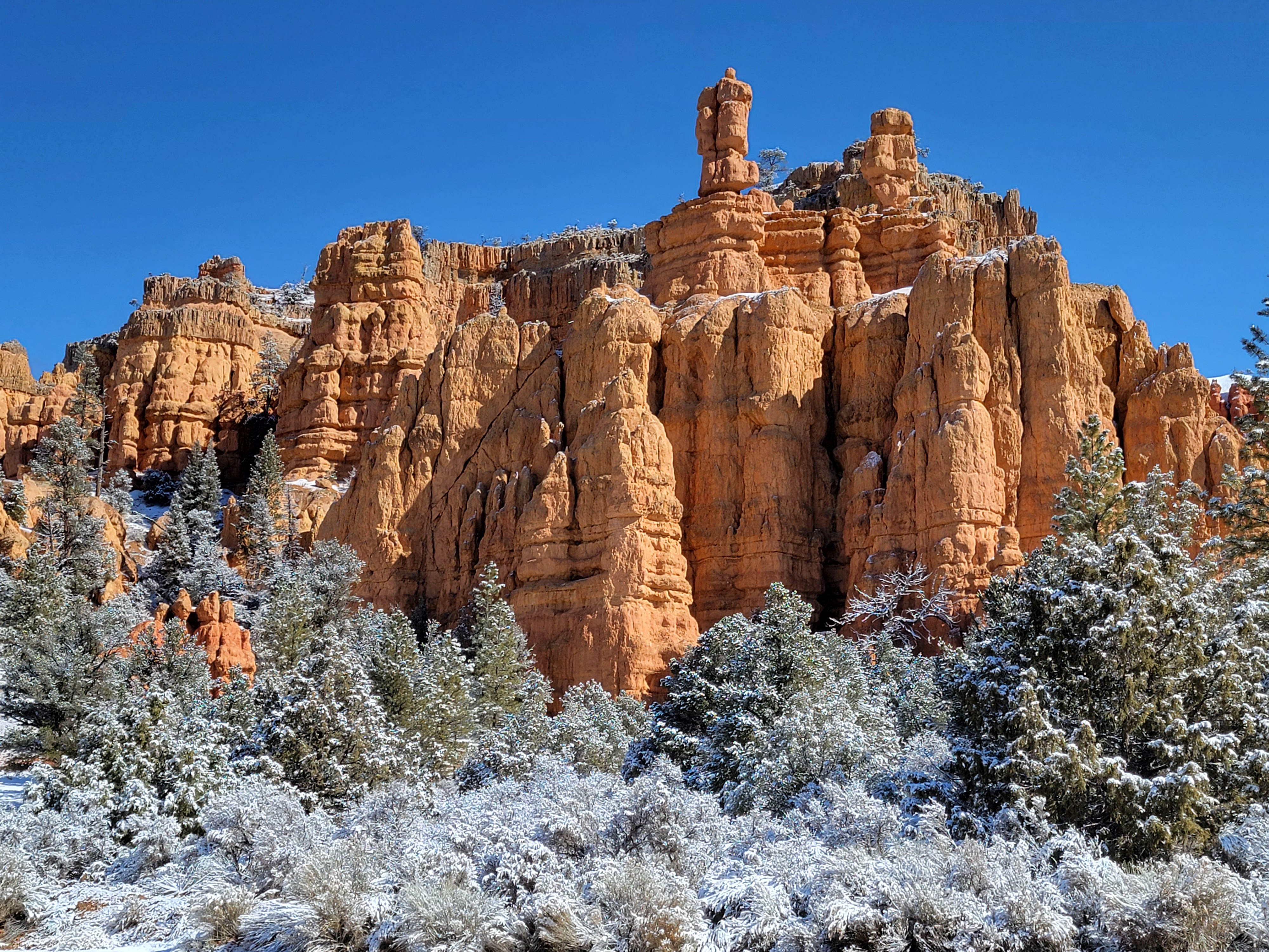 Red rocks, green trees, white snow and blue sky in Red Canyon
We had spent three days in Page, Arizona to start our vacation. We had hiked through a spectacular slot canyon. We played golf twice. We did several other short hikes. We hit most of the gift shops and restaurants in town. It was fun but now it was time to move on.
Next we had two nights planned at a bed and breakfast in the town of Escalante in central Utah. It would only be about a three and a half hour drive to get there so we were going to do something fun along the way. We had a number of options.
The first was to stop in Mt. Carmel Junction, where the road coming from Zion National Park intersects with US 89. There isn'r much of a town there - just a gas station, a restaurant and a motel. And a small nine hole golf course. I've always thought it would be fun to play there. According to the website for the course it would be cheap too. So one thought was to play nine holes of golf and then eat at the Thunderbird Restaurant, known for their "Ho-Made Pies". Sandy and I had eaten lunch there on a previous trip and the pie was indeed very good. Cherry pie ala mode might be my favorite dessert.
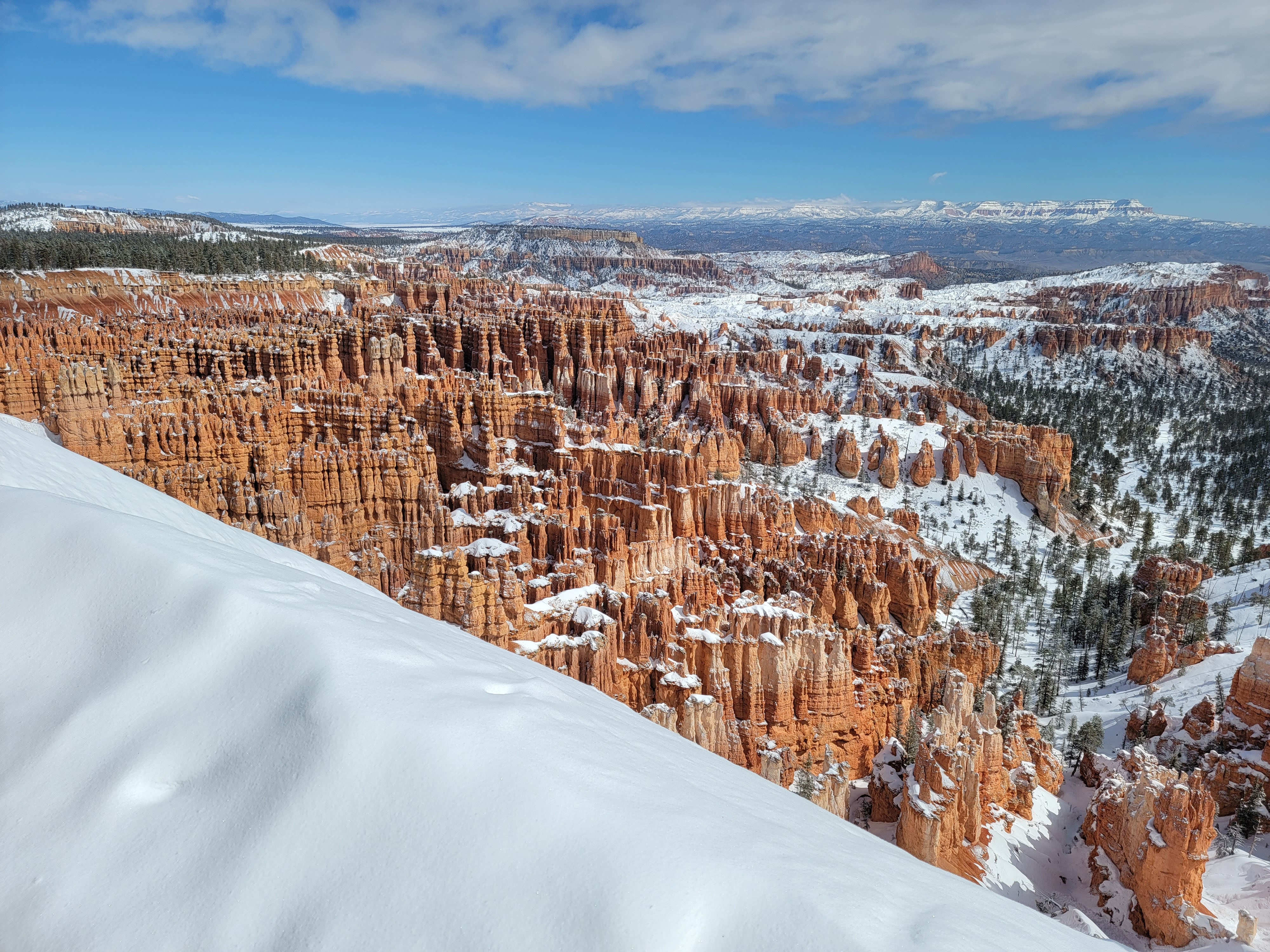 A winter view of Bryce Canyon
When we stopped in Kanab, Utah for gas, about a half hour from Mt. Carmel, the morning clouds were breaking up, the sun was coming out, and it was warming up. I was thinking the golf and cherry pie option was looking pretty good. But when we arrived in Mt. Carmel we got a surprise. The golf course was mobbed by teenage kids, not just a few playing golf but a huge crowd of them. Since it was spring break, they must have had some kind of high school event. That was the end of that idea. Maybe next time.
We still had two more options. On our way to Escalante we passed close to Bryce Canyon National Park. A bit further we also passed close to Kodachrome Basin State Park. Sandy says that Bryce is her favorite national park, so spending a couple of hours there would be fun. On the other hand, we have been there several times while we have never been to Kodochrome Basin. It would be a new experience. Complicating the choice was the fact that we didn't know about conditions in either park. Bryce is very high and is still snowbound in the spring when most of the canyon country is clear. Kodochrome Basin is lower but some of the trailheads are accessed by dirt roads. Since it had been a wet spring muddy roads could be a problem.
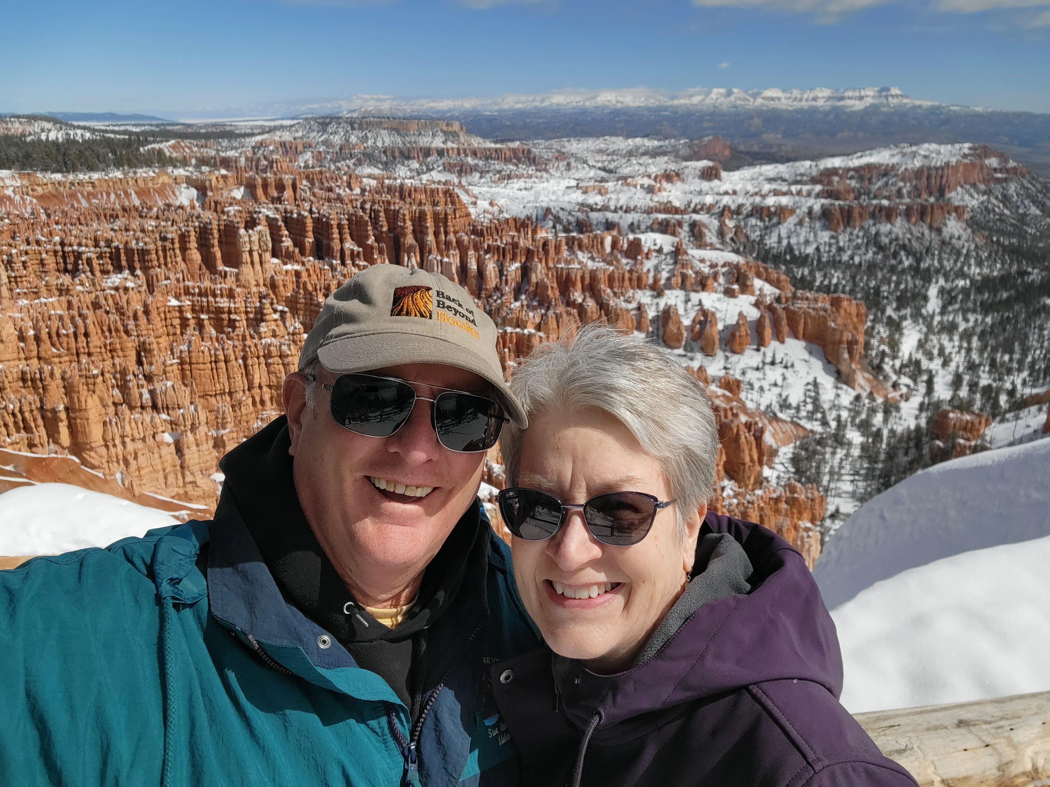 The intrepid travelers - a rare selfie
You would think that in the twenty first century you could just go on the web and find out what the current conditions are. You would think that but you would be wrong. Both the National Park Service and Utah State Parks have very professional looking websites with lots of information about the parks, almost all of which I don't care about. Current conditions, which would be really helpful, are pretty much absent. We decided that we would wait to make a decision until we got close enough that we could evaluate the conditions ourselves.
As we got close to the turnoff to Bryce we passed through the Red Canyon area of Dixie National Forest. It features a lot of hoodoo rock formations similar to those found in Bryce Canyon. It's very scenic but not on the same scale as the national park. It does serve as a good warmup to Bryce Canyon though. We stopped at several viewpoints and were impressed by how beautiful the contrast of the white snow, red rock, deep green forest and bright blue sky was. It looked totally different in winter (this high it was still winter) than in summer. We decided that we would make the side trip into the national park to see the main attraction. Kodochrome Basin would have to wait for another trip too.
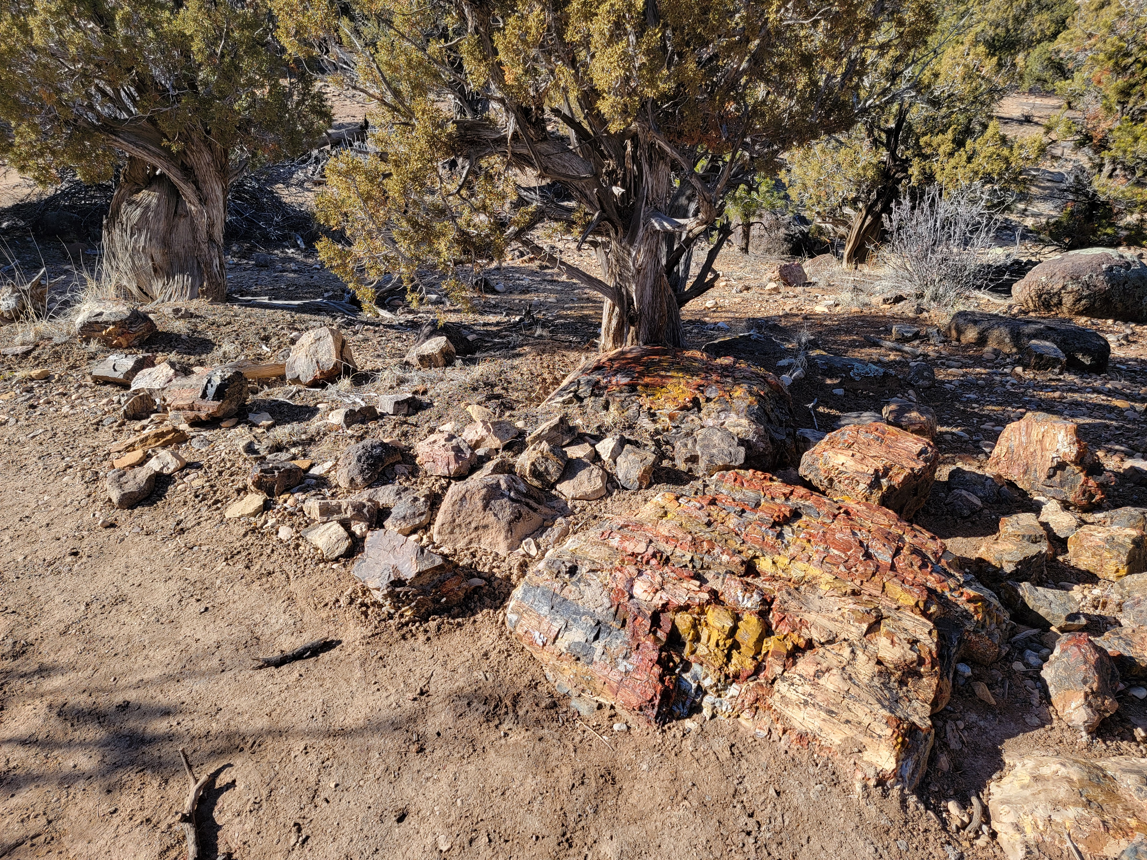 Those aren't rocks - they're petrified wood
First thing when we got into the park was a mandatory stop at the Visitor Center to check out the tshirts. They had some new designs since our last visit so we each got one. I already figured that we had made a good choice because any trip that I get a new tshirt can't be all bad.
After the Visitor Center the main park road continues for another eighteen miles, providing access to numerous viewpoints and trailheads along the way. But this early in the season there was still three or four feet of snow on the ground. The Park Service had only plowed the road for the first two and a half miles. That was enough to provide access to several viewpoints. We started by driving all the way to the end at Bryce Point. There wasn't much parking there and most of the lot was full. We were lucky that someone pulled out just as we got there so we got a spot. The view was spectacular, and because of the snow on the red rock it was quite different than on other visits that we had made. There was a cold wind blowing so we only walked a few hundred feet along the rim before heading back to the car.
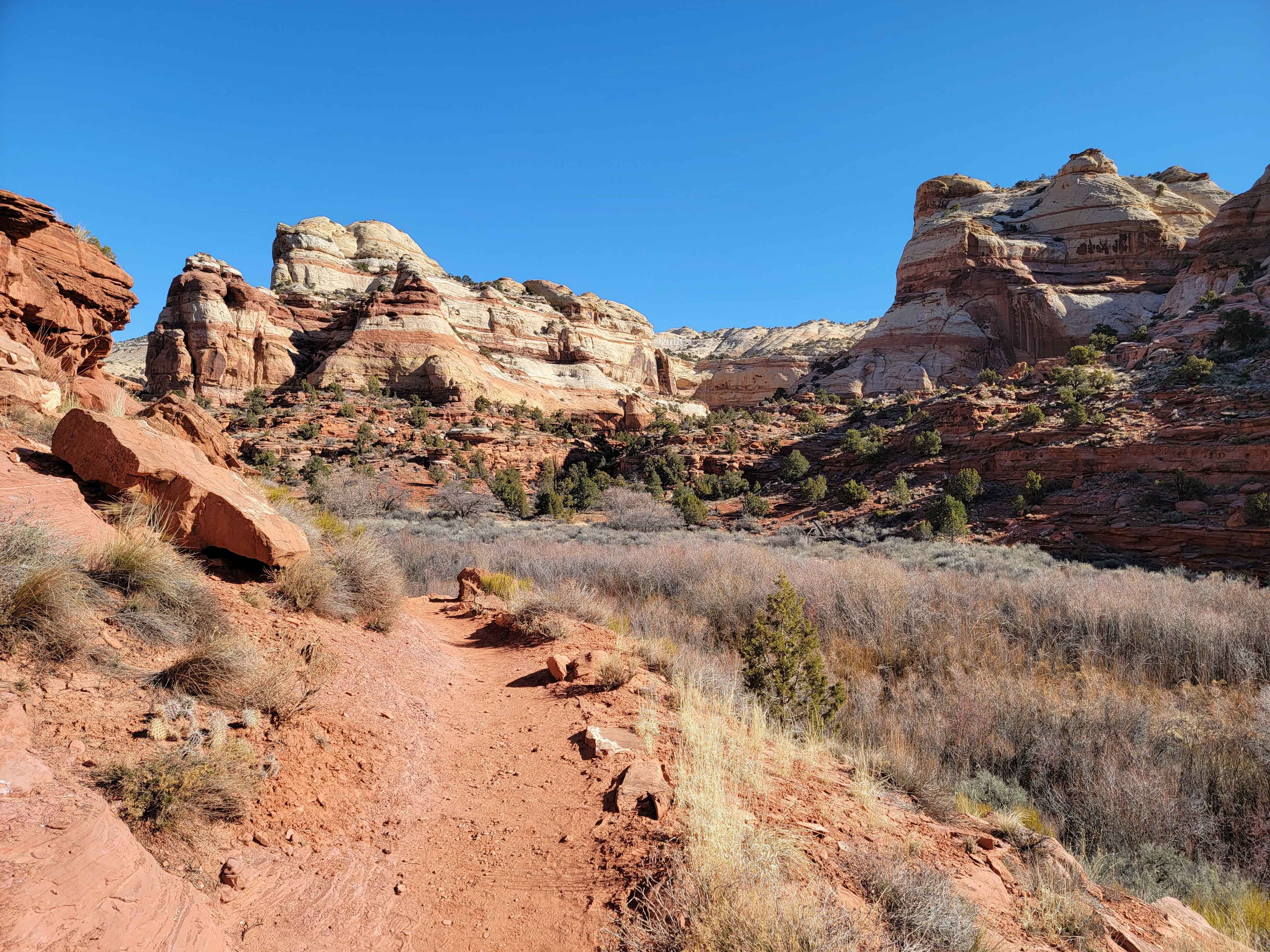 Heading into Calf Creek Canyon
Next we stopped at Lower Inspiration Point. Parking there was surprisingly easy so we got another, different, view of Bryce Canyon. After that we tried to stop at two more viewpoints on our way out of the park, but both were completely parked up with people circling waiting for a spot. That was way too much hassle for us. Since we had already seen two viewpoints we decided to head out. It was a short visit but we had seen some beautiful scenery and got some good pictures. And new tshirts.
The rest of the drive to Escalante was straighforward. We arrived there mid-afternoon. After stopping at the Escalante/Grand Staircase National Monument Visitor Center, we went to the Slot Canyon Inn, where we would be staying for the next two nights. It was about two miles out of town, about a quarter of a mile off of the highway. A very quiet and peaceful spot. We had exchanged texts with the person there and she told us the key to our room would be on the main desk. When we arrived there were some workers busy on an improvement behind the inn, but no one in the main building. We dropped off some stuff in our room and then headed into town to get something to eat. By now we were both pretty hungry.
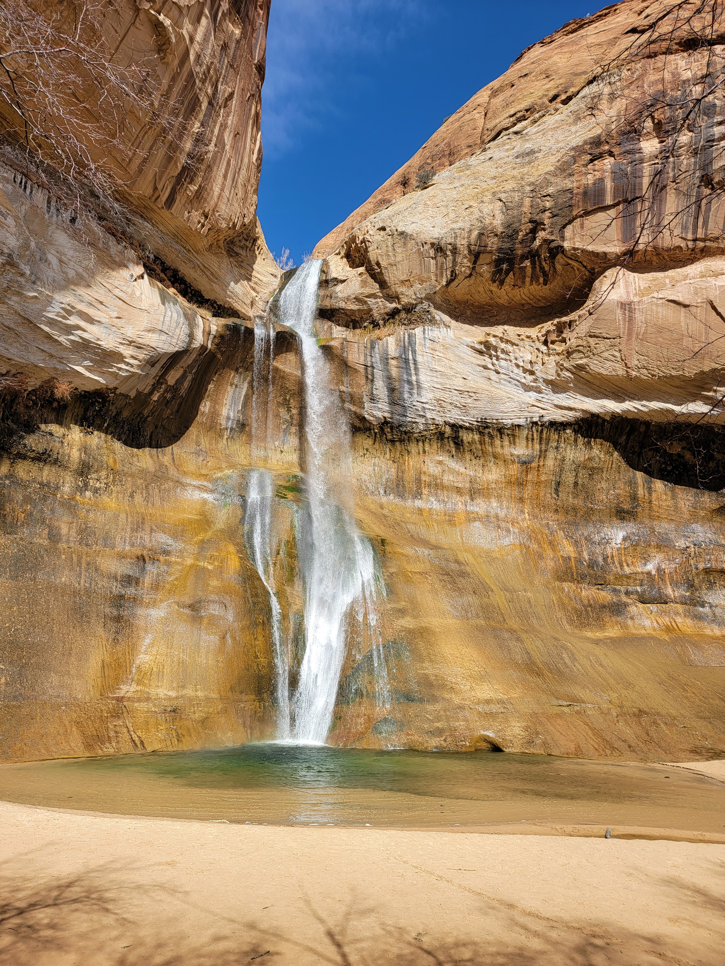 Lower Calf Creek Falls
Escalante is a small town and there aren't many places to eat. I had been there once before several years ago and remembered that Escalante Outfitters had good pizza. That was where we went and we were pleased to find out that they still served good pizza.
When we finished eating it was only about four in the afternoon. There was still plenty of daylight left so we decided to explore a little. Just before we got to town we had seen a sign for Escalante Petrified Forest State Park. We decided to check it out. We paid our fee, got a map, and saw that there was basically one main trail. We parked at the trailhead where there were only a couple of cars. The signs were confusing and it took us about ten minutes to actually find the main trail but eventually we got going on the right track. Expecting a short, easy walk we were surprised when the trail started a serious climb up onto a plateau. This was a little more than we had bargained for after a big meal. We took it slowly and were ok but we were glad when we finally reached the top and the trail leveled off. From there it did a loop, passing by several large pieces of petrified wood. Very cool. Frankly I'm surprised that everything hasn't been ripped off over the years. There was an additional loop we could add that went to a viewpoint over the town of Escalante, but we were content with just the main trail. It was only about a mile but with five hundred feet of elevation gain. We took it slowly and it was about an hour. Just right after the big meal that we had in town. We only saw two other groups of hikers, one at the very start and one that we passed along the way. Quite a contrast to the hordes at Bryce Canyon National Park where we had to fight for a parking spot.
 Petroglyphs across the canyon from the trail
We went back to the B&B where we met the lady that we had been texting all day. She said that she had a day job in town since early season was slow. She told us that we were the only guests that night. We had the whole place to ourselves! She asked what time we wanted breakfast the next morning. Since there wasn't anyone else there it was up to us. Pretty cool. Again, quite a difference from the national park hordes.
That night we took advantage of the jacuzi tub in our room, had a nice bottle of wine that we had bought at Escalante Outfitters (the only place in town where you could buy beer or wine - we were in the boonies in Utah remember) and then watched an episode of Midsomer Murders on my laptop. Next morning, our personal breakfast was awesome. Properly fortified, we set out for the day. Since it was clear overnight the temperature had dropped well below freezing, but with the sun up we hoping it would warm up some by the time we started hiking.
 A beautiful day for hiking
Our objective for the day was Lower Calf Creek Falls. I had done the hike once before, on my only visit to Escalante in 2011. Although there are other hikes in the area, many of them are longer backpacks or more difficult slot canyons or walk-in-the-river hikes. This one was easy - a little over three miles each way and with less than a thousand feet of elevation gain on a good trail. And it was a beautiful hike.
Another option would have been to do Peekaboo and Spooky Canyons, two famous slot canyons usually done as a loop, going up one and coming down the other. But that meant a long approach on a rough dirt road. It's also a more challenging hike. Since Sandy hadn't done Lower Calf Creek Falls before I thought that was a better choice. I still intend to get back to do those slot canyons someday. Maybe I'll stop in Escalante on my way back from Consimworld Expo this summer. It's a good way to break up the long trip home.
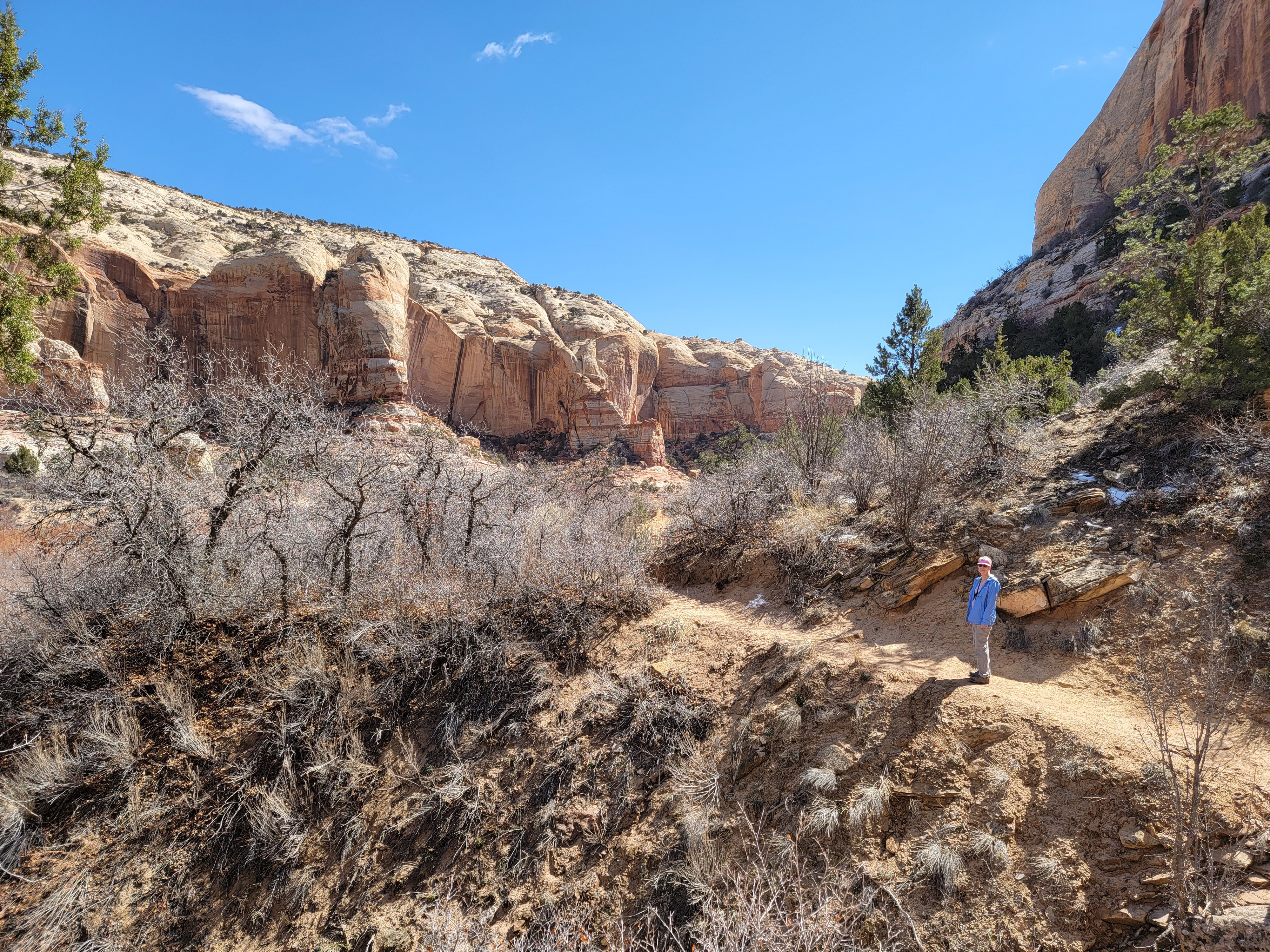 Sandy heading back to the trailhead
About ten miles out of town we stopped at a turnout that provided an impressive view of the Grand Staircase/Escalante National Monument. As far as the eye could see there was slick rock with deep canyons plunging out of sight and snow capped mountains on the distant horizon. A little further we stopped at another spot that provided a view into the Escalante River Canyon. It was impressive, but the view was marred by power cables that ran alongside the road.
When we reached the trailhead there were just a few cars there. We paid our parking fee, which is unusual for a BLM trailhead, but this one had a fancy restroom complete with flush toilets. Unfortunately there was also a sign saying it was closed. A BLM guy was working nearby and Sandy asked him about it, since we had to pay our fee even though the restroom was closed. He said they had been too ambitious and turned on the water too early and all the pipes froze and burst. Fortunately there was also a campground right next to the trailhead and we walked over there and used their good old reliable pit toilet before starting our hike.
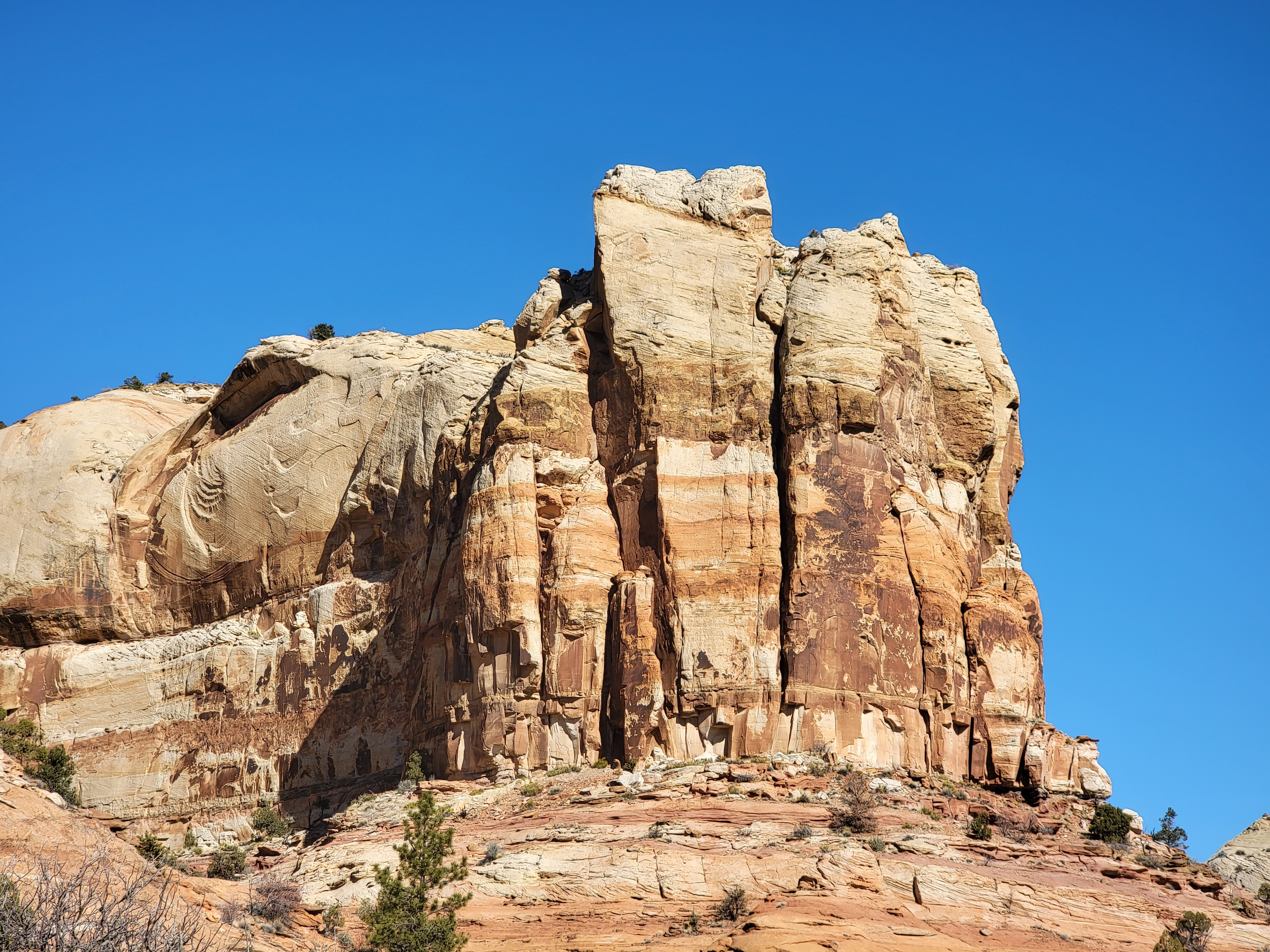 A prominent buttress in Calf Creek Canyon
The trail was mostly flat and easy. The canyon was quite wide at the start but narrowed as we hiked. About half way to the falls there were some petroglyphs visible on the canyon wall across the creek from the trail. Fortunately it looked like it would be a lot of work to get to them so they are probably fairly safe from vandalism.
As the canyon narrowed the trail contoured right next to the creek. It wasn't a raging torrent but with spring runoff it was a very pretty stream.
Eventually we reached the end of the trail. The canyon ended in a seventy foot high wall that Lower Calf Creek Falls flowed over. It was in a spectacular amphitheater and the falls were quite impressive even though the creek didn't seem to have that much water. Unfortuantely, although it had been pleasant all the way to the falls, at the end of the trail the combination of spray from the falls and a stiff wind (I have no idea where it came from) made it quite chilly. We took some pictures and recorded a short video, made sure we stored the sight of the falls in our memories, and then started back.
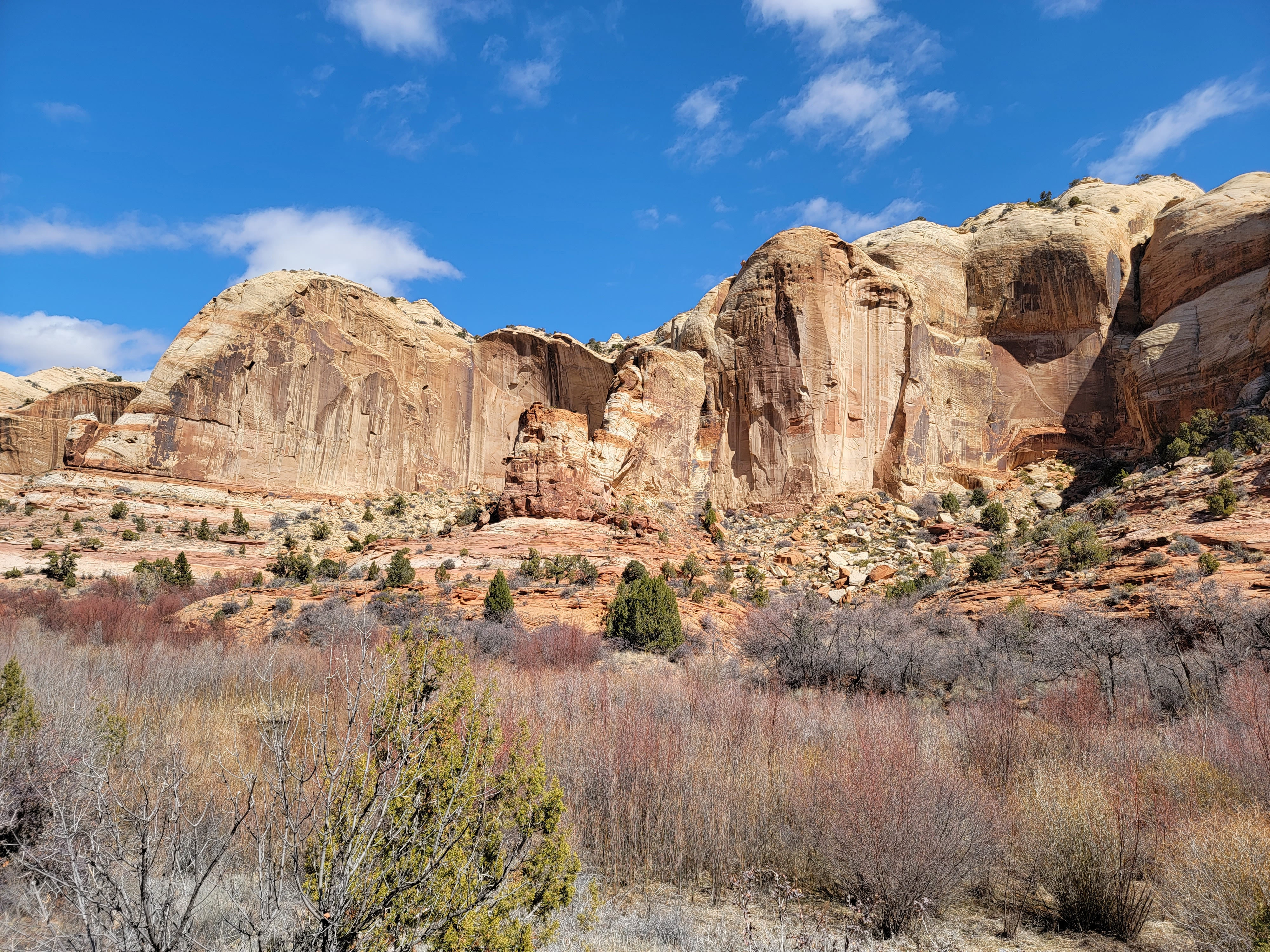
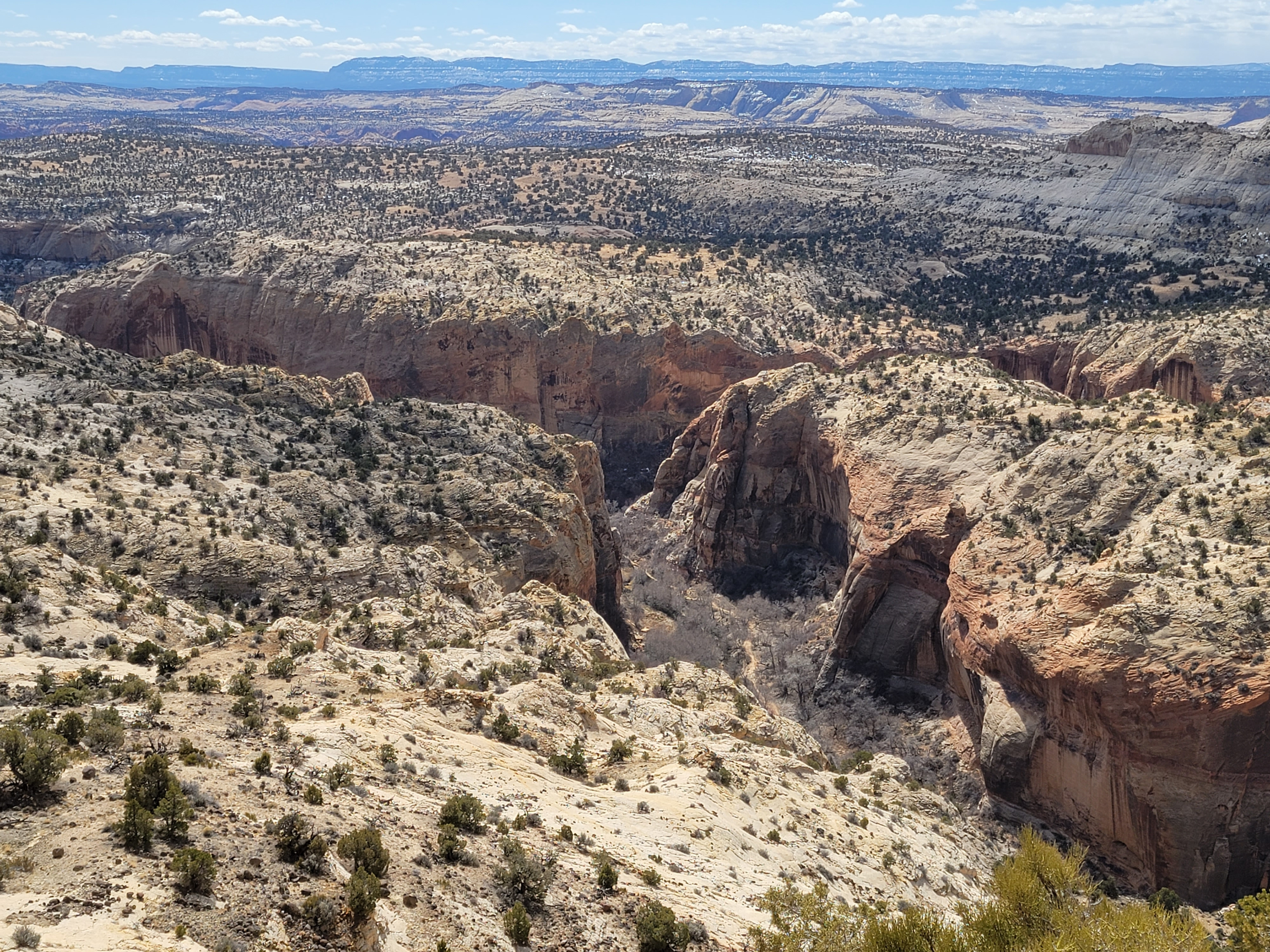 Looking down on our Calf Creek hike from the road above
The hike out was easy and very scenic. We saw very few people on the trail, with the exception of one large group of young people which we passed on the way out. Hiking in Grand Staircase is quite different than in the nearby national parks.
When we got back to our car we drove a few miles further along the road. We were able to look down from above into the canyon where we had just hiked. We were able to identify several landmarks from our hike, which we were now seeing from a very different perspective. Then it was back to Escalante where we had dinner at the 4th West Pub. We were there early so there was almost no one else there. We had burgers and fries which were very good, especially since we hadn't eaten since breakfast. Then it was back to the Slot Canyon Inn where the lady told us she expected another guest to arrive that night. Oh oh. Time to leave. It's getting too crowded.
Well, next morning it turned out the people never showed up. We still had the place all to ourselves. We had another excellent breakfast and then it was time to hit the road. We were heading home, but on the way we would stop in Ogden to see our good friends Ivan and Norma.
