Ice Lake
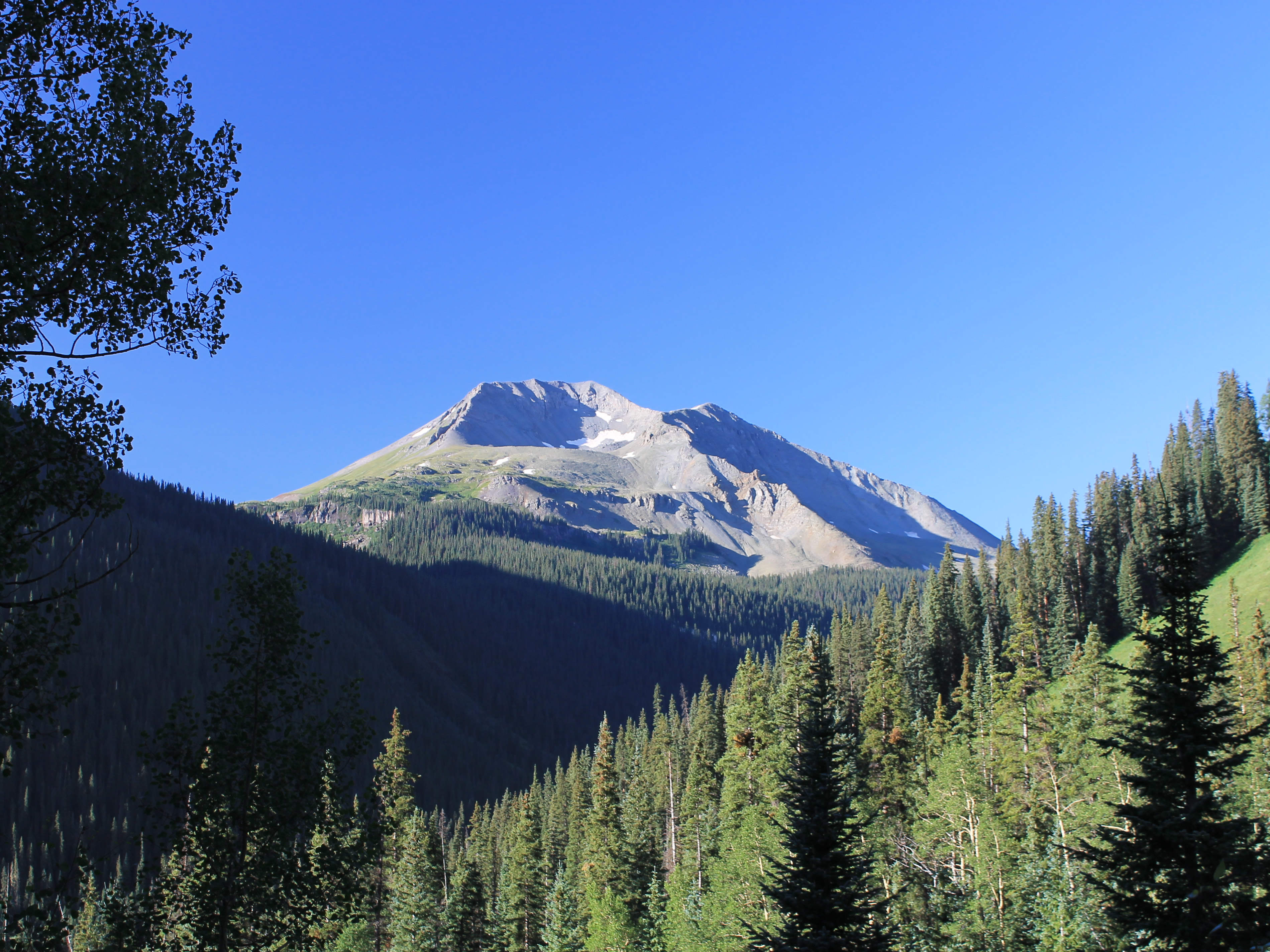 An early morning view of the Twin Sisters
It was our last full day in Ouray before moving on to South Fork where Sandy would be taking her quilting class, so it was our last chance to do a hike together. We had been conservative so far, doing a moderate hike to Upper Cascade Falls one day and doing some car touring and shopping the next day. We had been cautious with the weather and had taken our time to acclimatize to the high elevation. But now we had spent several days at altitude and had a weather forecast for a perfect day. It was time to do some serious hiking.
We had a lot of choices. There were several hikes in the area that looked like they would be excellent. I ended up picking Ice Lake. The guidebook said that it was "one of the premier hikes in the San Juans". That was a pretty high recommendation. It would also give us a chance to drive the Million Dollar Highway from Ouray to Silverton, which is touted as a very impressive and scenic route through the mountains.
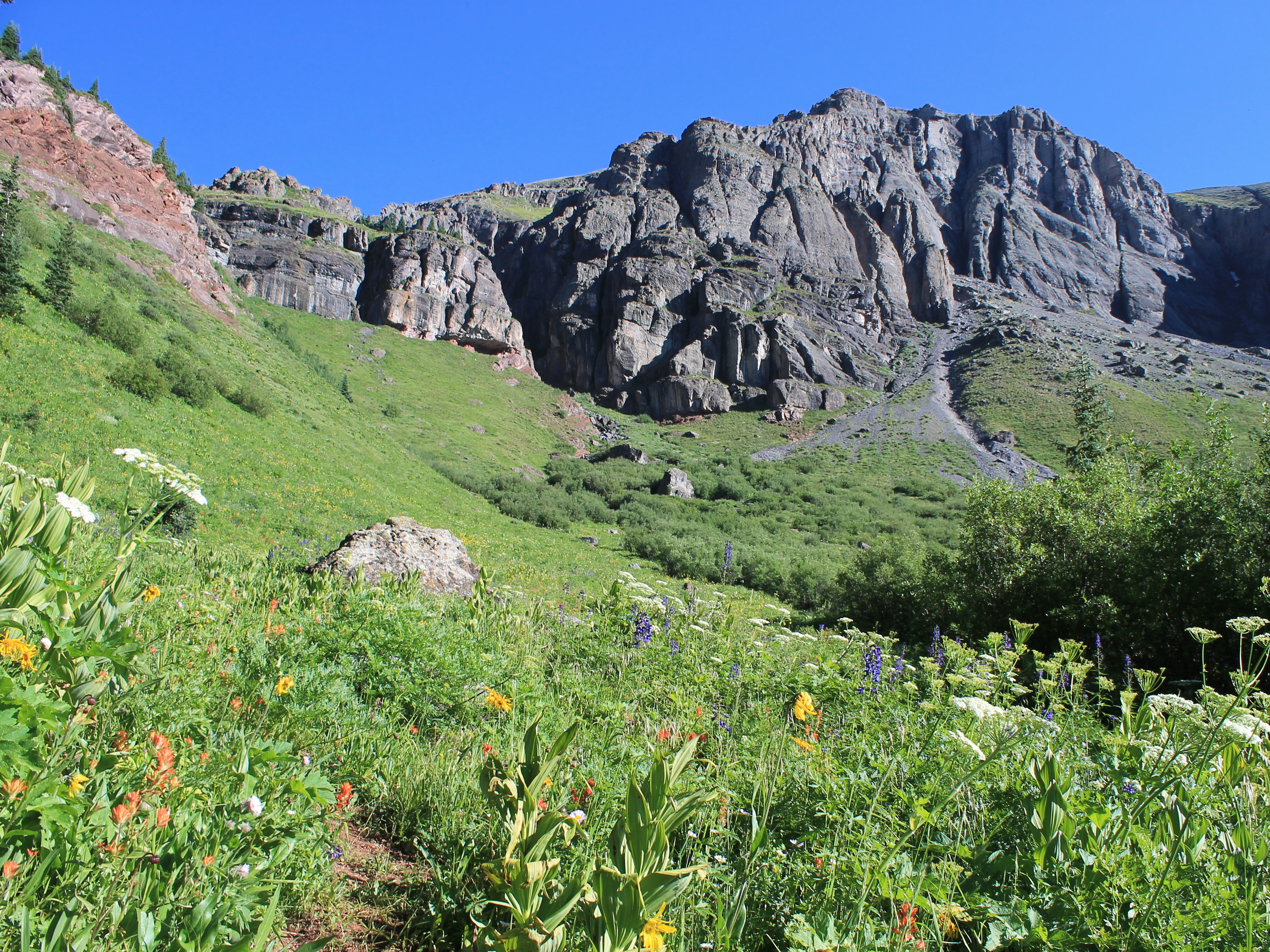 Wildflower meadows on the climb to the lower basin
We got everything ready the night before so we could make a quick getaway the next morning. As much as Sandy loves breakfast, she was willing to forego it this time for an early start. As we drove through town the next morning, we saw people lined up at the Roast and Toast restaurant waiting for it to open at six thirty. But we had a hike to do.
The Million Dollar Highway was certainly impressive. It did go through some beautiful mountains. But we were more impressed by how narrow and winding the road was than by the scenery. It certainly wouldn't be a good idea to be admiring the mountains while driving on this road, especially since there weren't any guardrails. It even got it's own listing on dangerousroads.org. It wasn't quite as bad as the Death Road in Bolivia, which I traveled on during my 2004 climbing trip to the Andes. It was scary enough that we took our time even though we were anxious to reach the trailhead and start hiking.
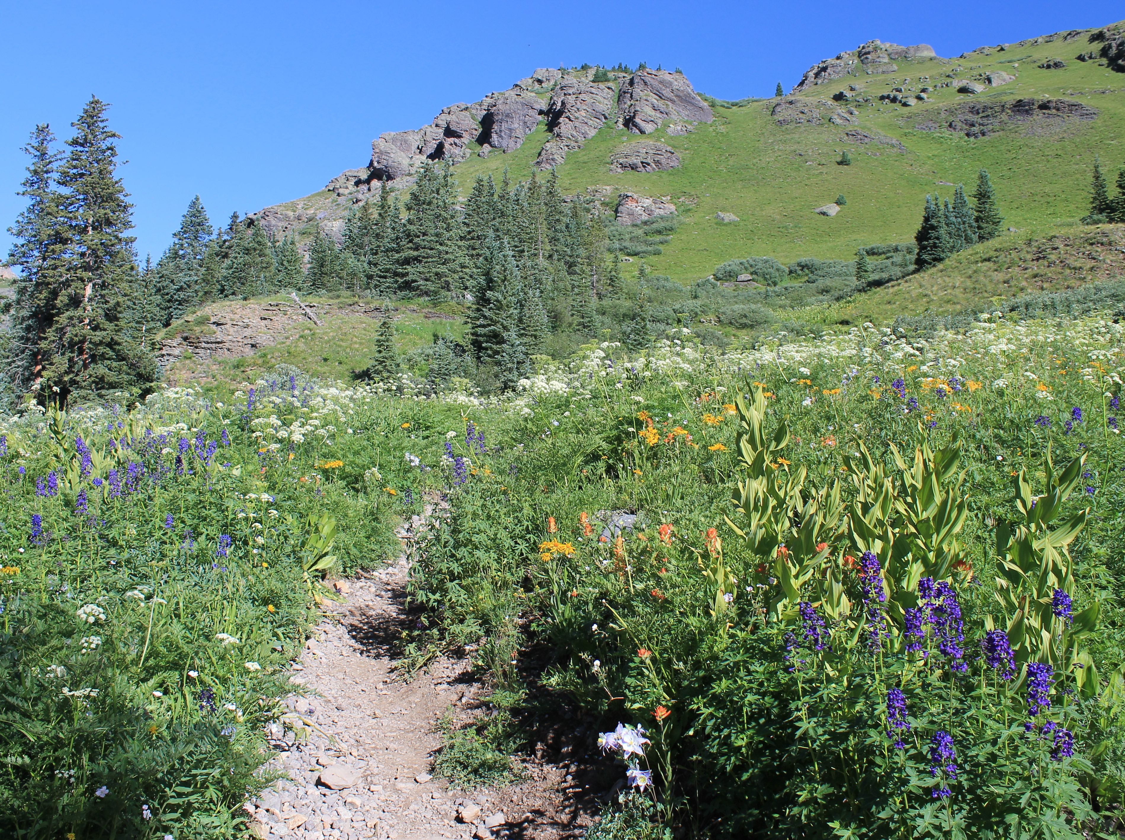 Flower filled meadow as we enter Lower Ice Lake Basin
We had to drive almost all the way to Silverton to reach our turnoff. Then it was another four and a half miles on a good gravel road that went up a side valley to get to the trailhead. We put on our boots, grabbed our packs and were on the trail at 7:23 am - a good early start. There were quite a few cars at the trailhead but most of them were probably overnight backpackers. We didn't see many day hikers out this early.
The trailhead was at 9,840 feet. We could tell that we were high because the temperature when we started was only 41 degrees. No wonder there weren't many hikers out yet. Sandy grabbed her long sleeve shirt to go with the jacket in her pack but I decided to tough it out at the beginning. We would be hiking hard, gaining elevation, and I knew that it would warm up quickly as the morning went on. There was no wind and I actually enjoyed the cool temperature for the early part of the hike. It meant that there were no bugs either, which definitely wouldn't be the case when we came down during the heat of the afternoon.
 Lower Ice Lake
The trail climbed through the forest, steady but at an easier grade than two days before. After about half a mile the trail crossed Clear Creek. The only way to cross was on two uneven logs, quite high above the creek. It wasn't easy to keep your balance as you crossed. The logs were high enough that a slip would mean more than just getting wet. It would be easy to twist an ankle or break a leg. Sandy was lamenting that fact that she hadn't brought her trekking polls, but we were both very careful and made it to the other side.
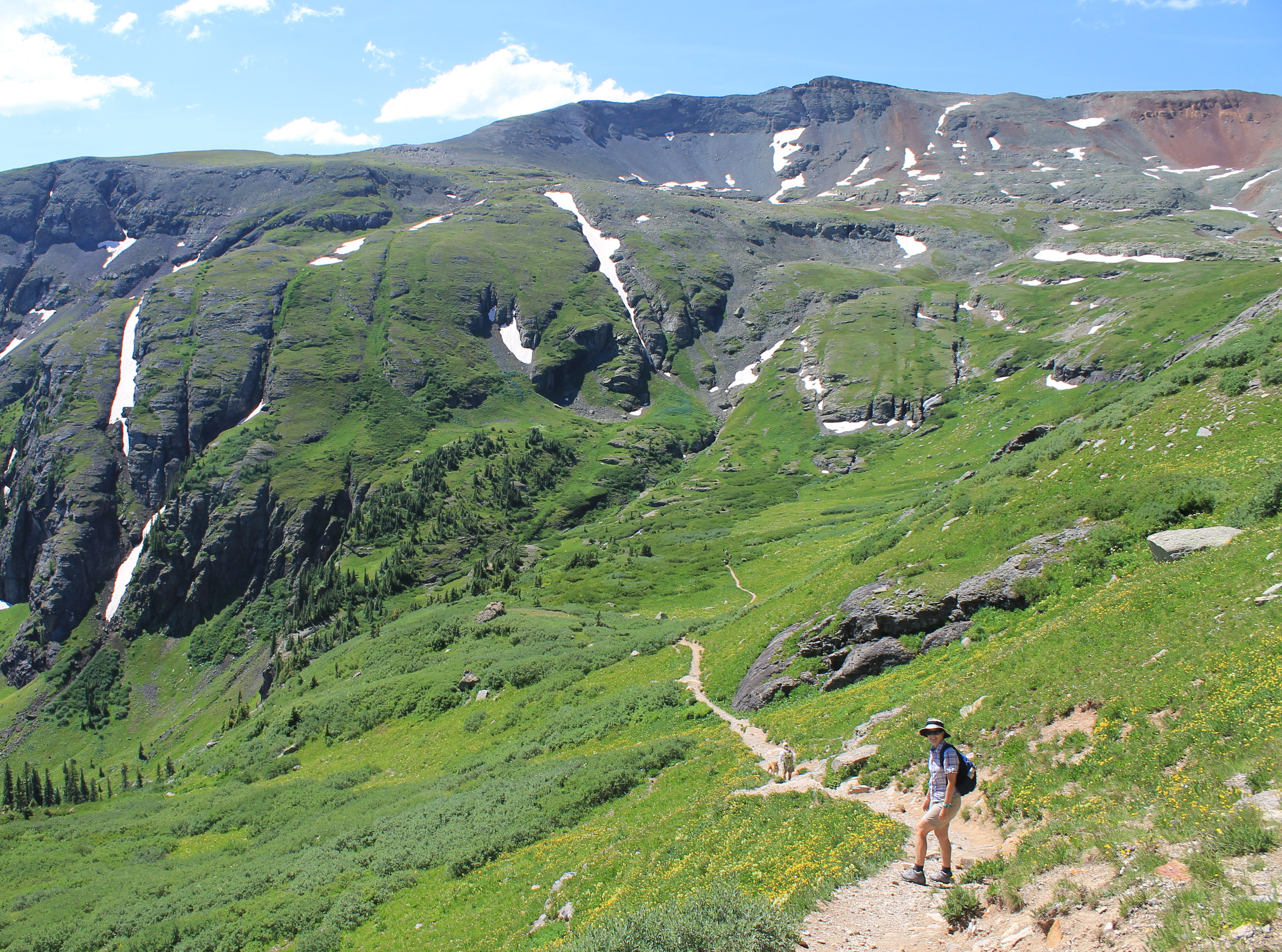
The trail just kept climbing. Gradually the forest thinned and eventually we came out onto an open slope where we had our first views. We could see the Twin Sister Peaks across the valley. Above us there were cliffs at the head of the Clear Creek drainage. In the distance we could see lots of mountains to the east. Close at hand, there were a lot of wildflowers on the slope that we were climbing. Everywhere we looked there was beauty all around us, both near and far. Even though we were climbing steadily and working hard, we were taking it slowly and enjoying the hike.
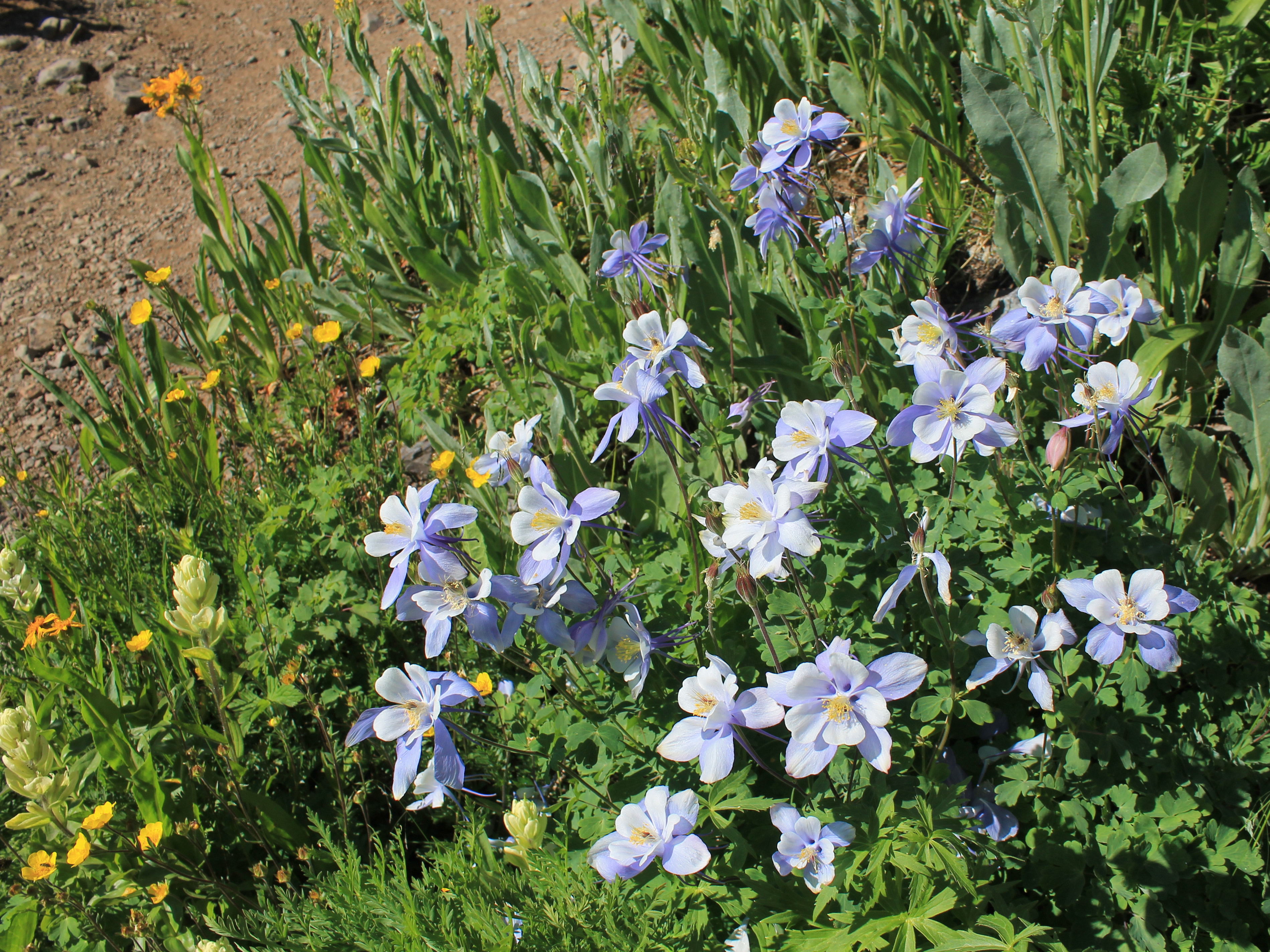 Columbine is the Colorado state flower
I did feel a little badly when a trail runner zoomed past us, but to be honest it didn't look like she was having much fun or paying much attention to the scenery.
After another long stretch of climbing through woods, we finally topped out on the slope and entered Lower Ice Lake Basin. It was only 2.25 miles from the trailhead but over 1600 feet of elevation gain, so it had taken us a while to get there. Now the trail levelled out and the walking was easy, although at 11,500 feet we were still moving slowly.
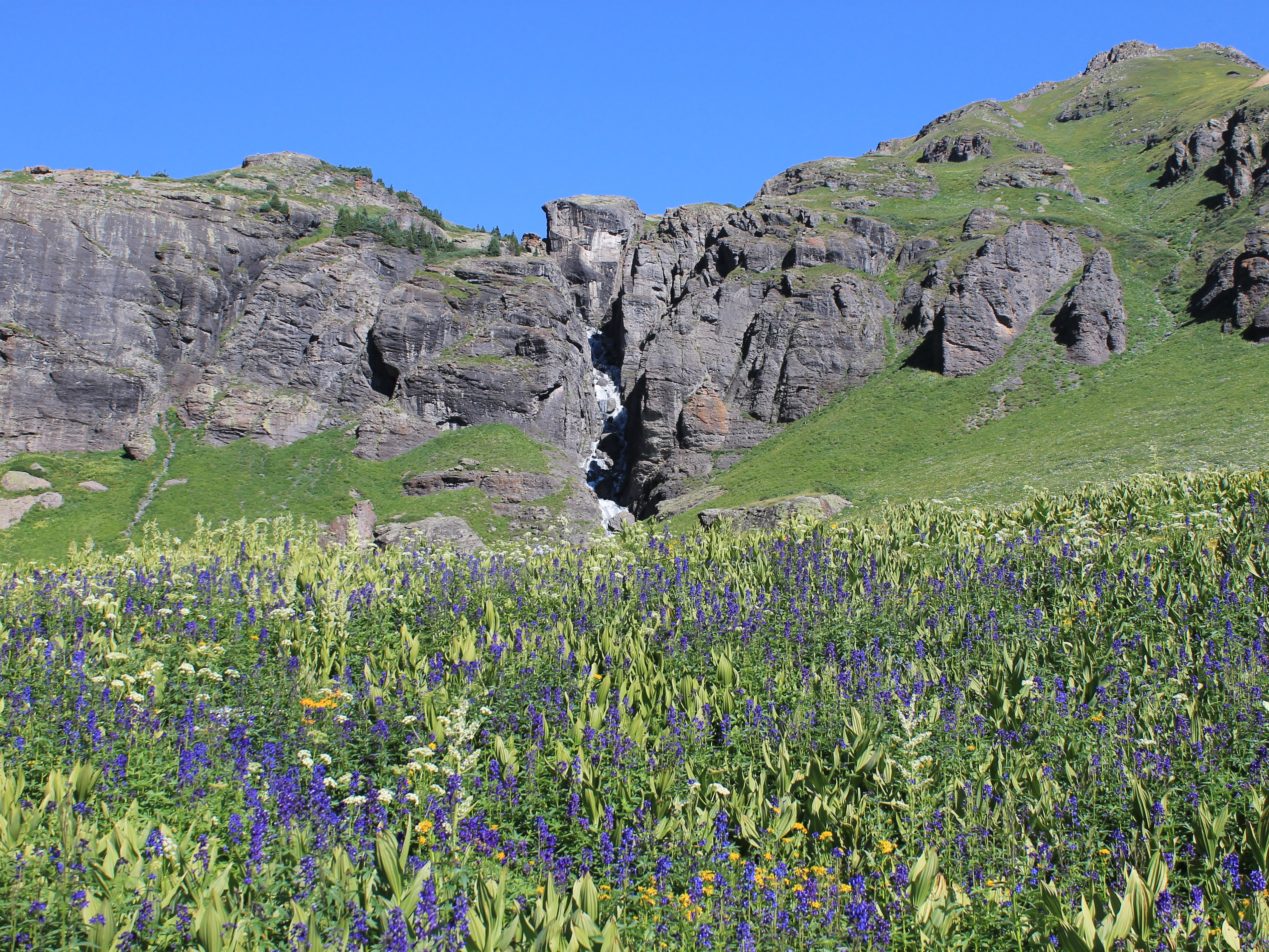
We were in an incredible place, a large basin lined with very steep cliffs on the left side. Ahead of us there were more cliffs that formed a headwall at the back of the basin. Above them we could see the tops of the high peaks that surround the upper basin, and two waterfalls fell from above, one on each side of the headwall.
 The outlet from Ice Lake cascades down cliffs below the lake
As we walked through the basin towards the headwall at the back we could see Lower Ice Lake about a quarter of a mile away. It looked pretty below dark gray cliffs. The trail didn't actually go to the lake. I suspect that close up it wasn't that pretty. It looked to be shallow and fringed with marshy grass. But a more distant view of it set in the basin was nice. It looked even better later when we could look down on it from above.
What really made the basin an awesome place were the spectacular wildflowers. They were everywhere. I usually think of the Olympics or the Cascades when I think of meadows just filled with flowers. We have done some hikes that featured pretty amazing flower fields, like Klahane Ridge in Olympic National Park, Paradise Meadows and Summerland in Mt. Rainier National Park, and Snowgrass Flats in the Goat Rocks Wilderness. But this hike might have had the best flower fields that I have ever seen.
 Trying to figure out how to cross the outlet from Ice Lake
I'm not an expert on wildflowers. I know more about mountains than I do flora or fauna. There were lots of flowers that I recognized: wild geraniums, Indian paintbrush, Columbines, penstemon, larkspur, fireweed. But there were lots that I had no idea of what they were. Sandy knows way more about flowers than I do and even she couldn't identify half of them. But they were amazing. Purple, blue, white, yellow, red, pink - bright colors on a lush green background.
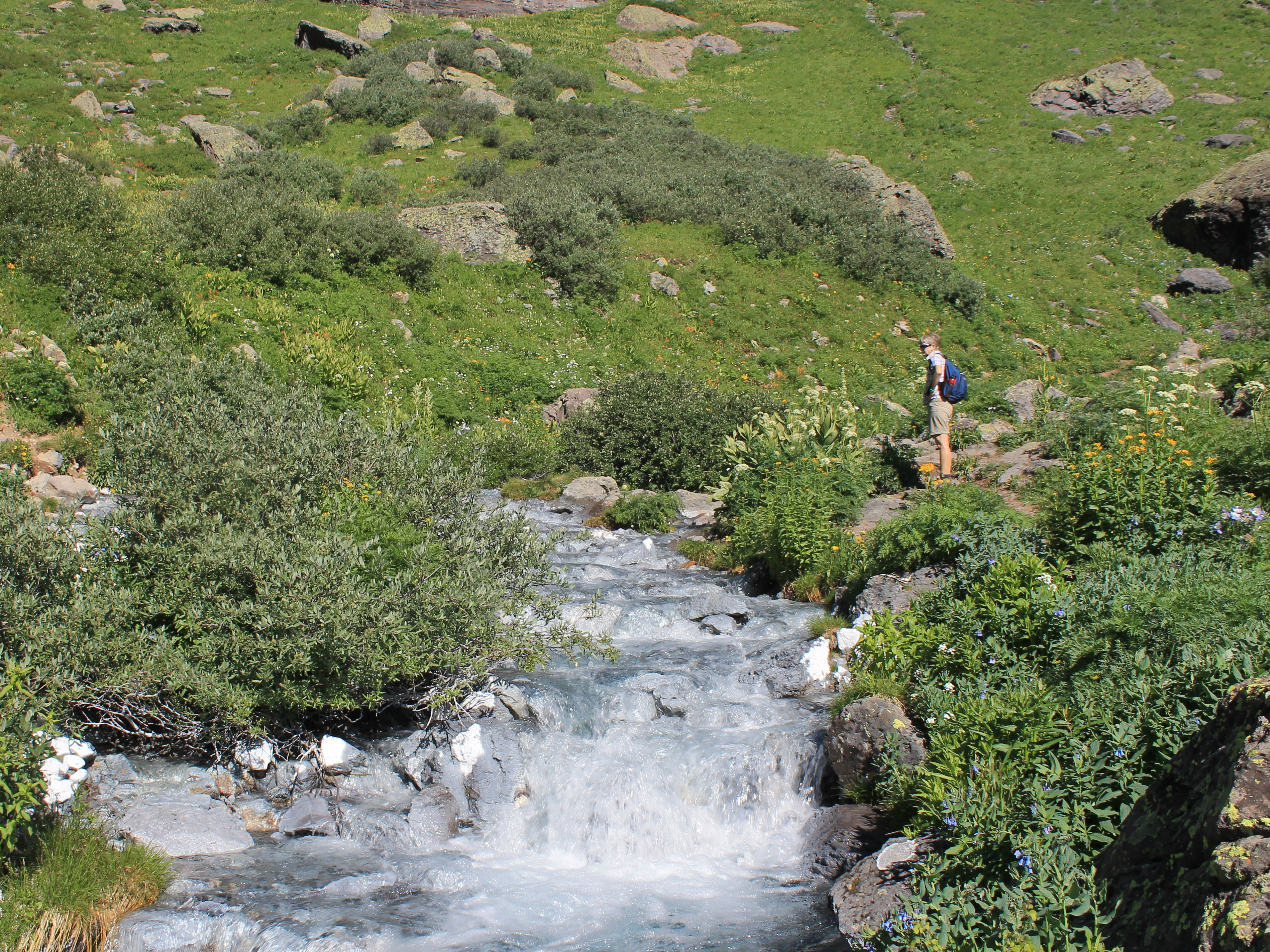
At the back of the basin we reached a stream that came from the base of one of the waterfalls that poured down from the upper basin. It was flowing very fast and there wasn't an obvious easy crossing. We looked up stream and down stream and finally just decided to go for it. We got a little wet in the process but made it across ok. Then came hard work again. The trail climbed over 750 feet to the upper basin in about half a mile.
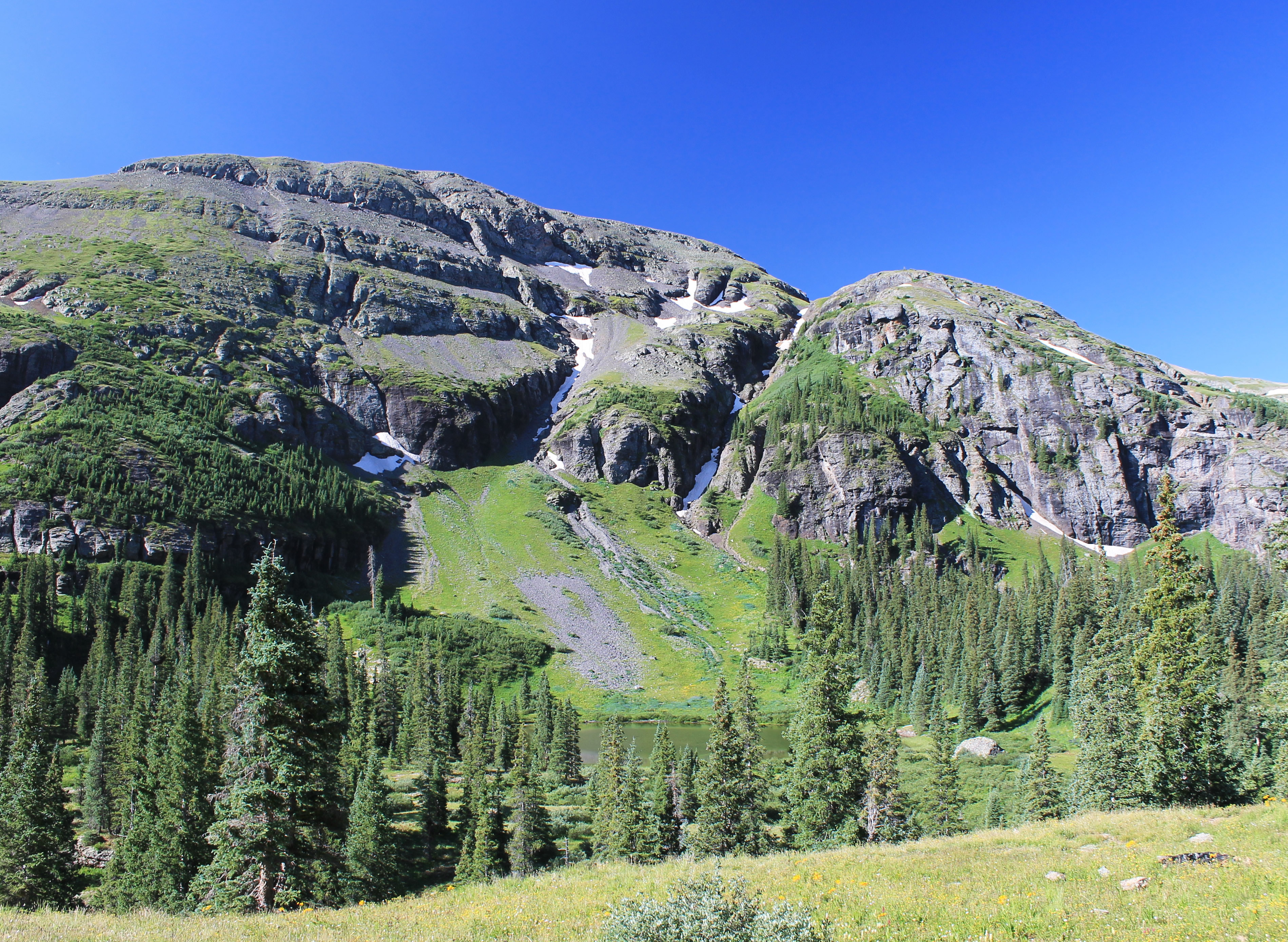
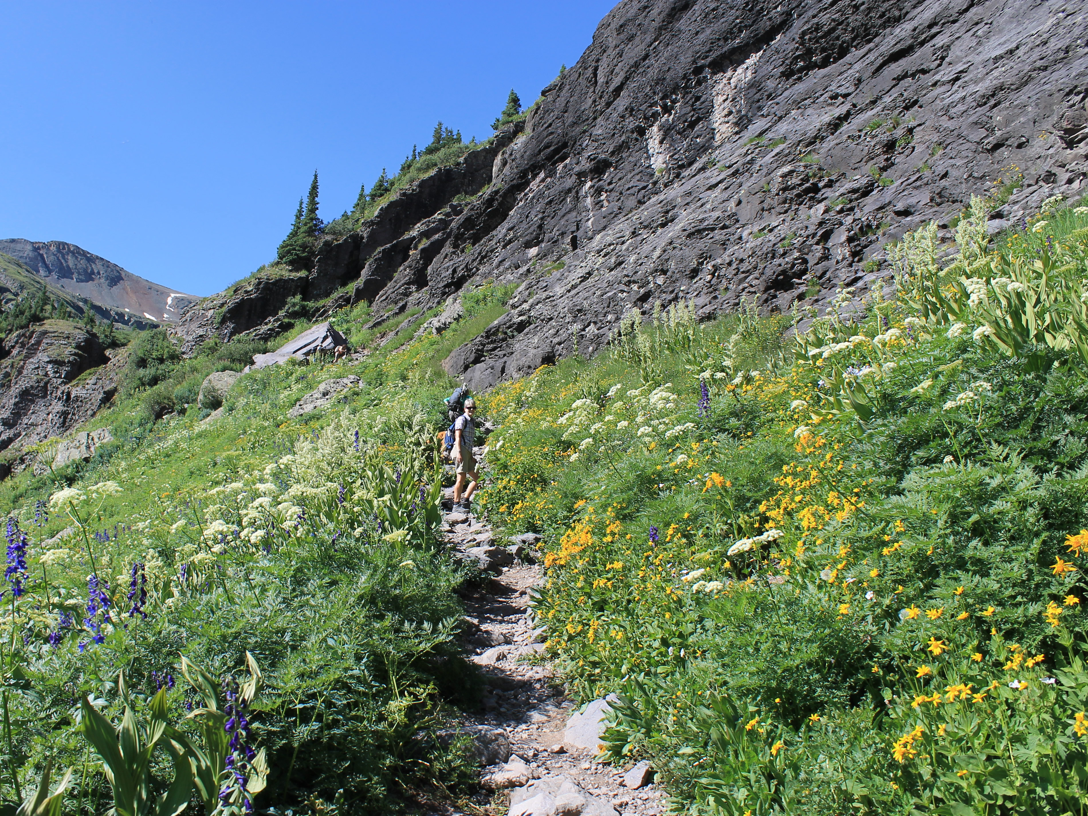 Climbing through the cliff bands to reach the upper lake
The lower basin was ringed by cliffs, but the trail angled up and went through a narrow gap, the only weakness in the cliff band. Because of the altitude and steepness it was very slow going. We got passed by several groups of hikers. I didn't care - I just took my time. At the end, even Sandy pulled ahead of me. She was anxious to get the climbing over with and get to the lake. Finally I topped out on the slope and could see Sandy waiting on a boulder a short distance ahead, with Ice Lake right behind her.
We found some rocks along the lakeshore to sit on, take a break to enjoy the view, and catch our breath. We were at 12, 270 feet and the air was thin. Our surroundings made us forget about the hard hike to get here. The lake was a beautiful blue-green color. There were steep thirteen thousand foot peaks all around. The trail continued, heading off to both the left and right. There were other lakes higher up in the basin and a lot of hikers were continuing on to them but we were content with Ice Lake.
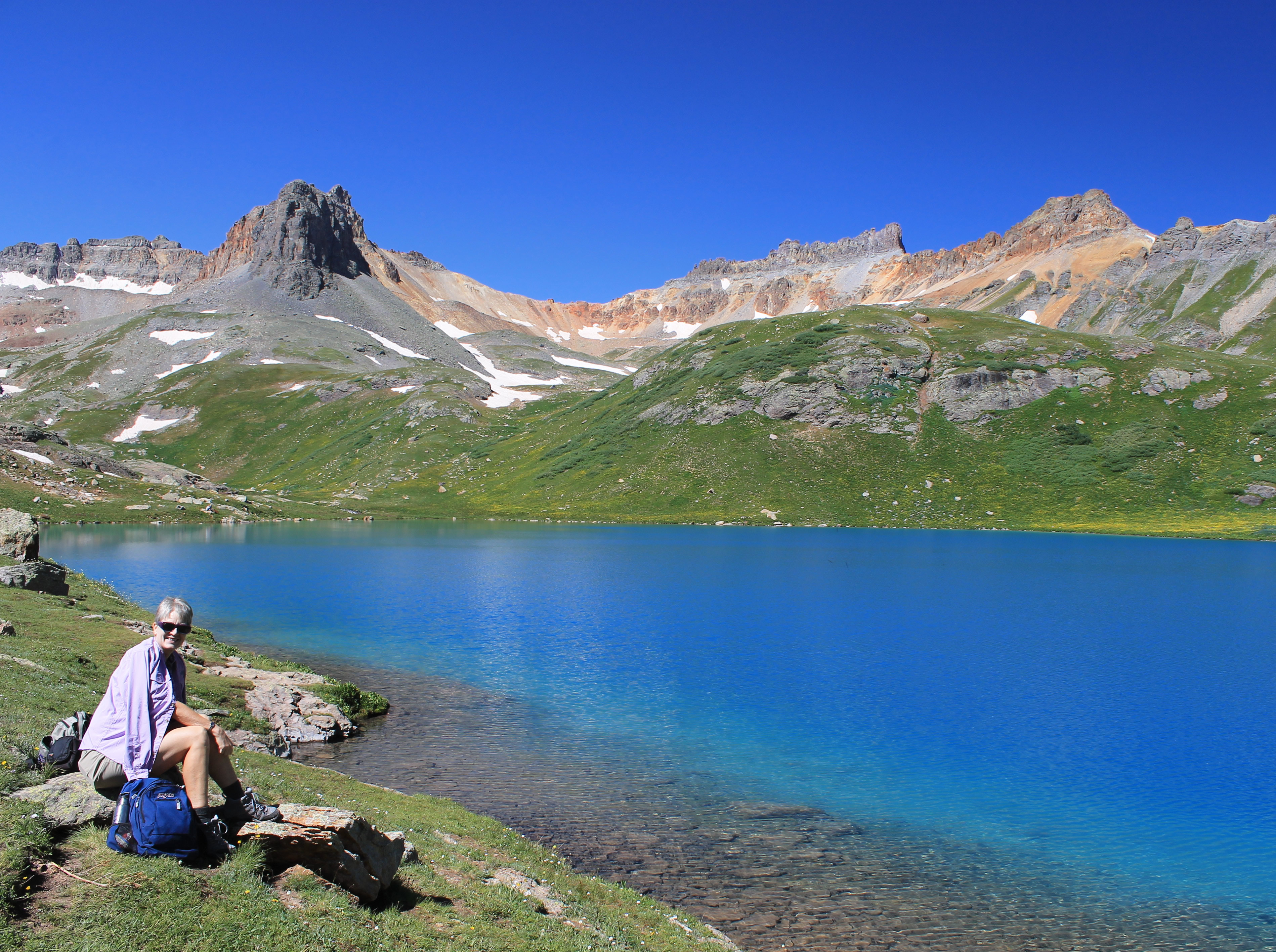 Ice Lake really was a remarkable color
Ice Lake was very pretty, but both of us agreed that the lower basin had been the highlight of the hike. Here the lake was above timberline, surrounded by grassy alpine tundra. There were craggy peaks surrounding the basin, but they were a crumbly rock that looked less impressive than the steeper cliffs below. And the flowers in the lower basin had definitely been the stars of the show. Still, it was an impressive spot and worth the effort to do 2500 feet of elevation gain to reach it.
Then it was time to head down. It was much quicker going down the headwall and the hikers we passed who were heading up looked at us enviously as we sauntered by. One young girl we passed was wheezing like a freight train with every breath. She sounded the way Abby sounds when she is straining as hard as she can against her pinch collar. We didn't know if she was really in trouble or if she was just putting on a show to get attention from everyone. At least we know she didn't collapse and die because we could still hear her loud breathing behind us long after we passed her.
 Sandy looks happy to be going down instead of up for a change
We didn't waste time on the stream crossing on the way back either. I stopped to take pictues and by the time I got there Sandy was already across. I followed quickly and then we had the easy, flat section. Here we slowed down, since this is where the flowers were the most spectacular.
We passed a forest service crew working on the trail. I complimented them on the nice trail but suggested that maybe a bridge for the stream we had just crossed would be a good idea. They said it was on the list. Just no budget for it.
It was quite warm on the way down and the bugs were making their presence felt. The basin was obviously wet and lush. The flowers liked it but so did the bugs. Eventually we were across the meadows and into the woods, starting down the big hill that led back to the trailhead. In the woods the flies were even worse. As long as we kept moving they were annoying but tolerable. You couldn't stop for more than a few seconds though. Fortunately we could keep up a pretty good pace going downhill.
 Construction delay on the Million Dollar Highway
We did not envy the people coming up though, and there were a lot of them. They looked really hot, climbing in the warm sun. Whenever they paused to rest, the bugs would be on them in a few seconds. Staring early in the morning when the temperature was in the down in the forties looked like sheer genius now.
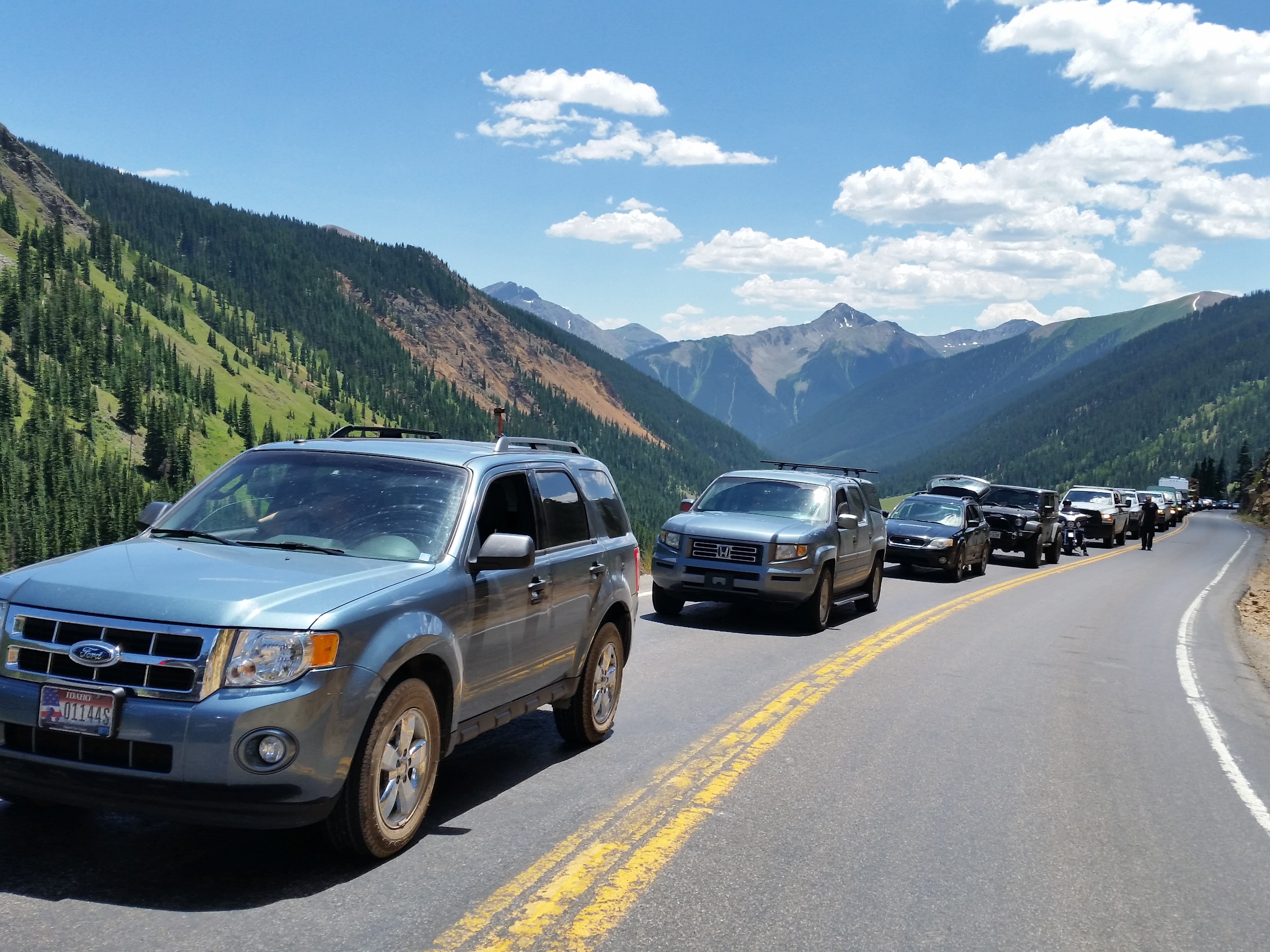
Finally we made it to the car. When we reached the highway we made the short drive to Silverton to buy cold drinks before heading back towards Ouray. Even that wasn't easy. We were stopped for construction on the Million Dollar Highway and had to wait for over fifteen minutes. But at least we were high up, there was a nice breeze, and since we were stopped we could enjoy the view while we waited. Finally we made it back to Ouray and our hotel.
We had indeed had an awesome hike on our best weather day of the trip. It was unusual for me because it was the spectacular wildflower and not the mountain scenery which was the highlight of the trip.
