Sequoia and Kings Canyon National Parks
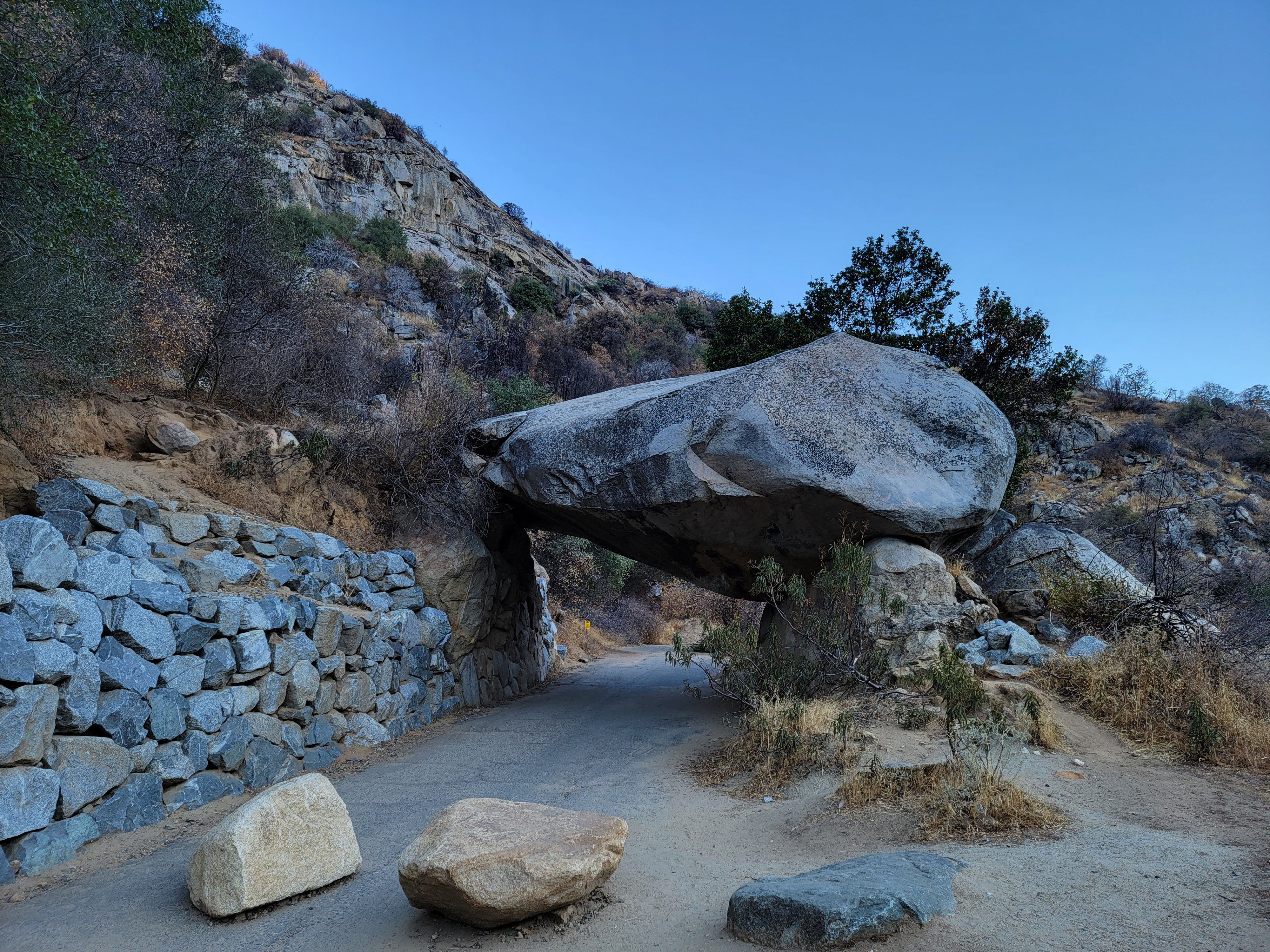 Tunnel Rock
I like to explore different mountain regions. Often when I travel for some other reason, I will find a way to include some extra time to do a hike nearby. Back when I worked at HP and had to travel to Colorado quite often, I managed to climb half a dozen fourteeners as add ons to buisiness trips. Now that I'm retired, I still do it. Most years that I drive to Phoenix for the Consimworld Expo wargame convention, I will make a stop on the way there or back. I've done hikes in Zion NP, Great Basin NP, Grand Canyon NP and Canyonlands NP on those trips.
The first time I went to GMT weekend at the warehouse was in spring 2010. I went a day early and visited Sequoia and Kings Canyon National Parks. GMT is in Hanford in the Central Valley and only fifty miles from the entrance to Sequoia. I had hiked into the parks from the Owens Valley on the east side of the Sierras but had never explored the west side. There is actually much better road access from the west and this looked like a good chance to check it out.
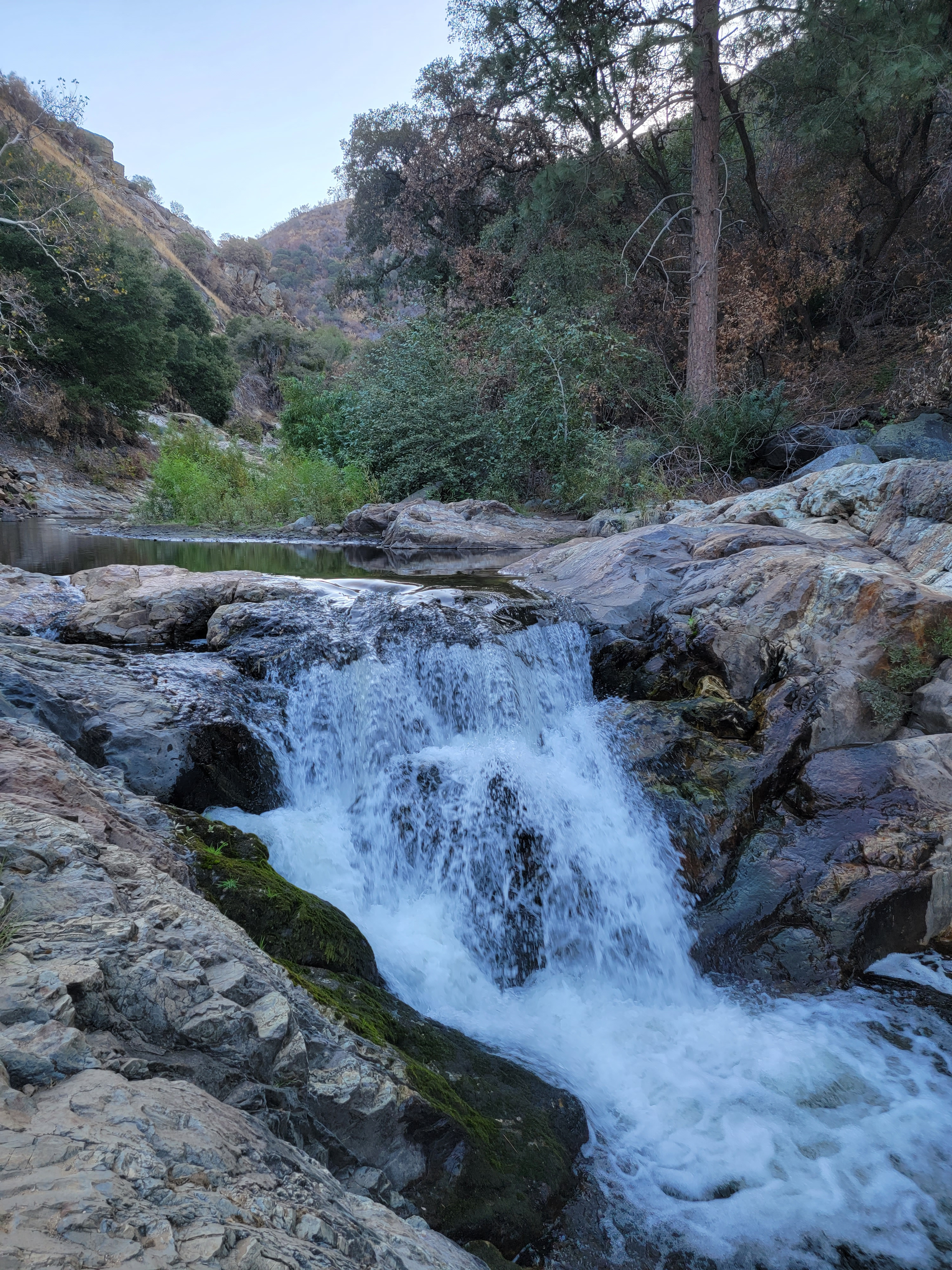 Early morning on the Middle Fork Kaweah River
Except that it wasn't. Weekend at the warehouse is held twice a year, in April and in October. The weather in the Central Valley is very nice then. The weather in the Sierras is usually not. I spent a day exploring Sequoia National Park but it was cloudy part of the time and raining the rest. I did manage to climb to the summit of Moro Rock, a huge granite monolith. An impressive trail changes what was a very challenging, exposed scramble into a hike. I missed out on the impressive view from the top as the summit was covered in clouds.
After the convention there was a rare clear spring day, and I did do a quick drive up to the mountains on my way home. My time was limited though so I explored Kings Canyon National Park instead of retracing my steps from earlier in the week. Because of the rain I hadn't even made it to Kings Canyon the first time. At least I had one good day in the mountains. But I hate unfinished business and I have always wanted to go back and climb to the top of Moro Rock on a clear day when I could experience the summit view. It's supposed to be spectacular. Although I have been to GMT many times since then, the weather in the mountains is rarely good at that time of the year.
This year we have had an exceptionally nice fall. The weather in the Idaho mountains has been fantastic. I checked the extended forecast for the Sierras a few days before my trip to Handford and sure enough, the weather was sunny all week. I decided to go early and have a day to spend in the mountains. Twelve years was long enough to wait for a chance to go back to Sequoia National Park and climb Moro Rock again.
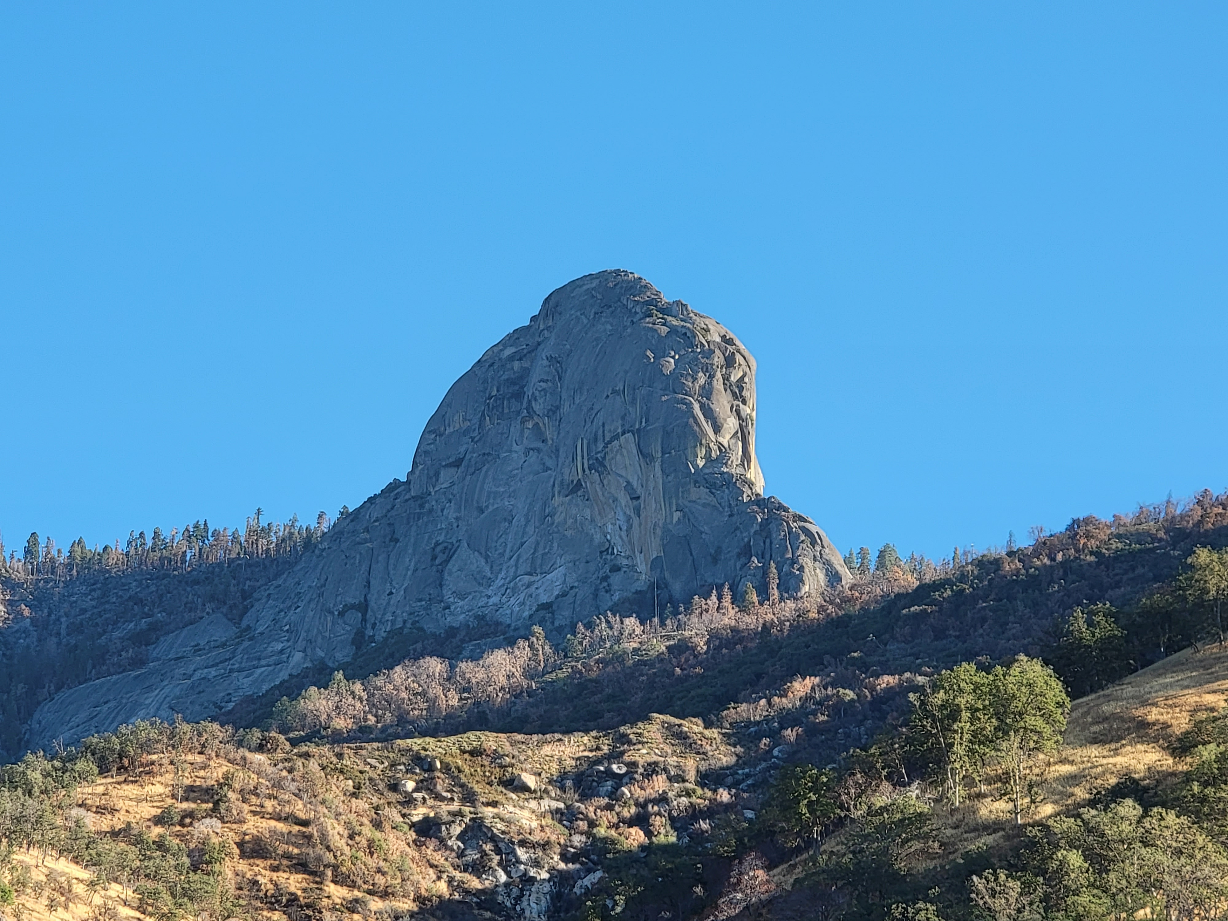 Moro Rock from the Kaweah River Canyon
I originally looked into staying as close to the park entrance as possible, maybe in the town of Three Rivers. I eventually decided to just go to Hanford a day early. Although it meant a longer drive in the morning, it meant that I didn't have to worry about changing hotels. It also meant that I didn't have to think about what time I got back from the mountains. I was already checked into the hotel I was staying at for the game convention.
I was hoping to get an early start. I needn't have worried. At 5 am a quiet but noticeable buzzing sound woke me up. That was a bit too early. It might not even be light when I got to the park. I tried to go back to sleep for another hour but didn't have any luck. I actually dawdled quite a bit before hitting the road at 7 am. That was still pretty early. When I reached the Foothills Visitor Center just inside the park entrance, it was still closed. That was where I had bought a Sequoia National Park tshirt on my trip their twelve years ago. Not this time.
 Moro Rock from the trailhead
Since it was early I took my time and stopped at places that looked interesting. First was Tunnel Rock, which is just off the road. It's a huge boulder that the old road passes under. During the Depression the Civilian Conservation Corps dug a tunnel under the rock rather than move the huge boulder. Eventually as vehicles got bigger they didn't fit and the road had to be rerouted to go around it.
Next was a turnout along the highway, where a steep but easy fifty foot scramble led down to the Middle Fork of the Kaweah River and a small but very pretty waterfall.
Another stop was at Hospital Rock. It's a huge boulder with a large natural cave underneath it. A small community of Monache Indians lived there as long ago as 1350AD. Later I learned that there are pictographs in the area but I didn't know about them so I didn't look for them. I did see a large flat rocky area where there were holes in the rock that were used for grinding grain. There was also a trail that led down to the river and another small waterfall. With steps cut into the rock, it was a lot easier than the scramble at my previous stop. An added bonus was a nice view from the parking area of Moro Rock, far above the bottom of the canyon. It looked impressive in the early morning light.
Then it was time to drive the long, winding road up out of the canyon. With lots of switchbacks and sharp hairpin turns, it was very slow going. I decided I would probably leave from the north side of the parks at the end of the day rather than returning back this way.
After climbing out of the canyon the road entered the Giant Forest section of the park. This is where many of the parks giant sequoias are. Just seeing them beside the road as you drive along is very impressive. Those are Big Trees.
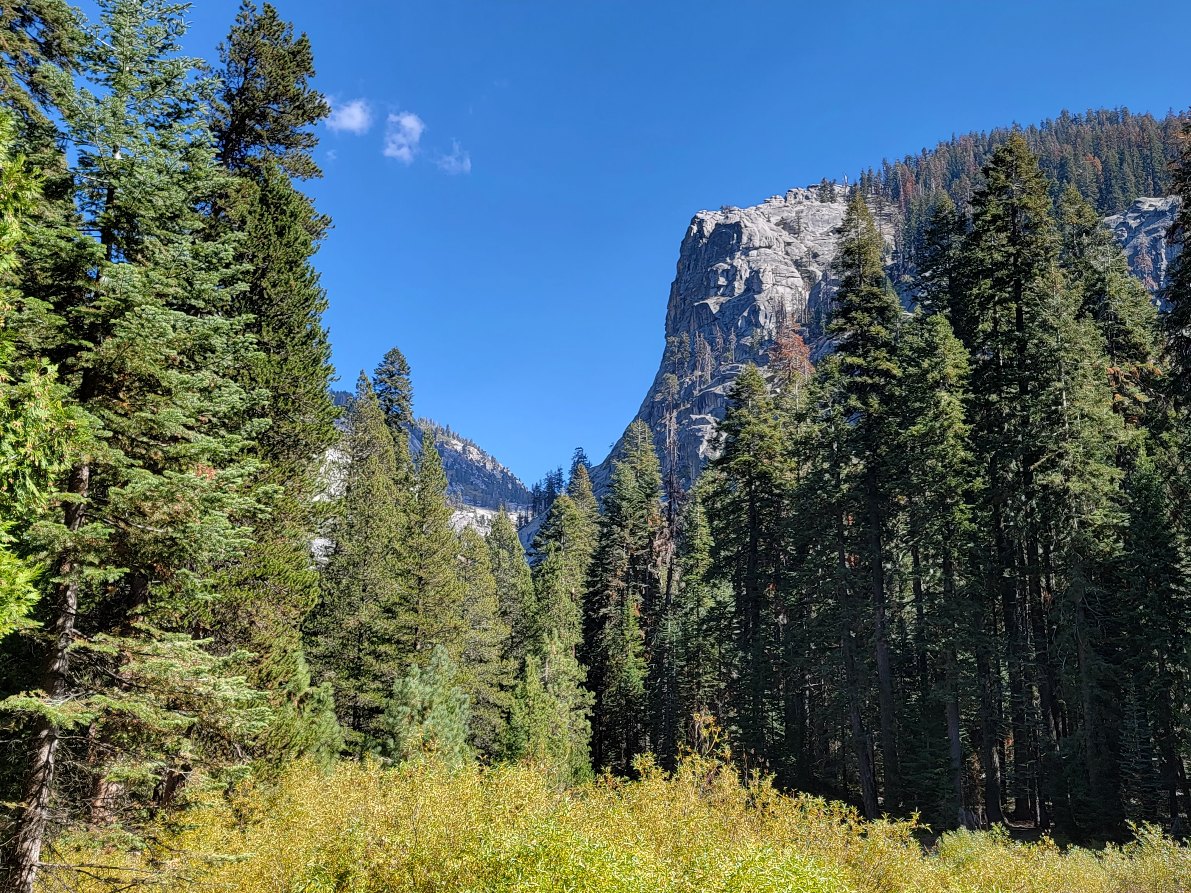
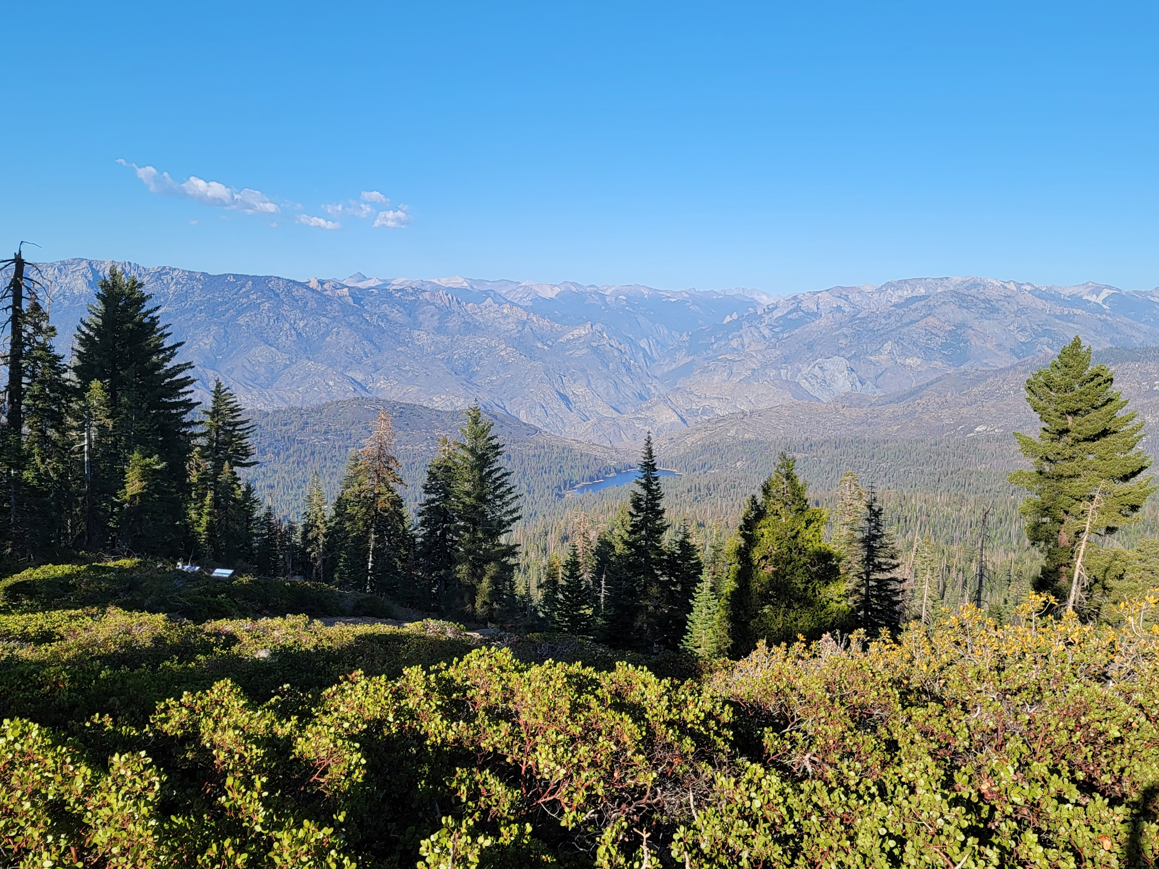
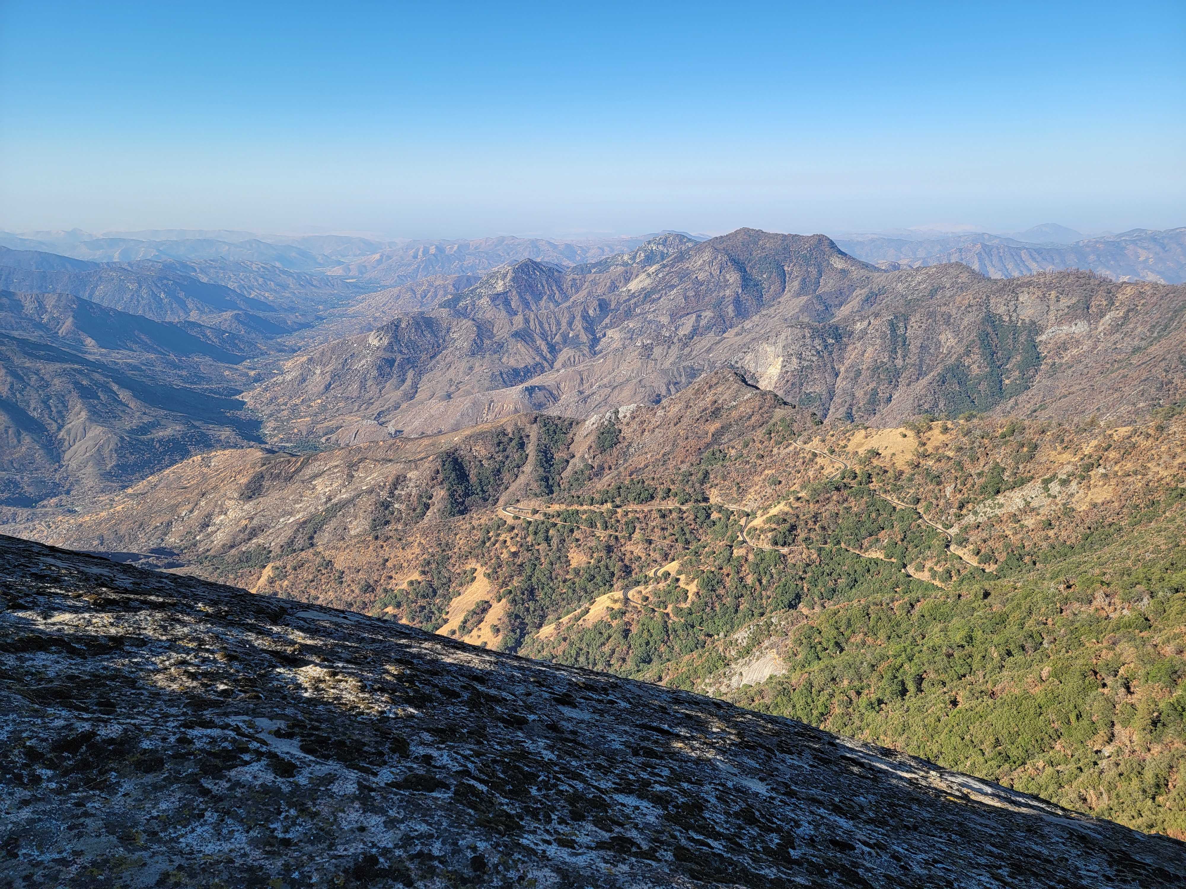 View west from Moro Rock - note the road out of the canyon
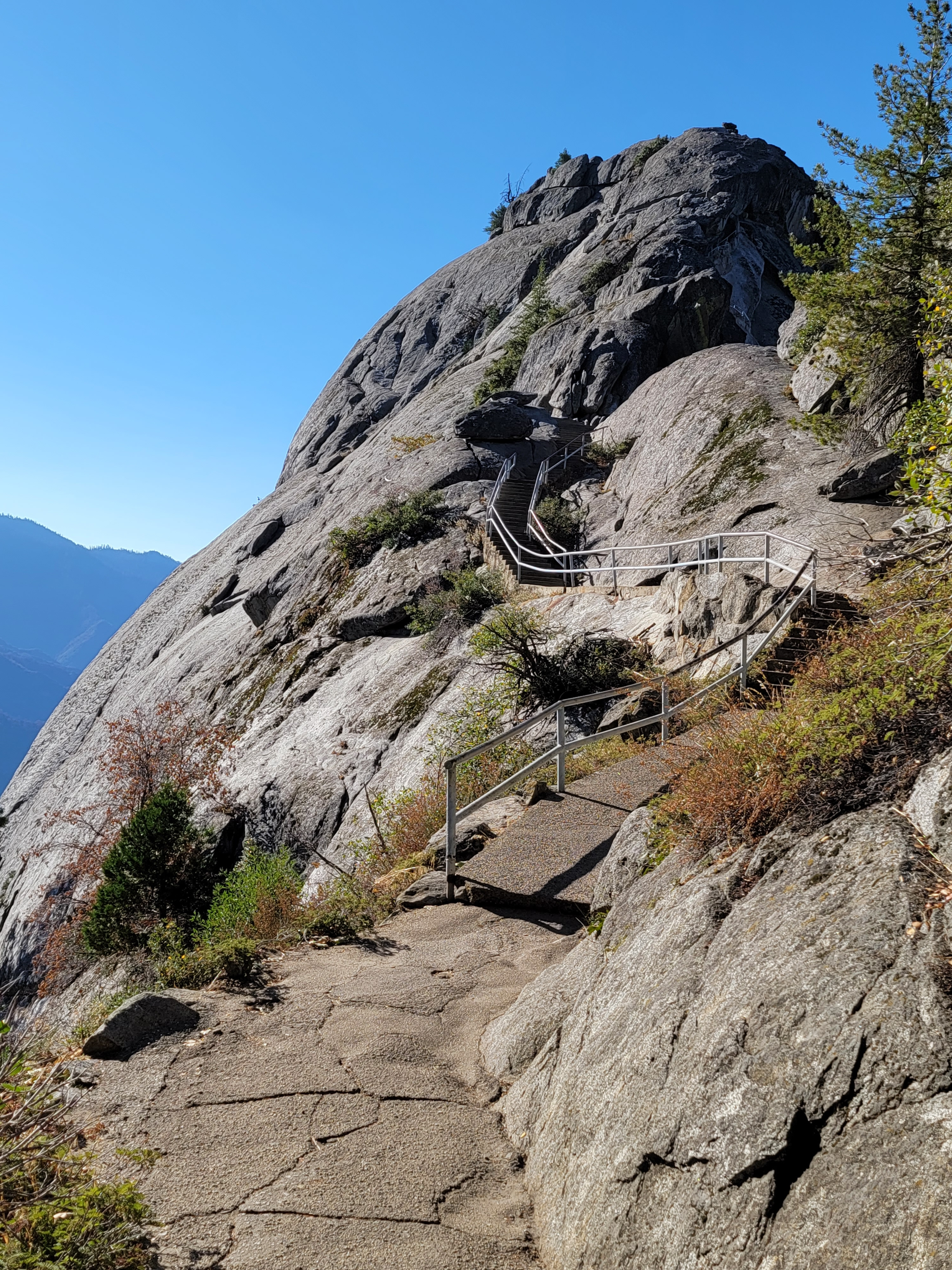
But the next order of business was Moro Rock. There are several trails that lead to it from the main highway, but I decided to save time and effort by taking the spur road right to the base. During the summer the road is closed to private vehicles and you have to take a shuttle or walk, but this late in the season there are no restrictions. Given how narrow and windy the spur road is, it isn't easy for two cars to pass in opposite directions. Fortunately I only encountered one other car on the way in.
The parking lot is right at the base of the rock. It's only a quarter of a mile and 300 feet of elevation gain to the top but it does look intimidating as you start out. Most of the "trail" consists of steps carved right out of the rock itself. It's basically like climbing to the top of a thirty storey building. Parts of the route are exposed but there are metal railings or stone slabs alongside wherever a fall would be serious. Although it reminds me of Angel's Landing in Zion National Park, it isn't nearly as serious. I did some checking and I could only find one person who died in a fall from Moro Rock in the last twenty years and that was a suspected suicide. Still, there is real exposure and care is needed. And like Angel's Landing, the biggest problem is probably crowds. It's one of the most popular attractions in the park. Fortunately since it was late in the season and very early in the day, there were only a couple of other cars in the parking lot. I didn't have the rock all to myself but it was probablyt as close as you can get.
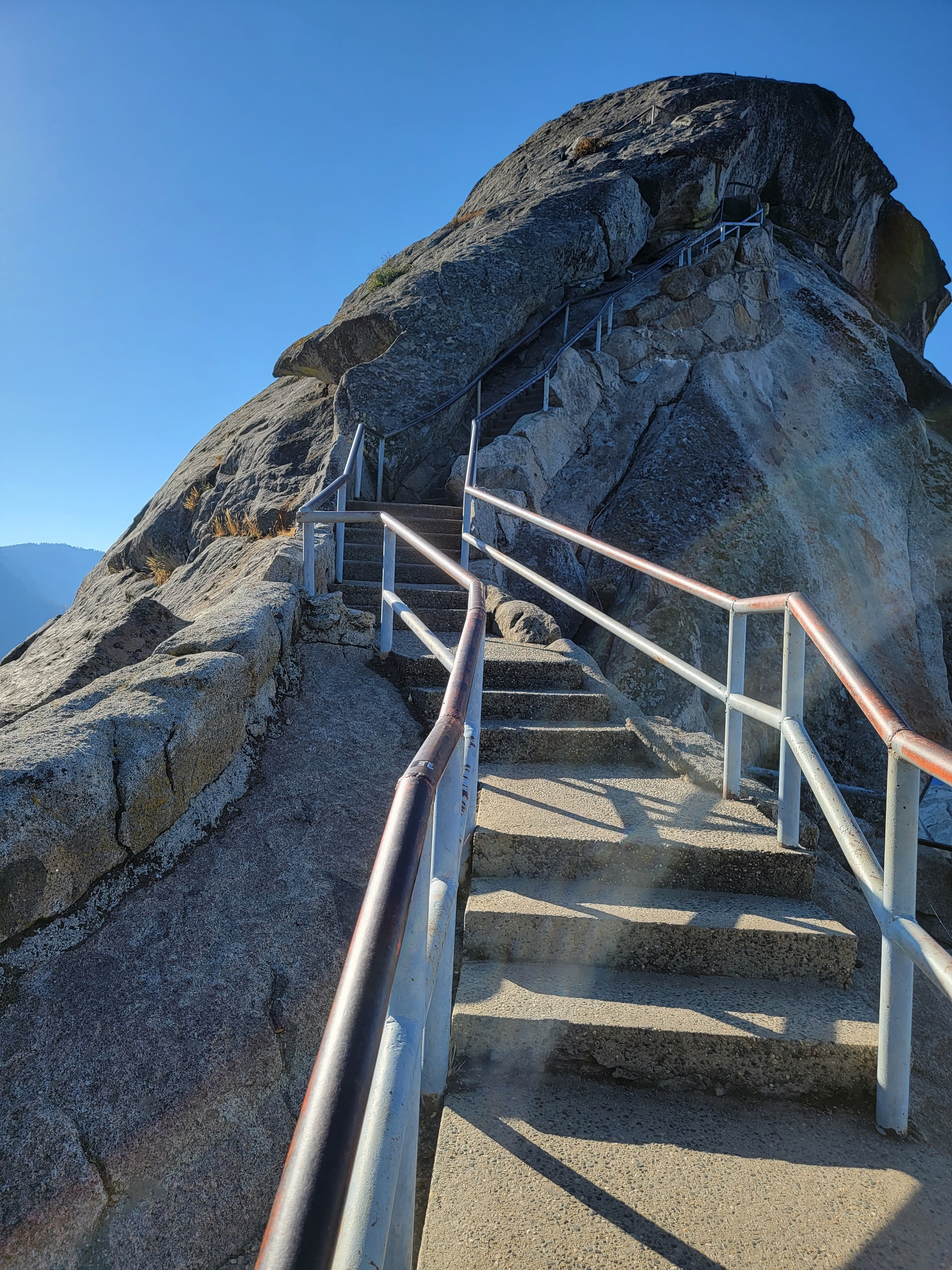 The stairs are carved right out of the rock
The view from the top was amazing. There wasn't a single cloud anywhere in the sky. To the east were the peaks of the High Sierra. To the west were the Sierra foothills, and beyond them the San Joaquin Valley was filed with haze. It might have been from wildfires but was probably just pollution. The Valley has about the worst air quality in the US, with car exhaust, industry and agriculture all contributing. To the north and south were the foothills stretched in both directions, rising a mere six thousand feet or so above the valley but still way below the Sierra crest. After twelve years I could finally check off that I had come back and been to the top of Moro Rock in good weather.
After coming down from the summit, I took a short hike on the Soldier's Trail past a couple of big sequoias. No one else was there. It was quiet, just me and the big trees. When I'm in a grove of the big trees, I get the same feeling as when I'm in a large cathedral. Unfortunately there were tiny flies, clouds of them, which is unusual for so late in the season. They didn't buzz or bite, but twice while I was walking I inhaled one. It kind of spoiled the mood.
When I got back to my car, I continuted driving north through the Giant Forest area. I stopped at the trailhead for the General Sherman tree, which is the largest living thing in the world by volume. It's reached by a wide, paved trail that drops two hundred feet down a hill in half a mile. The park service had signs everywhere warning about the steep return climb. There were benches beside the trail for people to stop and rest. I must be a hiking stud because I didn't think it was worth mentioning, although I will admit that a couple of people passed me on the way back up.
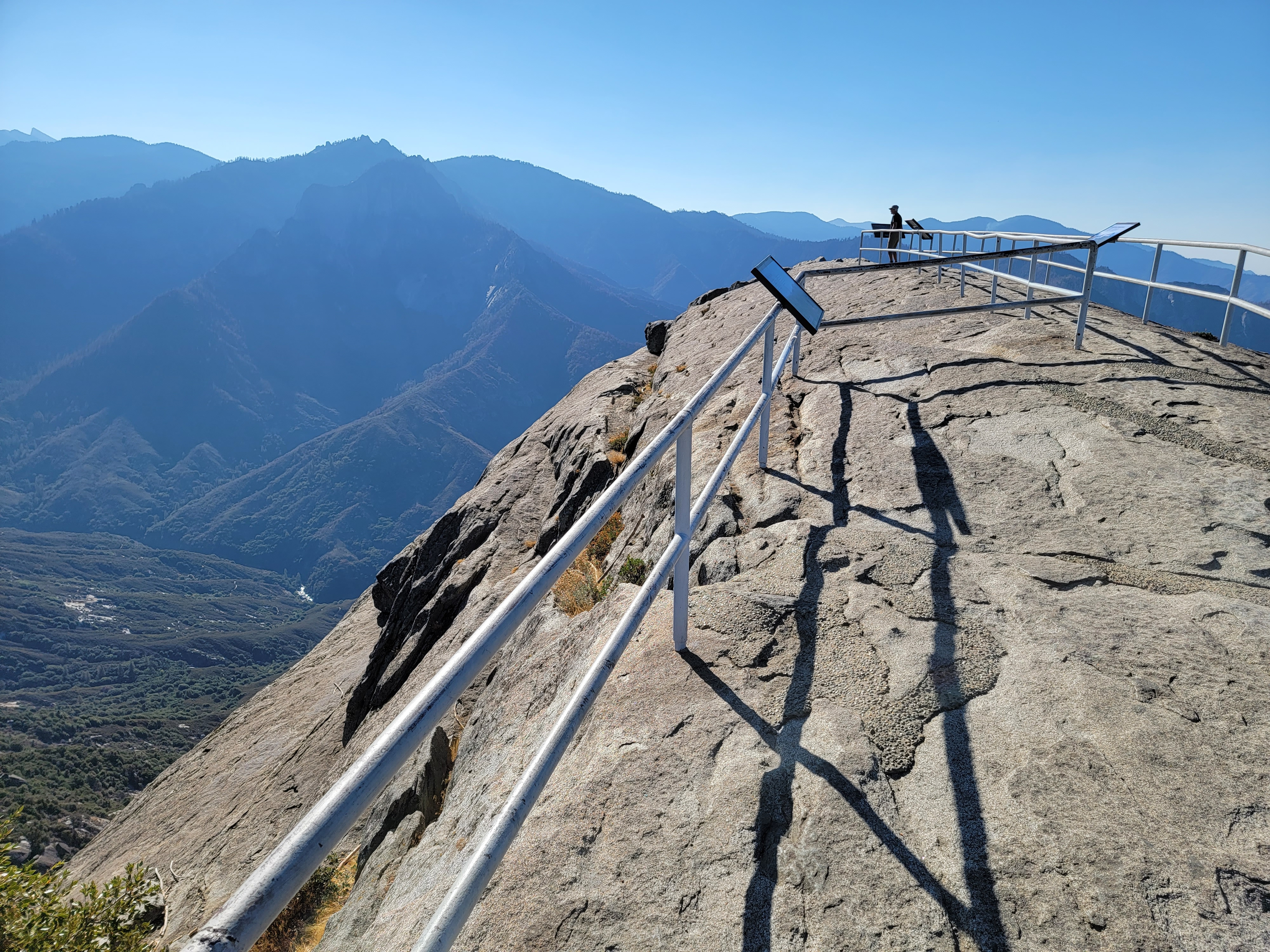 The summit of Moro Rock
The General Sherman Tree is massive, one hundred and five feet in circumference at the base. It's also tall, two hundred and eighteen feet. And while the girth was impressive, other trees around it were visibly higher and looked more majestic. I guess I'm just not that impressed by a fat tree.
Continuing to drive north, I turned off at Lodgepole Village. There is a large campground there, but from my previous visit I also remembered a visitor center and market. This would be my chance to get a park tshirt, since the other visitor center I passed had been closed when I went by. I was ready for a soda and a snack too. I even got a parking spot right up in front, which was possible because both the visitor center and the store were already closed for the season. Argh!!!
It was ok really. The main reason that I came to Lodgepole was to do the Tokopah Falls Trail. It follows the Marble Fork of the Kaweah River (how cool is that name) up a valley to an overlook of a major falls. This late in the season though it was likely the falls would be completely dried up. Still, from the description it sounded like the valley was pretty and the hike was moderate, four miles round trip and six hundred feet of elevation gain.
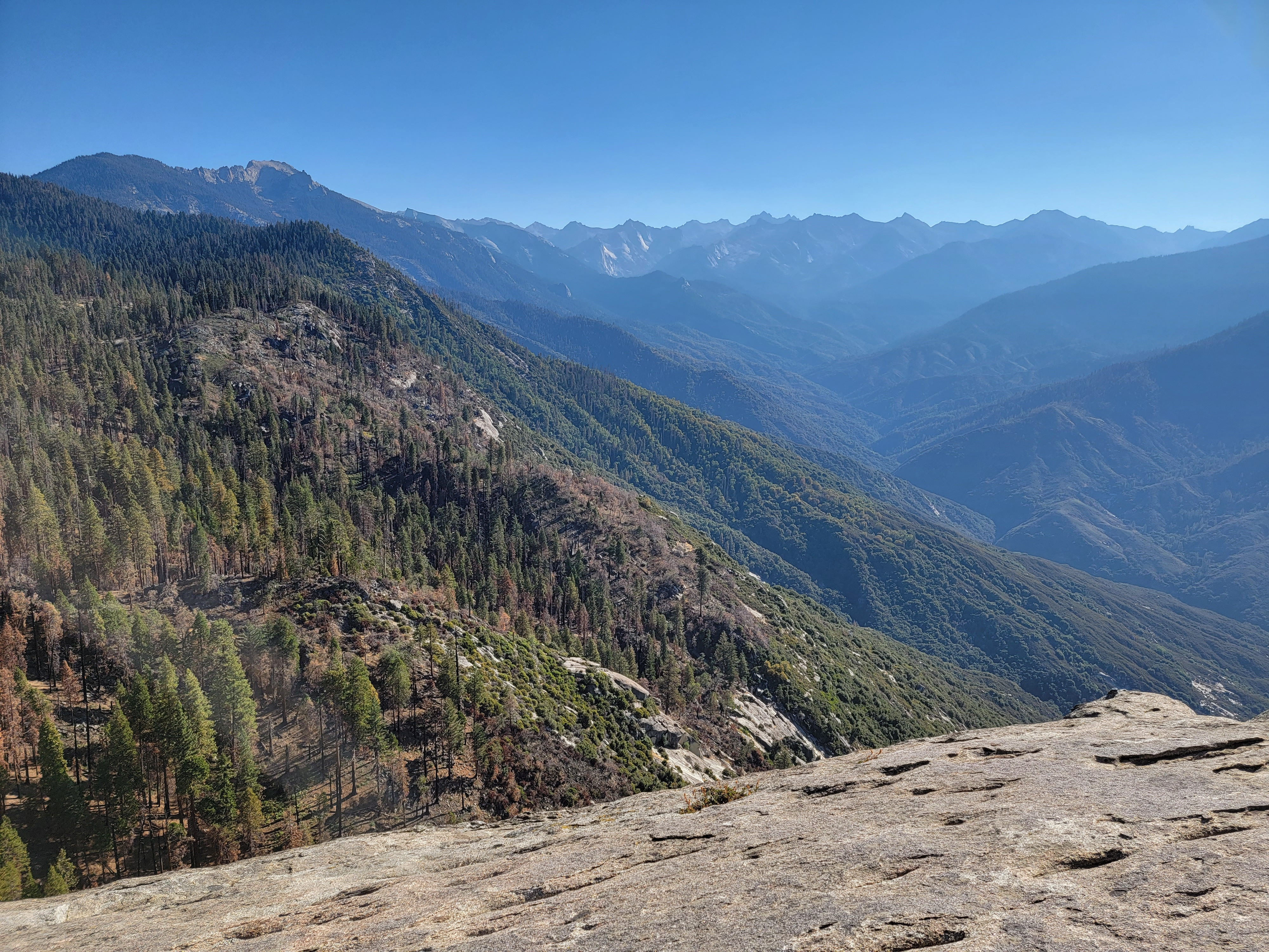 Looking east to the Great Western Divide
That's pretty much how the hike was. There was very little water in the river. The canyon was pretty, with steep rocky walls. The most impressive was a large granite monolith called the Watchtower (queue the Jimi Hendrix music). Along the way I crossed several bridges over side streams that were totally dry. When I reached the end of the trail, there was just a trickle of water where the falls should be, about as much as you would get by running a garden hose.
Although the trail was always close to the river, the water was usually hidden down a slope and behind vegetation. On the way back I took a couple of side trails that led off the main trail down to the river. The water flowed over lots of big granite slabs. It would be really impressive in spring with high flows. Even now, I found some spots that were very pretty. Quiet, peaceful, with just a tiny flow of water over the rocks. A different vibe than you would get during spring runoff. In one spot I even found a real waterfall, about fifteen feet high. There weren't many hikers on the trail but there were a few. But at each of these secret places that I found I was all alone and had a beautiful spot all to myself. I don't usually pause much while I'm hiking. I'm destination oriented. But today I stopped for a while at several spots, just enjoying the peace and quiet and beauty of each place. I didn't see the big waterfall but it had been a very good hike.
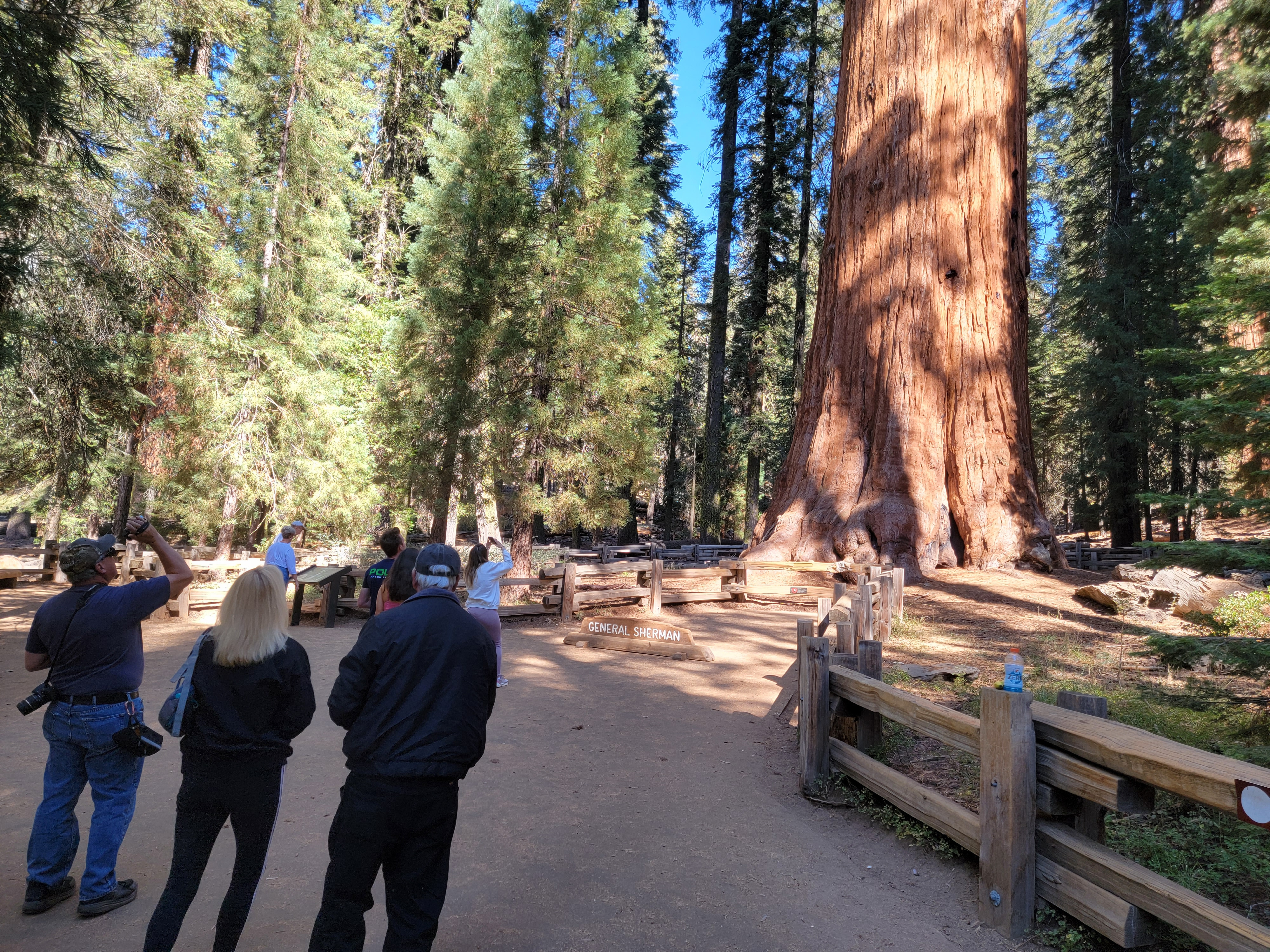 Tourists busy photographing the General Sherman tree
Back at the car I had a decision to make. It was 2 pm. I could turn around and go back the way that I had come. I could get to the Visitor Center near the entrance before it closed at 4 pm for a chance for a tshirt. I had seen what looked like a good pizza place in Three Rivers, a town just outside the park. There were also a souvenir shop or two, which meant more chances for tshirts. After dinner there I would get back to my hotel early evening.
My other option was to keep going to Kings Canyon National Park. According to the map there was a visitor center and store there in Grants Grove Village, but I had no way of knowing if they would be open or not. There was no cell service so I had no way to check. If I continued, I would probably have to head down to the valley from further north and return through Fresno, which might mean a lot of traffic. It would take way too long to drive all the way back through both parks. Since this was my only day in the parks, I decided to keep going and see as much as I could rather than retracing my steps. Onward!
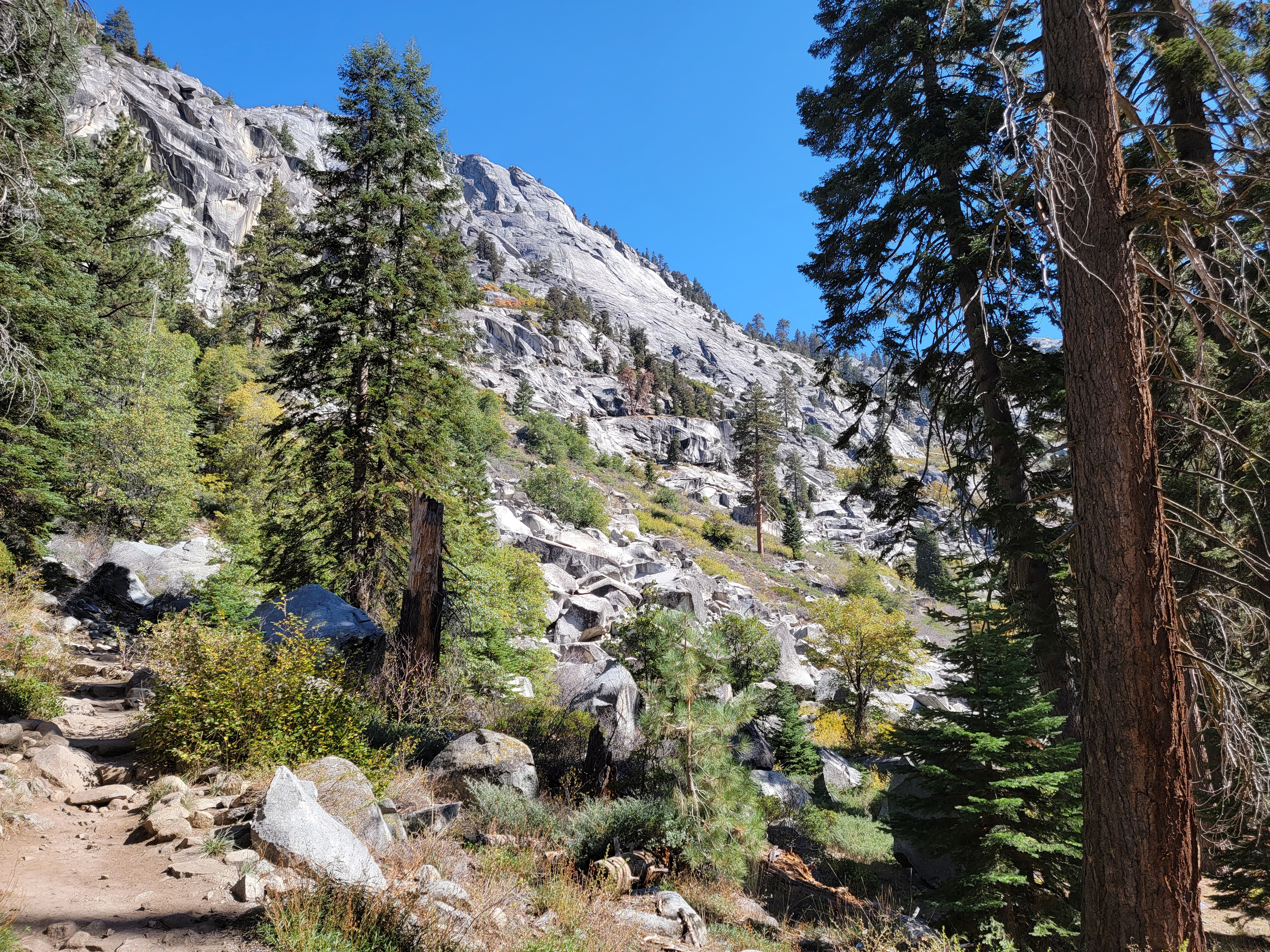
 The Watchtower from the Tokopah Falls Trail
Some distance to the north, the map had a spot along the highway marked "Kings Canyon Overlook". That sounded promising. Any feature that had a national park named after it must be impressive, right? When I finally got there, quite a few cars had pulled off into the parking area. But when I got out, it was quite disappointing. We were up high on a ridge with a view off to the west, of Kings Canyon and the Sierra crest beyond. But the view was mostly blocked by trees. You could see that there was a great view out there, but it was heavily obscured. I didn't even bother taking a picture.
When I got to Grants Grove Village there was good news and bad news. The visitor center and market were open. The gift shop was not. Still, I got a tshirt and a sweatshirt. Of more immediate concern, I got a (not very) cold soda. I was pretty thirsty after all my hikes through the day so it tasted really good.
Studying the map, I noticed a place called "Panoramic Point" down a side road that left Grant's Grove Village. My vague recollection of my 2010 trip to Kings Canyon was that there really weren't any good panoramic views of the canyon. But I had not been to Panoramic Point on that visit. I had to check it out.
 Canyon of the Marble Fork of the Kaweah River
It took me three tries to find the correct road. Literally I had to turn around and go back twice. Finally on the right road, it was incredibly narrow and windy and steep. All the way to the end I drove in second gear, except for two tight, steep hairpin turns where I had to grab first gear. It really was a one lane road so every curve had to be approached slowly. The two cars I met required some maneuvering to get by. It was a lot farther than I espected but I finally made it to the trailhead.
The walk to Panoramic Point was short, only two tenths of a mile, but it was, you guessed it, two hundred feet of elevation gain. It didn't take long. The trail led up to a saddle on the crest of Park Ridge. The view to the east was indeed panoramic. In the foreground were Hume Lake and Kings Canyon and the Middle Fork of the Kaweah Canyon. In the distance was the Monarch Divide and the Great Western Divide. Behind that, far off, was the crest of the Sierras, culminating in fourteen thousand foot North Palisade.
Ok. So Panoramic Point lived up to its name.
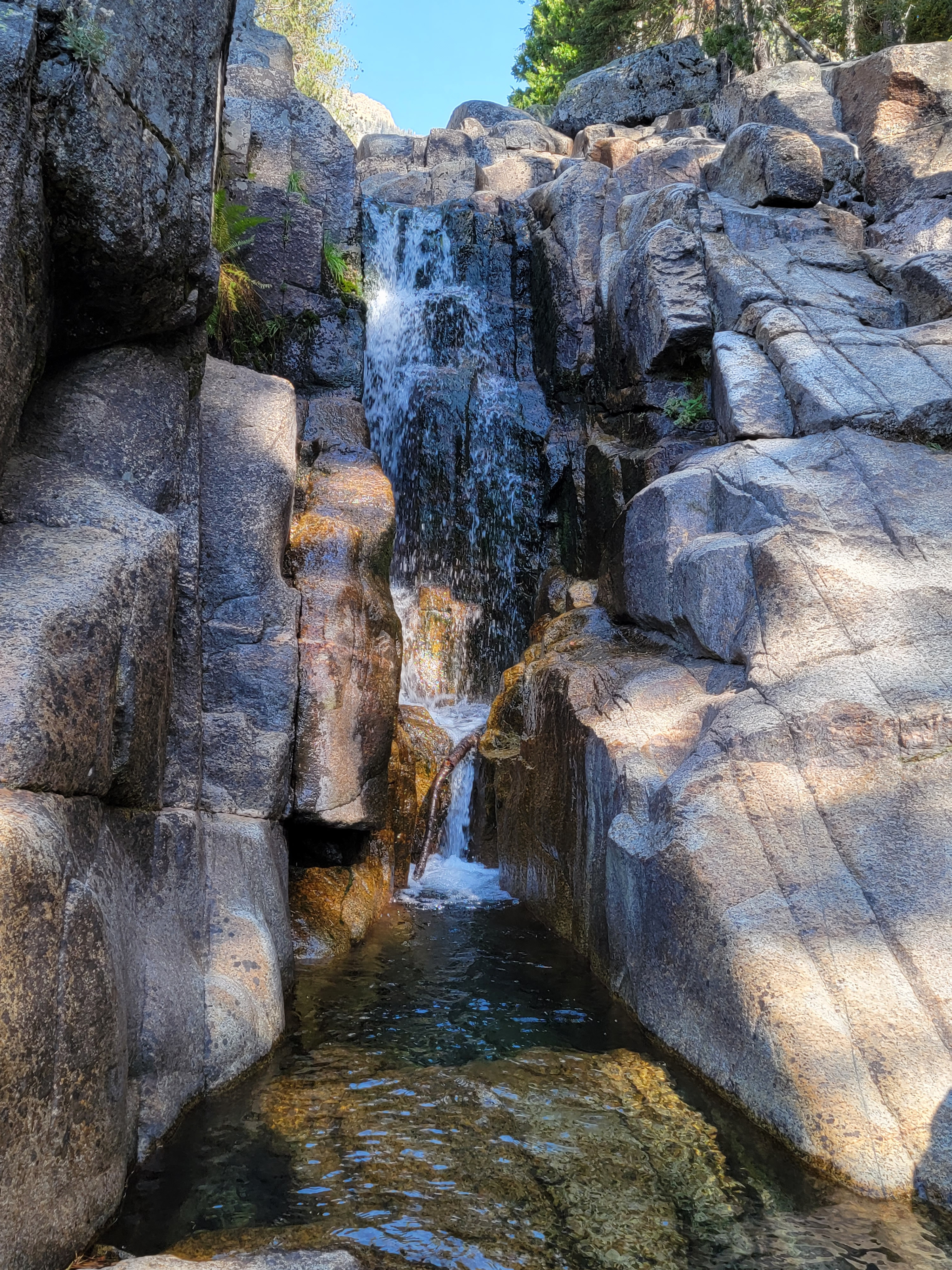 Hidden waterfall off the Tokopah Falls Trail
There were two other people there, even older than me (I know - that's hard to believe). There was a trail heading up the ridge and a sign that said "To Fire Lookouot". The other two people started up the trail. Well, if a couple of old codgers could do it so could I. It didn't look like the ridge went very much higher.
In a few minutes I caught up with the others. Since they had started up I assumed they knew how far it was to the lookout, but when I asked they said that they didn't know. Ok, but now that I had started, I figured I would go at least some way along the ridge. Soon I left them far behind. They probably wisely turned back.
I figured I would walk along the ridge for five minutes and if I didn't see a lookout, I would turn back. Did I say five minutes? I meant ten minutes. The trail rose to a high point that was an obvious place for the lookout. But it wasn't there, and the trail descended to a saddle and then rose to another high point, which was an obvious place for the lookout. I did this three times.
Along the way I met two Asian women coming down the trail. I asked them how far it was to the lookout. They both shook their heads and said "No, no, no." I interpreted that as either they didn't speak English, or there was some unspeakable horror further along the ridge. I bravely continued on.
Finally after reaching what had to be the last high point along the ridge for the third time, it was indeed the last high point along the ridge. The ridge, and the trail, dropped down steeply. Up to this point I had been stubborn but no way was I making a big descent and then having to climb back up again. I'd come a mile in twenty five minutes from Panoramic Point. Time to turn around and go home.
 View from Panoramic Point
I got back to the car at 4:30. I drove out towards Fresno but found a way to cut south long before I reached the city. It took me two hours and fifteen minutes to get back to the hotel, which wasn't bad. For dinner I went to Round Table Pizza. I hadn't eaten all day so I ordered a medium pizza (they didn't have small, only personal and medium) and ate the whole thing. Stuffed and content, I waddled back to the hotel. It had been a really good day in the mountains.
With my second trip to Kings Canyon and Sequoia National Parks, I came away with a conclusion. On the east side, the Sierras rise abrubtly from the Owens Valley. Most of the fourteen thousand foot peaks in the Sierras are visible from there. On the west side there are extensive foothills. Impressive mountains in their own right, there are still many miles to go before reaching the alpine peaks of the Sierra crest. So while there is cool stuff accessible from the west side, sequoia groves and deep river canyons, it's a multi-day backpack to reach the highest and most spectacular peaks. With the exception of Yosemite Valley, the most beautiful and spectacular places in the Sierras are more easily accessible from the east.
There is lots of cool stuff on the west side though. I am still going to check the weather every time I go to GMT weekend to see if I can get a day in the mountains.
