Home From CSWE With A Stop In Canyonlands
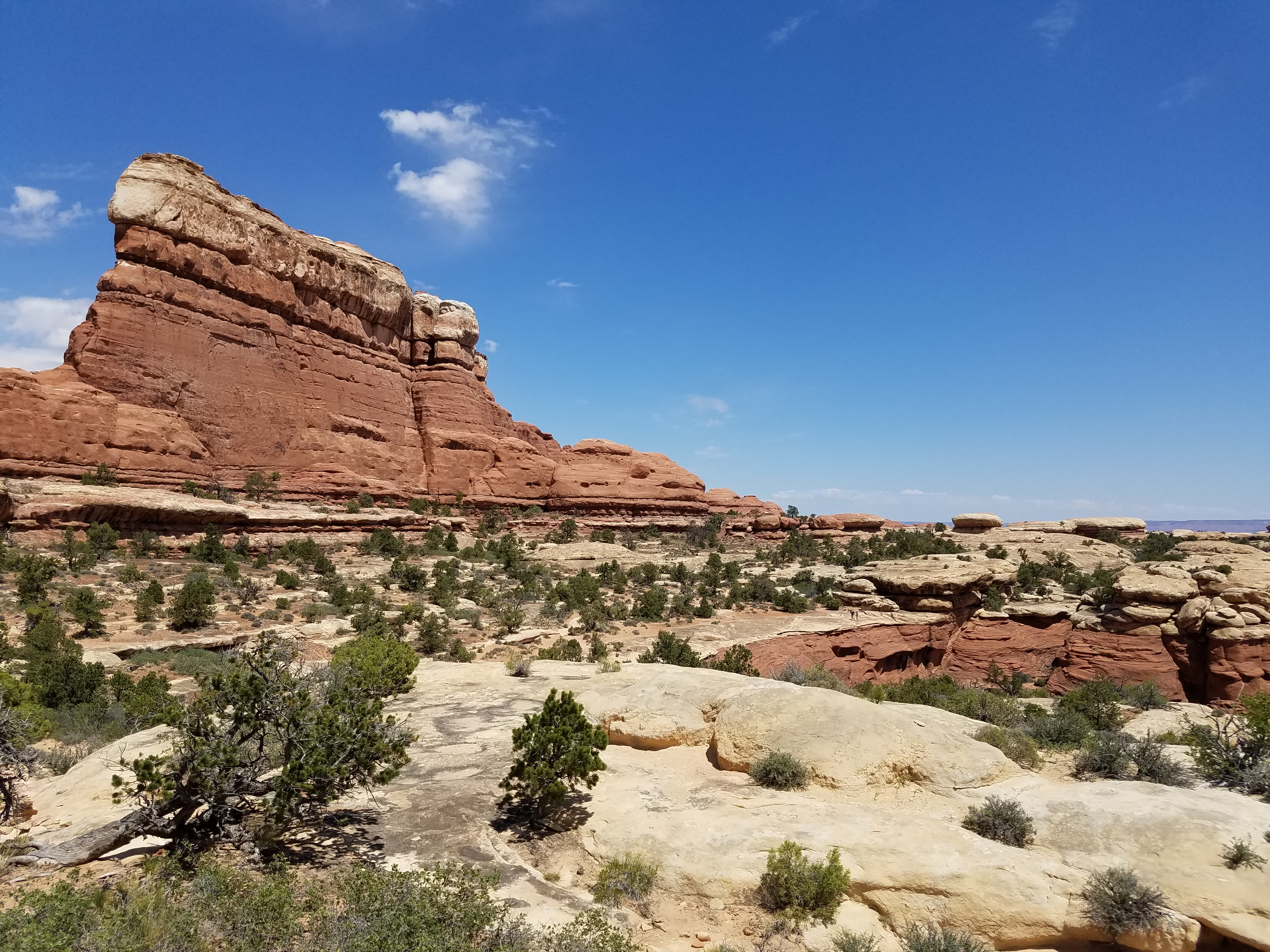 Hikers follow a slickrock shelf along a canyon rim
When I went to Consimworld Expo this year, I broke the trip into two days. The drive takes about fifteen hours so even with an early start from Boise I would arrive in Tempe quite late. With an hour time change, it's even worse. So on the way down I usually stop part way and do a hike somewhere in canyon country. This year I went to the North Rim of the Grand Canyon. On the way back I can drive straight through since it doesn't matter if I get in late. This year I did it differently. I didn't want to leave first thing in the morning and completely miss a day of the con but I was part way through a game and didn't need all day to finish. The obvious thing to do was to break up the trip home.
Paul Arena and I were in the middle of a game of Saratoga, from GMT's Battles of the American Revolution series. We had started Thursday night and were about half way through. The battle was very close and we wanted to finish it. Paul agreed to come in early Saturday (he's an academic so not a natural early riser, especially on a weekend). The game had a wild finish. Morgan's Rifles carried the day, taking out Burgoyne with a lucky shot and leading the Americans to a big victory. It was an exciting and fun game. Of course, it's easy for me to say that since I won!
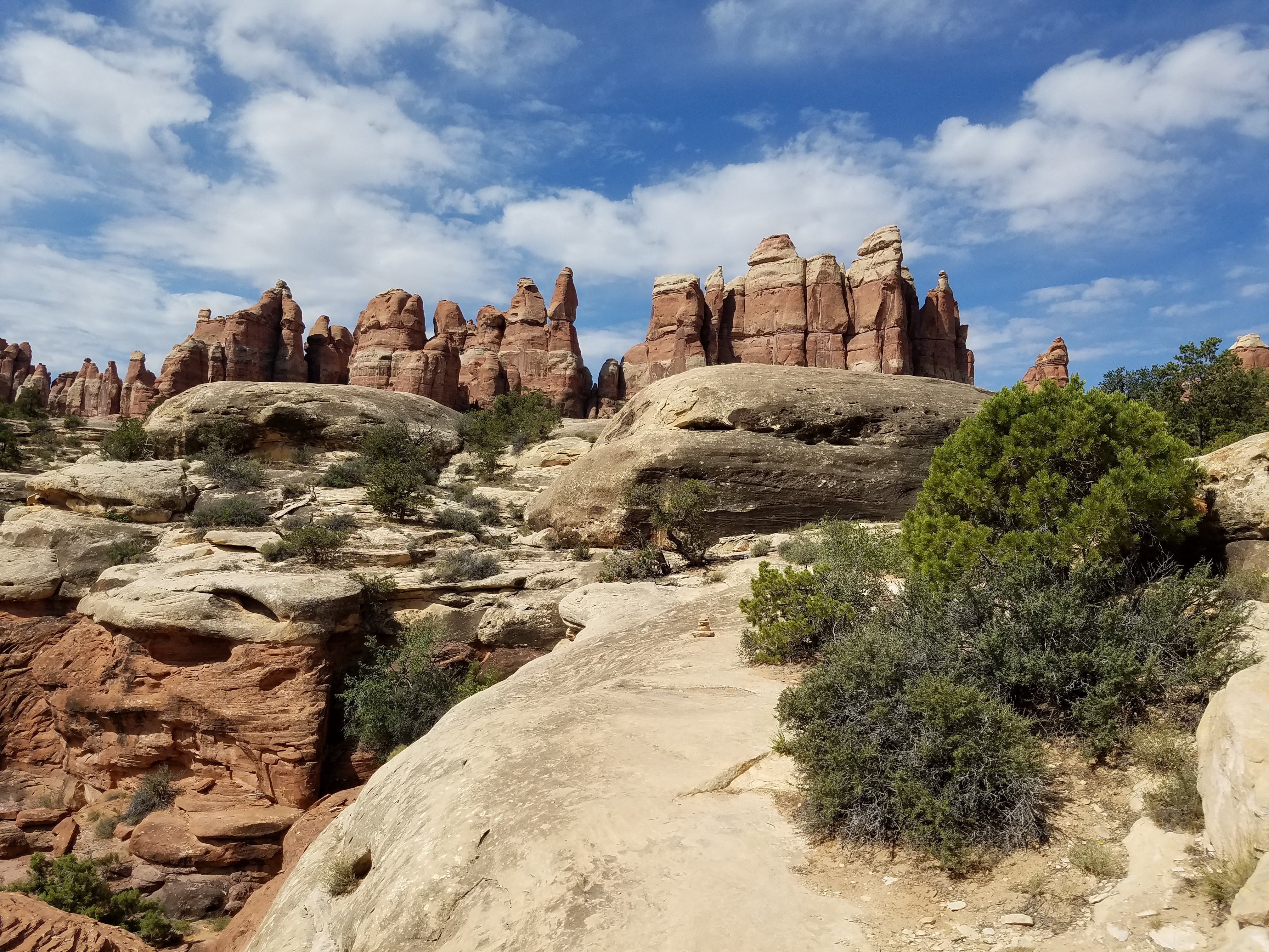
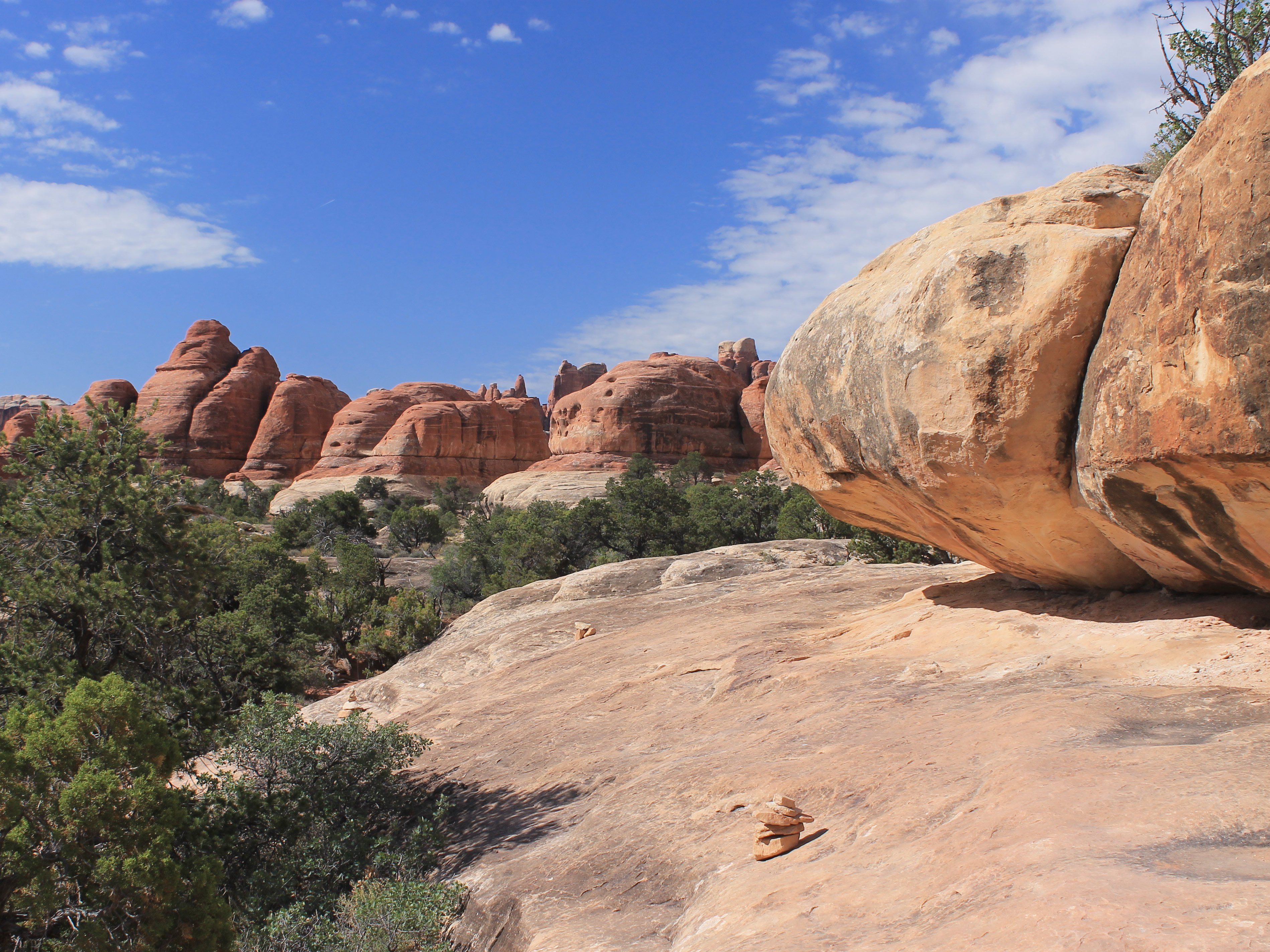 Traversing a slickrock shelf on the Chesler Park Trail
I packed my car the night before so I could leave as soon as we finished. I was on the road heading home at 11 am. My first worry was getting through downtown Phoenix. From the web, I knew that there was major work on the I10/I17 interchange, which I had to go through. The construction was on I10 west of the interchange, and I17 southbound. I was coming on I10 from the east and taking I17 northbound. There shouldn't be a problem, but I was nervous that any traffic problems might spread to affect my route. It turned out to be fine and I got out of the Phoenix area with no difficulties.
I was worried about I17 between Phoenix and Flagstaff. A lot of people leave the city to head up to Flagstaff on the weekends. Since it is at 7,000 feet, it can be in the seventies or eighties in Flagstaff when it is over a hundred degrees in Phoenix. There is a big hill about half way between the two cities where I got stuck in traffic when I was going home in previous years. This year, when I arrived the previous Friday (which was Memorial Day weekend) I17 northbound was backed up for almost ten miles. Fortunately then I was going the other way. Now I was expecting trouble.
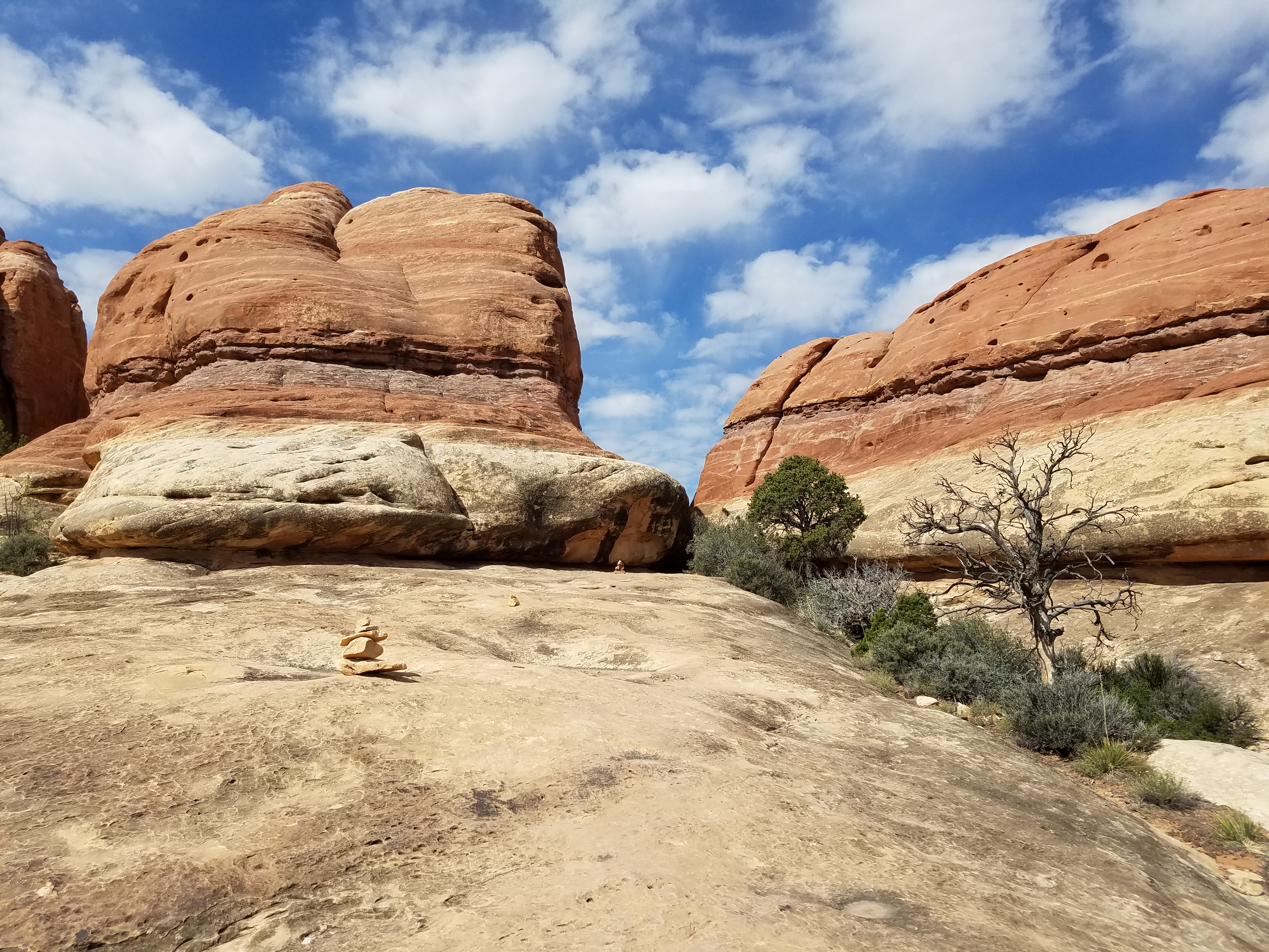 Yes, the route does lead into that gap
And I found some. Not far out of town I hit a major jam up where traffic slowed to ten miles per hour. It took about twenty minutes to get through. It turned out to be due to an accident. Then on the big hill, which is what I was mainly worried about, I hit another slowdown. This one only took about ten minutes to get through. So total I was delayed about a half hour. A nuisance, but not that bad. It certainly could have been worse.
By the time I reached Flagstaff it was early afternoon and I was starving. I stopped at a McDonald's but the line there was so long that I just decided to get back in my car. Two in the afternoon and it was the most crowded that I had seen a McDonald's in years. After Flagstaff my route headed up US89 into remote desert. Not many people. Not much traffic. Not much anything. I made good time but it was another two and a half hours before I finally got to eat in Kayenta Arizona, near Monument Valley. Their McDonald's wasn't busy.
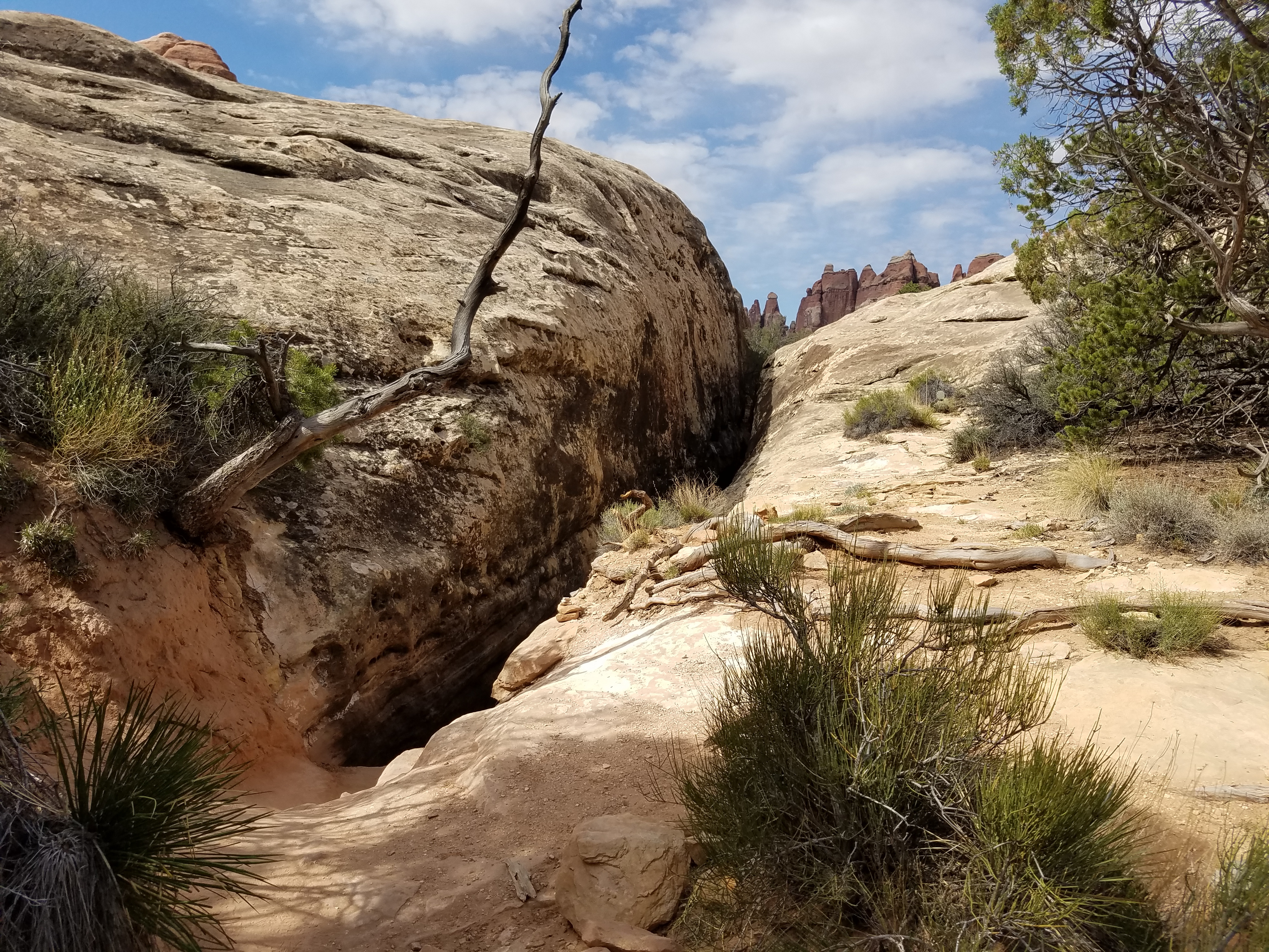 ...and it goes down there too
From here I was traveling on really remote roads through the lands of the Navaho Nation and Navaho National Monument. The monument is primarily to preserve some Anasazi cliff dwellings, which I didn't go out of my way to visit. But I was surprised that there were some impressive cliffs and rock formations. It was actually quite an interesting drive. I stopped for the night in Monticello Utah. Since it was a Saturday I had made reservations ahead of time.
It was already late in the season for hiking in canyon country and the forecast was for hot weather. I had just spent a week in over one hundred degree temperatures in Tempe so I wasn't looking to bake in the hot sun. For a hike I picked Chesler Park in the Needles district of Canyonlands National Park. It's a little higher (and therefore cooler) than most of the hikes in Zion or Arches or other places I could have picked. I also got an early start from the hotel in the morning and planned to be done around noon to avoid hiking during the hottest part of the day.
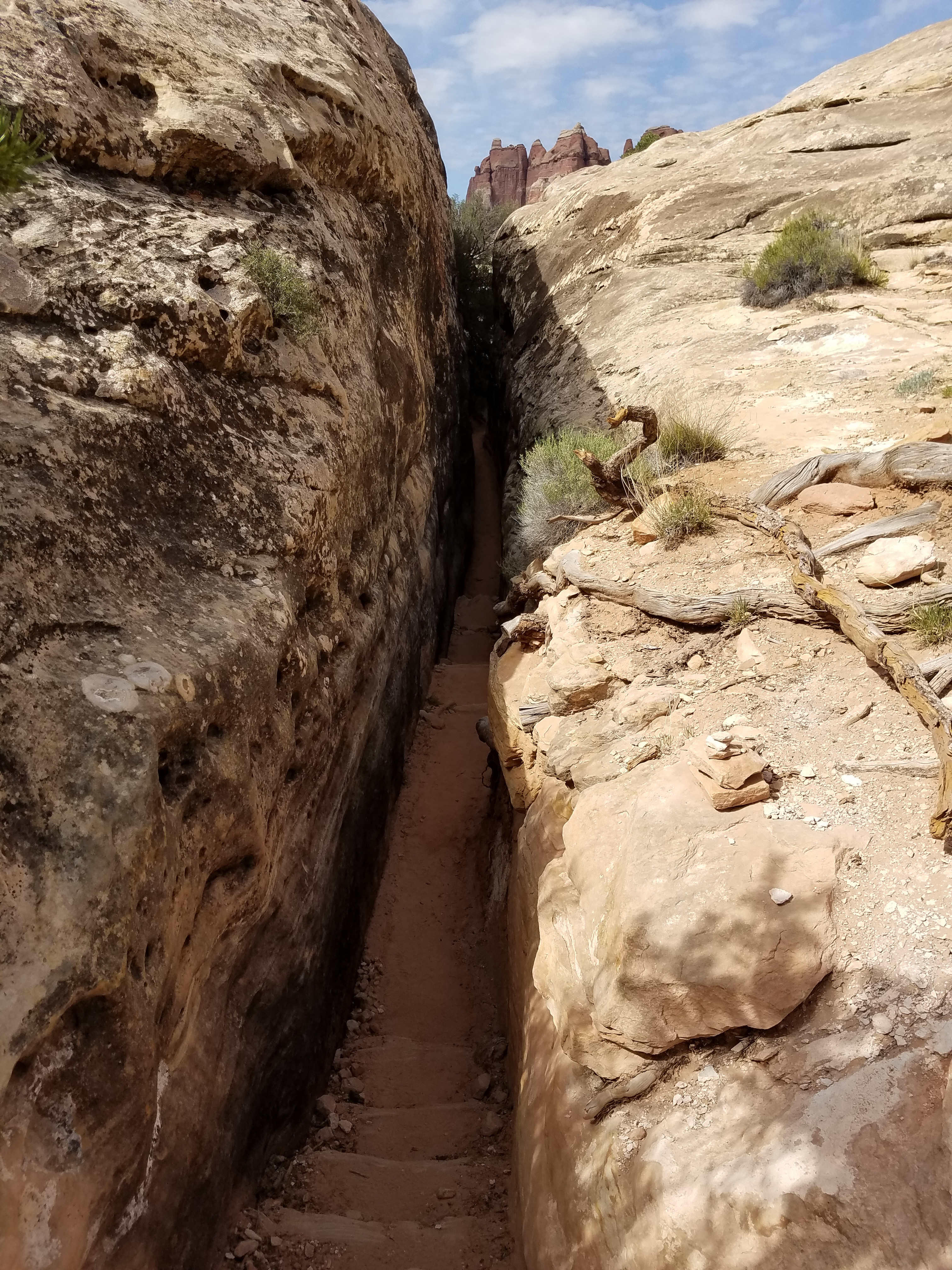 Good thing I'm skinny!
It's a long drive to the trailhead. From Monticello, it's 13 miles on the main highway to a turnoff. Then it's another 35 miles on the spur road into the park and 3 miles on a dirt road to the trailhead. With a quick stop at the Visitor Center, it took me an hour and a half to get from my hotel to the trailhead.
Sandy and I have done some nice hikes in the Needles district. We did one hike that went up Big Springs Canyon and came back down Squaw Canyon. We also did a hike called Peekaboo, which is probably the best slickrock hike I have ever done. But while we could see the Needles in the distance from those hikes, we had never actually hiked into them. Today I was going to fix that by hiking to Chesler Park, a sagebrush meadow in the heart of the Needles. The trail goes to an overlook, then does a loop all the way around Chesler Park before returning. Although the full hike would be fun, I had to settle for going only as far as the overlook if I wanted to be done by noon. That would be an easy hike, only five and a half miles and five hundred feet of elevation gain.
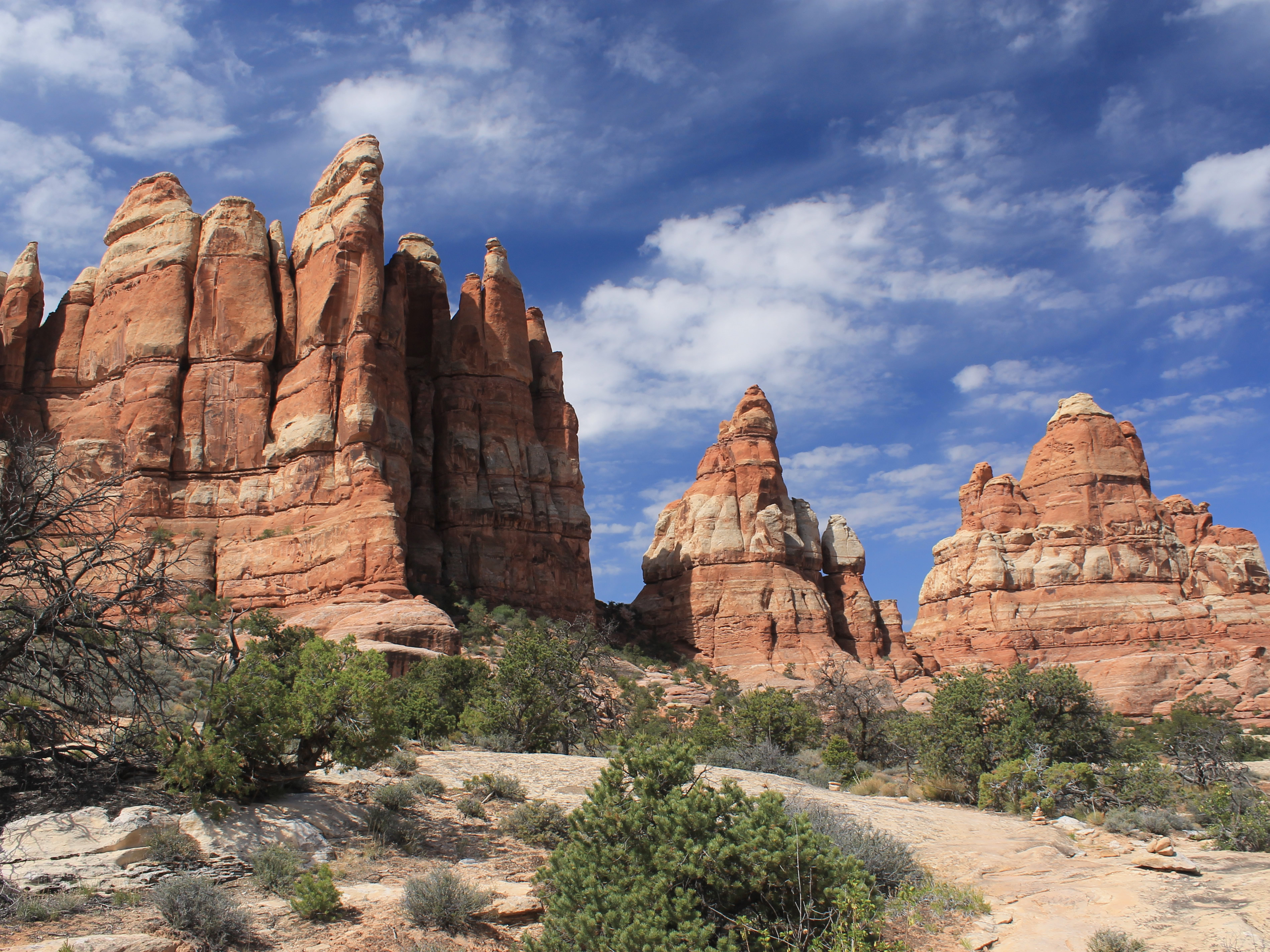
The trail went through maze-like terrain, although it wasn't quite as intense as the Fiery Furnace hike that I did in Arches National Park in February. It started by climbing out of the small canyon where the road ended. Near the top of the slope, stone steps led up a narrow gap between two large rocks. Then the route crossed a plateau, sometimes a trail, sometimes on slickrock, weaving along and around and between rock outcroppings. There were distant views of the La Sal Mountains off to the east but it was the amazing rock formations up close that I kept staring at.
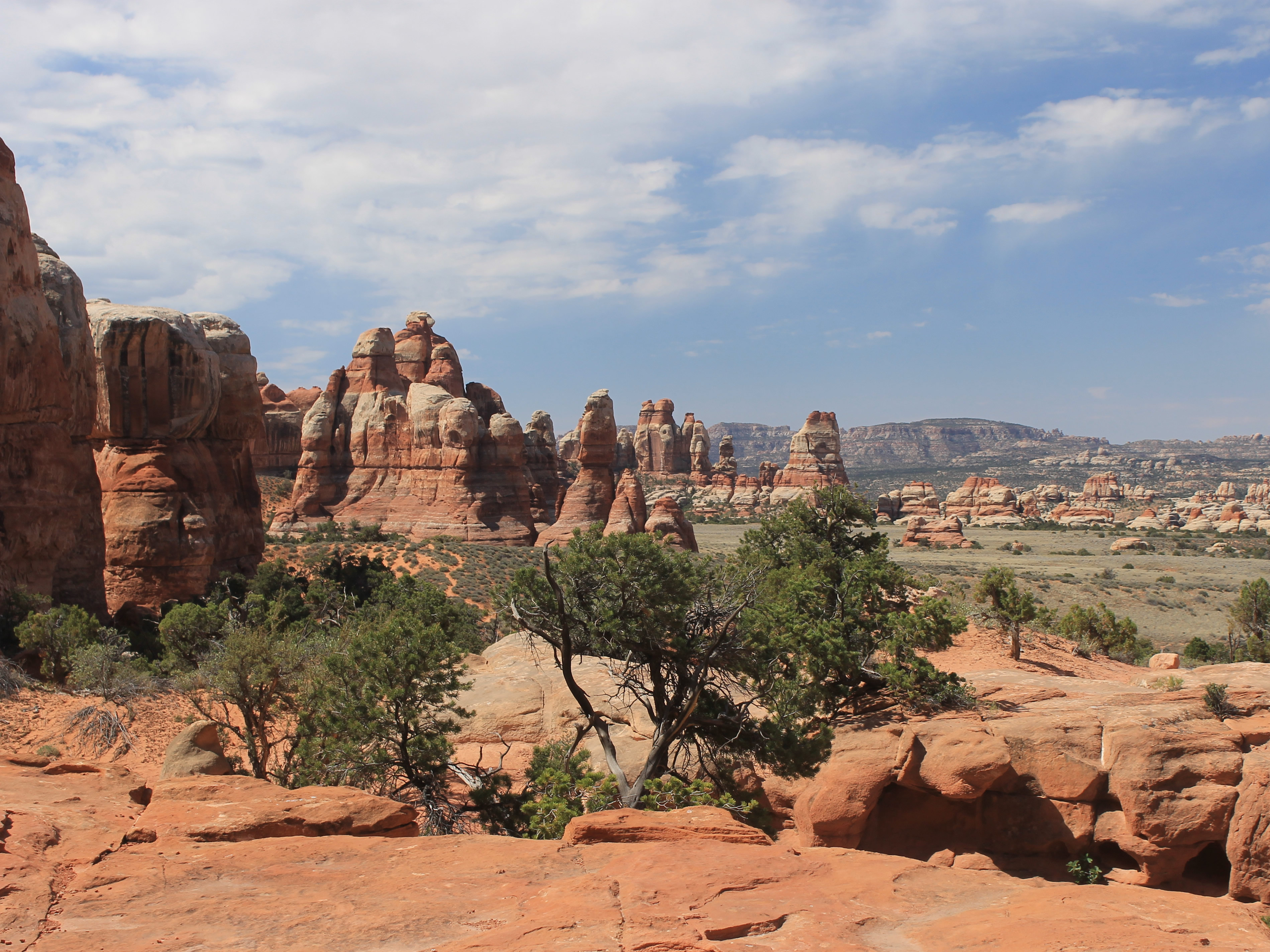
 The Needles from above Elephant Canyon
Eventually the trail dropped into the next canyon, crossed a dry wash, and climbed back up on the other side. It did that several times, so the elevation gain was more than was indicated by just looking at the difference between the start and end points. It still wasn't bad though.
There was a bright blue sky with a few white, puffy clouds. Together with scattered green vegetation it provided a beautiful contrast with the red rock formations. It was warm, especially in the sun or while going uphill, but not uncomfortably hot. Yet. It was still morning and it would certainly heat up a lot more by the middle of the afternoon. Doing just a half day hike was definitely the right choice.
Several times the route approached what seemed like a dead end, blocked by rocks and cliffs, only to squeeze through a narrow slot between rock formations. It made the hike more fun than just walking along on a trail. The cool, shady stretches were a nice break from the sun. One was about three hundred feet long and maybe two feet wide at its narrowest point. Not a good route for overweight hikers.
 The overlook is at the pass in the center of the photo
After dropping into and then climbing out of Elephant Canyon, the deepest of the drainages that I had to cross, there was a flat stretch that led right to the base of the Needles. A last steep climb led to a 5,640 foot pass between two huge sandstone fins. The trail dropped down from there into Chesler Park, but I follwed a sign which said "Overlook" and scrambled up some rocks to a shady ledge with a fantastic view. There was a wonderful cool breeze blowing through the pass and I took a long break there before heading back.
The return hike was straightforward. As usual, I saw more people who were just heading in than I saw when I started out in the morning. They might have been tougher than me but I don't think they were smarter. I was back at my car at 12:30 before the heat got to be unpleasant. Still, as soon as I started driving I cranked the air conditioning up full blast.
 Looking out over Chesler Park
After the hike I stopped at Needles Outpost, a remote store, gas station, restaurant and campground inside the park. I was looking forward to a cold soda and maybe lunch but unfortunately it was closed on Sundays. Oh well. Next time. It made the drive out to the main highway and then to Moab seem long indeed.
I stopped for a combined breakfast, lunch and dinner at my favorite restaurant in Moab, Pasta Jay's. Then it was just the familiar nine hour drive back from Moab. I had done it once this year already back in February.
It was an exceptional trip. I had a blast, both at Consimworld Expo and on the hikes I did on the way there and back. But after a week and a half away it was good to be back home. I had a lot of work to do on the Dog Blog!
